
I’ve roughed out two basic options so far based on our phone conversation. I’ve got a lot of other options I could cover, but lets start with these two and see if we have something that works for you.
The Loop
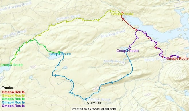
This is a slightly modified version of the Great Flood trip plan. I was thinking of starting at Trout Brook where we ended up at the end of the last try. It is actually the segment in red above, but starts on the far right and is obscured by the purple segment. That would make for a very flat first day of a little over 5 miles. The next day would be around 8 miles with some net elevation gain of about 300 feet, but as you may recall, a lot of up and down rolling hills. I need to verify this route is accurate as far as day three, but it should be a short one of between 4 and 5 miles with a little bit of a climb in the middle. Day four would be the longest day at about 10 miles and would include climbing up that “mountain” we climbed on the first day of the failed trip. The last day we hike back out to where we started via a pretty flat, but rolling 7 miles or so.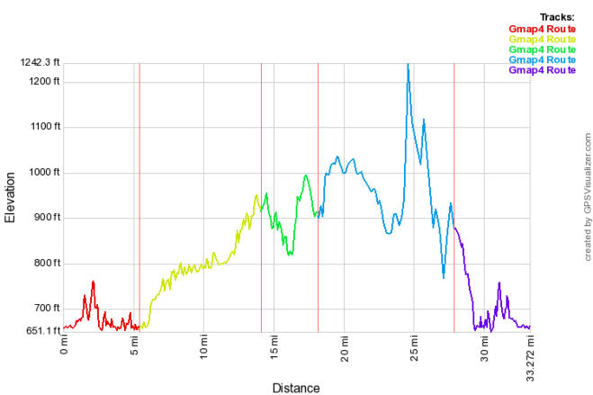
This elevation profile only looks scary until you consult the scale. Lots of rolling up and down, but the only actual steep part is that “mountain” we’ve already climbed pretty easily, though that was on day one.
On this plan we’d spend the first night at Little East which is the site we ate fish at last time. Josh would have access to the big lake during the day as well as the Webster stream at the campsite for collecting samples. The second night we’d be at Webster Outlet which is near where Webster Stream starts on Webster Lake. Josh would have access to the stream and lake. The third night we’d be at Hudson Pond and Josh would have access to Webster Stream, Hudson Brook, Hudson Pond. The fourth night we’d be at Frost Pond, where we spent the first night last time we tried this and Josh would have access to Wadleigh Bog, Wadleigh Brook and Frost Pond. The last day we go eat cheeseburgers and Josh better not stop to collect too many samples or he’ll get left behind.
The Meander
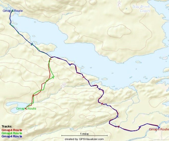
This plan involves spending two nights each at two campsites allowing a full day of hanging out or exploring at each location. Again starting at Trout Brook where we ended up last time we’d do a roughly 5.5 hike out to Frost Pond where we could spend a day paddling, fishing or just hanging out swatting skeeters. On day three we’d do that very short hike of a tad over 3 miles from Frost Pond to the Little East site on Webster Stream and spend another two nights there giving us a full day to fish, explore, etc. I am not sure, but there may be a canoe there as well, but that lake is a big one so a bit more serious to paddle on. Day five we hike out a little over 5 miles and go eat burgers. This version would give Josh time to explore Frost Pond and Webster Stream more thoroughly given the lack of travel on two days.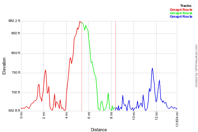
Very little actual elevation change, but plenty of rolling hills on this route. Keep in mind that the Little East campsite on Webster Stream has a tent site right next to the LT so we may have company there. I have to tell you that the LT we sheltered in when we turned back from the flood is no longer available. If we do the loop we’ll just have to hope we don’t need it again heh.
One last thing in considering these potential plans is that either of them could be done in the other direction if that looks better to you folks.
