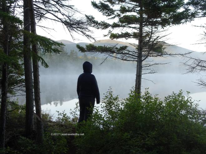
Still and video photography combined with an uncut, natural soundtrack. All were recorded June 12-13th at the NW Cove tent site on Baxter State Park’s Freezeout Trail. It is quiet so turn up your sound to hear the get the full effect!

Still and video photography combined with an uncut, natural soundtrack. All were recorded June 12-13th at the NW Cove tent site on Baxter State Park’s Freezeout Trail. It is quiet so turn up your sound to hear the get the full effect!

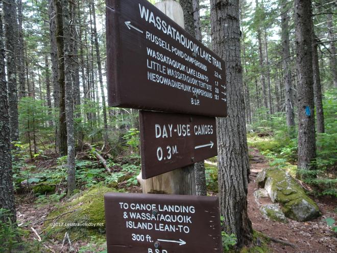
78 pics and some babbling from an amazing family trip to Baxter State Park that included visits to Center Pond, Little Wassataquoik Lake and Wassataquoik Lake Island.
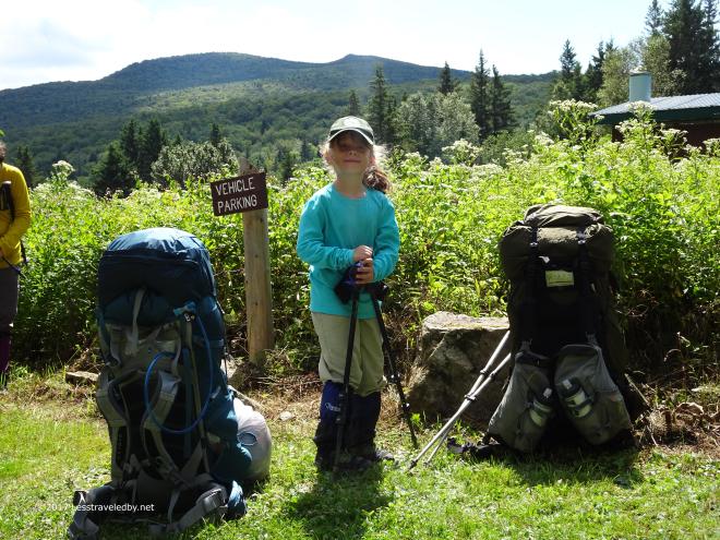 Our little one is not so little any more and after some discussion we decided that she was ready for something a little more ambitious than previous family trips. We planned out a six day back country trip that meant the parent packs would be not so little as well. The Mama Pack came in at 38lbs with 2L of water while the Daddy Pack weighed 57lbs with 2L of water. That might seem unfair, but I had most of the food, so my pack lost more weight each day than hers 🙂
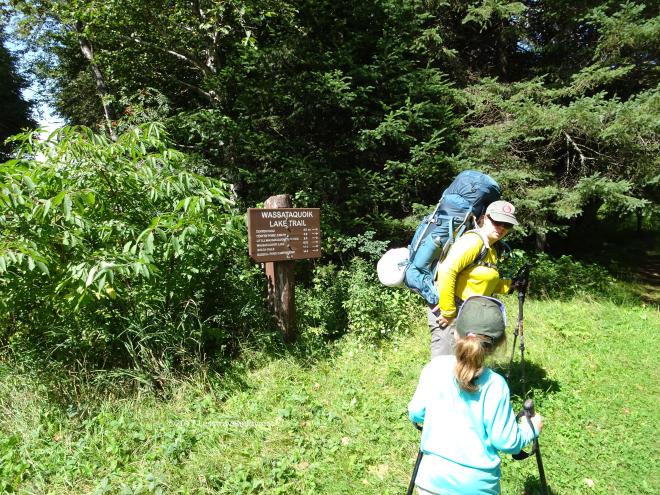 The first day called for a 4.5 mile walk from Nesowadnehunk Campground to the Center Pond LT via the Wassataquoik Lake Trail. Other than a bit of a climb right at the start this was a pretty level trail with little challenge. Great for folks getting out of the car after a four hour drive and donning heavy packs!
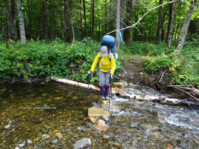 There was one small, two part, water crossing to navigate. Here Frau Stranger is demonstrating the extra safe, four pole technique. Well, in truth she is carrying our daughter’s poles as I had carried her over this section rather than let her get her shoes wet. She was not happy about that, but I knew doing the rest of the day’s hike wet would make for unhappy feet later and this was day one of a long, long adventure.
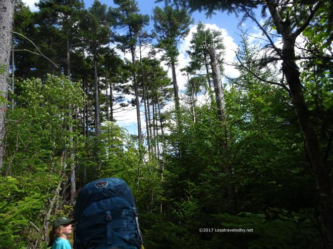 The weather was cool for August, mid 60s, with an amazing blue sky between the clouds zipping around above us. We stopped more than once to just stare at the view between the trees. We also stopped a few times to just look at the trees.
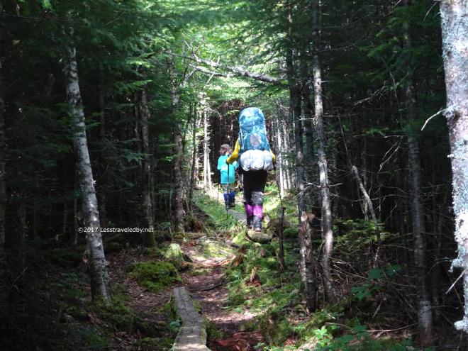 There were lots of bog boards in this section, even in places that didn’t really need them. Flat trails near the road always seem to be over improved while the deep back country sections get less love because they are harder to reach.
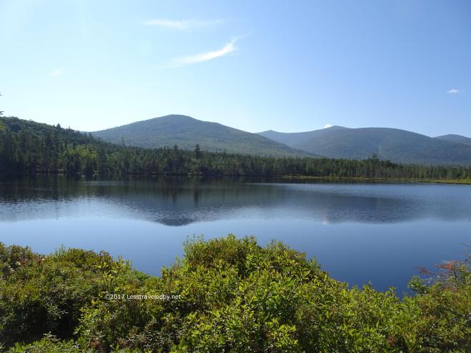
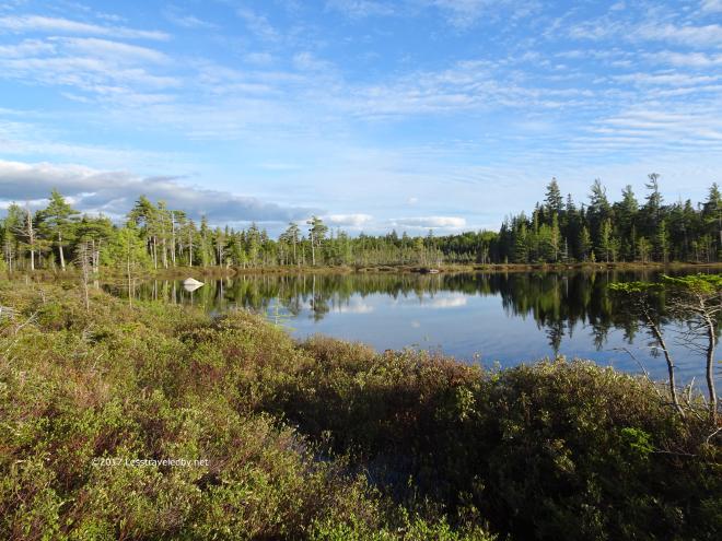
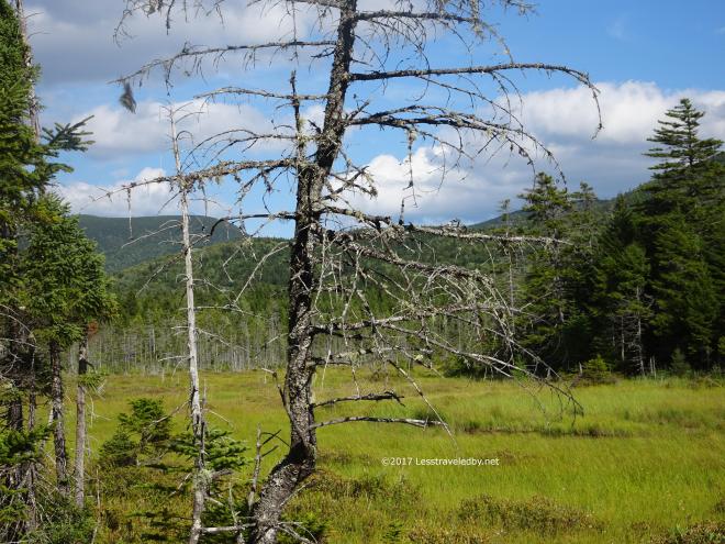 When the trees gave way to this large bog I knew we were getting close to Center Pond. Both the inflow and outflow areas were giant bogs as the flat elevation profile didn’t promote fast drainage.
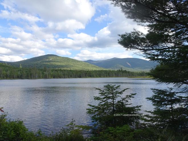 Then we reached the pond itself as it came into and out of view a few times before we reached the short spur to the lean to.
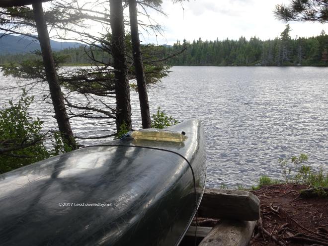 It was a bit choppy out there and you can see from the color of the bag of water on the canoe that the pond had some tannin content, most likely from the bog feeding into the pond. Once filtered it would be fine to drink though still a bit brown. Easier to drink from an opaque bottle than a transparent bag despite the taste being just fine.
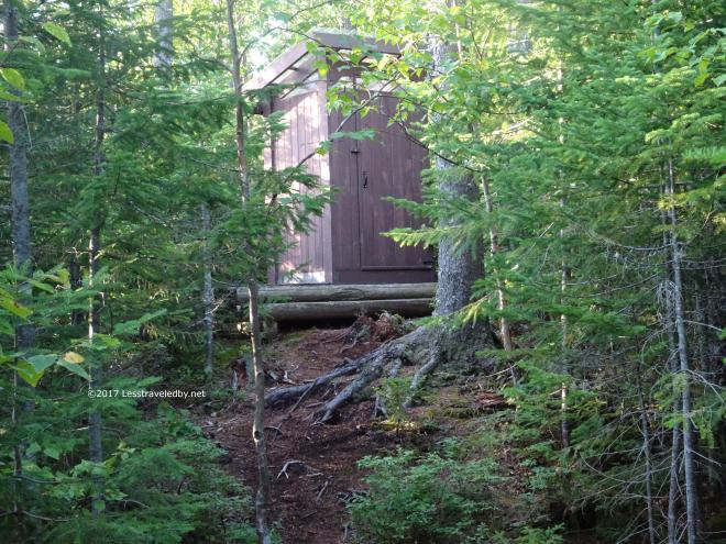 Another of Baxter’s fine latrines. Each one is of a slightly different design it seems and I always enjoy their craftsmanship. This one came with a clear roof that gave it wonderful light inside.
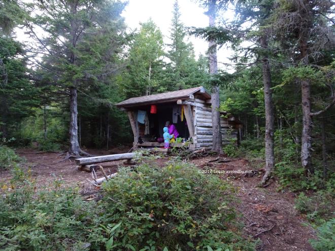 The LT was on the small side being a 4 person model, but enough room for us and all we’d carried in. With the cool weather we were happy to have a few walls to keep the wind off of us, though there was only a bit of a breeze.
 Everyone seemed happy with day one and a bit amazed to think about having five more ahead of us. We were ready for bed when darkness came, though we were disappointed in the lack of a loon crying out there.
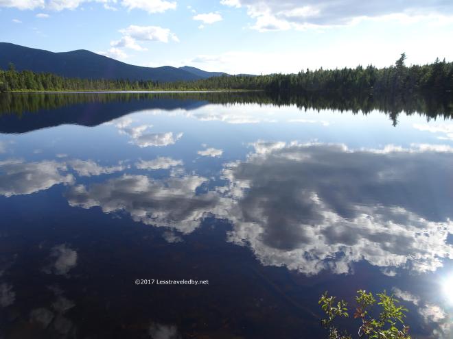
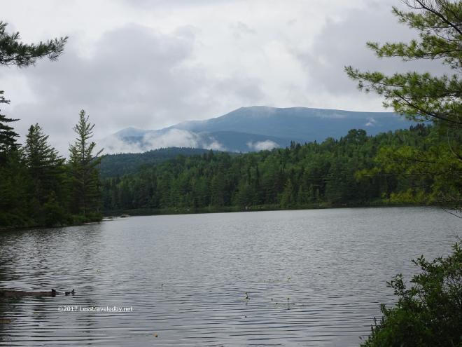
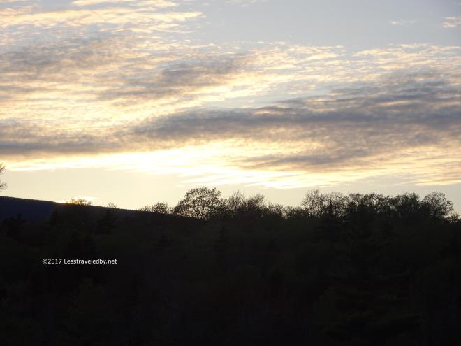
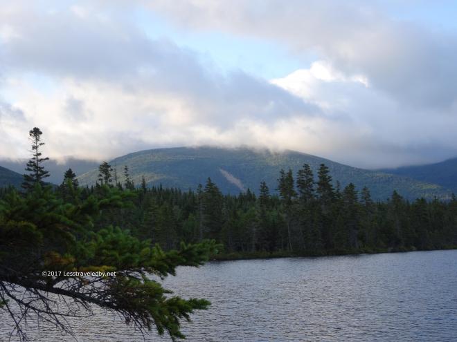 Dawn came with some interesting clouds on the mountains and some cool damp in the air.
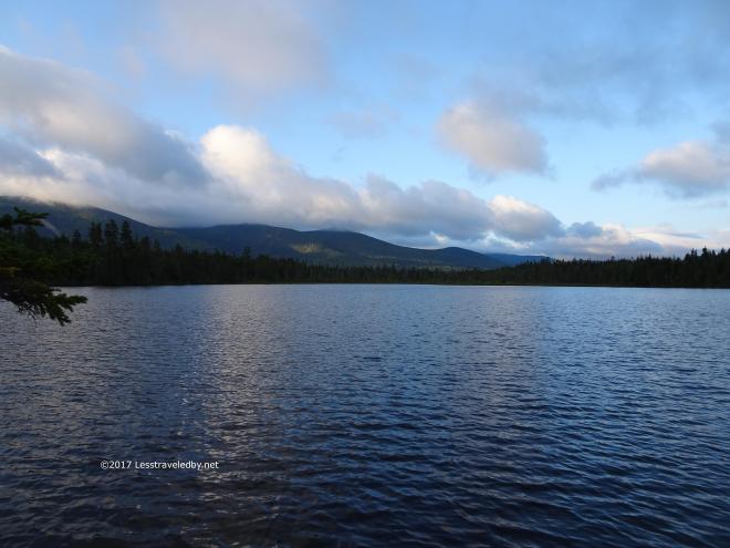
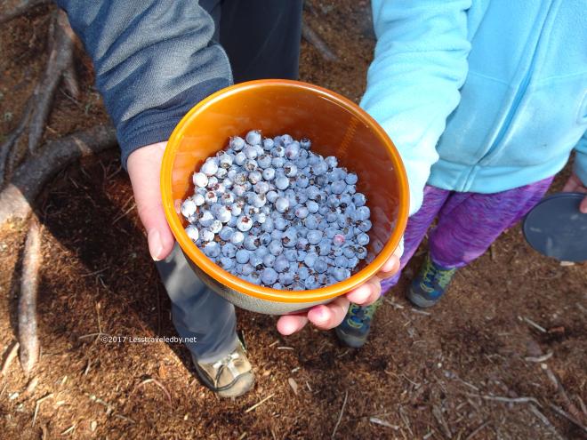 The girls went out to pick some blueberries and the sun had warmed things up nicely by the time they returned. Most of these ended up in their morning oatmeal, but some went directly into our bellies. Just shy of being perfectly ripe they were riding the line between sweet and tart.
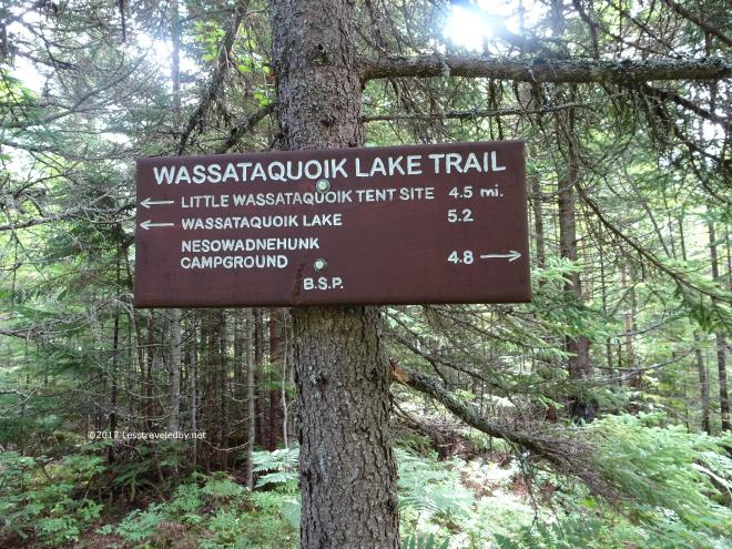 Then we were packed up and heading to the Little Wassataquoik Tent Site. Another 4.5 mile walk, but this one had a bit of a climb at the very end. Nothing too serious, but it looked scary on an elevation profile just because the rest of the trip was relatively flat.
 There were a few water crossings, just small rock hops, but one stream paralleled the trail for quite a while. It was nice to hear the rushing water as we hiked but not have to worry about wet feet.
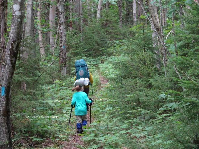 Soon it was time to hit the big climb. I am sort of joking, because it wasn’t really that much of a climb. I’m also a bit serious because with the heavy packs, getting up the little hill was a good workout. This is the beginning of the climb, but it got much steeper as it went up. I was definitely puffing by the time we reached the top.
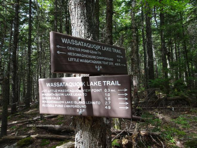 My wife sounded hopeful as she read this sign and saw it was only 1 mile to the LT. She was really happy when I pointed out we weren’t headed there, but aiming for the tent site 400 yards the other way instead 🙂
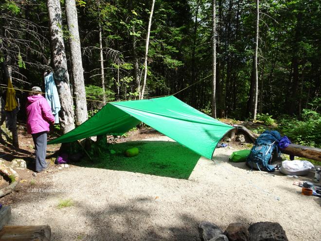 There were some clouds floating by that looked a bit threatening and a chance of rain in the forecast so the first thing we did was get the tarp up. This would be our first time using the bug house under a tarp rather than inside a lean to which is why I came up here on a previous trip to scope things out. Thanks to that research I came prepared with a 50′ ridgeline rather than the 30′ I normally use for tarps. By getting the tarp up, just in case, I managed to keep the rain away which was my hope all along.
 This is the view from in camp, looking at the rocky path that crossed over the brook on its way to the latrine. Definitely a place to keep your shoes and headlamp handy rather than trying to make the trip barefoot in the dark heh.
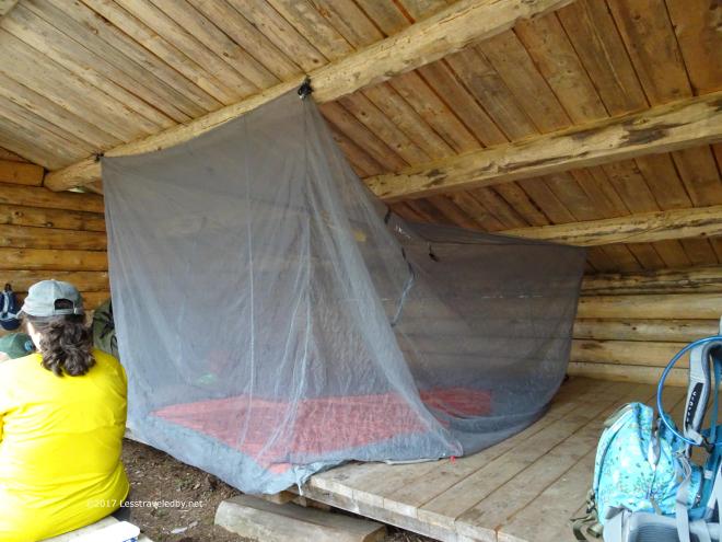
 I got our house set up under the tarp, learning as I went exactly how I was going to do that. It worked well enough, but the next time I set it up I was smarter and it worked even better. The girls broke out the Yahtzee using my grill bag to roll the dice on.
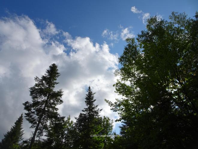 By late afternoon the threat of rain had passed and we were back to watching happy clouds racing through deep blue skies.
 Here is the view looking out at the campsite from bed the next morning. It felt extra special to wake up in this big, open air house rather than our tent. We weren’t covered in dew, so it didn’t feel like cowboy camping. It was similar, but better I’d say thanks to the tarp over head.
 This shot almost captures how happy I was to be sitting there drinking coffee, but neither pictures nor words can really do it justice. Waking up in this site with the waterfall burbling and my two favorite girls there was already pretty dang special. Hot coffee was just the frosting on top!
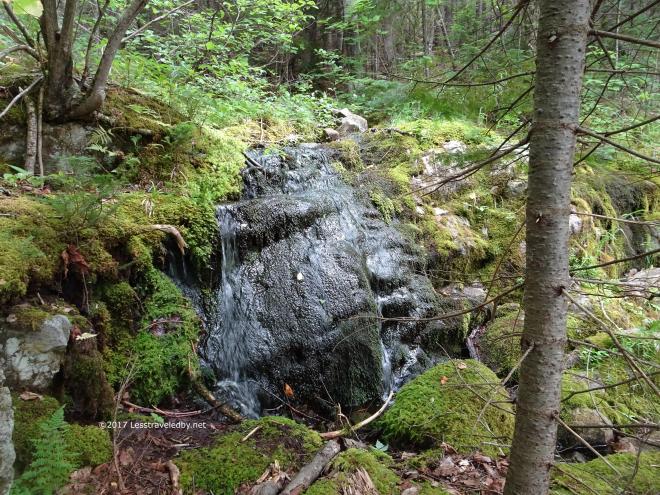 Speaking of burbling waterfalls…here it is up close. There is a small spring just up the hill from the campsite and it was flowing nicely even this late in the year. We still filtered it, but it was some of the coldest, clearest water to be found in the park.
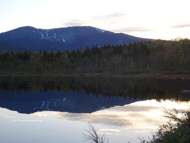
 On our way to the Wassataquoik Island site we took the side trail to the viewpoint on the cliff. A short, 0.3 mile spur, but a hefty climb to the top.
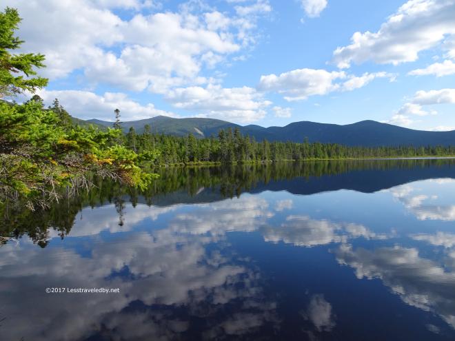
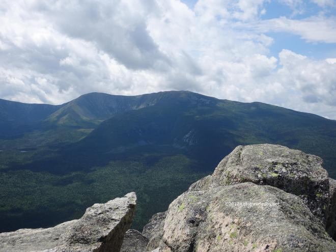
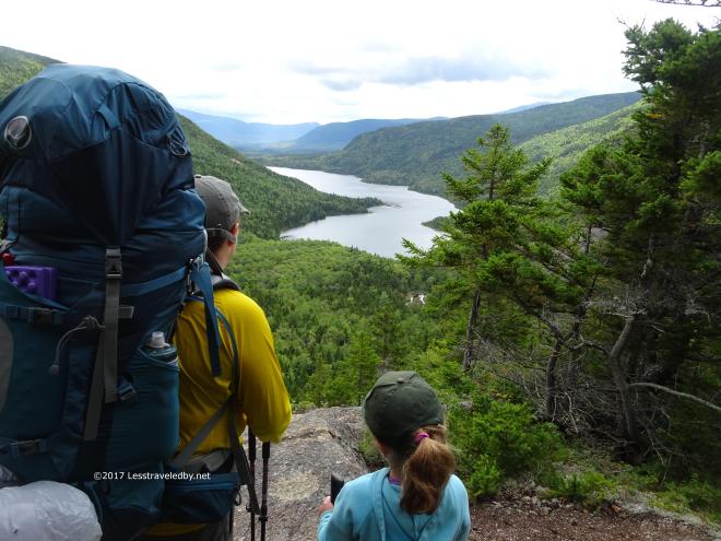 The reward is an amazing view of most of Wassataquoik Lake down below. Our hike for the day would take us around the right side, all the way to the other end out of view behind the ridge on the left.
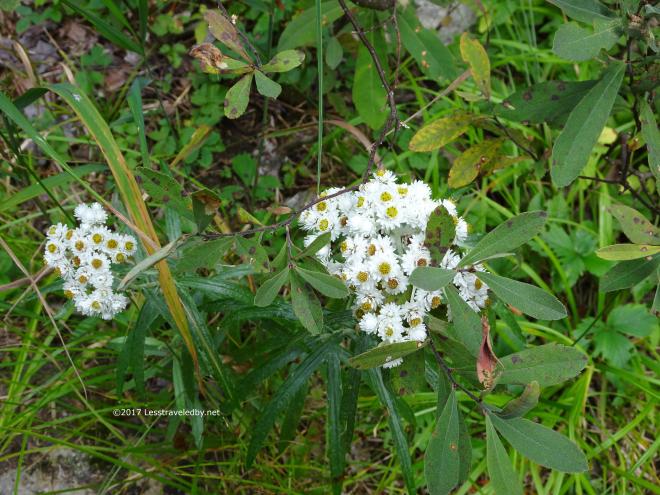 Being late August, late season flowers were wrapping things up before going to seed. With the cool weather there was a definitely sense that Summer was coming to an end and soon.
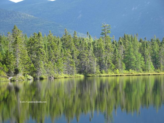
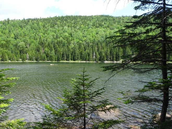
 We had a glimpse or three of Little Wassataquoik Lake along the way. It really is little compared to its bigger sibling.
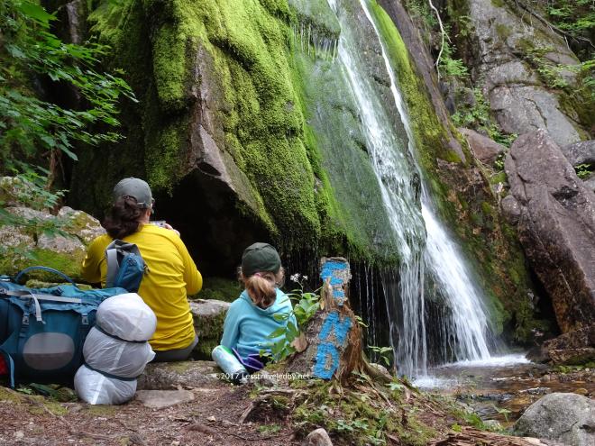 Green Falls is found via a very short, but wet and slippery, spur and is always worth the danger and effort of visiting. We stopped for snacks and pics as is the custom, at least it always is for me.
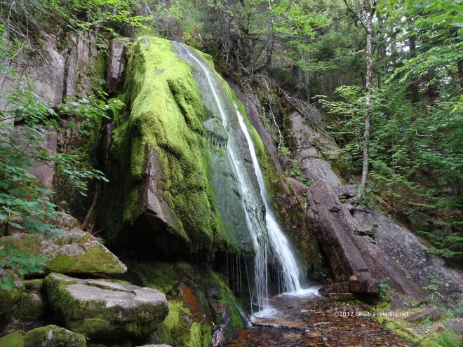
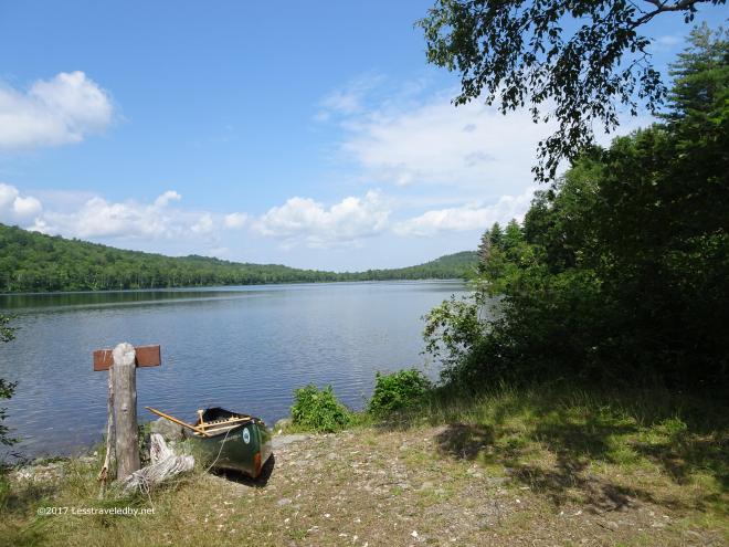
 Finally we found the turn off to our island retreat. This was my first time visiting this site as it is only open for a few weeks of the year and hard to book.
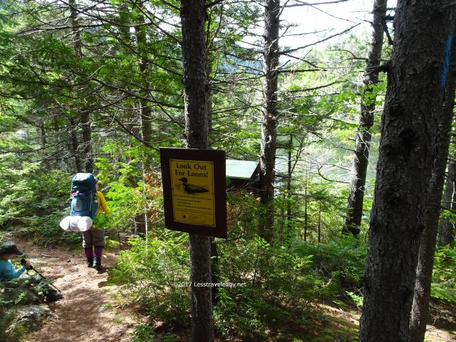 The loons have right of way on the island and nesting there keeps humans off until the chicks have hatched and moved out into the lake.
 These folks were out for a day paddle and seemed surprised to find us watching them from the lean to on the island.
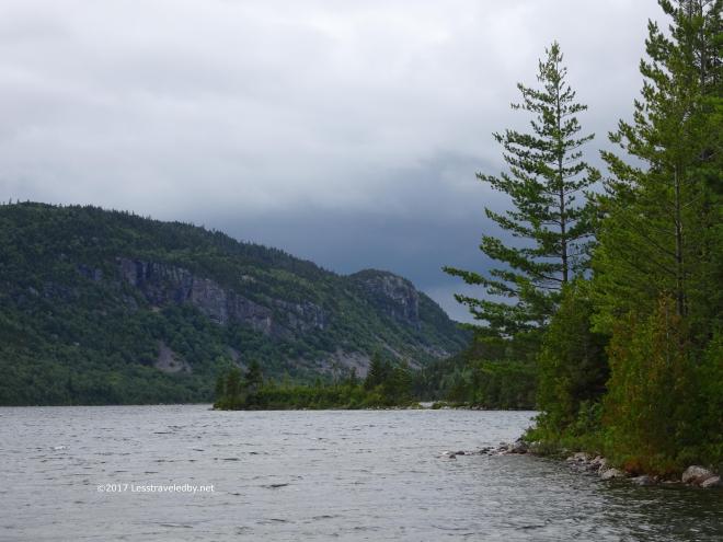 We were glad to have a lean to that night as the sky was looking a bit ominous. There were a few periods of rain in the late afternoon, but we had some time to explore a little as well. We would like to come back again if we can get a two night reservation so we can explore both the island and the lake for an entire day.
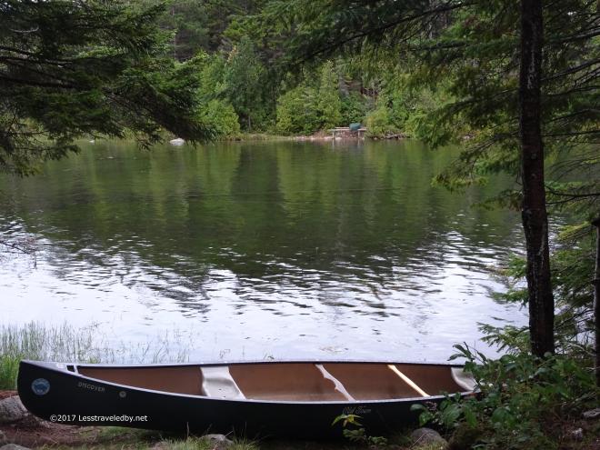 Here you can see our canoe on the island and the rack on the far shore where we launched from. It wasn’t far, but much drier to use a canoe than walking across hehe.
 I’ve gotten pretty good at setting up the bug house in shelters now. It makes a great place to play cards, rain or shine.
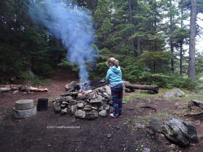 Finding wood on the island was a bit challenging, but I put together enough to make a small fire. Fire of course leads to marshmallow toasting!
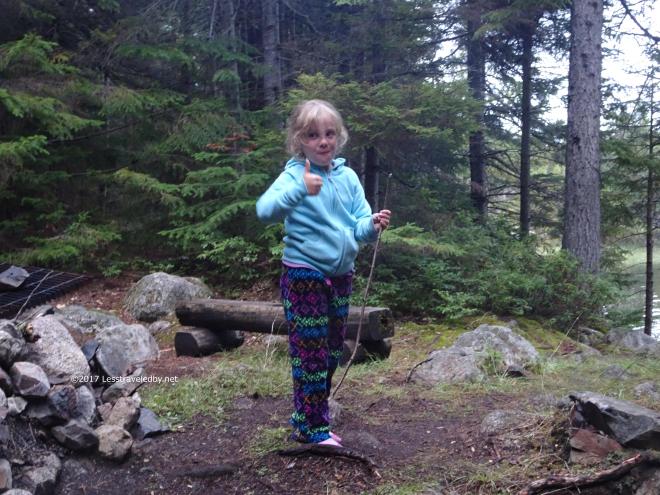 It looks like this one turned out pretty well if she does say so herself.
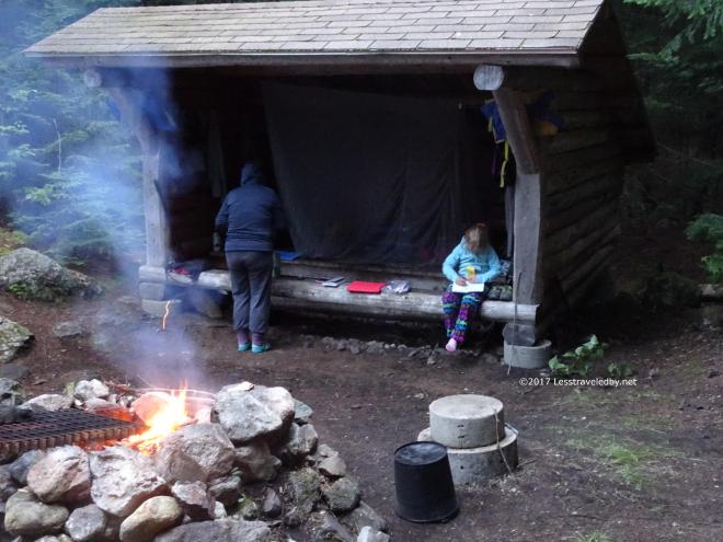 I bought my daughter a small, blank paged journal for the trip that she could use to create an art journal. Each day she created a few pictures to capture the story of part of the adventure or to show something she found worth sharing. If she says it is OK with her I may post some of those pictures here in a future post.
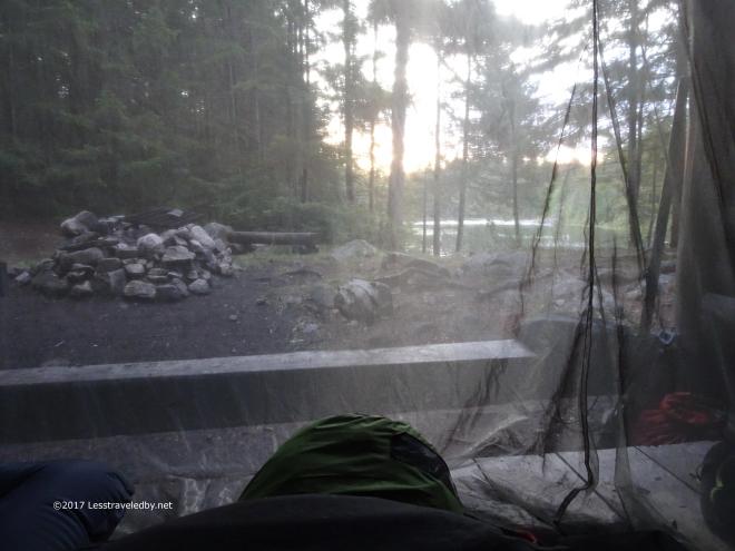 My view outside as the sun began to rise. So quiet, so peaceful, so beautiful.
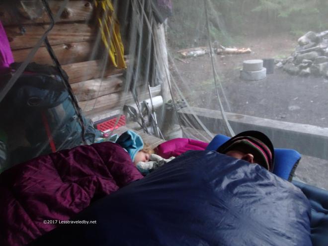 That goes for these two as well! So wonderful to come to such a special place with them instead of being here alone wishing they’d been able to come. They had worked hard to get here and deserved the chance to rest so I let them sleep in peace.
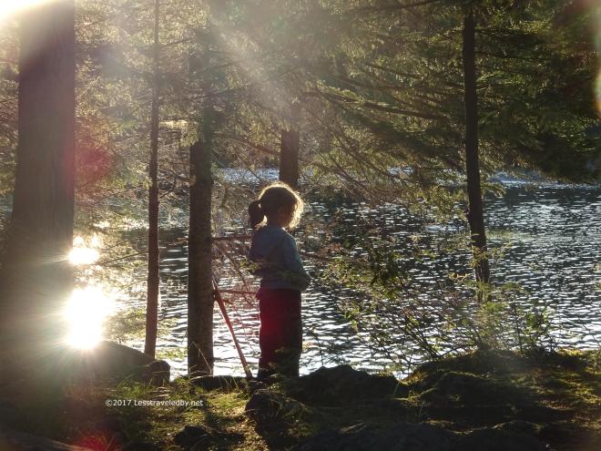 Later I caught this beautiful shot of my daughter looking out at the lake. That is no special filter there. That is shooting through the bug net, into the sun with a lot of zoom, but it sure looks nice to me.
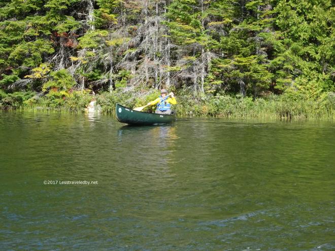 Then came a series of challenges that might have sent other folks into fits of rage or despair, but only served to leave us laughing. We packed up fast and were well on our way to an early lunch until I tried to put on my pack after we put the canoe away. It seems I had lost part of my belt buckle and there was no way I was carrying the Daddy Pack without a belt.
After looking around to be sure it wasn’t on this side of the crossing I paddled back alone to search for it. Just as I reached the far shore I heard my wife shouting out that she had found it under the canoe rack! So I paddled back, we stowed the canoe for a second time, donned our packs and started off. About three minutes later my wife made a comment about turning on her step tracker which made me reach for my inReach….which wasn’t there!
I had set it down by the fire ring when I sent a request for a weather report that morning and forgotten to pick it up after getting distracted by six other chores. Back to the canoe rack…this time my wife paddled over since I had gotten to have the fun the first time. That is her up above, happy as a clam because she loves to paddle. Finally we stowed the canoe for the third time and were on our way…and this time, we meant it!!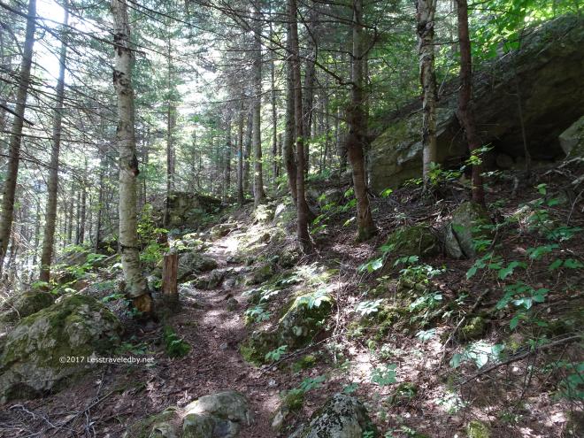 It was another beautiful day in the forest and everyone was happy to be moving finally. We were trying something new on this trip and eating hot lunches once we finished our hike for the day so we were motivated.
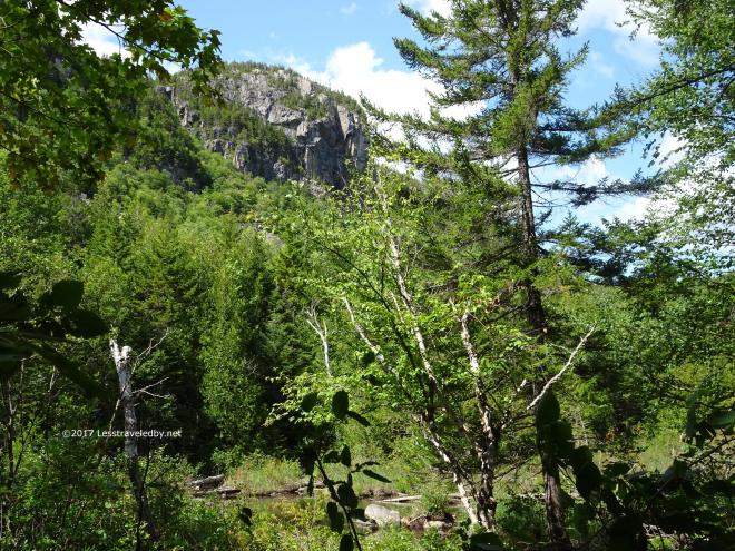 Going back the way we’d come now we had familiar landmarks to tell us of our progress.
 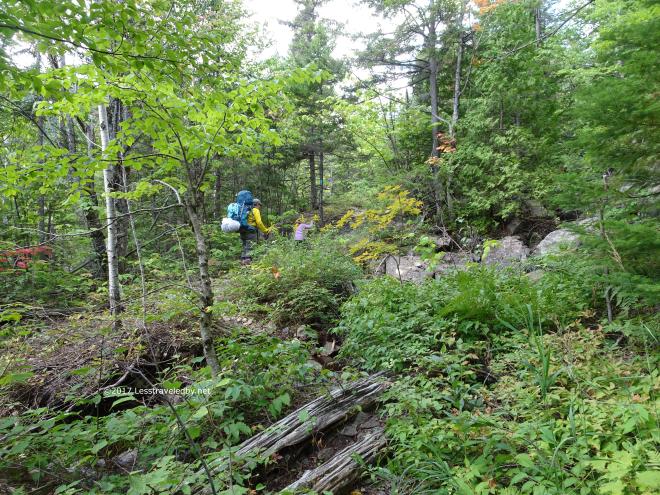 The girls were headed up the final bit of climb and showing no signs of slowing down.
 I ducked down a short path to Little Wassataquoik Lake to grab a few pics and feel the breeze blowing across the water.
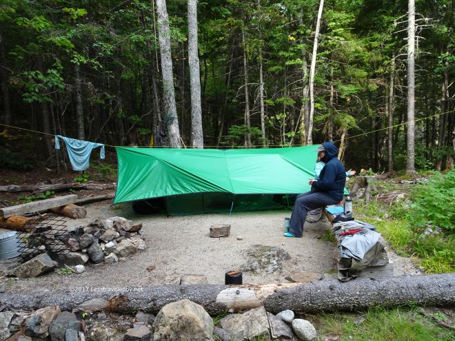 Then it was back to the tent site to set up camp and eat that hot lunch. We had delicious potato soup on two days and salmon with rice one day and noodles on another. Heavy stuff to carry, but boy were we happy to be eating like royalty out there.
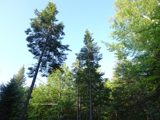 The next day dawned cold for August. I took a reading of 38°F that morning which I consider beyond cool for the time of year. We were glad we had packed plenty of warm layers along with the swimsuits that were never used.
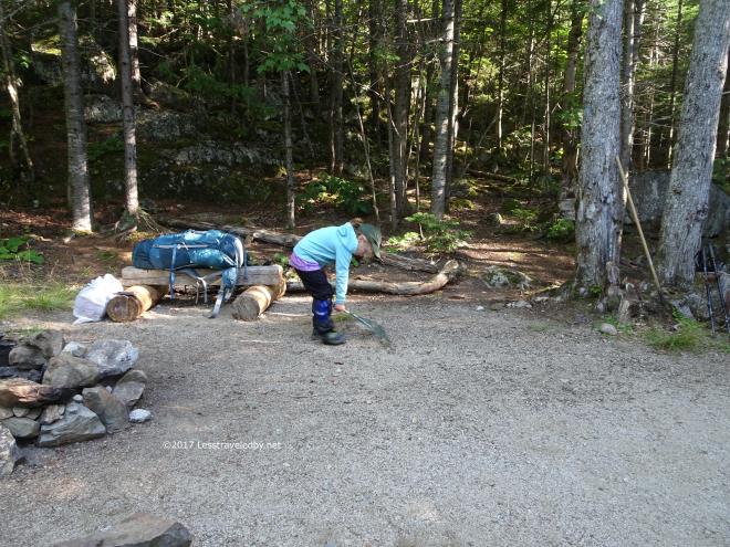 Last year our daughter completed the Baxter Junior Ranger program and received an official badge which we augmented by buying her an official looking hat. Now she takes her duties very seriously, including raking the sites before we leave if there is a rake available.
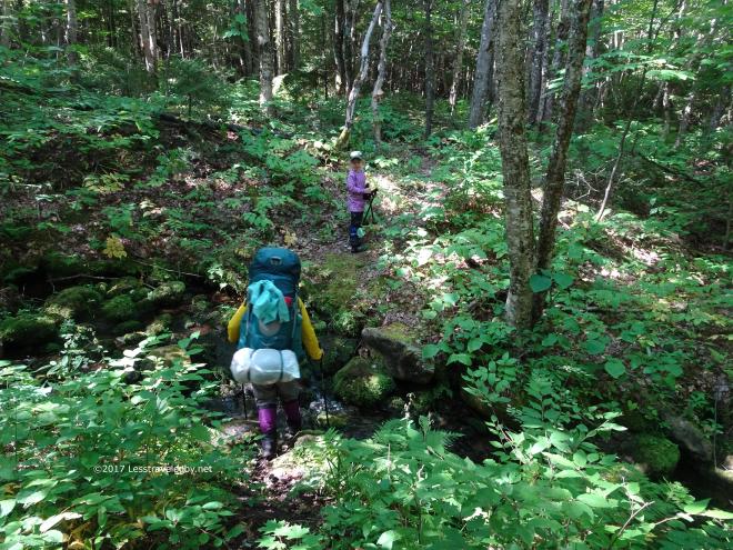 She also watches out for her mother on trail. Here you can see her waiting to make sure Mama is safely across this little water crossing before heading down the trail.
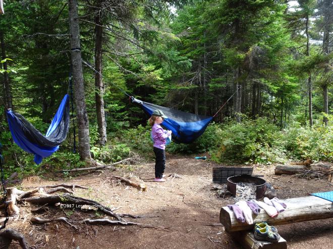 Relaxing is not her forte though I’m afraid. After hanging the hammocks both parents would gladly have taken a nap, but someone had to stay on duty to keep the little one from jumping in the pond. My total hanging time after putting up both hammocks was probably less than ten minutes, but still worth the effort, especially because Mama got at least a tiny nap in.
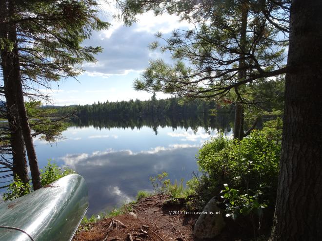
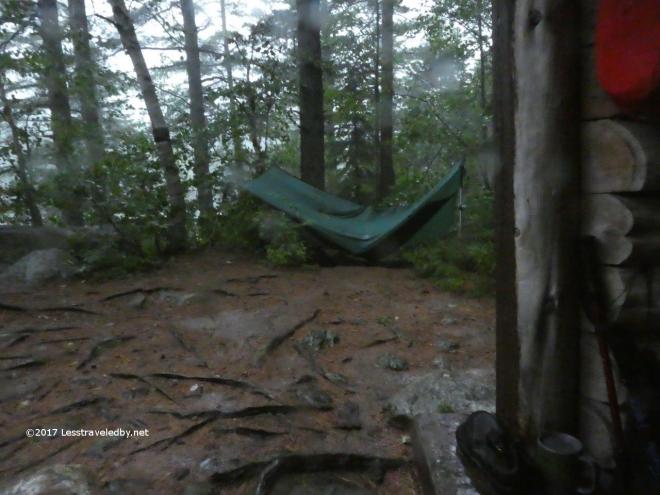
 A very peaceful afternoon on Center Pond even if I didn’t get a nap. The trip that had seemed impossibly long to start out now seemed to be ending too soon. Having some time to reflect (get it? 🙂 ) on our adventure was nice.
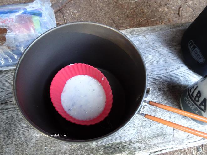 After dinner we decided to try putting some of those fresh blueberries to use in a couple of muffins. This is the first one going into the pot.
 I’d been carrying the gear for days and was glad we were giving it a shot to justify the effort. We’ll see how they turned out later….
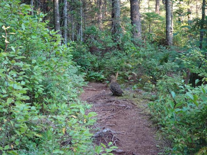 This wood grouse was making a lot of noise near camp so I had my camera ready expecting a deer or a moose to pop out. Frau Stranger whispered for me to hand her my camera and caught this shot around the corner from our camp.
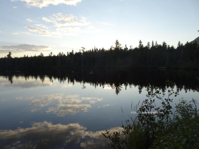
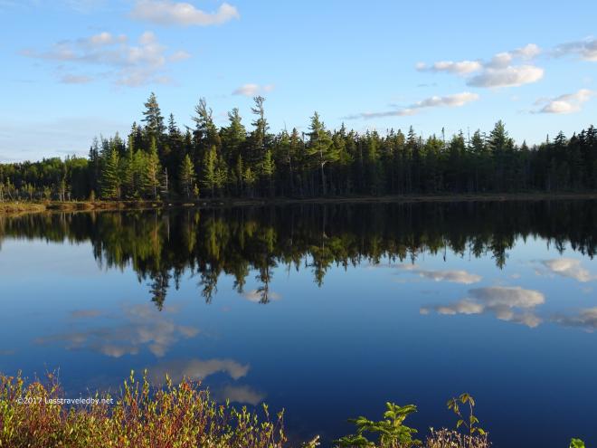
 More quiet reflection time (OK I will stop now)
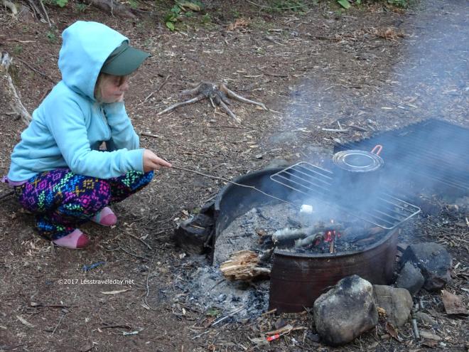 Also time for more marshmallows. Not sure this one was as good as the one on the island, but she seemed happy enough with her effort.
 I wasn’t that happy with my muffins though. The large pot seemed to leave the muffins below the heat at the top needed to brown them. They tasted fine enough, but didn’t fully rise like they should. We’ll apply the lessons learned next time and either use a shorter pot or a taller rack.
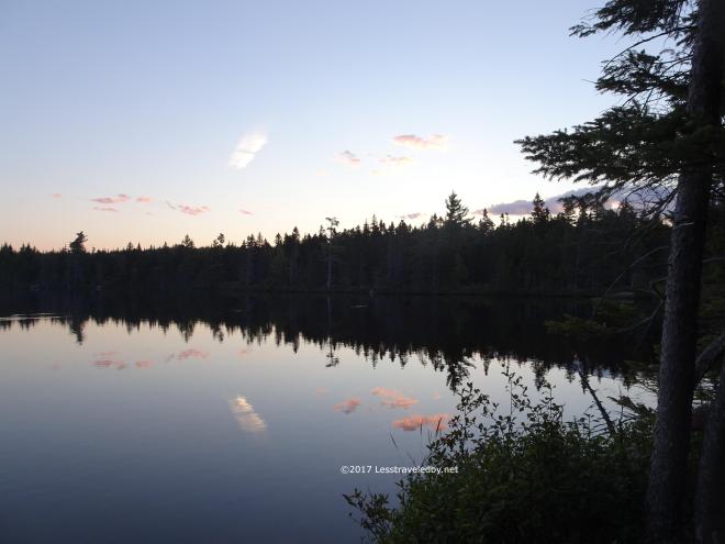
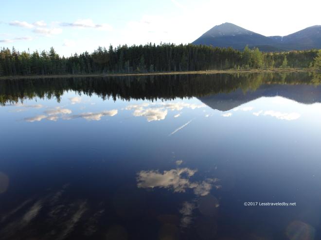
 Last sunset of the trip with just a sliver of moon floating in the sky and in the pond.
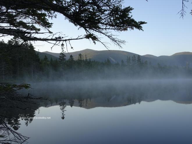
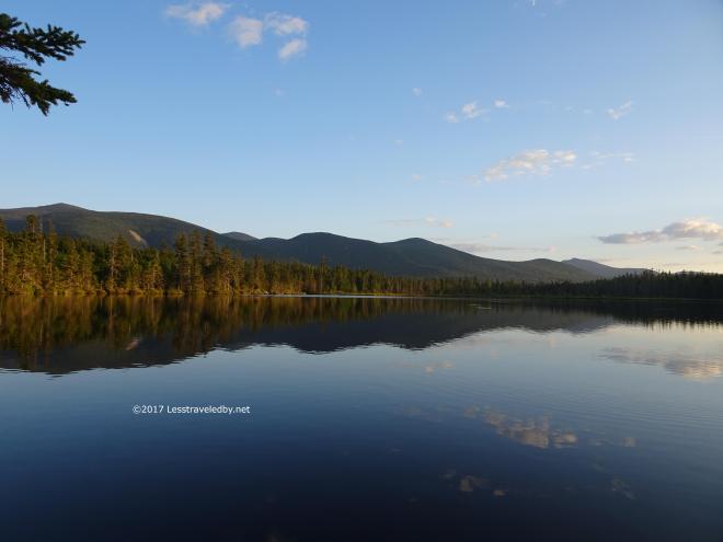
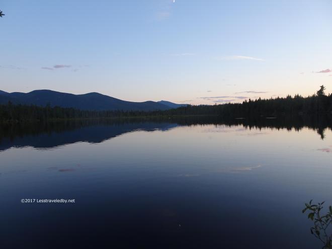
 One last peaceful morning on the shore. Definitely time to soak in that peace so you can carry it home with you.
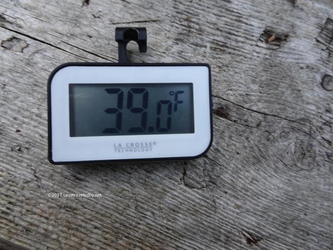 Another chilly morning encouraged us to get moving though, first to make breakfast and then to break camp.
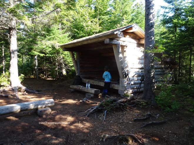 First we said our goodbyes to the camp and lean to…
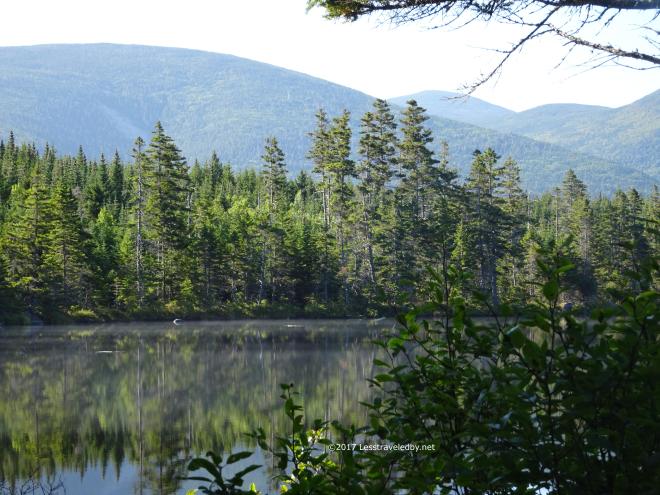
 Then we said our goodbyes to the pond….
 Then we stopped to eat a bunch of blueberries!!!
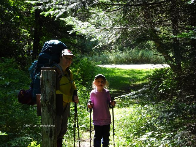 These are the “Holy cow we survived!” faces as we reached the trail head with our car just around the corner. Who could have guessed that we would make it through six days out there and still be smiling?
 This made me laugh when we got back to the car. You could see the rangers had to keep wiping off that spot to read our permit. I can imagine them each time thinking those poor folks must be lost for their car to be here so long, then seeing our permit through the dust and realizing we meant to be gone so long. Now that we’ve pushed our limits I can’t wait to see what we plan for next years adventures!
40 pictures and some babbling about the return of the Boys from Texas for a five day centeral Baxter State Park adventure. The plan was a simple and relaxing one on paper, but the weather made things interesting at times.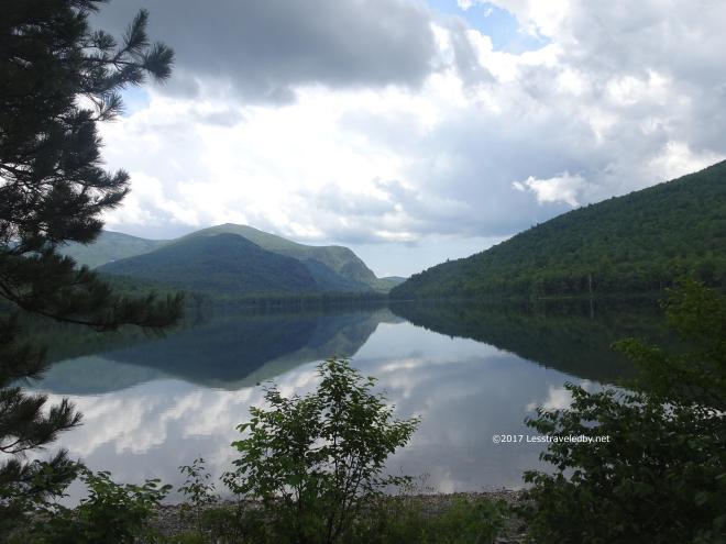 I hope you like this picture from the South Branch camping area looking towards Pogy, not so much because I put a lot of effort into it, but because it is the only picture from day one. We parked and loaded up packs just in time for a few sprinkles. I took a moment as we walked through the campground to the trail head to snap this. Good thing because soon after the sky opened and we were walking in rain for the rest of the day’s hike.
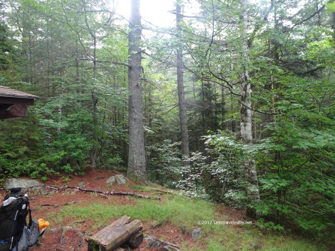 We were soaked when we arrived at the Pogy LT, but the rain stopped about that time so setting up camp was easier at least. A good dinner and sleep helped, but putting on wet clothes the next morning was not part of the original plan.
 Things were still wet, on the ground and in the air. We set out in rain gear to protect against the wet undergrowth of the campsite spur.
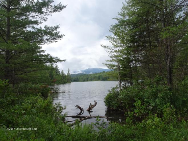
 Some nice views across Pogy towards the mountain despite the less than nice weather.
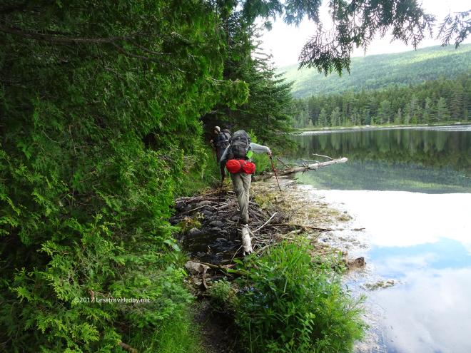 Things were starting to brighten up a bit as we passed through the Six Ponds area. Here we had the chance to test our balance using the outflow debris as a bridge at no risk since our boots were wet anyway.
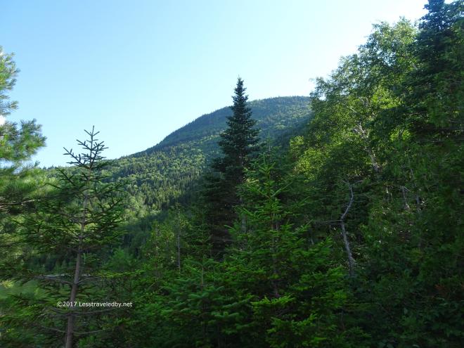 Then things really started to look up as we made our way around Wassataquoik Lake. We had sunshine, a nice breeze and glimpses of the mountains and cliffs rising up around the lake.
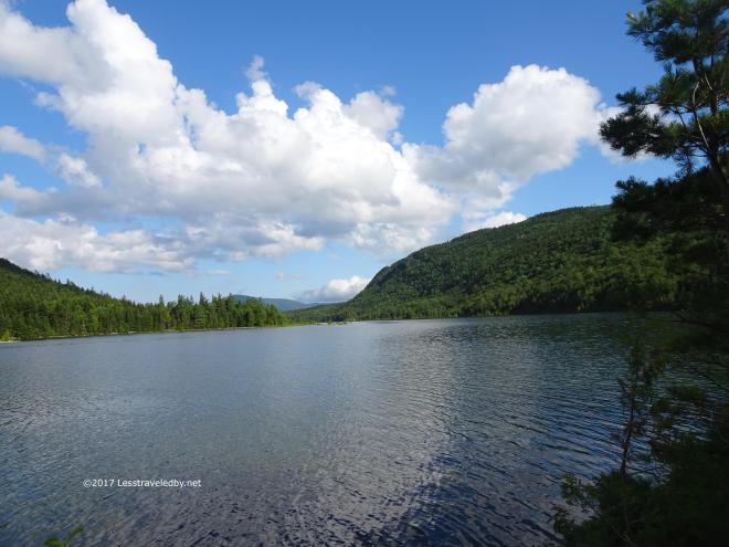 The view from the shore in front of the Wassataquoik Lake LT didn’t include the island at the far end of the lake and we had no sense we were sharing this wilderness with anyone else.
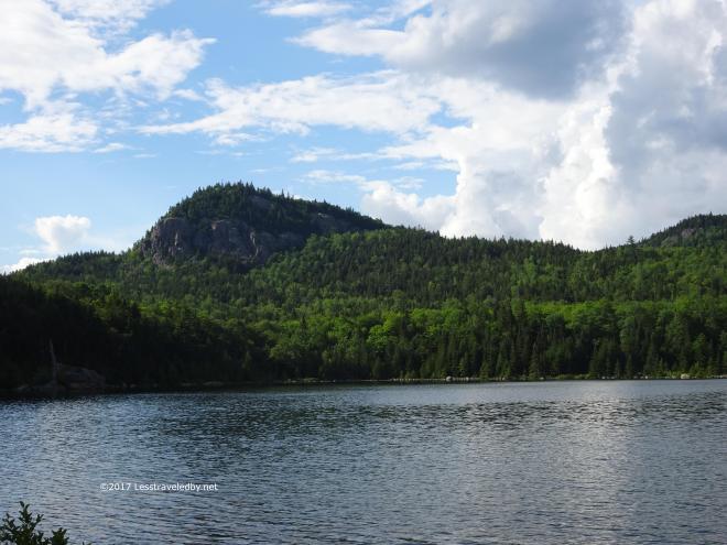
 None of my maps give a name to this little knob but it can be easily climbed via a trail that loops around the far side and has great views.
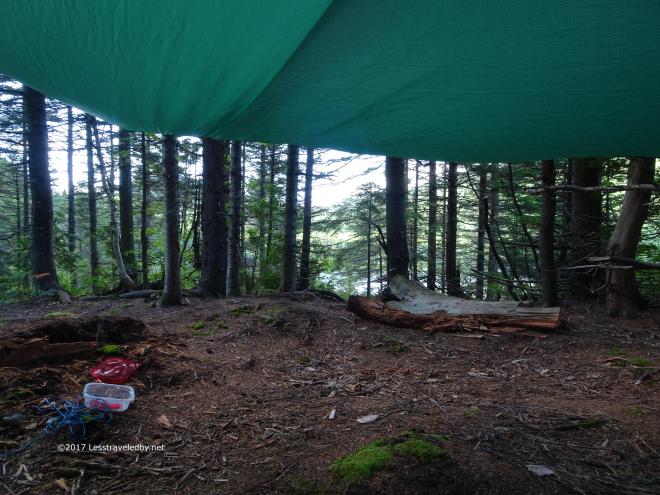 I had a nice view from under my tarp in camp too. With the lingering threat of showers it was nice to have some additional protected space since we were staying here for two nights.
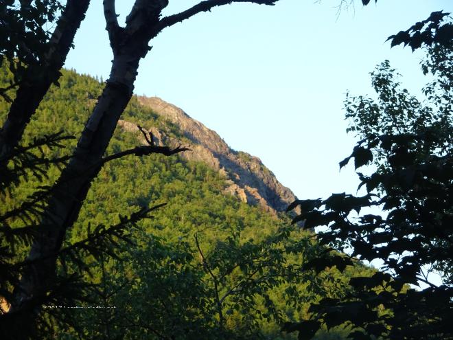 I think the boys may have tried some fishing that first evening, but I was content to just shoot some pictures.
 The mountain was getting ready for night, wrapping itself in what clouds it could find.
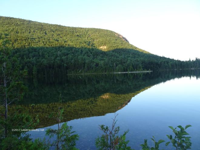 If we had known this was the last calm we’d see at this site we would have been out paddling or fishing. I was too busy enjoying how pretty it was to think that far ahead.
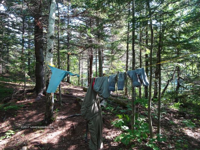 The next day was bright and breezy. Great weather for hanging out the hiking clothes, at least for a while. The boys were planning a quiet day around camp with hopes of fish for lunch, but I had a day hike up to Little Wassataquoik Lake on my to do list.
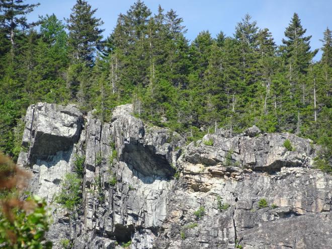
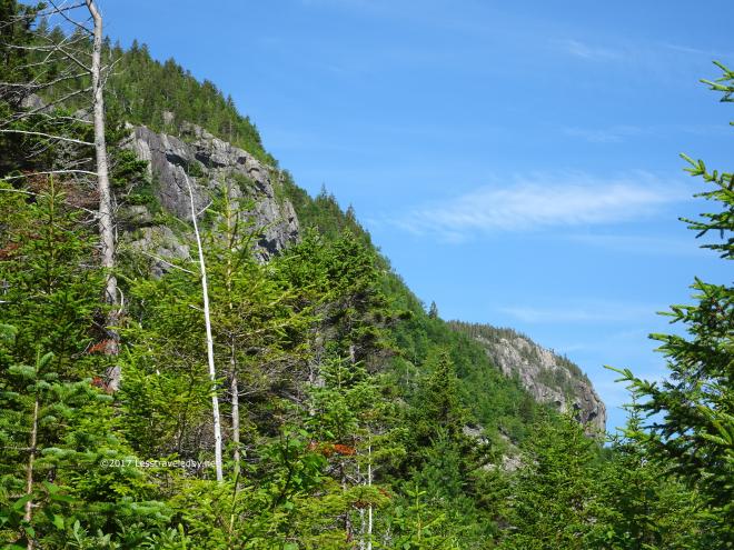 It was a great day for hiking, not too hot and I had almost nothing in my pack besides water and lunch. Hiking below these cliffs was interesting in several ways.
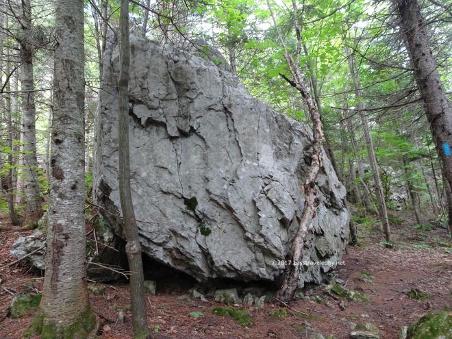 Seeing these chunks that had come down long ago standing next to the trail made you think about gravity and time. Well they did that for me at least.
 Then I reached my target for the day; the tent site named after Little Wass Lake, but not actually on the water. We had reservations to camp here later in the year as part of a family trip and I wanted to do a site inspection so we’d know what to expect. There was hope of leaving the tent at home and using the tarp and bug net to save weight. I made some measurements and took notes so I could figure out a plan later at home.
 Then I headed up the back side of that cliff via a short viewpoint trail and while it was steep it was definitely worth the climb.
 Looking back down at the lake our campsite was on the big point sticking out into the lake from the right side. It really isn’t that far or hard of a hike and would make a great day hike if staying down below.
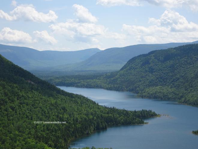
 Little Wassataquoik Lake is indeed little in comparison to the larger neighbor. It seemed shallow and rocky. I don’t believe there is a canoe here for that reason. Just a nice place for peace and quiet.
 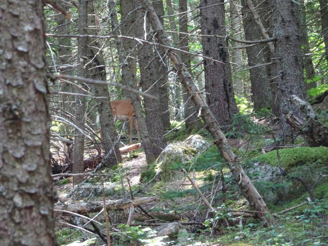 I was quiet enough to not drive this doe off when she was first startled by my approach and announced her presence.
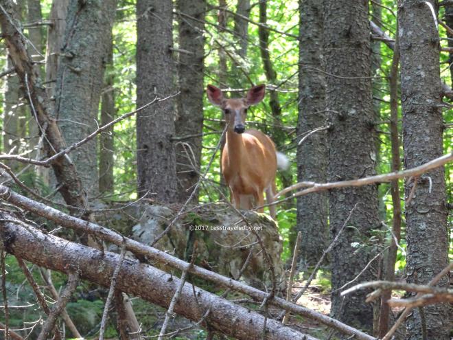 I resisted the urge to move to get a better angle and she rewarded me by moving around the trees to see what I was doing. She kept moving until I found myself snapping shots of her in this spot as she bobbed her head at me trying to figure out what the heck I was doing. This went on for a few minutes and I only wish I’d thought to hit the movie button.
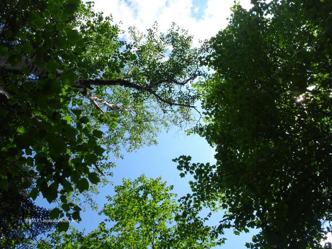 Long time readers will know who this shot is for 🙂
 Back in camp there was still plenty of time left to enjoy a lazy day off. Instead of planning a rugged mountain climbing adventure we were trying to relax more this year.
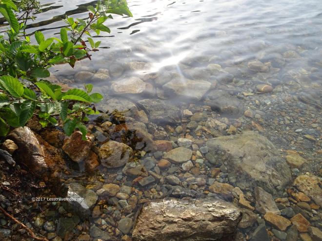 This camp on the lake was certainly a nice spot to spend some time. The water was amazingly clear and still nice and cool in the middle of Summer. The wind kept us out of the canoe and made for poor shore fishing, but we had a nice couple of days there.
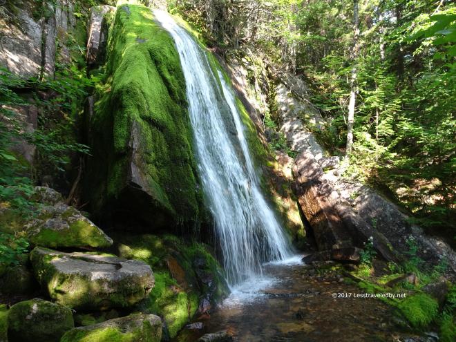 On our way back out on day four we stopped at Green Falls reached via a short and wet side trail.
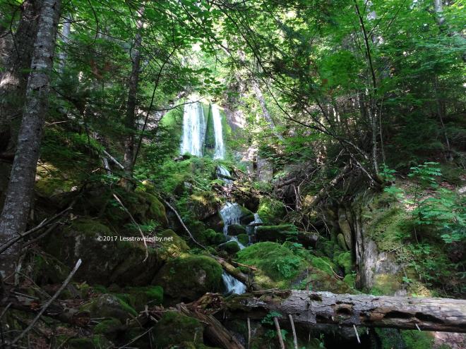 It is a neat spot I’ve been to several times now and I think I’ll always be willing to make time for this side trip when I’m near by.
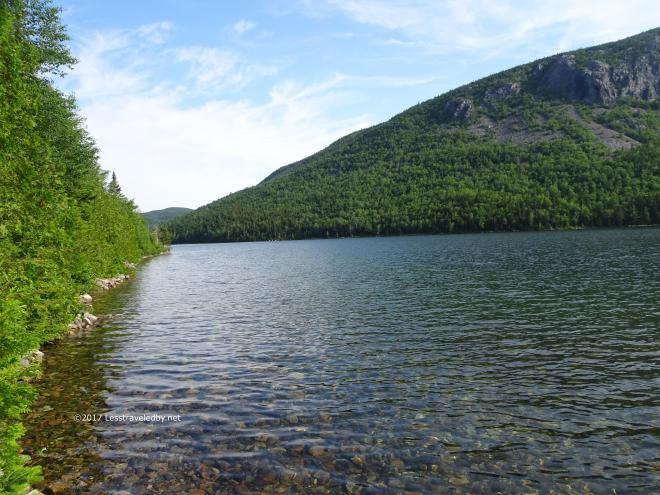 Stopping to take pics and some video I sent the boys on ahead. Racing to catch back up I missed my turn onto the main trail and almost walked right into the lake. Since I was there I figured I would take a few more pics before racing back the other way after them.
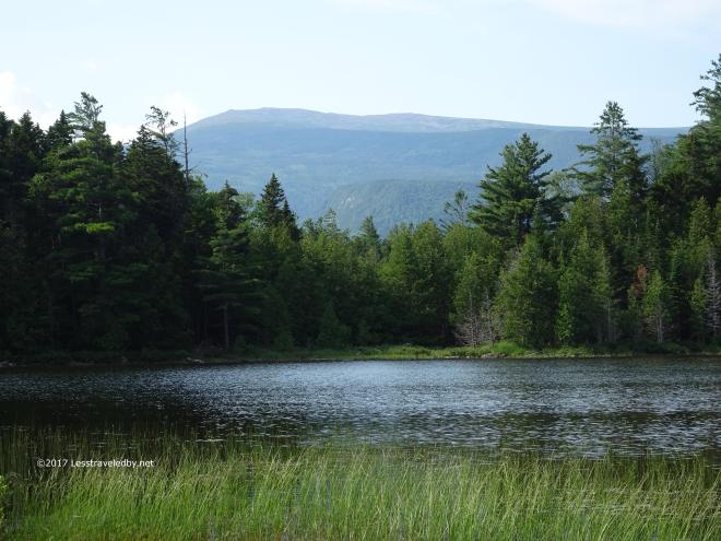 Then we were back at Pogy for our last night on trail. This time we were dry and in much better spirits. Sunshine and dry socks will do wonders for morale.
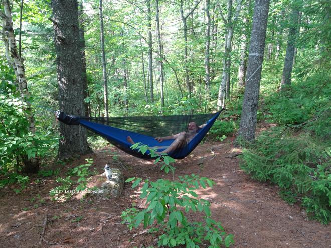 It was hot though with barely a puff of breeze now and again. We sweltered through the late afternoon and then began to hear murmurs of thunder in the distance. As it drew nearer we made some efforts to prepare for a little shower while grumbling about the 10% chance of rain in the forecast. Given the lack of wind we expected vertical falling rain so I set up my tarp in a bit of a porch mode to get some air. Then there was this odd noise for a few minutes that we eventually placed as powerful wind and rain because it was upon us 🙂
Credit for the following pics goes to my brother who first pulled everything he could into the lean to and then took time to take pictures of me trying not to drown as my tarp floundered in the storm.
 The Tato tarp connector sliding down the ridgeline is what led to my doom. This was after ten minutes of driving wind and rain. My brother has done some sailing so I trust his judgement of the winds which he thought were maxing out north of 40mph. Combined with the heavy downpour there was a lot more stress put on that tarp than I’d rigged it for. I never settle for a single hitch on that connector now and always double it up so it can’t go anywhere.
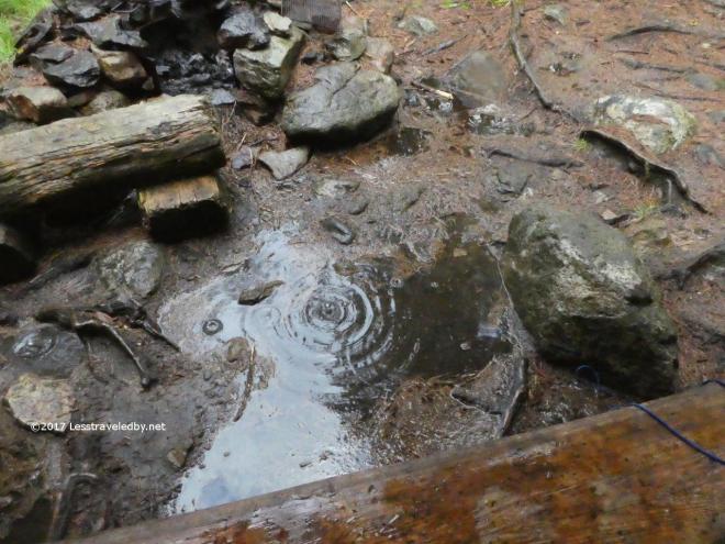 After a while the storm tapered off into just a shower, but it had left a flood behind. This had been one whopper of a summer thunderstorm. Felt bad for anyone caught out on trail in that one.
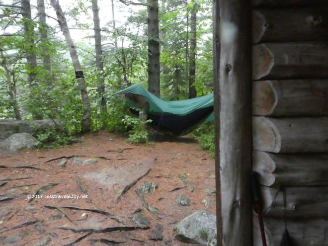 I stepped out into a bit of a puddle, but was able to stay under the tarp while getting it hooked back up properly. The next day while driving out we kept finding tree limbs and entire trees laying across the road. Guess there had been some sort of storm come though 🙂 The Boys from Texas always bring out Baxter’s best weather when they come! Thanks again to my brother for documenting my fight for survival.
  Day five started with some heavy looking skies over Pogy Pond. We knew the trail would be wet from the previous day, but now we were worried about more rain falling too. Still it looks sort of pretty and we were walking back to the car which is always easier.
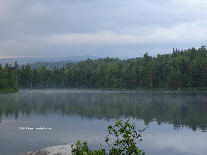 One last long look at the pond. Never enough of these moments so I try to soak them in when I can. Nature can be rough, make life difficult, but even at its darkest, there is great beauty.
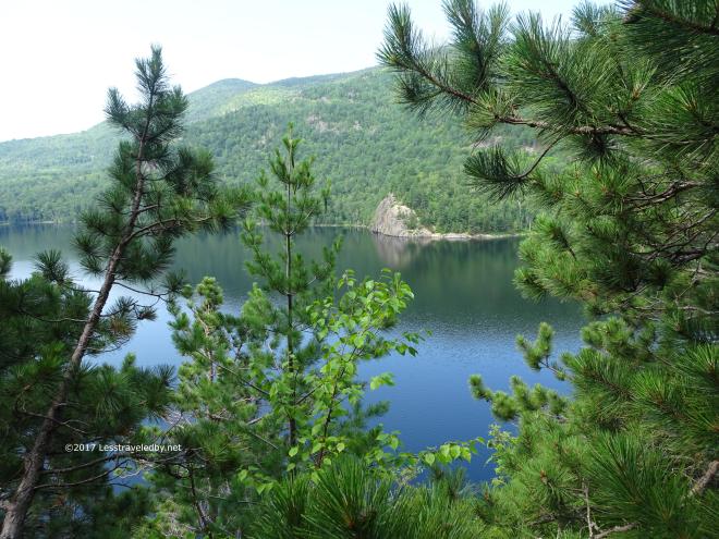 Climbing the bluffs along Upper South Branch Pond is always bittersweet. It is the last real effort before the flat trail that returns to the parking lot. I’m always happy to be up there and done with the work, but know that soon it will be time to start seeing the end of the fun too.
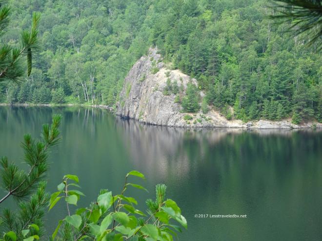
 Someone paddled over from the campground to start their day hike. We’ll end this trip here looking across South Branch Pond towards the campground, the car and civilization beyond.
It is always a pleasure to do this annual trip with the Boys, but boys do grow up. Not sure how long they will keep coming so I’m always glad when they say it is time to start making plans. Hope you folks have had a chance to make some plans this year. I know I have…

36 pics and some babbling about a great family adventure to Maine’s beautiful Baxter State Park. This was supposed to be a reunion after I’d spent eleven days doing the 150 miles from Caratunk to Katahdin Stream Campground, but that plan changed after one treacherous day on trail. Everything, including the sort of rocks you usually can trust when the mud and wet roots are too dangerous, was slippery as heck. I fell down three times on that first day including once while I was standing still talking to some other hikers. I’m too old for that sort of adventure and the weather for the next week justified my decision by raining almost every day including some tremendous thunderstorms. I would have been miserable out there even if I didn’t break my leg.
So instead of walking to Katahdin Stream I drove up with the girls and a cooler full of food. We’d never stayed on this side of the park before so it was fun to explore a new spot even if it was a campground. We got camp set up right away because rain was expected. We set up the bug house and a giant plastic tarp was strung over the picnic table.
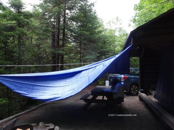 The girls had a safe place to play cards if it rained and I had a place to cook. The real genius of this set up showed up later as I toasted marshmallows over a giant fire while safely protected from the rain. We are backpackers at heart, but car camping does have some nice perks.
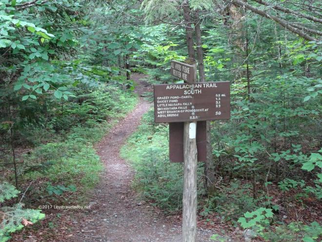 Before the rain started we did a little exploring by walking around the campground. We found the sign that points the way for the southbound AT hikers as they head out of the park.
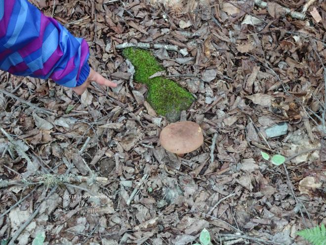 We also found this lovely mushroom which my assistant is so nicely pointing out here.
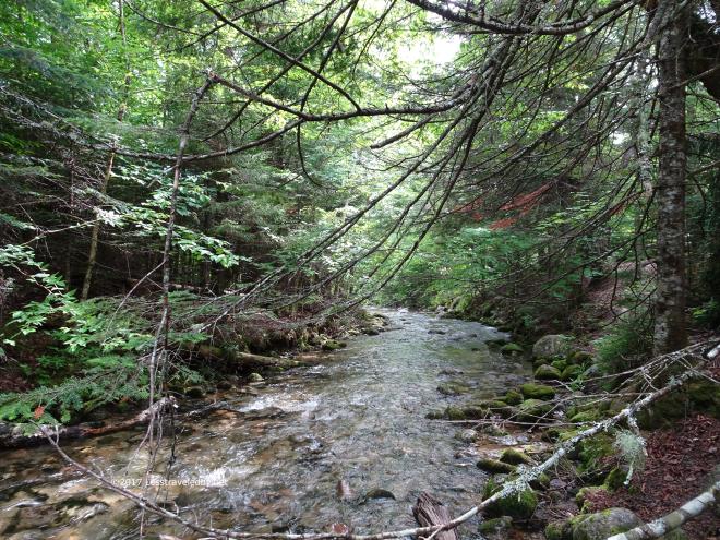 Katahdin Stream was flowing well giving us water right in our front yard both for drinking (filtered) or just listening to the burbling brook thing.
 The weather did catch up to us and there was some fair bit of rain though only a little thunder and wind. We were content to enjoy our dinner, toast marshmallows and snuggle in for the evening.
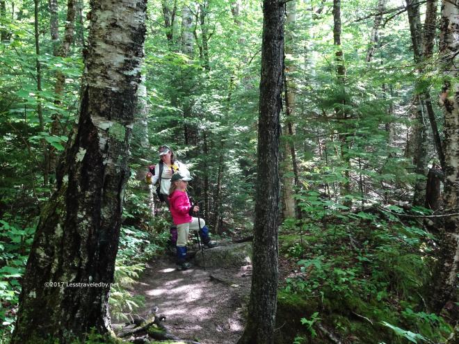 The next day we decided to take our time enjoying breakfast before moving the car to the day parking lot. While eating and enjoying a pot of coffee (Car camping rocks!) we watched the day’s summit seekers head past our site to the trail head. Then we headed up the Hunt Trail to see how far we’d get before we’d had enough. There were no delusions that we were climbing Katahdin that day as parts of the climb are too much for our daughter yet.
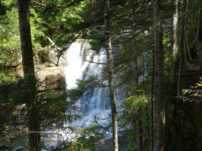 It was a great day to start, though you could feel the humidity of the day building into more rain. We climbed for much farther than we expected and were rewarded with several nice views and water features including this falls.
 Out on an open ledge we could see the clouds were building and sure enough the bottom fell out. No more pictures for a while as we threw on rain gear and carefully made our way back down hill.
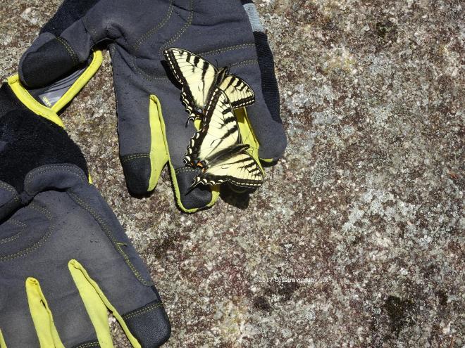 About the time we reached the spot where the little bridge crosses the stream the sun came back out so we stopped in the open to dry a bit. These butterflies seemed to think they’d found long lost kin when they saw my gloves drying on this rock.
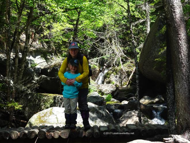 The girls were happy to have the sun back out but I think you can tell mama is worried about her baby going over the falls.
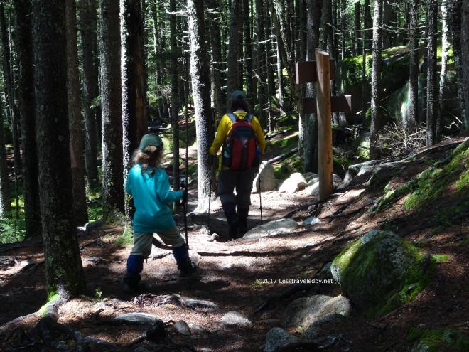 It was a great hike back to the car and then we drove back to the gate before turning towards Roaring Brook campground where we had another two nights booked.
 Another beauty spot with the brook running right past our site. It is campground camping so there are voices and cars, but a nice brook can cover a lot of that up.
 These LTs are a bit close, but we had nice neighbors the whole time which makes all the difference. They were from NJ as I recall and ended up bailing a day early because the bugs were driving them crazy. We’ve really enjoyed having the bug house on our lean to stays this Summer.
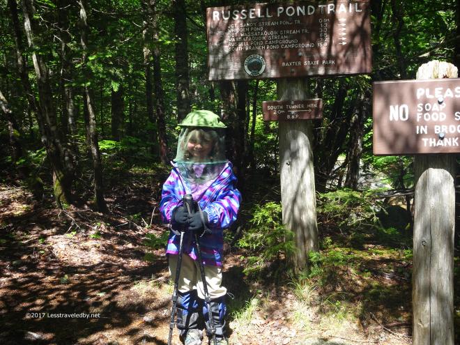 Then it was time for the big event of the trip. Ever since our trip to Roaring Brook last year my daughter had been working up to climbing South Turner Mountain. Telling her that she couldn’t do it then seemed to inspire her and this year we said we’d let her give it a shot. Any party member had the power to stop this trip at any time if they felt it was too much, we aren’t out there to get anyone hurt, but you can see the look of determination on that face. She was ready!
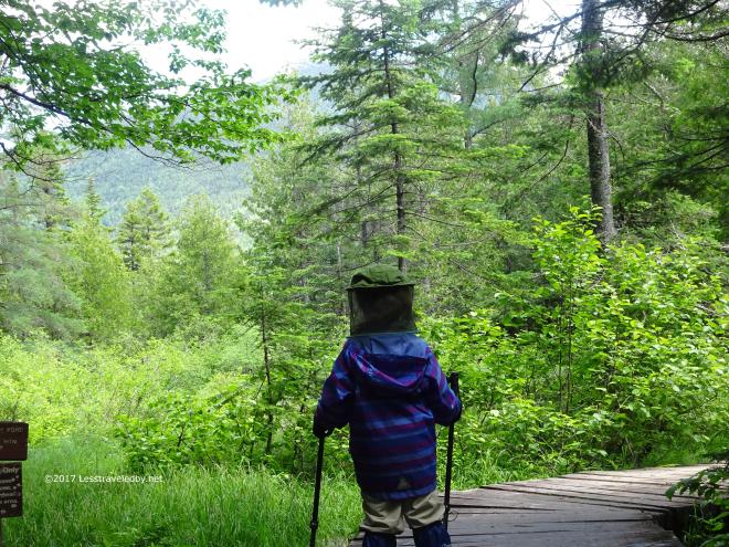 Then we headed down the Sandy Stream Trail a ways until the mountain came into view through the trees. I told her to take a good look so she knew where we were going. The first test of her determination.
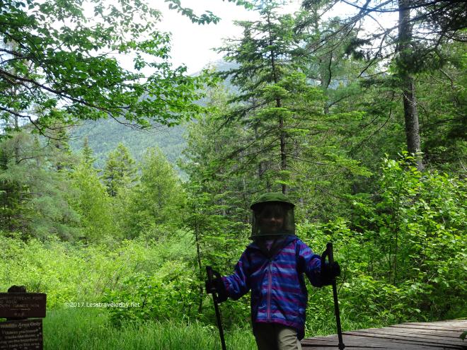 No problem she says, we got this!
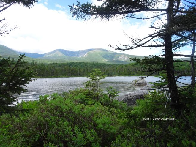 There was time for a few beauty shots as we walked through a Sandy Stream Pond viewpoint or two.
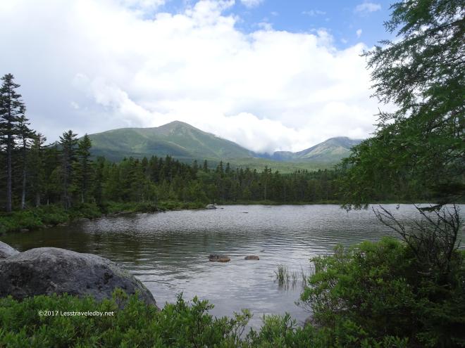 Hard to resist standing there and watching that cloud pour over the Knife Edge with only Pamola in sight, Baxter Peak completely obscured.
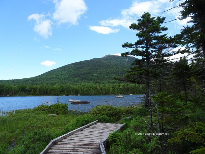 Then we remembered what we trying to do. That mountain with the big lumpy thing near the top was calling us out. We had some climbing to do!
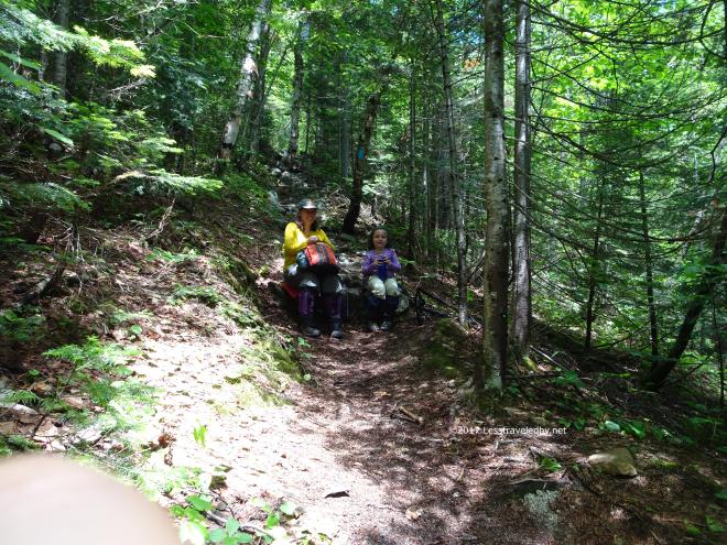 Lots of little steps, lots of daddy holding his hands out as she did the steep parts and plenty of rest stops to drink water and eat snacks got us up the first half of the climb. Then we dug into our reserves of determination to get us up the next sections.
 Finally we emerged from the trees onto a little ledge below the big lumpy thing. I kept expecting either mother or daughter to say that’s crazy and I’d have been happy to turn around here if they did. Nope, excelsior was the word of the day!
 This is the last pic until we reached the summit because it was the last time I wasn’t right behind my daughter with hands ready to catch her if she stumbled. She may be strong and courageous, but I worry. Both ladies were amazing considering the unstable, rocky terrain. They took their time and soon we could see the post at the top.
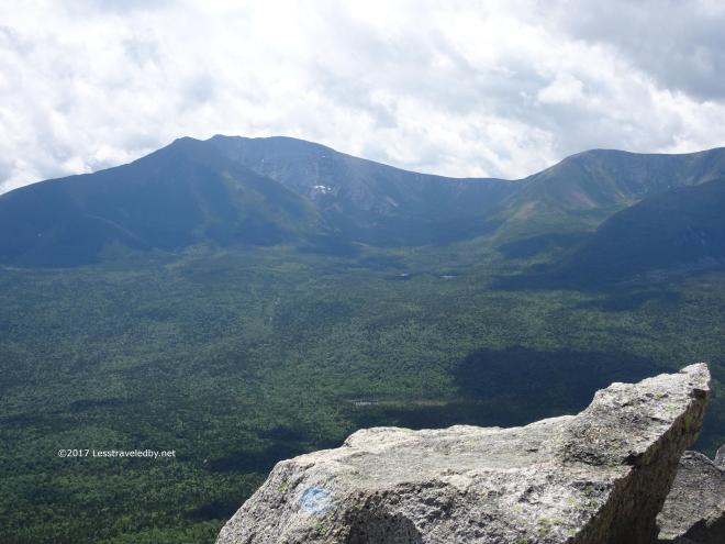
 Posts are nice, but first you’ll notice that the clouds have shifted and not only has Baxter Peak come into view, but Hamlin and its bowl were clear as well.
 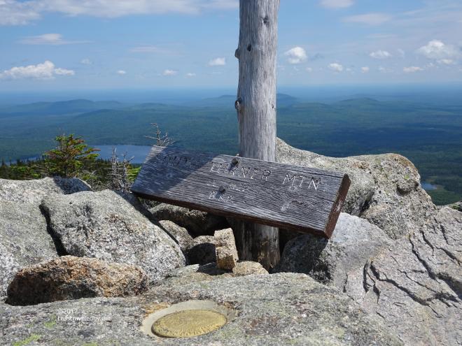 Now back to our post! The sign was just leaning there, but the geo marker made it clear we were in the right spot. We had just climbed a 3100′ mountain as a family setting a new elevation record by far.
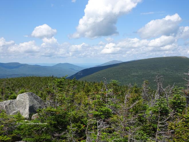
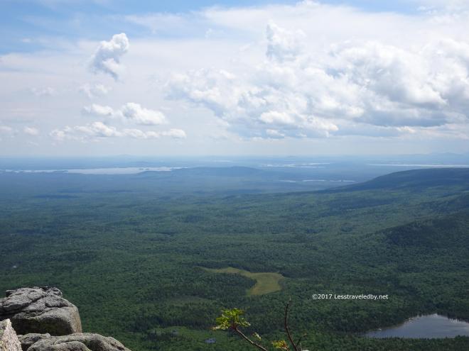
 Just such a beautiful day out there everywhere you looked. Sunshine and puffy clouds as far as the eye could see.
 Then there was this beauty! She had said she was going to climb this mountain and given the chance, she proved she could do it in style.
  While mama was equally proud of her little girl I have to say I was really impressed with my wife’s bravery as well. This was her first time climbing a mountain like this too, plus she had parental worrying to deal with just like I did. Everyone had a lot to feel good about after this adventure, that is for certain.
 Back down at the pond we stopped for a break and to soak in more of the mountain views.
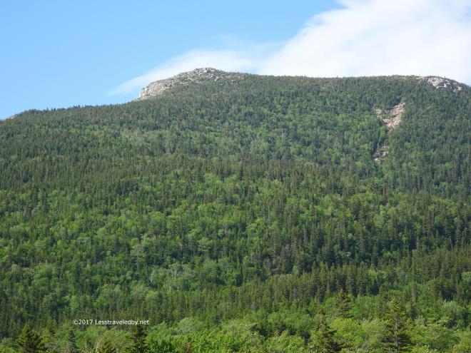 Looking back up to where we’d been it was hard to believe we were up there just a little bit before. The descent went much quicker than the climb 🙂
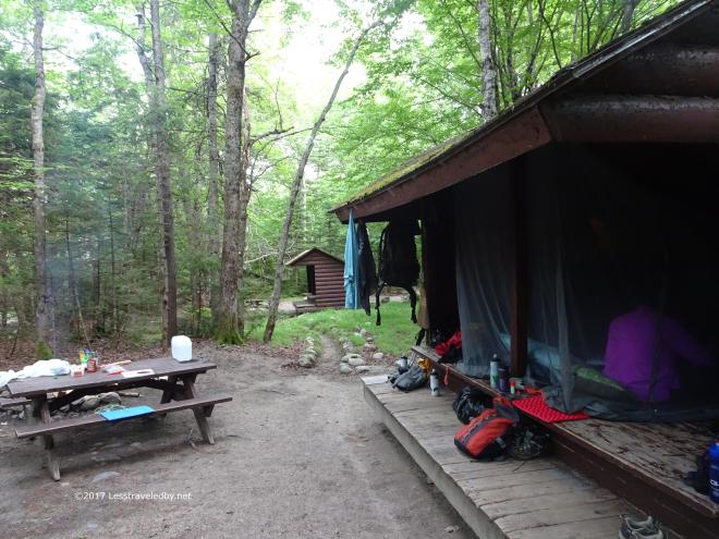 Back to camp for a giant celebratory dinner and of course more marshmallows over the fire. We didn’t have to worry about climbing mountains or long miles back to the car in the morning so we could pull out all the stops. Back country adventures are always nice, but we’re ok with a little car camping too!

48 pictures from a four day family trip to Baxter State Park.
We tempt the gods every year by making a reservation for a few days in the park the week before Memorial Day. It really is too early to be sure there won’t be snow, in the air or on the ground. We’ve only cancelled once due to a heavy rain forecast. This year we didn’t even let that stop us!
The first day we hiked into the Martin Ponds site so quickly I didn’t take any pictures on the walk in. I have some video of the girls walking across a bridge, but the still camera never came out. At less than three miles it is less than our usual morning walk, but we did have packs on. Still the hike just flew by and we were in camp early in the afternoon.
 Once we arrived I hurried to set up the new bug house we are trying this year. We’ve always set up our Kelty TR3 in lean tos previous years. The shelters vary quite a bit in terms of size and shape with some being a real challenge to squeeze the tent into. This big net rectangle can change shape to fit into what space is available. Thankfully the bugs weren’t too bad, it was cool and threatening rain, but it was good to have a safe place in case we were attacked.
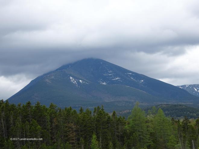 The skies were looking like the bigger threat at this point. Baxter and Pamola both disappeared into the clouds on the far side of the pond.
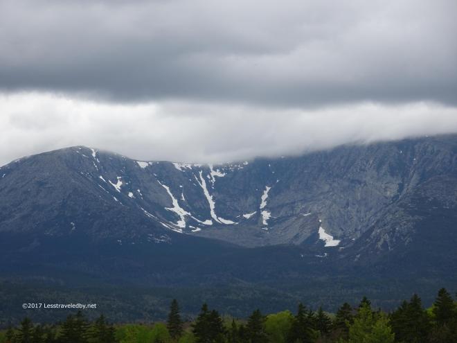 There was still a lot of snow up in the Hamlin bowl. Looking at that under the dark and threatening sky made me look forward to getting under the quilts later. We were expecting a damp night before the real weather hit the next day.
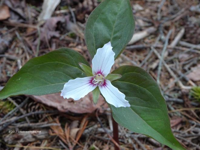 There were only a few early trillium out and about as Spring was taking it slow this year.
 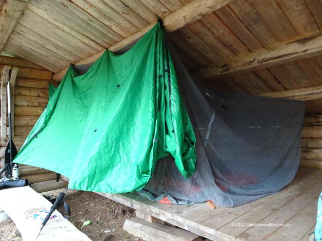 With the increasing dampness we decided to get rigged for weather before dinner. This being our first trip with a tarp rather than a tent we thought it best to have a plan that had been put together before we got wet rather than after. First I rigged it for the coming storm, then pulled it back like you see above so we had more light and air inside. This way I could go back to storm mode in an instant if the wind started pushing rain at us.
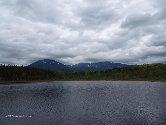 Knowing we’d be hiding out from the weather all too soon made me want to hang out down at the pond for a while after dinner. It looked very dramatic no matter which direction you turned your eyes in this light.
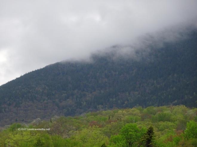 Even South Turner, a lower peak just to the north of our camp, began to fade into the clouds. The sky was coming down to meet us and it looked like it was going to be a wet embrace.
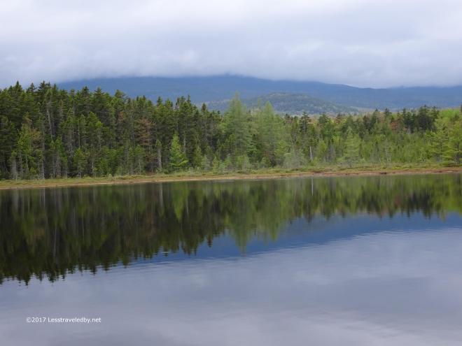 I said goodnight to the pond and what trees I could still see and headed up to join the girls in the lean to.
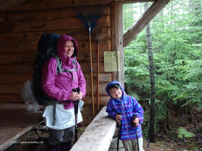 A good night’s sleep, warm cereal in our tummies and even a little coffee for the big kids left us all smiles as we prepared for the short hike to the North Katahdin Lake site. The rain waited until we were ready and then started in earnest just as we left camp.
 You can see puddles were forming before we even got started. I was taking advantage of the opportunity to test out a new rain skirt. Weighing almost nothing it kept my legs pretty dry until I topped my gaiters on a water crossing a little later in the morning. This soon after the snow melt things were pretty wet before the storm hit. After an hour or two of heavy downpour the two small water crossings we had to manage were a bit larger than we’d have liked.
The first we dealt with relatively easily with me carrying our daughter as we usually do. The second crossing looked bad so I started across alone without my poles to see how it might go if I tried to carry her. Glad I did because just a few steps told me this wasn’t going to work. Thankfully my wife and I work together well as a team. Just as I was feeling a bit stumped she noticed the brook split into two channels up stream and suggested we bushwhack to look for a better crossing. I married well!
It was an exciting crossing we won’t soon forget, but that is the stuff adventure is made of. Working as a team we got our little one safely across without her feet even getting wet. She actually led the way most of the day with a huge smile on her face.
 We call this the gumdrop look. You’ll notice my wife hasn’t even taken off her garbage bag skirt and we already have our little one in dry layers and swaddled in her 20°F synthetic bag. You can also see that she is staring intently at something she is about to devour heh. I stripped out of wet layers and applied dry ones to myself as well, though I opted to keep my down quilt packed up to avoid soaking up too much moisture from the air.
 The scene in front of our new lean to looked a bit grim though there was more light in the sky than during the worst of the storm. The rain would linger throughout most of the day with some breaks later.
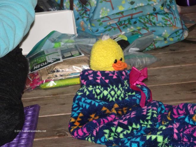 We made sure everyone stayed warm and dry. No duck left behind! is in fact one of our family’s official mottoes and we made sure this one, Boo Boo was as comfortable as the rest of us.
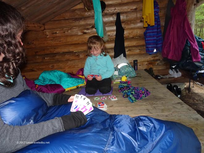 After making certain our daughter (and her duck) was warmed up it was my wife’s turn to get under her quilt. Then the Skip-Bo battle reignited which also helped keep things warm.
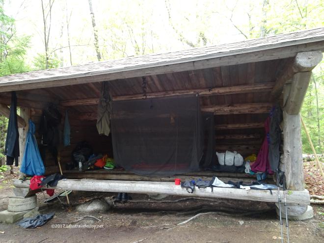 The next day we took our time leaving camp so we could dry out a bit before putting on our wet clothes for the trail. It also made sense to give the water levels time to go down, or at least we hoped they would be lower rather than higher.
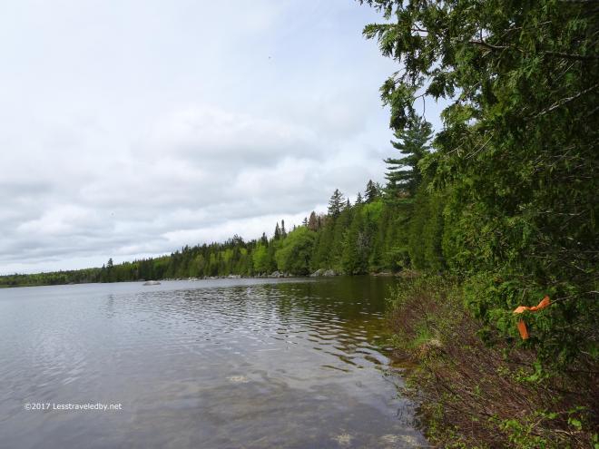 The rain had stopped but the damp air was cool and no one felt like paddling out on the lake. It wasn’t choppy, but it didn’t look inviting.
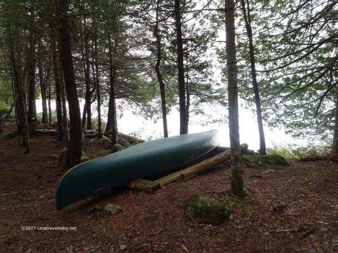 This is one of the camps where a canoe is included in your site rental at no extra charge. I have a feeling we will be back here for a warm weather visit so we can spend some time paddling and swimming in the clear lake water.
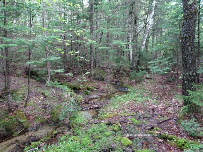 This was the little flow we used to collect drinking water to filter. It didn’t look like it would last into the drier months but it was handy on this trip. The lake had a lot of debris on the surface and suspended after the storm despite being relatively clear by Maine pond standards.
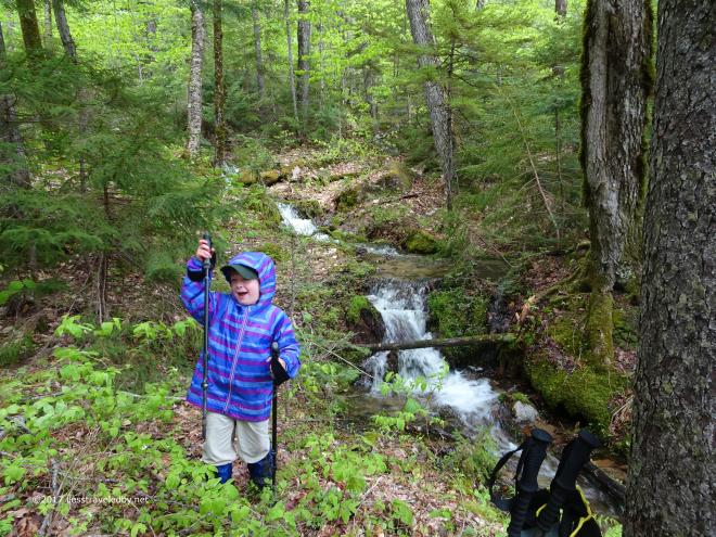 Then we were back on the trail headed to Martin Ponds for one more night. We stopped for a morning snack break next to this little falls.
 Just below it filled a swampy bog which looked about ready to explode with life. These areas and the larger ponds support huge populations of frogs. The sound can be deafening at times as multiple breeds try to all be heard at once.
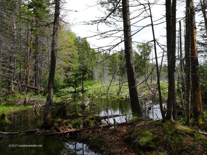 Beautiful to look at, but areas like this are why bushwhacking is not a good idea in large parts of Maine. If you don’t know how to get around all that wet then you are going to get wet!
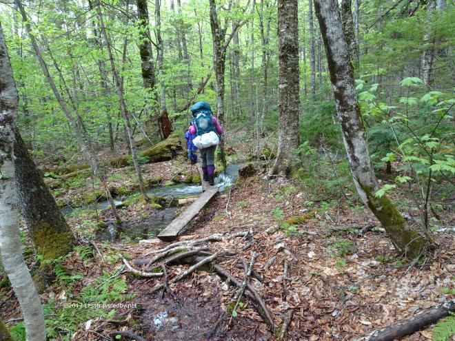 Here we had the luxury of relatively well maintained trail including the occasional, well placed bog board or two.
 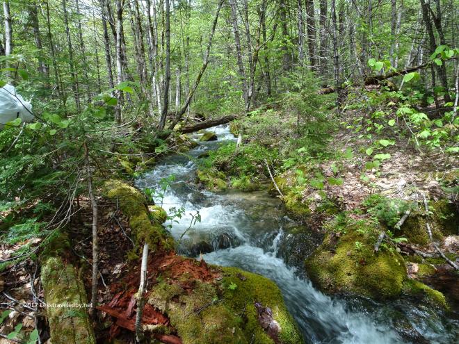 This was part of our exciting water crossing the day before. It was still exciting, but without the pouring rain and having survived the first attempt, it seemed less dangerous. The water level had dropped a bit too which likely helped.
 Here are the girls bushwhacking back downstream after we finished crossing the second channel. Again I have to acknowledge that I have been blessed with two strong and courageous trail companions. These two handle adversity better than most folks out there, staying cheerful and full of adventure.
 This is where the two channels rejoined making for a wide, deep section that was flowing strong. I could have crossed this alone that day, but we don’t take any chances with our little girl.
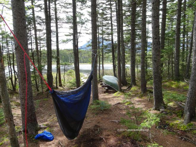 Once we got back to Martin Ponds I got the bug house set up first, then set up my hammock down by the pond so I could air out a bit in the breeze. Good thing I had the bug net because this was their day and they were out in force.
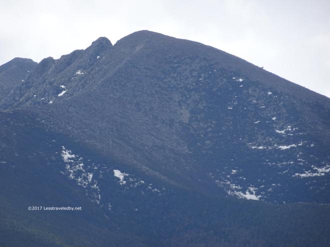 I also had a lot of time to play with the camera. Total count for this trip was 277 pictures over four days, plus some video that will show up once I’ve had a chance to do some editing. Here I was testing out the zoom function looking at Pamola and the start of the Knife Edge from a few miles away.
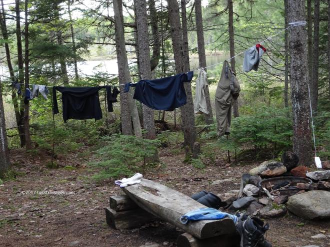 It isn’t all pretty out there though. After all the rain it was nice to have a chance to hang out the wet trail clothes. Something hopeful about stringing up the line and seeing if just maybe you can put them on dry the next day.
 The girls were enjoying a bug free afternoon of Skip-Bo in the shelter. After one trip we have decided that we really like this new set up in the shelters. We just aren’t sure if we will like it under a tarp without a lean to. It would work well enough in good weather I’m sure, but rain might be difficult to manage.
 Later in the day the wind dropped enough for the pond to start reflecting the sky and everything around it.
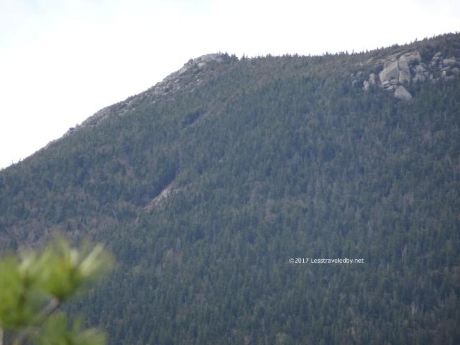 This is the summit of South Turner which my daughter would like to climb later this month. If we have good weather on the day we’re scheduled to be there we’ll give it a shot. Not sure she can do it, but she wants to try so we’ll find out I guess. No harm in turning back I always say 🙂
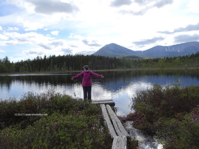 One of the best parts of going on family trips is seeing how happy my wife is when she gets to play outside. I feel the same way myself, but it is nice to see that look on another person’s face. Just the simple joy of existing in a beautiful place with time enough to appreciate it.
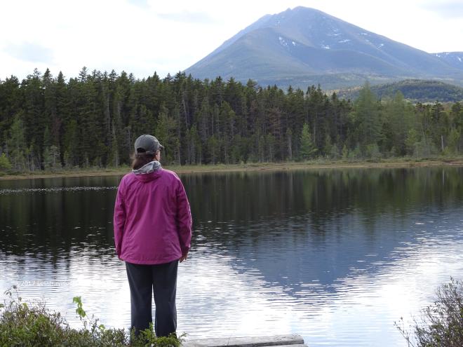 I don’t know exactly what she sees when she looks at the mountain. She has never been up there and I can’t imagine Katahdin looks the same to those who haven’t as it does to those who have been to the top. I hope we get the chance to do it together some day, with or without the little one.
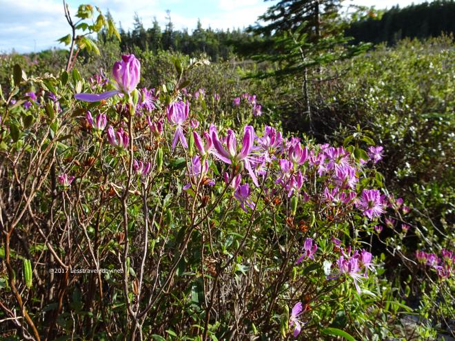 The rhodora around the pond were just starting to put out their beautiful flowers. For now green was still the dominant color around the edges of the water, but within days the entire area would turn purple it seemed.
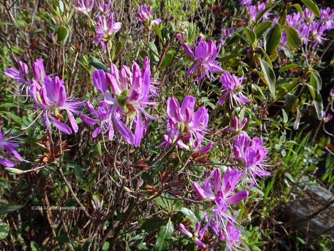
 As the water became even more calm and the sun started drifting lower bringing softer colors out it was time to capture some magic. Camera and location get all the credit, I just lug it around and point it at this stuff, so I’ll be quiet and let you look at the pretty pictures for a few minutes…
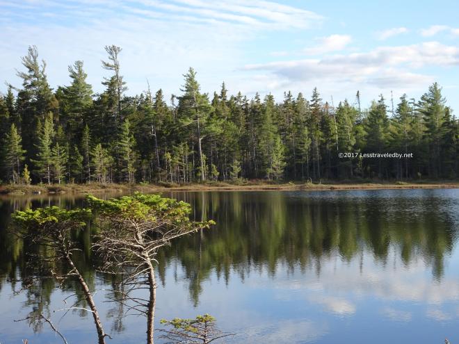

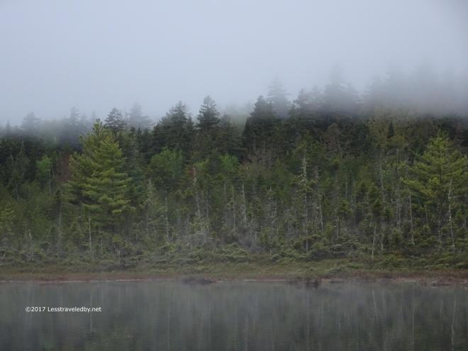 The next morning started with fog hanging just above the trees. Everything seemed quiet and peaceful. It would have been a good morning to go back to bed, but after three nights in the woods we were all looking forward to the traditional on the way home cheeseburgers.
 Still there was time to stop and soak it all in for a few moments. To be here at this misty pond listening to the nothing and being the better for it.
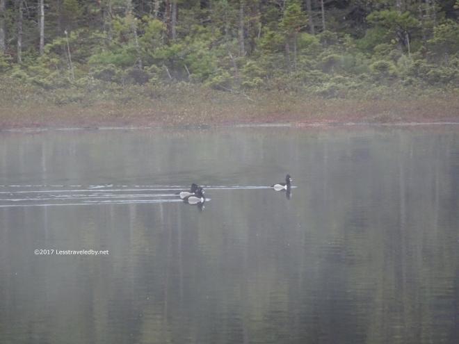 These are ringed ducks I’m told which explains why they didn’t look like loons to us. Other than splashing about playing or fishing they made no sound we noticed. They were pretty though!
 Also pretty! I rarely make a fire these days, but on this damp morning it seemed it would be appreciated. It looked picturesque as I recall so I thought it should be documented as a darn nice fire given the wet conditions.
 Homeward bound! Everything, wet or dry, crammed into packs one last time and then it was a sprint to the car. Cheeseburgers highly motivate us on the last day which is why everyone is sworn not to mention them earlier in the trip.
 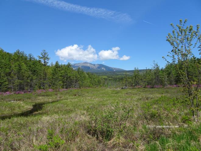 Despite that we had to stop along the road on the drive out of the park for this view. In another week that meadow was probably filled with colorful flowers, but you won’t find me complaining about the way this looked.
Hope you folks are getting out! I am which is why I will be falling behind on these reports. Don’t expect anything to be posted for the next couple of weeks as I haven’t figured out how to to access this site via satellite 🙂

39 pictures from a second attempt at a trip that ended waist deep in a flood when we first tried a few years back. This time we finally got to see the entire loop and no one was at much risk of being swept away.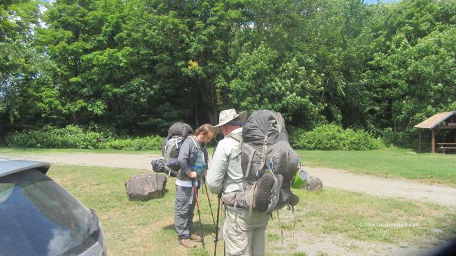 But let’s start at the beginning, loading up in the parking lot. Once a year the boys from Texas fly up to Maine to eat lobstahs and allow me to drag their butts through some mud or over a mountain or two. Like our previous attempt we were headed counter clockwise around the loop, but this time Frost Pond would be our last night rather than our first so we were starting from a different spot in the Trout Brook area.
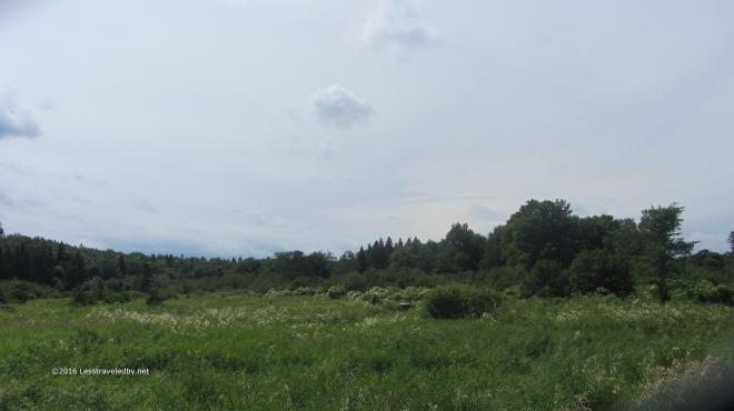 This trip was a month later in the year and we were hopeful the weather would be kinder as the forecast called for little chance of rain during the week. It was warm and a bit humid, but we had only five or six miles of relatively flat trail for the first day.
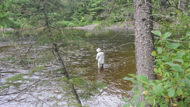 On our previous visit to the Little East campsite we’d had wonderful luck pulling dinner out of the brook before the storm hit. We all broke out our rods and got busy soon after reaching camp in hopes of a repeat performance.
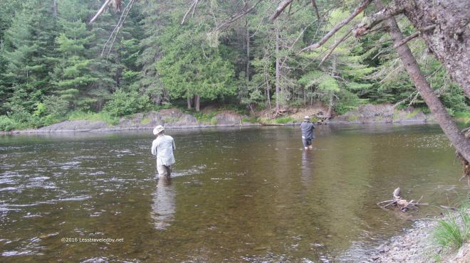 Sadly we were only getting hits from undersized fish for the most part, though my nephew did manage to find a couple of keepers to have for a snack. I felt bad about torturing the little ones that kept taking my lures and decided I’d settle for eating out of my food bag and sleeping better instead.
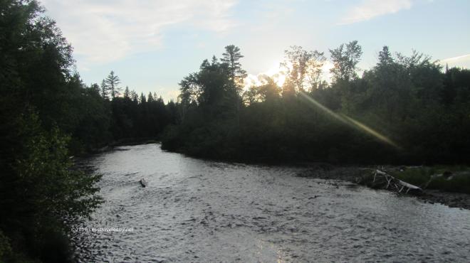 The brook was running quite a bit lower than normal as the Summer had been pretty dry. Certainly a far cry from the muddy and foaming flood that was pouring through here on our way out last time.
 The confluence of the Little East Branch of the Penobscot and Webster Brook was peaceful as evening came on. After a first day of easy trails everyone was feeling pretty good, but I could tell the horrors of the previous trip had left a mark on everyone, leaving us all a bit nervous despite the lack of reason for concern. I knew once we made it to camp the next day that would all be gone.
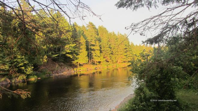 The peaceful sunset continued as sunsets do and we passed a relatively peaceful night. There was a brief shower and the patter of rain on the shelter roof was enough to make us all sleep a bit less easy. Thankfully the morning dawned clear and we were on our way up the brook.
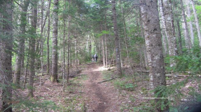 Having been here just a few years ago the trail seemed familiar, yet very different since it was so dry. Last time the rain had been coming down for more than twelve hours by the time we were in this spot and trail was puddling heavily already.
 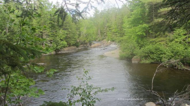 The brook was flowing well enough as it is fed from Webster Lake via an outlet near our next campsite. Last time it had seemed like it wanted to eat us, but now it looked like a relaxing spot to camp.
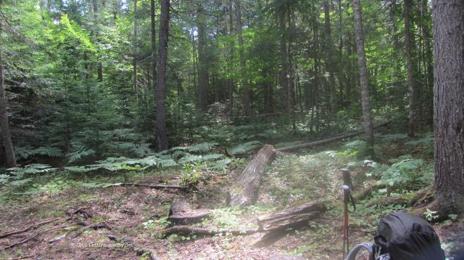 We stopped for lunch where the old Webster Stream LT used to be. I’m pretty certain it stood somewhere right about here. Not sure if they helicoptered out the debris, but the site restoration was so well done that we weren’t really sure if this was the exact spot. I did find a tiny piece of roof shingle to verify it had been here close by.
We took shelter here after being turned back by the flood on our previous attempt. Soaked after a long day of hiking in a deluge and then wading back out of the flood at the Hudson Brook crossing we were happy to spend the night here. In talking to the folks at the Baxter office they said almost no one ever reserved this site and after the tornado it was removed as part of the rehab effort.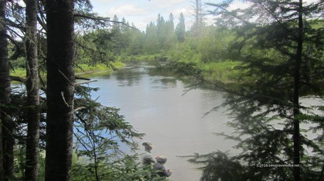 It really was a pretty spot and I’d imagine early in the year the fishing might be good as there is a deep channel here. The boys headed down to filter some water rather than fish as we still had some miles to go that afternoon.
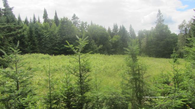 We passed through this area filled with raspberry bushes and I was grateful to find they weren’t quite ripe yet. I have a feeling this spot is bear central once those berries turn red. As much as I like eating those wild berries I don’t want to have to wrassle a bear over them.
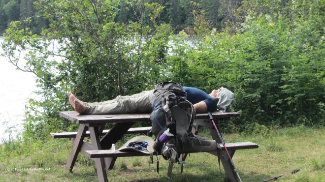 Ahhhh, camp. We found the newly created bypass trail to be an amazing bit of work. Shortly after the flood we enjoyed there followed a tornado that toppled a huge swath of trees. That one two punch left a mess easier bypassed than recovered so a couple of miles of new trail were created from scratch. When we crossed over Hudson Brook it was so tiny we didn’t even realize what it was at the time, but we were moving along quickly in anticipation of finding our campsite.
 Once we found it we were a bit less enthused heh. Clearly this site being so far from the park road and accessible via means other than walking (boat & snowmobile) meant it saw a lot of use and some of it by folks not too concerned with being good neighbors. Most sites with canoes will have a bunch of life vests and certainly more than just one paddle. On the other hand this site came with an old burnt up pan and a latrine filled to the top with trash so there was a trade off, though not in our favor.
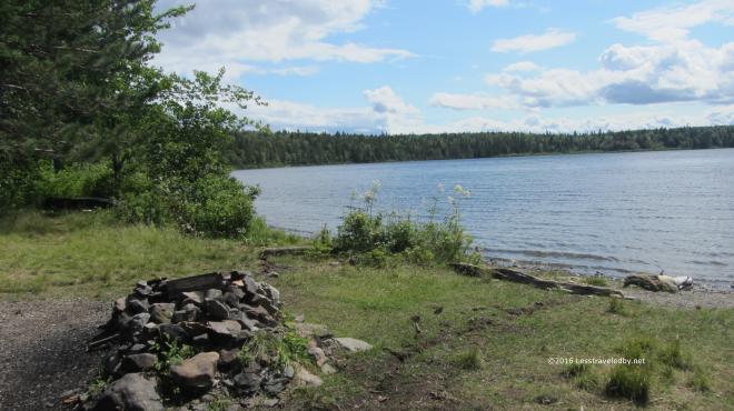 It did also come with some great views. Right on the lake it was exposed to the wind, but there was full sun and lot of beauty to soak up.
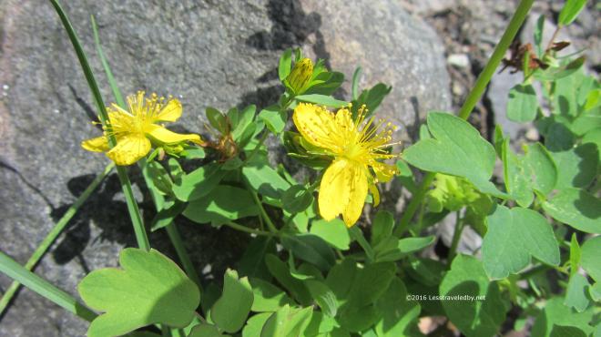
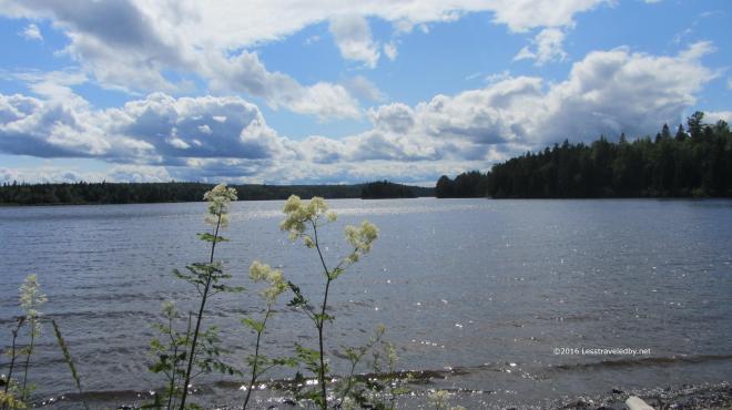
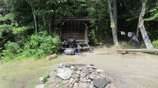 The LT here is pretty small, but this site is also a tent site which is rare, allowing a total of twelve in a party. The boys decided they would set up their tents on the grass to enjoy the breeze leaving me the lean to all to myself. Well except for a shelter mouse heh.
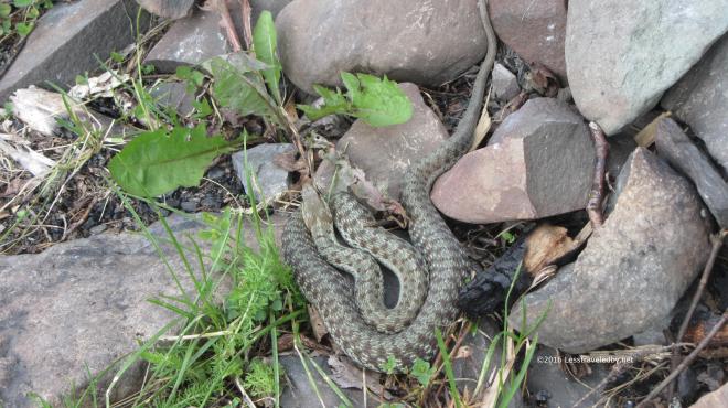 There were two different looking snakes living in the rocks around the fire ring. They would come out to sun themselves, only withdrawing into the rocks if we walked too close. I was hopeful at this point that they had eaten all of the shelter mice since they looked to be fat and happy snakes.
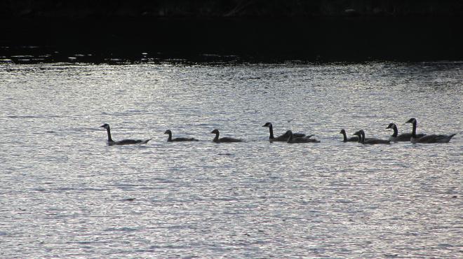 Speaking of fat and happy, this flock of geese swam right through our front yard later in the afternoon. There were also some loons and at least one bald eagle working the edge of the lake.
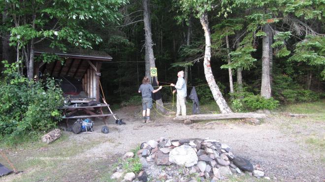 The boys decided to see if they could hang their food bags which made for good entertainment. They each took a shot at it and in the end settled for what they could make of the situation. Since mice and chipmunks were our biggest threat they did just fine, but I think a smarter than average bear might have gotten their bags.
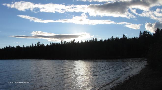 The campsite may have had a bit of a dumpy feel to it, but there was a lot of good to be seen here as well. There was a great moon to enjoy once the sun set, but we were sleepy campers and missed it for the most part.
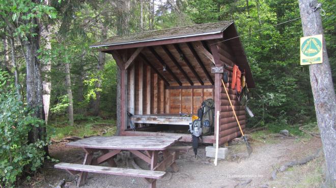 Packing up in the morning I’d survived my night with the shelter mouse. He survived too, but not unscathed. At one point, a particularly bad point for him, he jumped up onto the side of my tent that I’d pitched to keep him at bay. I happened to be sitting in just the right spot that the instant he hit the tent my hand instinctively slapped him off. He flew into the night and didn’t return 🙂
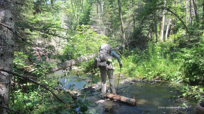 Leaving Webster Lake in the morning headed towards Hudson Pond we found ourselves crossing Hudson Brook again. It was hard not to giggle at the thought that this tiny creek had given birth to the raging flood we found ourselves trapped by on the last trip. Of course that was the nervous giggle that only a man whose found himself thigh deep with a rising flood roaring all around him knows isn’t all that funny, but still, this seemed impossibly small.
 Heading up the hill towards Hudson Pond we entered the Forest Science area of Baxter State Park. First we passed through an area that had been logged some years before. The trail there was very hard to follow at times with few blazes and little in terms of an obvious treadway. Some trees had been cut about ten feet up leaving a tall stump with a blaze on it, but there were areas where we had to really pick our path carefully while avoiding both mud pits and fallen branches hidden under deep grass.
Then we came to a warning sign that we were entering an active area and sure enough we crossed paths with a man hauling logs along a path slashed through the forest.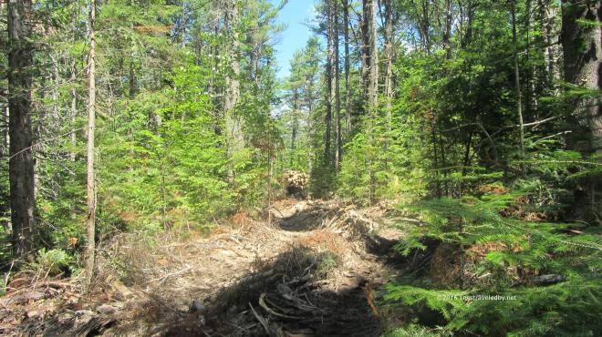 You can just make out the tail end of his tracked vehicle rounding the corner with a full load. The experience of watching and listening to this mechanical beast after several days on trail was most odd. Even stranger than the feeling one gets watching cars zip by at the average road crossing. Soon enough we were out of sight, but we would hear this man working for the rest of the afternoon.
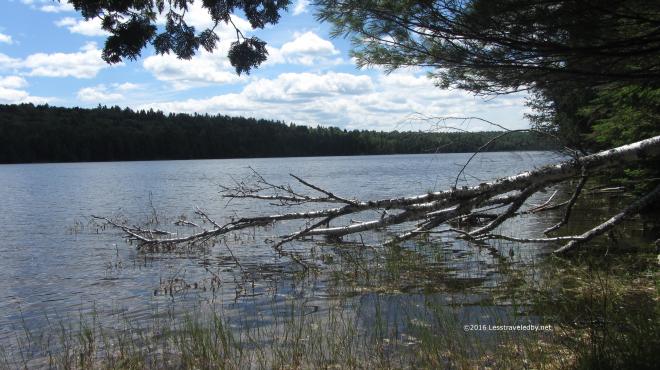 We arrived at Hudson Pond early enough in the day for some exploration, though it was a bit hot for hiking much more.
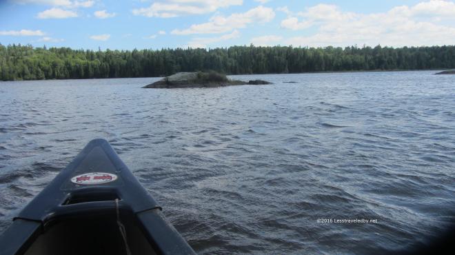 Thankfully this site not only came with a canoe, but two paddles. We took turns paddling with just two going out at a time to avoid overloading the canoe. There was a pretty stiff breeze out on the water though we were able to head up wind first and then coast home.
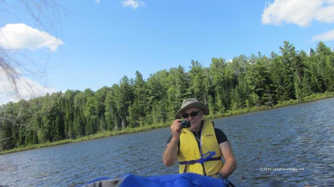 I took a series of wild, over the shoulder, no look shots of my brother with the rest coming out worse than this. Managing a camera and a paddle while bobbing up and down in a canoe is not an exact science so I was happy to have him actually in one of the shots.
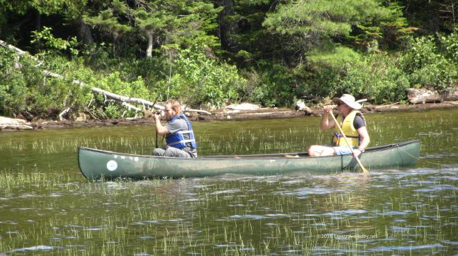 Later he headed out with his son who is studying aquatic bugs and turned our trip into a collecting expedition as well. He brought along numerous containers and a net for hunting down specimens. He also used his collection skills to wipe out a lot of deer flies which never seemed to end up in a collection jar so I’m guessing that was just personal.
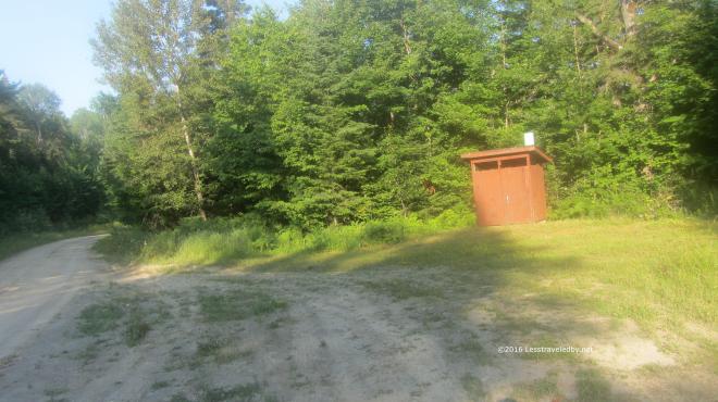 The next day we had a lot of miles to cover to reach our last campsite. We got an early start and soon were passing through a day use area where the forestry people have an open shelter and a privy. Once we passed this road we were back into the Baxter we know and love so well with lots of boggy sections.
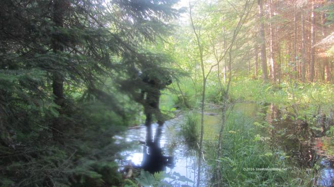 This crossing was one of the best parts of the trip. The trail just ended in this swampy pool being held back by a naturally formed debris wall. The murky water was about a foot deep with no clue as to how deep the mud below might be. The boys started talking about taking off their boots for a water crossing when I spotted the debris just down stream. Walking quickly as my feet were sinking in with each step, I carefully worked my way across. Seeing me on the other side is all it took to inspire them to follow quickly behind and I just barely managed to get my camera out for this shot. I think that is my nephew behind the tree, but it is hard to tell. I do know they both got their feet a bit wet but at least no one got sucked down into a mud pit.
 Gathering our courage for the big climb ahead of us. Well not a really big climb, but the only real mountain we’d see the entire trip. Hot and low on water due to nothing but swamps along the trail all day it was a bit of a struggle to the top.
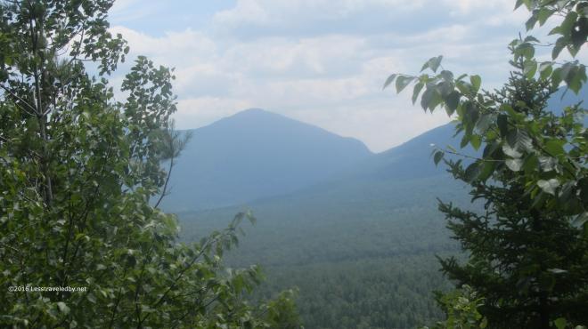 There was a bit of a view from some open rocky areas near the summit and we stopped for lunch. It was hot in the sun and the low water supplies kept us from staying here too long. The boys were very dry by the time we reach our final campsite at Frost Pond and while I drank the last of my water soon before finding the camp I too was ready to soak up a couple of liters of Gatorade.
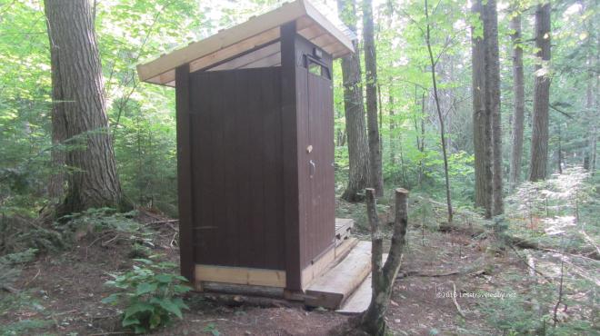 I was astounded to see this fancy new privy on the hill above camp. On our previous visit here the latrine was an open metal cage with a toilet seat bolted over a hole on top. This beauty smelled of fresh cedar and the boys kept saying it smelled like the lumber store. So in two days we went from one of the worst latrines I’ve ever seen to this brand new marvel. I feel bad for anyone doing the loop in the other direction. This is the sort of privy that spoils a person.
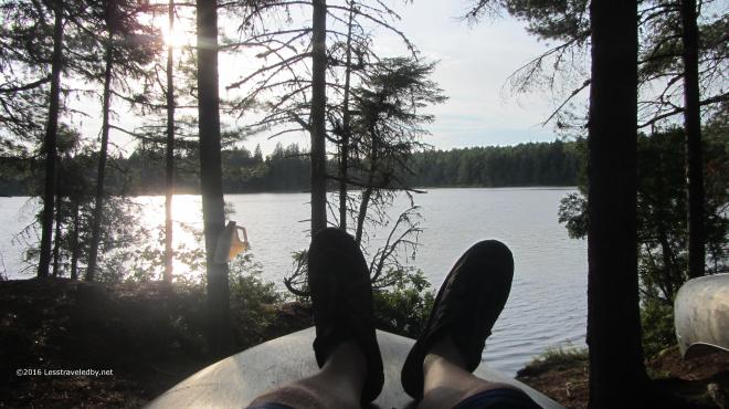 This relaxing late afternoon down by the pond cost me a few bug bites, but it was totally worth it. The canoes here were locked up, perhaps because they are closer to the trailhead. We were content to soak up water, then some dinner and then more water with no need for a paddle around the lake. I have heard good things about the fishing here though and would like to come back next Spring just after the season opens and spend some time with my pole here and at Little East.
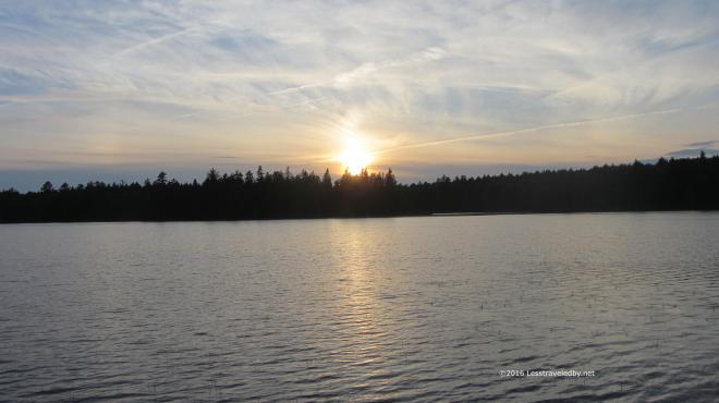
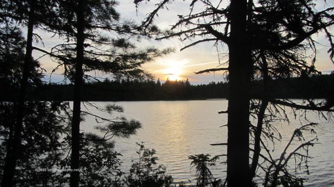 It was a great last night on the trail and with only a few miles back to the car our confidence of surviving this adventure was growing. Of course once you’ve survived everything seems easier and there had been some struggles along the way. Still it was nice to think we’d finally complete the loop that had eluded us.
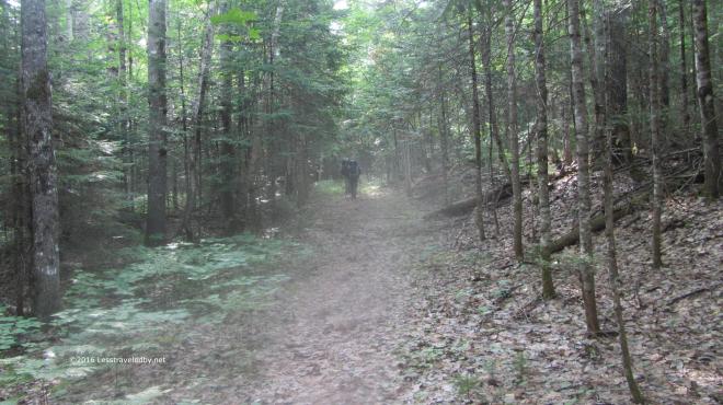 It was warm and steamy, but nothing was going to keep us from finishing the next morning. We all had our thoughts on the cheeseburgers we knew we’d find down the road once we reached the car. The boys were moving right along considering they were on day five of what for them is a rare chance to get out on trail. I’m thinking next year we need to find something with a real mountain in it or they are going to get soft on me. This was a great relaxer of a trip though and I always look forward to getting out on trail with the boys from Texas.
The aborted trip with the epic rain storm was before this site existed. If you are interested in reading the details of that adventure in more depth you can find the trip report I posted on Trailspace here http://www.trailspace.com/forums/trip-reports/topics/146513.html Along with the epic tale of flood survival you can also find a picture of the old Frost Pond latrine 🙂
If you are considering heading out on this loop be sure to come prepared. This is definitely a path less traveled by and you will not find any friendly park rangers out there to assist you. Be prepared to navigate and take your time in the logged out section as that is very hard to follow. Once a person lost the trail there it would be very difficult to find again. Also, during dry years, be wary of the lack of usable water between Hudson Pond and Frost Pond other than possibly Boody Brook after coming down Wadleigh Mtn. In between we found everything to be thickly stagnant and didn’t bother to try filtering. It isn’t a terribly difficult trail, but wilderness should always be respected and despite the forestry science logging this is definitely a wilderness adventure!

18 pictures from a rare car camping adventure in Baxter State Park. I’d made these reservations for a lean to at the Roaring Brook campground early in the year with a plan for the girls to be coming up to meet me at the end of my two week AT trip. They were going to bring lots of food and we’d joked about day hiking. As things turned out we had lots of food and went day hiking 🙂 Car camping is very different from backpacking. Some parts are bad, like having neighbors and overused privies. Other parts are good like a cooler full of food, a full sized propane burner and a percolator full of fresh brewed coffee. My wife and I used to hit the road for weeks at a time when we lived out West and have enjoyed eating well in some very remote places.
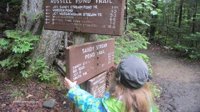 We didn’t let a damp start to the day keep us in camp. With hopes the clouds were about to part soon we headed across the brook via the Russell Pond Trail, but opted to swing off towards Sandy Stream Pond soon after the bridge. The RPT is a bit more rugged and has a rock hop that might have been a bit much for the youngster. Besides, while I’ve gone that way many times I’d never had a chance to try the Sandy Stream Pond Trail.
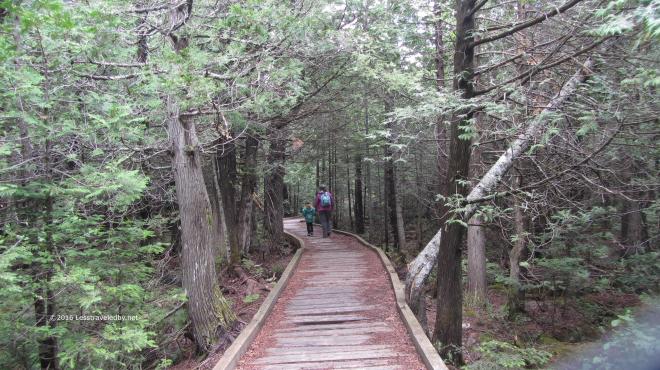 Yup, definitely a bit less rugged this way. The trip out to the pond to look for moose is part of the standard visitor experience it seems and we met many other folks out enjoying the day. My trips to Baxter usually involve rushing away from the trailhead and out into the empty wilderness as fast as possible so it seemed odd to see so many people. I think there may have been a dozen over the four hours we were on this hike, so it wasn’t crowded. I just think of Baxter as empty.
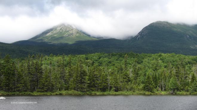 The clouds were starting to lift by the time we reached the first of several viewpoints on the edge of the pond. Hamlin and Pamola were starting to come into view, but Katahdin itself remained shrouded.
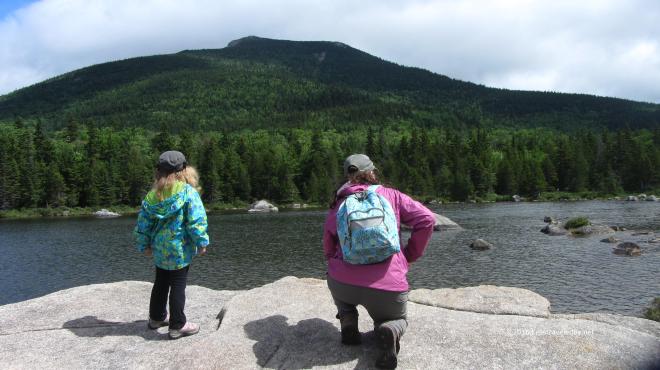 The pond was quite shallow, at least around the edge we were on. The light was constantly changing along with the clouds making it a great day to just sit and look. Backpacking is fun, but there is something nice about not trying to get anywhere too. We had plenty of time to soak the views in before heading further down the trail.
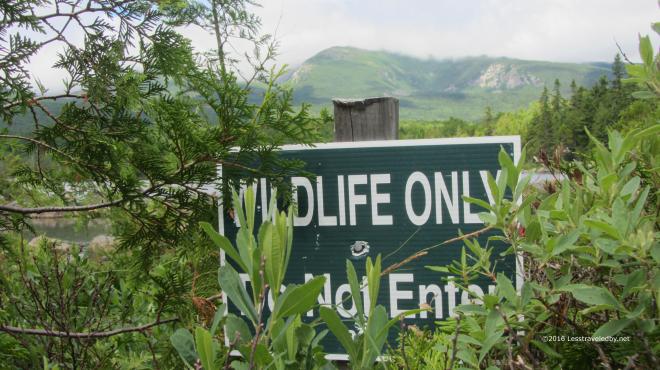 Most folks don’t realize it, but you are free to roam off trail in the Baxter wilderness if you are so inclined. There are a few exceptions though and the area around most of Sandy Stream Pond is set aside to allow the animals a place to be completely free of humans. The signs make me laugh because it seems odd to have a preserve in the middle of a giant park.
 We eventually rejoined the RPT and headed out to Whidden Ponds for lunch. The clouds had continued to linger on the mountains but it was a great day down below.
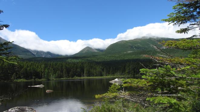 What may have been an annoyance for those hoping for summit views made for a beautiful sight to us. I have stopped at this pond on every trip down this trail to take pictures and probably always will.
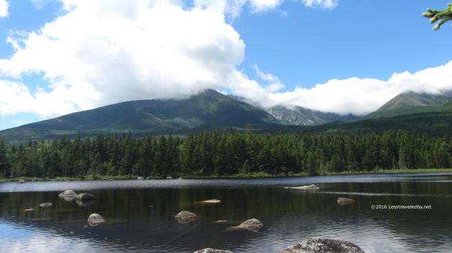 This day was special though because I had the girls with me. Every other time I’d been to this spot I’d thought how nice it would be if my wife could see it. She has had to look at all the pictures I’ve taken from here over the years so it was nice that she finally got to see it in person.
 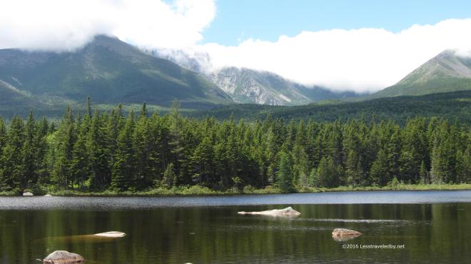 Baxter Peak was starting to be glimpsed through the clouds at times. Maybe the folks would get their summit view yet that day, but we finished up our tuna wraps and started back towards camp.
 Along the way we came across this well hidden toad. Actually we came across quite a few of a wide variety, but this one was so hard to spot at first I decided to take some pictures.
 If you couldn’t find him before this close up might help. Was glad I’d taken this picture to remind me in case I lost him in the wide shot.
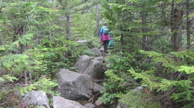 My daughter insisted we were going to climb up South Turner Mountain because the sign said it was only 1.5 miles and she was sure she could walk that far. No matter how much I tried to explain why that wasn’t going to actually happen she refused to be dissuaded. So we went a ways down the trail until we hit the boulder field that marked the start of the actual climb. She didn’t want to admit defeat, but the size of the rocks eventually convinced her we should wait till next year to see if her legs were longer.
 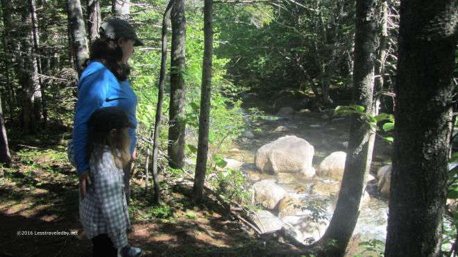 Later in the day we decided to explore the Nature Trail which is a small loop just across the brook from the campground. It wound through the forest, first along the brook and then away from it. Eventually it gave access to two separate boardwalks that let you travel well out into a large bog.
  There were several interesting types of plants to be found. A ranger later explained that there are two types of carnivorous plants in this bog, though they like to eat tiny flies so we were never in any real danger.
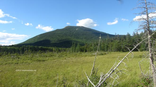 Besides the bog there was also a really nice view of South Turner. My daughter was still saying we should go up there and I think she’s right, we should.
 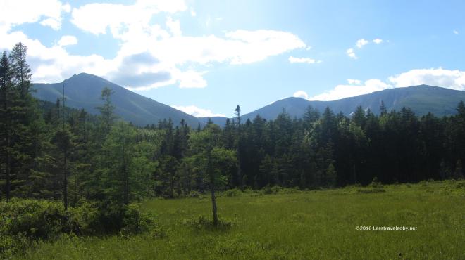 Late in the day to be on the summit, but the views definitely opened up. I’m sure there were a few folks coming down in the dark with their headlamps on with memories to last a lifetime. We had it much easier on this trip. Unless you count the hard work of carrying our gear into our walk in lean to or the challenge of cooking the perfect campfire pizzas we didn’t do much to earn our reward, but we left with memories to last too.

36 pictures from a late May, early season, visit to Baxter State Park. The girls were ready to get out for their first trip of the year so we booked three nights in an area near the south end of the park.
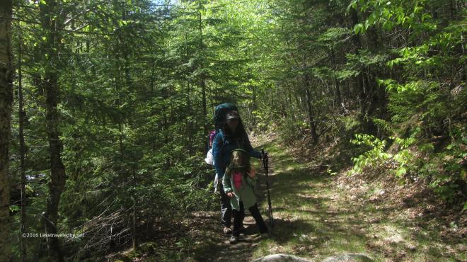 We aren’t afraid of the early season bugs because we come prepared. Good thing too because those early season bugs certainly weren’t afraid of us! I’d treated our clothing with permethrin which only left them with our heads and hands to target. Head nets might look a bit silly, but they make all the difference on a visit to the Maine woods in the late Spring and early Summer.
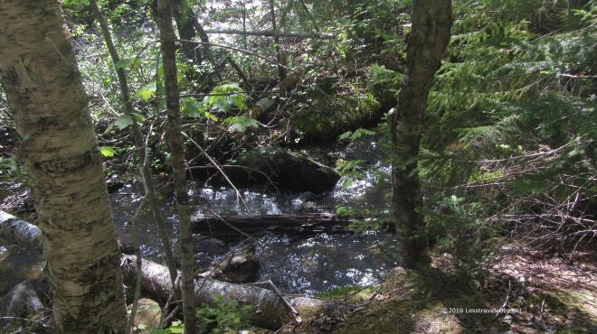 The light in the forest was amazing! Still the clear, white light of Spring, but strong with the coming intensity of the approaching Summer.
 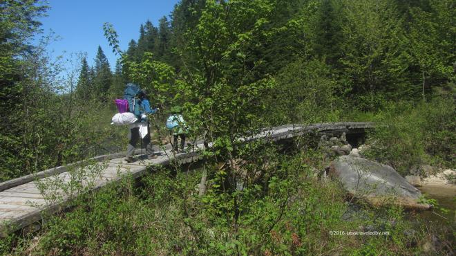 We didn’t have far to travel compared to my usual solo adventures, but part of keeping it fun for everyone is keeping the distances realistic for a five year old. Starting out from the Avalanche Field trailhead we covered the first two miles pretty fast as the trail followed an old logging road and was pretty flat.
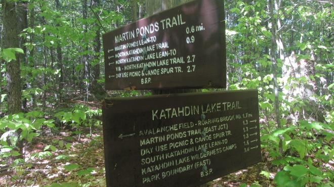 Reaching the turn off for the Martin Ponds trail we left the flat of the old road and walked on some authentic Maine hills, mostly up, towards our destination.
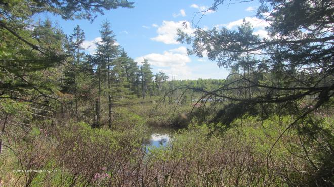 Approaching from the boggy end we could see the open water of the pond ahead. Later, after a good look at the pond I realized that all the ends were boggy.
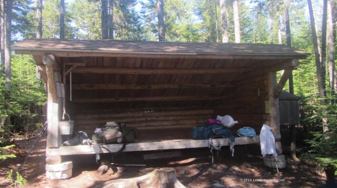 The Martin Ponds lean to advertises room for six. This was our first attempt at family camping in a lean to so we were glad to have plenty of room. I was able to rig up our Kelty TR3 to keep the bugs off of us while we slept which was our hope. Pretty sure we’ll be investing in some sleeping nets in the near future which are a lot more flexible in terms of fitting inside LTs. I have used one on solo trips for years. Best $7 I ever spent, but I think I may invest in something more substantial for us.
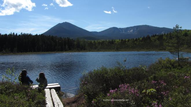 The girls headed down to the pond to enjoy the breeze. I’d often heard that this spot was one of the best places to view Katahdin and I have to agree. So much easier than climbing up there and seeing it up close, that’s for sure!
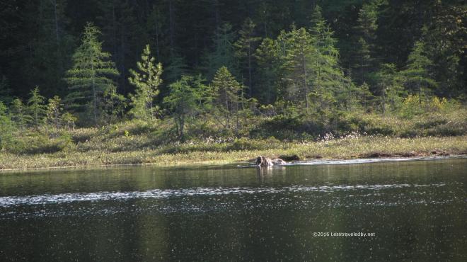 Later I went down to spend a moment alone on the shore only to notice that I wasn’t alone. Mrs Moose had been standing on the far side, out of the water until she saw me. She moved into the water and browsed for a minute so I ran to bring the girls down to see.
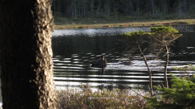 By the time we returned the cow was swimming half way across the pond. We watched, whispering in awe, as she swam towards us and then veered off as she approached. I can never tell if they are just checking us out when they do this or putting on a show for the cameras.
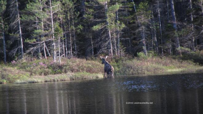 She took to the shore and dawdled a bit making sure we had time to get a few more shots before disappearing into the forest.
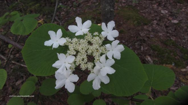 We still had plenty of nature to enjoy though. There were a wide variety of frogs providing background music throughout the afternoon and evening. There also were some lovely Spring flowers to be seen including this Hobblebush which we mistook for some sort of dogwood.
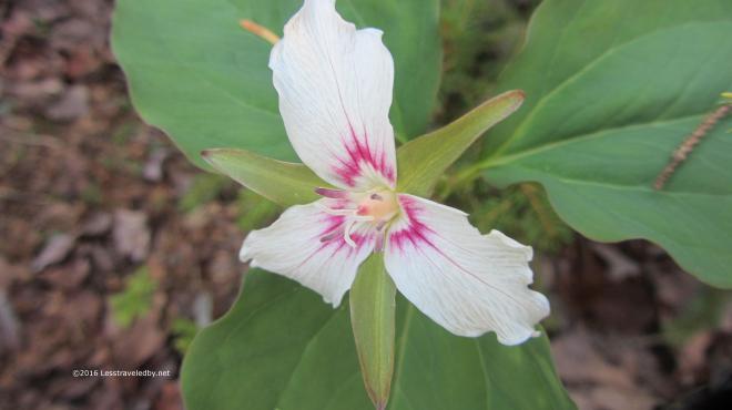 We also were there at the right time to see some Painted Trillium at their peak. These only last for a few days and then disappear for another year.
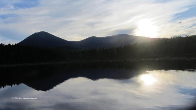 Sunset over the pond was calm and quite froggy. Things cooled rapidly once the sun dropped and a shower came through overnight.
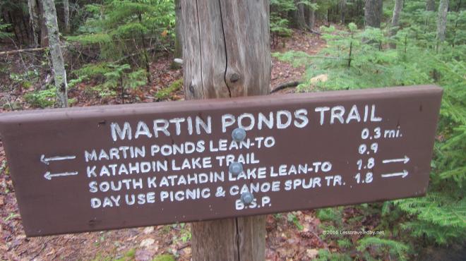 In the morning we were off to our next camp at South Katahdin Lake. It was only about a two mile hike, but with lots of interesting terrain for a five year old. We were all happy to reach the lake shore, especially since it looked like there might be more rain on the way.
 The ceiling was a bit higher than the last time I visited this site, though only the foot of East Turner was visible on the far shore. We’d see some rain as the afternoon went on, but nothing like that trip thankfully!!
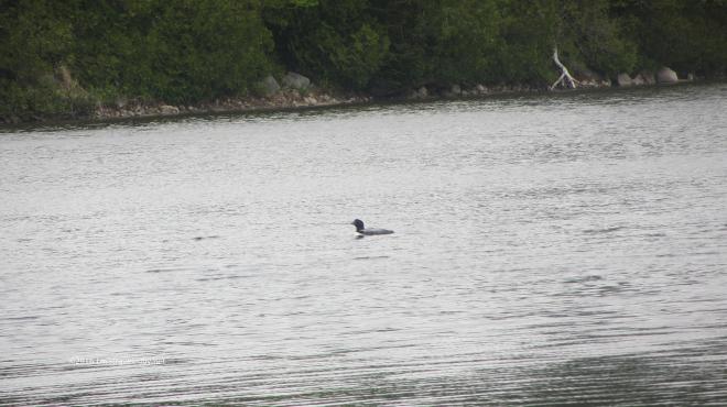 I think the expression is “Great weather for a duck.” but the local loon population seemed pretty happy as well. There seemed to be a group of at least four or five that was hanging around near our camp on the shore.
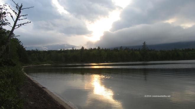 We had some breaks in the clouds near sunset, but not enough to reveal the big mountains to our west.
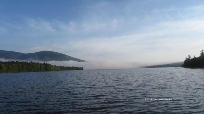 Morning brought definite signs of clearing, but this bank of clouds remained for some time. Watching it closely I realized it was a long narrow tube of moisture being pushed around the side of the mountain in a steady stream. Weather does some weird things around these big peaks poking up all of a sudden.
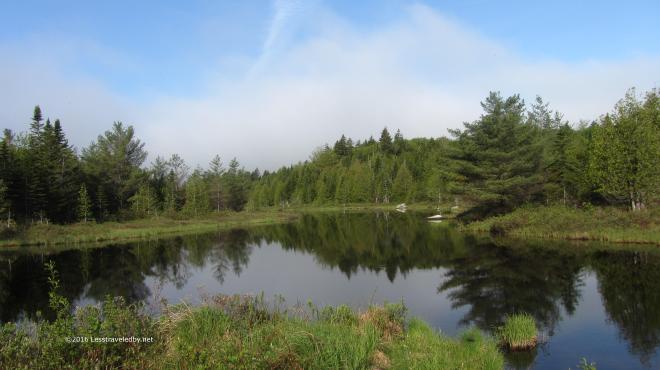 We had a great day for hanging around and exploring. This flowage enters the lake just downstream, but is backed up by something resembling a beaver dam.
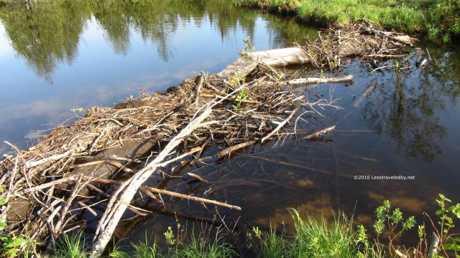 Not sure if any beaver were involved in this or not, as they usually do a better job on construction. I do know those bog boards are the trail crossing we arrived on the day before and that tilted one towards the top was very interesting while wearing the big daddy pack.
 This was a day of many walks as our daughter was taking full advantage of her time in the woods. We’d no more than sit down from one than she would announce it was time to begin another. We visited all the local landmarks and even roamed through the nearby Katahdin Lake Camp and some distance beyond. I have no real account to rely on, but would guess we did at least seven miles that day.
 There was some time for cards though. This girl never stops even when she stops so we know to bring along plenty of things to keep her entertained. Of course that is never enough which is why I’m sure a few minutes after this picture it was time for another walk.
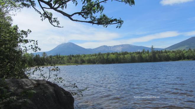 With the low cloud deck finally gone the mountain came into full view. We couldn’t see it from our camp site, but thankfully we had plenty of chances to see it on our walks.
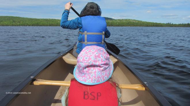 Later in the afternoon the breeze died down enough we felt confident enough to try taking the canoe out. On a lake this size the weather can cause a lot of trouble so we opted to just take a tour around the nearby island.
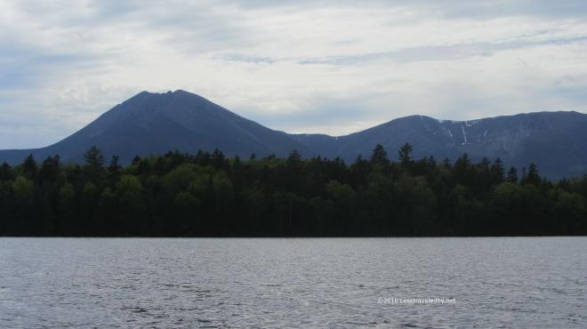 Between the breeze that was still blowing and my wife’s incredibly powerful paddling stroke I had to spend most of my time focused on manning the rudder. I did manage to get a few shots of the mountain from this unique perspective in the middle of the lake.
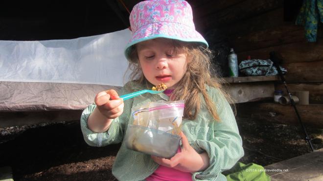 We earned our dinner that day for sure! Between all the walks and a bit of paddling everyone was ready for a bag of dinner. She may be only five but she is getting the hang of eating out of a freezer bag like a pro. I made her a special chili mac without the added dehydrated salsa that went into the parent’s portions which were also a bit larger.
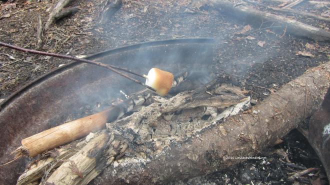 I didn’t want to fill her up with chili mac and have her turning down toasted marshmallows. My wife is an artist when it comes toasting, patient and always aiming for perfection.
 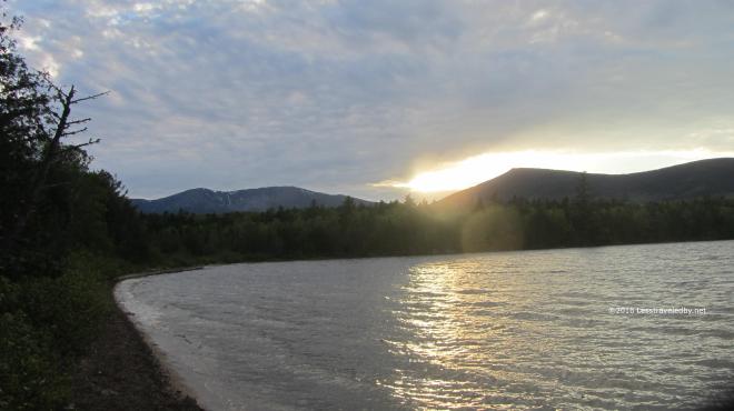 One last sunset over the mountains before the clouds moved back in. Again I was reminded of my previous visit, tired, wet, wet and wet. That was an adventure, but I’m pretty sure this was more fun. Maybe next time we’ll try the north end of the lake!
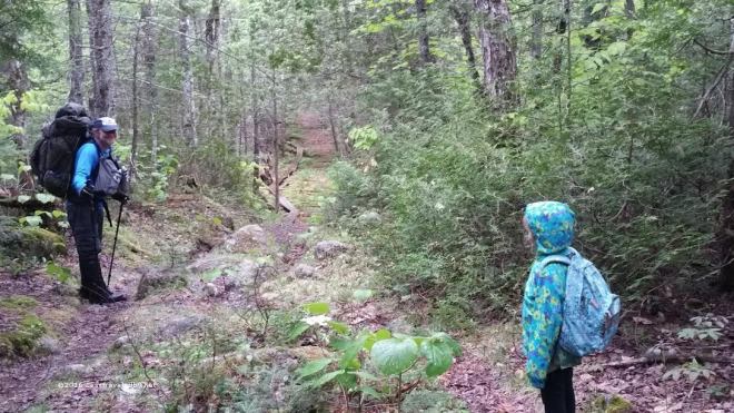 The next day brought showers which arrived just about the exact time we left camp. We had three miles of trail to cover including some wet and slippery bog boards. The girls put on raincoats but in warm temperatures like this I prefer to just get wet. Well up to a point at least heh.
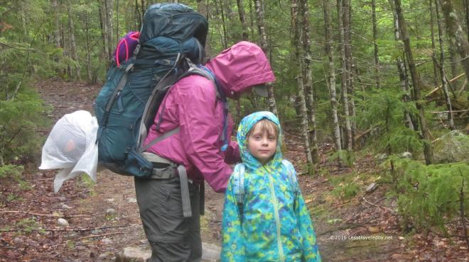 We didn’t let a little shower keep us from stopping for a snack break. Loading up afterwards I could tell the little one was enjoying being out in the rain. I didn’t realize just how much until she saw a trail head sign on the drive out and tried to get me to stop so we could go on a hike. That’s my girl!!
Quick video from the BSP/IAT week long loop. This was just the tail end of a whopper of a storm that caught me a few miles out from Pogy Pond. Never been wetter in my life even in my surfing days heh. Sorry there is no video of the thunderstorm that preceded this rain but I was too busy racing down the trail to document properly.

About time I started working on getting the adventure reports up to date. It has been a great year so far and this trip was definitely one of the highlights. Some of you might recall I tried to do this loop last Fall and was hit by a freakishly hot day that just about did me in. Not to spoil the suspense, but while there were some serious challenges along the way, I didn’t die this year either!

As is so often the case, things started out looking calm enough. I again made arrangements to park my scoot with the folks at Matagamon Wilderness Camp. They let folks park for free in their lot along the road, but I feel safer leaving the bike with them and it gives me an excuse to have an ice cream cone while I’m there.
From there it is just a short road walk to Baxter’s north gate. Amusingly, the ranger at the gate was the same lady I registered with on this trip last year. She recalled meeting me then but was surprised to hear about the trouble I’d had. I figured that was a good sign that the park rangers weren’t all sitting around laughing about my previous debacle and set off towards the trailhead.

The weather was on my side this time it seemed. Much cooler and while things were on the dry side the forest was inviting after a long motorcycle ride and a few miles of road walk.

After spending so much time in New Hampshire, the forest here seemed very different again as it had on the trip with the boys from Texas. Pines and birches dominate both areas, but they don’t feel the same. Something about the density of the woods and how sunlight comes through it I think.

Horse Mountain was just a little bump as my legs warmed up and I hit a good stride. I found myself down the other side and enjoying the cool breeze coming across Billfish Pond in no time at all. There are in fact no billfish in this pond or on Billfish Mt beyond. Seems the area was named Bill Fish long ago and somewhere lost the space in the official records. There is a campsite here that is rarely used and pretty easy to get to, though it isn’t right on the water.
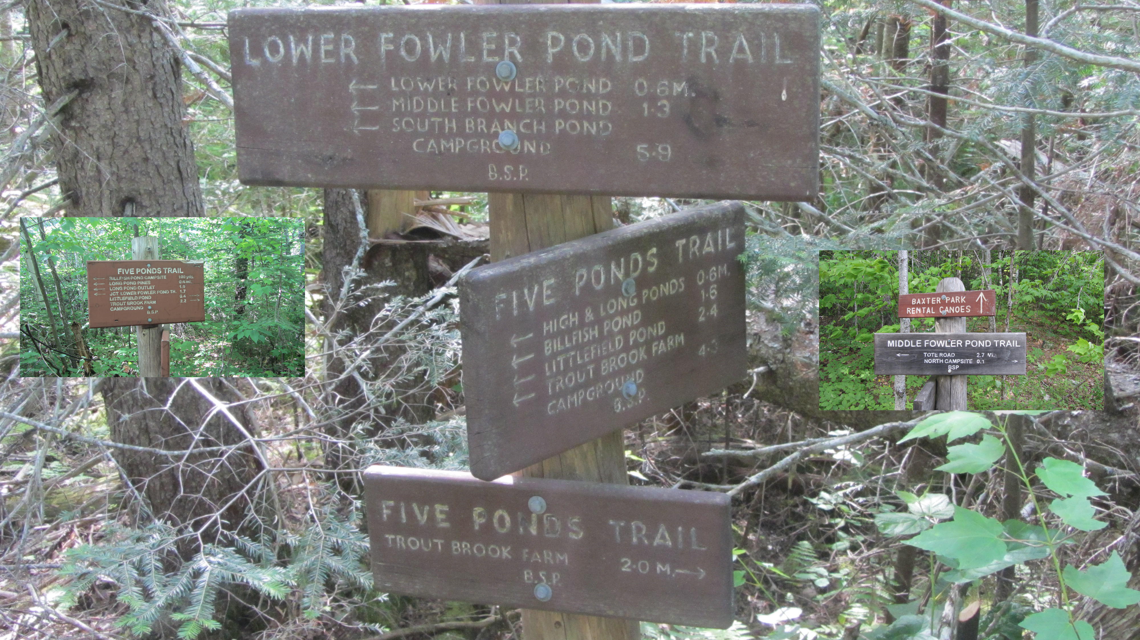
This route took me through lots of intersections. I’ve walked through this area enough on solo and family trips that there was no confusion, but I can only imagine a novice hiker coming across that signpost in the middle and being overwhelmed. Definitely a good time to break out the map if you aren’t totally positive as to which way you’re headed.
 This is where I was headed. North campsite on Middle Fowler Pond looking towards the outlet. The site was very overgrown and looked as though it had seen very little use this year. The entire Fowler Ponds area is lightly used and often available to reserve on short notice. Great spot for family trips or anyone looking for more relaxing and casual terrain compared with the nearby mountains.

My daughter sent this little guy along at the last minute. She was worried I might be lonely and need someone to snuggle with. I told her I’d bring back pictures so she could see the adventure it went on.
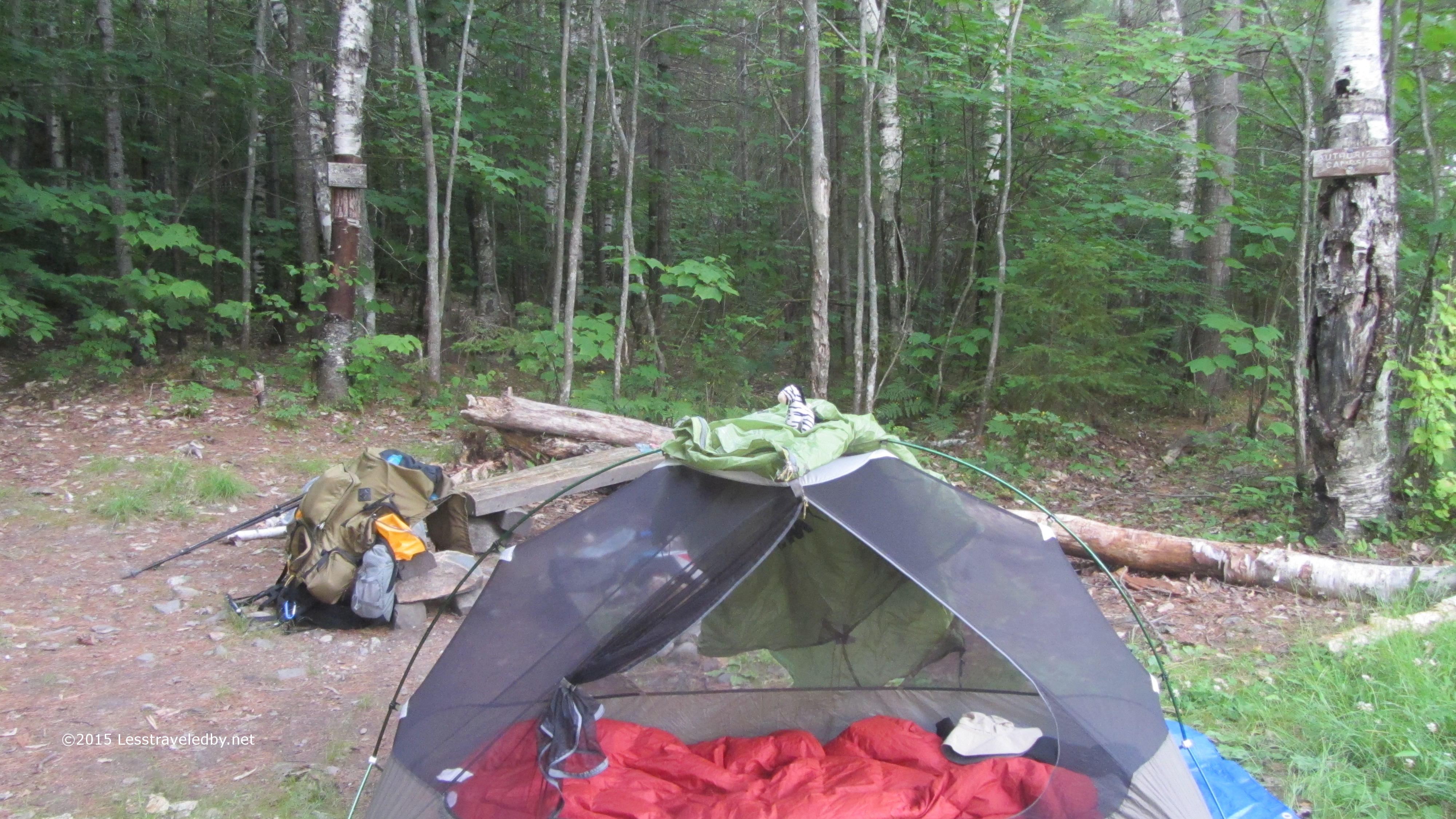 A few years ago I reported to the rangers that the tree they had tacked the campsite sign to was in danger of falling. It still makes me chuckle to see it there right where they pushed it over after moving the sign to a new tree. Very peaceful little site with the rental canoes just down the trail and I’ve seen locals hiking in to fish here so might make a nice place to hang out for a few days.

Morning came with some expected cloud cover and a light mist during breakfast. I lingered a bit and let it blow through before heading to the other side of the pond and beginning my climb up to Barrel Ridge.
If you look between the pine needles you can just make out this beautiful white tailed doe on the other side. I was glad I was able to get this glimpse on camera because as soon as I tried to move to get a better shot she was gone.

Last year this was a very wet sub-alpine bog, but on this trip it was bone dry. Well at least when I was passing through…
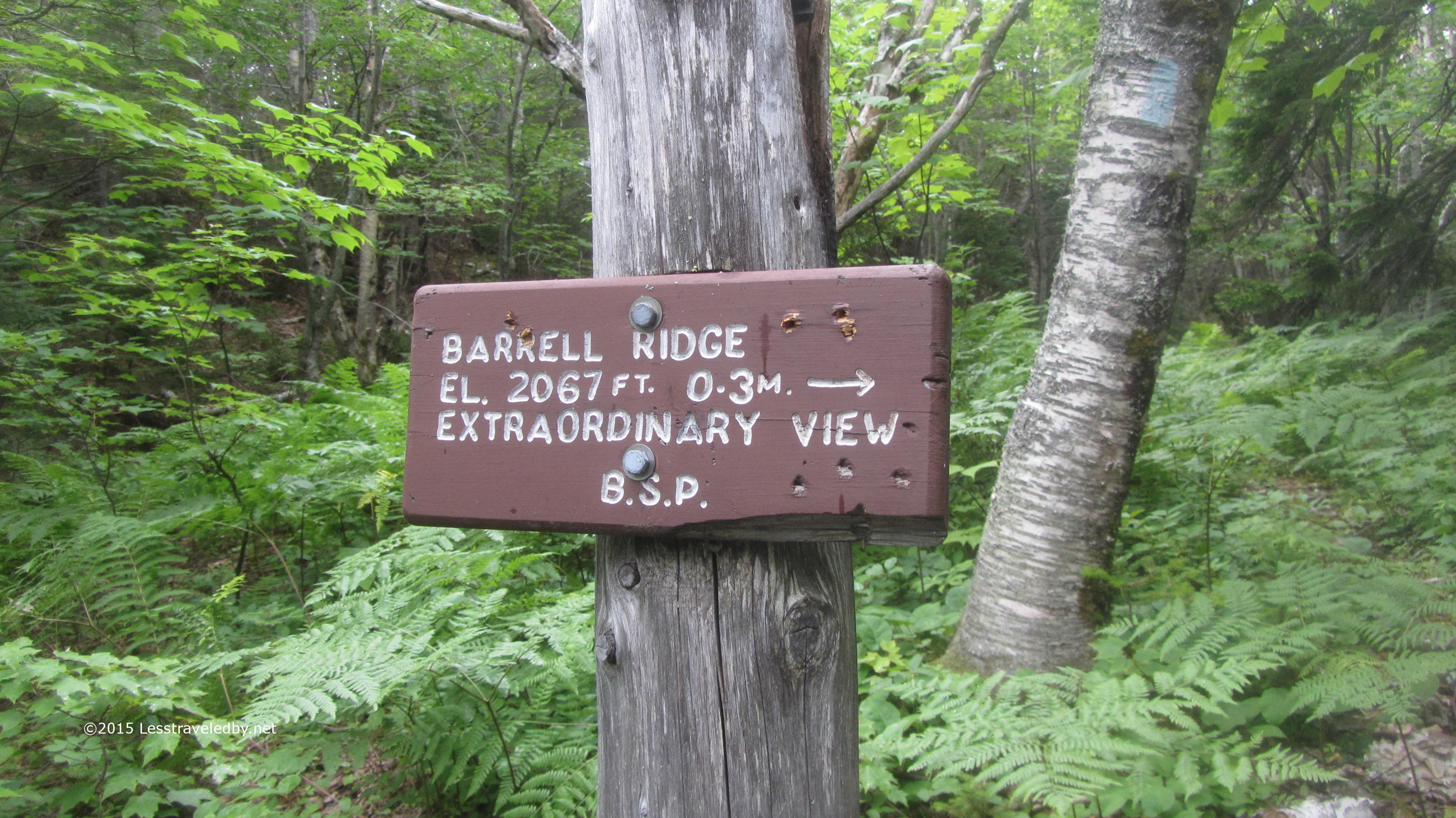
Last year I skipped Barrell Ridge because of the heat. This year I figured I had plenty of time because I’d made camp three miles farther along and the weather seemed nice enough.
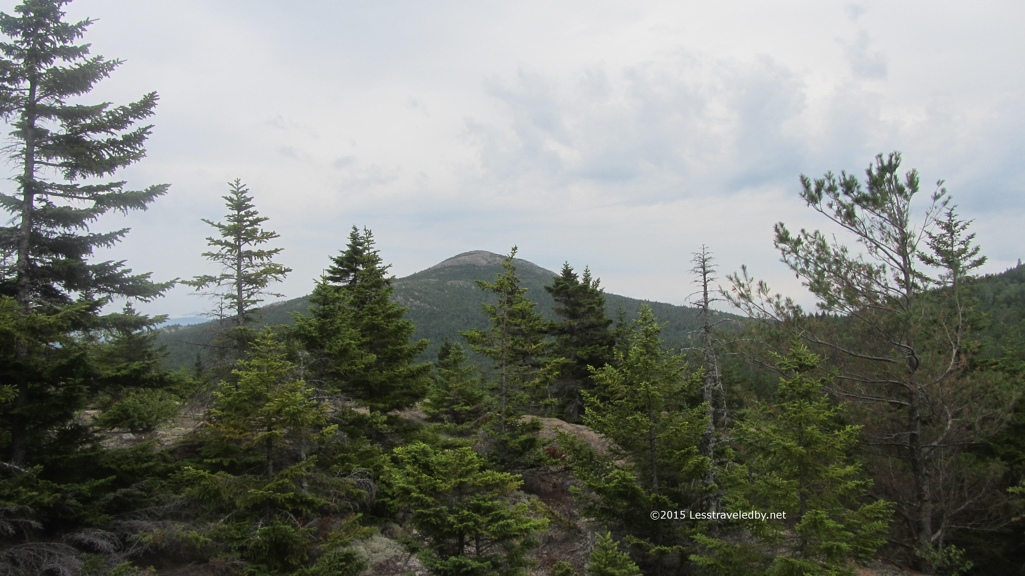
A few ridges of mossy rocks brought me to a nice ledge where I took a break and looked around. About that time the mist started up again and I noticed how slippery the lightly traveled rocks were becoming. Rather than push on to the top of the ridge I started back down just to be safe.
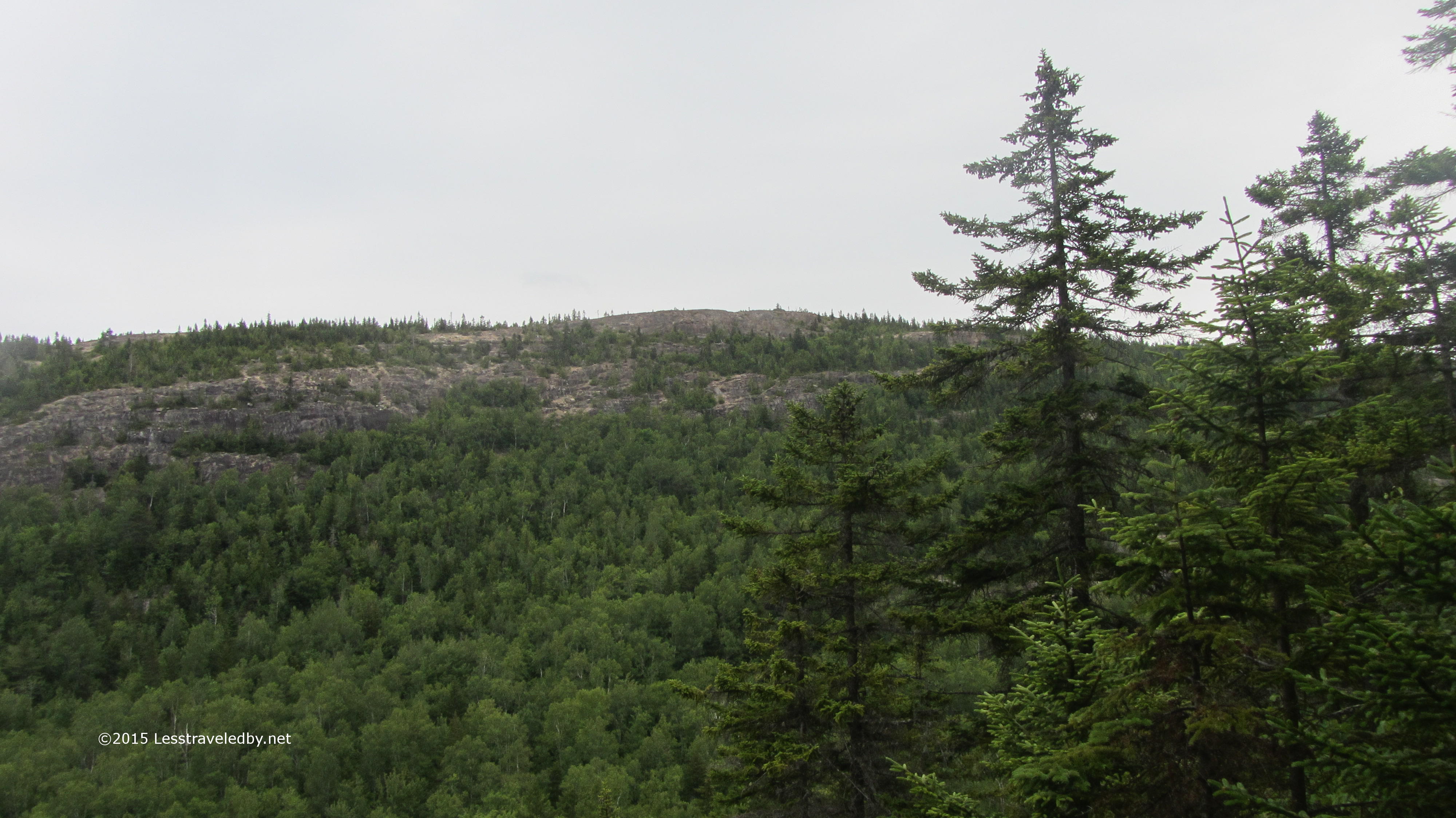
Looking back up at the ridge from a distance I could see where I’d stopped and the steep section I’d skipped. I’m thinking that this place will make a great day hike in a few years when my daughter can hike up there from the pond below.
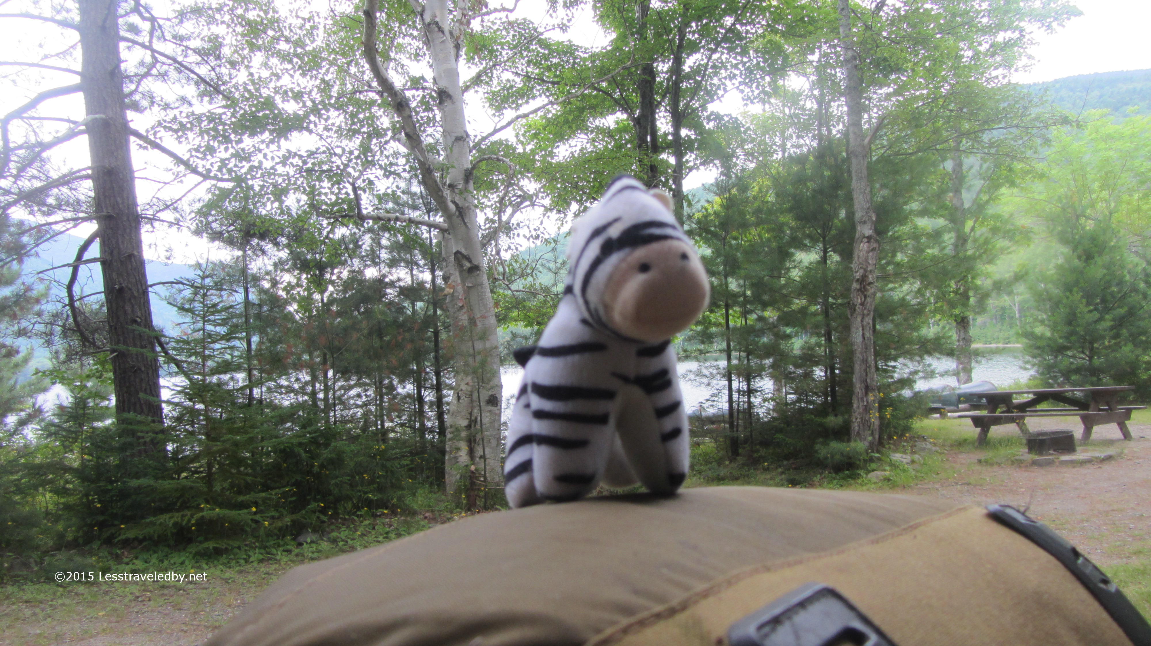
I stopped for a nice long break at the South Branch campground. There was plenty of time for snacking and photographing wildlife.
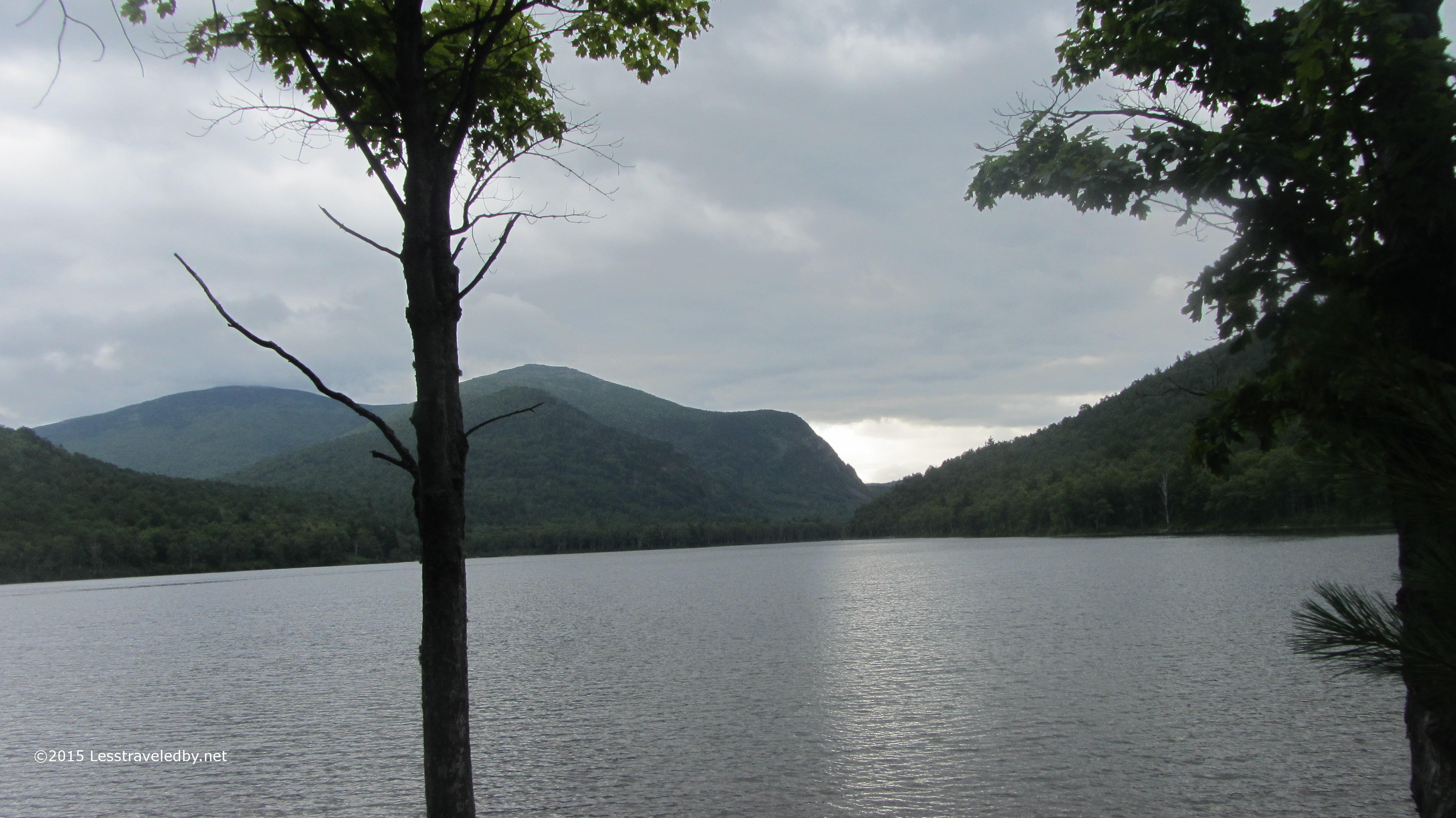
Things looked a little gloomy in the direction I was headed, but there wasn’t any sense of impending doom. Of course there rarely is heh. This is one of the last pictures I’d take for the next two days, but oh the stories I have to tell!
The mist turned to a light shower about half way through the six mile hike to Pogy Pond. Another mile on and it was a hard rain headed towards downpour. Then things got serious. The last mile and a half were done at almost a running pace through a white wall of near solid water with lightning flashing through the trees at times for added incentive.
By the time I reached the LT at Pogy my boots were literally filled with water that had run down my body. Thanks to good packing and organization I was able to quickly get the wet clothes hanging from the rafters with warm, dry clothes covering my bones. The rain continued for another hour or so with great intensity. I captured a little video I’ll be sharing later, but you really have to be inside a good mountain storm to truly understand how impressive they can be. Thankfully the wasps that had been in the LT on my visit here the previous month were gone so I had the place to myself.
The next day was cloudy and while there was no rain in the morning the woods was wet from the previous day. My trail clothes were wet when I put them on and only got wetter as I walked. An hour in I hit Russell Pond and swung by the ranger station there just to say hi. They made a note of my name which was the point of my visit and I was back on trail. I took the more direct Russell Pond trail towards Roaring Brook which I don’t recall taking before. Very nice trail, easier than the Wassataquoik Stream trail I always take I think, though perhaps not as pretty.
With little elevation to deal with I made good time to Roaring Brook, signed the register at the rangers cabin there and headed out through the parking lot. It seemed strange to sign in and then leave rather than enter the park but the Katahdin Lake trailhead is a few miles of road walk along the narrow park access road. If you’re doing this walk keep your ears open for traffic and be ready to jump off the road as many folks ignore the speed limit on their way in to the park it seems.
The trail follows old logging roads and is quite easily navigated. I was nearing the end of a roughly 16 mile day but making good time until the light mist rapidly turned to another downpour. Again I arrived at camp totally soaked with boots full of water. The LT at South Katahdin Lake was huge so I soon had wet things spread out all over and dry fleece all over myself. Mother Nature was throwing everything she had at me this trip but other than some very wrinkly feet I was holding up pretty well.

The rain let up enough for me to finally unwrap my camera. Here is my luxurious abode at Katahdin Lake. This site is super easy to access, about three miles of easy trail and is right on the lake. Lots of day hikers and proximity to the camp next door seem to keep this place underused it seems.
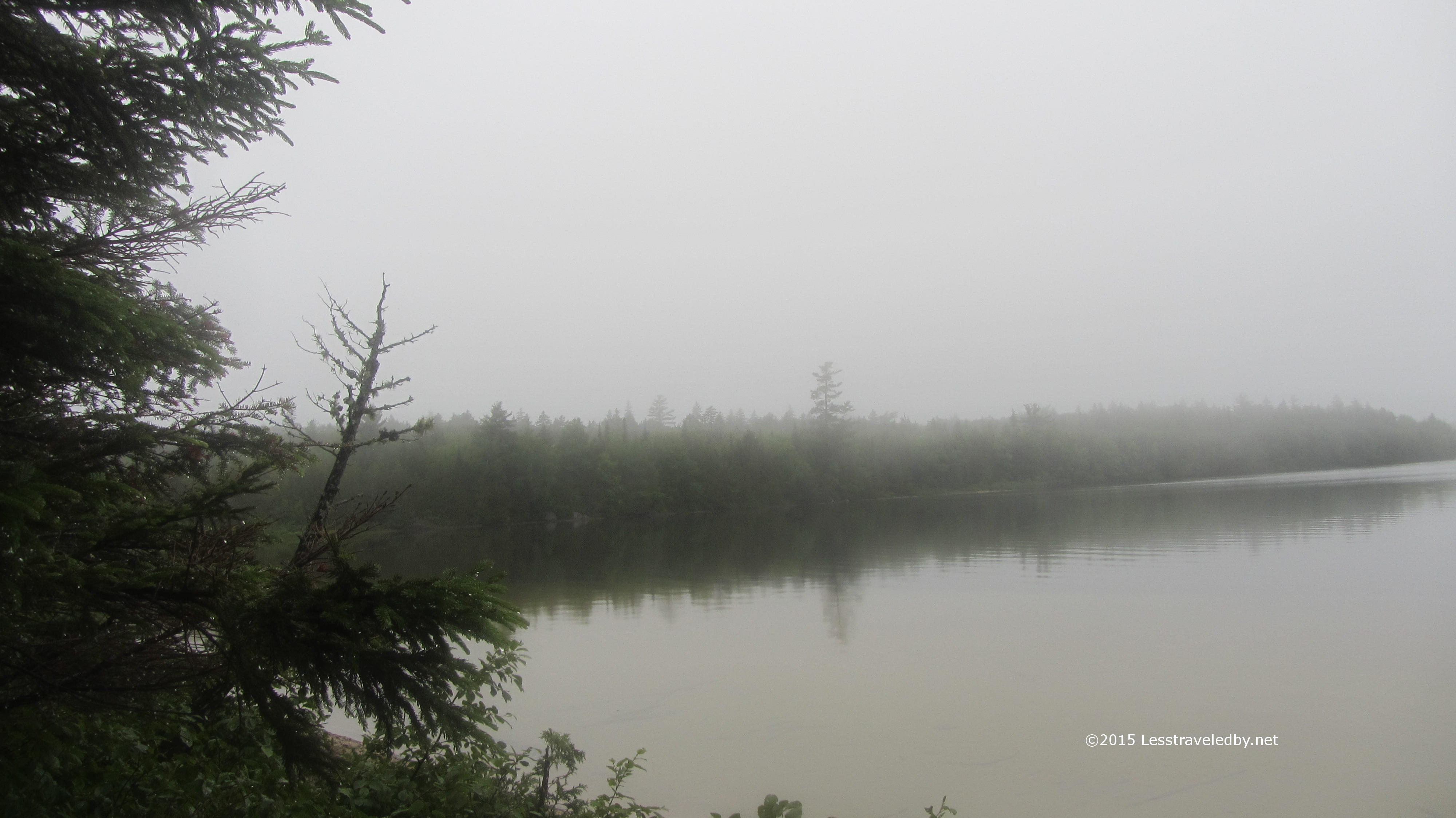 The lake was shrouded in mist so it was hard to get a sense of how big it really is. I know from the map it is a lot larger than what I could see.
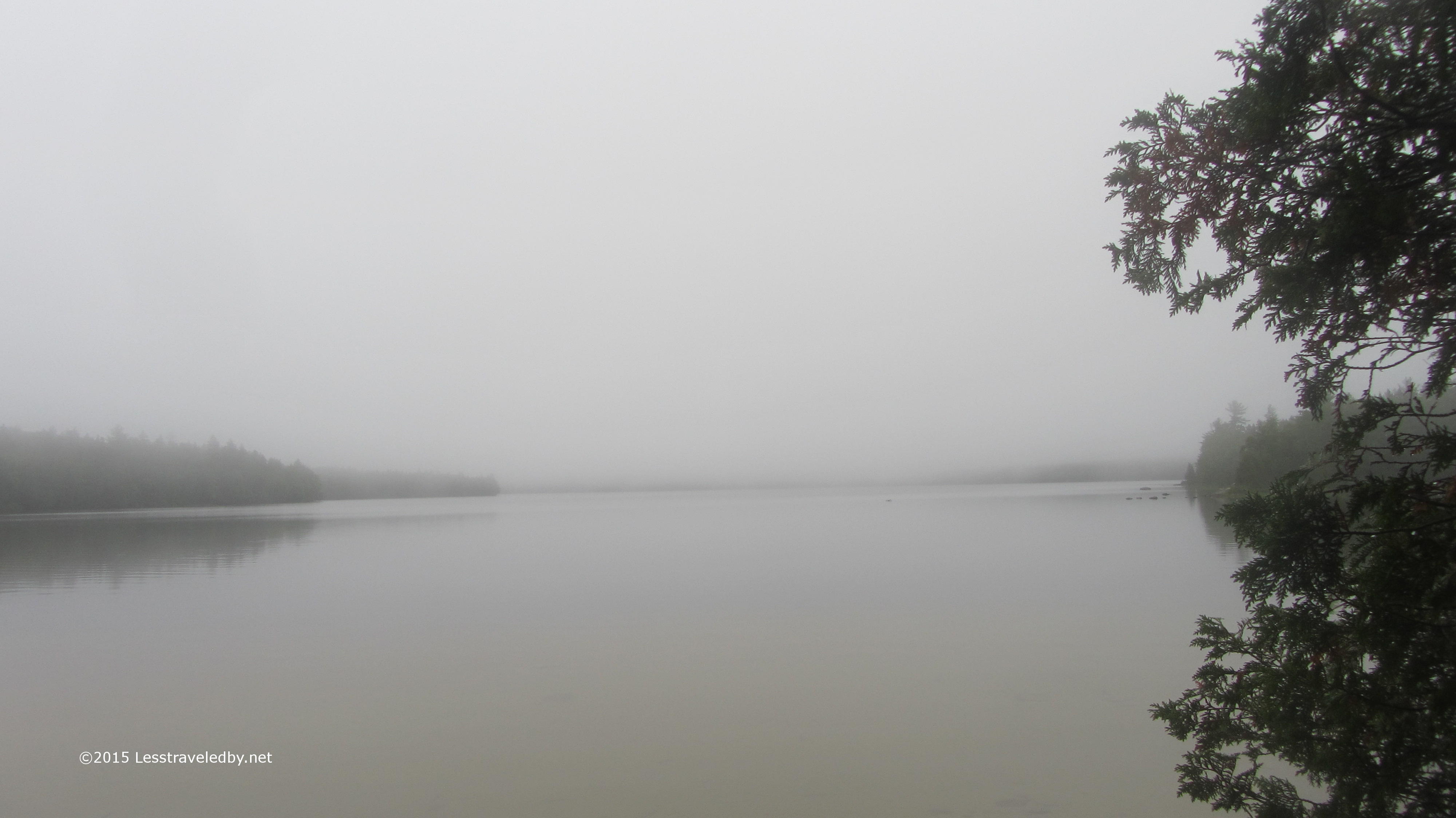 The sky seemed to melt right into the water and after two days of rain it seemed that everything, including me, was all wrapped up in one big cloud of moisture. Some parts were less wet than others, but nothing could truly claim to be dry at this point.
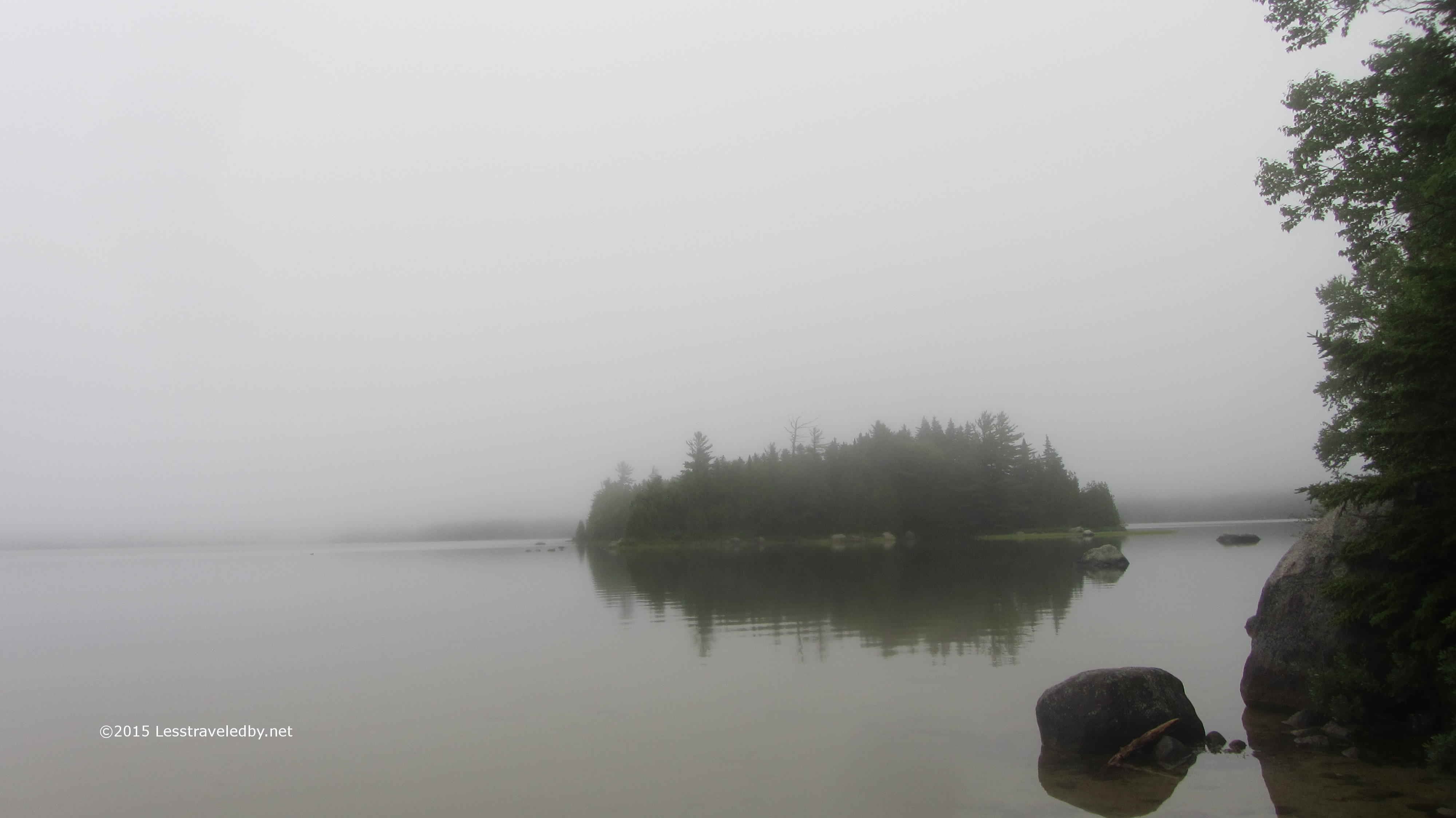 With a canoe right there in camp this looks like a place to come do some exploring on the water. Might make a nice family trip next year if I can convince my daughter to stay in the canoe for more than twenty minutes at a time.
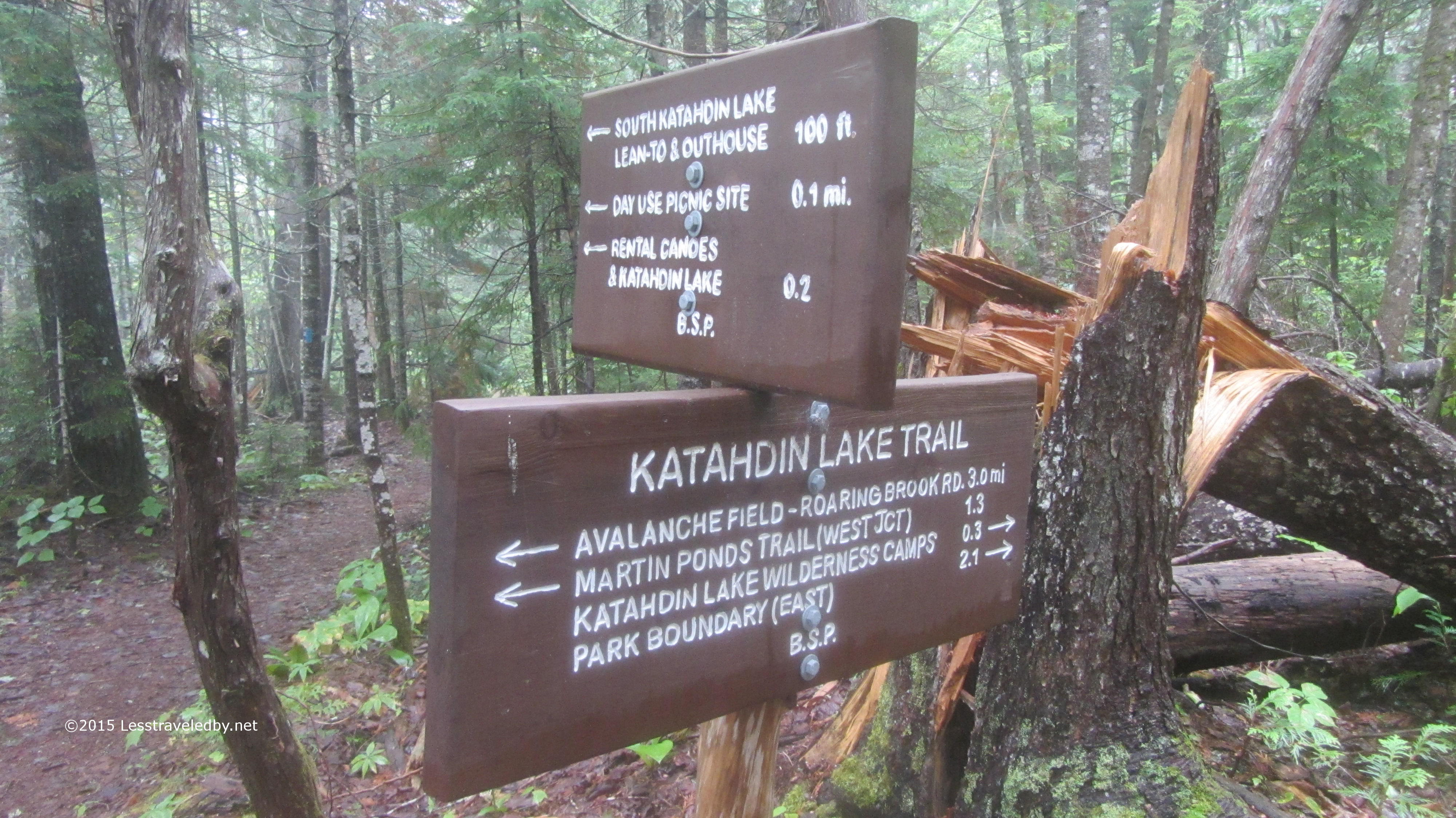
This is your standard trail sign documentation picture until you notice that tree in the background. Guessing there might have been a bit of wind gusting off the lake to snap that trunk like that. Neat to see after the fact but probably a bit scary to listen to in the dark.
 Day four again started without rain, but also without sun. The clouds seemed to reach all the way to the ground and everything was still dripping. Reaching the border between Baxter State Park and the start of the International Appalachian Trail I found an old logging road disappearing into the fog.

The mileage sign laid out my itinerary pretty well, listing the shelters I’d sleep at, the highest mountain and finally, thirty miles on, the road where I’d finish my week long hike. I remember now thinking with a grin that it would be easier to go forward than to go back so there was no need to worry about failure any longer.
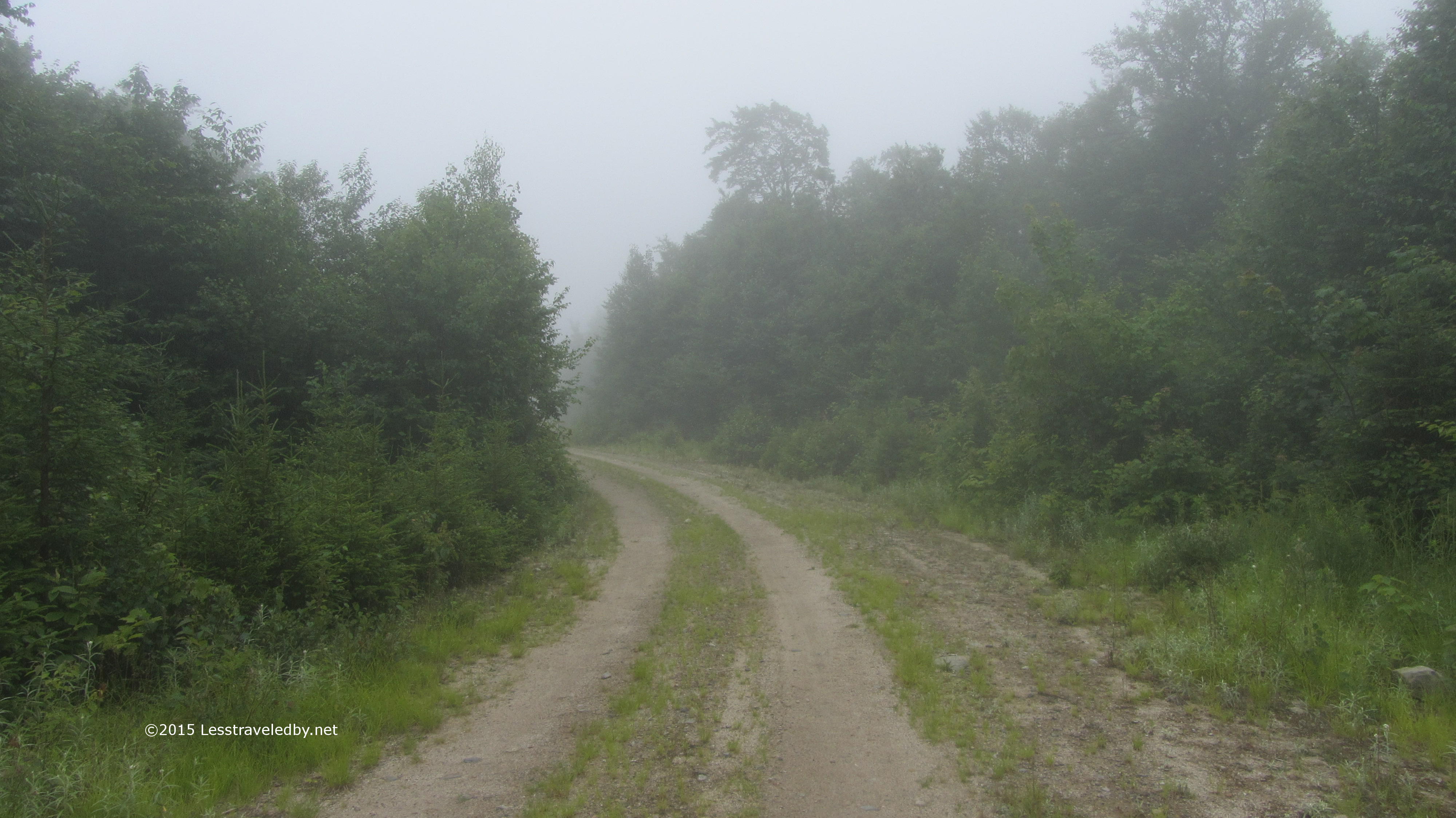
This section of road was pretty open, but there were other areas where the berry bushes have reclaimed most of it. Between the thick fog and the heavy brush I found myself instinctively breaking into song to warn the bears I was coming. The number and size of the bear scat piles was a clear reminder that this was their turf.
 The first LT on the IAT seemed functional, but without much character. There was a small stream nearby for a water source and it was peaceful enough, but with another shelter a few miles farther on it doesn’t seem to get much use. About this time the showers started up again.
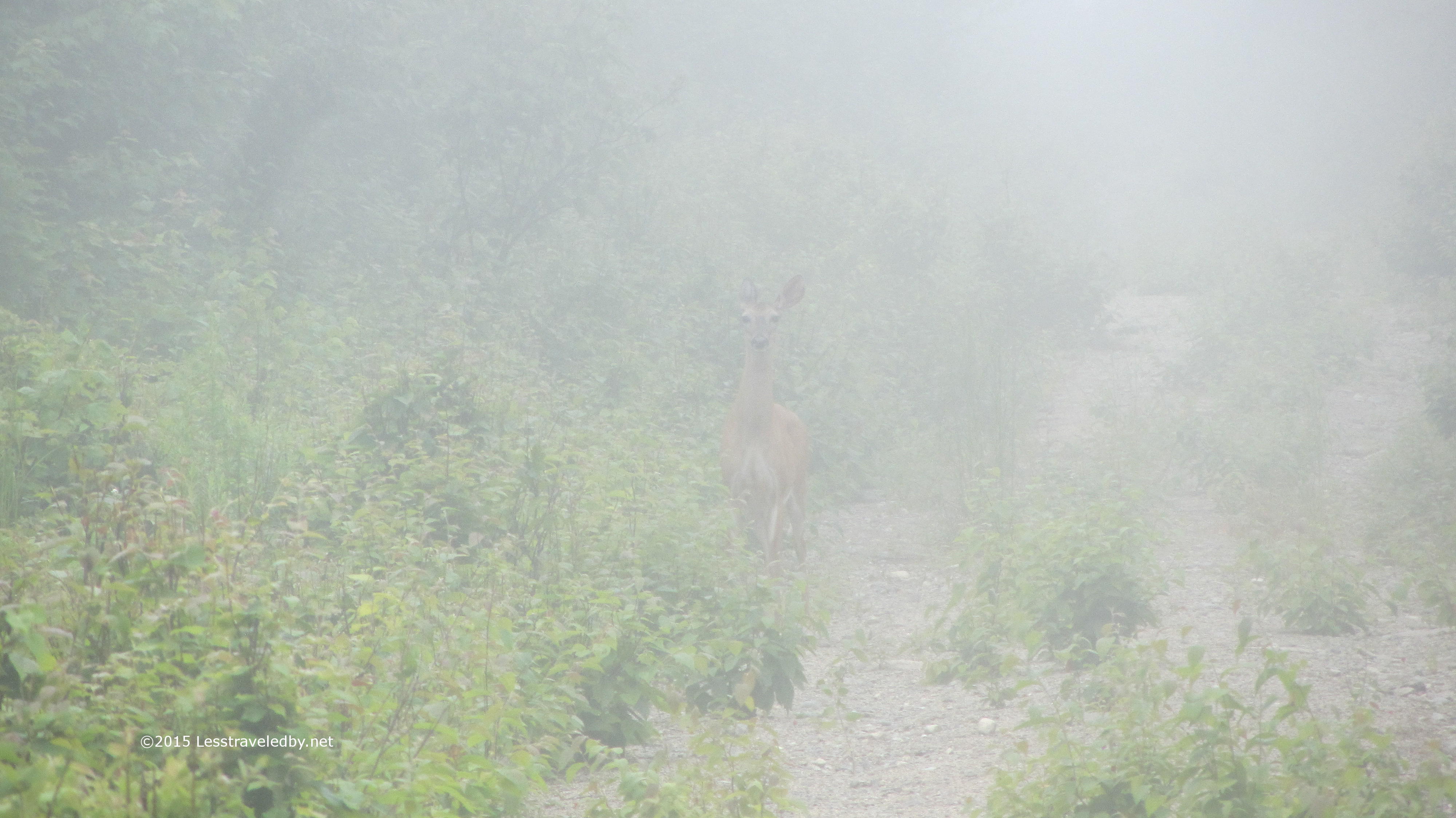
Much like my previous deer picture this one will require some sharp eyes. If you peer through the fog you may see a doe peering back at you. We studied one another like this for a while before I edged too close and she darted off into the mist.
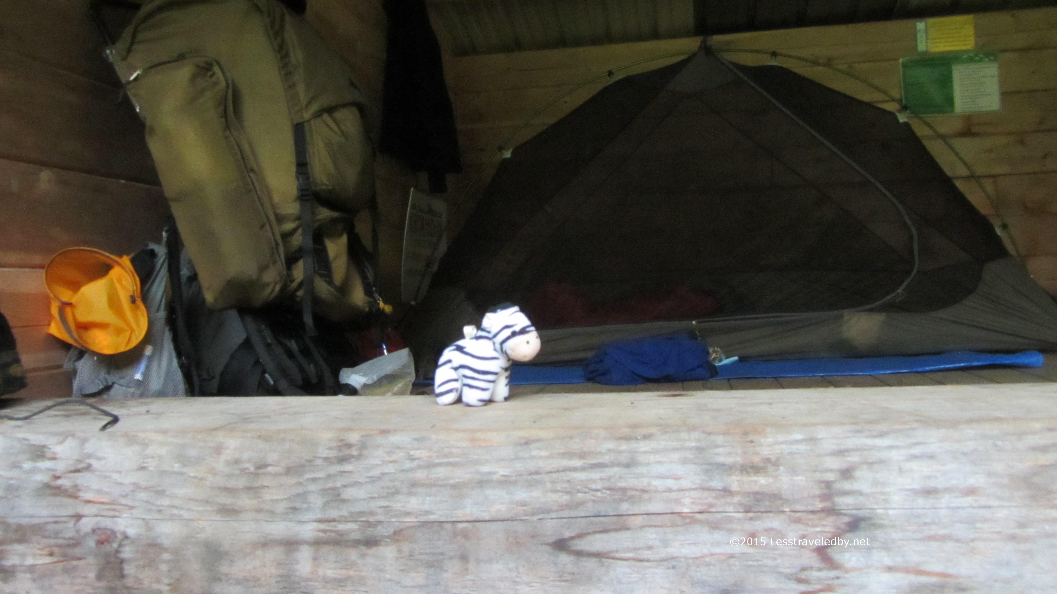 Thankfully I only got wet rather than soaked. When I got to the Wassataquoik Stream IAT shelter it was filled with gear much to my surprise. A crew of trail workers soon arrived and informed me they’d been camped there for a week, but were just about to move off. Me and the zebra were just getting settled in for the night when a couple of IAT hikers arrived. Gen and Emmanuel were from Quebec and planning on heading all the way to the Canadian border. Considering they were on their first night out and I’d been hiking in the rain for three days at this point I thought they were pretty brave to share the shelter with me.

The next day we set out together and did the big stream crossing to start our day. If you look closely you can spot him putting his shoes back on while she looks back over the ford we’d just completed.

Just in case you were thinking you didn’t have to cross this stream they made it pretty clear. There is a high water route that adds about eight miles of hiking if you really want to skip this crossing, but it was only a bit above knee deep on this trip so not a big deal.
 Just before the Deasey Mountain climb begins in earnest the trail passes the remains of the old lookout cabin. They are slowly dismantling this and seem to be crowdsourcing the removal labor. There is a box of construction debris bags and a sign explaining that volunteers can hike out a bag of debris to help out. The goal is to completely restore the site eventually.
From this spot to the top of Deasey is listed as .8 mile, but it is a rough, up hill section that was slippery in spots. My reward on reaching the top was to be totally socked in. That is why there are no summit pics from Deasey.
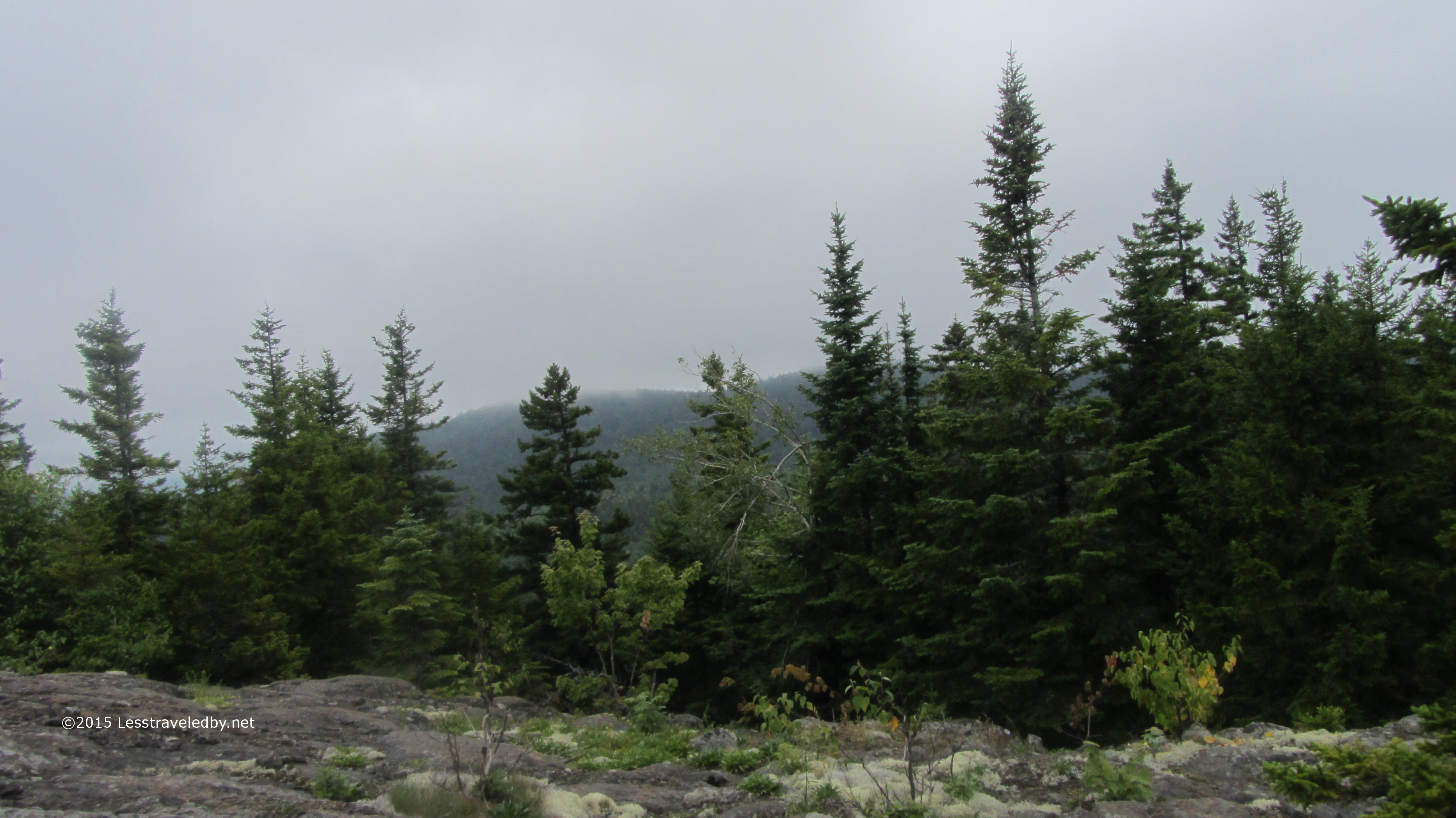
After descending into way too deep of a col and slabbing my way up to the top of Lunksoos I was at least allowed a few minutes with the clouds above me before they settled back down stealing the views.
 I just barely had time to snap this zebra shot before a gust of wind nearly tossed him off the top of the mountain. I headed on down to the Lunksoos shelter to see if my Canadian friends were there, but they had apparently headed farther on.

A pity as they missed some wonderful views the next morning. The folks who built the Lunksoos LT seem to have tossed LNT ethics beside and chopped down some trees to open up the view of Katahdin in the distance. Since the damage was already done I figured I may as well enjoy it.
 After three days of hiking in the rain I was thinking today might finally be the day to break out my dry socks. With luck I might keep my feet from falling off over the 17 or so miles I had left.
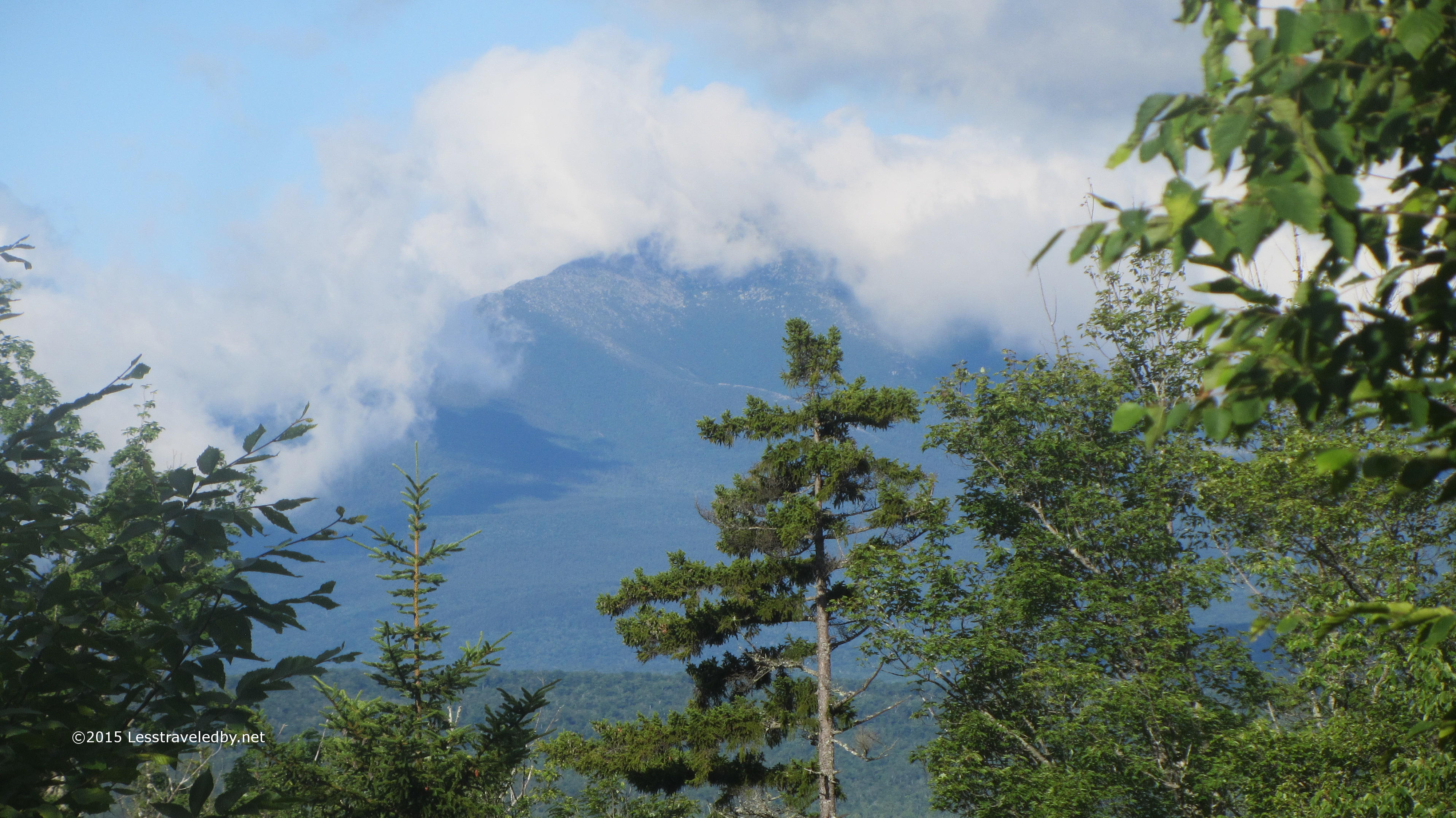 The mountain looked like an exciting place to be that day with clouds coming and going rapidly. I was headed the other direction so enjoyed it while I could and then hiked into the forest again.
 Of course the sun soon changed to clouds and I was getting rained on a bit, but these flowers kept my spirits up. Later I had my first ever bear sighting right on the trail. What looked to be a yearling was foraging until he noticed me approaching. Before I could even think of pulling out my camera he was bounding off away from me. Thankfully flowers can’t run!

This is the bridge across the East Branch of the Penobscot that leads to Bowlin Camps. I had a nice chat with the caretakers there and will be devoting a post to my visit with them in the future.
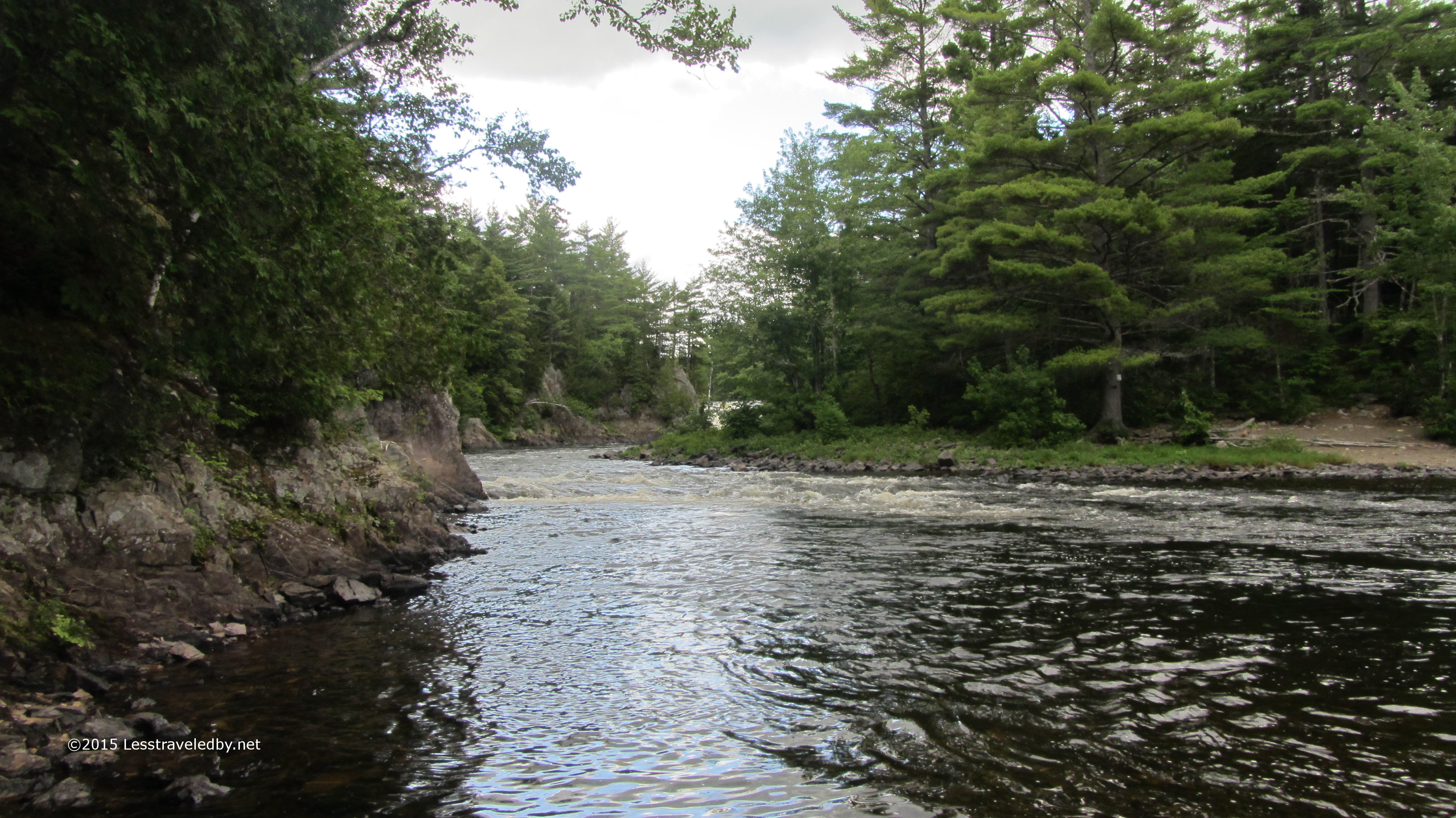
After setting up camp at the Grand Pitch shelter I took advantage of the opportunity to break out my fishing pole. I didn’t feel like fighting my way down to the pool right under the falls and settled for this one a bit farther below.
 My efforts were amply rewarded with this good sized trout. One of his smaller cousins swallowed a hook and had to join him for dinner, but this one would have been a meal in itself.
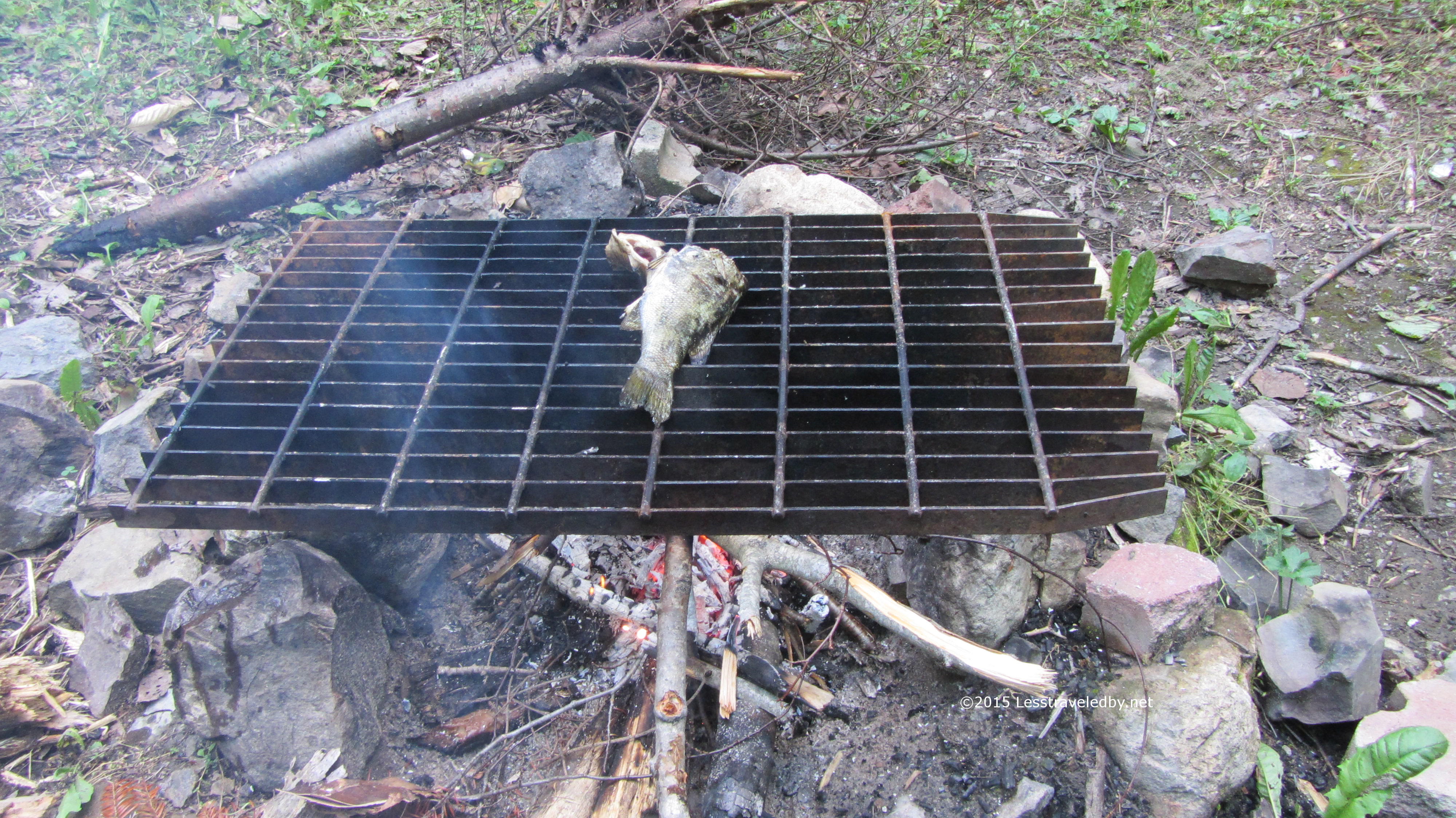 Of course after four days of rain making a fire was a bit of a challenge. Being in a well used campsite didn’t help as the easily foraged kindling had already been gleaned. Thankfully my fire skills were up to par and despite wet wood and gusting winds I managed to get a cooking fire started. I’ll admit there was a moment when it was getting darker and I was starting to wonder if I could make trout soup in my kettle.
The fish were fantastic! I’m sure six days on the trail whetted my appetite, but fresh trout with a little garlic and dill roasted over a fire is darn fine eating any day of the week.
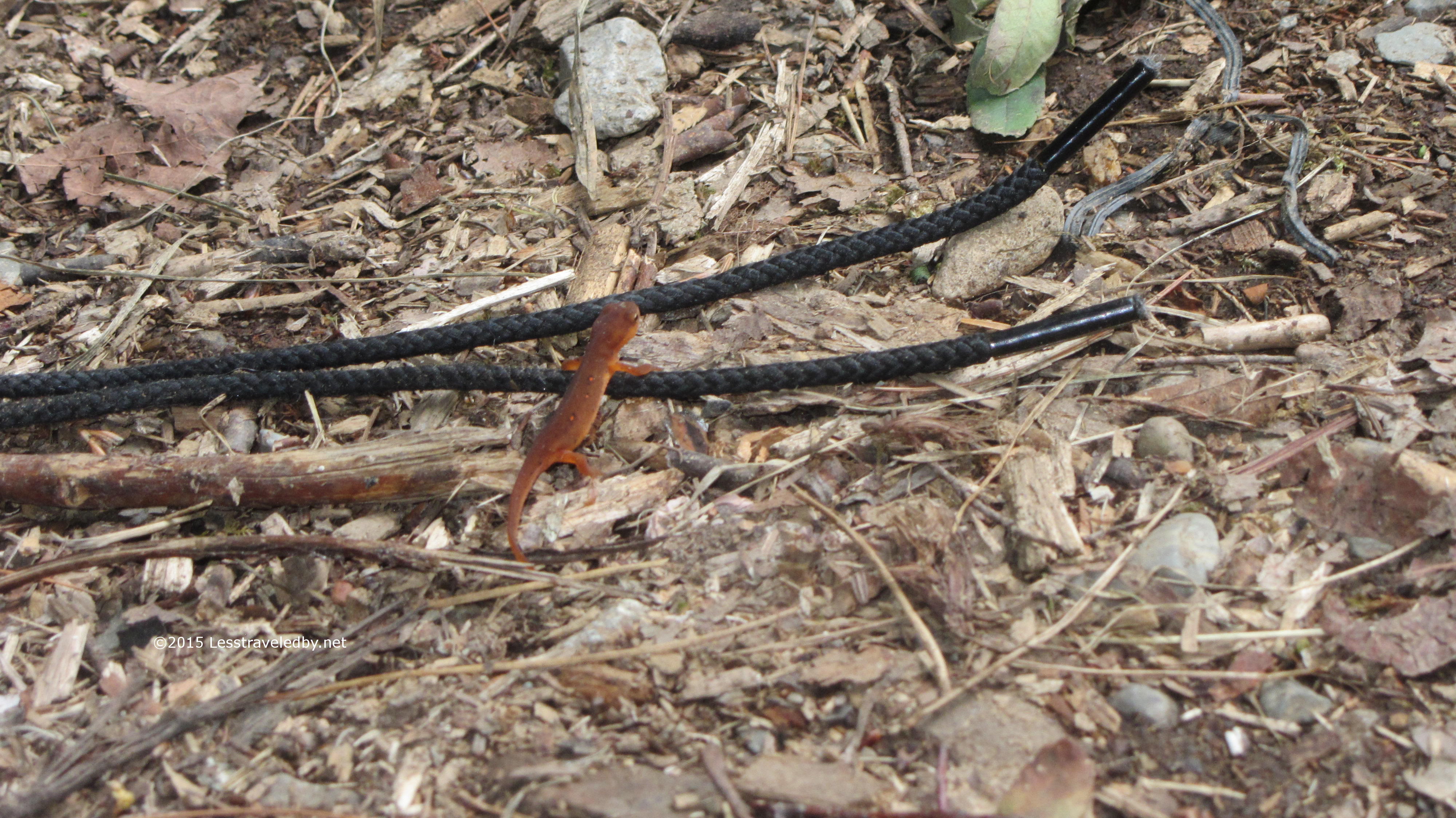
This bit of wildlife was for viewing only. Not sure any amount of herbs and spices would make that taste good. Pretty to look at though!

They seem to have some bird nesting problems at this shelter. Guess it is better than wasps, but I was glad they didn’t seem to be around while I was there.
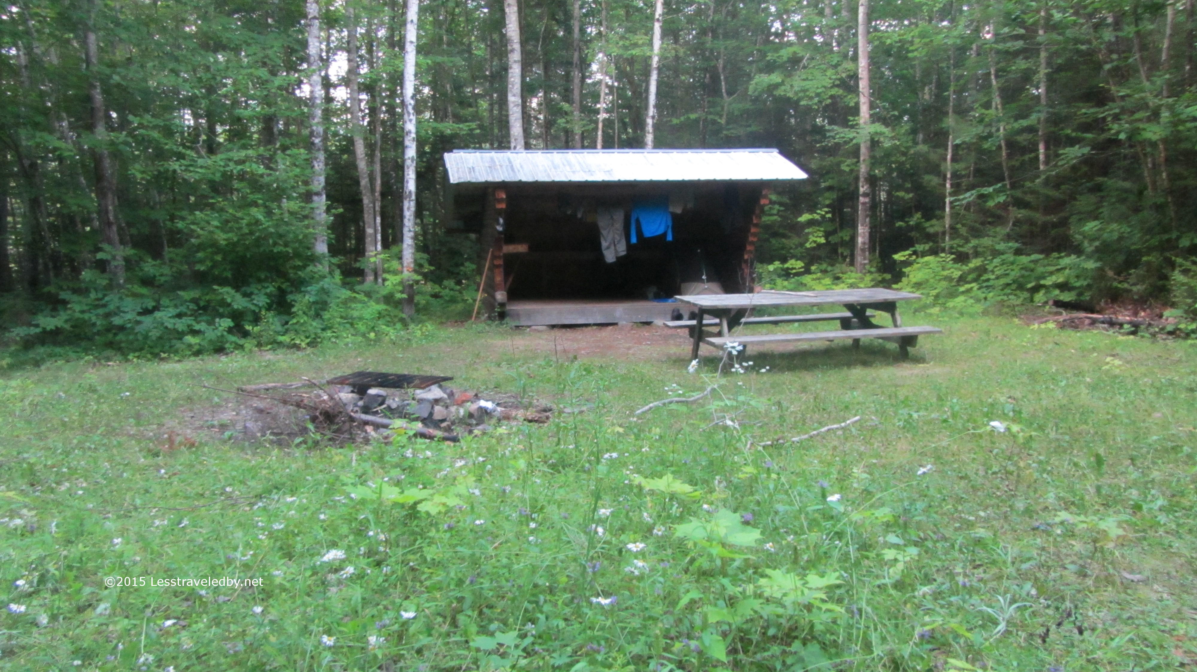 This shelter was on the small side, but with plenty of room to set up tents around it. With the river right near by it seems like a great place to set up to do some fishing or paddling.
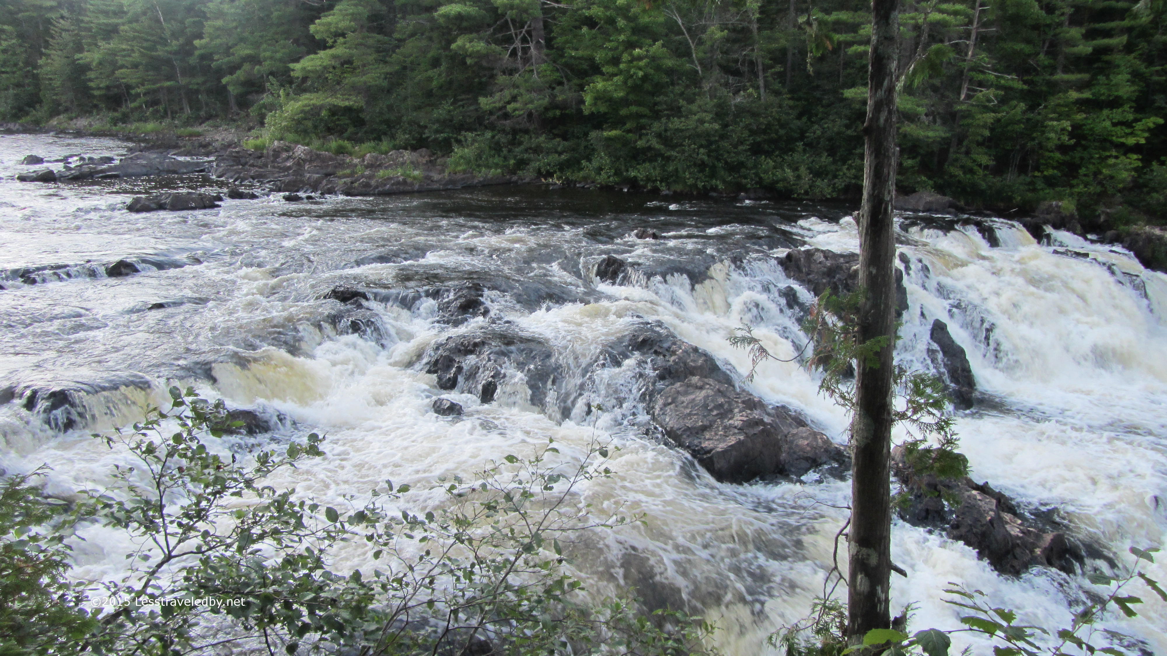
I took the portage trail down to see the falls near sunset. Even in a dry year there was plenty of water headed down river.
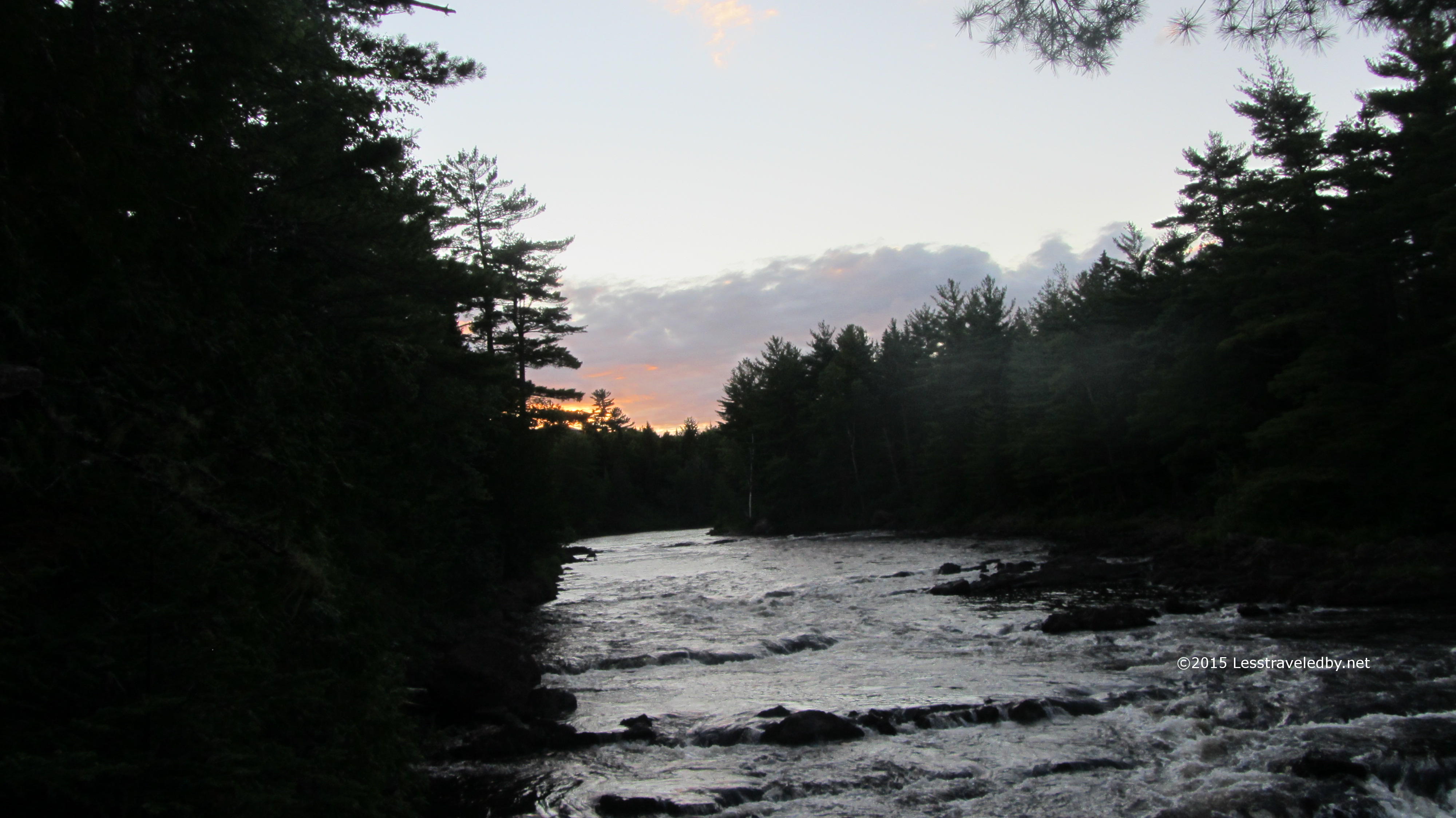
I had the place to myself and with the sunset slowly coming on it was a great place to spend my last night on the trail. The weather hadn’t made things easy and I still wasn’t convinced my feet wouldn’t fall off, but it had been one heck of a great trip as far as I was concerned.
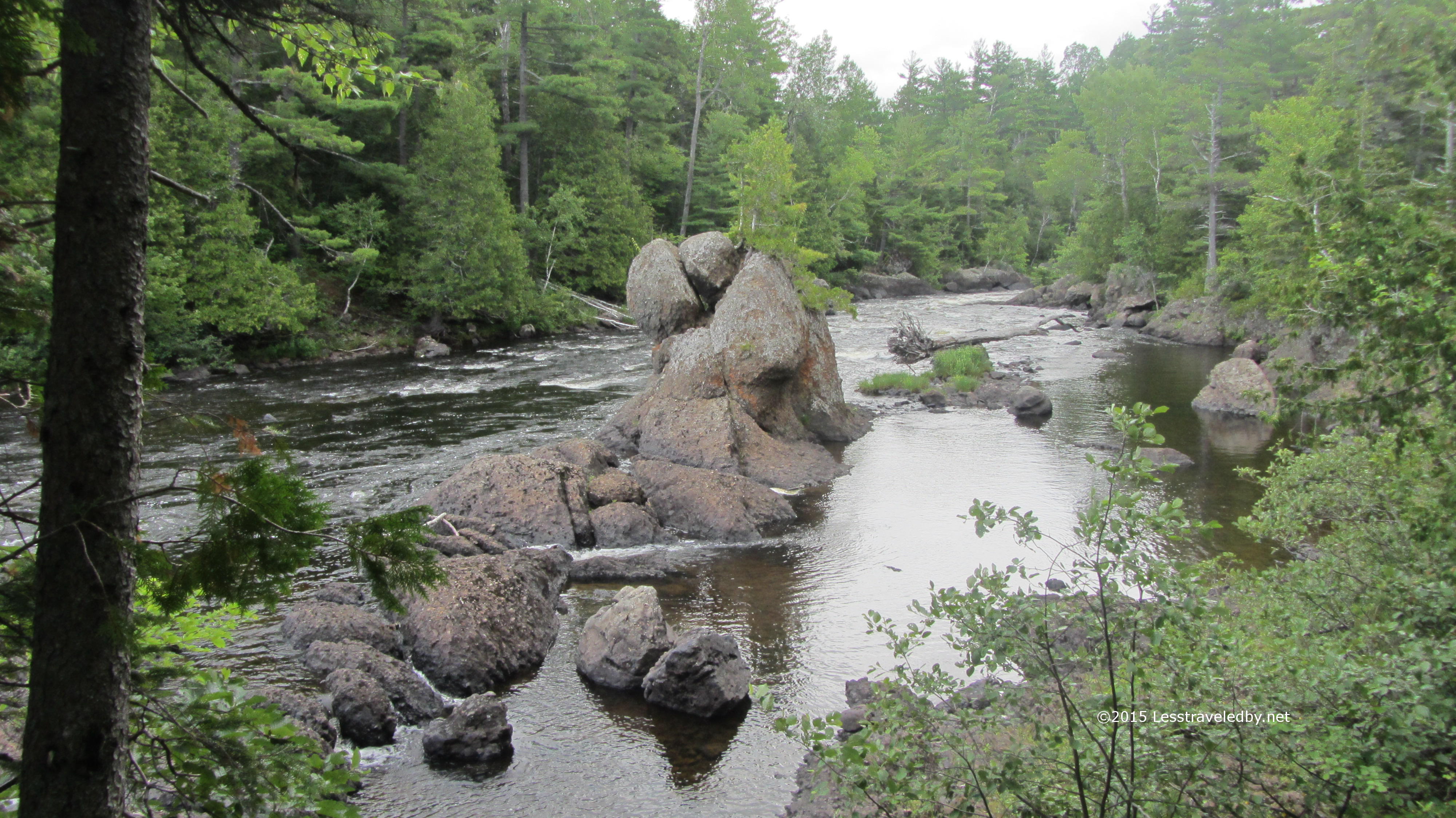
This rock in the middle of the river is iconic enough to have a name; Haskell Rock. Looks like it has been there a while and try though it might the river isn’t moving it any time soon.
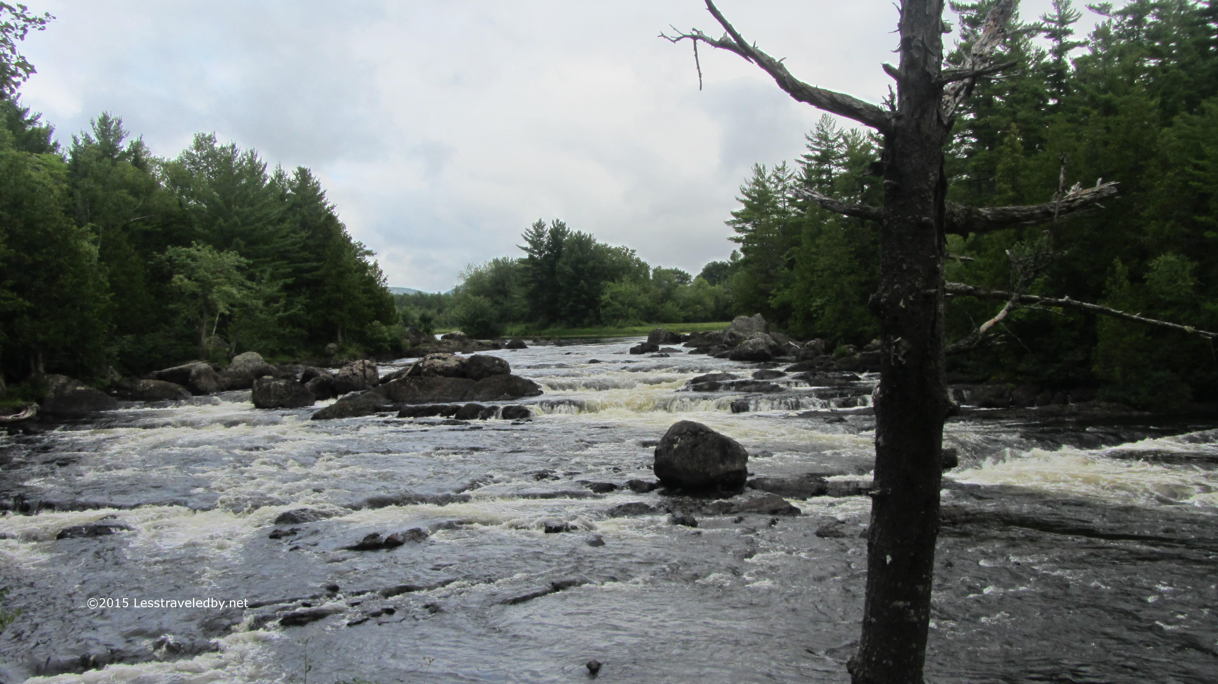 I believe this is the section known as the hulling machine. An eater of canoes and kayaks that has led to more than a few rescues over the years.
 And of course on the final day we had to have at least one shower. The clouds came down and did their best but I knew I was getting close so didn’t let it bother me.
 Horse Mountain coming up on my left confirmed I was just about back to Grand Lake Road. This area showed signs of having a lot more traffic, but I only met one person the whole day.
 Back on the road I was treated to great views of the river. Well and if you look closely you can see the ice cream cone shaped sign up ahead telling me I’d finished my loop. Time for one of their giant cones full of vanilla! Roughly 70 miles, much of it in the rain and I’d totally do it again. Maybe next year?
As a bonus, on my ride out I spotted Gen and Emanuel hiking down the road. The next section of the IAT is a long road walk so they’d be dodging logging trucks for a while. I stopped to chat with them and found they had put in a 20 mile day after we parted, then did a very short day and camped at a Matagamon Wilderness site to recover. These two were always smiling it seemed and I hope the rest of their adventure went well.
A little technical info: Rough mileage worked out to about 70 actual trail miles. The Baxter trails are pretty well maintained and easy to follow. The IAT is sparsely blazed in places and the lack of foot traffic can make following the trail a bit tricky at times. Good path finding and navigation skills will come in handy when the trail just seems to disappear. A lot of the IAT section follows old logging roads and is very easy to follow. Most of the difficult sections were between the Wassataquoik Stream ford and Deasey Mountain.
Reservations are required for Baxter State Park camping so some planning is required. Keep the miles manageable so you can be certain of reaching your intended sites. Once on the IAT it seemed wilderness camping was allowed between shelters so you can be more flexible, but the shelters are nicely spaced.
This route traverses some lightly traveled areas and has some challenging terrain. Definitely not a good first trip, but if you are looking for adventure this is a great route to find some.