
Two nights resulted in hundreds of pictures and many videos despite some rain the first day. I’ve whittled it down to 39 pics for this post with several videos to follow including a great sunset time lapse.
The first day’s hike took me across the river and into the western side of the Pemigewasset Wilderness for a change. Previous adventures have taken me on the Twinway from Galehead to Zealand but I didn’t have time to make the side trip over Guyot to the Bonds before. While I knew I wanted to get this trip in before things got too crowded in this popular area the weather was uncooperative. It took three weeks before I could find enough breaks in the weather for both the motorcycle ride to NH and a trip up the mountain and even then I knew I’d see at least some rain.
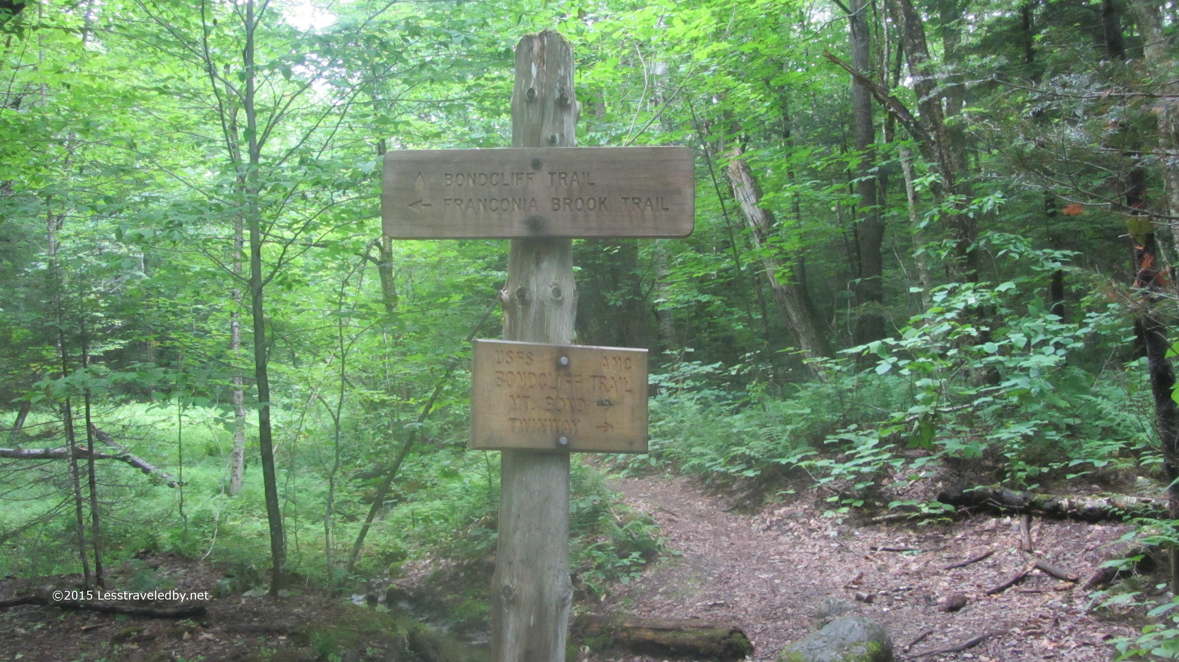
A trip last year saw me headed out as far as the intersection with the Bond Cliff Trail, but that time I’d continued out to 13 Falls on the Franconia Brook Trail. This time I followed the old rail bed into the wilderness with the sound of the Pemigewasset River coming and going through the trees but the water rarely in sight.
I ran into a group of young men at the intersection where the Bond Cliff Trail heads up away from the river and the now abandoned section of the Wilderness Trail that used to lead across Black Brook and then the Pemi via a couple of bridges since removed. They had been thinking of following the old trail and crossing the river but found both were obstacles better left unchallenged. I gave them some ideas on where to look for camp sites and warned them a storm was forecast to come though soon so they’d best not wait too long to get set up. Being young they may not have listened to my old man advice, but hopefully they stayed dry enough.
I ambled up the beginnings of the notch that Black Brook descends from and soon began to feel a light rain begin to fall. There wasn’t a definite target for a campsite that night so as soon as I felt the light dim a bit and the rain begin to become more steady I stepped off the trail near one of the water crossings and found a place many before me had spent the night. Definitely a bit more over used than my usual camps, but it was there when I needed it.
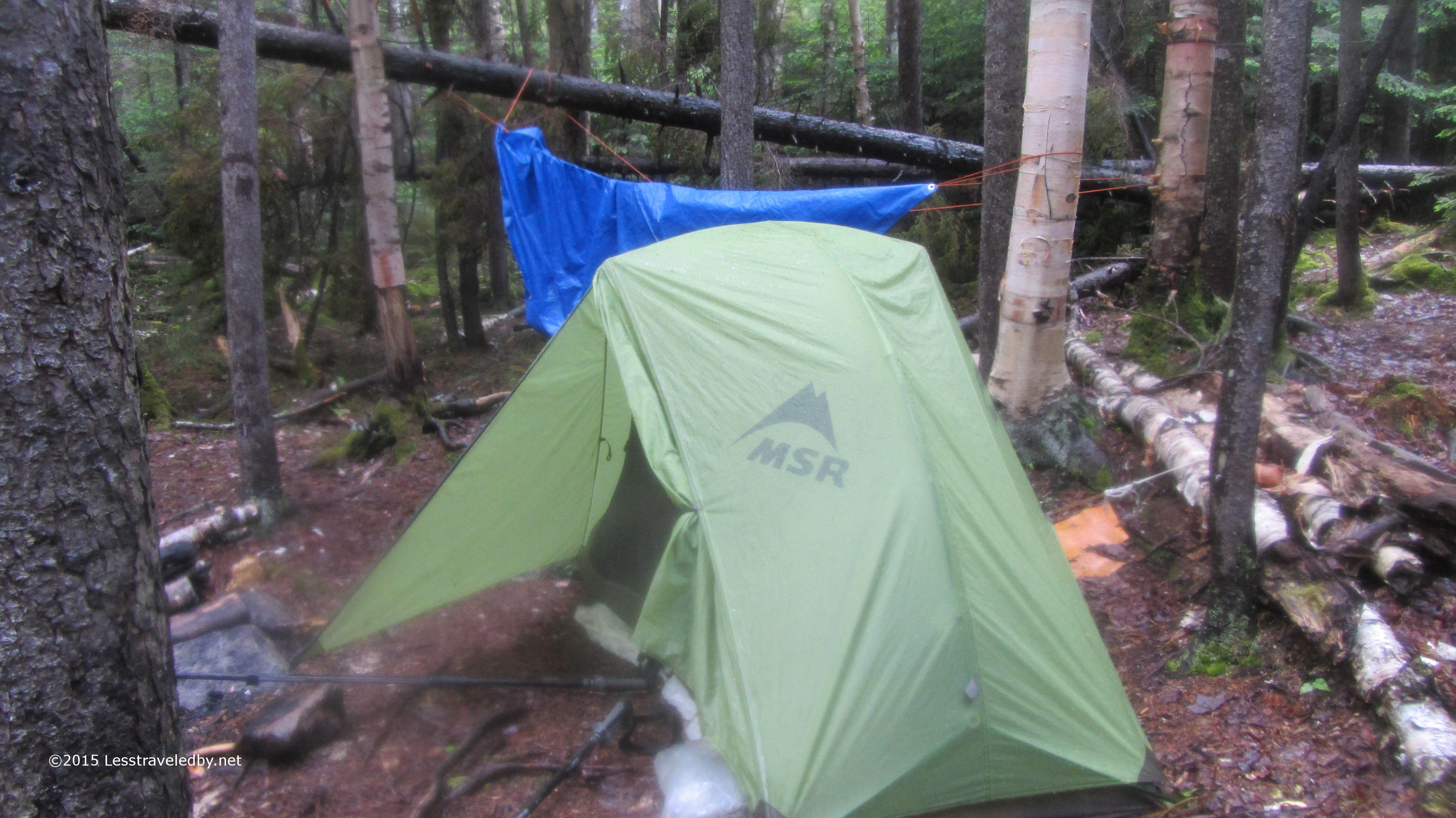
Just before the rain began to get serious I managed to get a tarp strung up hastily from whatever anchor points I could manage quickly. That let me and my pack hang out under its protection while I snapped together my tent pole and set up as dryly as possible in a storm. The rain was pretty heavy for a few hours which gave me time to cook and eat dinner, set up my bed and even relax inside the tent in dry clothes for a bit before it turned to intermittent showers.
The rain had been incredibly loud pounding on both the tarp and my rain fly. I decided while laying there that when the rain let up I would take down the tarp so it didn’t wake me up if more rain fell during the night. The picture above is from when I was starting to take it down. While doing that I began to notice a birch tree near my camp that hadn’t caught my eye earlier. It was dead and in process of falling down around my camping area in small, but heavy pieces. The more I looked at it the more I didn’t like it, but finding a spot for my tent that wouldn’t also collect water if it rained heavily was hard. I went back and forth before finally moving a fair bit away to a spot I felt better about. I checked in the morning and nothing had fallen where I was, but I still slept a lot better knowing that thing wasn’t looming over my head.
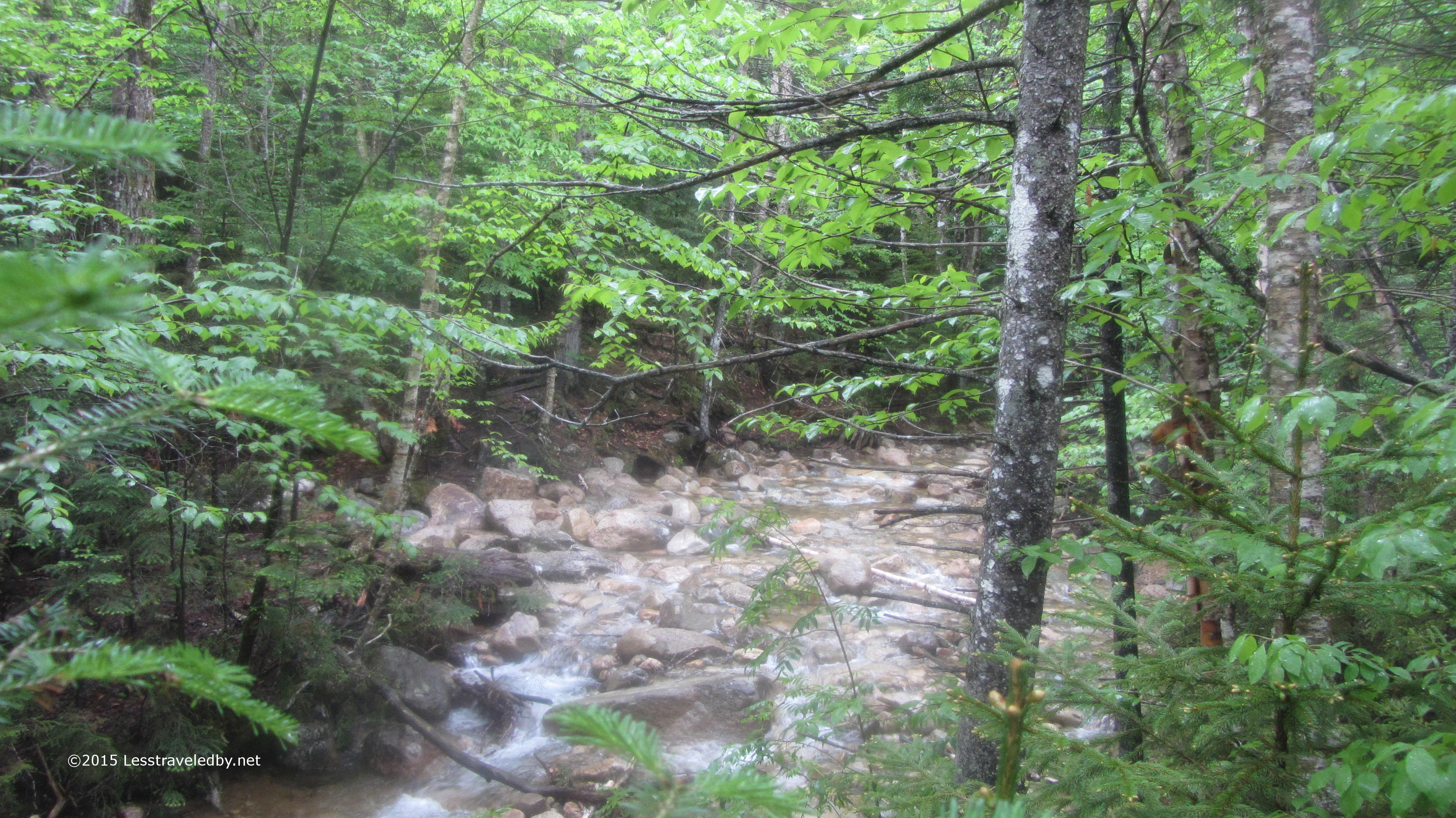
This little brook was not far from my camp and there was a nice fallen log there to sit on. I had breakfast there in the morning and watched a hiker with full pack slowly work his way across with no idea of me being there.
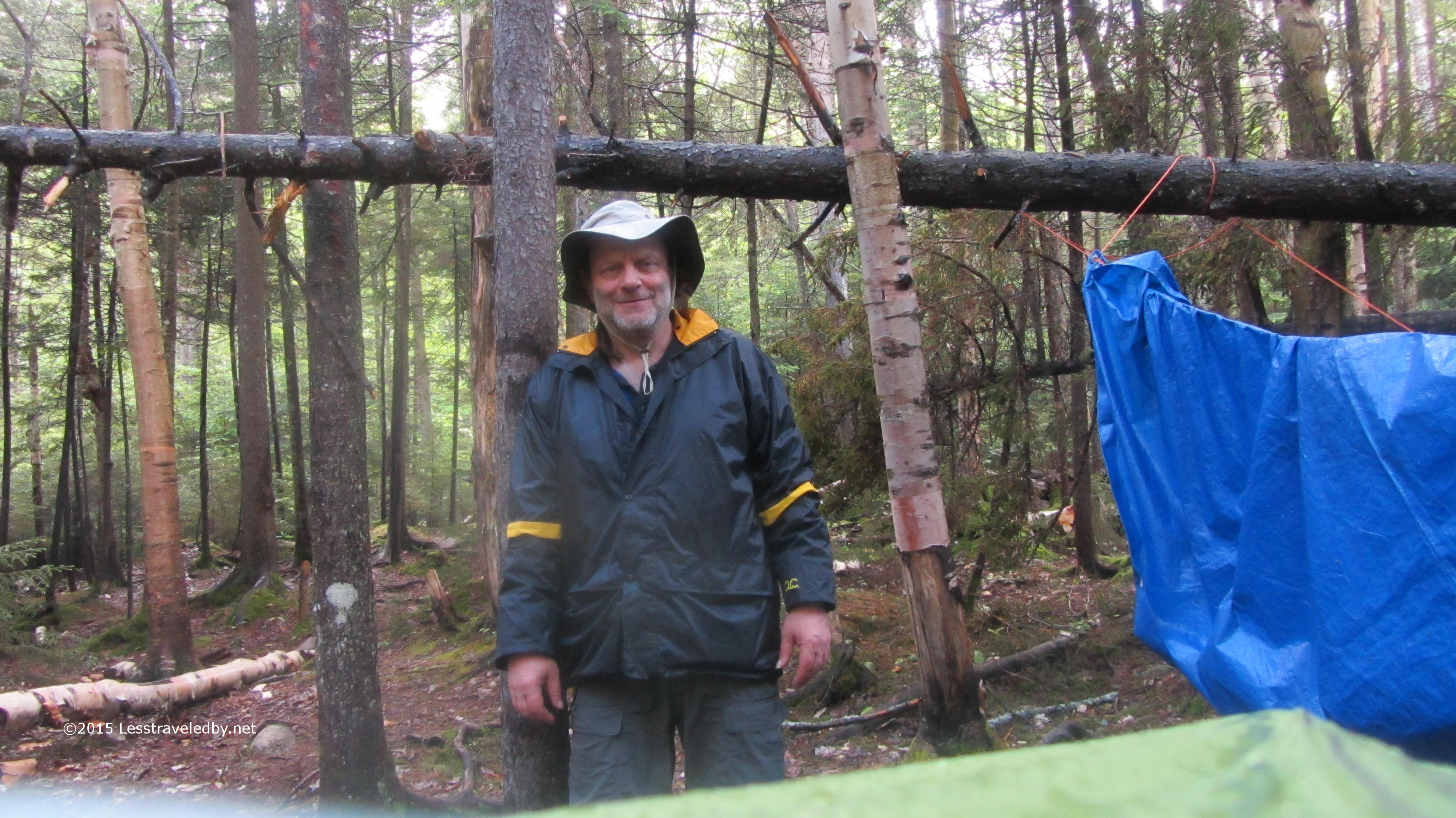
I had the camera out to take a picture of my camp so I thought I’d get a shot of my new hat. Finally retired the straw hat last year and thought I’d try one of the popular light cloth ones to replace it. It doesn’t provide as much protection, but it does pack well unlike straw.
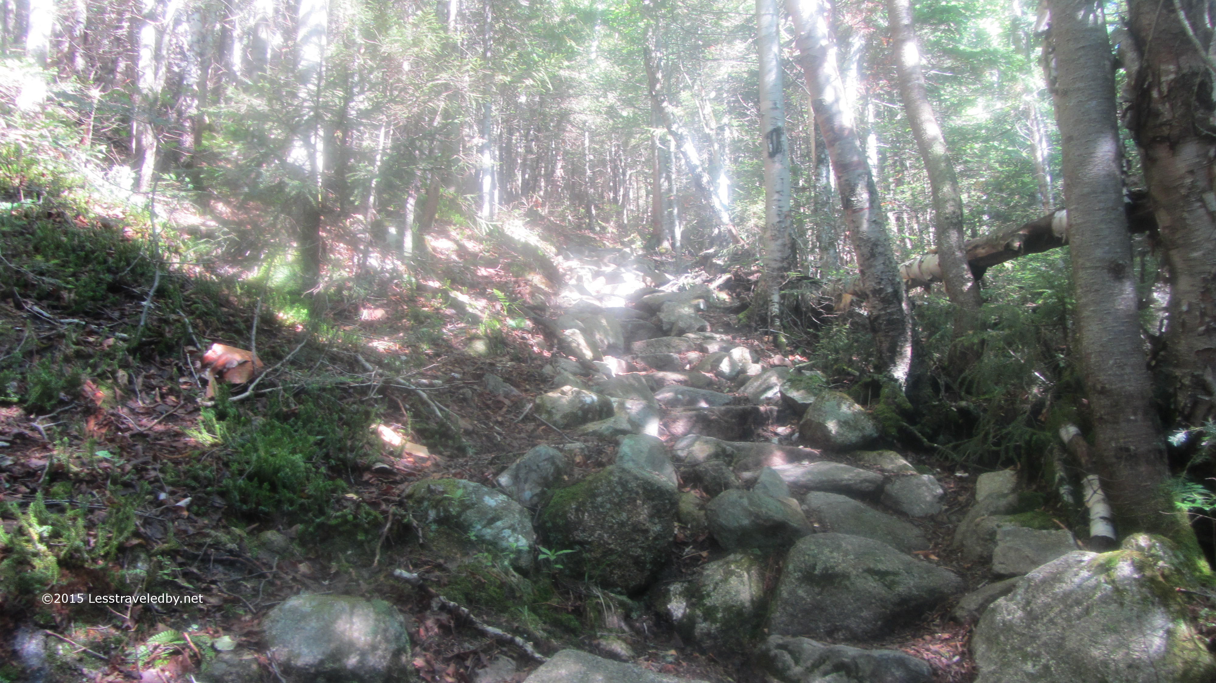
After breakfast I started heading up through the wet forest. The trail soon went from a balance of rocks and dirt to mostly rocks in many stretches. There were several crossings of Black Brook as well as other wet spots. Combined with a couple of switchbacks this section picked up a little elevation before giving a view of what was to come.
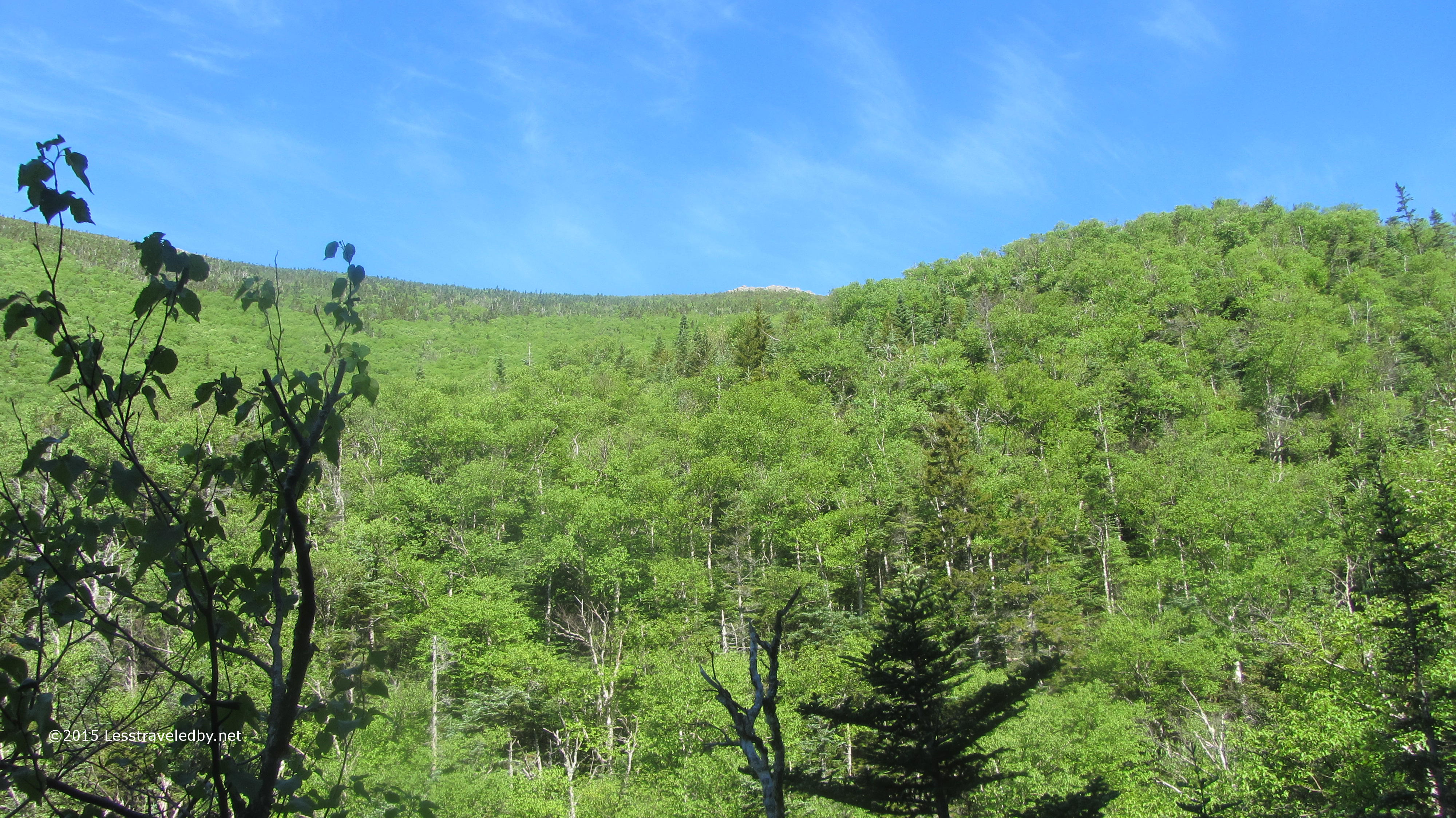
I was a little blown away by the perspective when the trees opened up and I could see what remained of this side of the mountain before me. That bit of rock poking out of the top was where I was headed, but it seemed much farther and higher than the map implied.
That beautiful green canopy against the clearing sky the storm had left behind was a great motivator though. I laughed to myself that the only way to find out what it looked like from above was to climb up there and it wasn’t as though I was going to turn around without at least trying so I might as well get going.
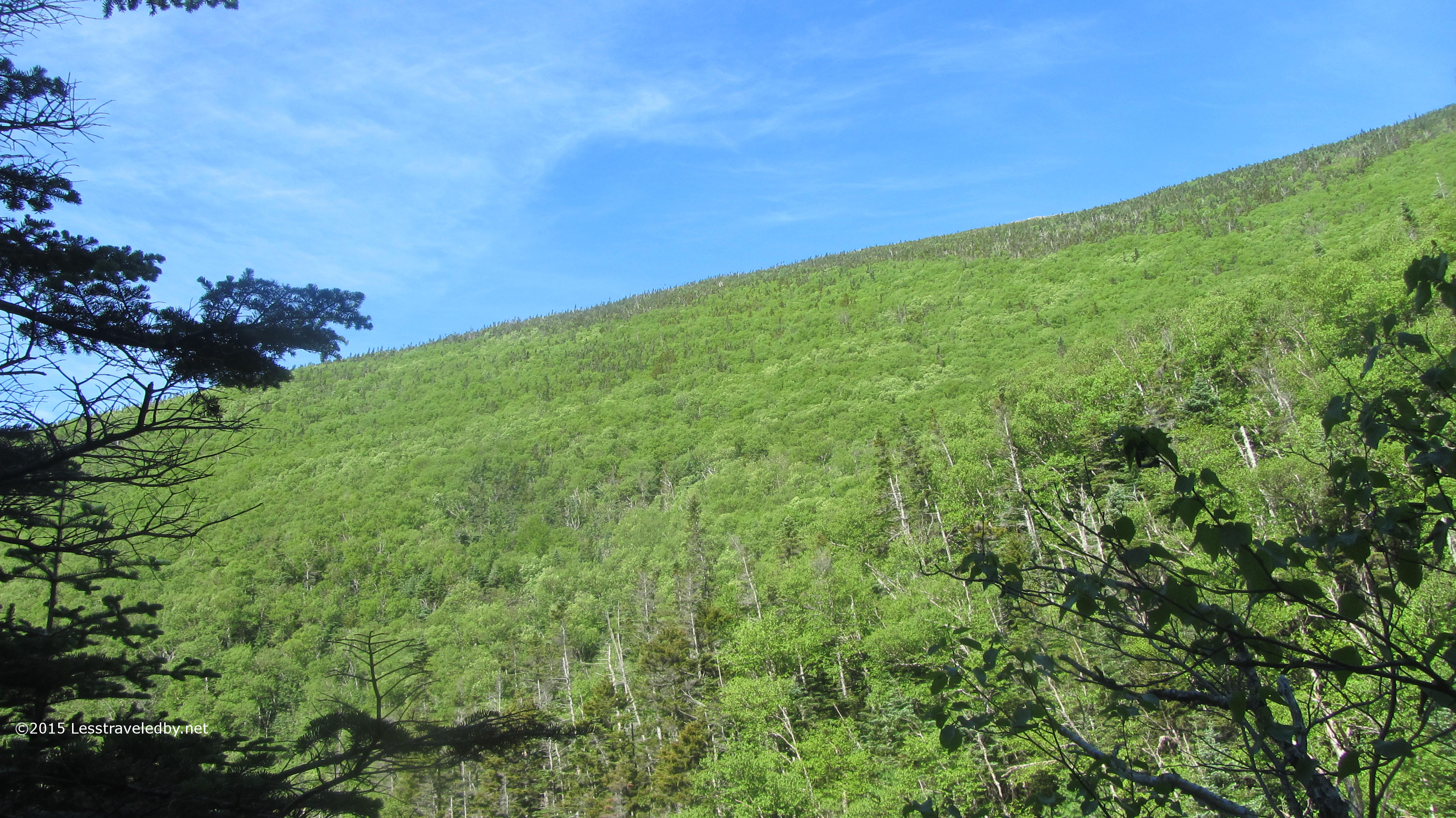
Soon after that I was rewarded with this great stretch of trail. With rare White Mountains dirt and a thick carpet of pine needles it made for a steady ramp that gained a lot of easy elevation while traversing the slope. It also had the benefits of both views and breezes hinted at between the thinning trees.
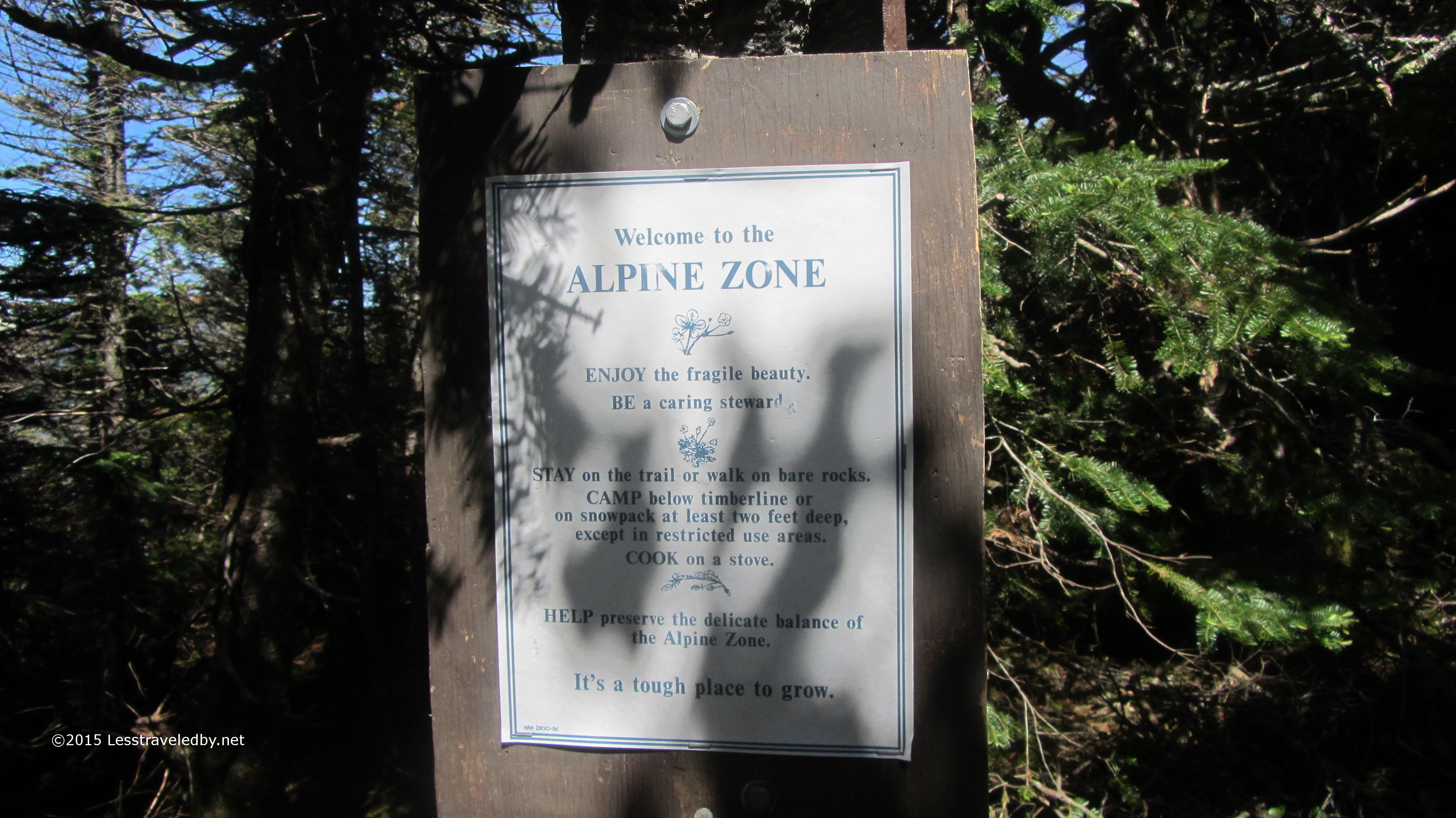
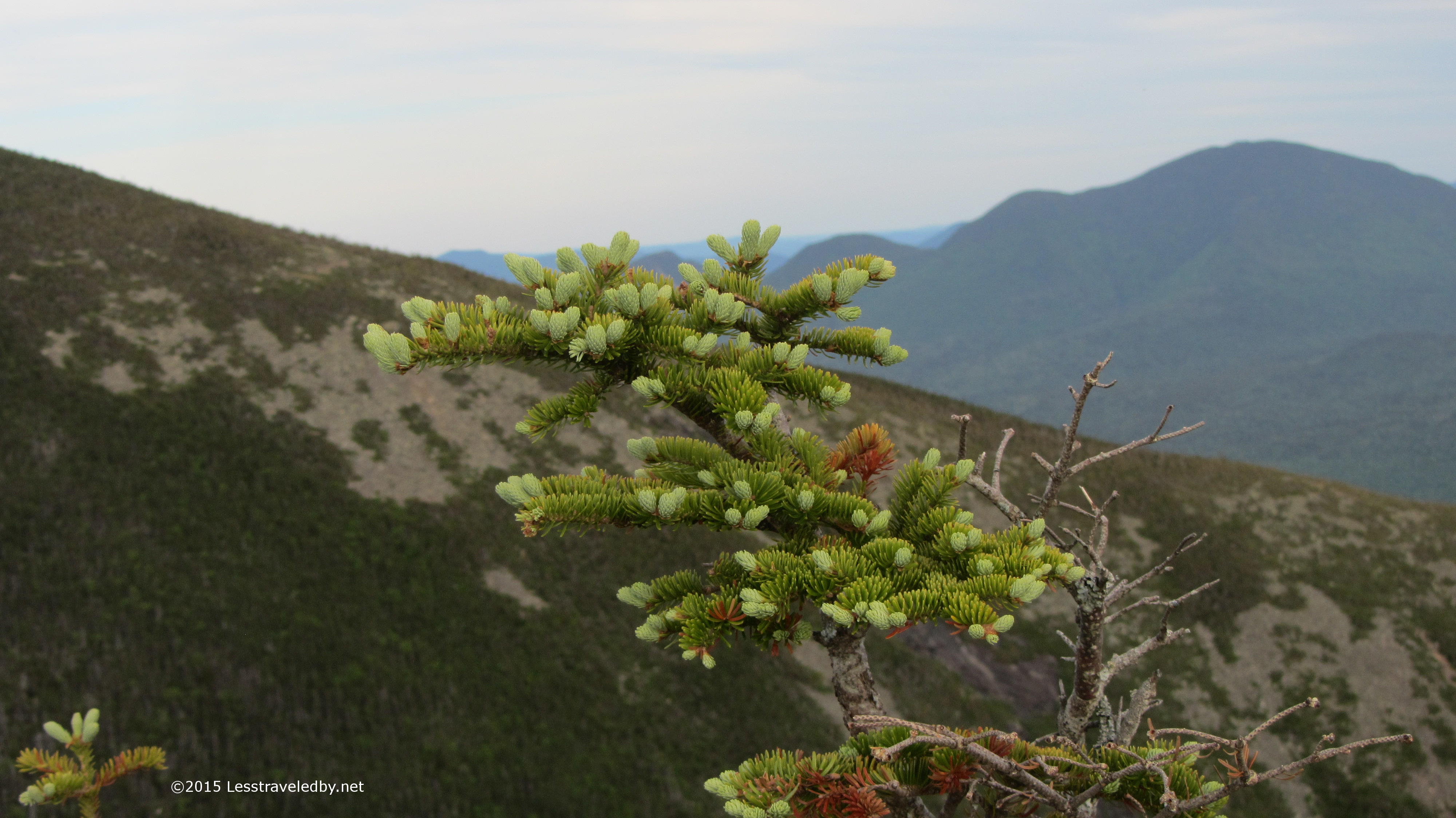
They don’t put up many signs in the wilderness, but this information was worth the intrusion. Life is hard enough on the plants in alpine areas and they can’t afford to take abuse from us. Of course some moron built a campfire on top of the cliffs, but I see that as all the more reason the rest of us need to do our part.
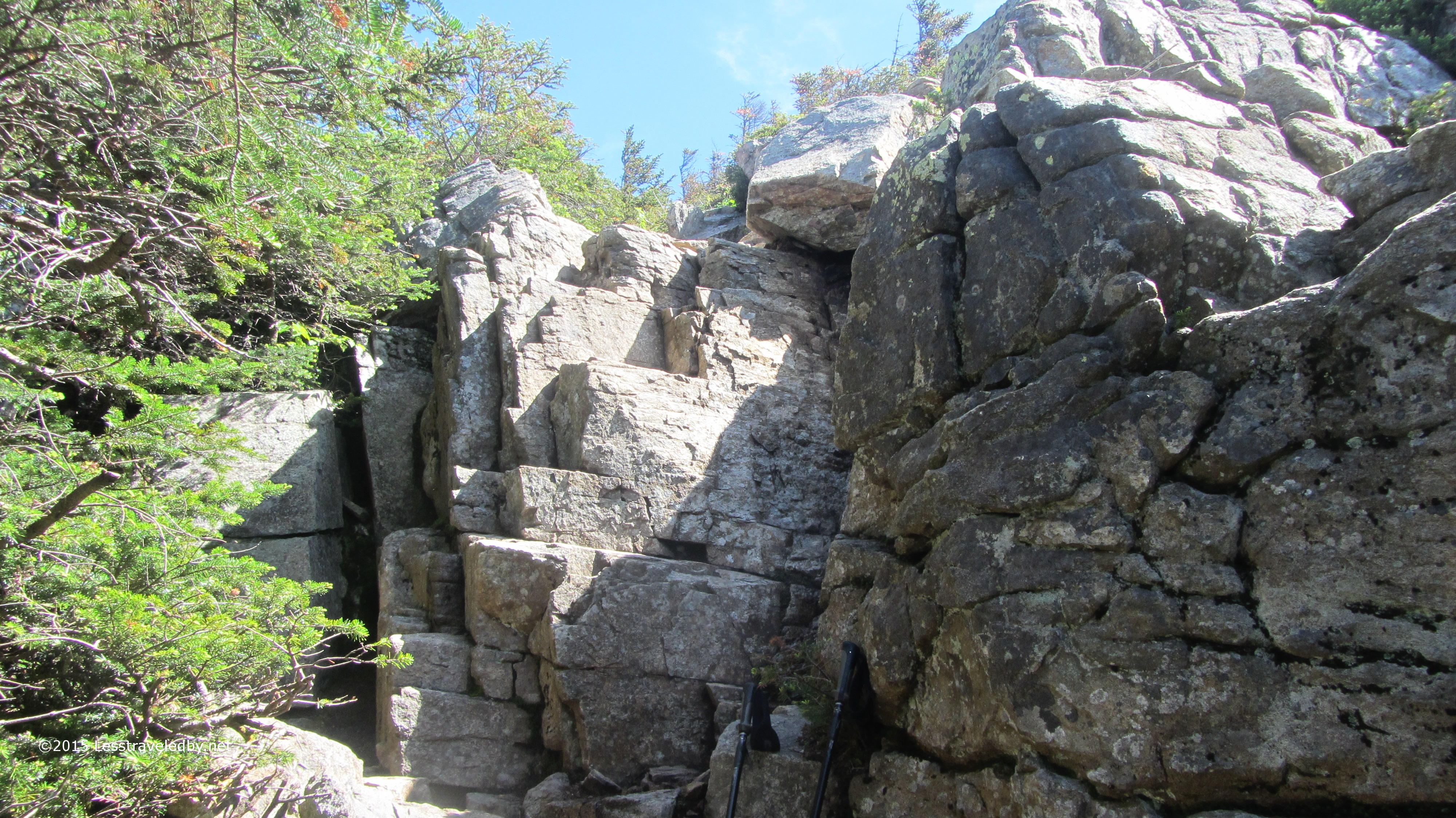
Speaking of cliffs; I found those rocks I’d been looking for. Now I just had to figure out how to get up them. The ledges provided pretty good toe holds but not much for the hands. With a full pack I took my time working my way up reminding myself what I tell my four year old daughter when she is climbing things, “One hand. One foot. One hand. One foot.”

Looking back down you can see not only the sign at the base of the cliff, but the first views of why I made the effort. Above the trees the breezes were free to roam and it was a beautiful day. Right after a front moves through is often a great time to be up top taking in the views.

Looking down the Pemi valley back towards the trail head I came in from. You can make out the ski runs at Loon Mt beyond.
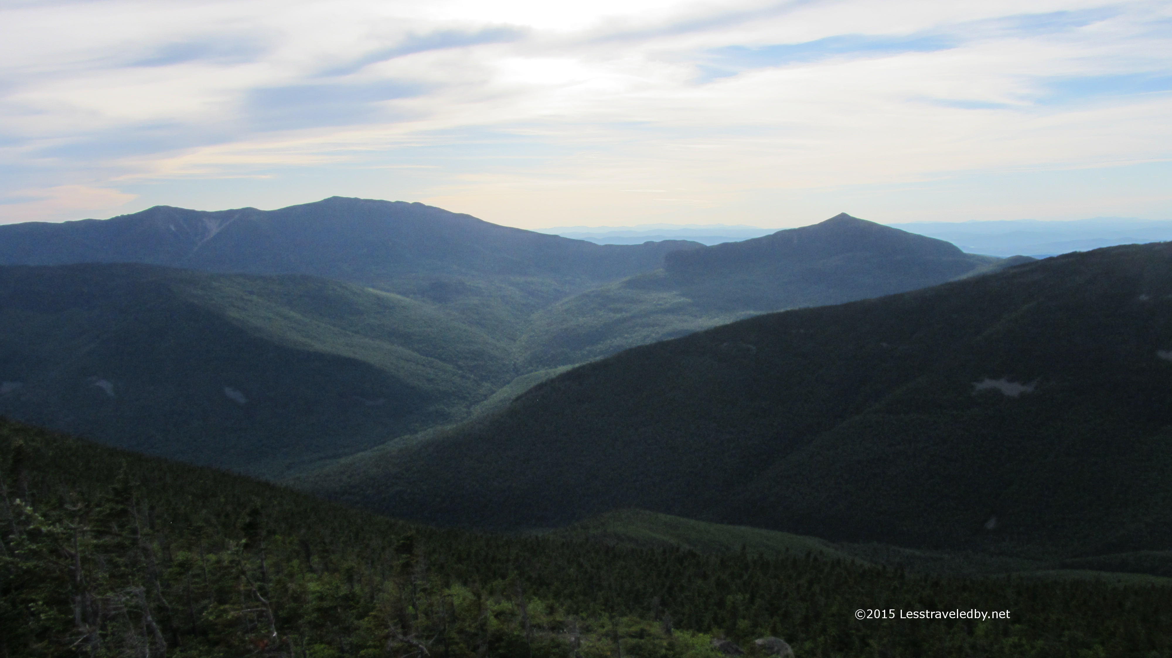
So many peaks it is hard to keep them all straight with views like this, but I’m going with Hancocks in the left center with Osceola in the distance.

These cliffs were amazing to walk along. The exposed stone seemed to make the empty space beyond more palpable. Whenever I was especially near the edge I could feel the void as much as see it and my feet seemed to step lightly rather than risk breaking the mountain.
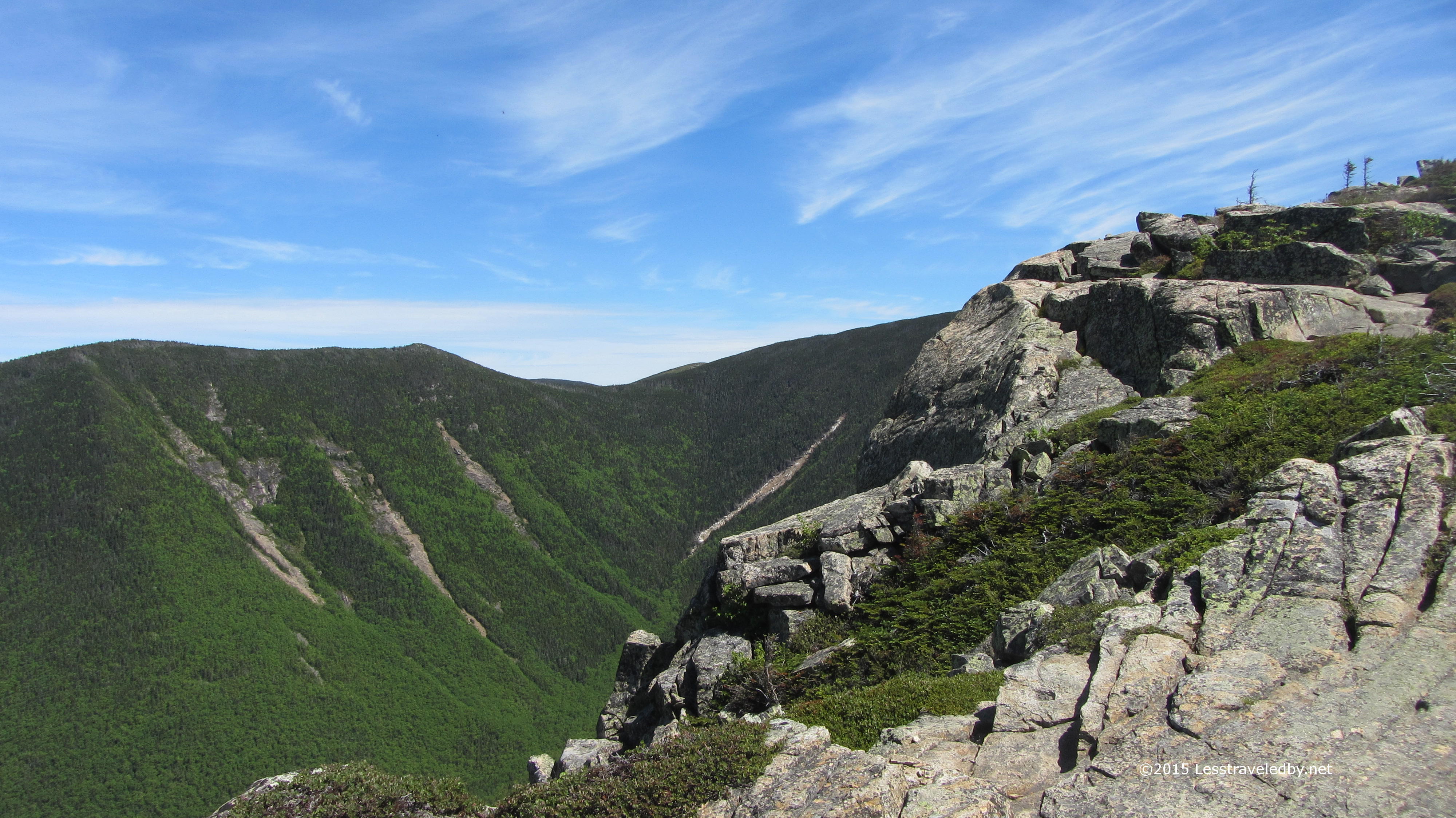
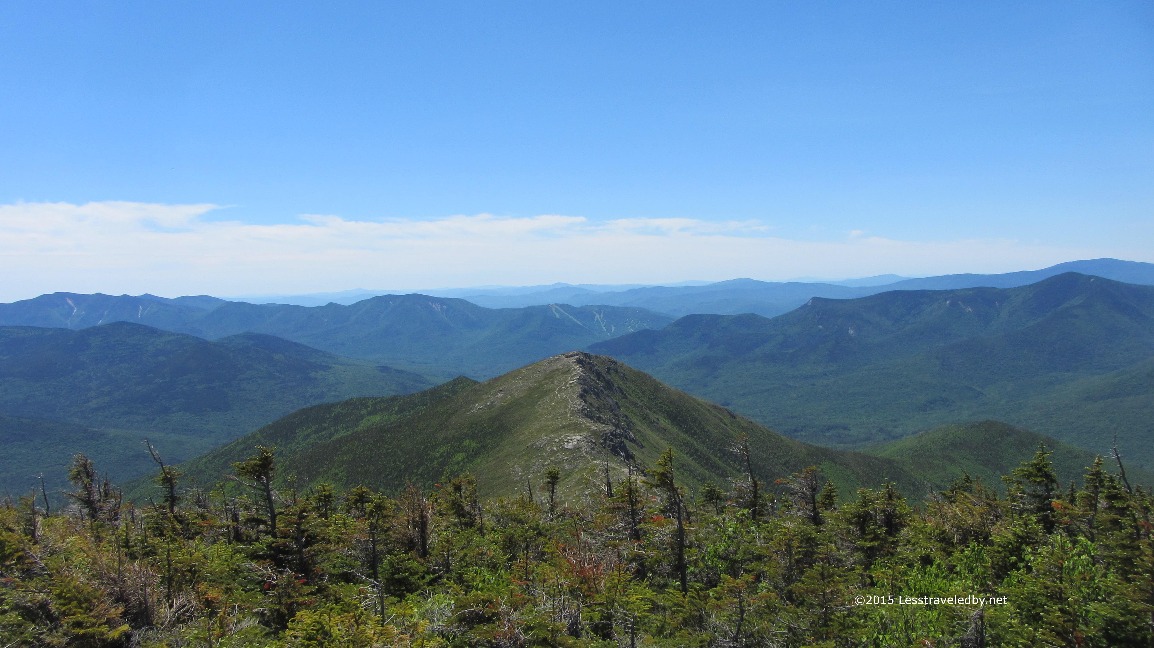
 The last rise to the top of Bond Cliff. Thankfully there was just a nice cooling breeze as I was crossing. There really was a great sense of exposure from here and up the next part of the ridge towards Mt Bond. Not the sort of place I want to be on a big wind day for certain.
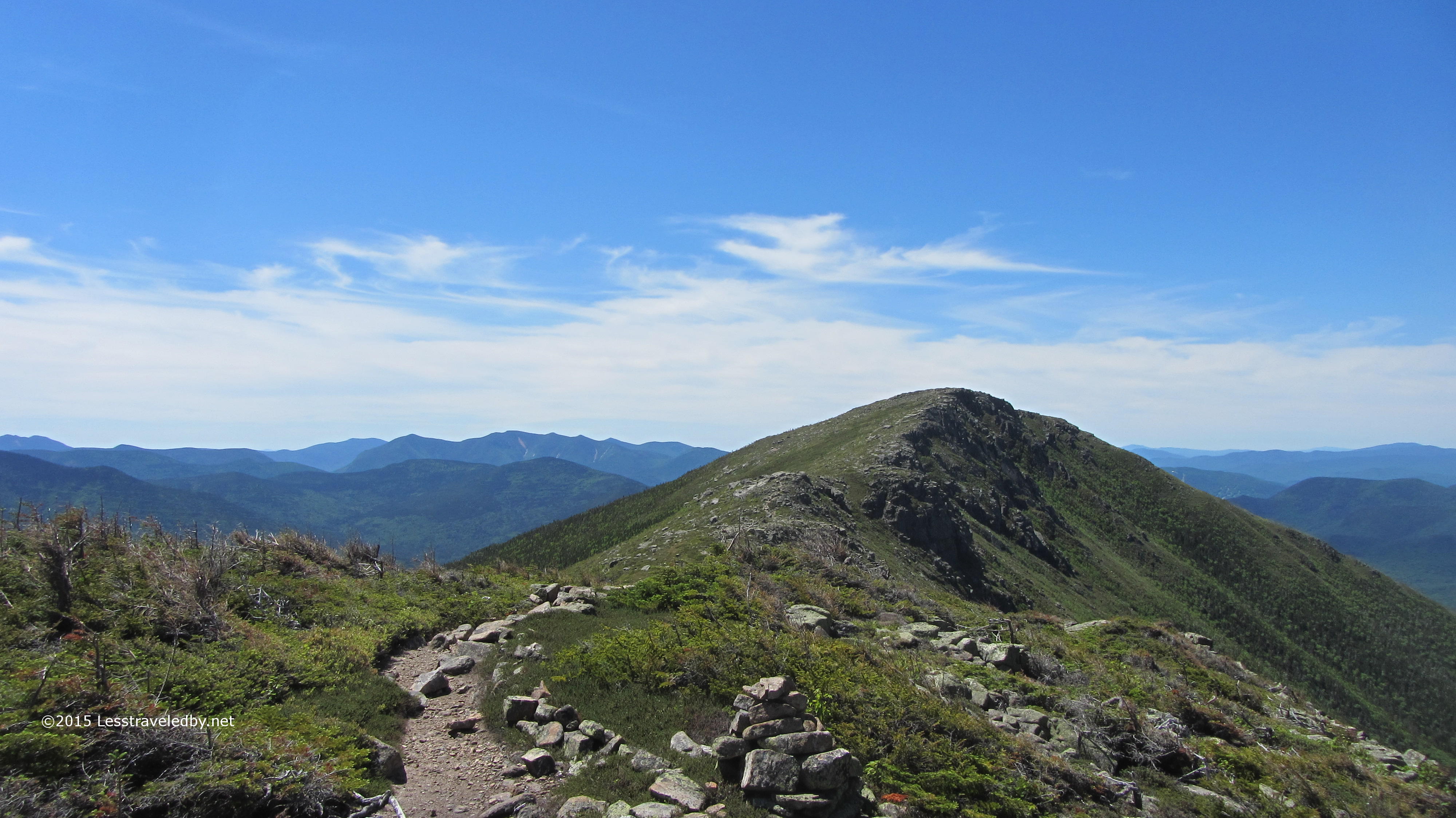
 From the top of the cliff the route up Mt Bond became clear though the ridge trail disappeared into some low trees near the summit. It looked simple enough from here and I stopped to chat with some folks I met coming the other way. They, like a man right behind them and many others I met on this trip, were doing the pretty standard Pemi Loop that takes folks along Franconia Ridge, across Garfield before heading up to South Twin and then out across the Bonds. They spent a big part of the day before hiking in the rain but still seemed very pleased with their trip. A beautiful day like this makes up for a lot of rain.
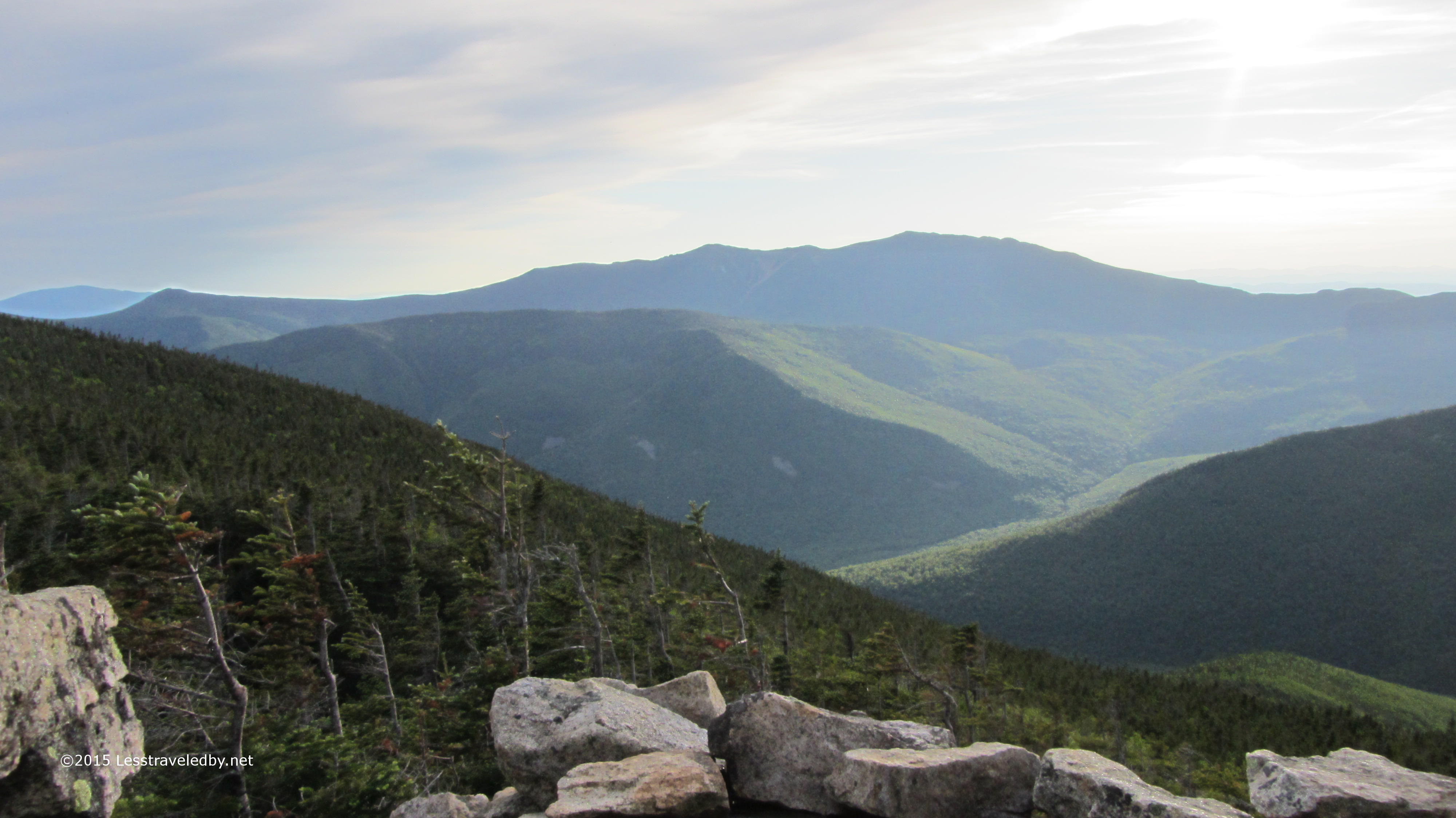
 Looking back at the cliffs as I worked my way up the ridge toward Bond. Seeing those rock faces from this distance seemed to make them look even larger than when I was on top of them. It was hard to fathom the size up close and only when seen as part of a bigger picture could their scale be fully realized.
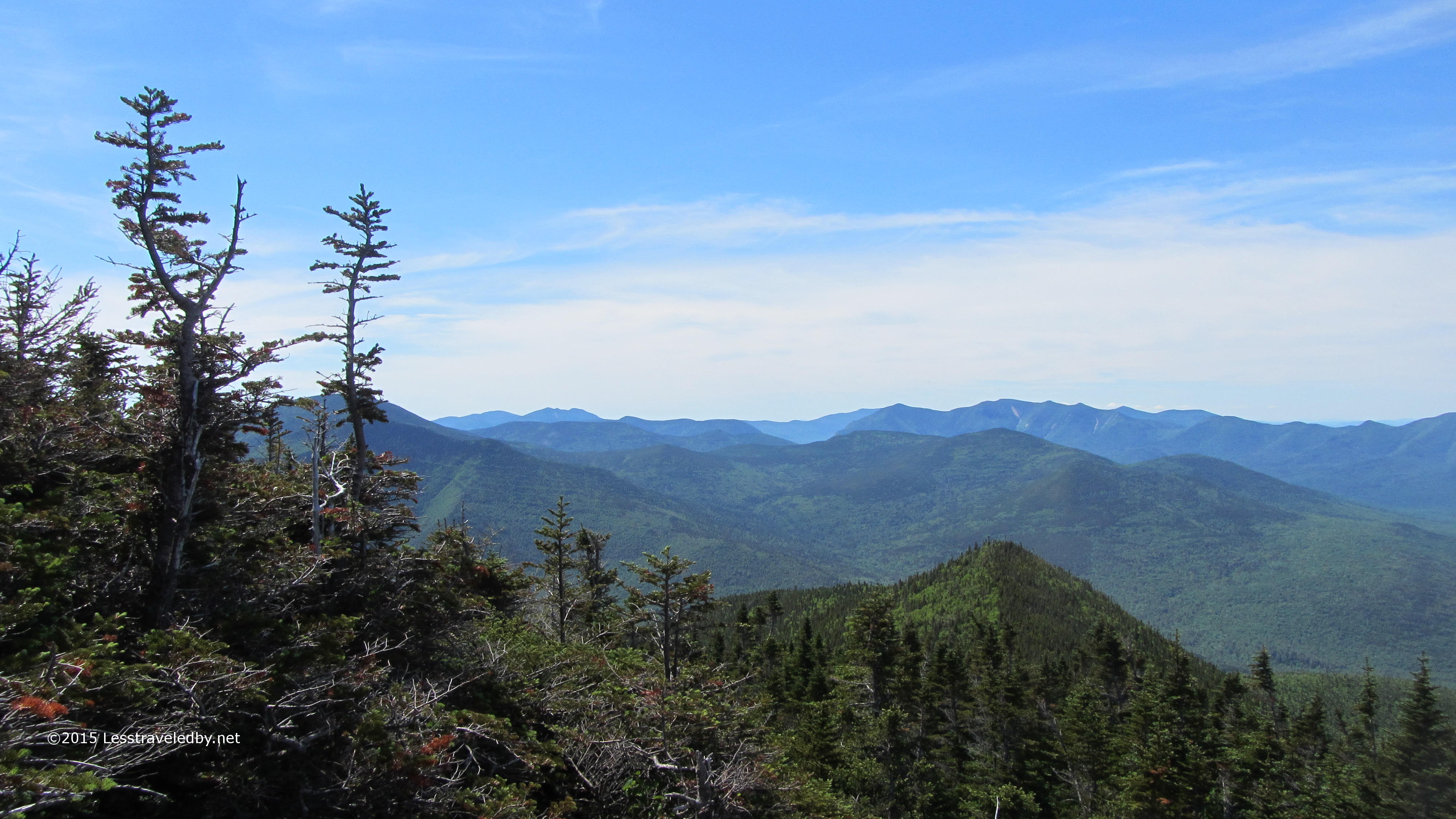
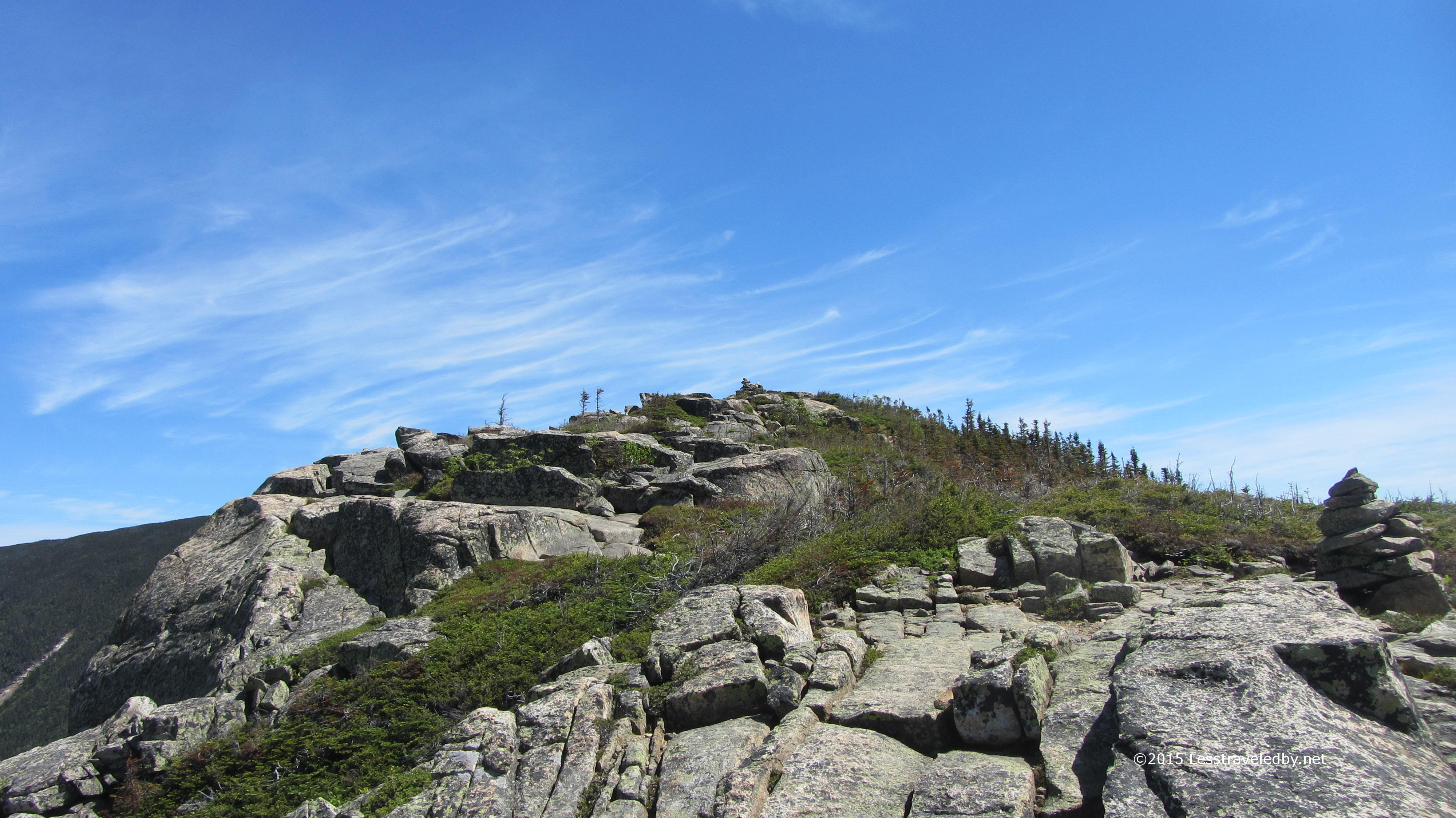
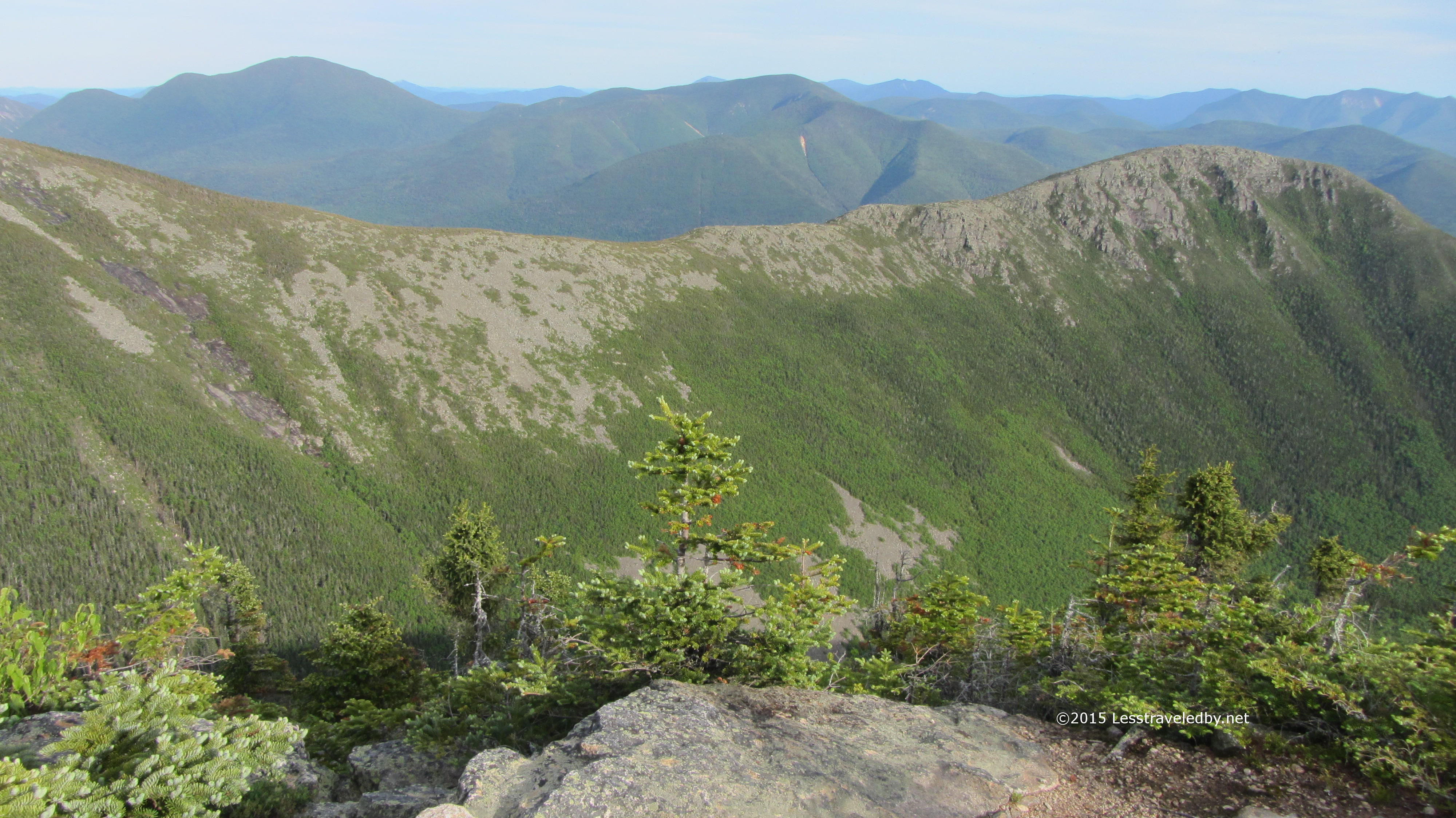
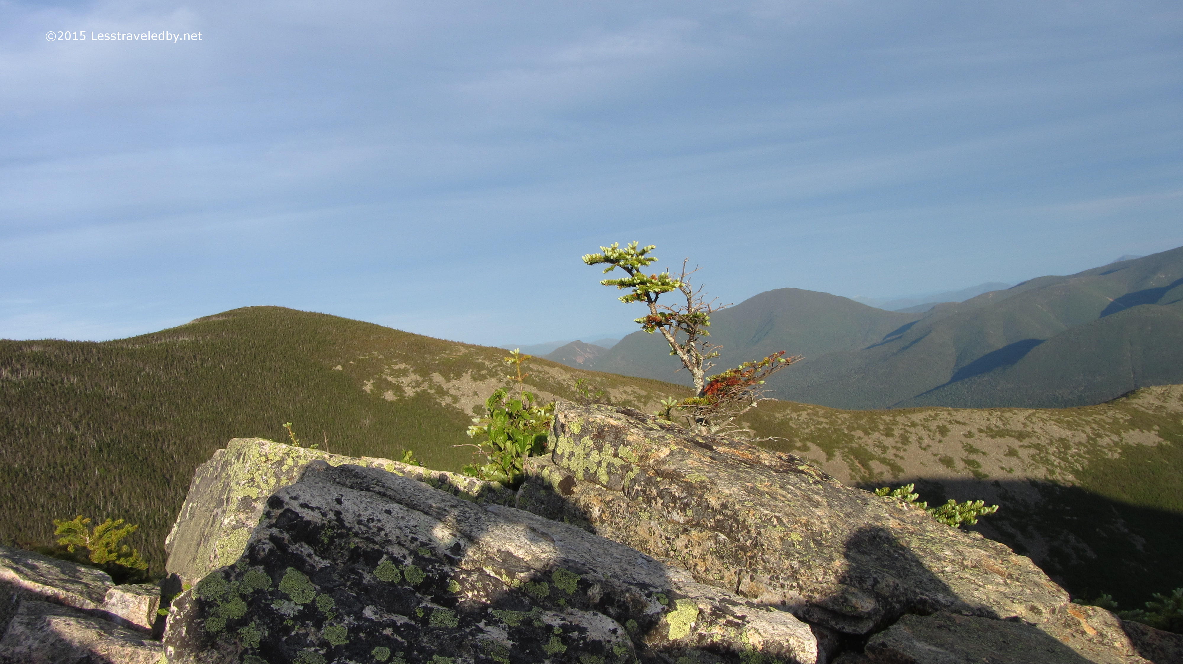
 The stunted trees managed to grow almost to the very top of Mt Bond, but you could feel this was a place life had to really hang on at times. A great place to visit but not one you’d want to be at when the winds were blowing. The views were open in all directions with ridges of mountains extending to the horizon most places you could see.
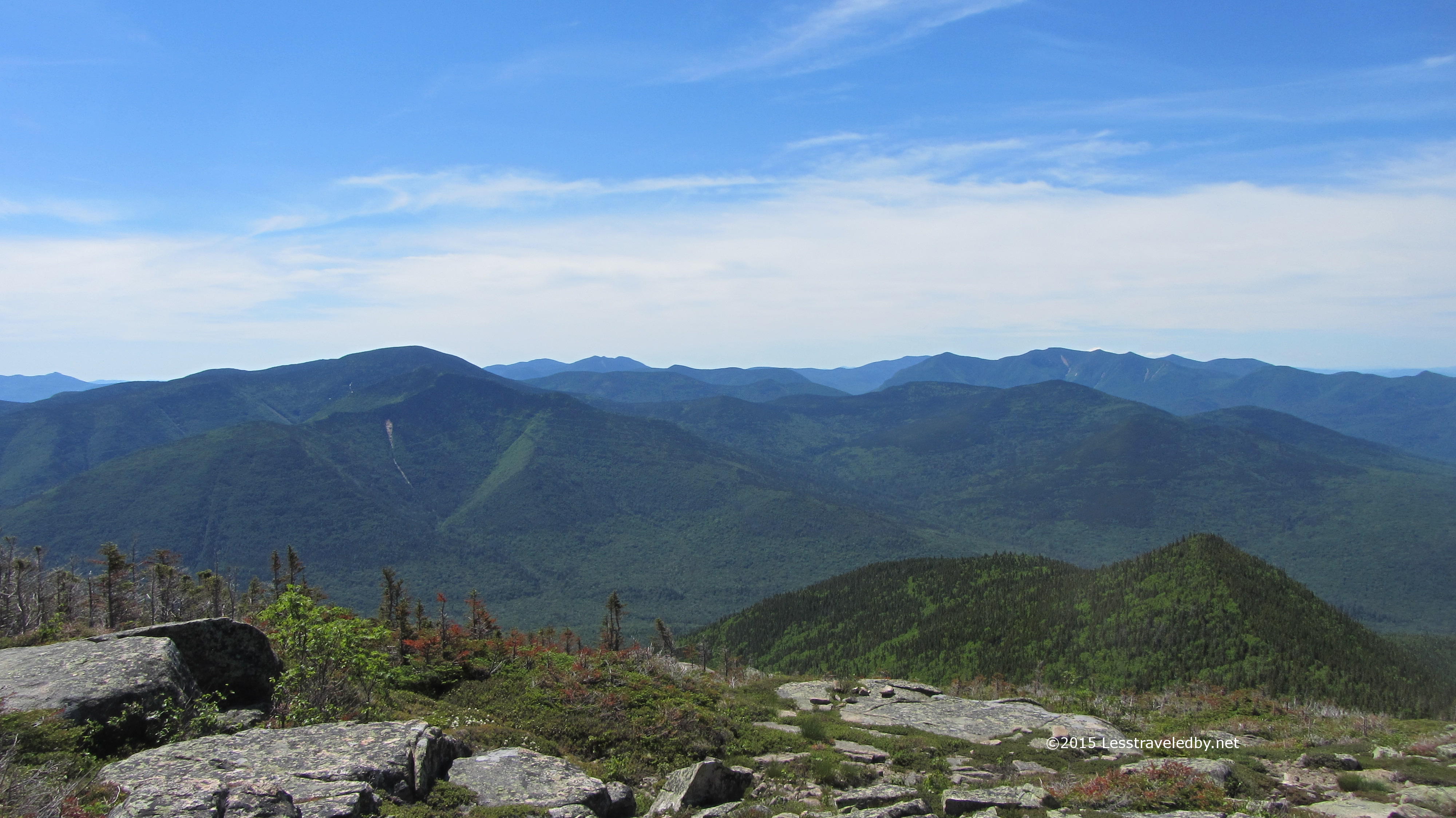
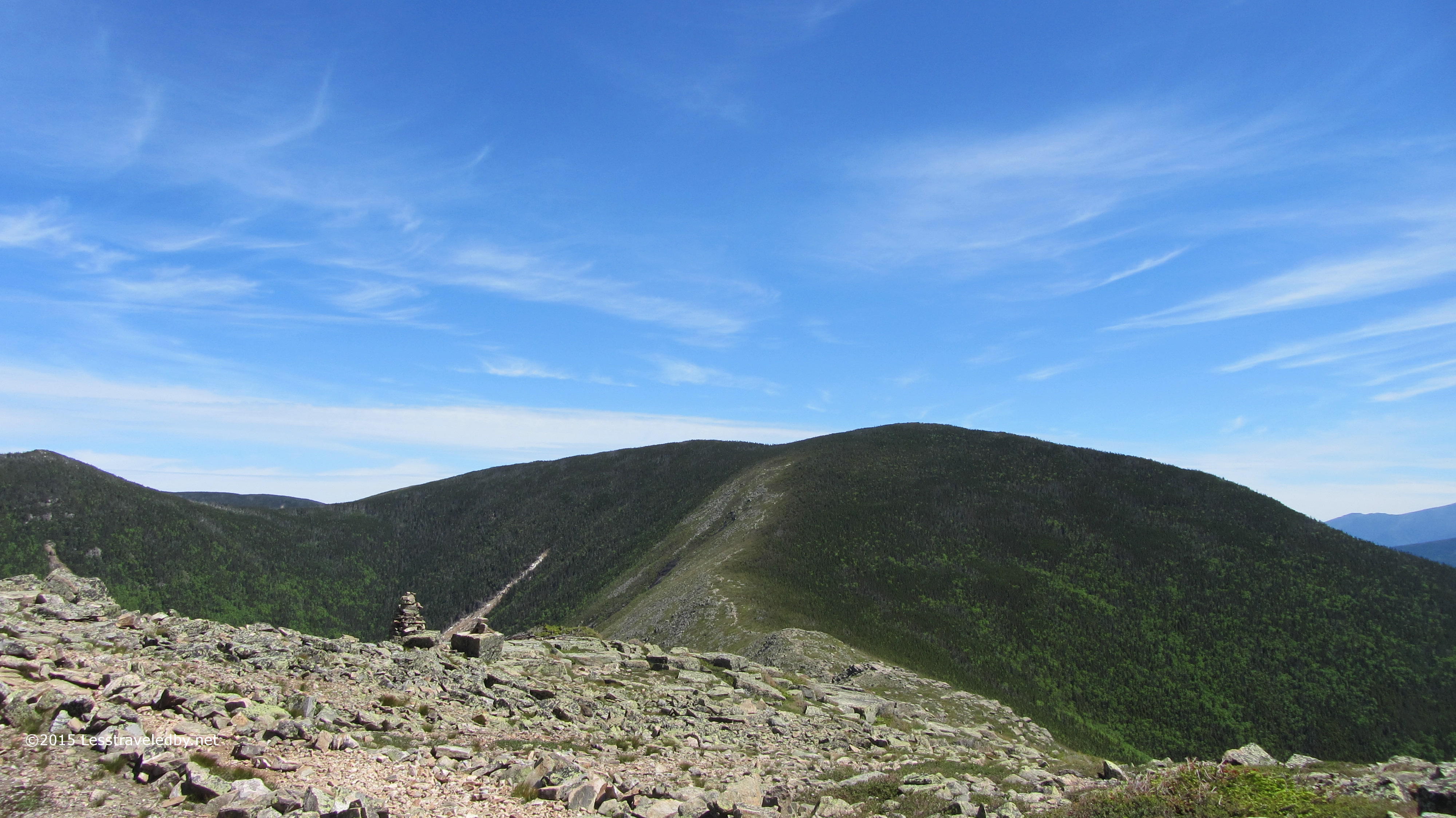
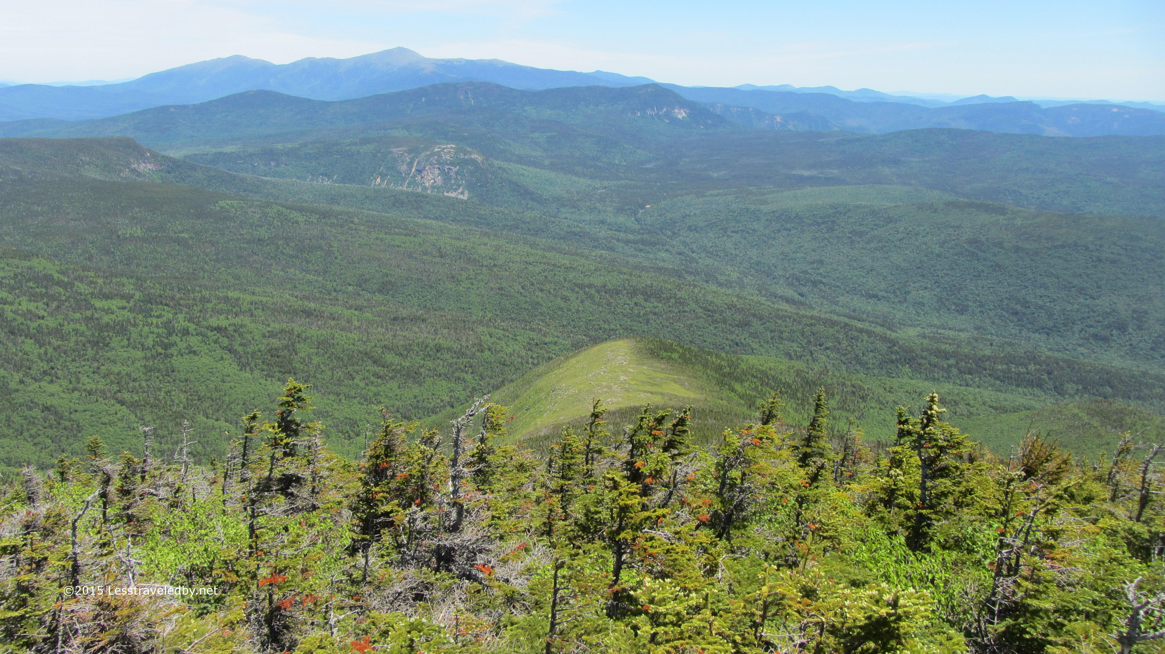
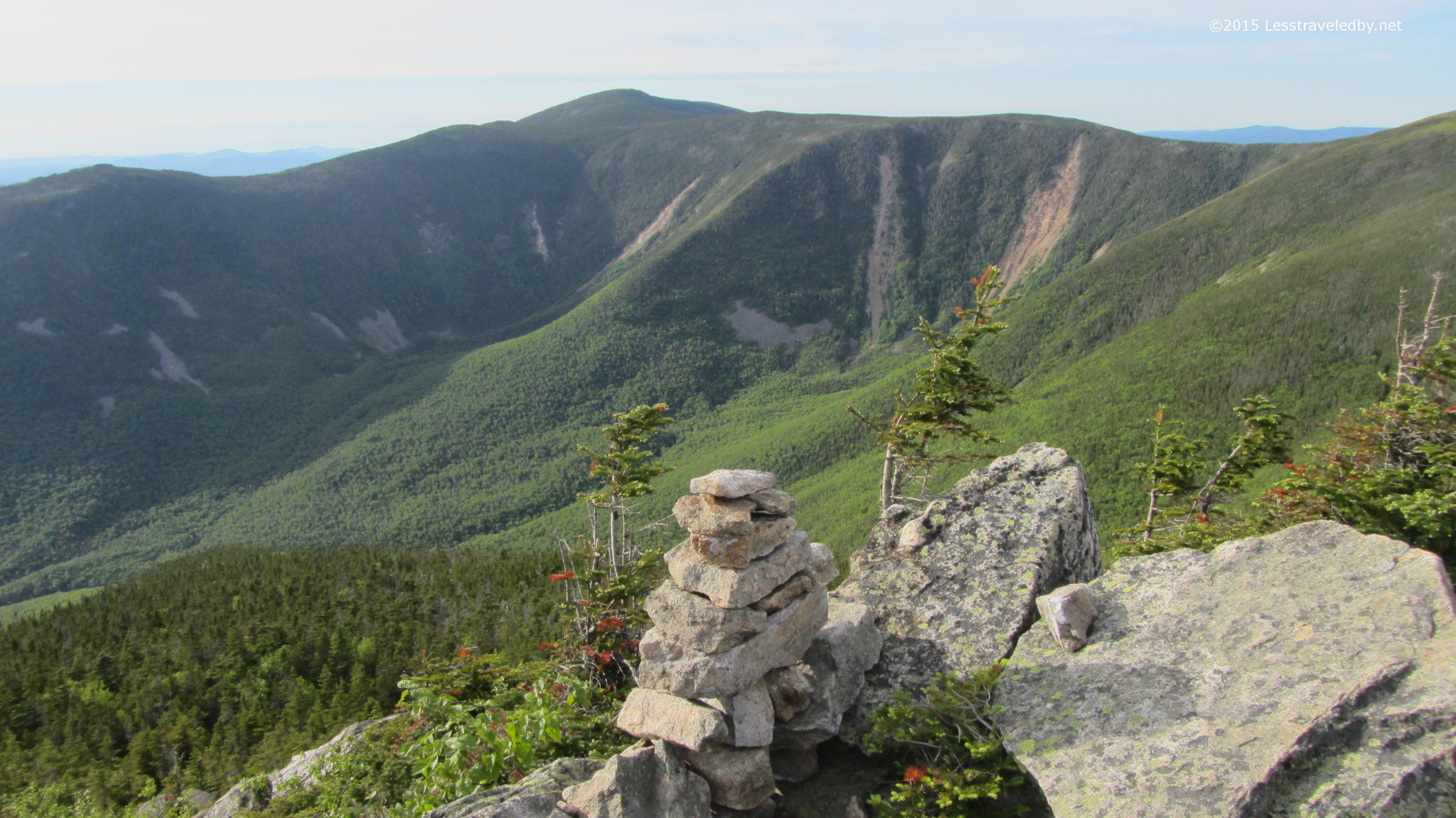
 Looking down on the Bond Cliffs below provides another new perspective. Having so recently been there looking up here I can trace my route down the cliffs and into the trees that led me to this spot. You can’t beat that for a sense of where you are and how you got there.
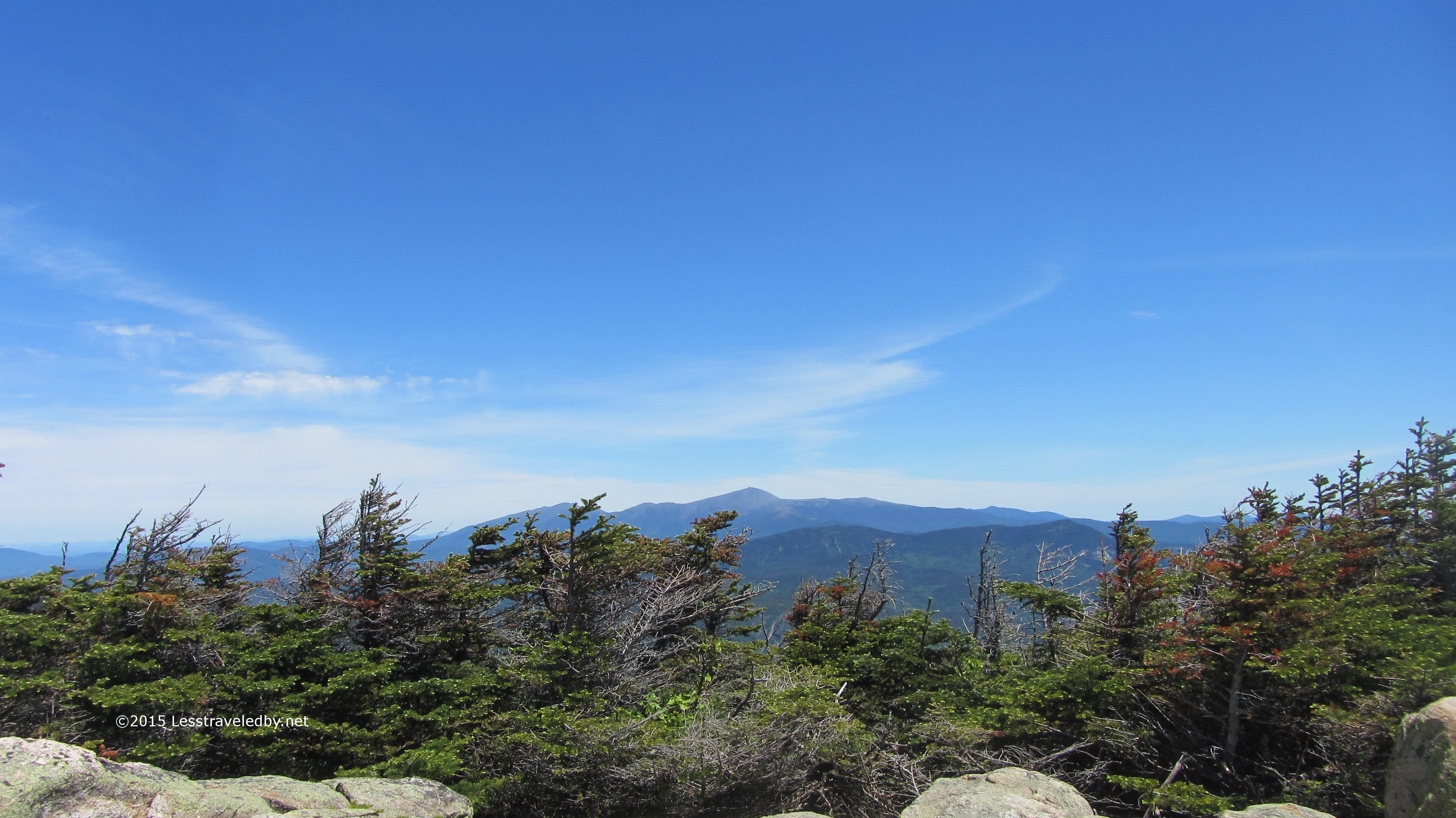
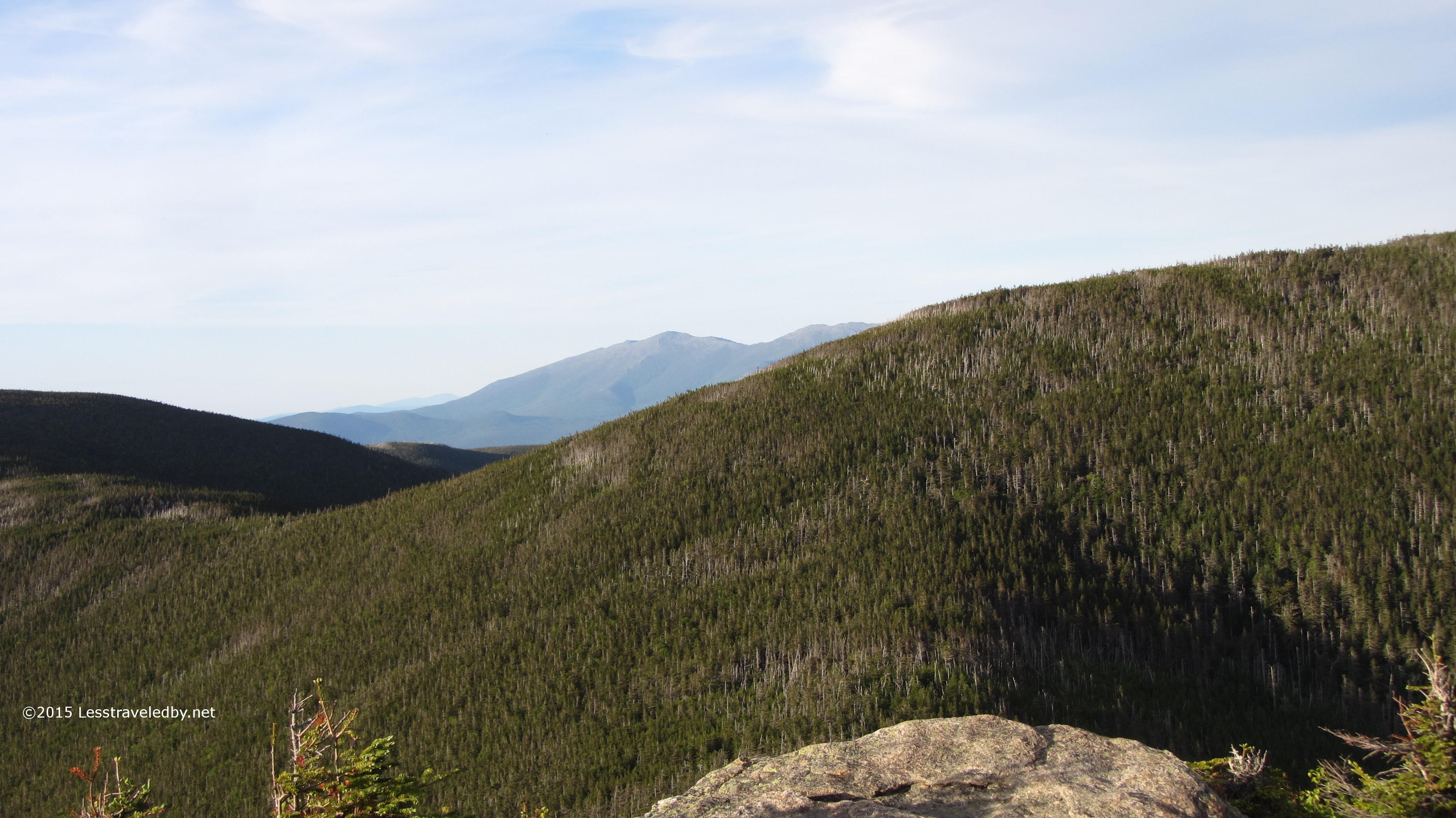
 This little wind scoured ridge caught my eye. You can see how anything much taller than a blade of grass has been peeled off leaving no protection for any ambitious new tree or shrub to take root. Oh yeah, that may be Mt Washington in the distance beyond the Wileys, but really, look at this windswept hill.
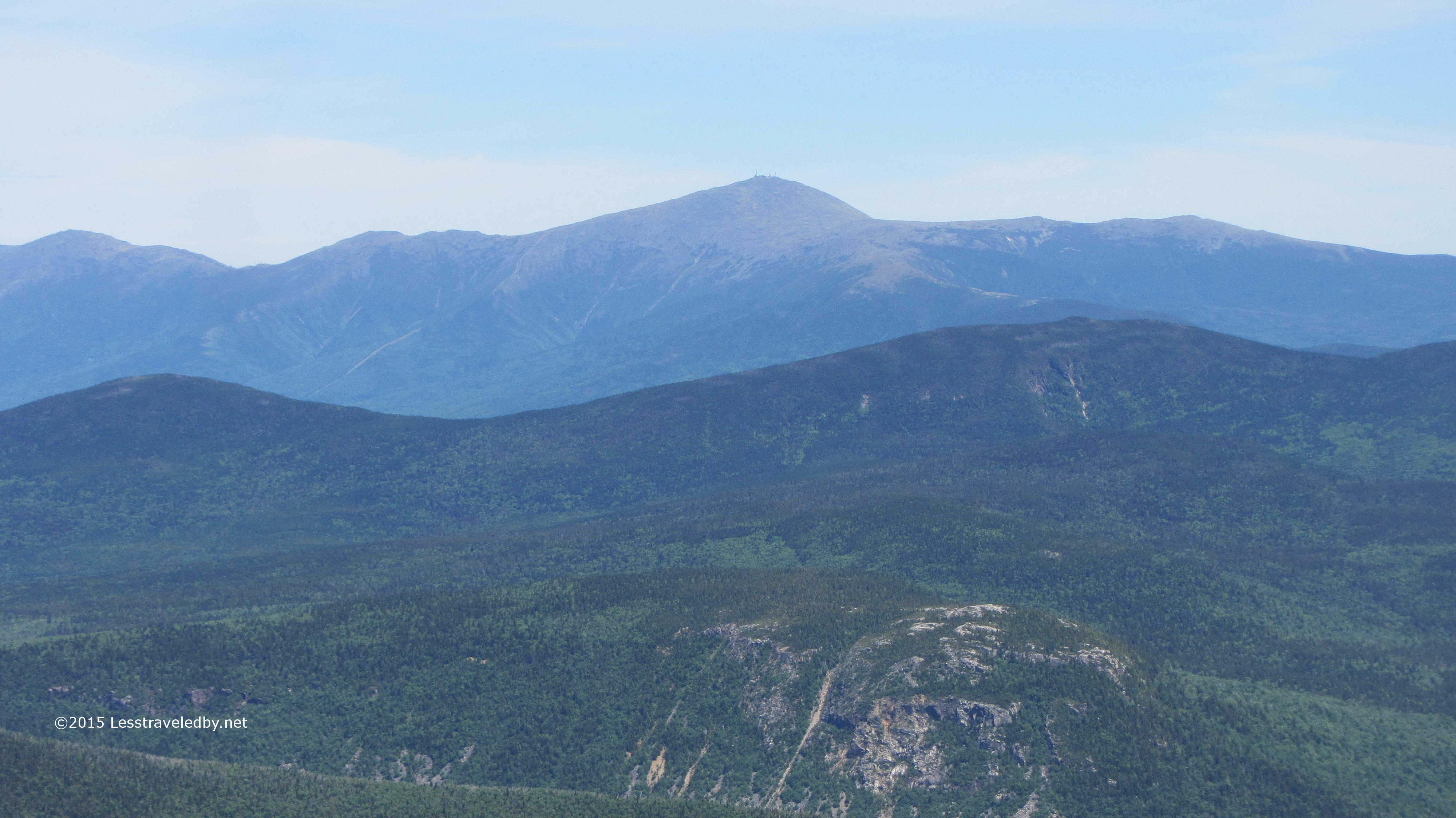 OK, now you can look at Mt Washington if you’d like. Actually a pretty good view of Whitewall and Mt Field too.
 I was lucky enough to have this platform at the AMC Guyot camp all to myself for the night. Sure it was the farthest from the kitchen area and water supply down a pretty steep hill, but if I have to camp in an organized site I like to have some privacy if possible.
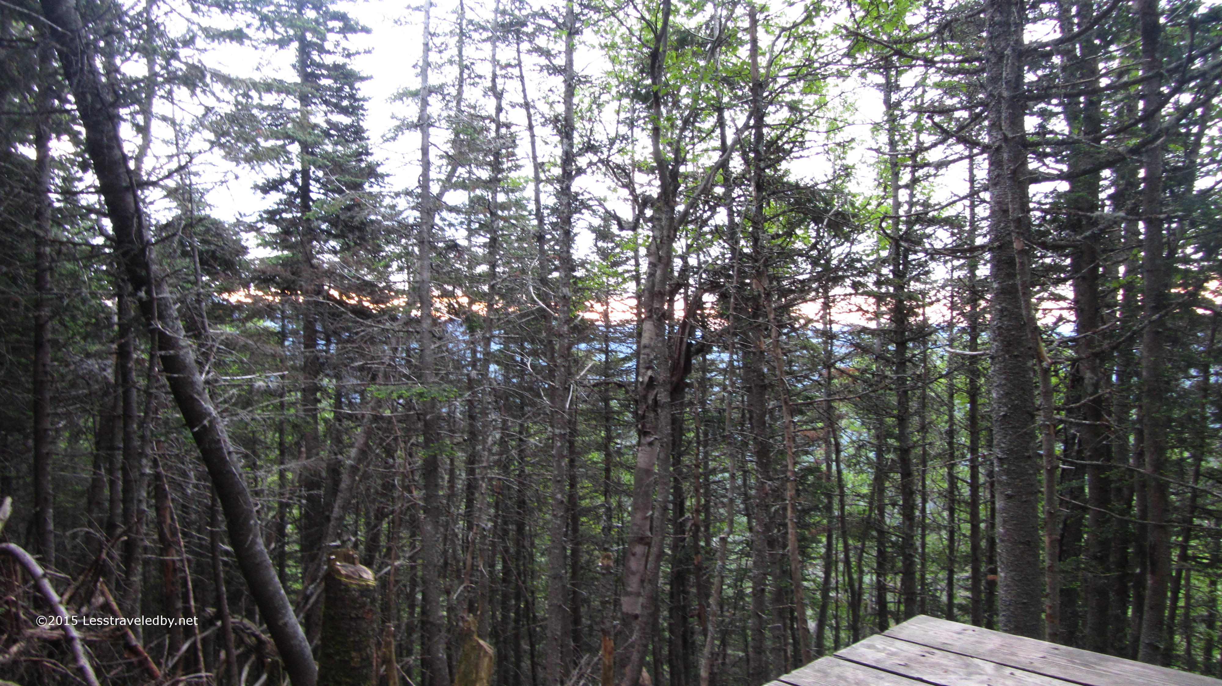
 The view was limited to the forest in front of me, but I just wanted a place to set up my bed before I went out hunting the famous West Bond sunset.
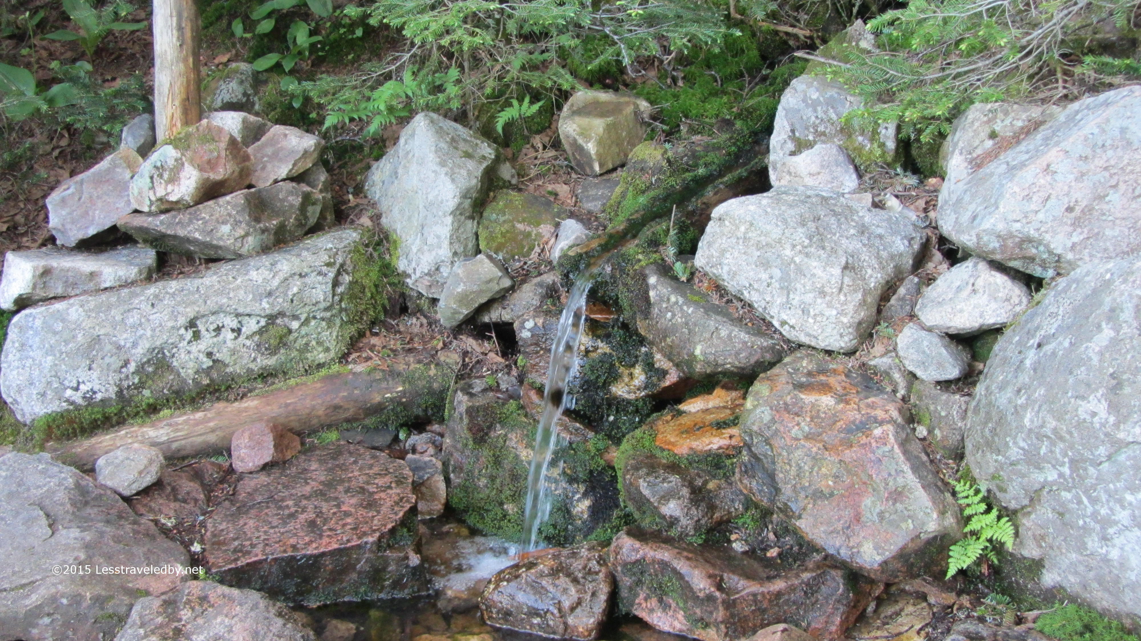 The water supply at the Guyot camp is some of the cleanest water you’ll find coming from a spring just above the camp. I still used my filter just because I don’t like to take any chances on getting sick, but I’m told that despite the warning signs many folks just drink it as is.
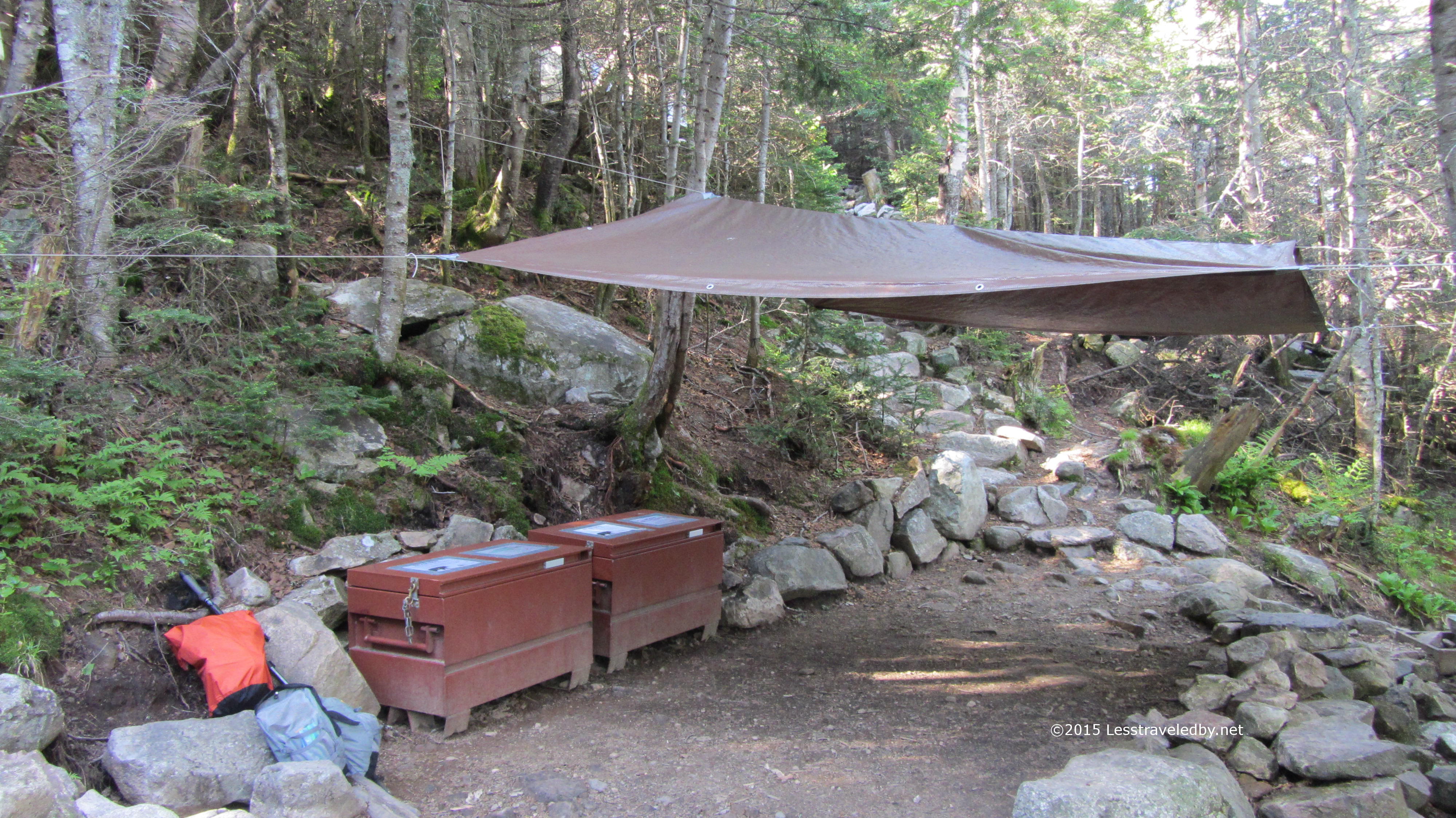 The bear boxes and cooking area are designed to centralize food activity. The caretaker said bears usually don’t roam this high, but that they still had a bear issue in recent years. Bears conditioned to know where to look for food is one of the reasons I don’t like to use these camps, but at least the caretakers try to keep folks in line unlike the unsupervised Franconia Tent Site.
I had an early dinner and headed out to West Bond a good two hours before sunset. I had the place all to myself for most of that time before being joined by three nice young folks from MA.
It is so rare to be able to relax in a spot like this and let evening come on. Most times I visit the pretty spots in the course of a difficult hike and then disappear into the woods below to spend the night.
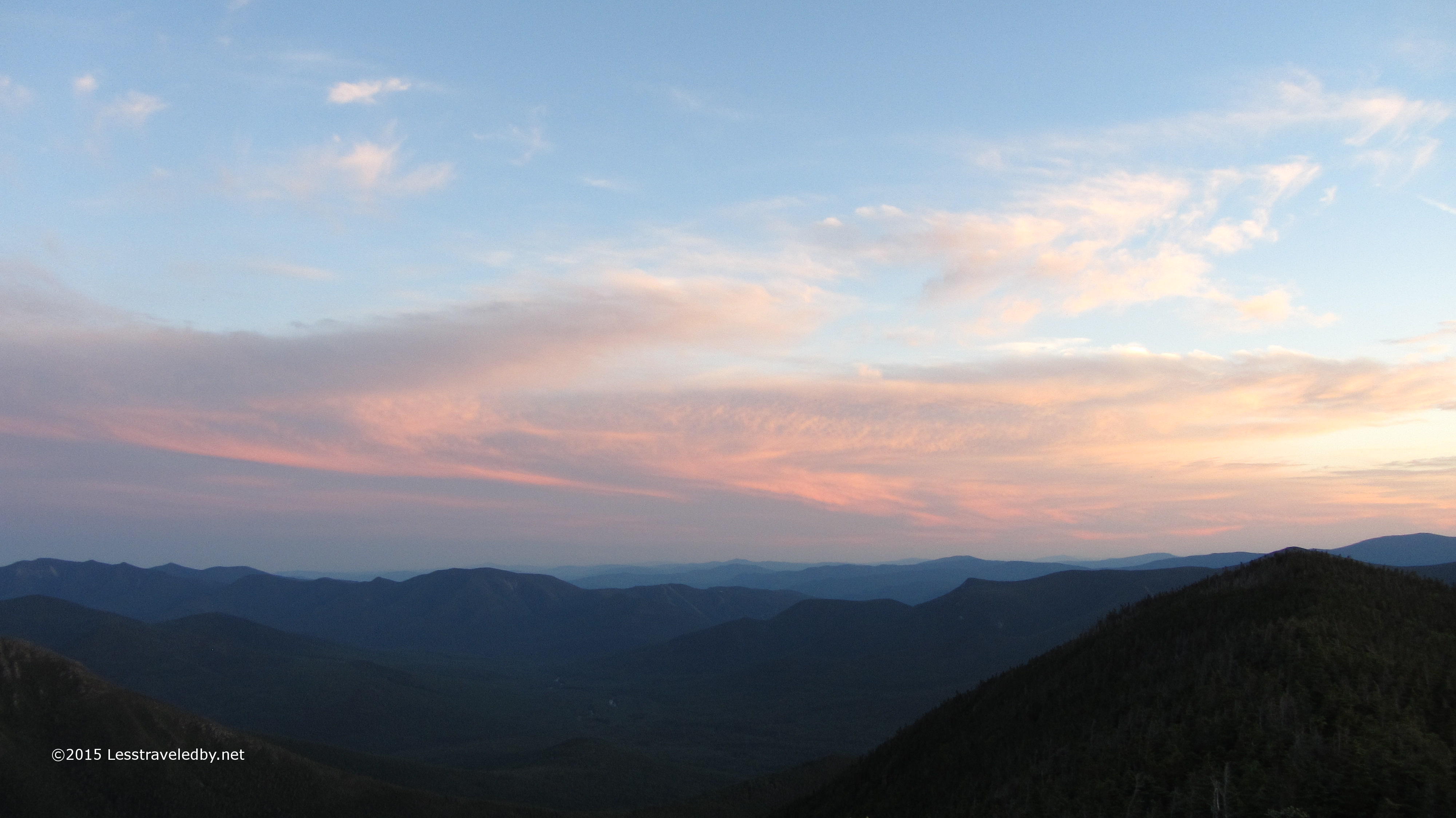
Feeling the light slowly change is always something special. The connection to the natural world was only magnified by taking it all in on a panorama of this scale.
Slowly the light changed to yellow and then orange. The shadows deepened on the distant ridges of the Hancocks with Carrigain in the distance. At one point I could make out the fire tower I’d climbed there a few weeks earlier silhouetted against the sky. 
A bit of the alpenglow on Bond Cliff. Those few moments of light coming up through a sunset to splash this color across a rock face are one of my favorite memories to collect.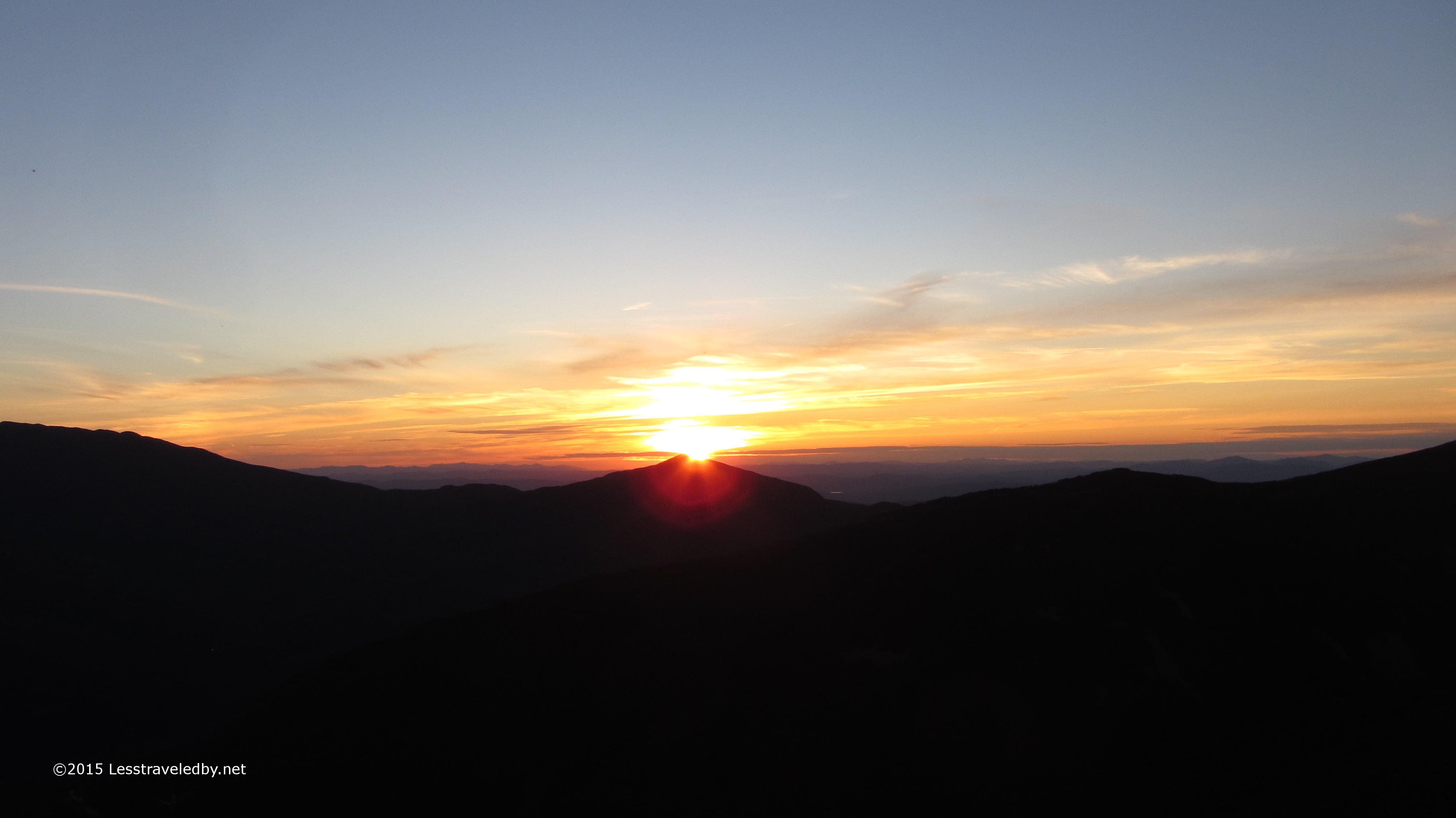
Final moments of the sunset behind Mt Garfield. I have a bit over thirty minutes of this sunset on video which is probably more than most people want to watch, but look for a two minute time lapse version to be posted here soon.
The walk back to camp was less than a mile but I was glad I’d brought my headlamp along. I was able to stay and enjoy a little sunset afterglow and still get back without breaking anything.
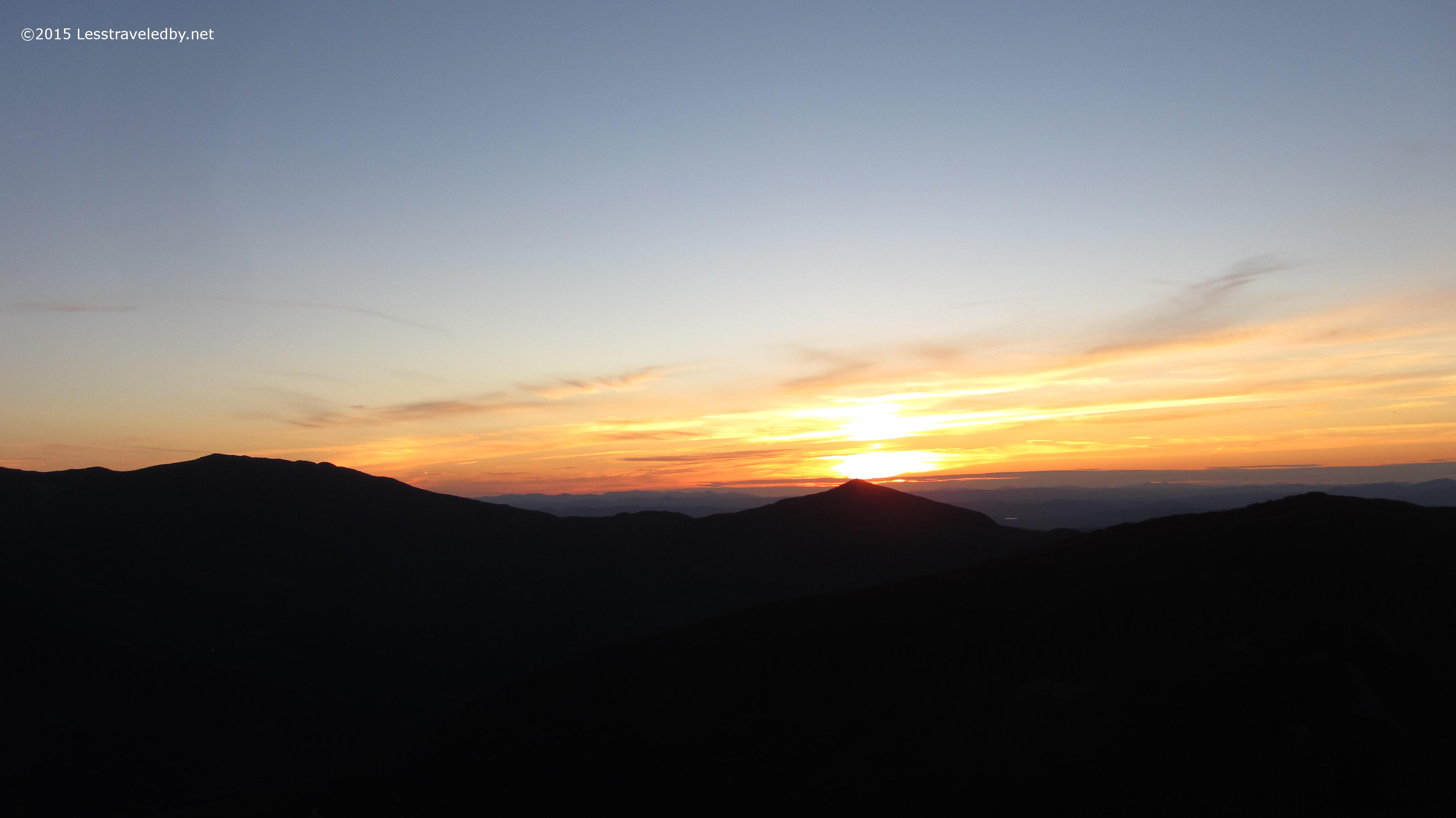
 Tiny bit of sunrise visible from my tent platform. I packed up quickly because I knew I had a lot of miles to cover and last I’d heard rain was possible. Sure enough a few drops splattered on the tarp over the cooking area while I enjoyed my morning coffee with a big group of neighbors. There was one SOBO on the AT doing a major section hike, a grandfather escorting a couple of teen boys including his grandson who was finishing up his NH48 as well as the three folks from MA I’d shared the sunset with the night before. While I’m happier camping alone in the woods I can see where these camps make for a bit of social gathering place that many folks seem to enjoy.
Speaking of enjoying I have to mention the warm welcome and hospitality provided by the AMC caretaker at the Guyot camp. Much like my experience last year at 13 Falls I was given my choice of spots and allowed to get settled in before returning to pay for my site. Since it was early in the afternoon and no one else was around yet my host shared a cup of coffee and a bit of conversation before returning to her duties as other folks began to arrive. It certainly makes it easier for me to give up the privacy of wilderness camping when you get a chance to meet nice people in return.
With the threat of rain hovering over me as well as about 11 miles back to my scoot in the parking lot I finished my coffee and headed back up Mt Bond one last time and then on down beyond to the cliffs. I wasn’t exactly sure how I was going to get down that last bit of cliff, but when the time came I just turned around and used the old one hand, one foot technique like I was climbing down a ladder.
I knew I’d be crossing Black Brook several times on my way down so kept my water bag pretty light in my pack. At each crossing I’d toss off my pack and grab my Sawyer Mini with drink tube attached to camel up water right from the brook. I was doing just that when two men came to the crossing also headed down. They didn’t stay to chat for long, but it seemed they were saying they were finishing up the “Pemi Loop” and this was only their second day. I thought either I’d misheard them or they were doing some sort of mini loop. I went flying past them soon after on the down hill, but they caught up as I was finishing my lunch. In talking some more it turns out they had indeed done the entire loop in just two days. Huge miles, but they stayed at an AMC hut so were able to hike long hours and then have a hot meal. Still I was quite impressed, though one of them came up lame coming down the last stretch.
Thankfully the rains held off all the way not only to the parking lot but all the way home. That many miles of trail is a bit more than I’d like before the long motorcycle ride home, but I wasn’t complaining. Not about the rain on the first day either. Those views up top were definitely worth any hardship I endured. Since I do still need to climb the Zeacliff Trail I’m thinking I might use that as an excuse to head this way again soon. It is a bit of a stretch, but if I make it up that trail I think I’ll have earned another chance to relax and soak up the views. Besides I’ve heard the sunrise on Mt Bond is as good as the West Bond sunset. Better bring the video camera!

Beautiful views! Looks like it was time well spent ; ) Thanks for sharing.
So beautiful. I do miss the White Mountains. I love the centralized cook site. That’s such a great idea.
Pingback: West Bond Sunset Timelapse – June 2015 | Less traveled by