
It wasn’t easy, but I culled several hundred shots down to 37 pics for this post. I can see why this loop is so popular, but I have no idea why folks rush through it so fast. Planning a leisurely five day trip, I had plenty of time to stop and pull out my cameras. Well and to stop and snack or just to stop and soak in the views. Definitely some challenging terrain, but by keeping the miles reasonable and the feedings frequent it made for a fantastic adventure.
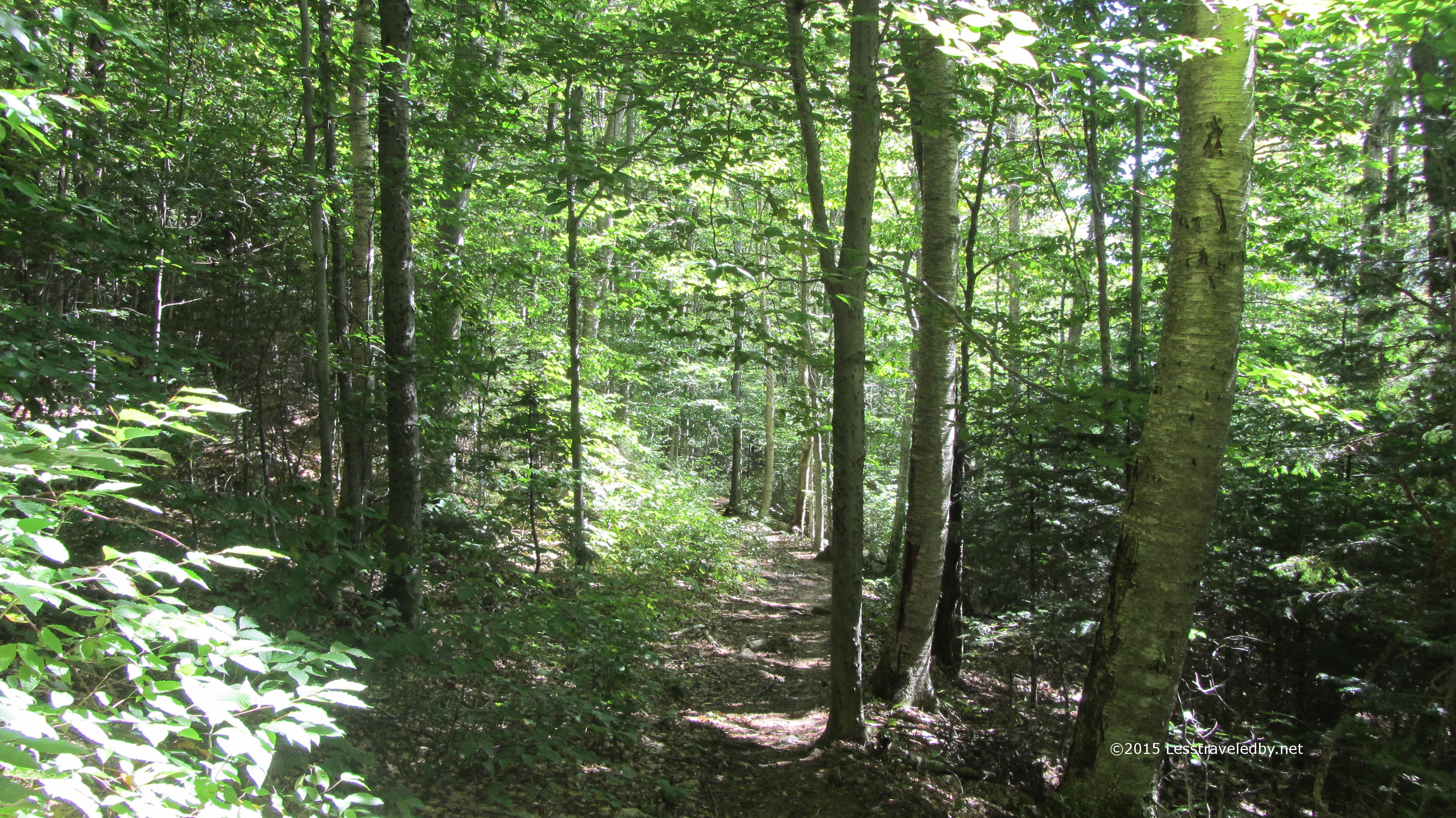 I’d gotten a nice early start and arrived in time to enjoy a little morning light on the Osseo Trail. Gently at first and then steeper at times it soon took me up a few thousand feet, but views were limited as the forest was thick around me.
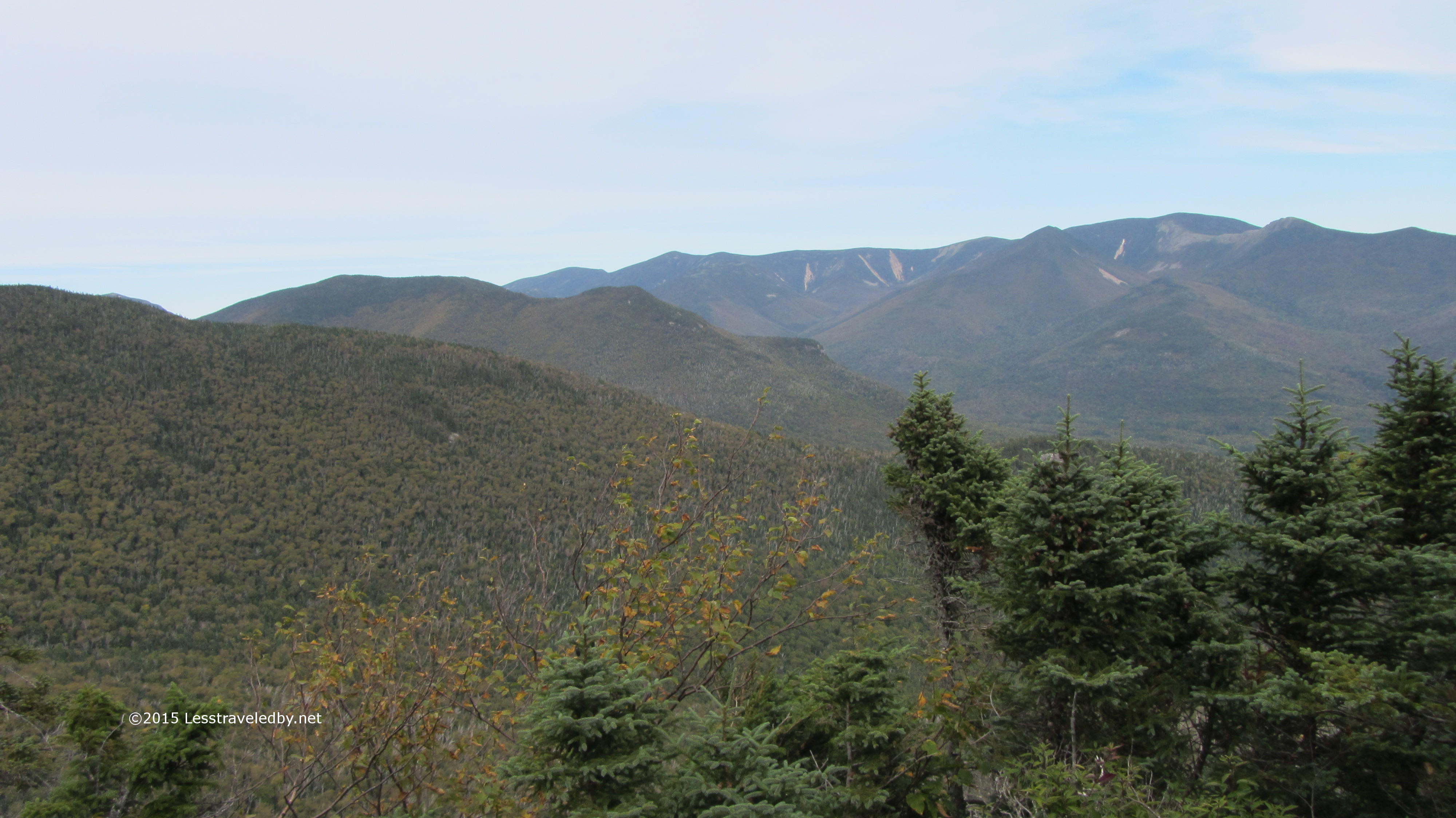 Noting a sign for a view I stepped a few feet off the trail and was rewarded with my first sight of the land opening up below. This view is to the east with Owls Head and Bond the first few bumps.
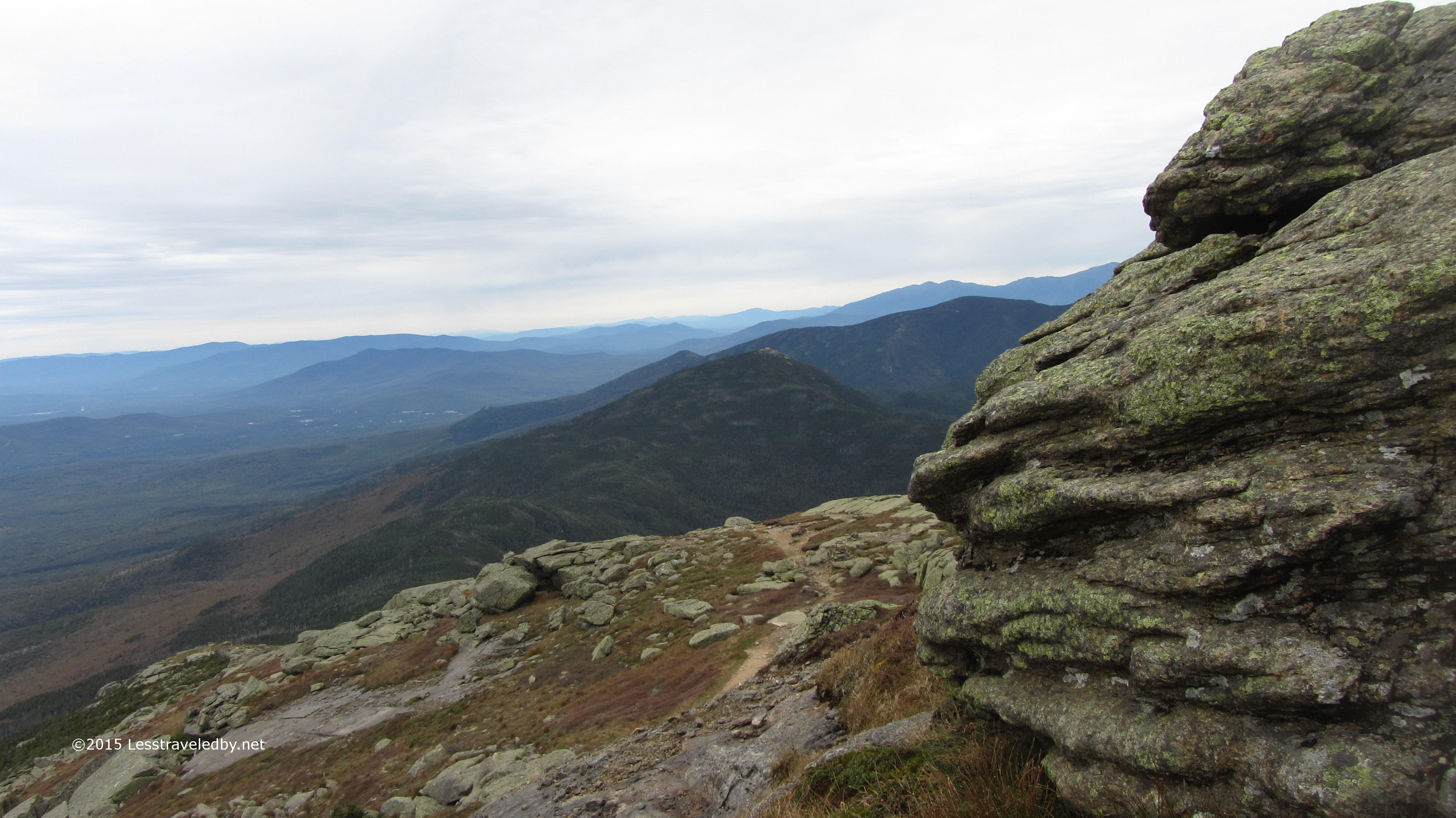
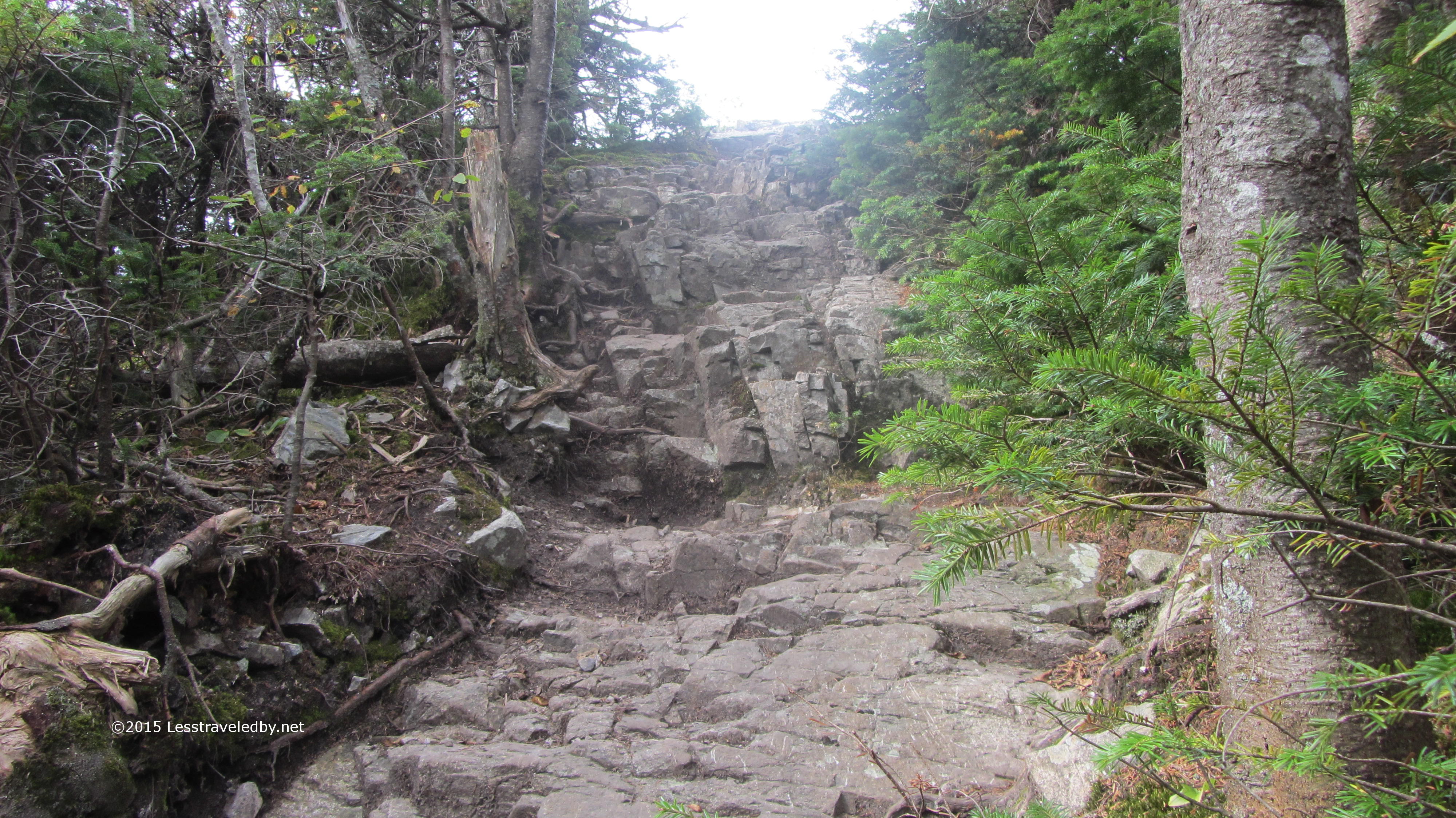 Finally I could see I was breaking out of the trees, but getting up there didn’t look to be easy. Actually with open sky and a little breeze inspiring me it wasn’t that bad.
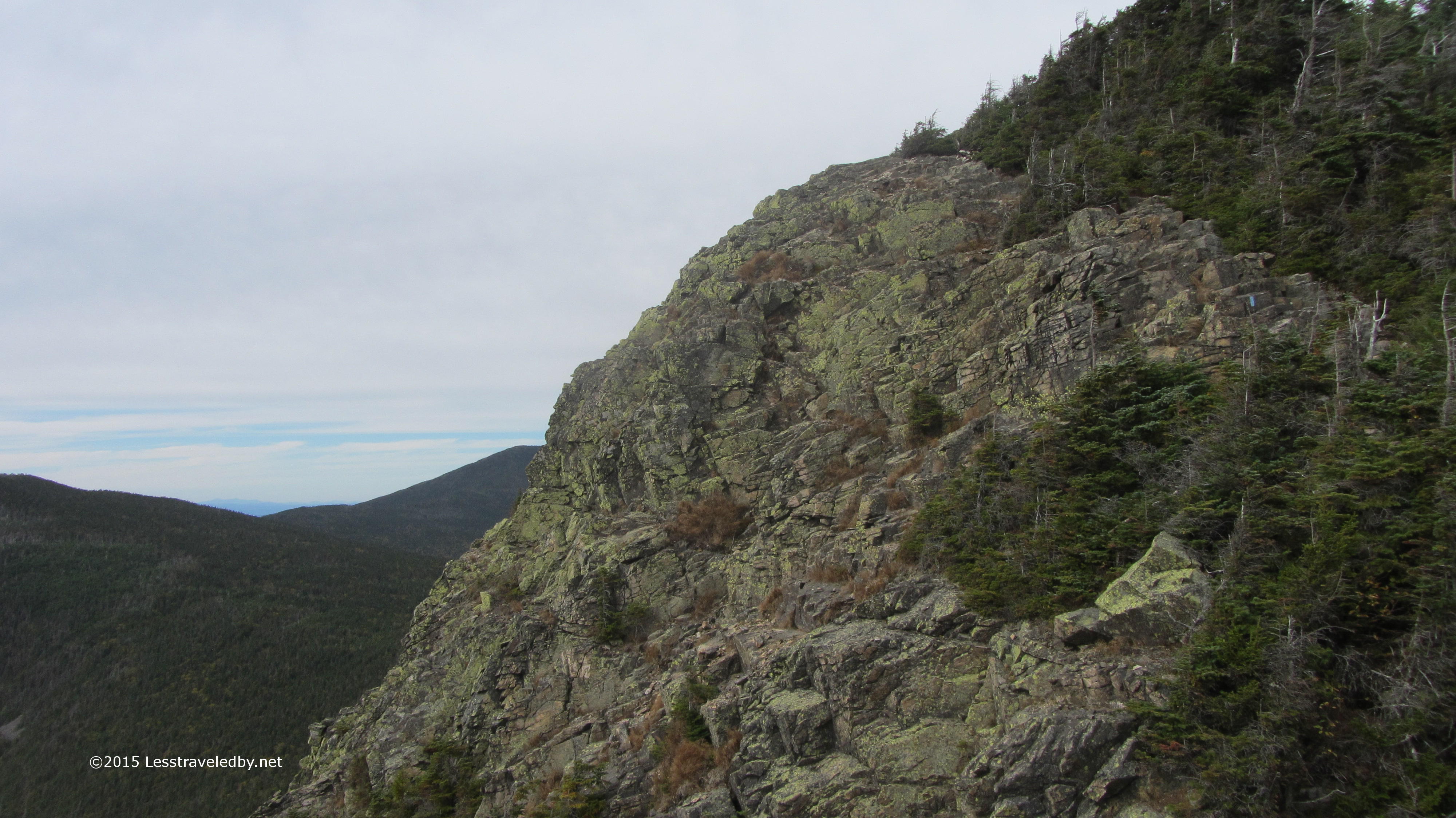 You may need to enlarge this picture to see the blue blaze, but that is where the trail was headed next. Walking along that fully exposed rock section with my pack filled with five days of food was invigorating to say the least.
 After crossing over Mount Flume I headed on towards Liberty. There was a bit of a col between the two and as usual I cursed every foot of descent knowing I’d soon be having to climb back up. It is all part of the fun of course.
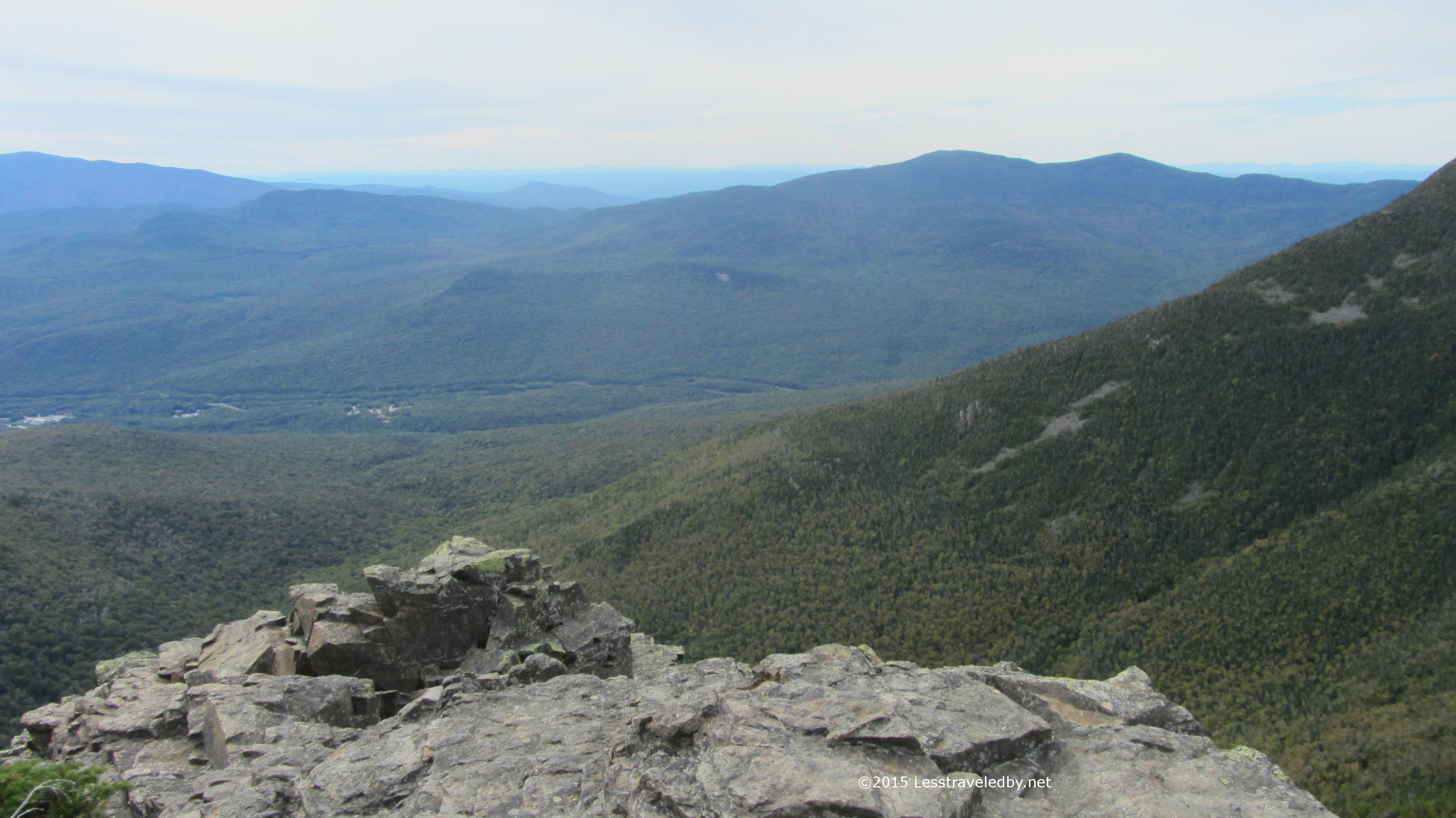
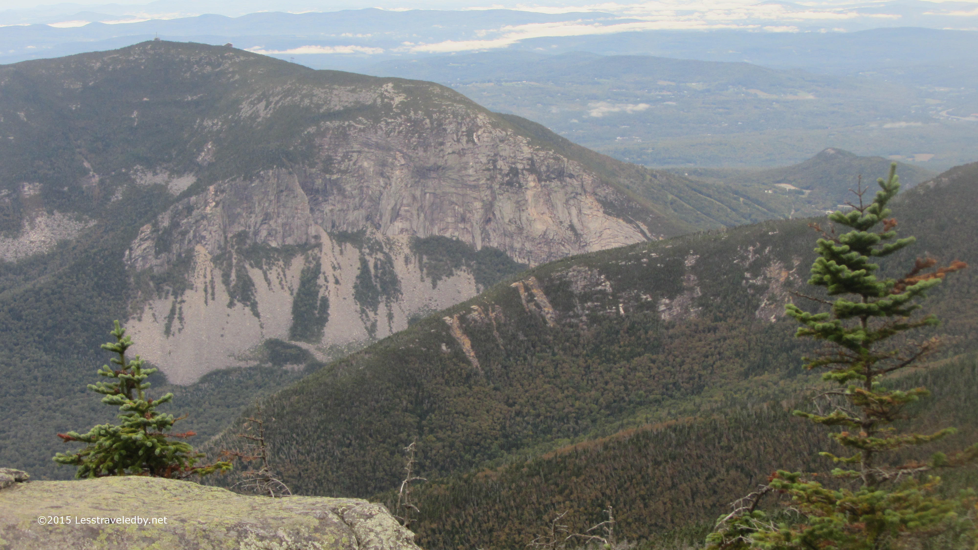
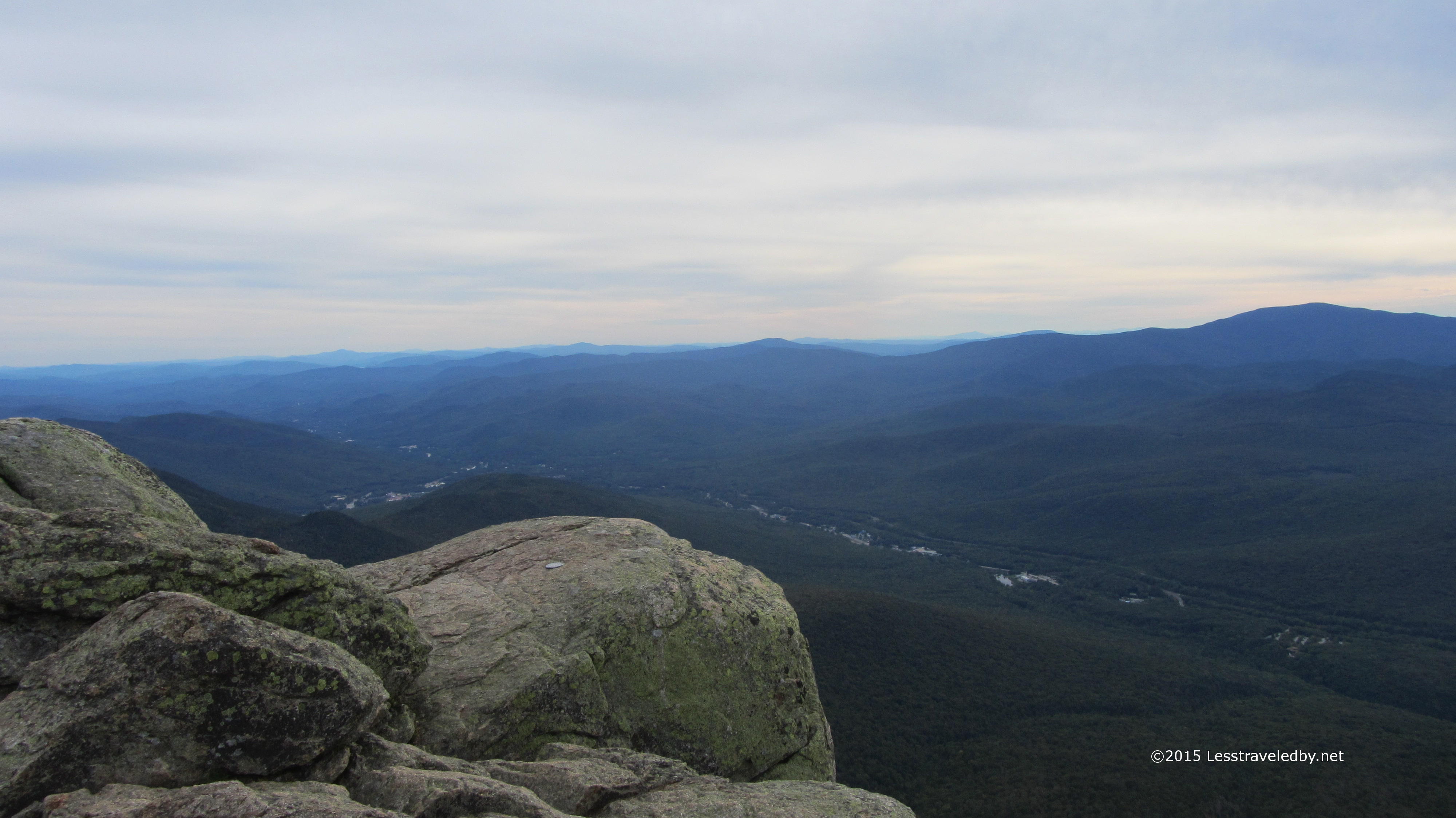 Getting to the top of Liberty made it definitely seem worthwhile. There is an interstate down there, but if you can overlook that the view was amazing. The light was fading in the late afternoon with some haze giving everything a soft edge in the distance. I lingered here for a bit and was soon joined by a few trail workers enjoying a hike on their day off.
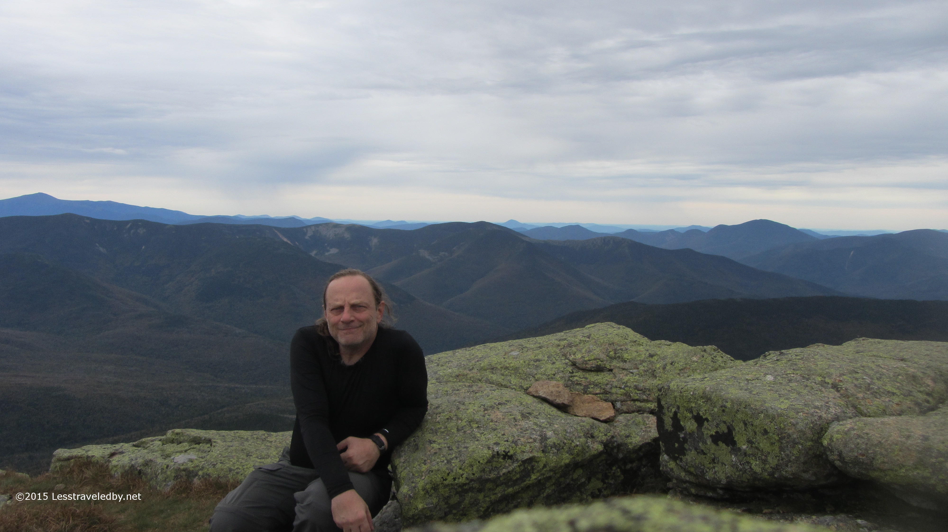
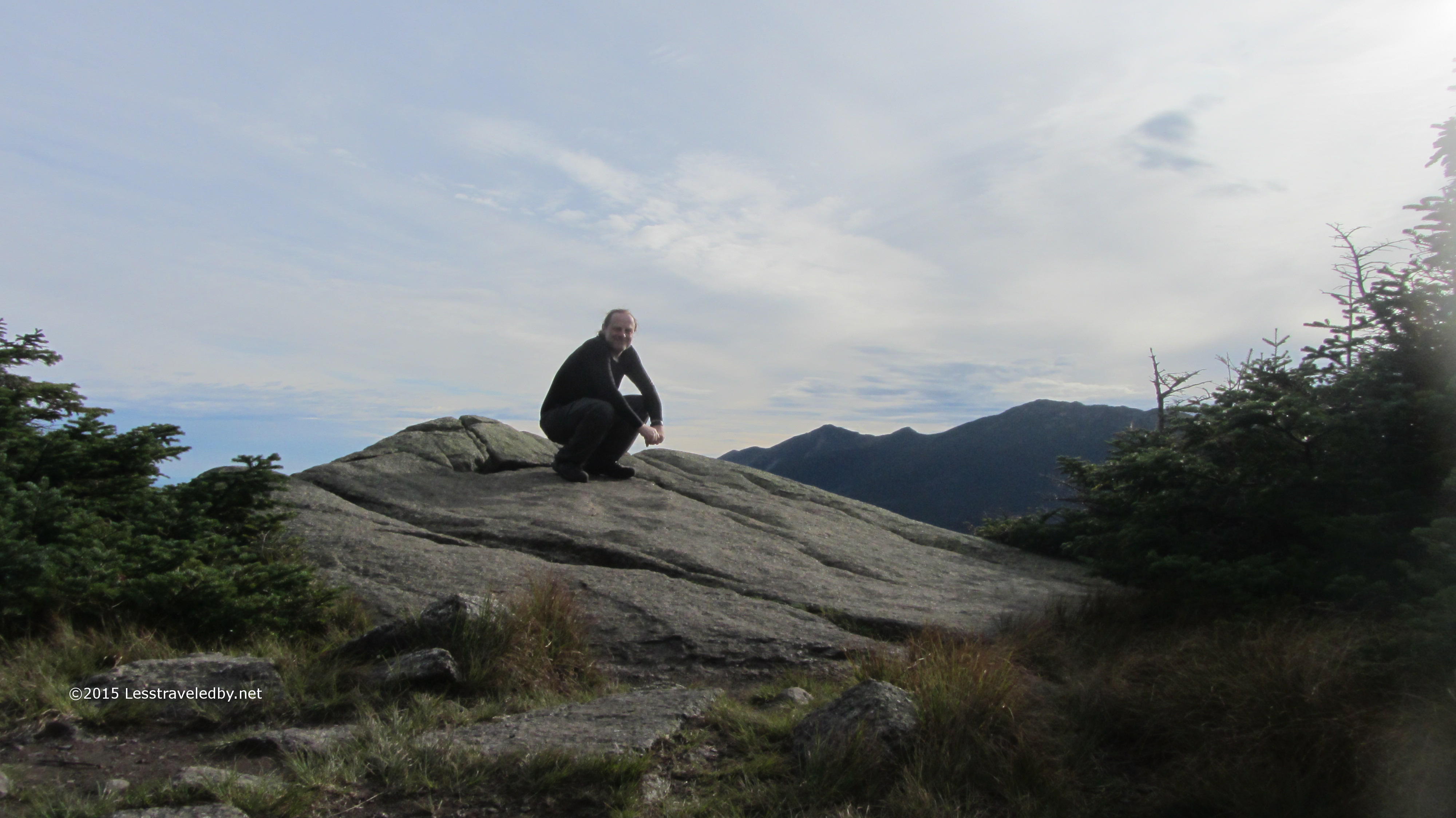
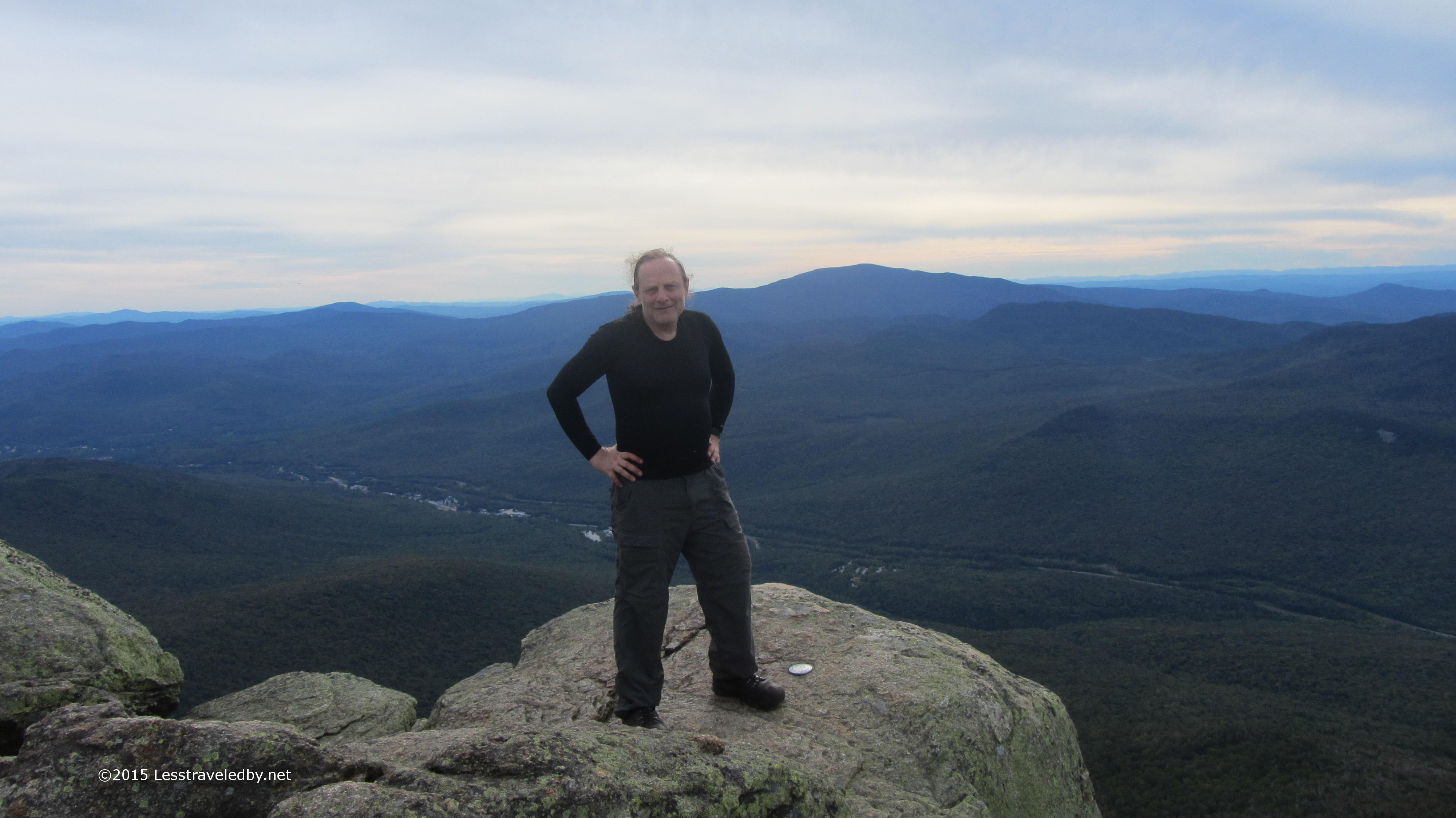 Same shot but with me in the way this time. I was afraid to set up my timer and jump out there, but one of the guys was nice enough to take this one for me. It really was a neat spot with a nice breeze blowing, but I was looking forward to camp and dinner up ahead.
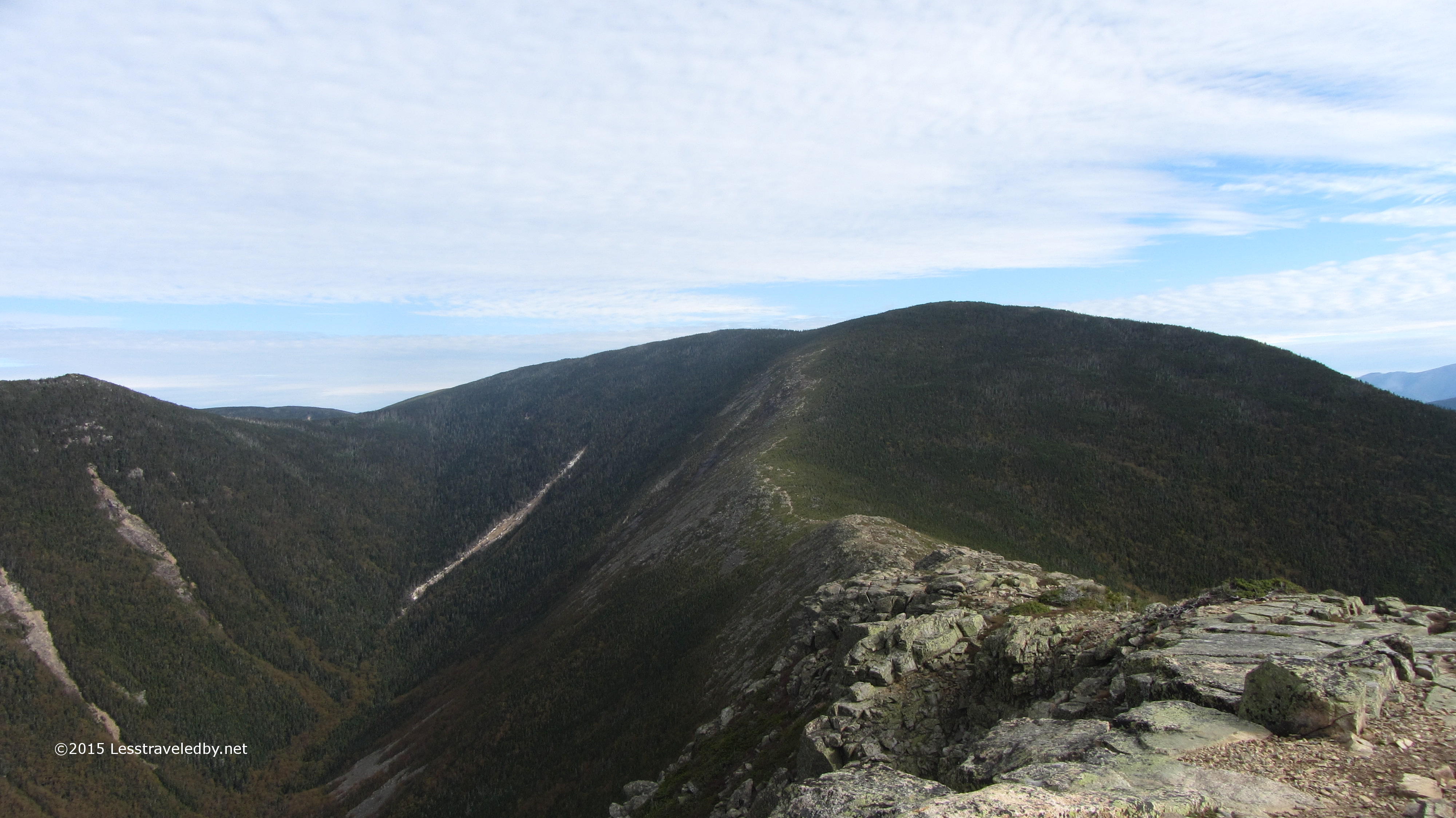
 You can spot a couple of folks headed up the way I needed to travel down. Beyond this open rock section the trail would fall away to another col.
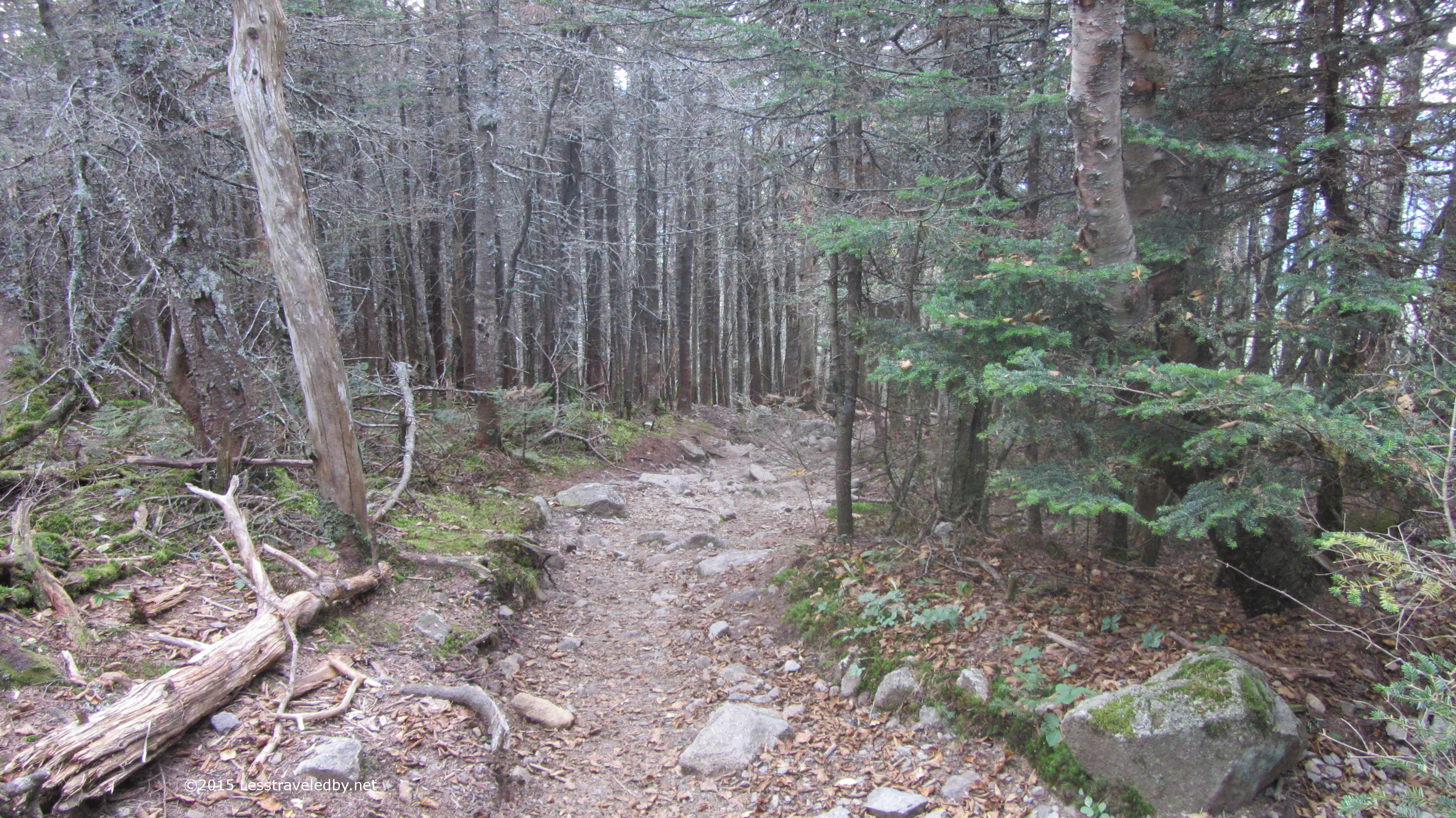 These trails are heavily traveled and very well maintained. Despite all the up and down sections the going wasn’t that bad. The trail down to the tent sites at Liberty Springs was a bit steep and knowing I’d have to climb back out in the morning made it seem longer than the signs claimed.
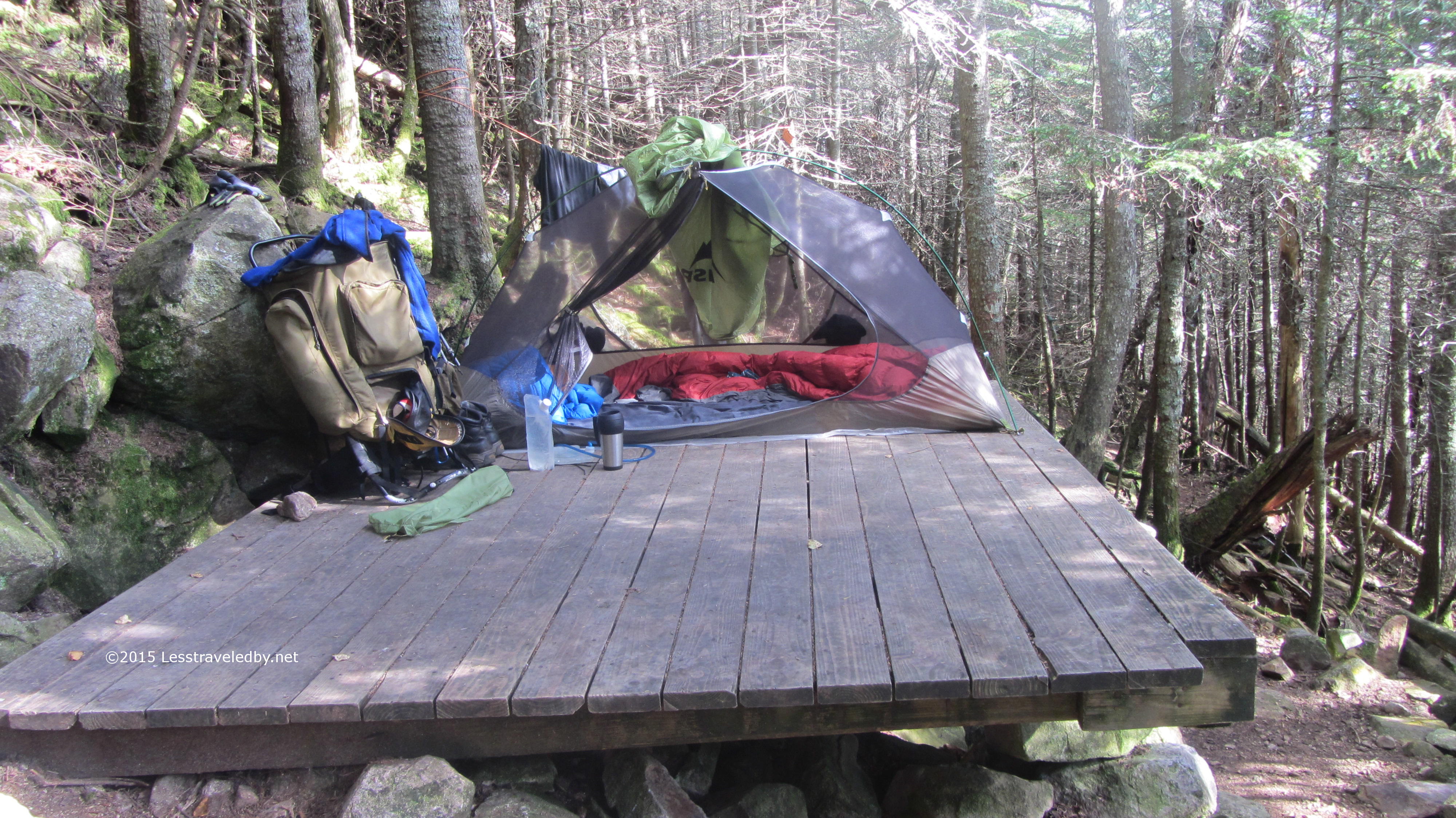
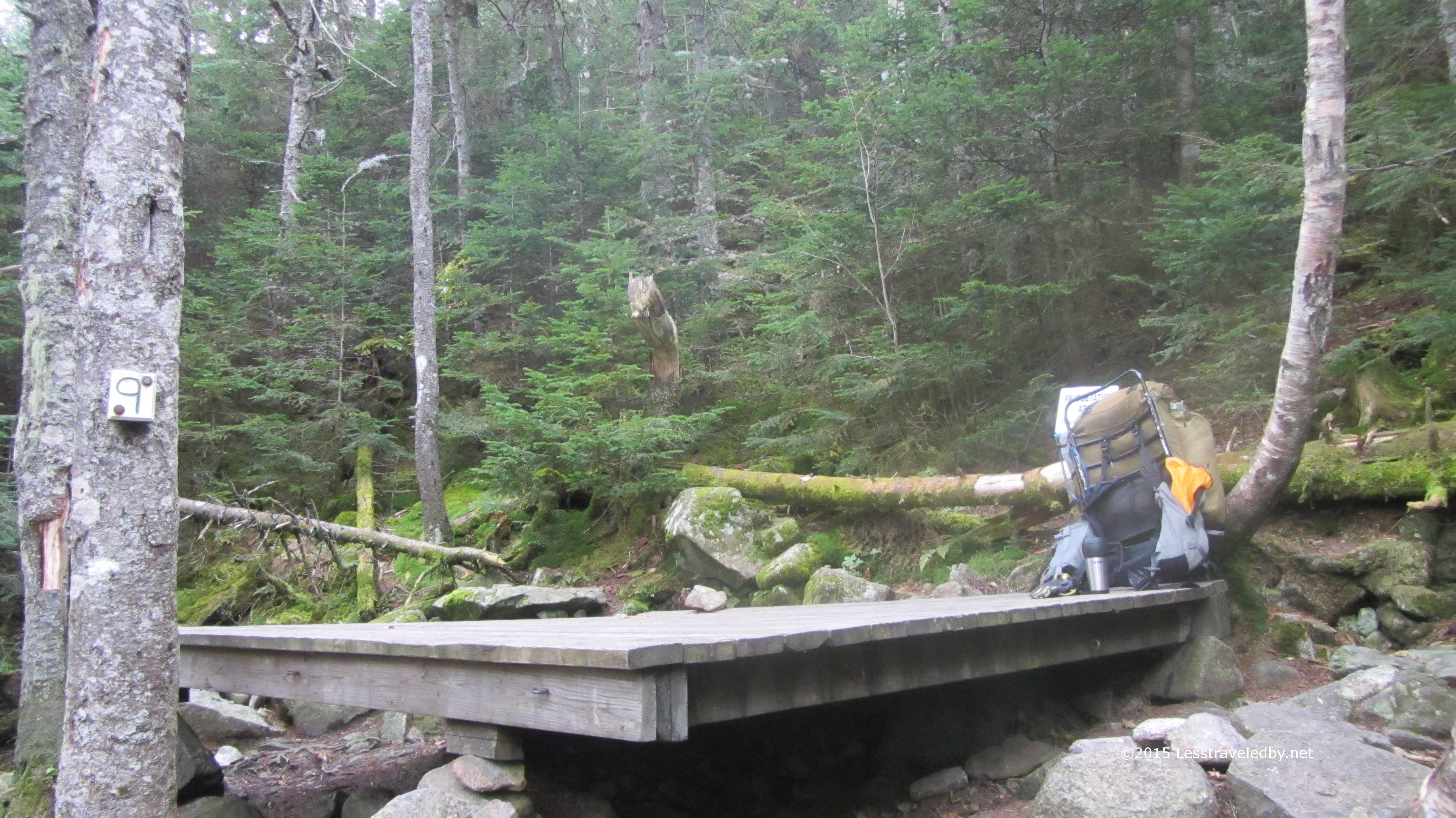 It was worth the effort though with a friendly caretaker who was a enjoying a late season change from being a trail worker. There were a number of other folks there but it wasn’t a very social scene. I ate dinner in the cooking area and headed off to my private platform for the night.
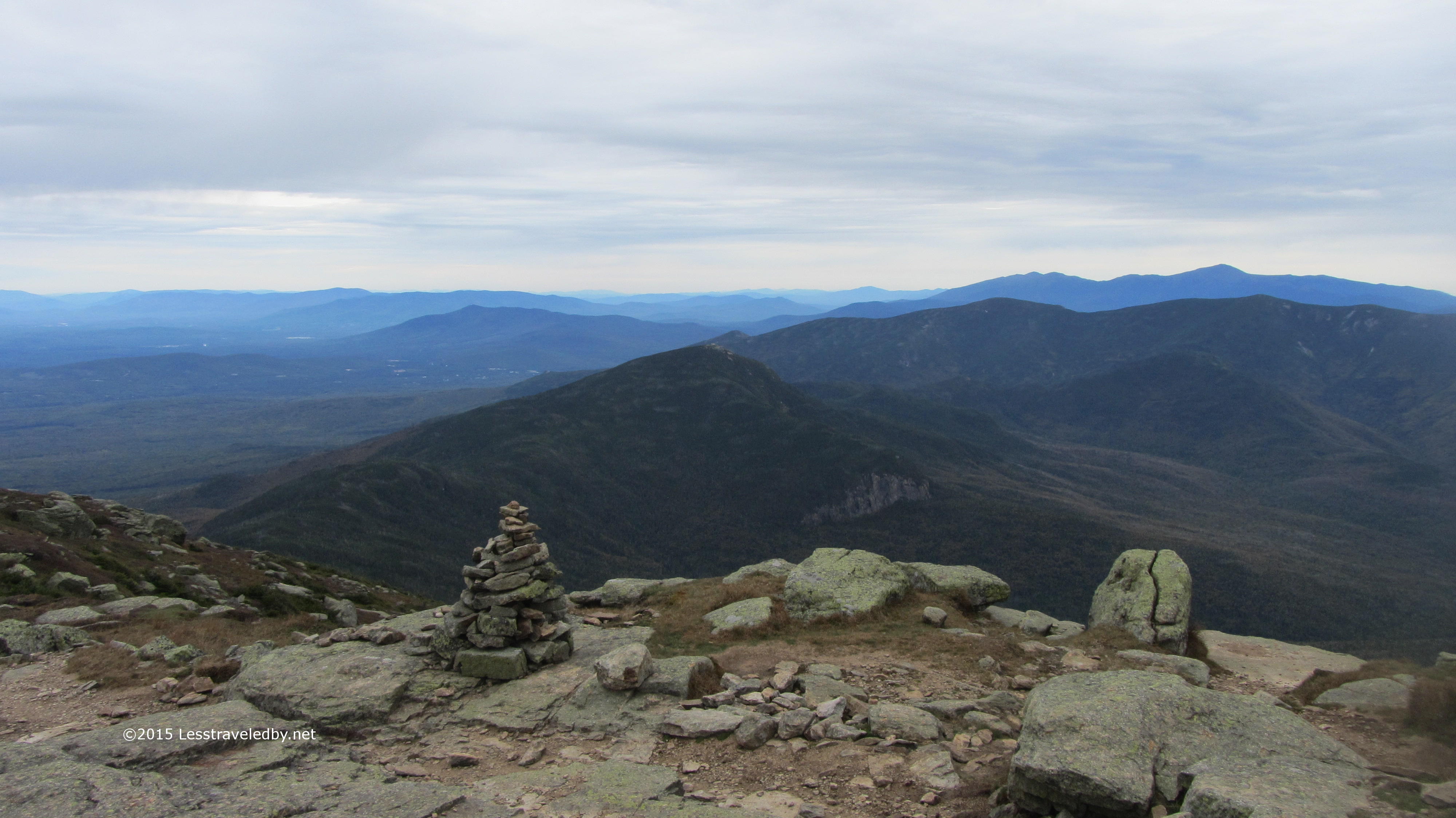
 The next day was spent almost entirely on the exposed Franconia Ridge. The sky was cloudy all day, but the ceiling was high enough that there were still views. With a constant series of peaks there was a steady stream of climbs followed by victory celebrations that required pulling out a snack or two.
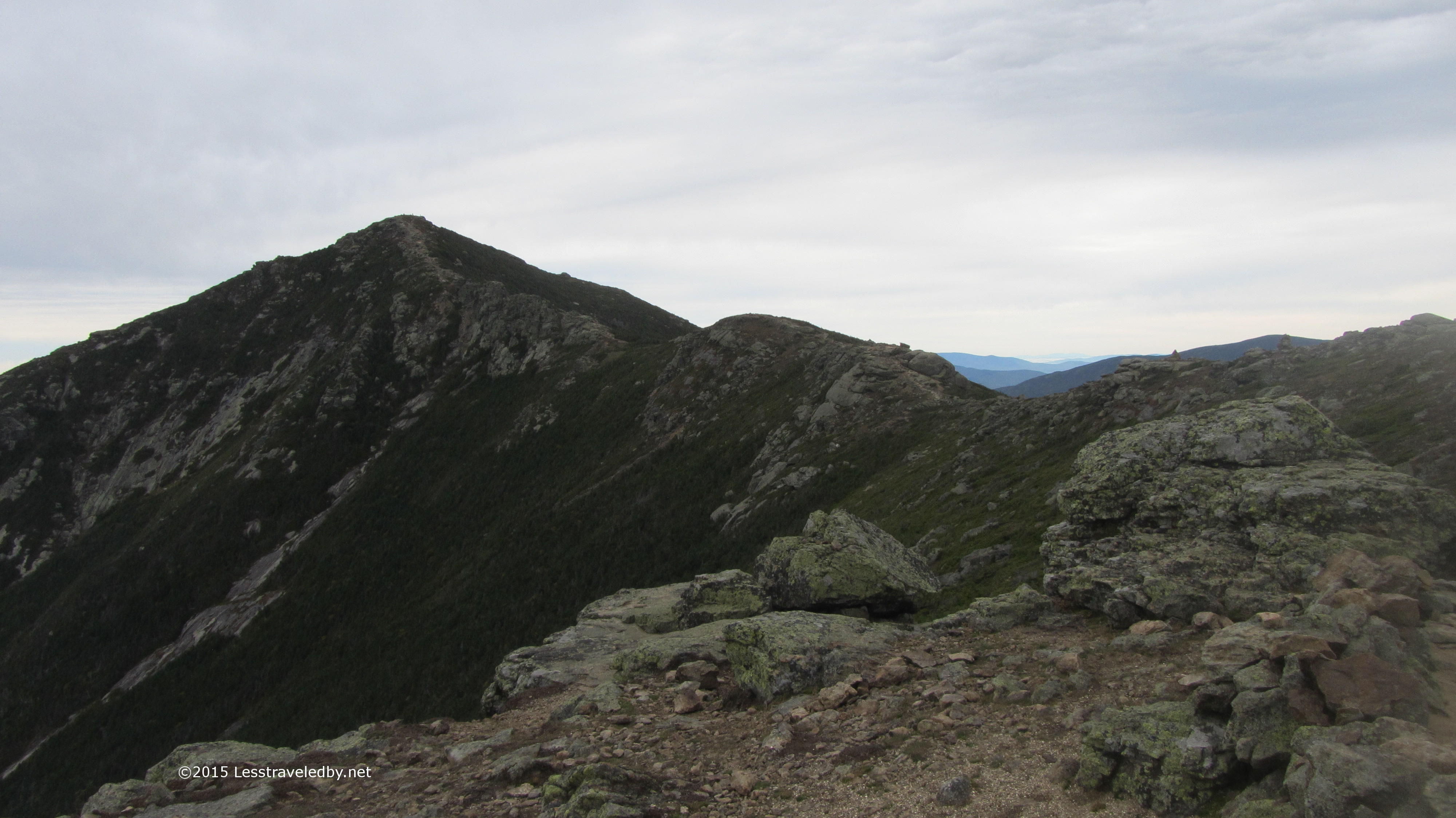 Each peak gave views of the next with the trail clearly visible between. Very relaxing to enjoy a break while pondering the next short climb knowing there will be another excuse to stop soon enough.
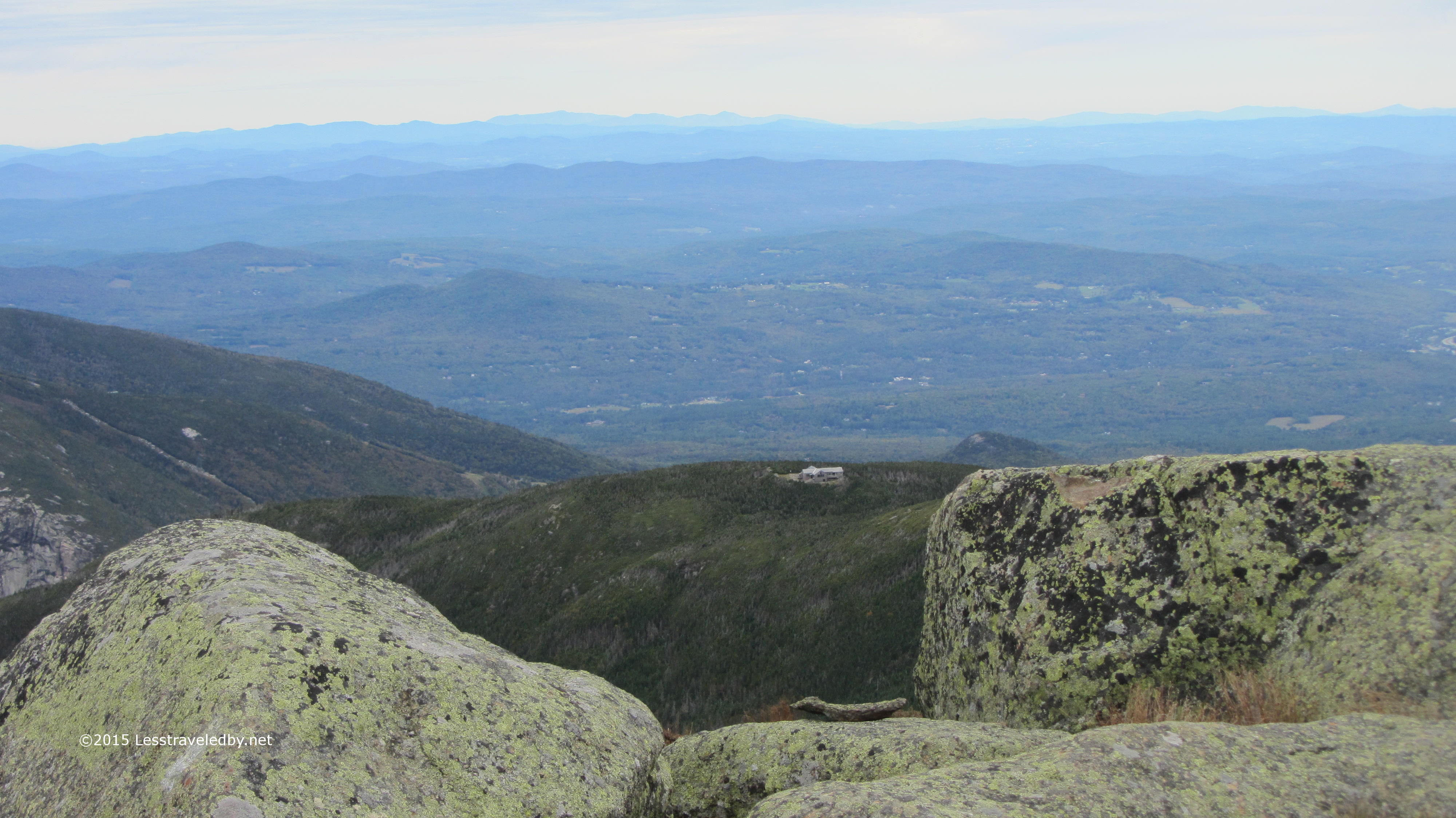 The Greenleaf Hut seemed a bit out of place, but I’m sure the views are pretty nice on the front porch after one of their big dinners.
 I hit Lafayette just in time to meet the lunch hour crowds. It seemed a lot of day hikers had come up to spend some time at the summit so I snapped a few pictures before moving on to the next unimportant peak to have lunch alone.
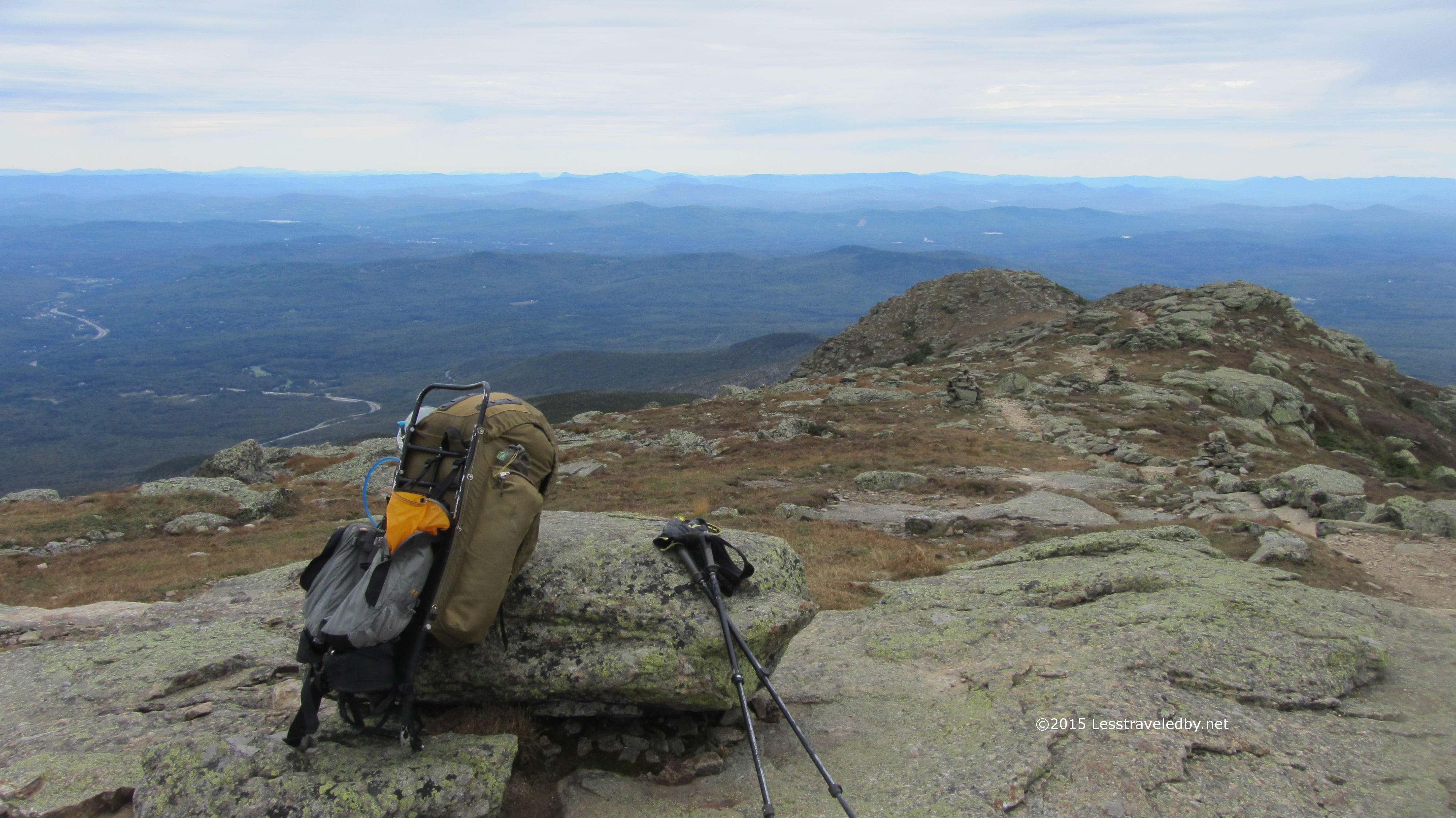 The views were too nice not to stop for a bit though. Time enough to dig out the video camera for some panorama shots too.
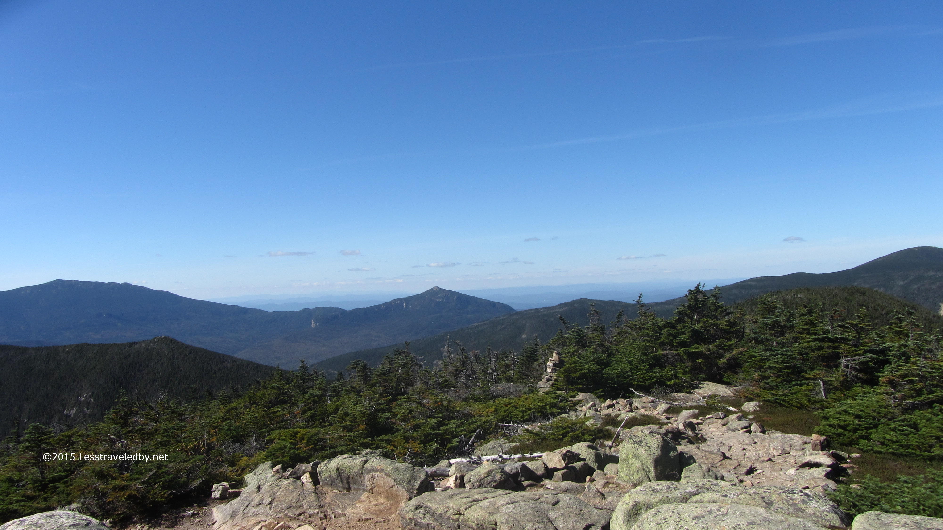
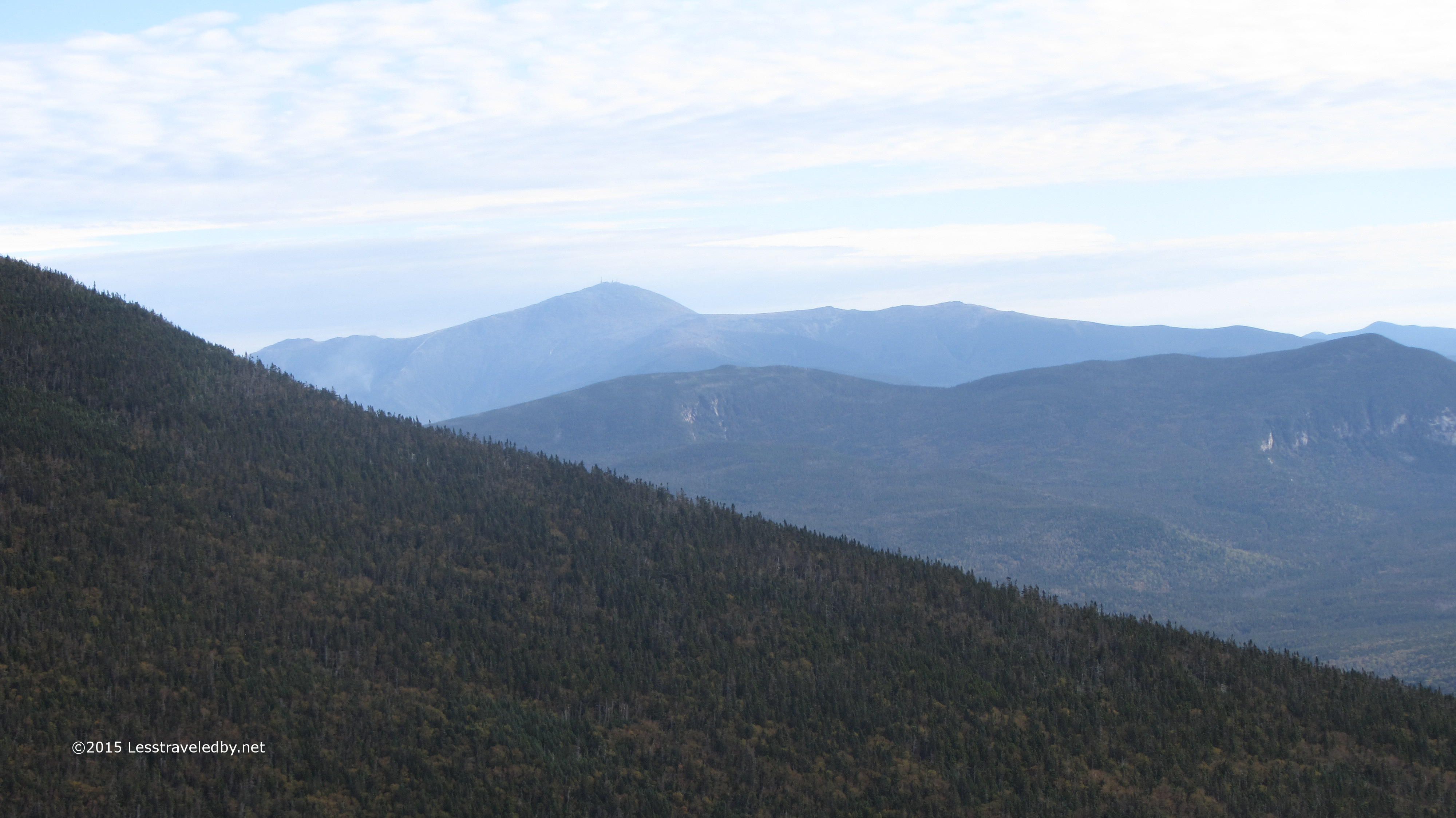
 There are the Bonds again. The angle is changing as I make my way around the loop. I enjoyed being able to see where I would be in a few days, especially because I had budgeted an extra day to just hang out when I got over there.
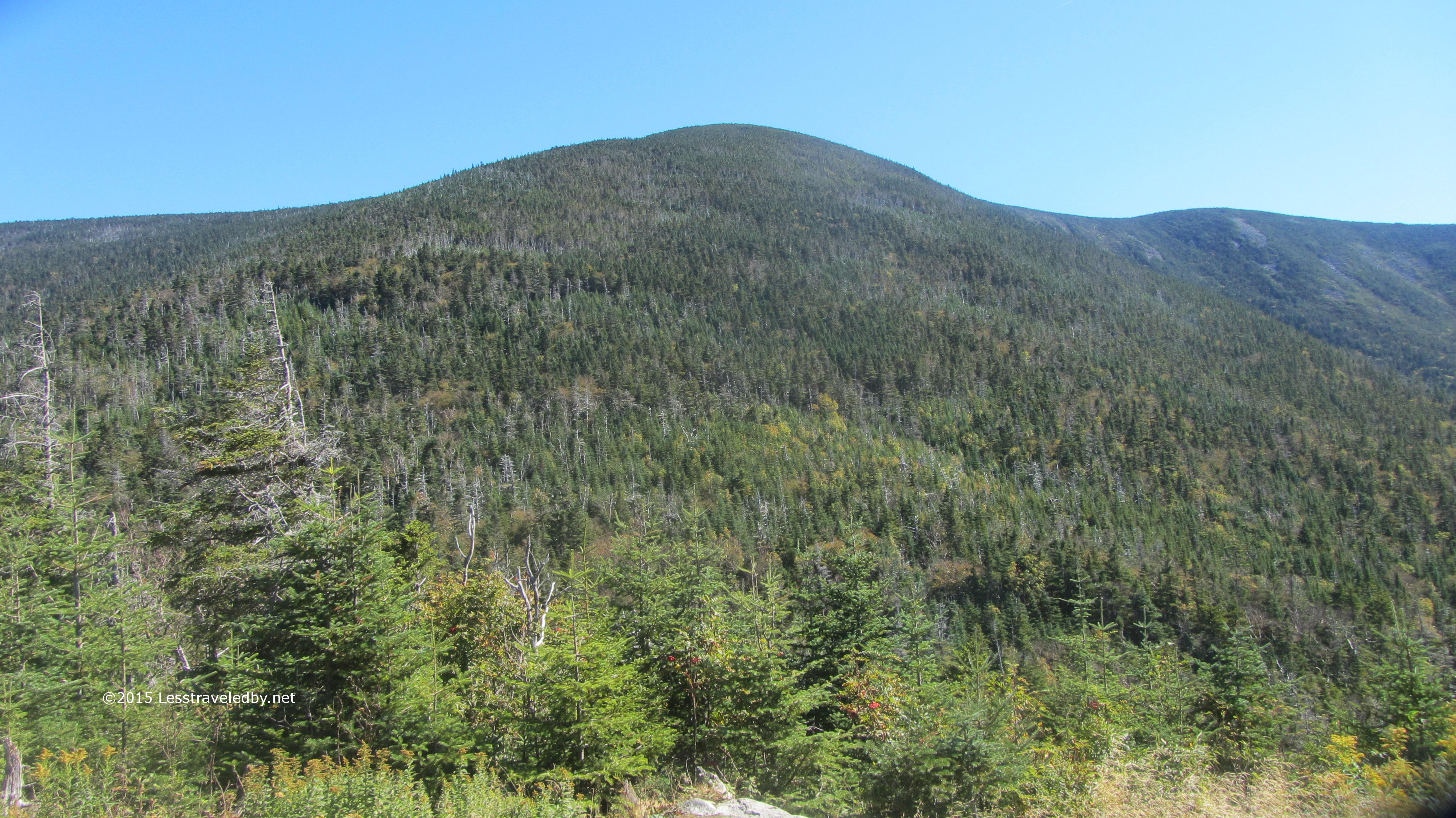
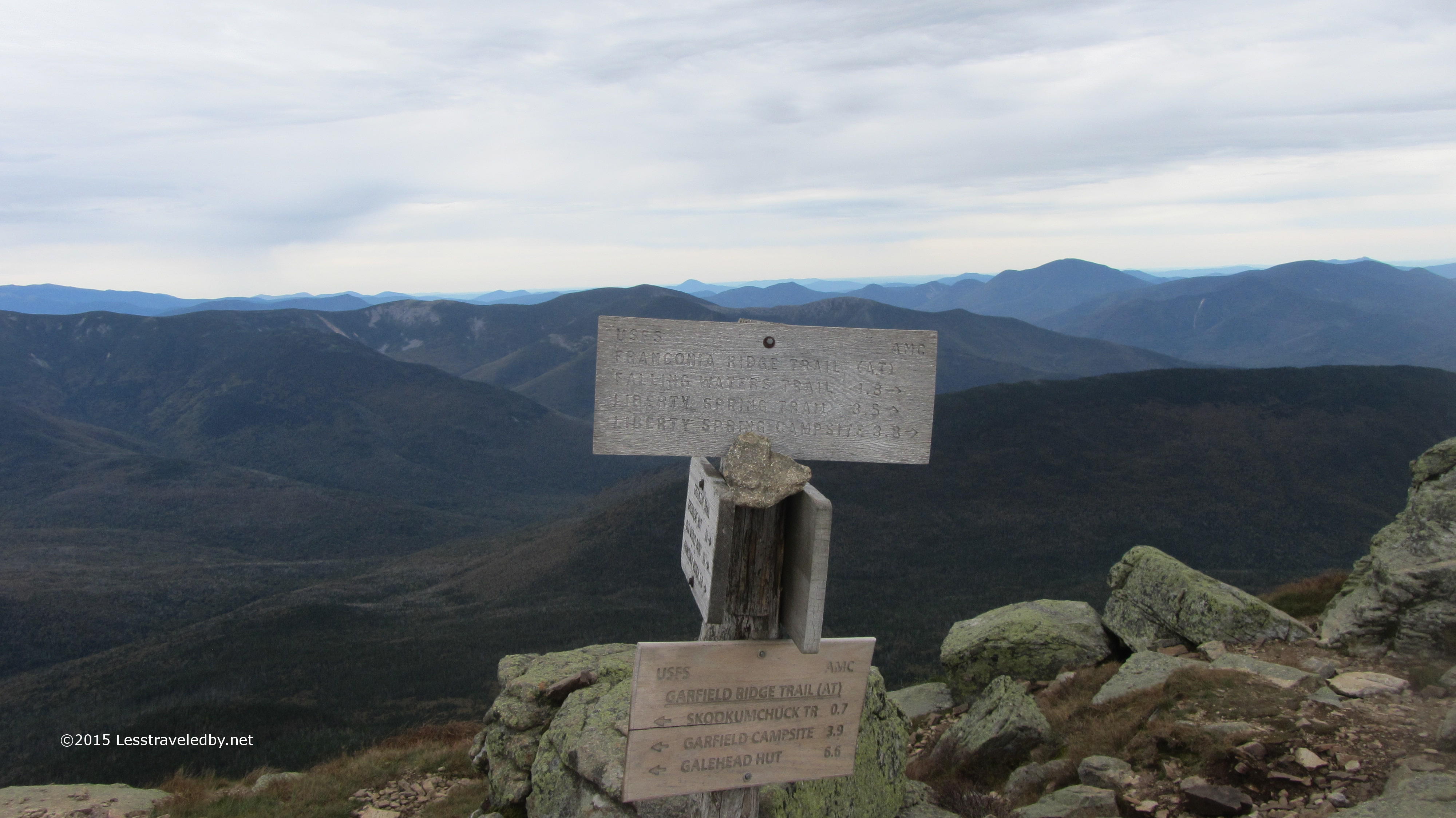 First I had to get to Garfield Ridge Shelter and that meant getting over Garfield. Not a lot of miles left in my day, but Garfield is a pointy bit of mountain and I’d need most of the remaining daylight to get there.
 Of course before I could climb Garfield I had to descend. Sure I was above it now, but they don’t let you start climbs at the top.
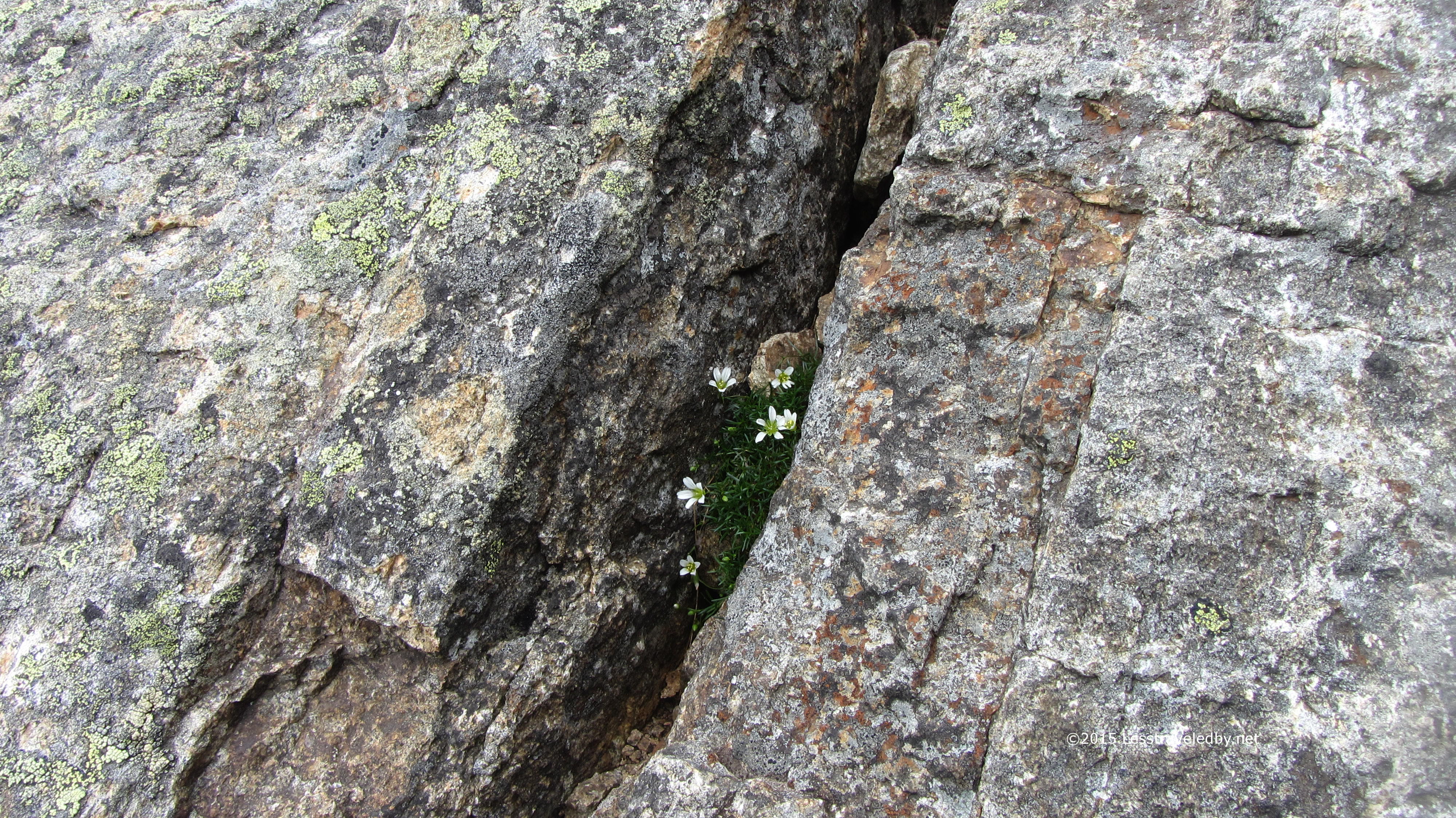
 Those two pics are for my wife. She has a thing about tiny flowers growing out of rocks and will often stop to take pictures of them when we are hiking. I felt it was my duty to bring her home a few shots of these because they were very tiny and the rock was very big.
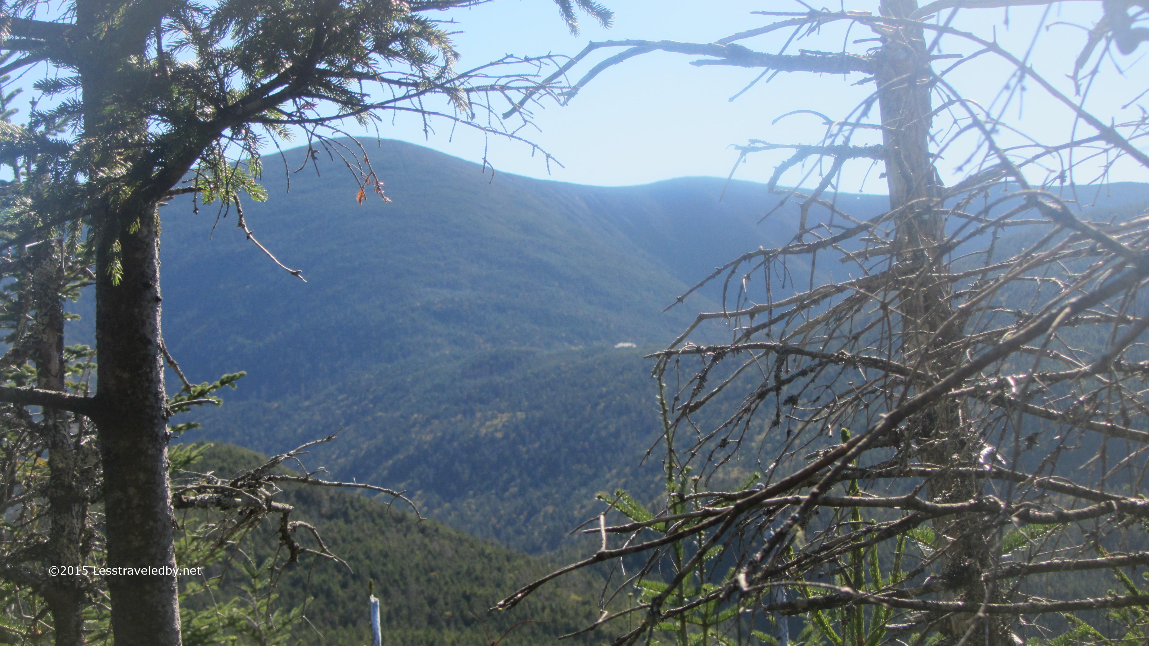
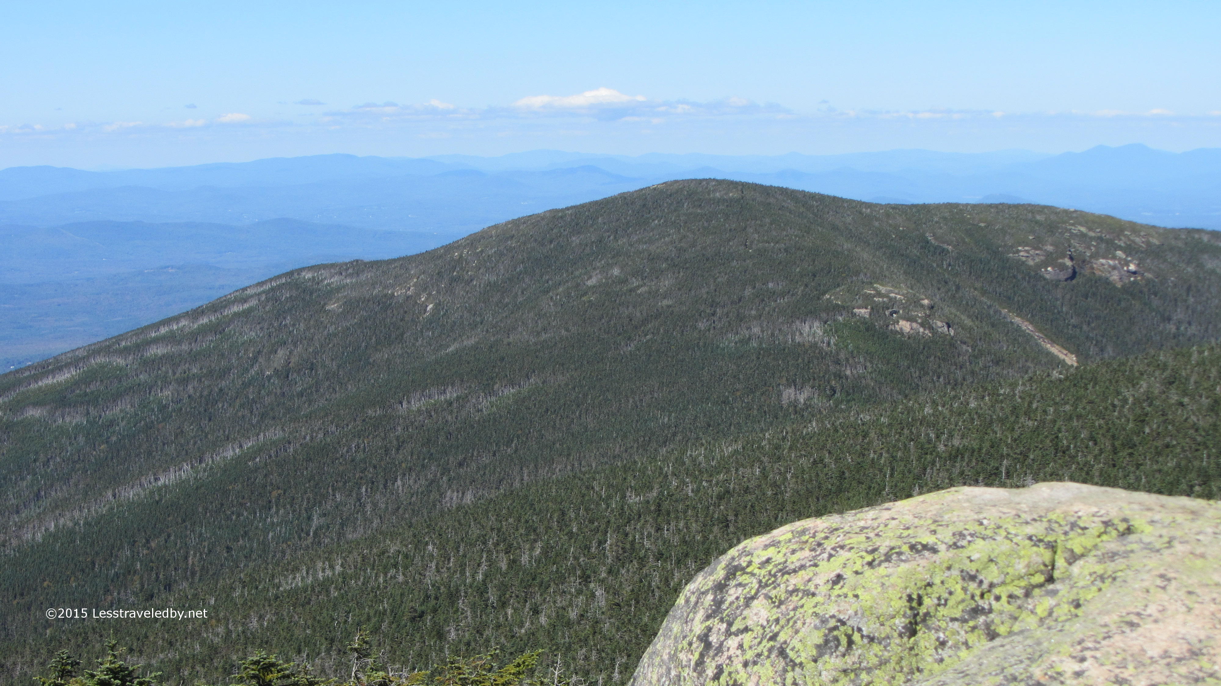
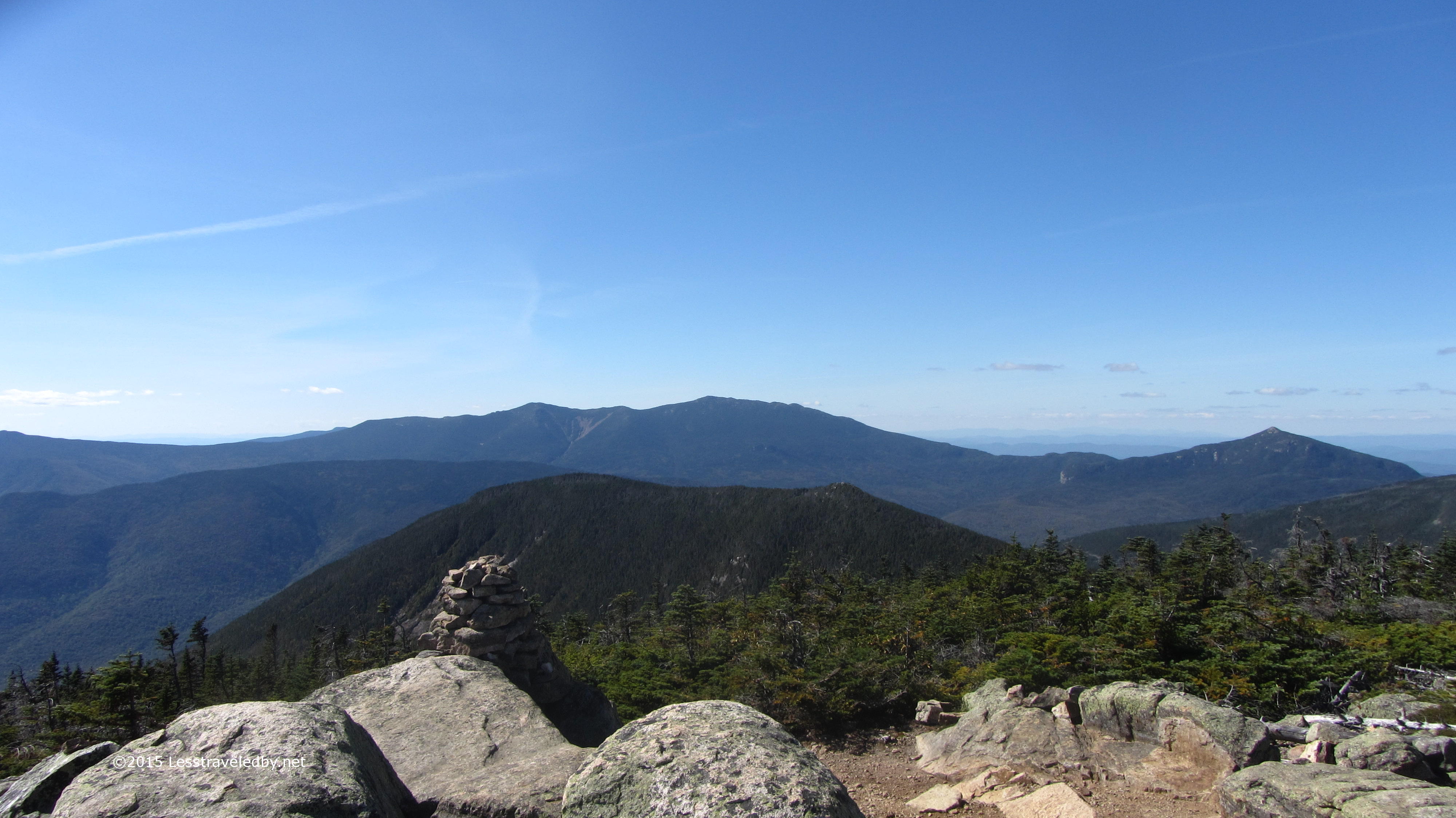
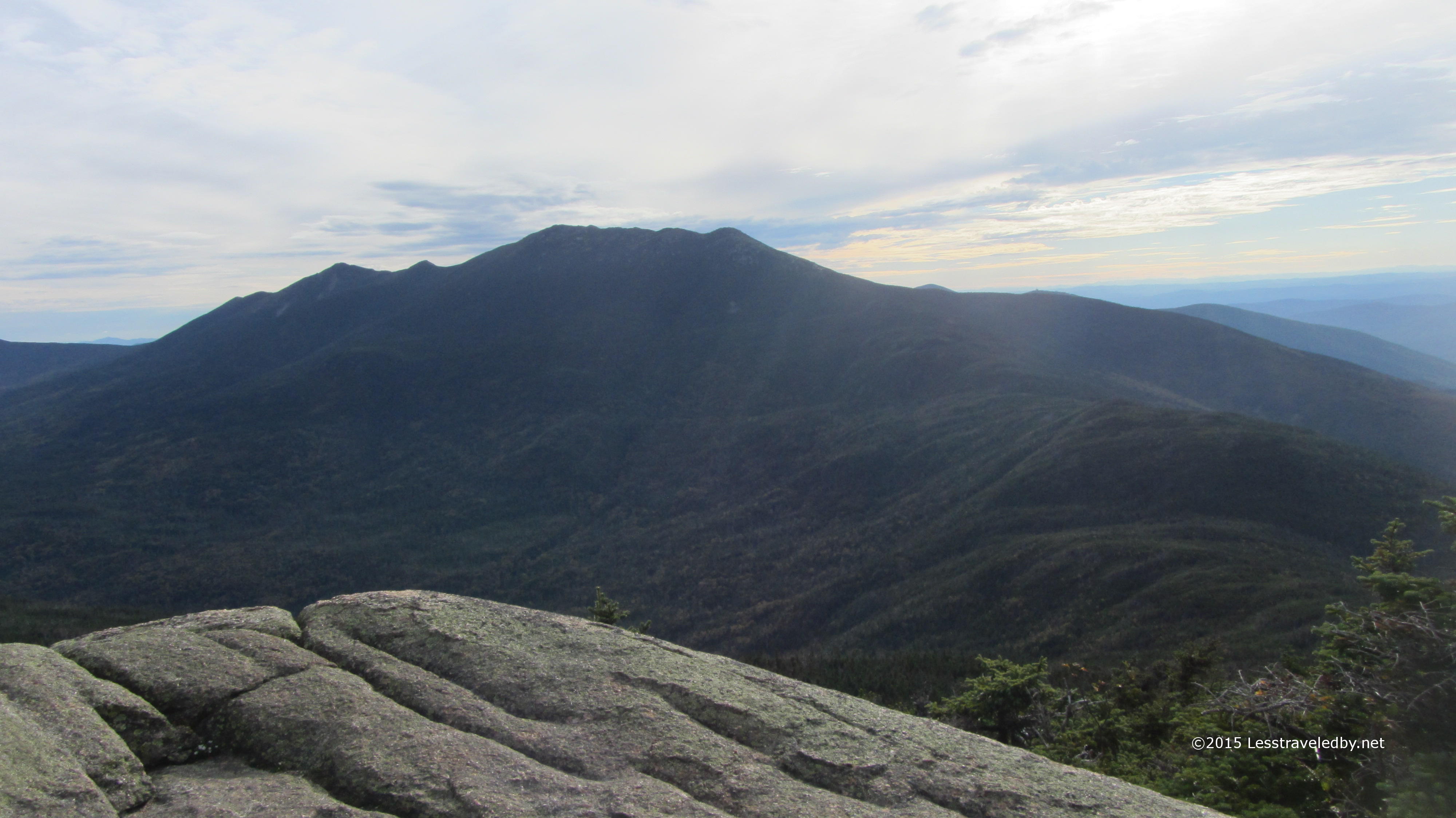 Nearing the top of Garfield looking back towards Franconia Ridge. Again it was neat to be able to see the day’s route, this time from near the end tracing where I’d been.
 One last pic on the sunny side of the mountain and then it was over the top and down to the tent site. Well down to the trail that leads up to the site at least. Definitely get your water before going up or you’ll end up making the climb twice like I did. Not fun after a long day of going up and down mountains.
It was a nice enough spot with a big shelter and a lot of large group tenting platforms. Thankfully I got a small one to myself as there was almost no one there that night. I did eat dinner with a lady from New Zealand who was doing the entire loop in two days. I’d met some others on an earlier trip this year doing the same. Seems way too nice a place to rush through like that, but I guess folks do what they enjoy.
I was visited by a camp host after dark who had just climbed up the mountain. After jokingly giving him a hard time about being late I paid the fee without getting out of bed. Talking with him in the morning he said he was late because he had to hitchhike to the trailhead. Late in the season the shuttles don’t run and he’d had a hard time getting a ride.
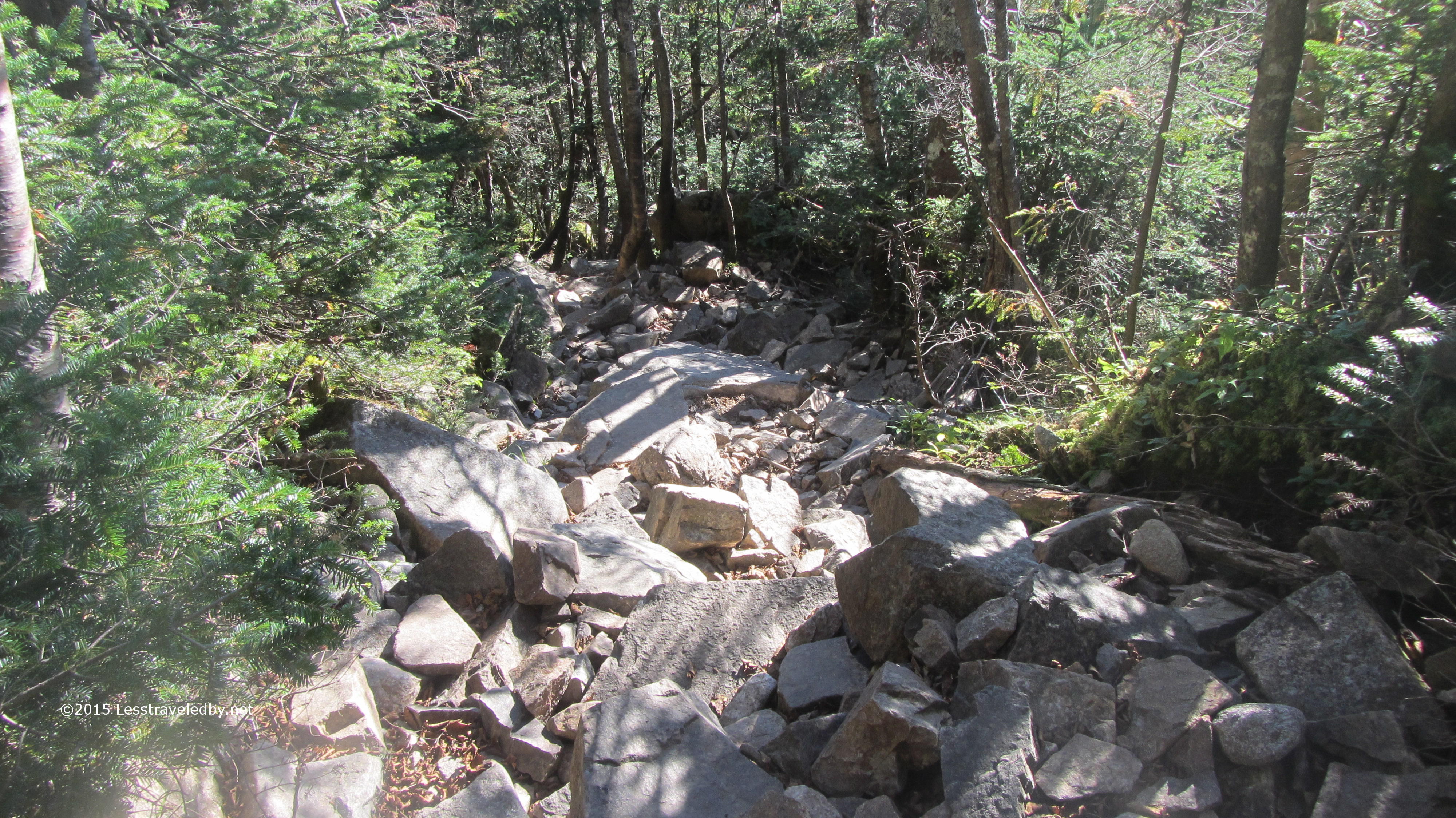 I refilled my water supply at the spring and headed down the trail towards Galehead. Well you could call it a trail, but I had my doubts at times. This section was really just a pile of rocks. The only way to know it was a trail was that there was nothing better to be found so it had to be the right way.
On my way down I began to catch glimpses of the Galehead Hut. Not sure if the terrain between me and the hut was more intimidating or South Twin looming beyond. The climb up that mountain last year did some serious physical and mental damage so I was already thinking about it. Now I was wondering how I’d feel when I reached the start because that hut looked pretty far away.
 Once I got off the rock pile and the trail evened out a bit I was able to make great time. I soon found myself sitting in front of the hut looking back towards where I’d started the loop days earlier.
 Well I snuck a few peeks at South Twin while I was sitting there too. This time I knew I’d have to really work for my next snack break.
 Which is why I spent a while sitting on the porch, soaking up the free water from the hut and fueling up for the climb. There was a steady stream of people coming and going so some conversation to be had as well. Finally it was time to do what needed to be done…
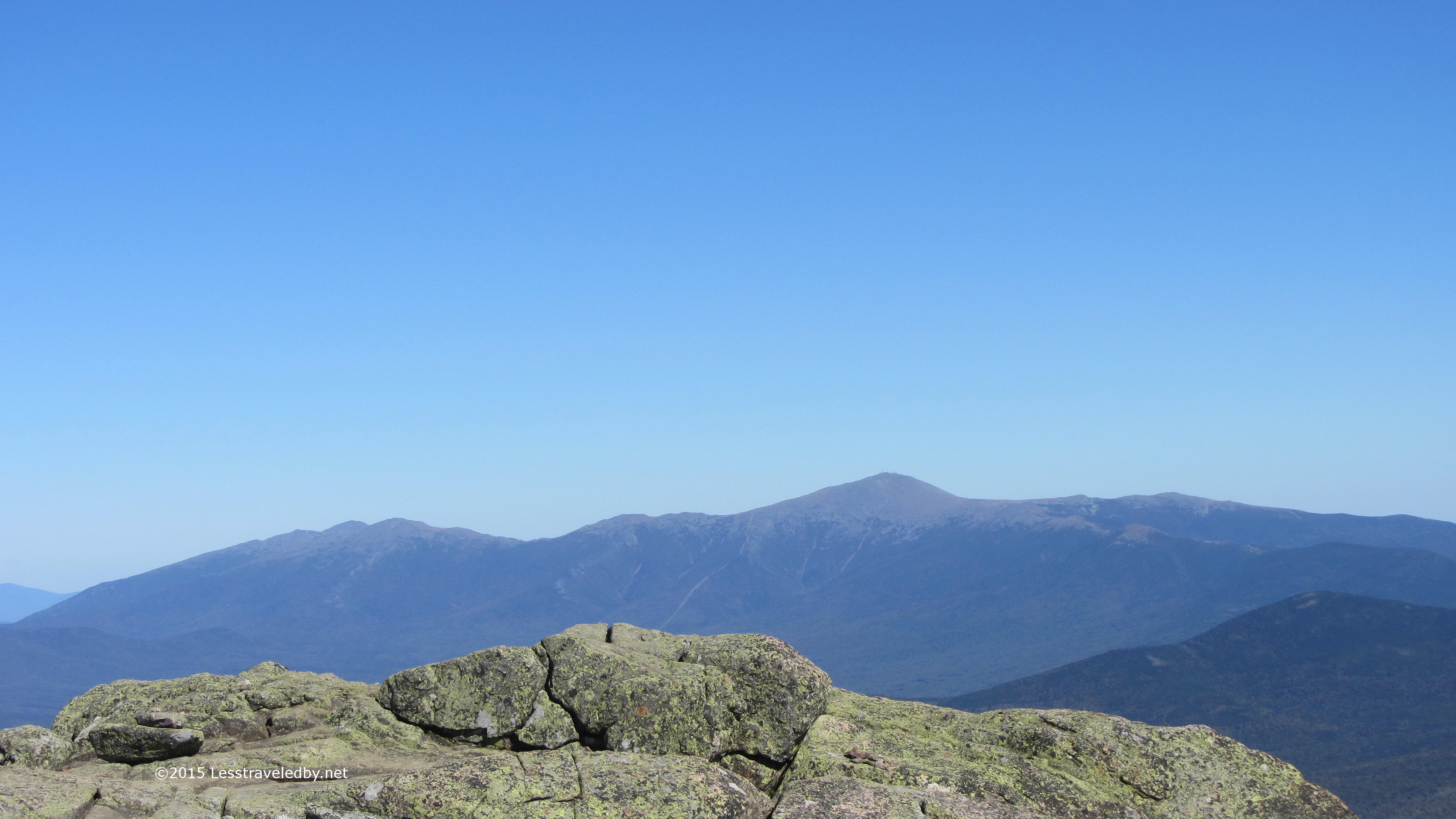
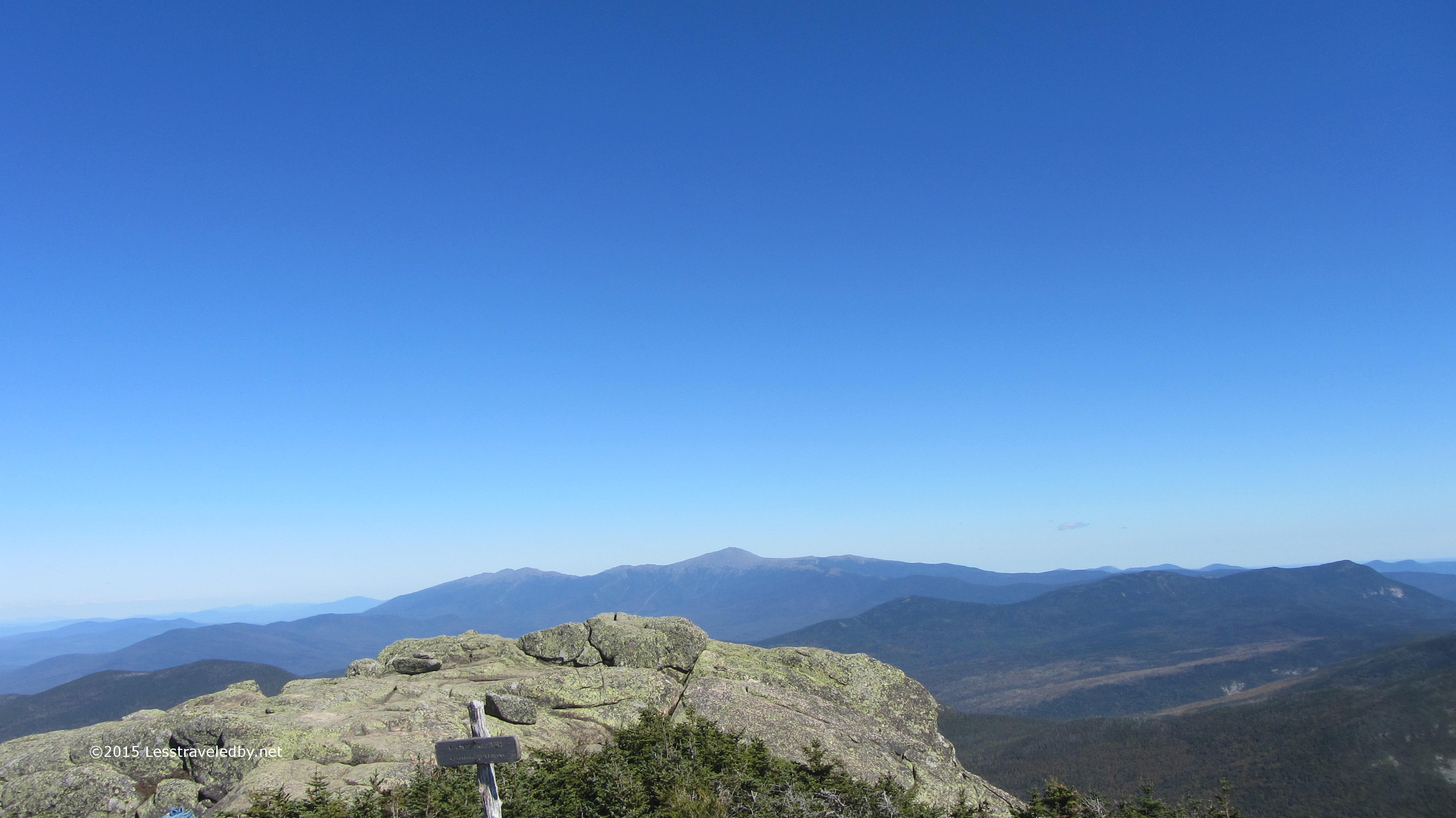 So I stomped up the mountain. The effort was well rewarded with a nice breeze and clear sky. The view of the Presidents from this spot is even better than from Bond Summit I think. Not nearly as crowded as Lafayette had been the day before it was a great place to relax for a bit.
 Again I have to question the folks who race around this loop. I was glad to have time to stop and take it all in. Really taking some time to look at where I was and what could be seen. The chance to be in a spot like this doesn’t come along every day. It should be savored.
 I briefly considered hitting North Twin, but opted to head down the other side towards Guyot and the Bonds. I knew I was probably too late for afternoon coffee with the caretaker and was hoping I would be in time to get a good tent platform.
 No need to worry. My latrine view suite was all mine for two nights. With the season starting to change the forest was thinning out and the latrine did seem closer, but still a fine spot to rest and relax. The Guyot site was very busy as usual. Watching all the various ways folks cook dinner is always entertaining and there is often some good conversation to be had.
The next day I enjoyed a late breakfast followed by some time laying in my tent watching the shadows on the leaves. Thankfully the caretaker began to do some composting work at the nearby latrine which encouraged me to get up heh. I packed a lunch and headed up to Bond Summit for a few hours. I knew I’d have to climb it again the next day, but I figured the walk would do my legs some good.
I almost fell over when I put my pack on. After a few days of tossing the full load up on my back I was used to, the nearly empty pack was a shock. It certainly seemed a lot easier climbing the mountain with that load.
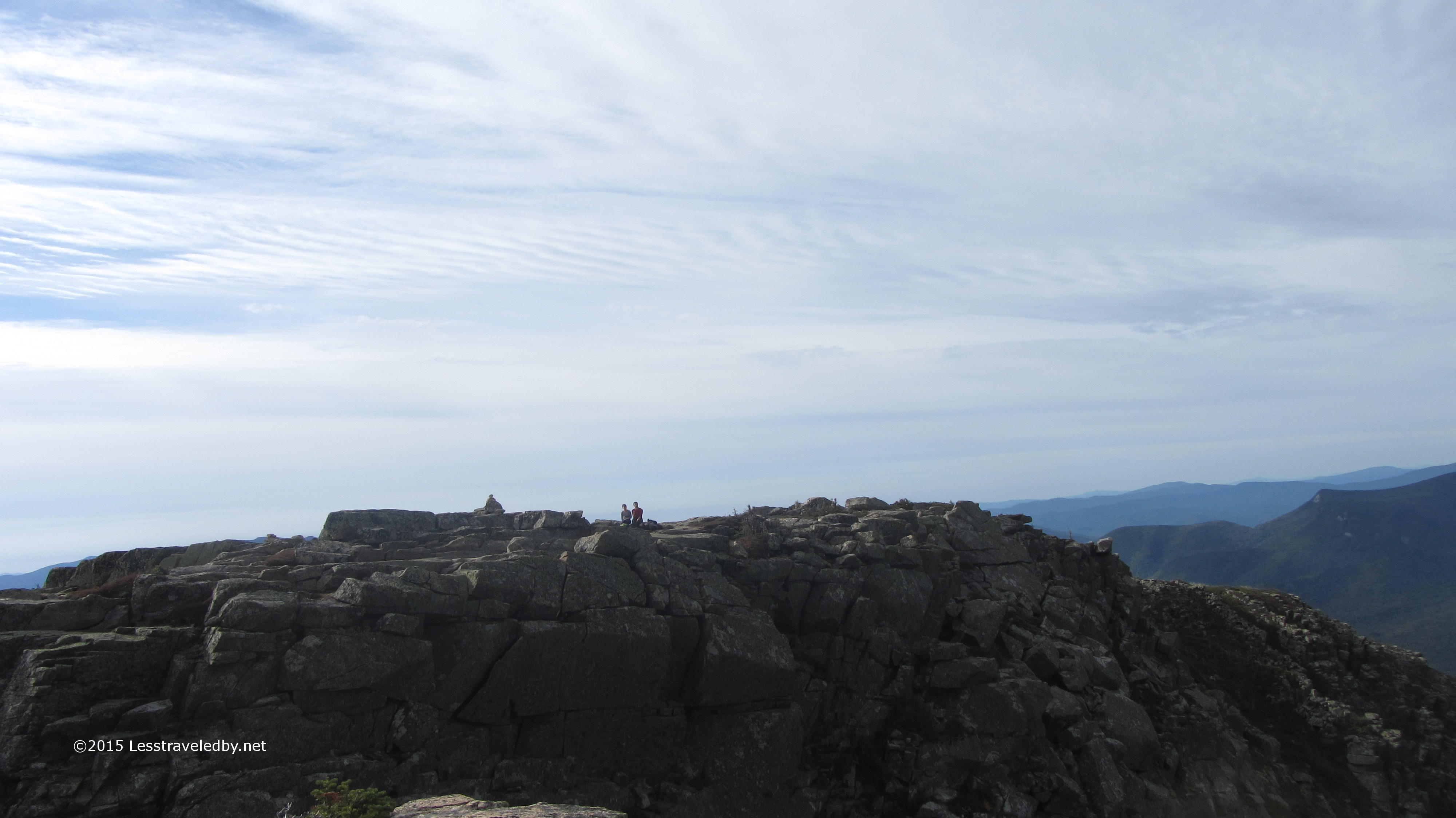
 It was another gorgeous day up top. I shared the summit with a couple of folks for a while before they headed down, then had it alone for an hour or so before going down myself. My timing for this trip was really lucky with great weather and lots of solitude despite being on popular trails.
 After a second night of listening to a lonely moose calling down below it was time to head home. On my way across Bondcliff I caught a pic of these two having second breakfast a bit head of me on the trail. We chatted when I caught up; they’d been at Guyot the night before as well and were from the UK I believe. They were on a series of hikes in the Whites and rattled off trail names like locals which sounded funny given their accent.
 Last time the summit was hidden by clouds on my way out, but this time it was easy to trace the trail almost all the way to the top. This is a bittersweet view while headed down. I hate to go, but at least I don’t have to climb up there today. It is pretty to look at, though a bit steep towards the top.
 One last look back towards Washington and then it was down into the forest for the hike out. I’ve spent a lot of time in this area over the last few years, but doing this loop added another perspective on the place. It is clear why so many are drawn to do this hike. It isn’t easy, but there are so many rewarding moments that you can’t really find time to suffer.
A little technical information:

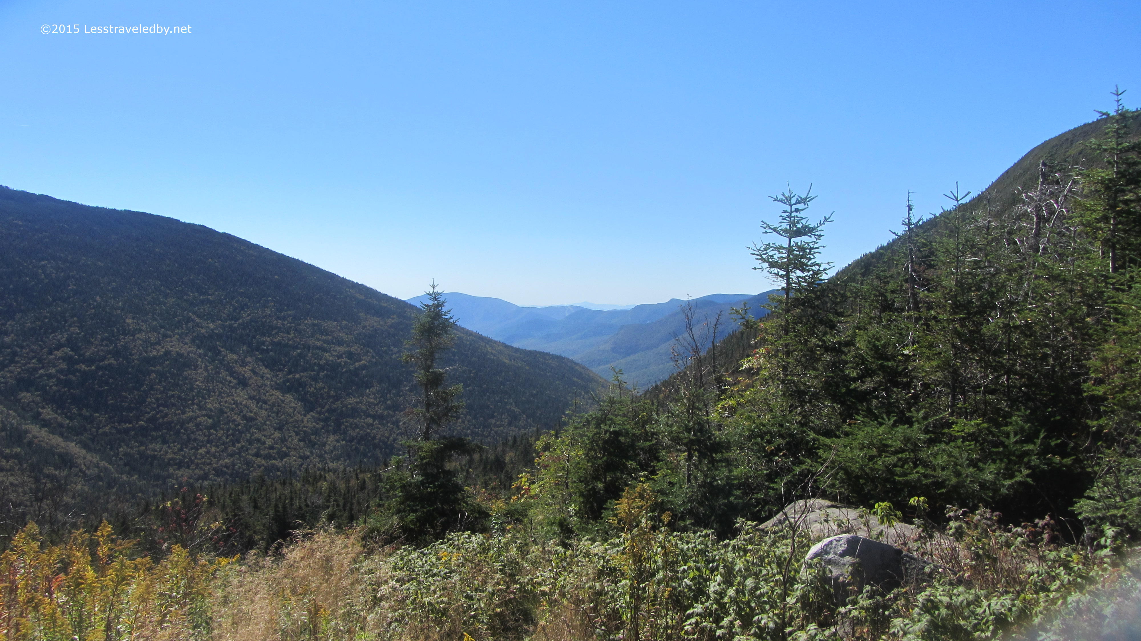
Roughly 32 mile clockwise lollipop loop starting from the Lincoln Woods trailhead, traversing the western edge of the Pemigewasset Wilderness via Franconia Ridge, the northern edge via Garfield Ridge and the Twinway, then cutting down through the middle via Bondcliff. This route bypasses the entire eastern portion of the wilderness, staying on the high ridges for views for most of the time.

My hand crafted elevation profile doesn’t reflect the mileage accurately, but it does give a pretty good picture of the major climbs and descents. What it can’t show is how rough the terrain is. This heavily traveled trail is well maintained and quite smooth in spots, but there are some rocky areas that can be challenging to say the least. No ladders or actual climbing required other than the 20′ or so vertical section of the Bondcliff. That spot, as I’ve covered in previous trip reports, does require the use of hand holds.
Both the big climb at the start and the big descent at the end are done via relatively gentle trails. Lots of elevation, but they seem much easier than they look on paper. The ridges in between however do go up and down steeply, often via large boulder hops. With lots of loose dirt and scree those with low shoes might want to think about gaiters.
Unlike the trails that pass through the middle of the Pemigewasset Wilderness, the trails on this route are all well blazed and maintained. Route finding was not an issue other than one spot on Garfield Ridge that looked more like a dry creek than a trail and had no blazes. There being no other option visible I took my chances and found that it was indeed the trail a few minutes later.
If you go, be prepared for changing weather. With so much exposure thunderstorms or just a good wind can make things pretty dangerous. Keep current on the forecast and be aware of where your bailout routes are to get down off the ridge just in case.

Pingback: Two Year Blogiversary | Less traveled by