
35 pictures from an adventure that didn’t go as planned, but certainly was worth the hot, sweaty effort. The idea was a two week trip to test out the Seek Outside Unaweep’s ability to carry that much food and my ability to live out of my pack for that long. The pack did its part and the food was fantastic, but there were a few other issues along the way 🙂 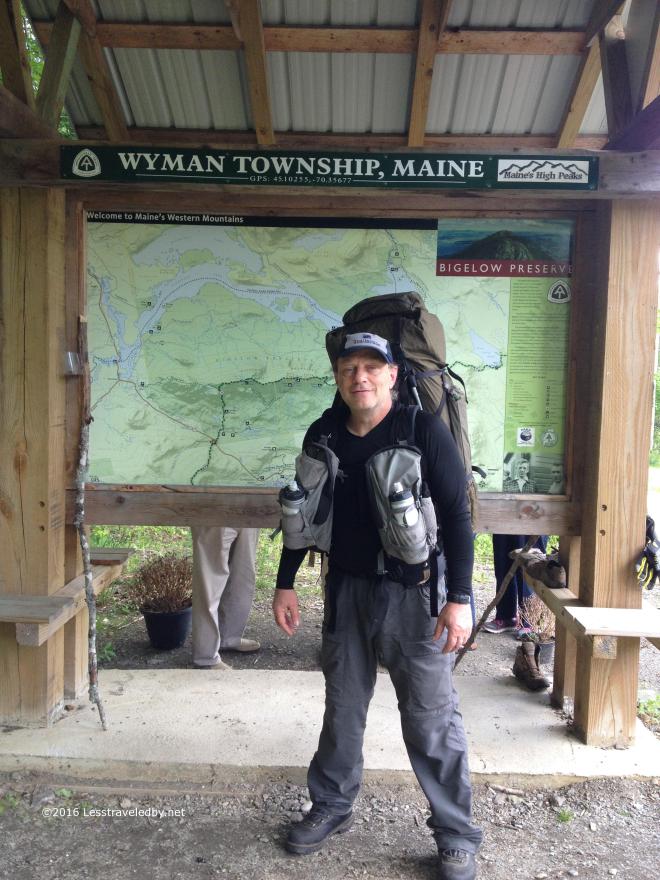 The girls were kind enough to drop me off where the AT crosses the highway just south of Stratton. They were headed on to VT and NY for some road trip camping while I did it the hard way. I remember being a bit nervous before walking away from the car, but as soon as I crossed the road and entered the woods on the other side the peace started to wash over me.
  A rare peek at the peak through the forest gave me a glimpse of where I was headed that afternoon. Warm and steamy down below, but I was hopeful of cool breezes up above.
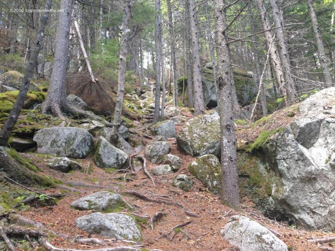 There would be some climbing involved to find those breezes though. You might be tempted to think this picture shows a particularly difficult section of trail, but this is actually the easy part. Later there would be large, cracked slabs of rock with water flowing down them in parts to navigate. I didn’t pull out the camera there because my hands were wet.
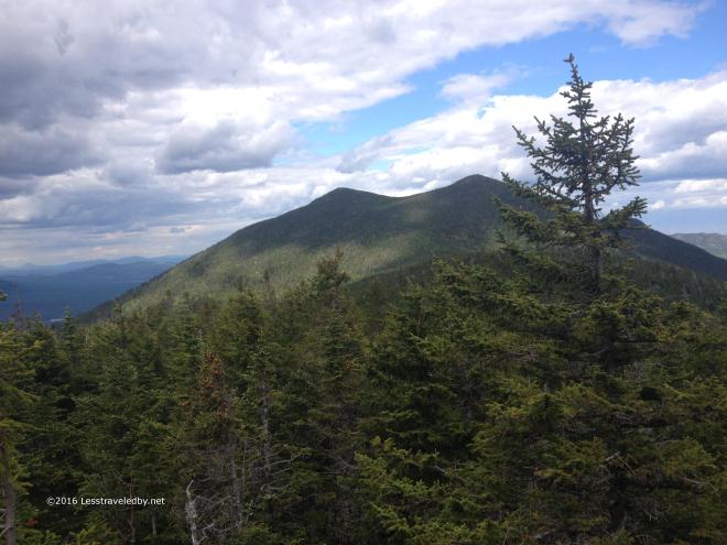 There were breezes on top of the ridge and “viewpoints” too! I’d made myself a promise to visit viewpoints on this trip. My natural inclination is to stomp on past them so it can be hard to stop, but I was rewarded with some sights like this one of The Horns.
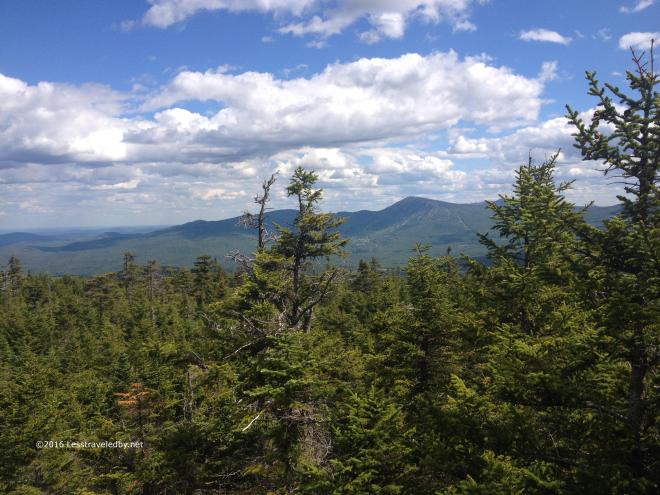 There were lots of other great views along the ridge often framed by the stunted evergreens. Not a fully exposed trail, but you could tell from the trees that life was hard up here when the winds blew.
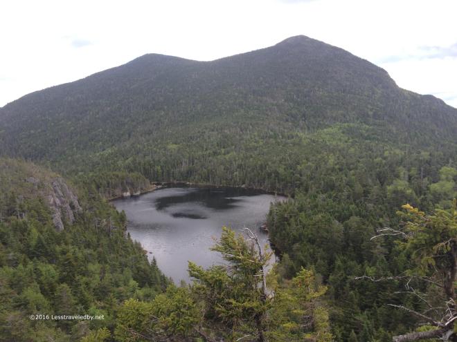 Then on one of my viewpoint visits I finally spotted Horn Pond below me. Somewhere down there I’d find a campsite waiting for me though it was impossible to guess exactly where from up here.
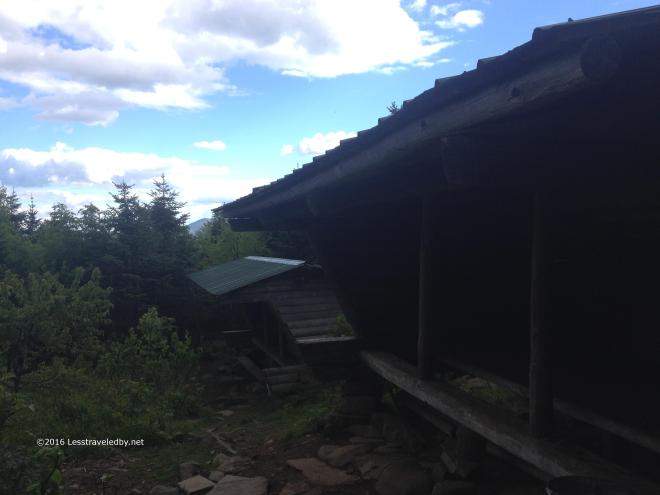 The Horn Pond campsite is actually quite large. There are these two good sized lean tos, plus a number of tent sites spread over a wide area. Each site had a 5 gal plastic bucket to protect food from the squirrels and chipmunks and there were several signs warning to be on guard of them.
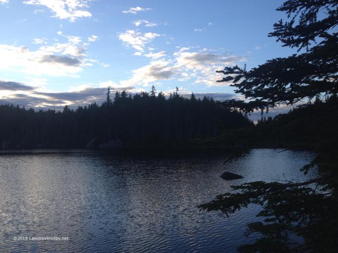 Horn Pond was amazing up close as most lakes you find at altitude tend to be. I guess I enjoy all lakes I visit, but something about finding water like this up high always seems extra special. They had just hiked up a fresh batch of trout to stock the pond and the big fish were feasting on the recent arrivals in the early evening.
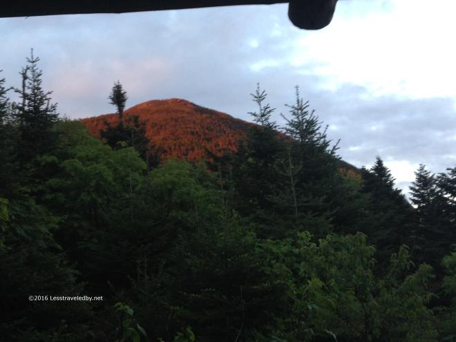 Back at the lean tos, which I had all to myself at this point, I was treated to a wonderful alpenglow display up on South Horn. Tomorrow I’d climb up there, but for now it was nice to relax and enjoy the view. I had a visit from Frog, the first of many SOBO thru hikers I’d meet on this trip, before he headed out to set up his tent after a long day crossing the Bigelows. Around dark, about 1030pm or so, another thru hiker came in and set up in the empty lean to next door.
 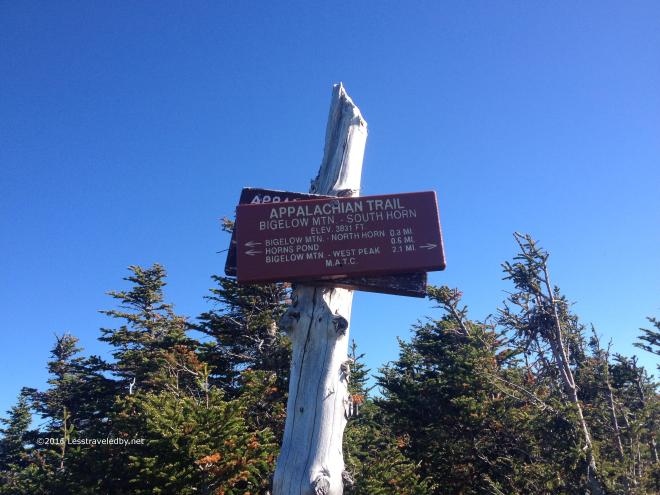 Day two started out clear and warm. The sort of day you know is going to be rough for climbing, so I took off early at a good pace and soon found myself at the top of South Horn. I’d bypassed the option to catch the view from North Horn, despite the recommendation of the camp host back at the pond, because it was listed as .3 miles on the sign and looked a lot more.
This sign was my first time noticing that the mileages listed seemed to be different from what I was expecting and not in my favor. Seems the electronic mapping and .gpx files I used were greatly underestimating distances and elevation change in some spots. So much for planning! Next time I rely on old fashioned paper maps that at least tell the same lies as the trail signs 🙂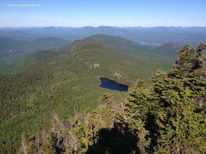 Standing up there on South Horn looking back towards the pond I could just make out the two lean tos below. I always get a kick out of being on one spot looking at where you are going and then going there and looking back to where you were before. Being able to actually see the exact spot made it even better.
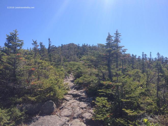 Then it was time to continue on the Bigelows roller coaster. After South Horn came West Bigelow Peak and eventually Avery. The col between each peak drops several hundred feet which lets you cross the 4k mark multiple times.
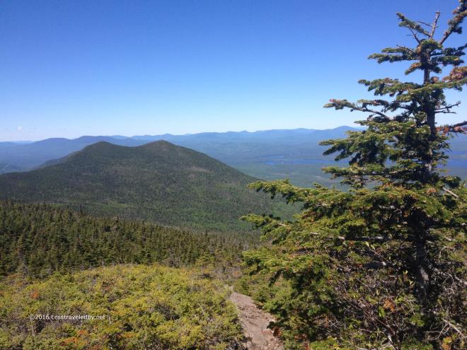 Nearing the top of West Bigelow looking back at The Horns you can see how they earned their name. You can just barely make out the only cloud in the sky there on the horizon. Probably in NH or maybe even VT, it did little to provide shade on this exposed ridge. Air temps were in the low 80s and I was looking forward to finding the campsite coming up to refill my water supply.
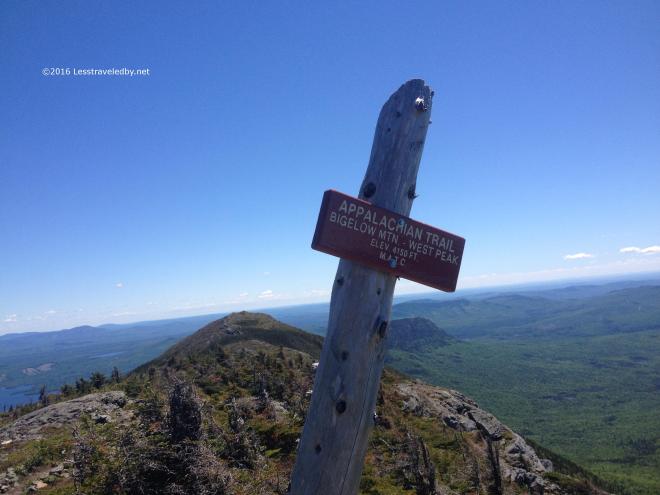 Well, I suppose there were more clouds than the one in NH, but these still were too far off to be of much use. Nice views though, with Avery close by and Little Bigelow down below hiding behind the signpost.
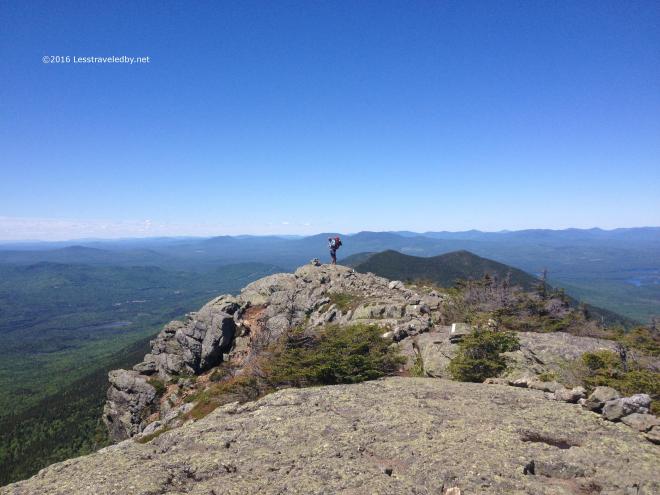 I met a lot of SOBO thru hikers coming across this ridge. Seemed I was heading into a large bubble that formed after Katahdin finally opened for the season. Each day I’d meet more and more of these hikers. First it was the fast ones, then the ones who were moving a bit more slowly with a few fast late starters mixed in.
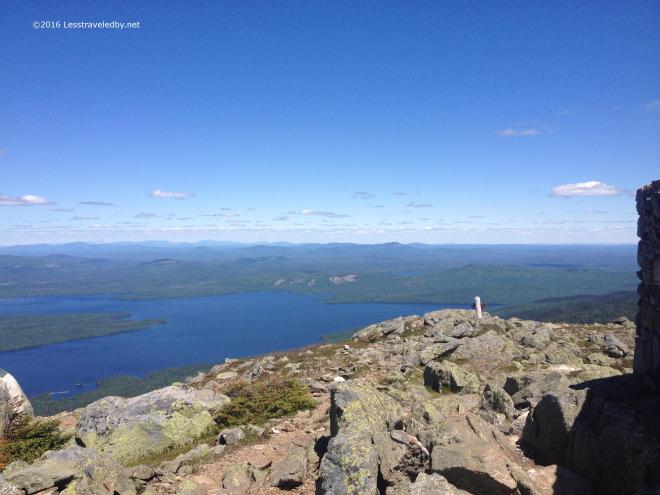 I managed a bit of water from the nearly dry spring in the Avery col and then headed up to the last big peak I’d see for a while. Hard not to stop and enjoy the views so I had a late lunch here. A big change I’ve made to my feeding program for these longer hikes is the addition of lunch. Rather than snack all day I tried out bringing dried sausage and tortillas. With the addition of a cheese stick one or two of those makes a satisfying, high fat content, meal.
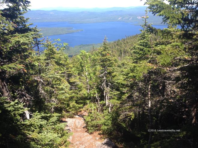 Then it was time to drop off the ridge and head back into the trees. I had hopes of making it over Little Bigelow that afternoon so despite losing the summit breeze I pushed on at a pretty good pace. Finally reaching the bottom much later than I’d expected I again realized that my mapping had underestimated the actual trail miles. Seeing a sign for the Safford campsite I headed off onto a side trail that took me through a small rock cave before ending at a tiny, primitive camp area well off the AT.
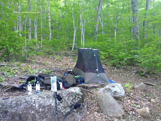 There was a broken tent platform so I used this spot instead. I found a tiny stream nearby to filter some water and located a well maintained privy a bit farther in the other direction near another sad looking platform. Being used to wilderness camping this barely there campsite seemed pretty luxurious to me and I enjoyed a peaceful evening indeed. There were even a couple of fireflies.
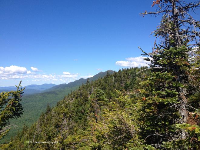 The next day is when I had to admit that with my poorly mapped trails I wasn’t going to cover nearly the ground I’d expected to. So I set my sites on enjoying my walk and not worrying about where I ended up each day. I think it was about the tenth false summit coming up Little Bigelow that broke me. Combined with a hot sticky day it was enough to make me set up camp mid afternoon at the Little Bigelow shelter and spend the day soaking up water in the shade and visiting with the SOBO hikers who passed through and those who eventually stayed the night.
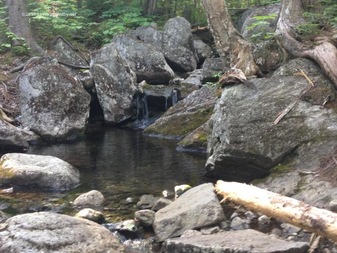 The Tubs are a series of natural baths in the small stream running near the shelter. Even with the heat the water was much too cold for me to take a dip, but I did enjoy drinking my fill.
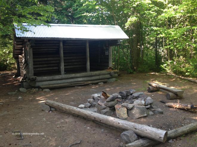 The shelter was filled that night with a half dozen tents set up around it as well. I hadn’t expected so many SOBO thru hikers to be coming through at once and I’m sure I’m not the only one who felt that way. With changes in traffic a lot of folks are going to have to get better prepared for crowds earlier in the season including hostels and the folks who run the canoe ferry.
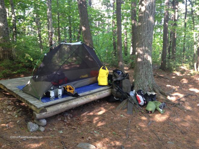 This platform was in fine condition and I enjoyed another peaceful night once the thru hikers finally stopped hooting. That yellow bag is one of two that carried my food supply on this trip. Inside I’d organized things into three five day supplies with larger portions in the later stages.
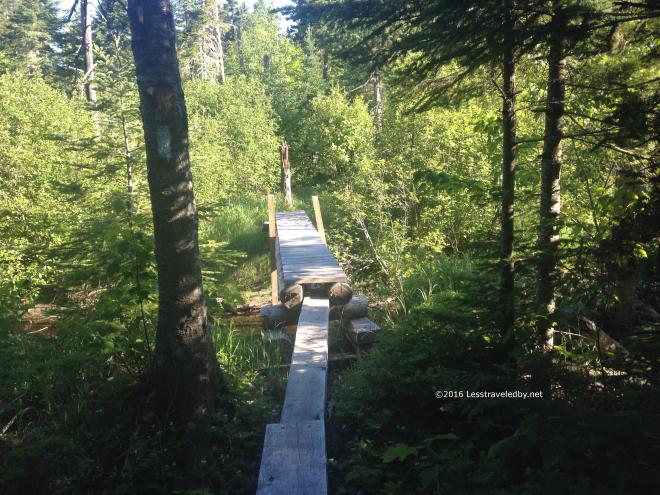 Day four was steamy to start and expected to get close to 90°f so I again headed out as early as I could to put some miles in. This nice bit of bridging put a smile on my face which is always better than mud in my boots.
 This was one of several spots that laid claim to being the 2k mark. I’m assuming that with reroutes the exact spot has moved over time and they were all right at one point. I stopped for second breakfast at a road crossing just past this sign and marveled at the frightening speeds vehicles came rocketing down the road. Well, and I swatted at horseflies too, but that doesn’t sound as romantic as marveling.
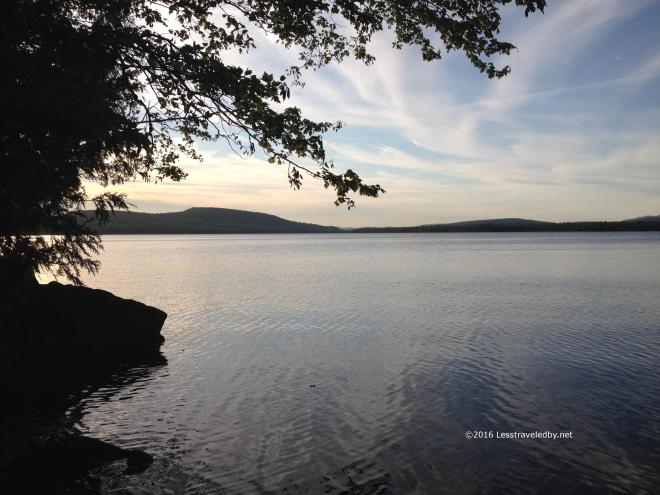 West Carry Pond late in the day looked cool, but it was a bit tropical to be honest. The spring near by was dead so warm pond water was the only source to be had. Another large group was gathered here and I was glad I’d set up my tent early to get a spot.
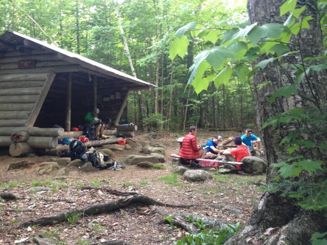 There was such variety in the thru hikers which really made the SOBOs seem like a different species from the NOBOs I’ve grown used to dealing with over the years. These people were still doing their own things in their own way. They hadn’t had their originality beaten out of them yet, though there were a few I met the night before who sounded ready to do as they were told.
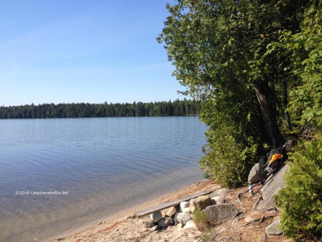 Another hot and sweaty morning meant another early start. I found this fantastic beach as the trail followed the East Carry Pond shore for a bit.
 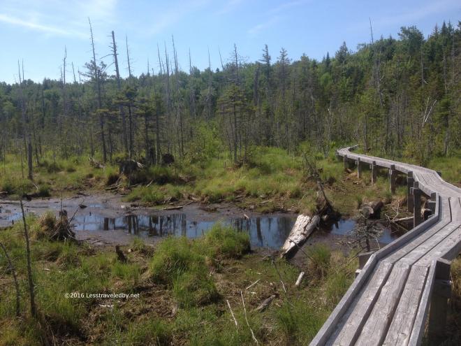 The MATC has built some fantastic bridgework through some areas in this section. I came upon a crew a bit past here that was setting up for the day and looked to be working on another huge section.
Somewhere between East Carry and Pierce Ponds my leg almost fell off. I was just walking down the trail, taking another of the millions of steps I’ve taken over the years and when I went to pick up my leg something went horribly wrong in my hip. Surprisingly enough it held my weight when I set it down and I just kept walking. There wasn’t pain, but I could tell something didn’t feel the same. Pretty soon I was more worried about finding water than my leg and forgot about it for the most part.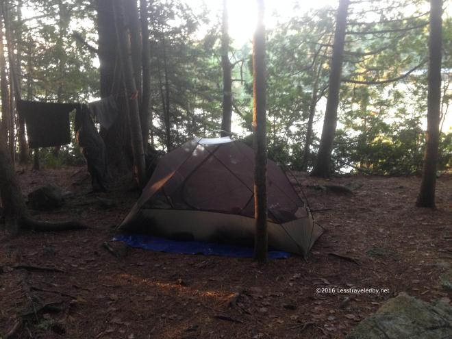 Pierce Pond is pretty popular with NOBO hikers because it is the last shelter before the Kennebec canoe ferry. Harrison’s camp next door with their famous pancake breakfast might have something to do with it too.
After setting up camp and wandering up and down the hills in the area a bit I realized that my hip definitely felt different. Not painful, just not normal. As the afternoon turned into evening another group of SOBO thru hikers moved in and then towards sunset a solo, NOBO section hiker stopped in before heading over to Harrisons to make breakfast reservations.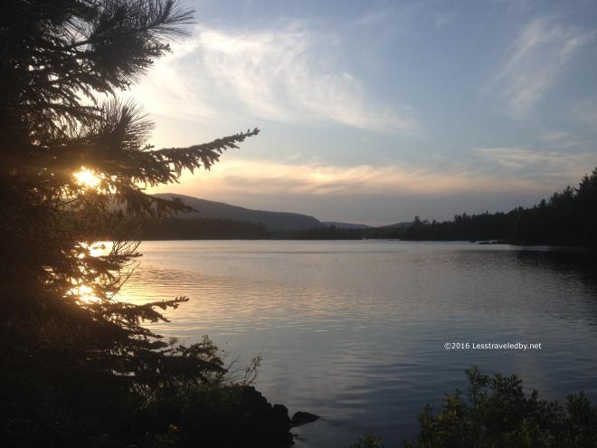 Sunsets come pretty late this far north around the Summer solstice. Pretty pretty too!
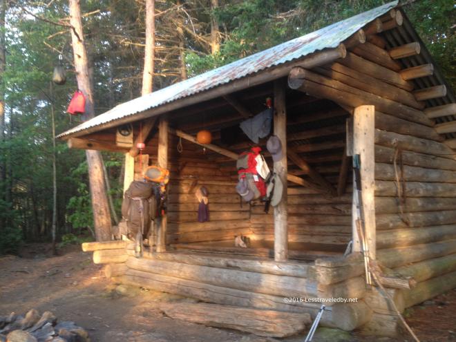 The entire group of thru hikers opted to set up their tents after one of them spotted some big spiders. It struck me as funny that there was this fantastic sunset to be viewed from the shelter, but no one was there to enjoy it because the spiders scared them off.
 Sometime in the night or early the next morning I decided to spend a zero day to see if I could figure out what was up with my hip. Once the thru hikers left in the morning I had this beautiful place all to myself. Well, there were a few passing fisherman in boats on the pond and a couple of folks stopped in for lunch breaks, but really it was a quiet day to relax and enjoy.
I shared the spot with a wide variety of dragon fly type creatures. First there were a bunch of black and white ones.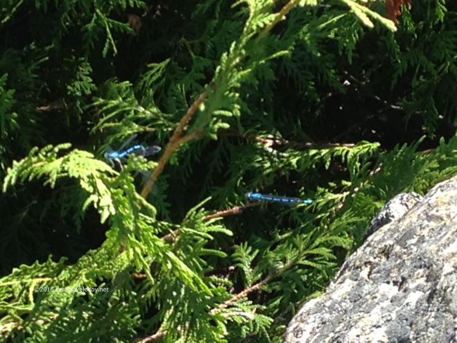 Then I found some blue ones that seemed to be molting. One was ready to go but waited for the other before they moved off eventually.
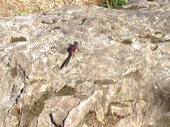 Then this big red one showed up to pose for me. Like I said, it wasn’t a very busy day 🙂
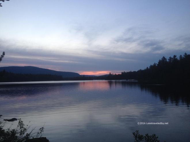 Another peaceful sunset and I had the place all to myself. There was a chance of rain before morning so I moved into the lean to with the spiders. I’ve let wasps move me out of a shelter before, but the choice between sleeping with spiders or packing up a wet tent in the morning was an easy one. All night I had a great view of the pond whenever I woke up. This really is a nice spot if you can find it empty.
The next day I started off rested and hopeful that my leg issue was behind me. I had about four miles to the canoe ferry which only runs from 9a-11a this time of year so got an early start. I was moving pretty well and acually did the four miles in under two hours, but I could still tell something didn’t feel right in my hip. I debated my options and after giving consideration to the poor folks who would have to carry me down the mountain if my leg fell off I decided to pull the plug on this trip. I had a highway where I could get a ride home so better to stop here than risk heading up the next mountains was my reasoning.
So my fifteen day trip only lasted seven and I didn’t cover even half the miles I’d expected. Still I am glad I erred on the side of caution. Working through the leg issue here at home I’m becoming somewhat convinced it was caused by heel cushions I added to my boots just prior to the trip. My feet were incredibly happy in the Limmers on this trip and the cushion did great at absorbing the heel shock I’d been feeling, but removing the cushions seems to be helping the hip issue. I have been day hiking all along and managed a 5 day Baxter loop with the boys from Texas last week so am hopeful that I will continue to walk on.
Besides the leg falling off there were a few other bad points to this trip. The bad electronic mapping really left me with a failed plan to start out. I have good paper maps for most of the areas I visit, but obviously need to find some for this area if I’m going back again. In more forgiving terrain a few miles difference isn’t so much to deal with, but when mountains are involved those unexpected miles can seem very long. The weather really was a big challenge as well. I’d much rather hike in below zero snow than 90° heat, but I dealt with it pretty well considering.
On more positive notes…the Unaweep was amazing at carrying the load. The hip belt and shoulder harness keep the pack in place well even when crawling under blowdowns or clambering up steeps. I started with 57 pounds wet including the front packs and never experienced any contact point pain or abrasion. The food also worked out really well. I wasn’t really hungry after seven days which is somewhat astounding to me. I am usually starving after five or six days, just ravenous. The biggest difference was the sausage and cheese tortillas for lunch. I was so well fed I wasn’t eating my rations of trail mix or chips. One other big win on this trip was a warm weather wool shirt I was testing out for future review. Amazing material worked as a cooling shirt when wet, warming shirt when dry and somehow managed to not smell after a week of hot sweaty trail use.
One other really big positive on this trip was the people. It was fun to meet the SOBO hikers early in their trip. The couple of flip floppers I met really stood out as they were all about the business and not much about the fun by this point. It seems a shame to lose that natural enthusiasm so I’m hoping the folks I met are still rolling down the trail having a good time doing their own thing.
As I mentioned there has been a Baxter trip since then, two actually as we did a family outing up that way as well. Pondering our next move as we have a few weeks before the little one starts school. Then we’ll see what the Fall brings…

Thanks so much for a glimpse of this section, and the realities of June hiking here. While my SOBO thru-hike was originally targeted for 2017, I’ve now had to move it off indefinitely due to major life changes. But catching hold of folks out there walking it keeps my dream fresh and alive. Hope the hip continues to heal 🙂 PS. What is the shirt?
Glad you enjoyed it! The thru hikers seemed to be having a lot more fun than me so I’d say go for it when you can. SOBO seems to be the way to go, but I think I’d try it later in the year for cooler temps. Starting in June headed south it just keeps getting hotter as you go which is not for me.
The shirt is a WOOLPRO Skylark. Long sleeved and made from a very fine wool mesh. Worked well for a steam engine like me since I’m going to be sweating anyway so why not use that sweat to cool off? Those who merely glow while hiking would find it better suited as a colder weather layer.as it would just serve to warm them rather than cool. Either way the no stink wool is a treat compared to the stench of synthetics.
LOL, sounds like the WOOLPROO will be something to look at for me (also a steam engine, and red-faced to boot). I like icebreakers line for those same reasons.
I planned (on my original schedule) to start at Katahdin in mid-July and travel south along with mid-summer and fall. I’ve tried to keep an eye on the temps of the regions each year as I don’t walk it 🙂 Probably take me 5 months at my current full-pack hike rate, to enjoy it, not just accomplish it.