
33 Pics and tales of adventure on the GLT / AT
After over four weeks without putting on a pack and very few days with even a good walk it seemed the perfect opportunity to head out on one of the toughest hikes I know. The Grafton Loop Trail is officially listed at about 38 miles and includes roughly 12 miles of well groomed and heavily traveled Appalachian Trail along with lesser maintained sections that are far less traveled.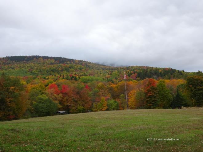 My previous two training trips to this area in August were launched from the state park lot where the AT crosses the highway that bisects Grafton Notch. When I make what has been my annual pilgrimage to head up and try to do the entire loop I prefer to park at the quieter loop trail head lot found on the southern end of the notch. From there I like to do the short road walk and cross the private lands that lead to where the trail heads up towards Bald Mtn for those heading clockwise around the loop.
This area of farm land leads to a snowmobile trail with a bridge across Bear Brook and then eventually the start of the real trail itself. It is a gentle, rolling hike which is a great way to get warmed up before the climbing begins.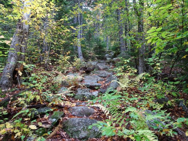 Normally it is also a wet walk with lots of little creek crossings, but this year it was quite dry. I was hoping the water sources were running again as there had been some rain. The empty channels down below made me wonder what I’d find on the other side of the day’s mountains.
 The AMC handles the trails on the west side of the notch and they have built some nice, terrain saving, steps in a few spots. These things really keep hikers from tearing up the ground which lets the rain and snow melt quickly dig down to the rock below. They also make a great spot to sit down and have a snack on a wet day. Climbing up into the clouds I reached the point where everything was wet including me and wished I’d brought my OR Crocs along.
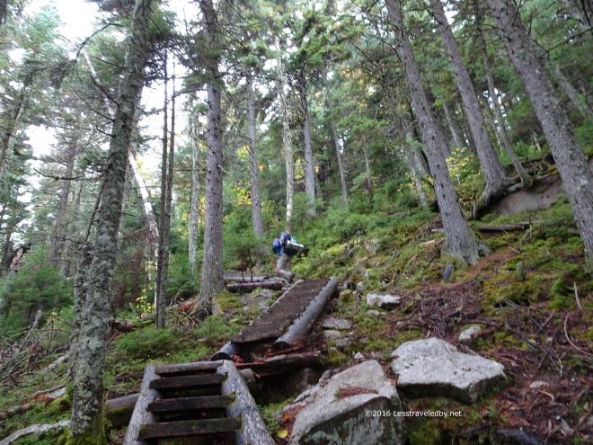 This quick picture of a hiker disappearing up the steps is my only way to know that I didn’t imagine the encounter. I have almost never met anyone on this loop other than on the AT section. We chatted for a bit before he headed on and he mentioned he was planning on camping at either the Slide or Bull Run sites. I never saw him again, but finding this pic on my camera at least reassured me that he wasn’t just a figment of my imagination heh.
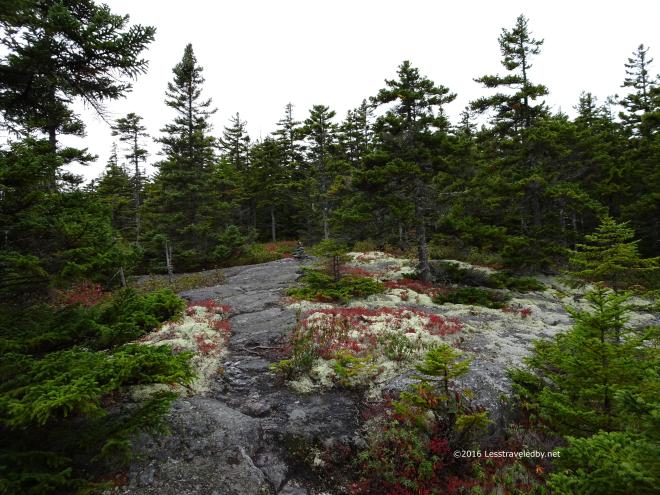 Bald Mtn is not as bald as it once was, but it does provide the first hints of the views to come. It also has some wonderful alpine lichen patches. This means we’re getting up into the sensitive area and its time to start being really careful where we put our feet.
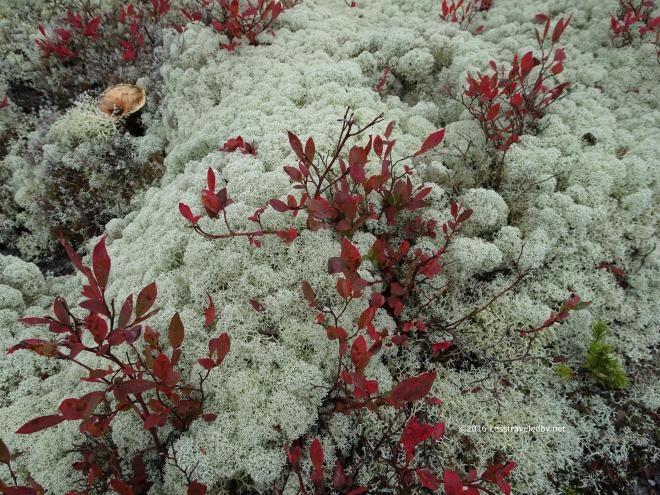 Left untrampled this stuff can have the time it needs to grow which it does very, very slowly. It is great to see a small patch, but when you find yourself in an area with large patches of it all around it starts to feel really magical. To me it signals the entry to the summit areas above the trees and it always brings a smile to my face.
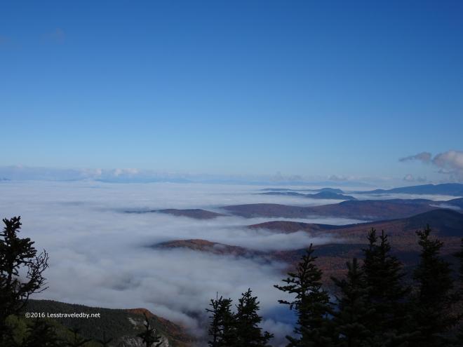
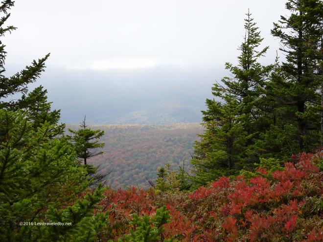 So did the views starting to open out in the space between the clouds just above and the trees below. There were hints of sun sneaking in from somewhere. I was just happy the clouds had lifted enough to be over my head as I was a bit wet from climbing up through them earlier.
 The colors were a bit muted by the hazy air, but those glints of sun were giving me hope things might still clear up before I finished crossing Sunday River Whitecap. Coming up out of these trees on to the summit is one of my favorite bit of trail ever. The views suddenly begin to open up to the horizon which on a clear day can be quite far indeed.
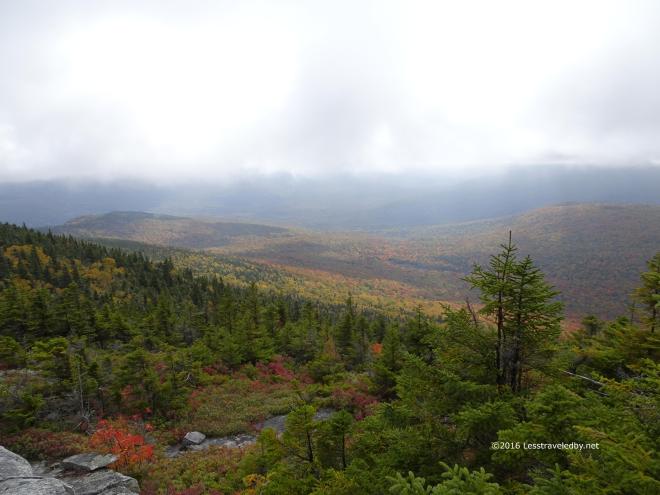 This was a different experience. Interesting in a different way with the muted light and shorter horizon the clouds were creating. So long as the clouds stayed up I was fine with it all. Don’t fall on me…
 Stopping for a break near the end of the summit area I discovered that my legs had something they wanted to say about taking over a month off and then climbing up this mountain with a full pack. What they had to say was, “You will pay for this!!” as I felt the first twinges of cramps tightening up the lower front of my quads. Having expected trouble and well supplied from the aborted LT trip I had some Gatorade pouches along and mixed up a double batch while I was here.
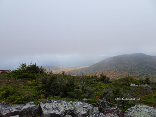 Then it was time to head down the steep pitches that would lead me around Slide Mountain first far off to the right of this view and then across towards the sunlit area to the left of Slide Mtn. This area is relatively casual trail once you get down from the summit, but by this point my legs are always a bit tired. On this trip they weren’t feeling tired, they still were strong from the long summer of training. What they were was angry!! Not only did they start to cramp up in the front of the quads, but I found out that there is a spot in the back of the quad that can cramp up too. Astoundingly painful and a total surprise after a lifetime of football, surfing, cycling and backpacking. I had no idea that was even an option let alone how much it could hurt heh.
Being the sturdy adventurer I am, I of course didn’t stop at the Slide campsite and opted to head another mile or so on to Bull Run as intended. Keeping the legs from cramping up was an interesting exercise in mind over body. No idea if the guy I’d met earlier camped there at the Slide site, but he was no where to be found when I arrived at Bull Run. I have camped at both spots before and prefer both camping and waking up at Bull Run. The water supply is more reliable and you wake up in a great spot to climb Old Speck first thing in the morning, though in that regard the walk from Slide can be a nice warm up before the climb and the side trail there leads down from camp rather than up.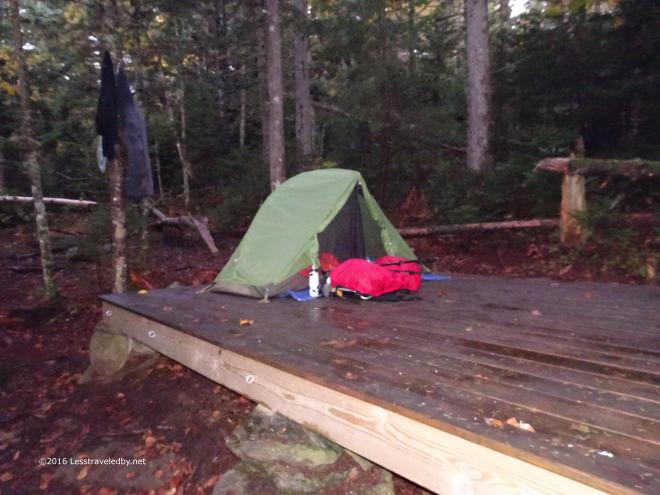 As usual when I camp on this side of the mountain it was a windy night. There were a few branches I heard crashing down in the dark, but the platform was a safe enough spot. It was a bit wet by dawn though with the trees scraping the clouds over night. I was up early that day so only have this quick flash picture before I left camp.
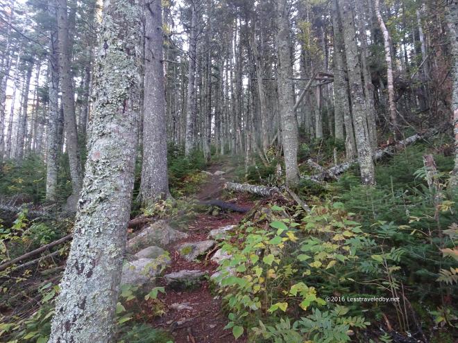 The climb up to Old Speck from this side is much easier than either of the other two approaches via the Appalachian Trail. There is dirt under foot in many places on this side while the huge number of hikers have worn the other routes down to the rock in many places. There are also found here a thing rarely seen in Maine; Switchbacks! The trail really could have gone straight up as it doesn’t seem that steep. I’m guessing they wanted to protect the ground and avoid the deep erosion found on the other side of the mountain.
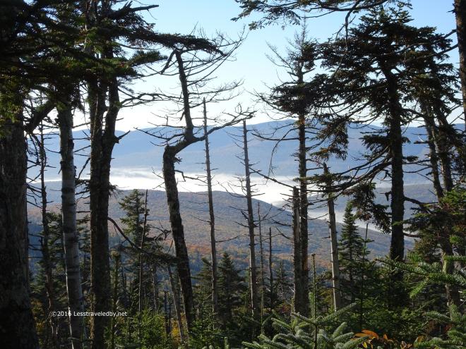 It was a great morning for climbing with cool, damp air. I did stop and take some pictures along the way, but didn’t linger long. The fog in the valleys below certainly was tempting though.
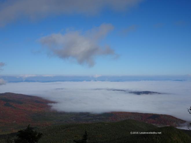
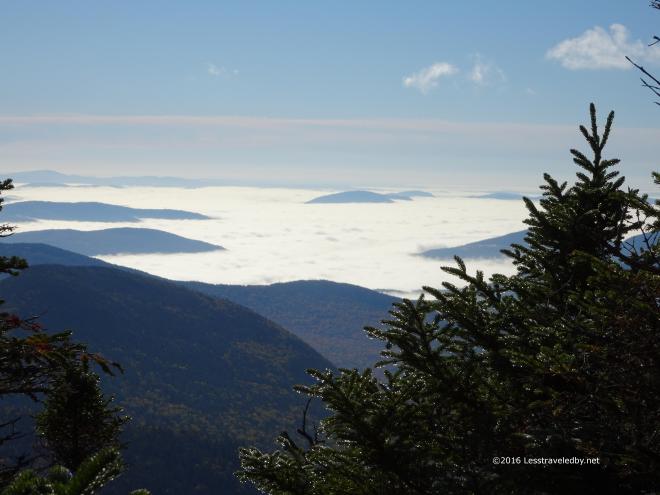 Neat to be in the sun up above looking down on this stuff on such a scale. I was soaked and dripping just like the trees so I really appreciated the open summit.
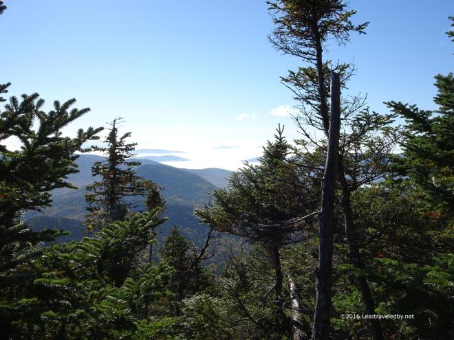 So tempting to just sit here and watch the day go by from this magical viewpoint, but I knew I had the worst of the notch ahead of me so didn’t dare get too comfortable.
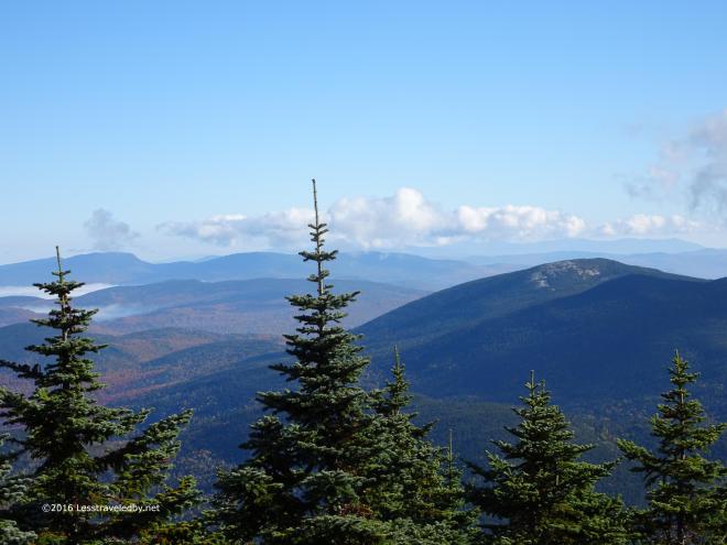
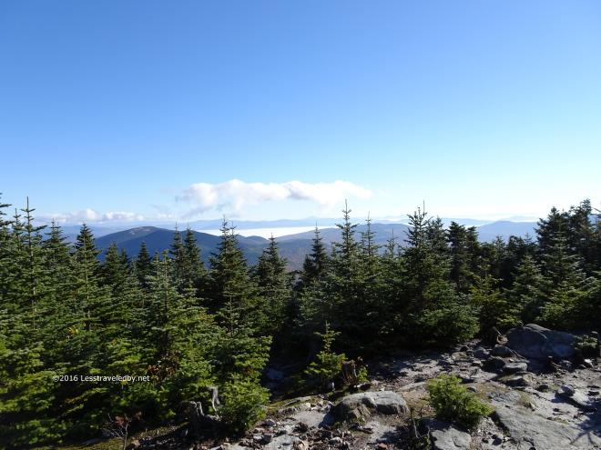 My goal for the day was to get a few miles beyond East Baldpate, the exposed ridge on the left. Not so far as the crow flies, but as seen on the previous trips to this area, the steep notch makes it interesting to say the least.
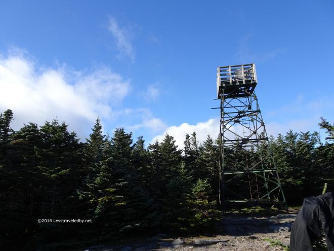 I had my second breakfast with most of my trail clothes laid out in the sun in hopes of drying a bit. That was about as futile as me climbing this dang tower’s ladder or finishing this loop for that matter heh. Still, you have to keep trying. I focused on eating and taking pics rather than wasting any time on the tower this trip.
 It looked like it was a perfect day to be up there on that ridge. Actually it was a pretty good day to be anywhere with a view. Just enough clouds in the distance to make things look picturesque and plenty of blue up above.
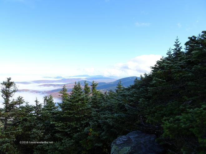
 A few last looks before heading down into the notch.
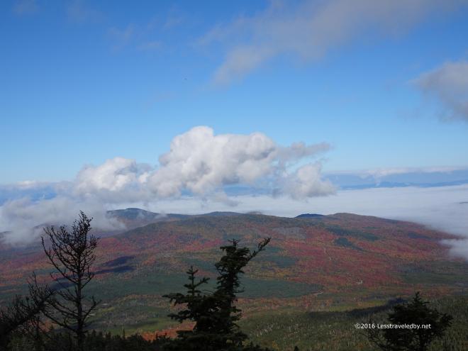
 Well, OK, a few more. Just an amazing day to be out there!
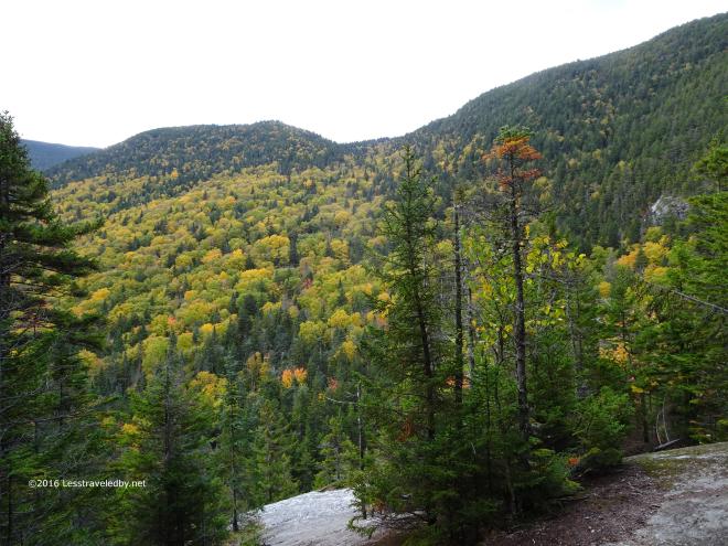 Making my way down towards the bottom but still a long ways to go. This section seems short on the map, less than four miles. The steep, rocky areas combined with some rolling PUD combine to make it both time consuming and tiring.
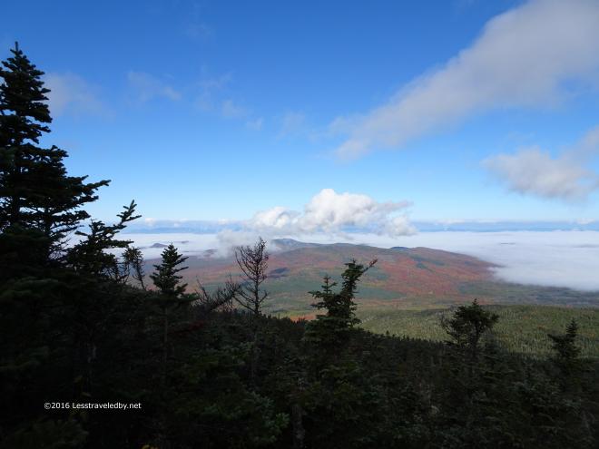
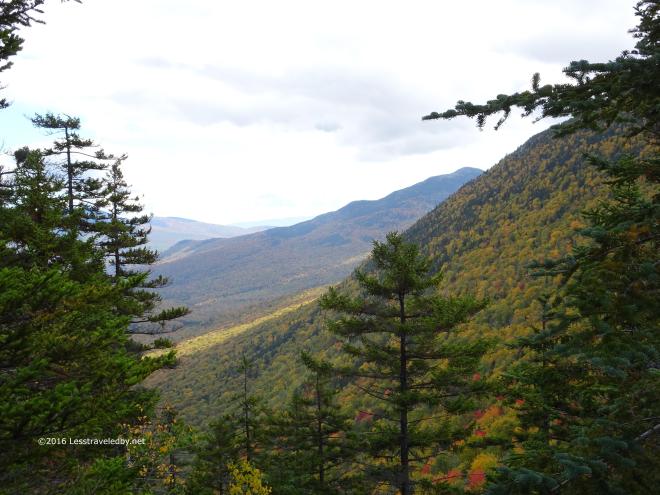 Thankfully there are a few viewpoints that open up on the way down. Color was a bit low as far as the leaves were concerned. Still it gives a person an excuse to stand still for a moment and remember why you put in all the effort.
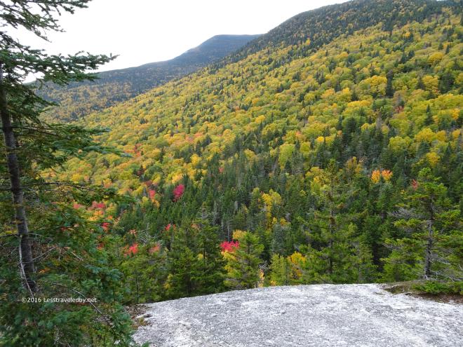 There were a few fiery red maples sprinkled throughout the canopy. I appreciated what I found as I’d come with low expectations due to the dry year.
I guess you could say I came with low expectations about this loop too after all of these years of not finishing it. This time I managed to cross the highway and start up the other side. Watching the clock as I climbed over Hedgehog Hill and towards the Baldpates I could see I wasn’t moving fast enough to make it to the camp on the far side of the mountains before dark. Having eaten my dinner by headlamp the night before I wasn’t excited about doing it again. Knowing the rough trail on the descent the idea of night hiking didn’t appeal much either so I decided to spend the night at the Baldpate Shelter.
The nice brook I’d found there the month before was barely a trickle, but I had the place to myself for a few hours which I used to dry out as much as possible. Well and to eat and eat and then have a snack heh. A couple of section hikers came in just before dark and set up tents nearby leaving me and the mice to the shelter for the night.
I had an extra dinner with me and was thinking I’d change my three night trip into a four night trip. It seemed this might finally be my year to go all the way around this loop. Then I got the bright idea to check the weather report heh. I’ve been carrying a Delorme inReach this year and one of the features is the ability to request localized weather reports. Both that night and in the morning it said I’d be hiking down in the rain and riding home wet on the scoot if I stayed out for two more nights. I don’t mind hiking in the rain that much, but hiking wet and then doing a few hours in the rain on the bike sounded like more than I was willing to deal with. So, I did the “smart” thing and headed back down the mountain the way I’d come up.
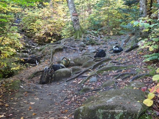 On the way down I was treated to this sight at the upper intersection with the Table Rock viewpoint trail. These folks seem to have just dropped their packs in the middle of the trail and ran off to see the view. Well, either that or it was some sort of mini Rapture, but either way it seemed a bit odd.
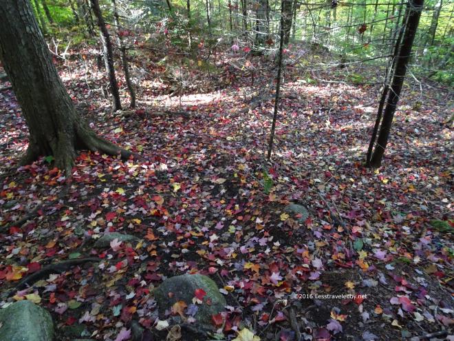 Plenty of other nice things to be seen though. It was a beautiful morning in the forest and I was headed down hill on some steep, but well maintained trail.
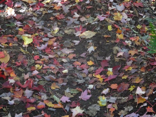 Yup, plenty of time to enjoy the colors and the smells of Fall.
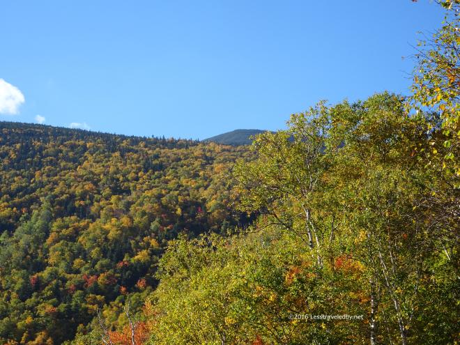 After my relaxing walk down the mountain I had a wonderful second breakfast at the parking area. While there I exchanged my mud splattered hiking pants for a clean pair of hitchhiking pants heh. Having traveled this highway before I knew I’d stand a better chance of getting a ride if I made the effort.
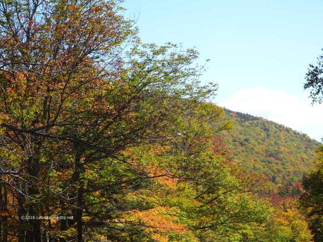 I made it a ways down the road, maybe a mile or two, before a state park ranger stopped his truck and gave me a lift back to my scoot. Time enough to get a few more shots of the leaves. Failing to do this loop had never felt so good! My legs got over their anger for the most part after the first day. I’d been eating like a king since I had LT supplies to use up. Plus the sun was shining and I didn’t have to pay for a tow truck ride home 🙂
Think I’ll actually be a bit sad if I ever actually finish this loop. It has jokingly become my white whale and I think I’d miss it in that context if I go all the way around. Definitely will be back next year to try though!

OMg, thank you for the autumn porn, LS! 😀 Spectacular scenery! I don’t Hike (capital H) like you do, but on my forays into the Boulder foothills I sometimes come across backpacks in the middle of the trail, like you did. (LOVE your “rapture” thought – LOL!) Question: what was your altitude gain?
Stick around for the next report if the Fall leafy stuff gets you going Mouse. I got in one more good one before the color started to fade.
Elevation gain was probably about 3k the first day with another 1300 or so for breakfast on day two followed by the 2600′ descent into the notch with an immediate 1500′ or so from there up to the shelter. I just posted a quick and dirty elevation profile here https://lesstraveledby.net/gltoct16profile/ if you want to see it in graph format. I really need to plan this for four nights if I’m ever going to actually go all the way around. It is some rugged stuff for an old fat man 🙂