
The Grafton Loop is a rather rugged 39 miles or so of trails that circle the peaks that define the Grafton Notch. The state highway rolls and bends below with families enjoying day trips exploring the park areas along the road. Up above, despite the short distance away, is a very different area to explore.
Other than the 7 miles or so that follows the AT, the Grafton Loop is lightly traveled though Puzzle Mt is a somewhat popular day hike. I have traveled sections of the trail at various times over the last few years and have only seen people one time other than on the AT and have never shared a camp location.
This trip was a potential full loop. I brought enough supplies for one at least, but when the time came to decide I opted for just the west side.
 Things started off great as I reached the parking lot at the south end of the loop mid morning. There was a .6 mile road walk to reach the trail, but a great day for walking. I met a guy in the parking lot heading in the other direction who disappeared into the woods headed up towards Puzzle Mt though we two were the only vehicles in the lot early on a Friday.
 The start of the trail on this section is accessed via private land. Most of the trail is either part of a land trust created to protect these mountains or is actually on private land. Camping is limited to designated sites and no fires are allowed.
 The first mile or so of trail is along the route of a snowmobile trail. That works out well because those folks have built this great bridge across the Bear River.
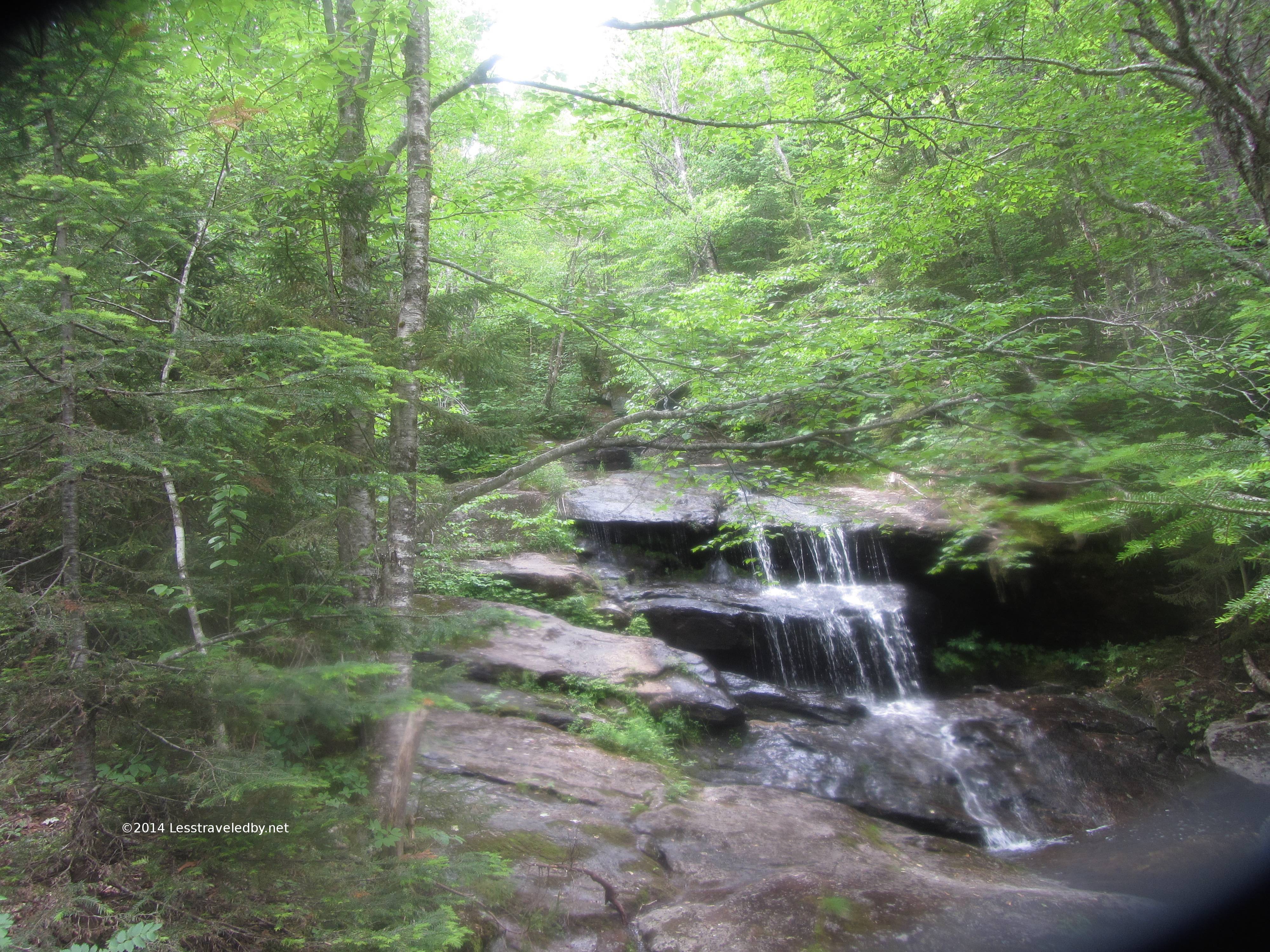
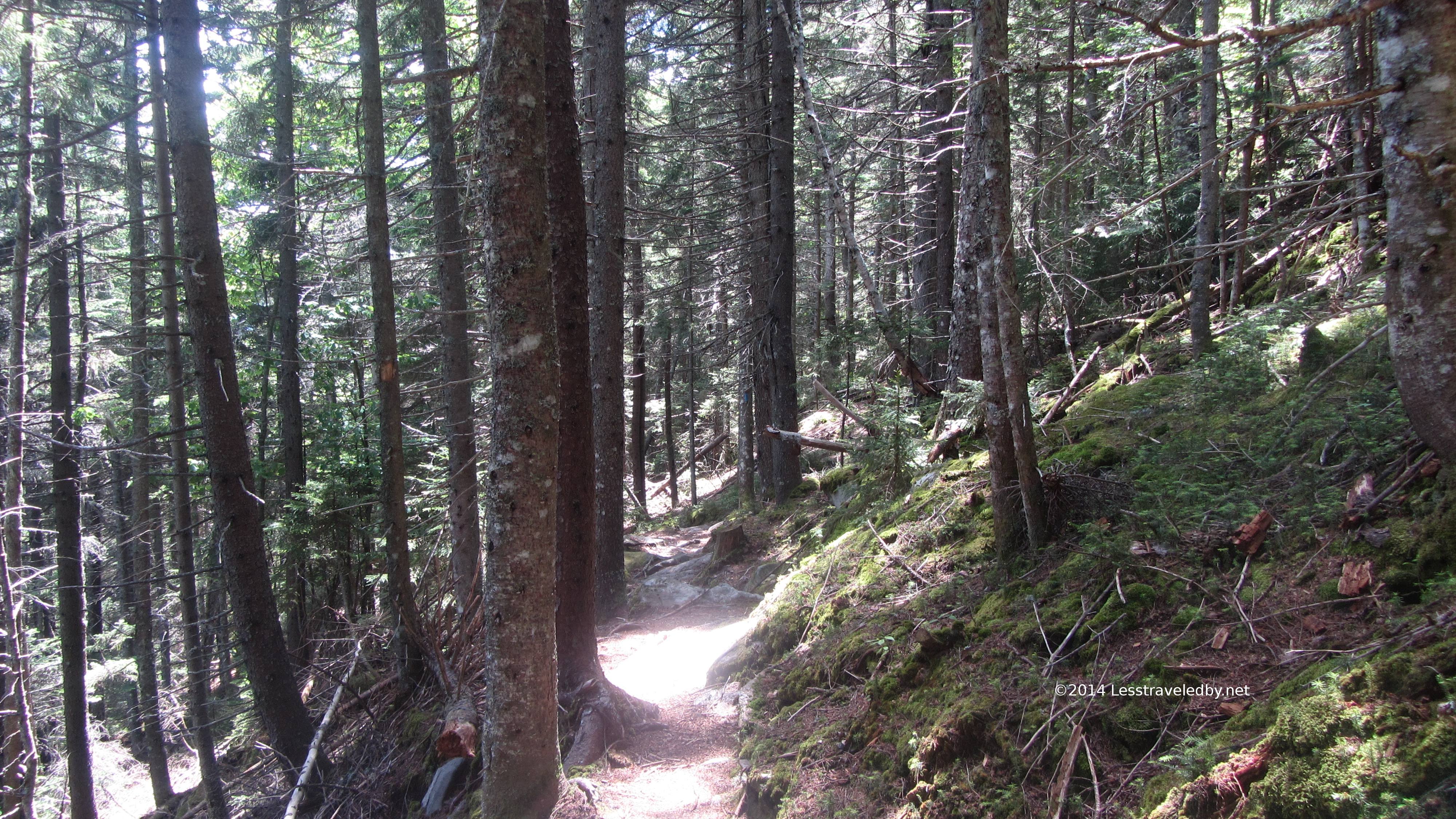 Soon though the trail begins for real with the woods closing in and frequent small creek crossings. There had been recent heavy rain so even though the day was bright it was a bit steamy in the forest at low elevation.
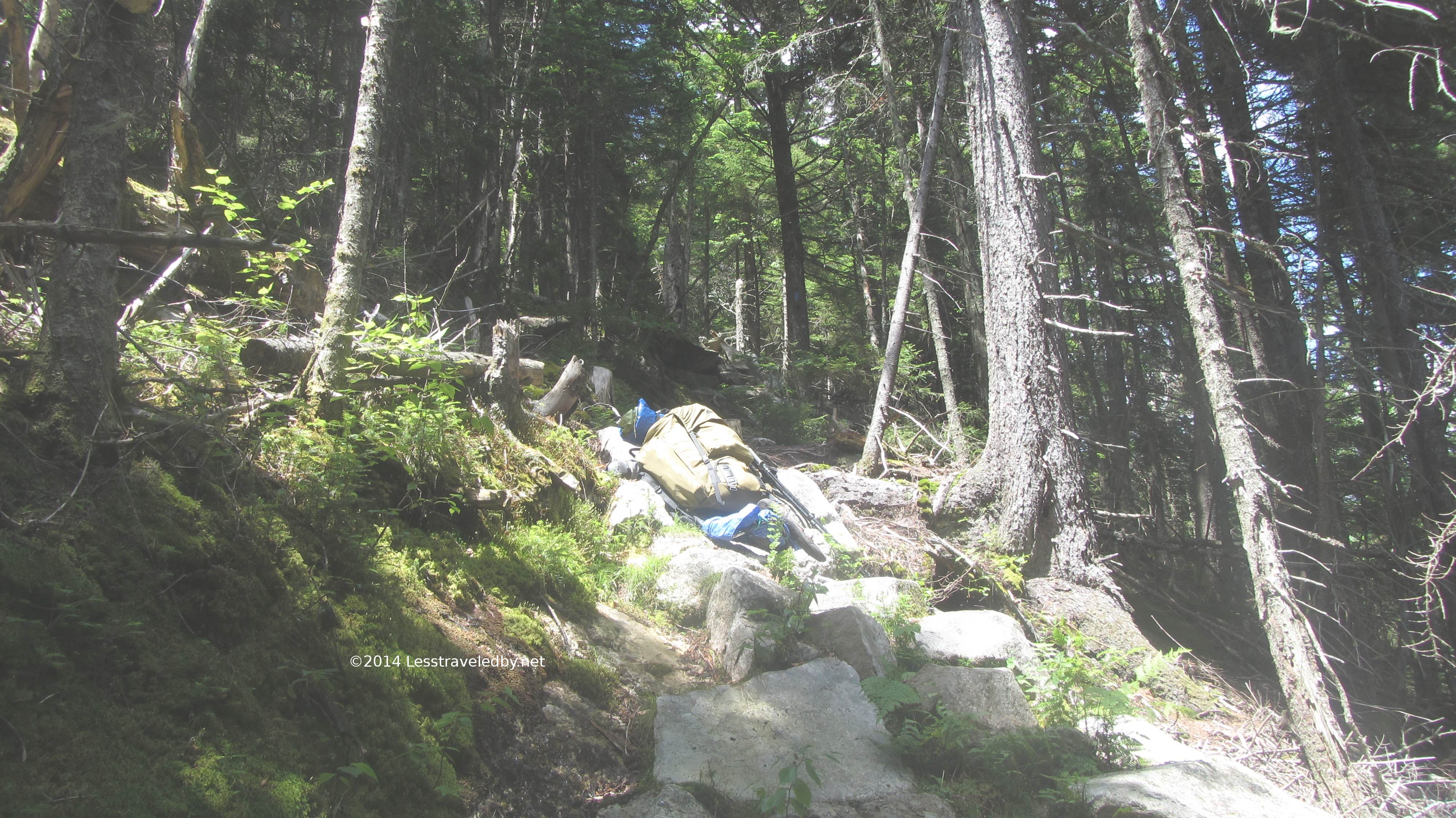 Thankfully I was headed up! Those aren’t some convenient rocks I found to set my pack on for a break. That is the trail heh.
 There is a steady climb of about two thousand feet to reach Stowe peak and then some rolling terrain on the way to the Sergeant Brook camp site. The AMC built and maintains the trail on this side of the loop and they do excellent work. The stairs in this section really protect the terrain below though they are definitely a workout to climb.
 I stopped at Sargent Brook to filter some water. The creek at this site is small even this time of year but was still flowing when I was up there last October and seems pretty reliable. This is a good spot to top off before heading up Sunday River Whitecap. The camp sites are functional, but as with most all of the sites on the loop without view.
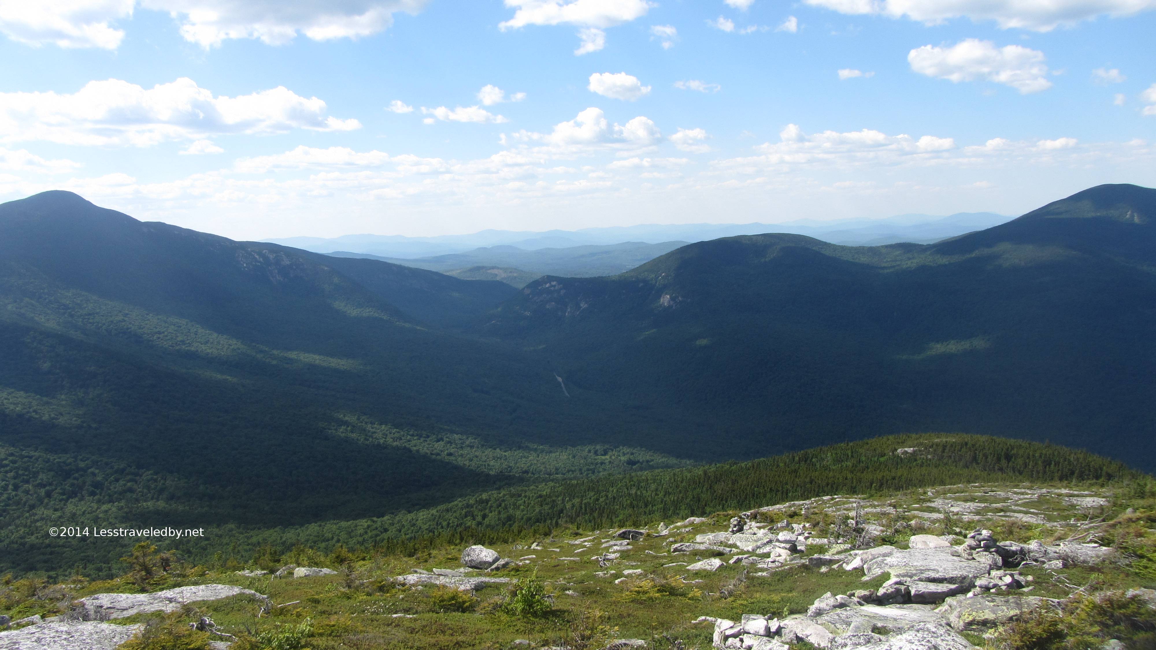
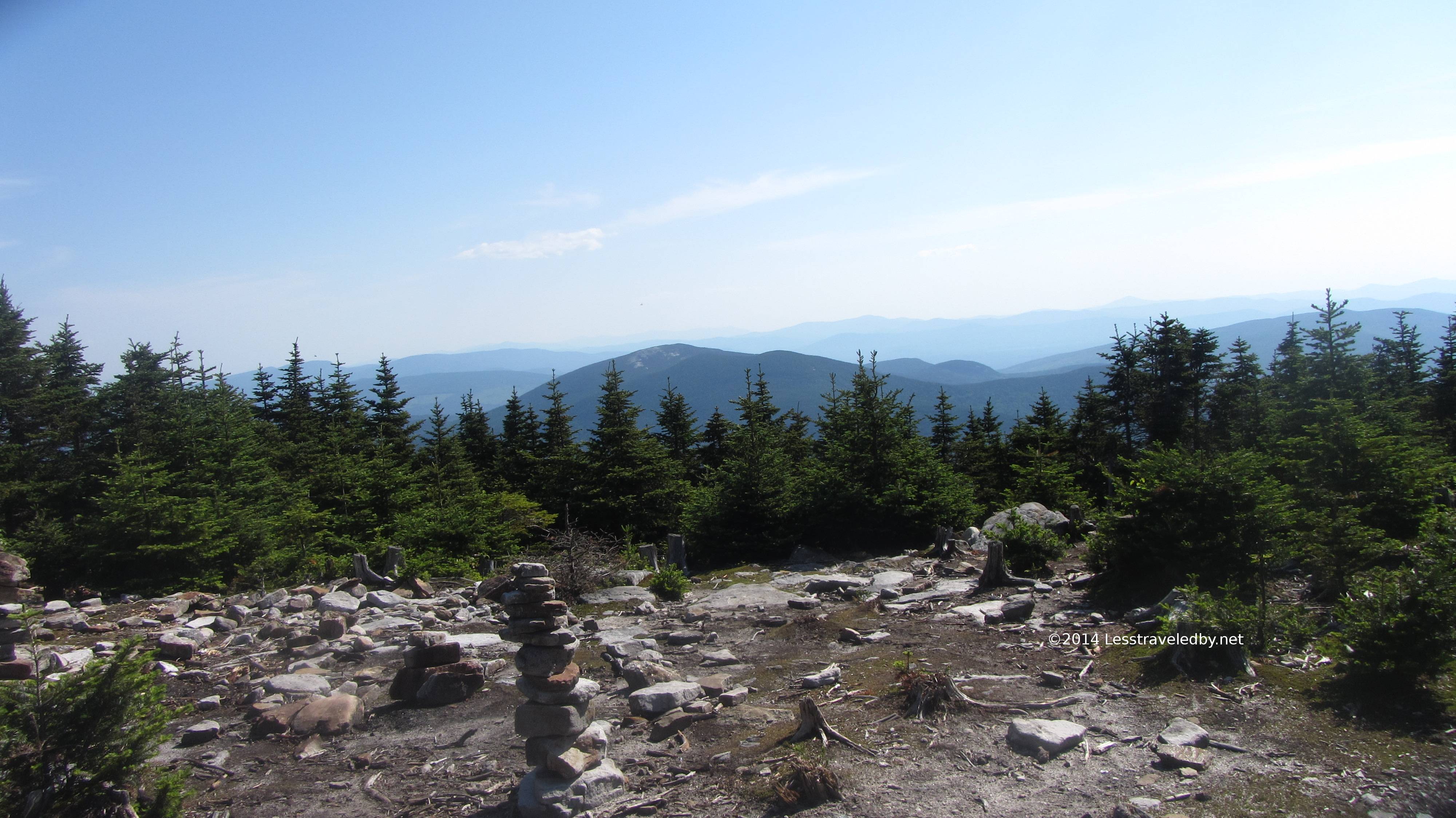
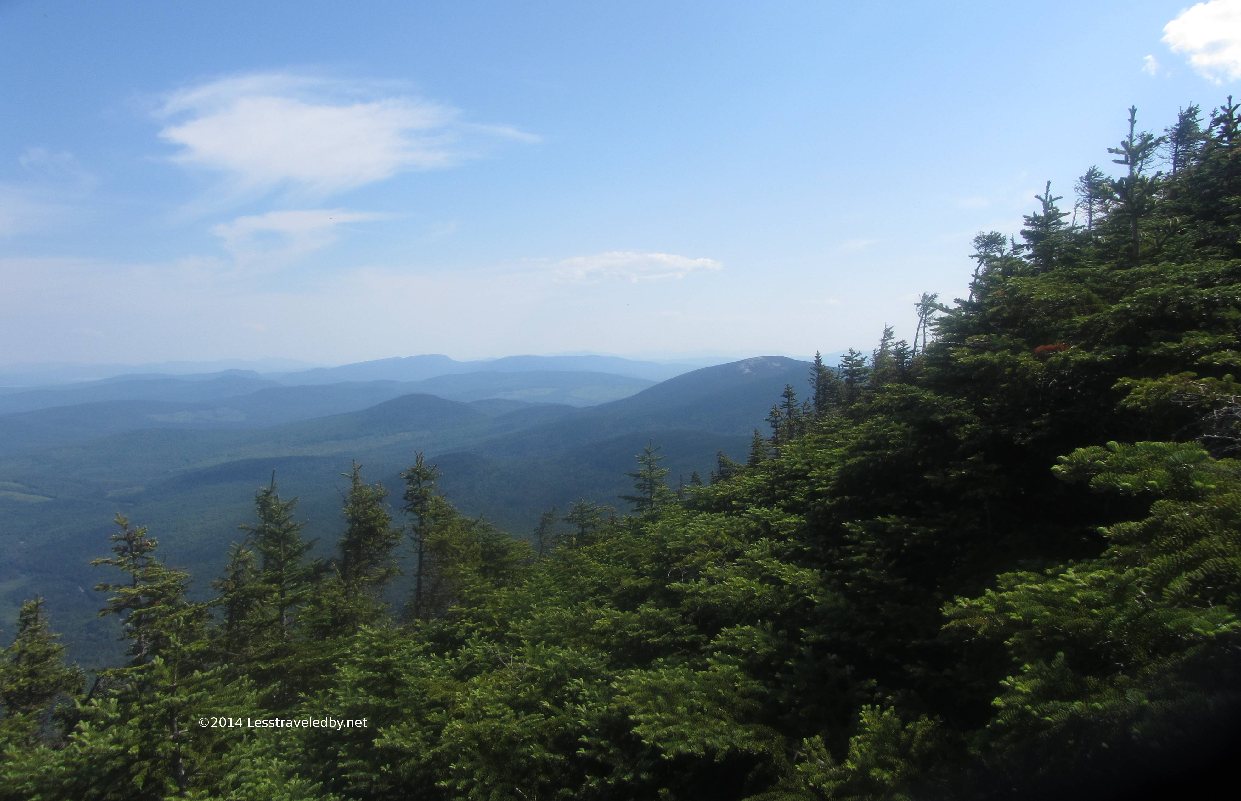
 Working on the six hundred foot or so climb the views started to show through the trees at times. This is looking roughly south into the Mahoosuc Reserve lands where the famed notch lurks.
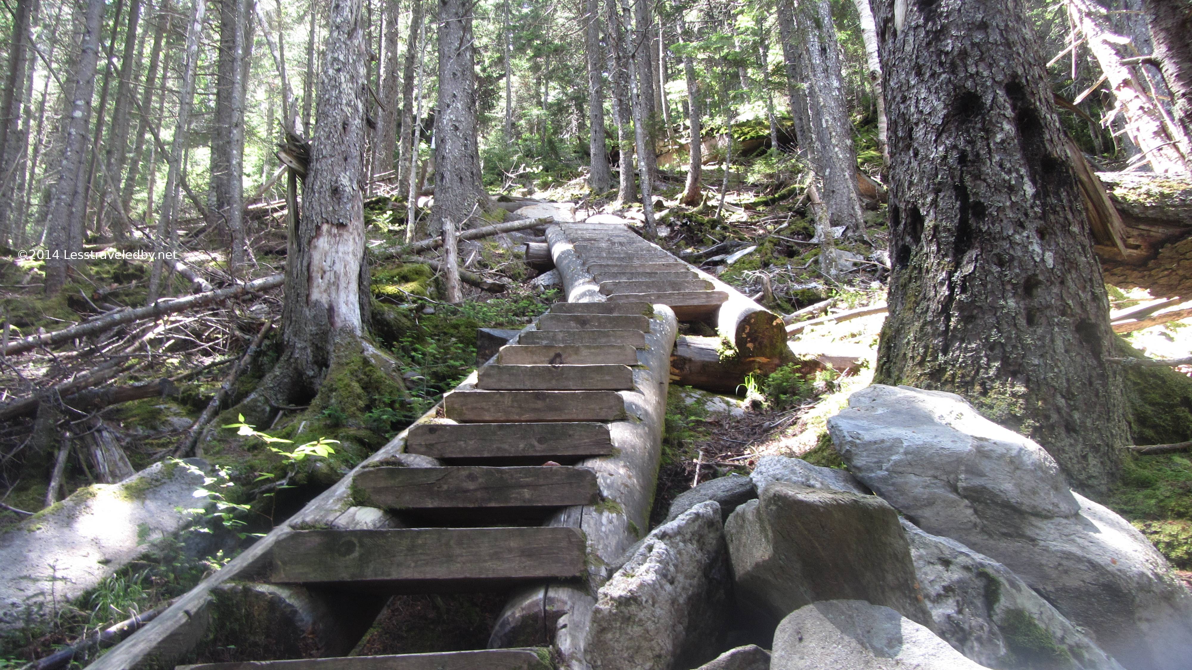
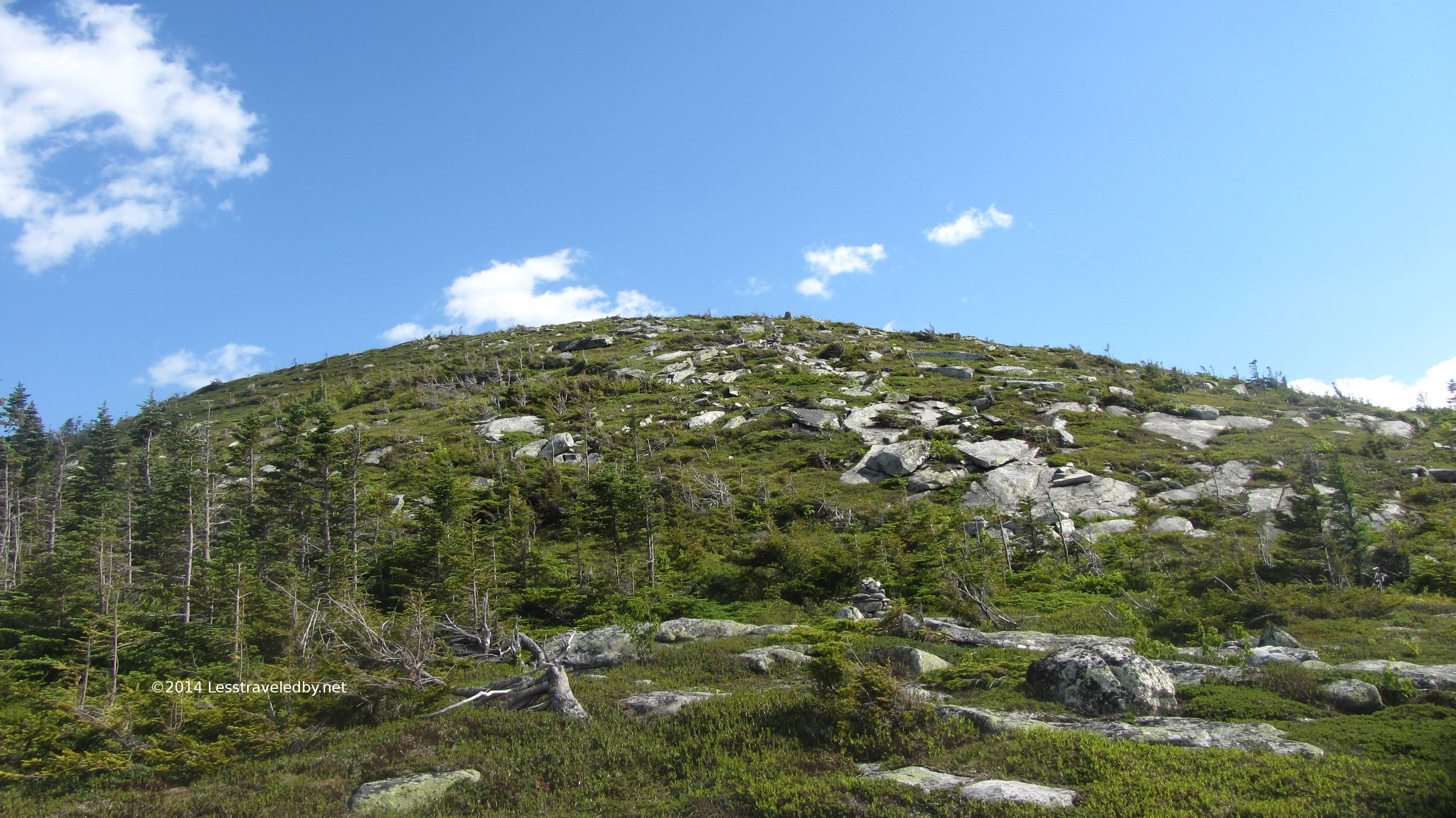
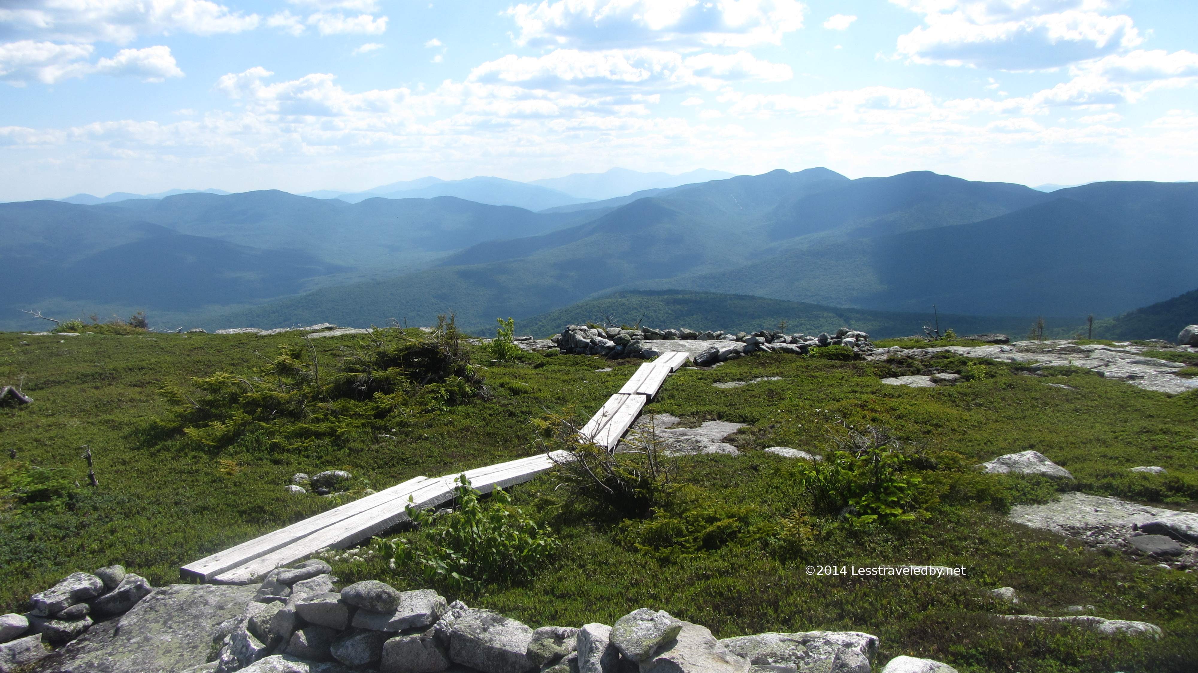 The top of Sunday River Whitecap is completely without tree cover. The sensitive terrain is protected with a series of board walks and scree trails to limit foot impact. Life is hard for plants up here even without people trampling them so the AMC has done a lot of work to prevent damage while still allowing access to the views.
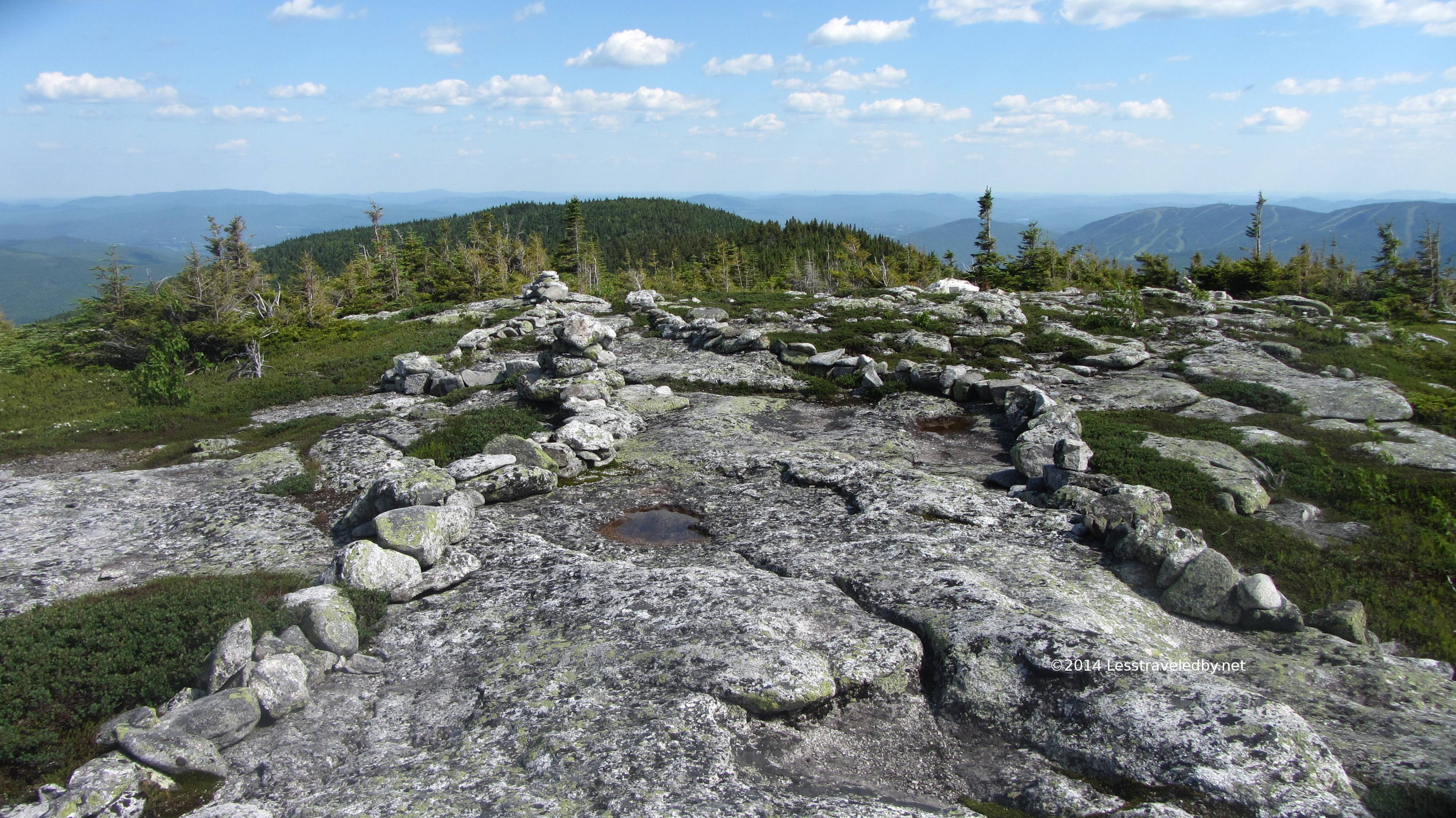 You can see here how scree walls lightly define the trail without really even disturbing the view.
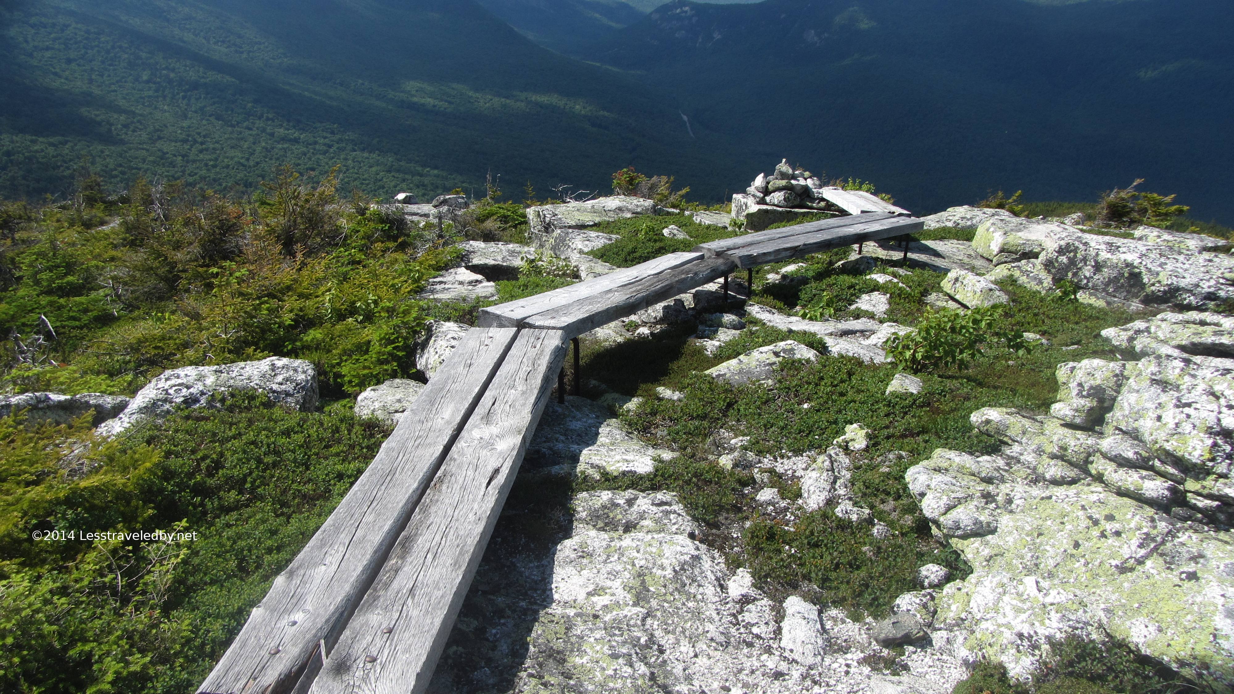 These bog boards are riding on rebar so there is minimal contact with the ground allowing light, air and water to reach beneath them. They also make for an interesting walk across the top of the mountain.
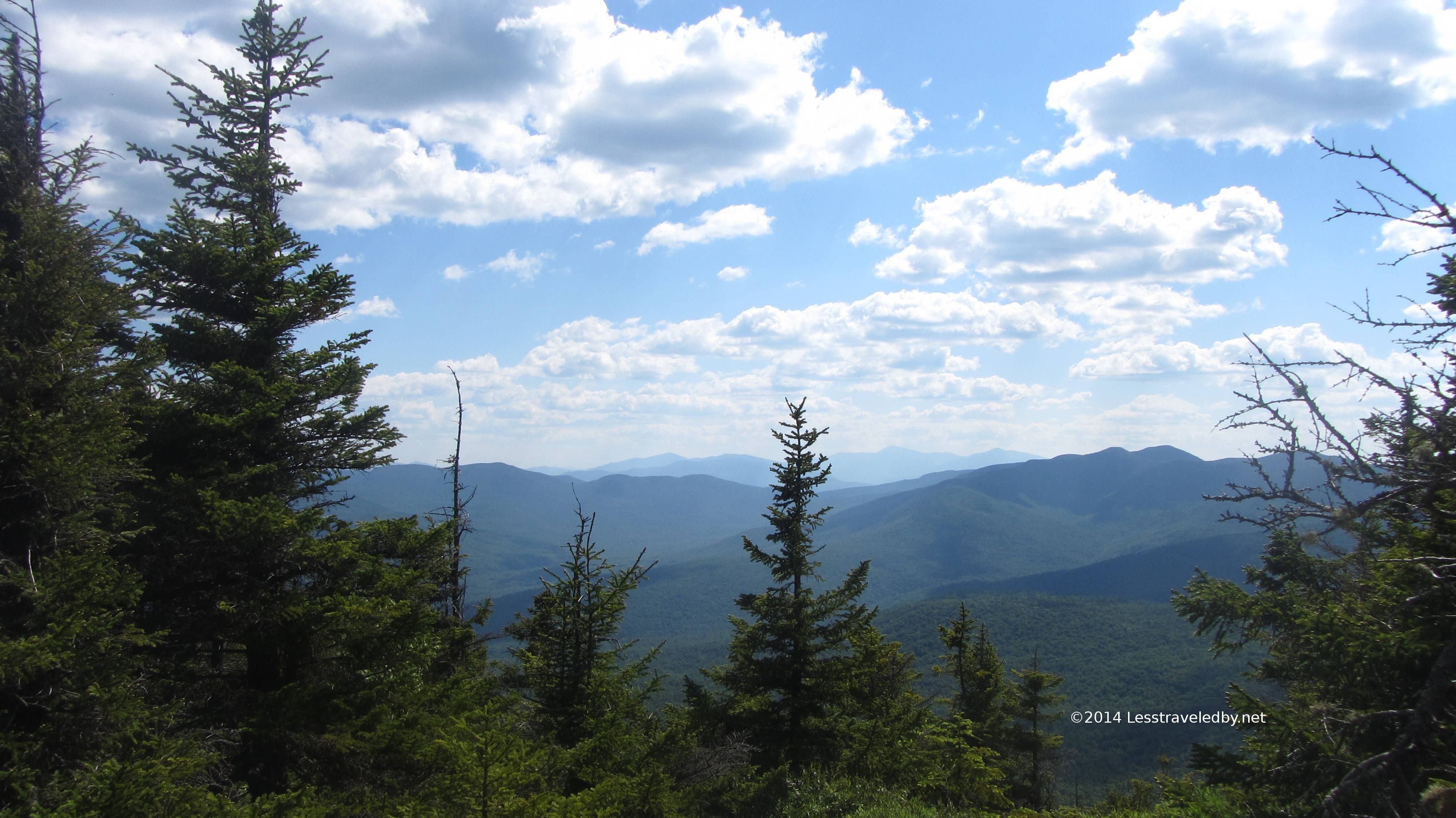
 This is the view looking north, across the notch, at the Baldpates. The eastern side of the Grafton Loop climbs them via the AT before splitting off to the east towards Puzzle Mt. I had previously stood on that side looking this way, but this was my first time seeing them from here.
 Looking west down into the notch and towards New Hampshire beyond. It really was hard to not stay up here as the weather was great, the bugs minimal and views in every direction.
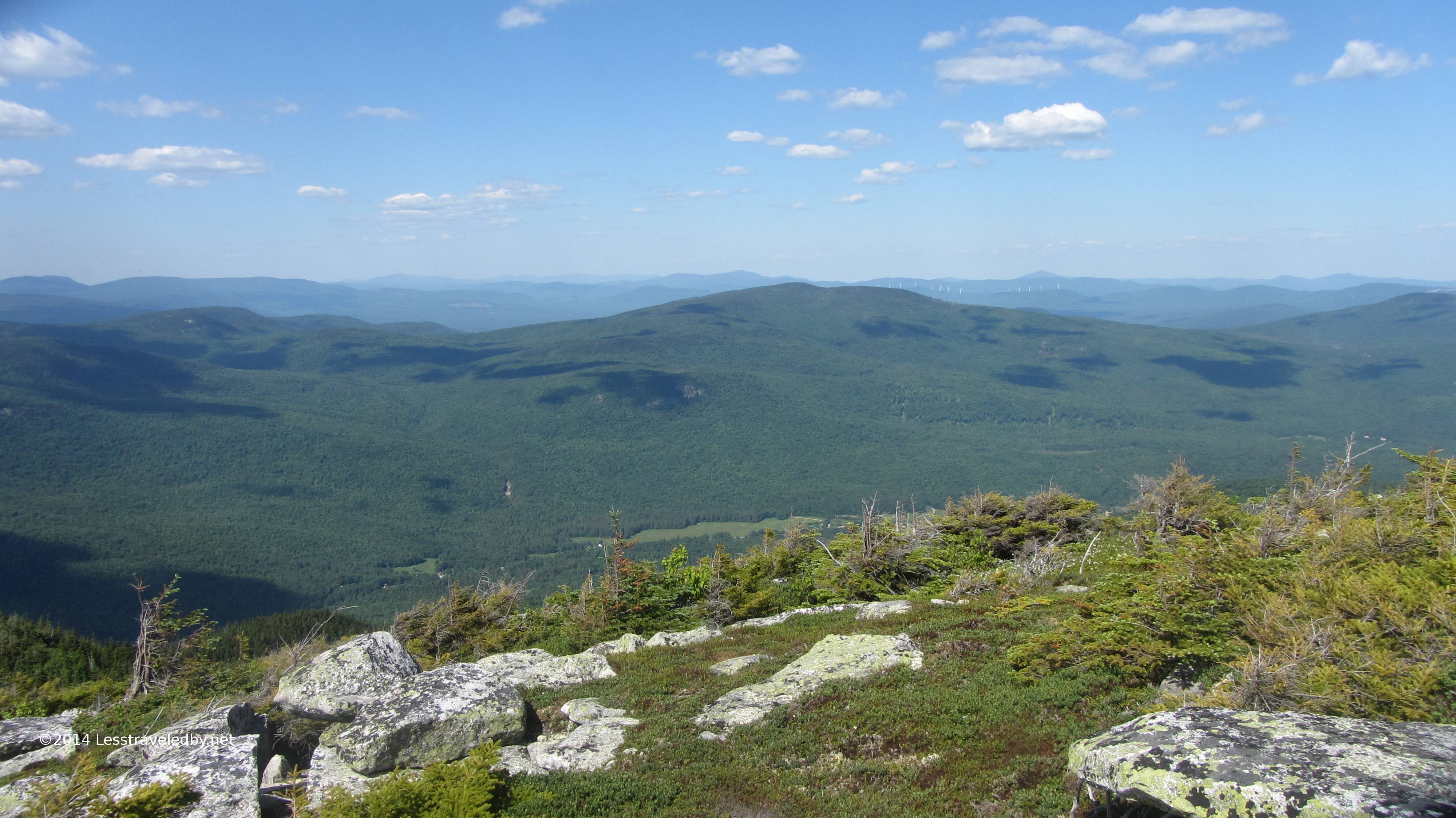 Another view looking north past Long Mt. Katahdin lies up that way but I don’t think we can see that far in this hazy sky.
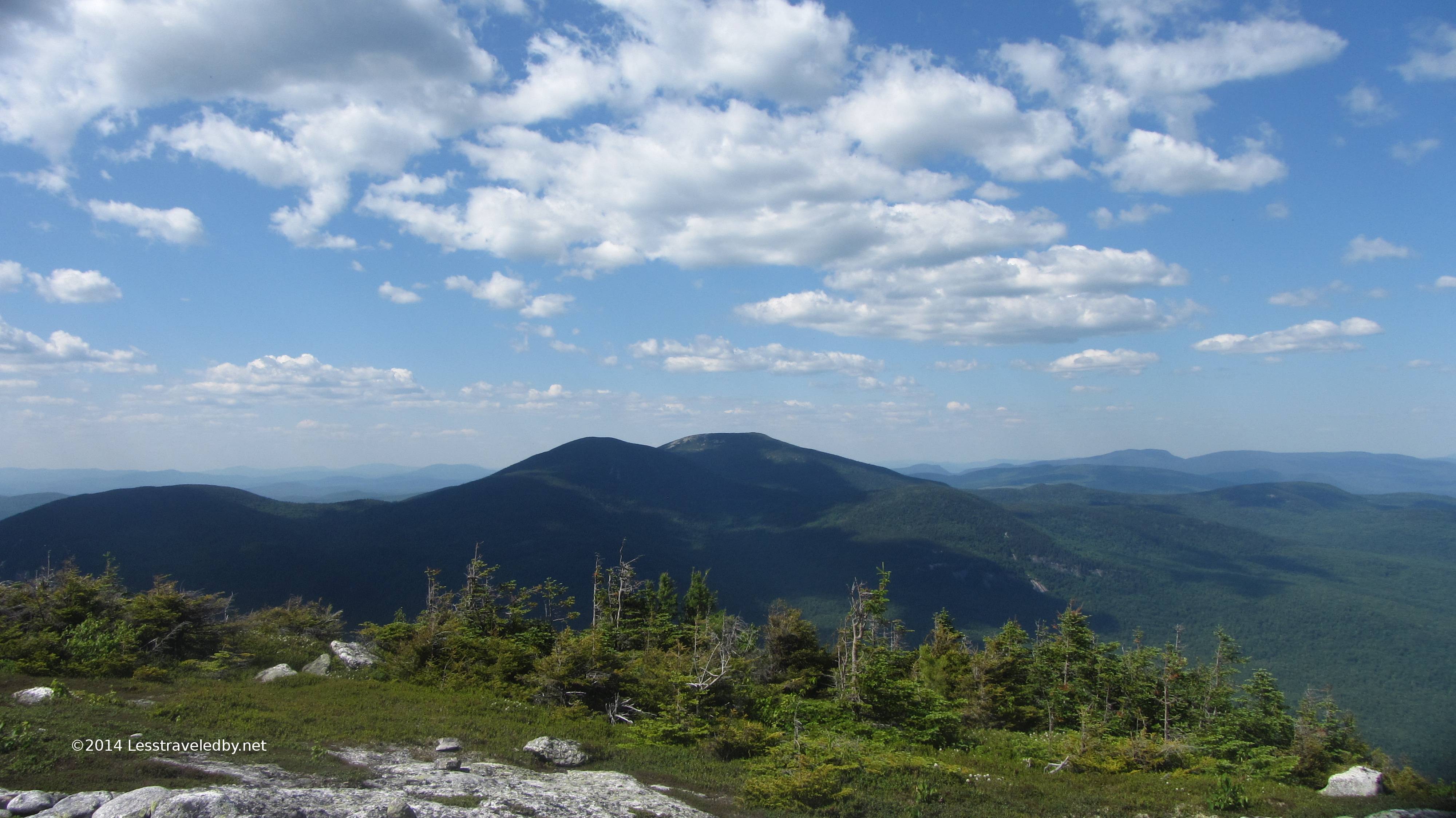
 Here is the view looking back up Sunday River Whitecap on the way down to the saddle towards Old Speck. Again the trail here is almost entirely defined by scree and small cairns.
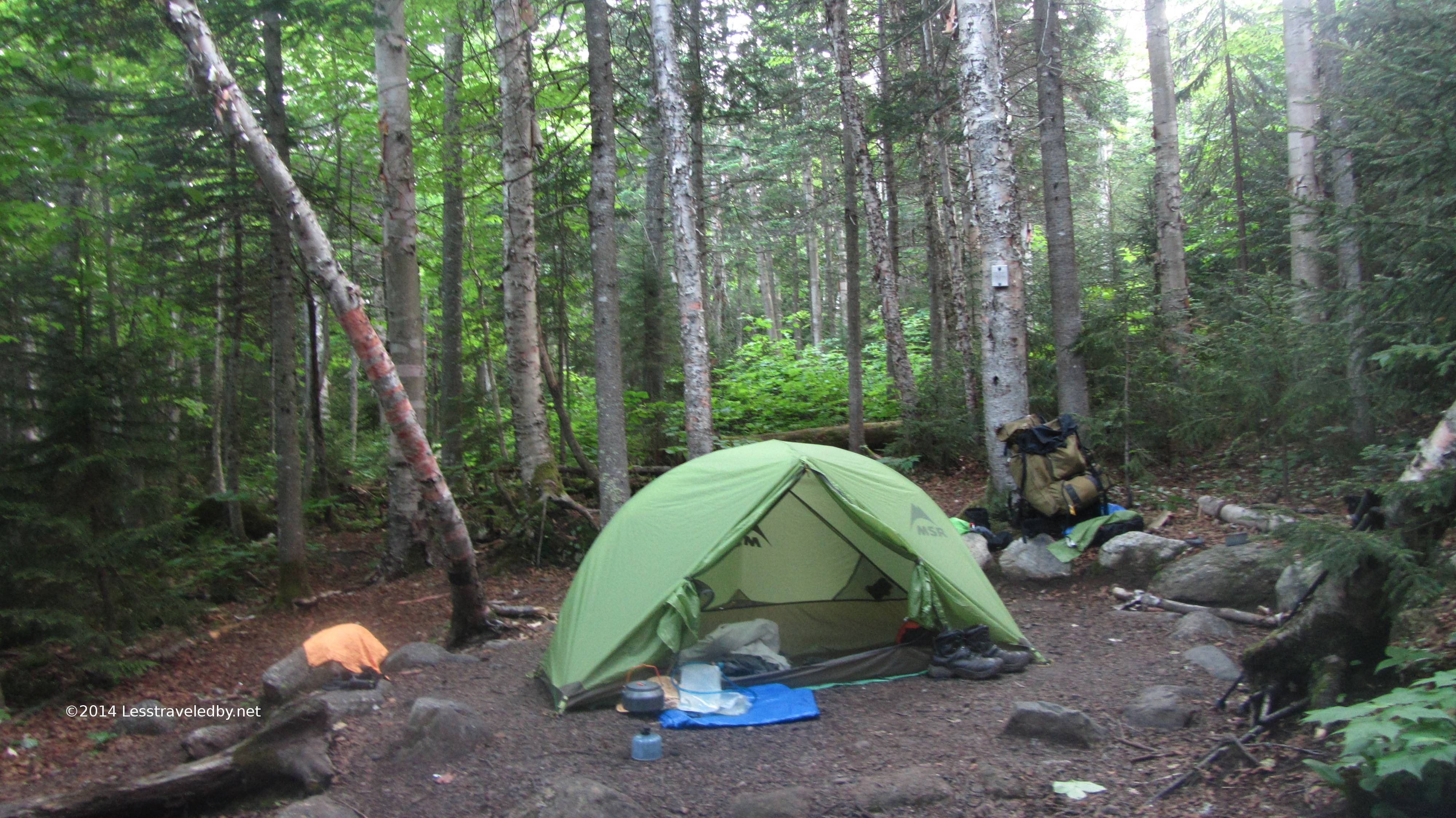 Early morning at the Slide camp site. My night here was incredibly peaceful. I arrived in time to filter water for the night and the next day so I could get an early start. There is a communal cooking area between the two camp sites which has a large, sturdy metal bear box which I took advantage of even though my supplies are pretty smell proof.
That first day covered about 10.5 miles of trail and using rough numbers involved about 3300 feet of up while giving back about 1500 feet of down. That doesn’t include all the little rolling bits, just the major elevation points. Apparently that was a bit much for this early in the year as my legs did some very creative cramping after dinner. One was in a spot I didn’t even know had a muscle heh.
Once the legs calmed down it was a great night of napping, listening to the woods and I even saw a star or two through the trees at one point. I recall waking up about a quarter to four with the sky just hinting at first light and noticed the woods was entirely silent. The night creatures were headed to bed with the morning shift not quite up. Not even a puff of wind in the trees…just quiet. I celebrated by going back to sleep for two hours!
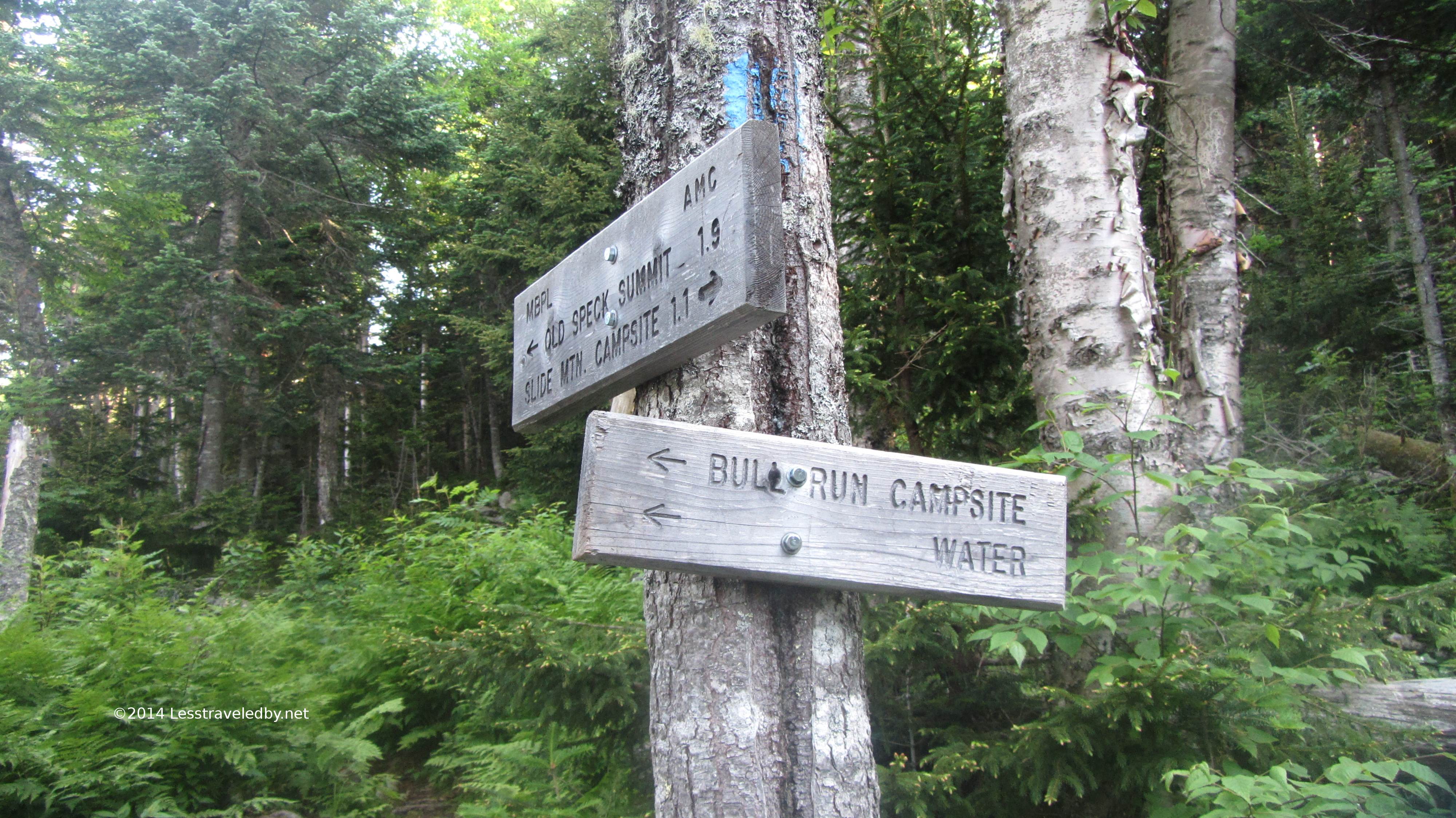 Then it was time to climb some more. The first mile or so to the Bull Run camp site was just a rolling climb and I knocked that out in half an hour. Not wanting to lose my morning momentum I didn’t stop to explore this camp, but I’m betting folks doing the loop in the other direction are happy to arrive here after going over Old Speck.
 The last two miles or so up to the summit were a steady climb through the forest with enough switchbacking that there was never a sense of going straight up. It took me a bit less than two hours to get up there and my legs were feeling great at this point. Just a few miles down this mountain to the bottom of the notch, then the climb back up to that peak right over there and down the back side to dinner.
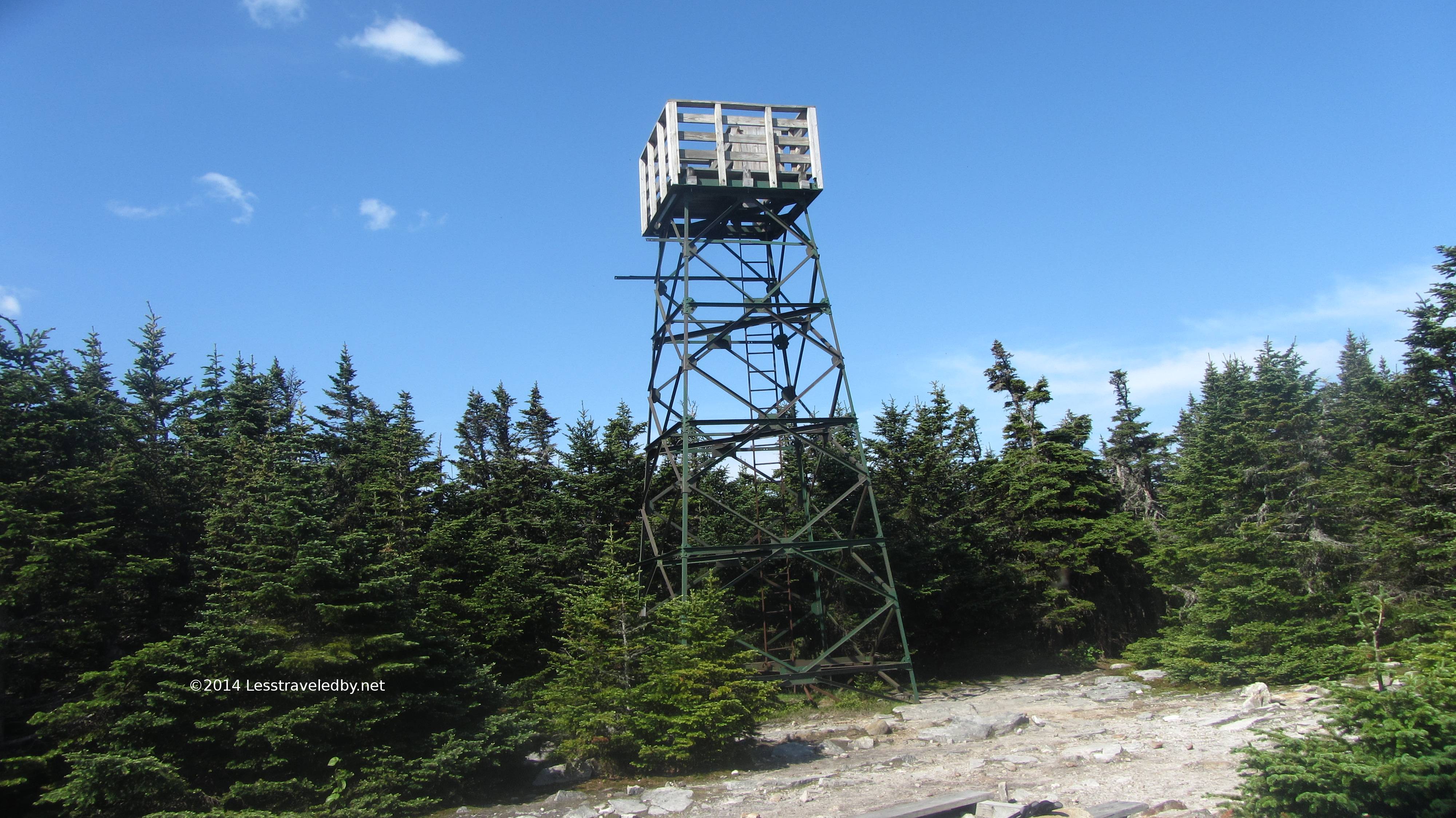 I figured I would just set down my pack and climb up the fire tower to take in that 360° view. I dropped my pack, picked up my camera and then realized the air around me had turned to flies. The dreaded blackfly had appeared and in great numbers. I considered fishing out my head net and DEET, but instead opted to pack up and flee for my life. If they don’t drain you of blood individually they will suffocate you in numbers. They owned the summit that day but no matter as I had a mountain to climb down.
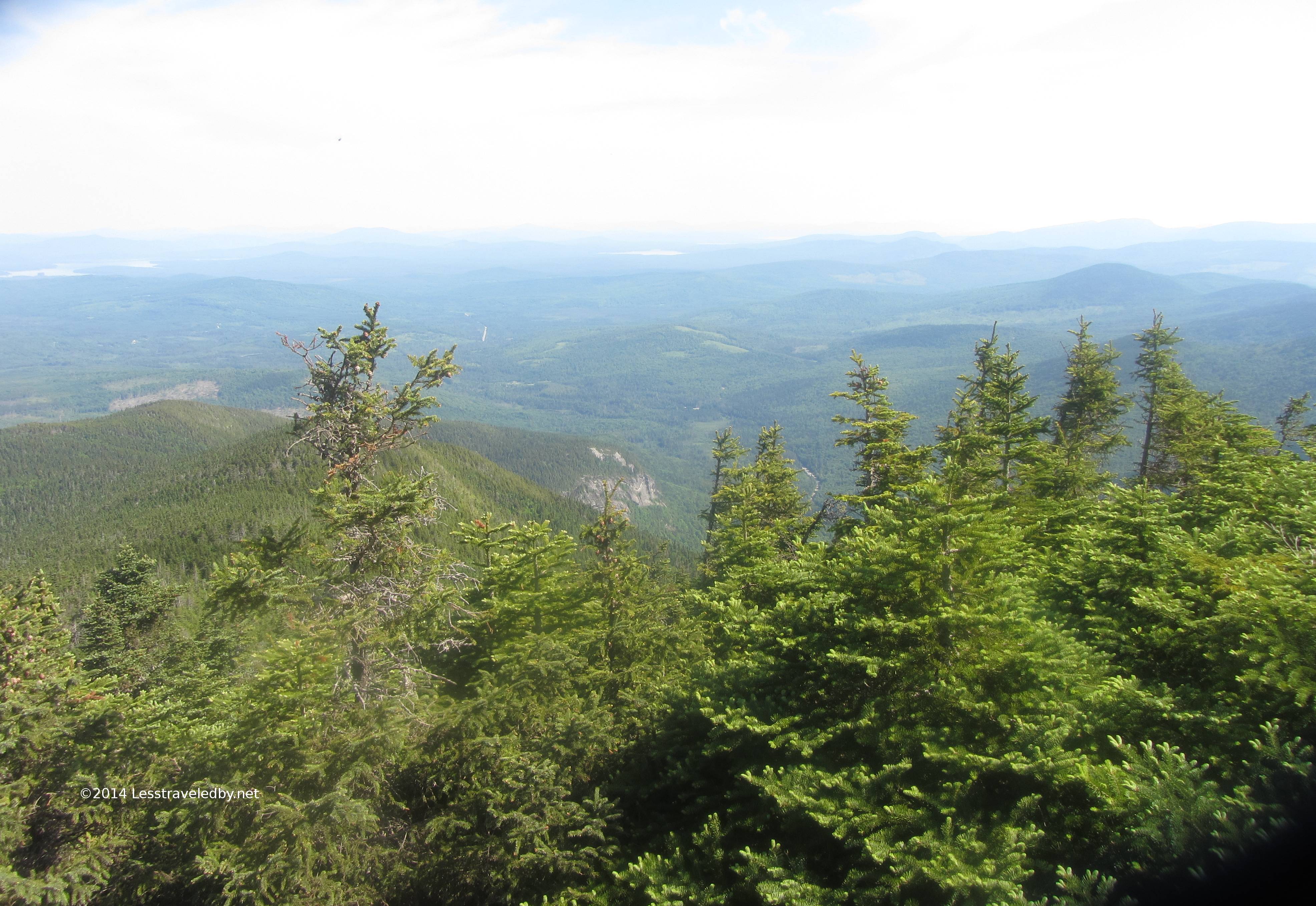 Soon after the summit the loop joins the AT for the next few miles down into and then back out of the notch. This view is just before the trail plunges into the forest for the descent. That rock feature in the middle distance is where the Eyebrow Trail branches out and across the ledges.
 One last look at the views before heading down. I remember still feeling pretty good about my plan to do the whole loop at this point. Then I headed down the mountain.
The AT being so much more heavily traveled is a very different trail than the rest of the loop. The dirt has been eroded away in most places leaving exposed rock as the primary surface. In some places the rocks are boulders and you have to find your own way down from them as everything has been worn away around them. The terrain here really took a toll on me and my pace slowed to a crawl.
I kept looking at my watch and seeing time go by but I could tell I was not making much progress. Part of that whole Situational Awareness thing is to be constantly collecting data and analyzing it. Running through that process as I hiked I went from realizing I might have to consider changing my plans, to considering changing my plans as I made my way down to the parking lot at the bottom of the notch.
 I filtered a few liters of water and packed an extra liter as well still thinking I might be going ahead, but by the time I reached the parking lot it was almost 2pm. My intended camp was more than six miles on with a couple of climbs totaling about twenty five hundred feet and even if I climbed well it would be a pretty late arrival. I considered just climbing up to the West Baldpate AT shelter, but decided to err on the side of caution and road walk back to my motorcycle. I may have been influenced by visions of a cheeseburger, but I’ve climbed that mountain before on fresh legs and it wasn’t easy so that was part of the decision as well.
After coming home I had to look at the elevation profile again to appreciate just how steep that descent is. In about 4 miles of trail there is a roughly 2600 foot net loss of elevation. Climbing isn’t easy, but descending is the hardest part for me and this trip really underscored that. I’ve been looking at the LT profile as well and see a couple of mountains that are going to hurt going down. The next few months are going to require some work to improve on that skill or it is going to take me a very long time to get to Canada!
Hopefully I haven’t scared you away from this beautiful trail with my story about a broken down old man. A few days of eating and I’m already thinking I probably could have made that climb. A few days more and I’ll be thinking I should have heh, but I’m pretty sure I made the right call. Just as the body recovers so to does the spirit. I had a few doubts about Vermont, but now I’m thinking in terms of getting better prepared.
I definitely can recommend part or all of the Grafton Loop if you are looking for rugged adventure. If you go don’t underestimate the terrain. Previous trips there had taught me to respect the climbs, but now I have a pretty good respect for the descents too. Also if you go, please abide the rules. Respect for the land owners is vital to keep this area accessible. All it takes is one person to ruin it for everyone so camp at the sites, don’t build fires and pack out your trash. Keep it clean, keep it safe and keep getting out there on this great path less traveled by

Pingback: Grafton Loop West Side Trip Report June 2014 | Less traveled by