Trailspace Review Contest

elie650

Check out their post at the link below for details:

http://www.trailspace.com/blog/2015/07/01/win-elie-kayak-lavika-paddle.html

If you aren’t familiar with Trailspace they are worth a visit whether you are interested in writing reviews or just reading. Gear for most outdoor, back country activities is covered by real people with real experience using things in the real world. Check them out if you have a few minutes between adventures.

June Visit to the Bonds

June Visit to the Bonds

Two nights resulted in hundreds of pictures and many videos despite some rain the first day. I’ve whittled it down to 39 pics for this post with several videos to follow including a great sunset time lapse.

The first day’s hike took me across the river and into the western side of the Pemigewasset Wilderness for a change. Previous adventures have taken me on the Twinway from Galehead to Zealand but I didn’t have time to make the side trip over Guyot to the Bonds before. While I knew I wanted to get this trip in before things got too crowded in this popular area the weather was uncooperative. It took three weeks before I could find enough breaks in the weather for both the motorcycle ride to NH and a trip up the mountain and even then I knew I’d see at least some rain.

IMG_4435a

A trip last year saw me headed out as far as the intersection with the Bond Cliff Trail, but that time I’d continued out to 13 Falls on the Franconia Brook Trail. This time I followed the old rail bed into the wilderness with the sound of the Pemigewasset River coming and going through the trees but the water rarely in sight.

I ran into a group of young men at the intersection where the Bond Cliff Trail heads up away from the river and the now abandoned section of the Wilderness Trail that used to lead across Black Brook and then the Pemi via a couple of bridges since removed. They had been thinking of following the old trail and crossing the river but found both were obstacles better left unchallenged. I gave them some ideas on where to look for camp sites and warned them a storm was forecast to come though soon so they’d best not wait too long to get set up. Being young they may not have listened to my old man advice, but hopefully they stayed dry enough.

IMG_4436a

I ambled up the beginnings of the notch that Black Brook descends from and soon began to feel a light rain begin to fall. There wasn’t a definite target for a campsite that night so as soon as I felt the light dim a bit and the rain begin to become more steady I stepped off the trail near one of the water crossings and found a place many before me had spent the night. Definitely a bit more over used than my usual camps, but it was there when I needed it.

Just before the rain began to get serious I managed to get a tarp strung up hastily from whatever anchor points I could manage quickly. That let me and my pack hang out under its protection while I snapped together my tent pole and set up as dryly as possible in a storm. The rain was pretty heavy for a few hours which gave me time to cook and eat dinner, set up my bed and even relax inside the tent in dry clothes for a bit before it turned to intermittent showers.

The rain had been incredibly loud pounding on both the tarp and my rain fly. I decided while laying there that when the rain let up I would take down the tarp so it didn’t wake me up if more rain fell during the night. The picture above is from when I was starting to take it down. While doing that I began to notice a birch tree near my camp that hadn’t caught my eye earlier. It was dead and in process of falling down around my camping area in small, but heavy pieces. The more I looked at it the more I didn’t like it, but finding a spot for my tent that wouldn’t also collect water if it rained heavily was hard. I went back and forth before finally moving a fair bit away to a spot I felt better about. I checked in the morning and nothing had fallen where I was, but I still slept a lot better knowing that thing wasn’t looming over my head.

IMG_4439a

This little brook was not far from my camp and there was a nice fallen log there to sit on. I had breakfast there in the morning and watched a hiker with full pack slowly work his way across with no idea of me being there.

IMG_4440a


I had the camera out to take a picture of my camp so I thought I’d get a shot of my new hat. Finally retired the straw hat last year and thought I’d try one of the popular light cloth ones to replace it. It doesn’t provide as much protection, but it does pack well unlike straw.

IMG_4443a

After breakfast I started heading up through the wet forest. The trail soon went from a balance of rocks and dirt to mostly rocks in many stretches. There were several crossings of Black Brook as well as other wet spots. Combined with a couple of switchbacks this section picked up a little elevation before giving a view of what was to come.

IMG_4445a

I was a little blown away by the perspective when the trees opened up and I could see what remained of this side of the mountain before me. That bit of rock poking out of the top was where I was headed, but it seemed much farther and higher than the map implied.

IMG_4449a

That beautiful green canopy against the clearing sky the storm had left behind was a great motivator though. I laughed to myself that the only way to find out what it looked like from above was to climb up there and it wasn’t as though I was going to turn around without at least trying so I might as well get going.

IMG_4452a

Soon after that I was rewarded with this great stretch of trail. With rare White Mountains dirt and a thick carpet of pine needles it made for a steady ramp that gained a lot of easy elevation while traversing the slope.  It also had the benefits of both views and breezes hinted at between the thinning trees.

IMG_4453a

They don’t put up many signs in the wilderness, but this information was worth the intrusion. Life is hard enough on the plants in alpine areas and they can’t afford to take abuse from us. Of course some moron built a campfire on top of the cliffs, but I see that as all the more reason the rest of us need to do our part.

IMG_4454a

Speaking of cliffs; I found those rocks I’d been looking for. Now I just had to figure out how to get up them. The ledges provided pretty good toe holds but not much for the hands. With a full pack I took my time working my way up reminding myself what I tell my four year old daughter when she is climbing things, “One hand. One foot. One hand. One foot.”

IMG_4458a

Looking back down you can see not only the sign at the base of the cliff, but the first views of why I made the effort. Above the trees the breezes were free to roam and it was a beautiful day. Right after a front moves through is often a great time to be up top taking in the views.

IMG_4459a

Looking down the Pemi valley back towards the trail head I came in from. You can make out the ski runs at Loon Mt beyond.

IMG_4460a

IMG_4465a

So many peaks it is hard to keep them all straight with views like this, but I’m going with Hancocks in the left center with Osceola in the distance.

IMG_4467a

These cliffs were amazing to walk along. The exposed stone seemed to make the empty space beyond more palpable. Whenever I was especially near the edge I could feel the void as much as see it and my feet seemed to step lightly rather than risk breaking the mountain.

IMG_4468a

IMG_4469aThe last rise to the top of Bond Cliff. Thankfully there was just a nice cooling breeze as I was crossing. There really was a great sense of exposure from here and up the next part of the ridge towards Mt Bond. Not the sort of place I want to be on a big wind day for certain.
IMG_4472aFrom the top of the cliff the route up Mt Bond became clear though the ridge trail disappeared into some low trees near the summit. It looked simple enough from here and I stopped to chat with some folks I met coming the other way. They, like a man right behind them and many others I met on this trip, were doing the pretty standard Pemi Loop that takes folks along Franconia Ridge, across Garfield before heading up to South Twin and then out across the Bonds. They spent a big part of the day before hiking in the rain but still seemed very pleased with their trip. A beautiful day like this makes up for a lot of rain.
IMG_4474aLooking back at the cliffs as I worked my way up the ridge toward Bond. Seeing those rock faces from this distance seemed to make them look even larger than when I was on top of them. It was hard to fathom the size up close and only when seen as part of a bigger picture could their scale be fully realized.
IMG_4475aThe stunted trees managed to grow almost to the very top of Mt Bond, but you could feel this was a place life had to really hang on at times. A great place to visit but not one you’d want to be at when the winds were blowing. The views were open in all directions with ridges of mountains extending to the horizon most places you could see.
IMG_4479aLooking down on the Bond Cliffs below provides another new perspective. Having so recently been there looking up here I can trace my route down the cliffs and into the trees that led me to this spot. You can’t beat that for a sense of where you are and how you got there.
IMG_4482aThis little wind scoured ridge caught my eye. You can see how anything much taller than a blade of grass has been peeled off leaving no protection for any ambitious new tree or shrub to take root. Oh yeah, that may be Mt Washington in the distance beyond the Wileys, but really, look at this windswept hill.
IMG_4484aOK, now you can look at Mt Washington if you’d like. Actually a pretty good view of Whitewall and Mt Field too.
IMG_4487aI was lucky enough to have this platform at the AMC Guyot camp all to myself for the night. Sure it was the farthest from the kitchen area and water supply down a pretty steep hill, but if I have to camp in an organized site I like to have some privacy if possible.
IMG_4489aThe view was limited to the forest in front of me, but I just wanted a place to set up my bed before I went out hunting the famous West Bond sunset.
IMG_4490aThe water supply at the Guyot camp is some of the cleanest water you’ll find coming from a spring just above the camp. I still used my filter just because I don’t like to take any chances on getting sick, but I’m told that despite the warning signs many folks just drink it as is.
IMG_4493aThe bear boxes and cooking area are designed to centralize food activity. The caretaker said bears usually don’t roam this high, but that they still had a bear issue in recent years. Bears conditioned to know where to look for food is one of the reasons I don’t like to use these camps, but at least the caretakers try to keep folks in line unlike the unsupervised Franconia Tent Site.
IMG_4494a

I had an early dinner and headed out to West Bond a good two hours before sunset. I had the place all to myself for most of that time before being joined by three nice young folks from MA.

IMG_4496a

It is so rare to be able to relax in a spot like this and let evening come on. Most times I visit the pretty spots in the course of a difficult hike and then disappear into the woods below to spend the night.

IMG_4508a

IMG_4511a

Feeling the light slowly change is always something special. The connection to the natural world was only magnified by taking it all in on a panorama of this scale.

IMG_4521a

IMG_4540a

IMG_4550a

Slowly the light changed to yellow and then orange. The shadows deepened on the distant ridges of the Hancocks with Carrigain in the distance. At one point I could make out the fire tower I’d climbed there a few weeks earlier silhouetted against the sky. IMG_4564a

A bit of the alpenglow on Bond Cliff. Those few moments of light coming up through a sunset to splash this color across a rock face are one of my favorite memories to collect.IMG_4567a

Final moments of the sunset behind Mt Garfield. I have a bit over thirty minutes of this sunset on video which is probably more than most people want to watch, but look for a two minute time lapse version to be posted here soon.

IMG_4570a

IMG_4572a

The walk back to camp was less than a mile but I was glad I’d brought my headlamp along. I was able to stay and enjoy a little sunset afterglow and still get back without breaking anything.

IMG_4574aTiny bit of sunrise visible from my tent platform. I packed up quickly because I knew I had a lot of miles to cover and last I’d heard rain was possible. Sure enough a few drops splattered on the tarp over the cooking area while I enjoyed my morning coffee with a big group of neighbors. There was one SOBO on the AT doing a major section hike, a grandfather escorting a couple of teen boys including his grandson who was finishing up his NH48 as well as the three folks from MA I’d shared the sunset with the night before. While I’m happier camping alone in the woods I can see where these camps make for a bit of social gathering place that many folks seem to enjoy.

Speaking of enjoying I have to mention the warm welcome and hospitality provided by the AMC caretaker at the Guyot camp. Much like my experience last year at 13 Falls I was given my choice of spots and allowed to get settled in before returning to pay for my site. Since it was early in the afternoon and no one else was around yet my host shared a cup of coffee and a bit of conversation before returning to her duties as other folks began to arrive. It certainly makes it easier for me to give up the privacy of wilderness camping when you get a chance to meet nice people in return.

With the threat of rain hovering over me as well as about 11 miles back to my scoot in the parking lot I finished my coffee and headed back up Mt Bond one last time and then on down beyond to the cliffs. I wasn’t exactly sure how I was going to get down that last bit of cliff, but when the time came I just turned around and used the old one hand, one foot technique like I was climbing down a ladder.

I knew I’d be crossing Black Brook several times on my way down so kept my water bag pretty light in my pack. At each crossing I’d toss off my pack and grab my Sawyer Mini with drink tube attached to camel up water right from the brook. I was doing just that when two men came to the crossing also headed down. They didn’t stay to chat for long, but it seemed they were saying they were finishing up the “Pemi Loop” and this was only their second day. I thought either I’d misheard them or they were doing some sort of mini loop. I went flying past them soon after on the down hill, but they caught up as I was finishing my lunch. In talking some more it turns out they had indeed done the entire loop in just two days. Huge miles, but they stayed at an AMC hut so were able to hike long hours and then have a hot meal. Still I was quite impressed, though one of them came up lame coming down the last stretch.

Thankfully the rains held off all the way not only to the parking lot but all the way home. That many miles of trail is a bit more than I’d like before the long motorcycle ride home, but I wasn’t complaining. Not about the rain on the first day either. Those views up top were definitely worth any hardship I endured. Since I do still need to climb the Zeacliff Trail I’m thinking I might use that as an excuse to head this way again soon. It is a bit of a stretch, but if I make it up that trail I think I’ll have earned another chance to relax and soak up the views. Besides I’ve heard the sunrise on Mt Bond is as good as the West Bond sunset. Better bring the video camera!

Mt Carrigain Via the Desolation Trail

Mt Carrigain Via the Desolation Trail

The weather being on the cool side for a family trip I snuck out for a few nights solo before the holiday weekend. The plan was as usual ambitious for a man of my advanced years and mileage. Hike in to the Stillwater area, camp out, then take a shot at Carrigain via the Desolation Trail. I wasn’t exactly sure I’d make it all the way up so I didn’t think it made sense to guess where I’d be camping that night.

The first time I saw the name of the Desolation Trail I thought it sounded like it might be one of those less traveled paths I’m fond of. Then I looked at a topo map and laughed at the brown smudge in the middle where the elevation lines came together in a very short piece of trail. Not something I thought I’d actually do, but a nice one to laugh about when I had the map out. Then last week I was in need of some place to go and figured what the heck, go and see how far you can get…

The first part of the trip is familiar trail I’ve covered in several previous adventure reports so I’ll skip on ahead to a bit past where the Thoreau Falls Trail splits off from the Wilderness Trail.

IMG_4265aCame across an area that looked like it was being worked over by beaver. Not sure where they were set up, certainly not in the river, but it seemed they’d been busy.

IMG_4264a

From the height this one was cut at I’m guessing they’d been out when there was still a fair amount of snow on the ground. Probably after early season buds to nibble on after a long winter.

IMG_4270a

Looking west towards Hancock and you can see how everything has filled in with green in the few weeks since my last visit here to New Hampshire. I knew I might see some rain the next day so was really enjoying the nice spring hiking weather while I had it.

IMG_4280a

Not being sure how strong the melt run off was I was prepared for camping short of this crossing and going on in the morning if necessary. You can see from the size and depth of the channel in the rock bed that this is not one to mess with at times.

IMG_4282a

Luckily it was a pretty easy rock hop. That made me happy not just for this crossing, but because it meant I had a better chance of not running into a lot of snow up above. At least that is what I was hoping!

IMG_4284a

At the Stillwater intersection the Shoal Pond Trail heads north. There is some very peaceful camping to be found up that way before the pond.

IMG_4285a

Of course I continue my love affair with old, weathered trail signs. These seem especially informative in that they mention not just the trail name, but other trails found in that direction. After a lot of miles of wilderness trails that don’t have blazes it seems unusual to find such clear directions, but I guess getting lost in this deep is best avoided.

IMG_4288a

My home for the first evening was this lovely perch on a little knob a ways back from the brook I’d cross to start my hike in the morning. I arrived early enough to relax a bit before dinner. Changing to camp shoes I found a surprise blister on my left heel. I hadn’t felt a thing on the walk in, but it wasn’t major and a bit of moleskin in the morning is all the doctor ordered.

Dinner was my first chance to field test the batch of lobster marinara I’d cooked and dehydrated a while back. With shrimp and pasta I also dried myself it was a nice treat. Next time I need to bring a pinch of pecorino romano to help thicken the sauce and maybe an appropriate wine heh. Great for a family trip so I can share it with my wife.

IMG_4290a

A great night’s sleep without a single bear dream and it was time to be on my way. A quick breakfast was made especially quick because I realized I’d left one of my most important pieces of gear at home. I had no cup to make coffee! Oh well, no time to cry because there was a mountain to climb, or at least try heh.

IMG_4296a

Before breaking camp I wandered off a little ways to get a perspective on how well blended in I was. I guess those orange tents are easier to find if you lose them, but I like to become part of the forest in my little green home away from home. Since the plan was to return this way I could have left my camp set up, but plans change. Besides I wanted to test out my knees with a full pack and this was sure to be a good test.

IMG_4293a

Then there was the  sign. I had arrived at the place I joked about going and couldn’t help but chuckle about it all over again now that I was actually there. Besides these signs are beautifully weathered. Someone has to come out here and take pictures of them.

IMG_4294a

This one has begun to grow some lovely moss at the top. This was a two paths diverging moment because the rest of Carrigain Notch and Nancy Pond Trails will remain for another day. One by one I seem to be crossing off every trail in this Wilderness so I have strong hopes of returning, yet knowing how way leads on to way…

IMG_4299a

The trail started off with a nice gentle climb. There were stepping stones, but no mud at first. Then a few wet areas, but nothing major for this time of year. The climb was indeed gentle, but it was steady.

IMG_4301a

There were occasional hints between the trees that the valley was opening up below as I went up. It was a nice cool morning, perfect for climbing as far as I’m concerned.

IMG_4304a

Running along the shoulder of the ridge there was a shift to rockier trail and a bit more steepness. This was old forest, dense with lots of blowdowns. Getting over or under was preferable, as bushwhacking, even a bit, was challenging and a bit treacherous at times.
IMG_4305a

The effort was rewarded though as the views became progressively more expansive. Climbing is always hard work for me, but being able to sense the accomplishment does a lot to keep me motivated. Besides, it is awfully pretty!
IMG_4307a

There were other rewards to be found for the effort too such as this bit of trail. The ice hidden between the rocks is extremely hard. Poking it with my poles gained little purchase, but there was plenty of exposed rock to climb on.

IMG_4309a

Speaking of climbing I’m not sure if that is an old ice axe or a pick axe, but someone lugged it up or down this trail at some point. I almost didn’t notice it there at first and was about to walk past when it caught my eye.

Just when the steepest part of the trail was navigated and I knew it wouldn’t be much farther to the top I began to run into patches of hard frozen snow and ice covering most all of the trail. There were just enough rocks and dirt poking through and around the edges that I kept on without putting on my spikes.

Then something happened that took me a bit by surprise. If you’ve read enough of my trail stories you may be a bit shocked as well, but I reached the top of the mountain I’d come to climb! Clearly I need to start setting harder goals because I actually accomplished this one.
IMG_4311a

The approaching front was a great motivator I have to admit. It had been much clearer to start the day and as the clouds started moving in I was afraid the views would be gone by the time I reached the top. I gave some thought to going down those rocks in the rain too, but mostly I was worried I wouldn’t get to see Mt Washington from up there.
IMG_4312a

The views from the top of the tower were definitely worth the effort. Not getting up the mountain, I meant getting up the tower. Those things spook me way more than climbing on rocks and ice, but I knew that was where the show was.
IMG_4313a
IMG_4314a

The cloud shadows on the valley were amazing from this perspective. The light green spot middle center is the ridge I started the climb on.
IMG_4315a

That tower may have spooked me but I needed to get one shot of what an old man on top of a mountain looks like. I did cheat a bit and leave my pack at the foot of the tower though.
IMG_4317a
IMG_4318a

There were some excellent shadows working their way across the mountains. Bright and darker greens between the jagged edged ridges and just so much depth to the space. Is it any wonder people like climbing to these spots?
IMG_4319a

Then suddenly and without warning danger appeared. This large Gray Jay noticed me and came in to see what he could steal. First he hopped and fluttered around a bit, but once he realized I wasn’t going to give him anything he stopped pretending he was a cute little bird.
IMG_4321a

He made it clear this was his turf and I was fair game so long as I remained. Another soon joined him and the two took turns flapping around me or hopefully hopping over to my pack in case it had come open since the last time they checked.
IMG_4322a

Looking back across the Pemi River valley the clouds started looking more serious. Last I’d heard the front was expected mid day or early afternoon so I didn’t want to linger too long.
IMG_4323a

Besides I had my trip back down into the wilderness to survive before this trip could actually be considered a success. Climbing up a mountain is all well and good, but you do have to get back down.
IMG_4324a

Down is indeed what it was all about. I hope this shot captures the feeling because I didn’t take any more pics the rest of the way down. The ice and snow section was nerve wracking headed in this direction, but the rocks went quickly. It was nice to have a descent that got easier as I went and soon I reached the water crossing at the base of the mountain. Just in time as I was low on water and ready to fill up.

Not sure how much rain was coming with the expected storm I had hopes of getting out of Stillwater before making camp. Of course I noticed a dozen great sites to set up along the way, but I didn’t want to take a chance on getting caught on the wrong side of that crossing if the water jumped up.
IMG_4331a

Startled this fellow off the trail, but then stopped to wait til he came back out to catch the sun. Not sure if he knew I had my camera out but he kept coming closer and doing better poses so I shot several.
IMG_4332a

I put in about five miles after coming down the mountain and figured I was close enough to make a quick walk of it out in the morning. A good breeze had picked up and the clouds seemed more broken up so I was thinking perhaps the front had gone though without leaving any rain. I opted to go cookless for dinner and enjoyed some snacks along with a generous portion of my most recent batch of jerky.

I could have easily fallen asleep by 630p but made myself stay up later for fear of a very long night. I read the final Division of the Long Trail Guide and ate cookies until it got dark enough to call it a day. The night was indeed long as the front finally arrived with a few rain squalls, but more importantly it brought wind.

The howling roar of large pieces of air moving through mountains filled with trees is a truly majestic and amazing thing to witness. It is also dang loud and can wake you up if you’re trying to get some sleep. Might as well enjoy it since you are up is how I usually feel about it, but then I had a visitor. Mouse I think it was from the sound of his steps, but he was persistent. Slapping the tent, turning on a light and even an anti-bear strength “Hey!” didn’t deter him. Finally I let him creep in close and made a sudden loud slurping sound like I was trying to eat him. I heard him jump and that was the last I heard of him heh.

I slept off and on listening to the wind and some rain til predawn started to light up the sky around 4a. Then I took a pretty solid nap for an hour or so before getting up for the day. The wind wasn’t steady, but came in waves that announced their arrival with a roar before setting the dry leaf litter in motion. I opted to go cold again for breakfast rather than fight the wind and hit the trail early. I was glad I did too.

I may not have seen anyone for a few days, but with the start of the holiday weekend they were headed out in great numbers. First I met a few who seemed a bit unsure of themselves. Maybe it was the howling winds, maybe it was the sight of me headed towards them, but most everyone I met seemed to have a bit of doubt in their eye.

Then I passed through the tent site area and could see the season had indeed begun. One site sported a big box of wine while another group seemed to have set up in an unauthorized area despite there being available spaces near by. The smell of cooking breakfast wafted in the air as I met some folks at the bear box. From there to the parking lot I ran into a lot of small groups headed out with packs for the weekend and a few day hikers with dogs.

The parking lot was a zoo. Totally full at 10am with folks circling looking for a spot. The poor ranger had a line of people asking him what they should do since their plans of hitting the higher peaks for a holiday adventure were running into a major wind event. Between the weather and the crowds I was glad I’d gotten my adventure in early and my work was done.

Well except for riding the scoot loaded with my backpack the length of the Kanc Highway in a wind storm, but that is a totally different sort of adventure 🙂

Hancock Attempt From the Pemi Side – or – Another Glorious Failure

Hancock Attempt From the Pemi Side – or – Another Glorious Failure

I often like to set overly ambitious goals and see how far I can get before I have to turn back. With alternatives already planned from the start it is easy enough to give something a shot and still have a great time if that doesn’t work out. Of course you have to know when to turn around and some folks aren’t disposed to giving up so this style of trip could actually be dangerous, but it works for me because I have a good time whatever ends up happening.

With that intro I don’t have to tell you I didn’t get to the top on this trip, but it was a really fun couple of nights. If you are in the mood for pictures you’re in luck because I took too many. With my cameras in a new easy access pouch on a shoulder strap it was just too easy. More on the pouch later.

IMG_4192a
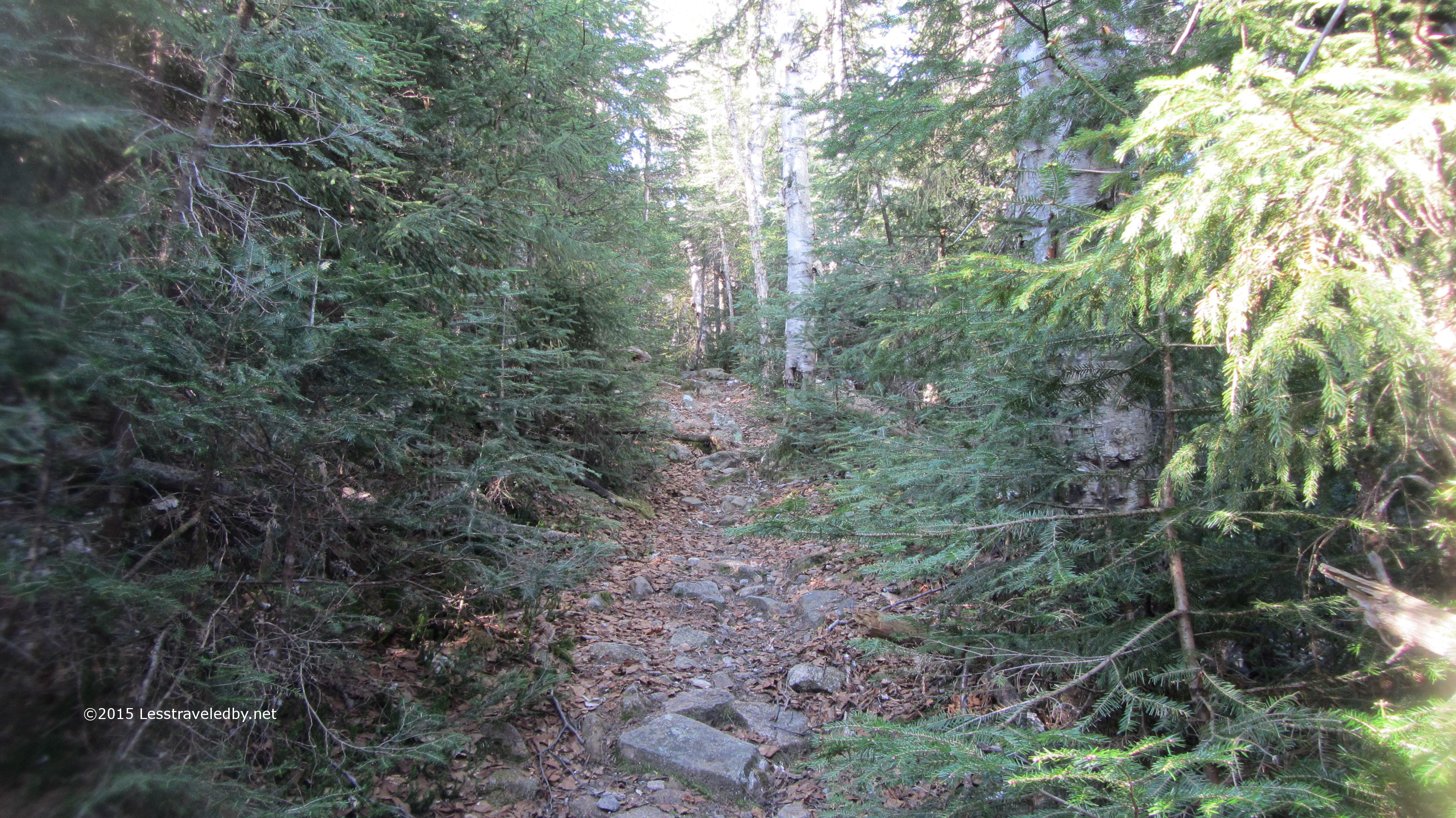
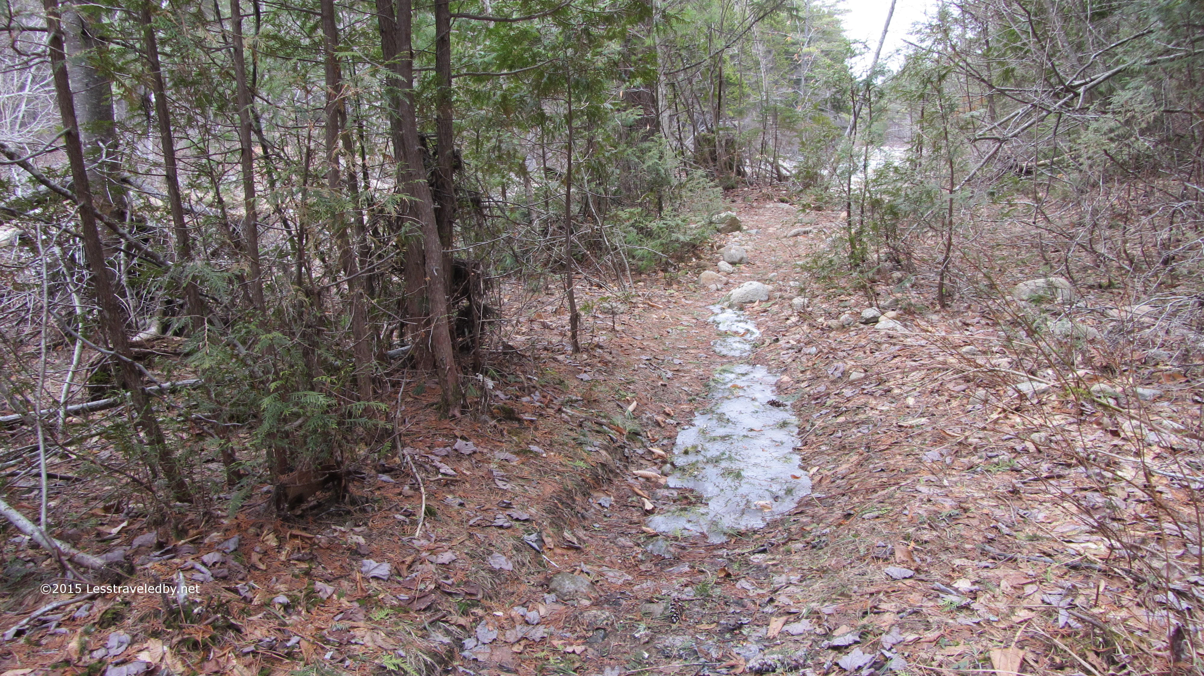
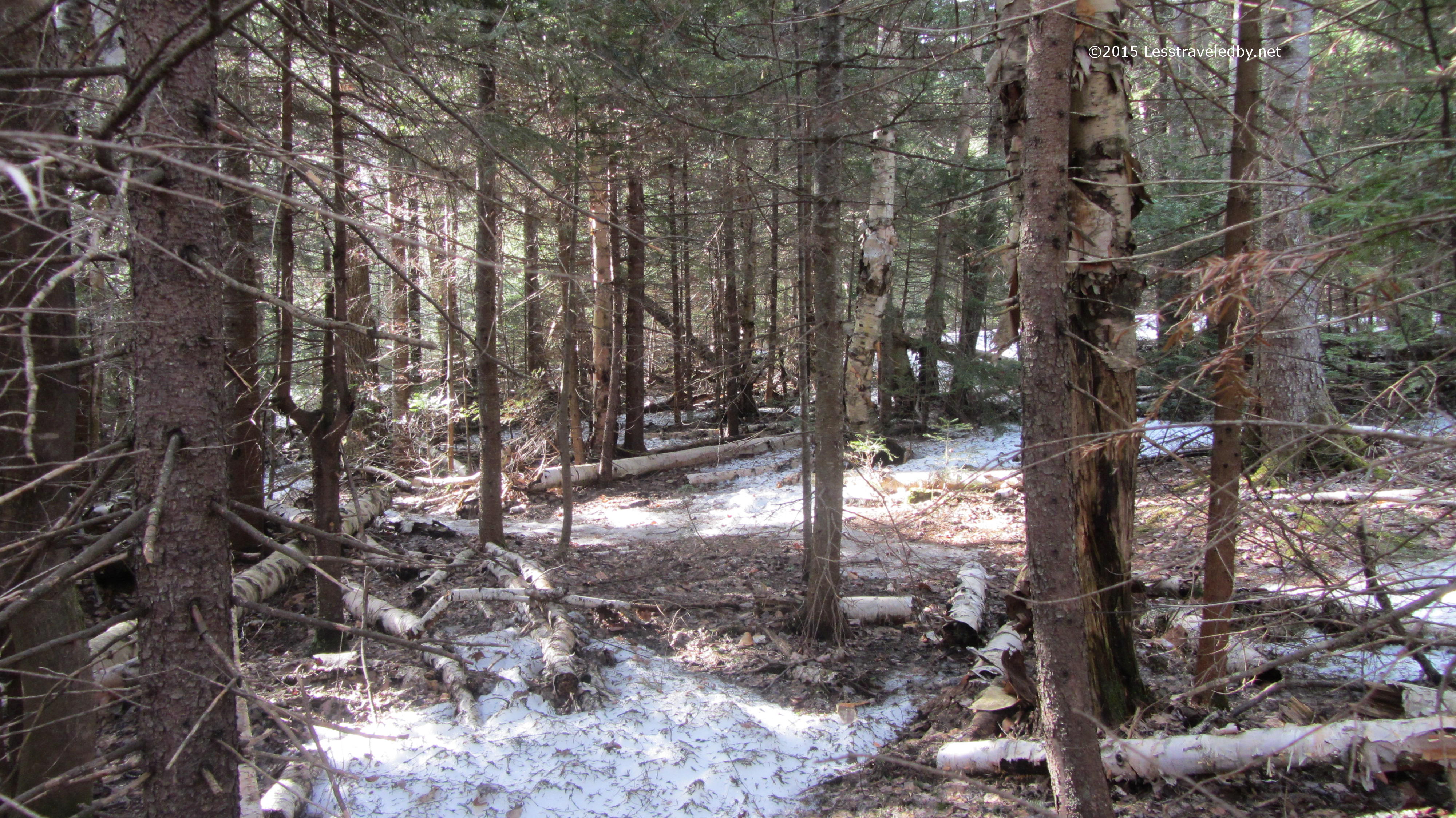
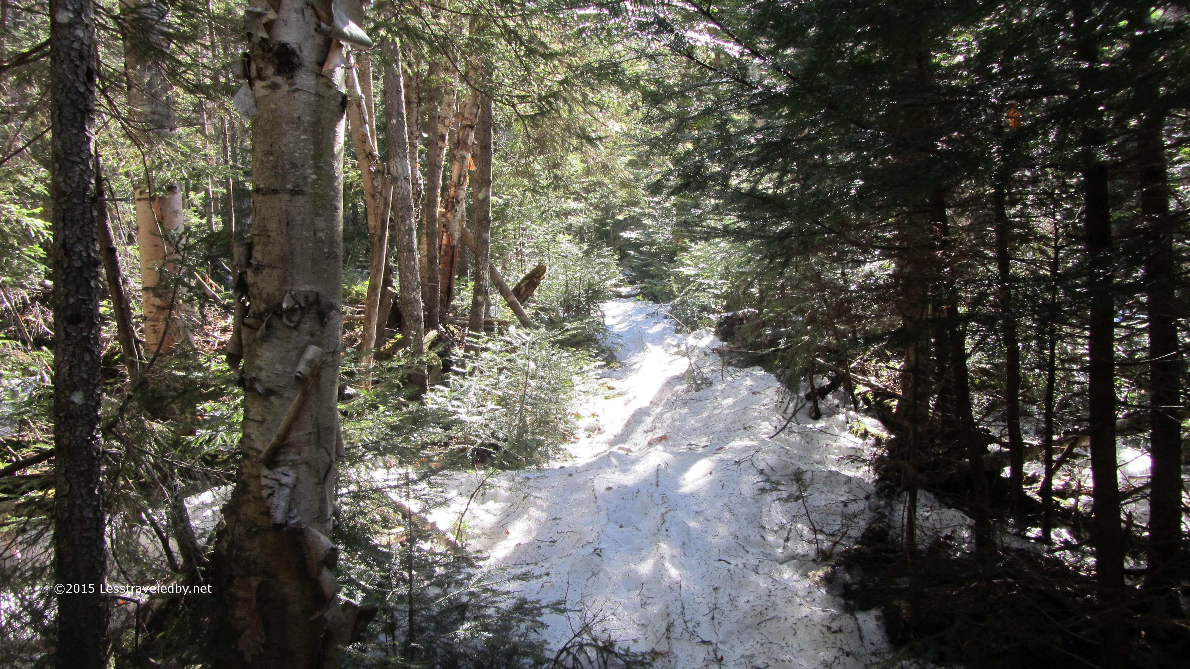
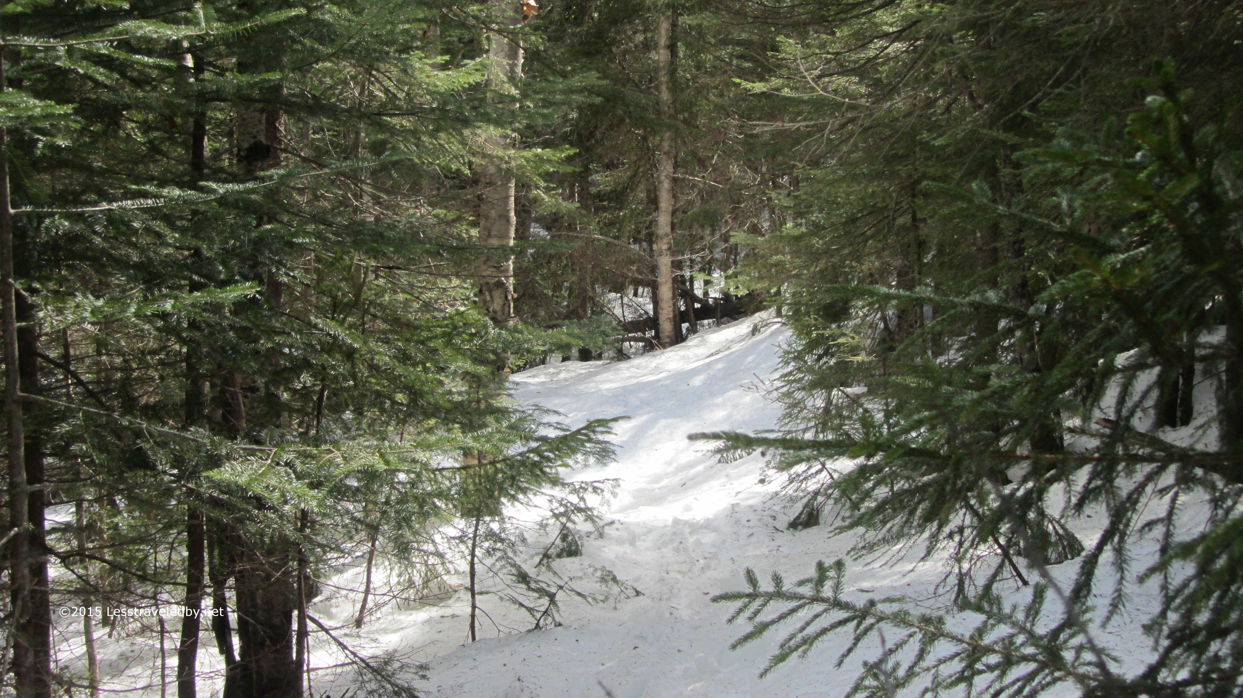
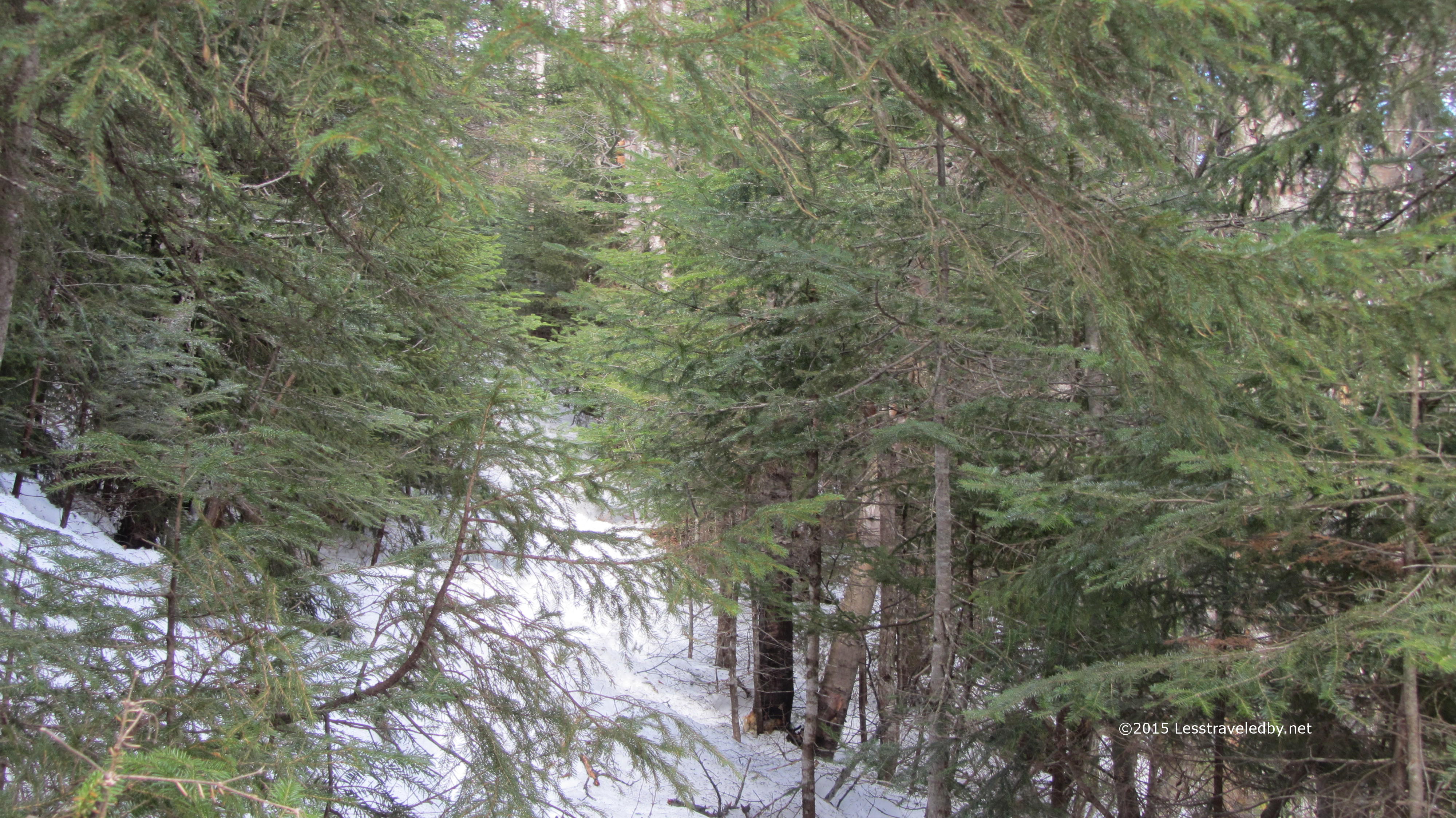
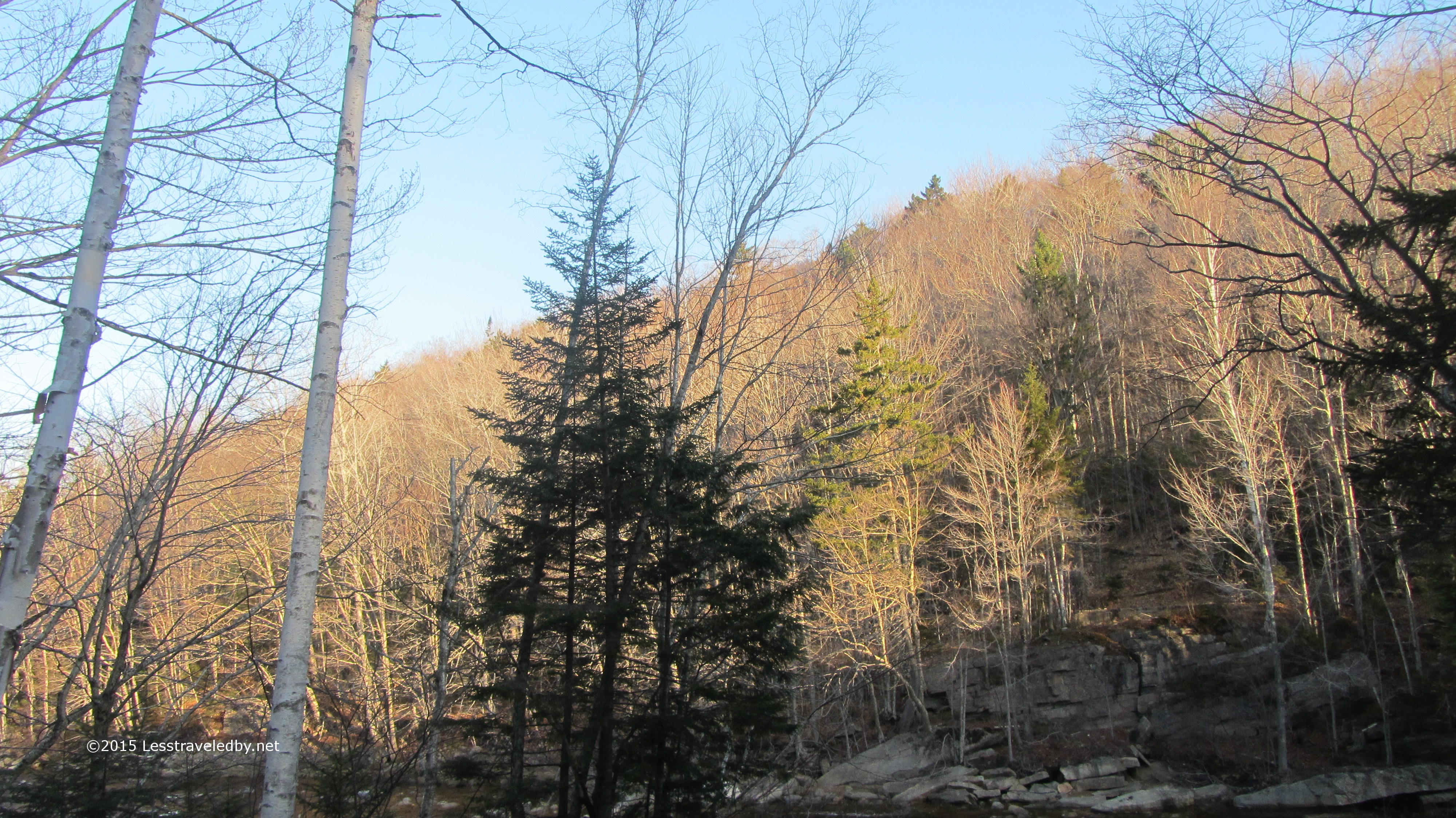
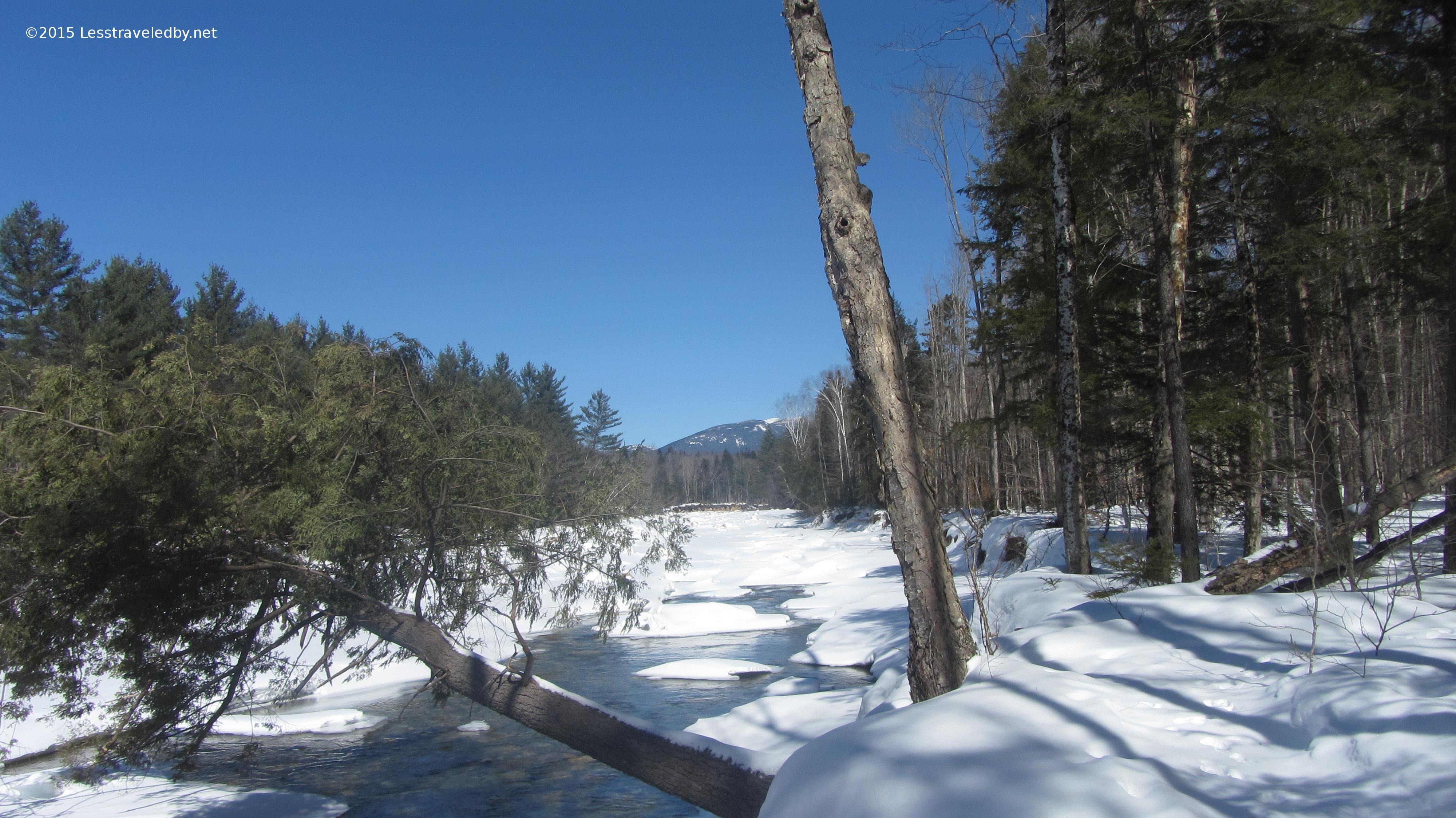
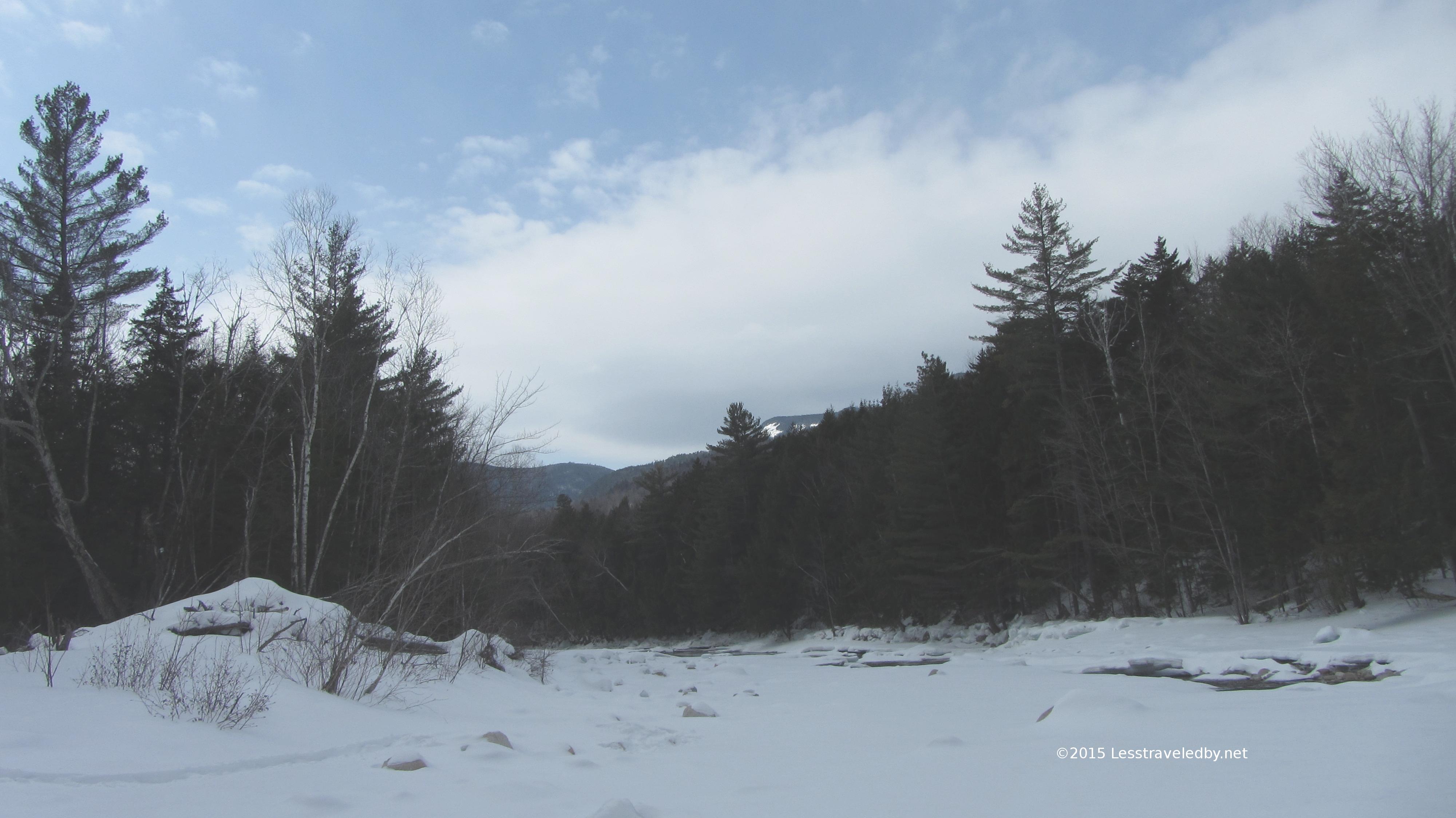
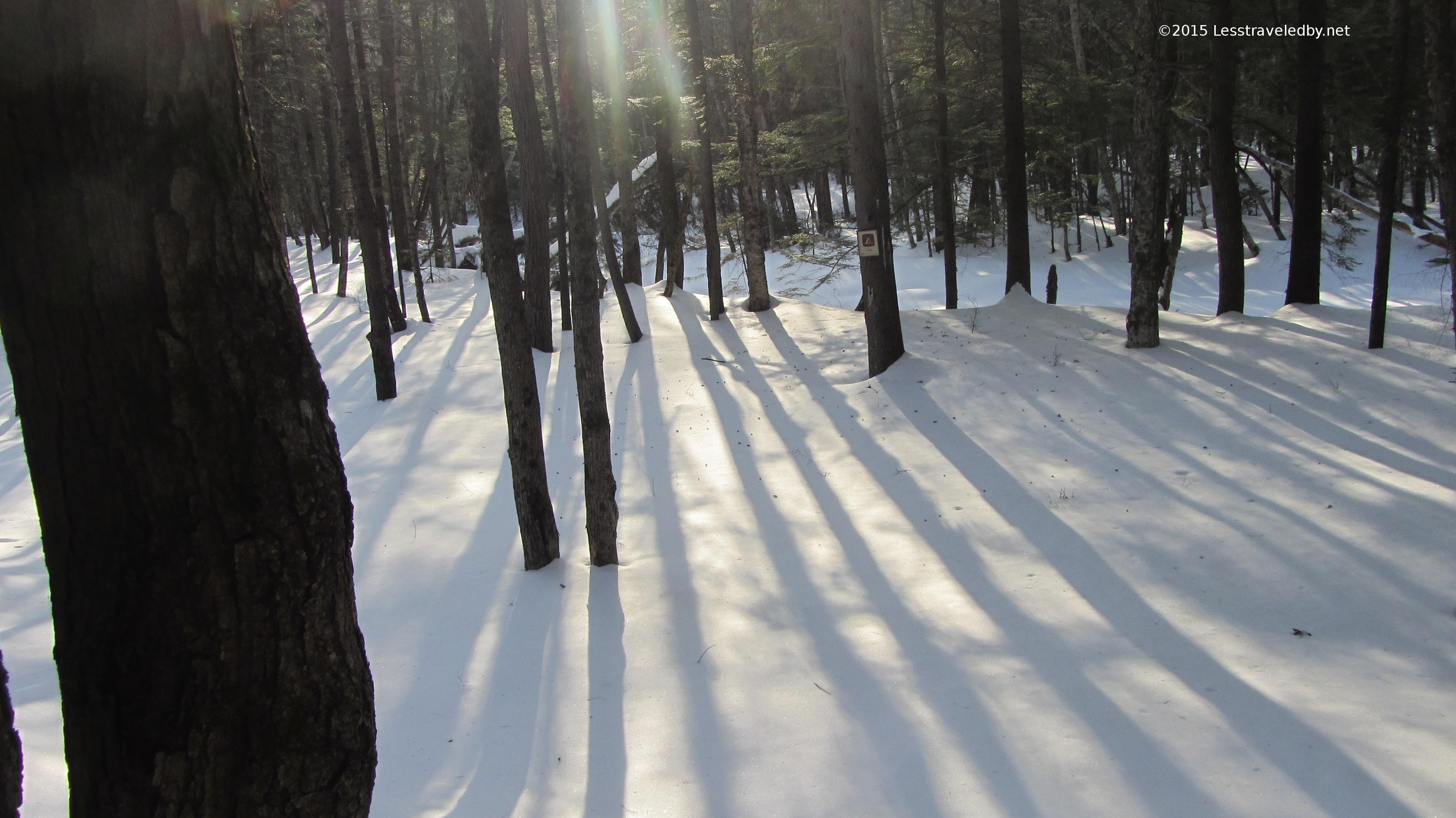
The plan was to follow the East Side Trail and the river into the wilderness, then head up the Cedar Brook Trail to some place above 2000 feet to camp for the night. Down low the trail was surprisingly dry for this time of year. The leaves were rustling like October, but there were a few patches of ice remaining in spots.

IMG_4193a
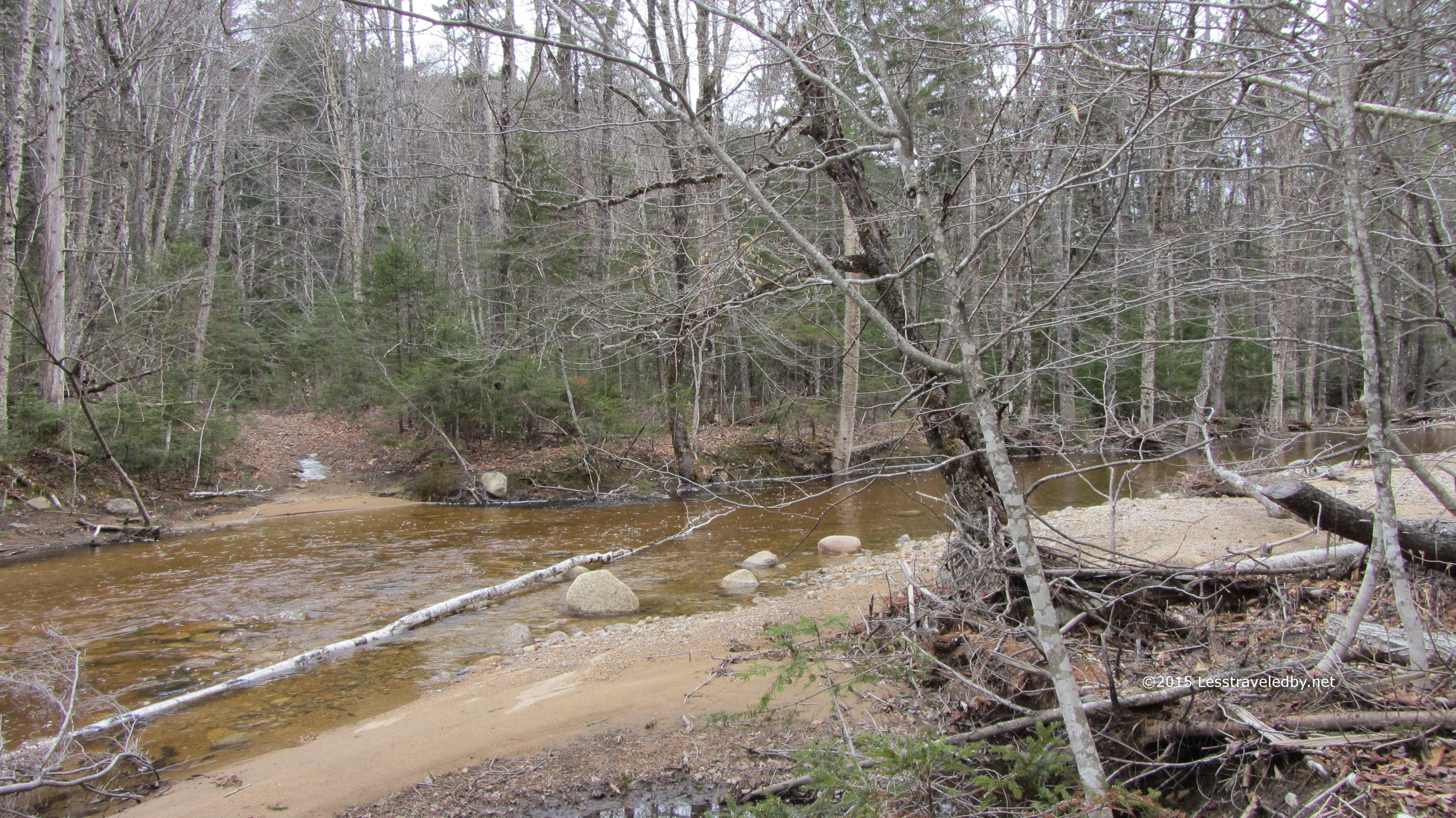
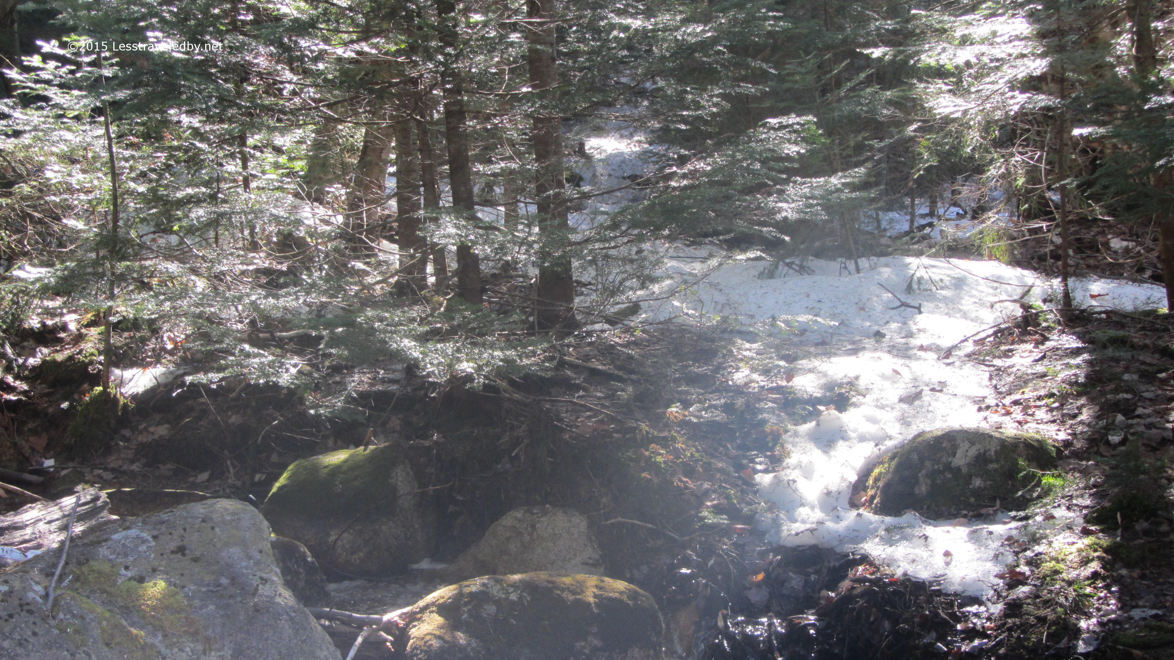
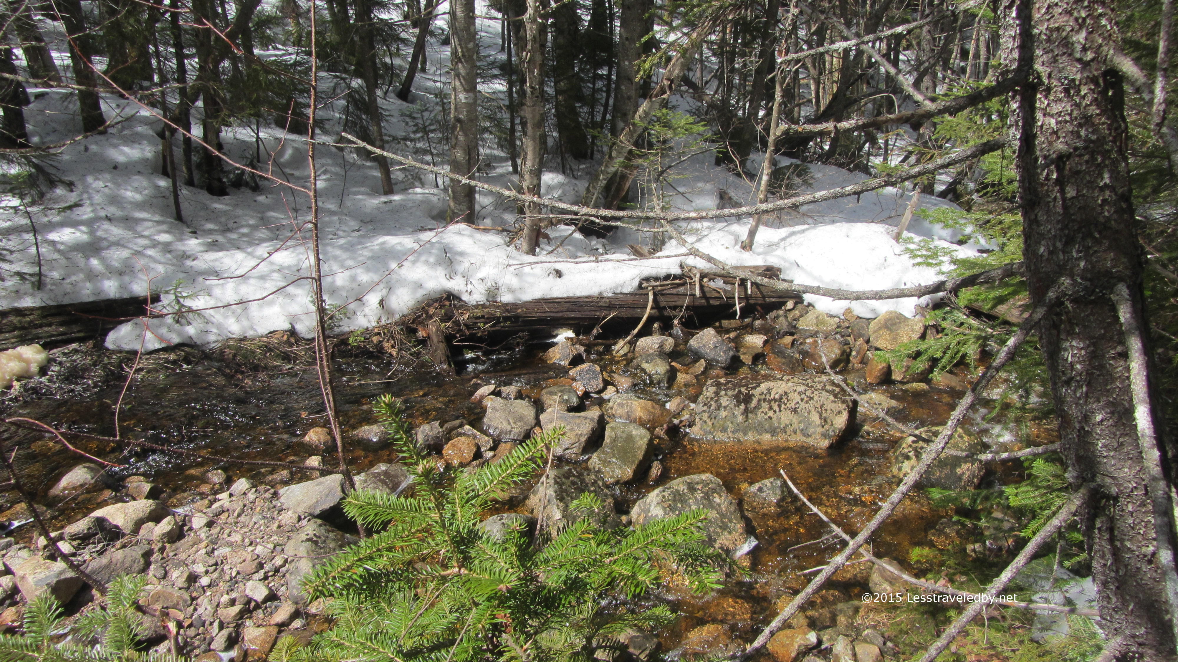
Looking back across Cedar Brook where the trail crosses. Way deeper than my boots and icy cold with run off from above so I didn’t put on my water shoes for this one. In the summer this is a great place to take off your shoes and cool your feet though.

IMG_4194a
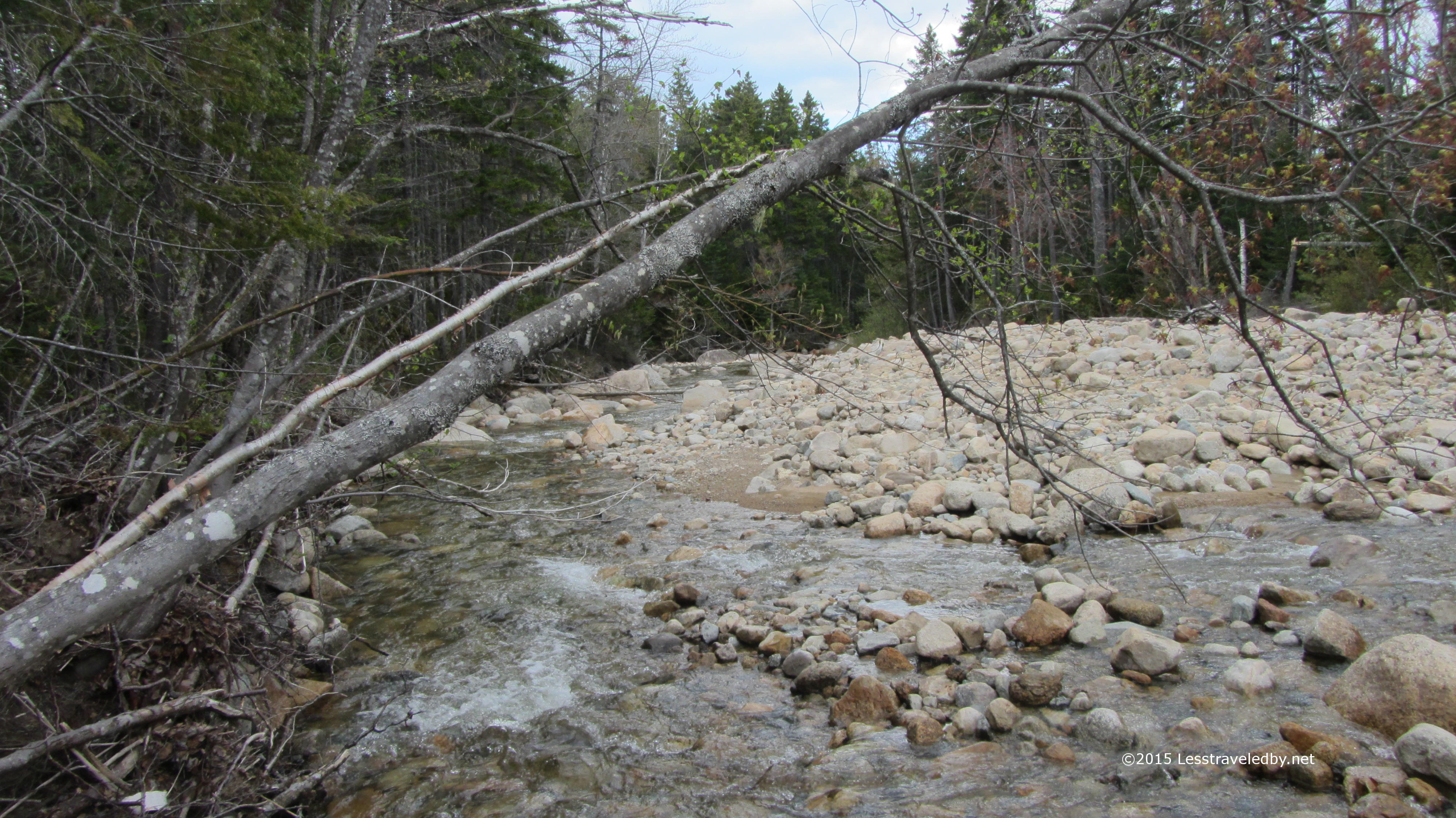
My usual crossing when I don’t want to get my feet wet is up stream a ways past that tree across the brook. Many of the rocks were under the water a few inches, but that is what waterproof boots are for. Great for taking your time with a full pack and not worrying about wet socks. After crossing dry footed again on my way out I was feeling pretty good til I noticed a man with an expedition pack on his back walking across that fallen tree with a long branch planted in the water as a staff. Sorry I couldn’t get into position to get a picture, but I was bushwhacking back to the trail and didn’t want to shout to him to wait for fear he’d fall in.

IMG_4196a
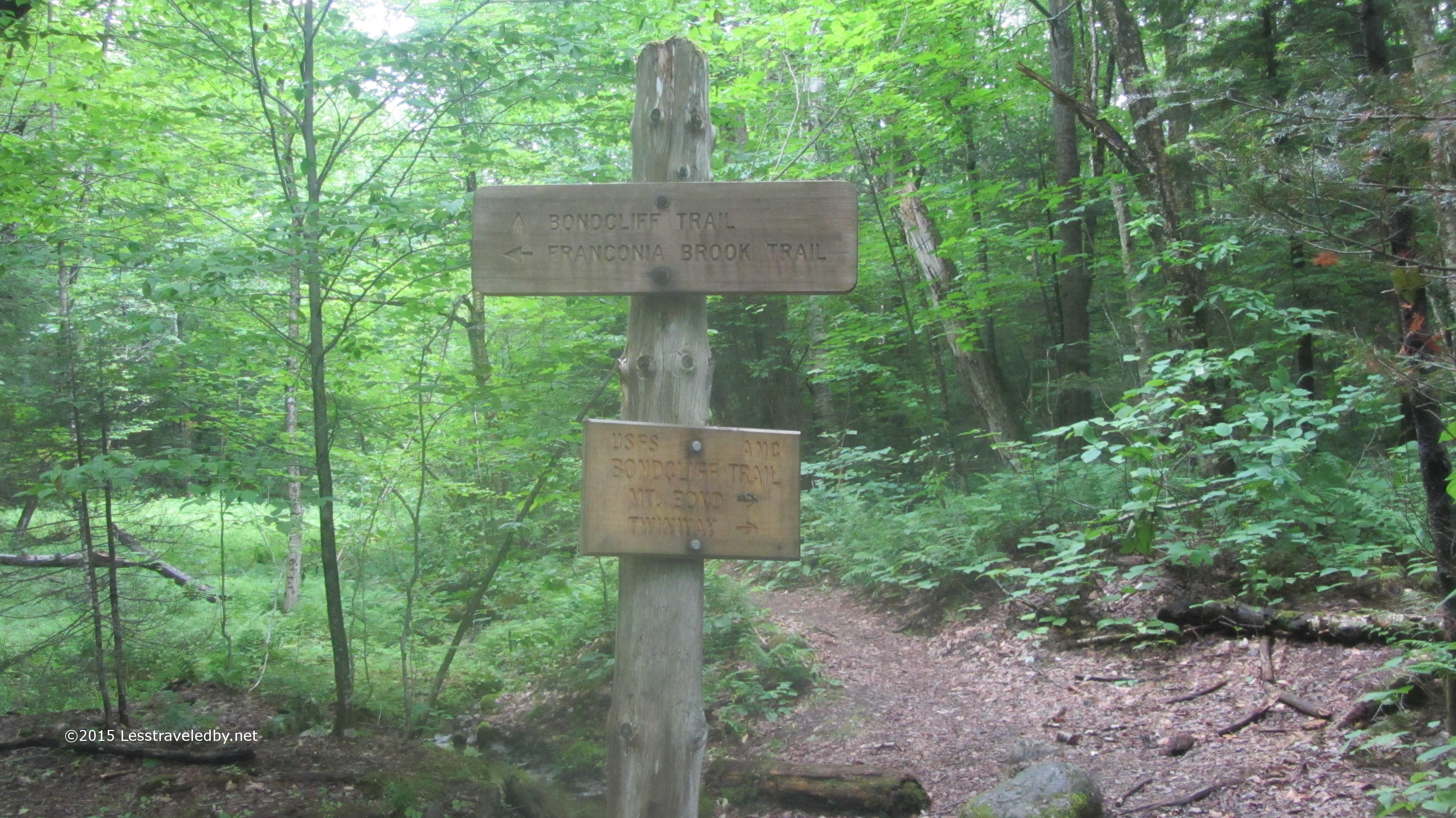
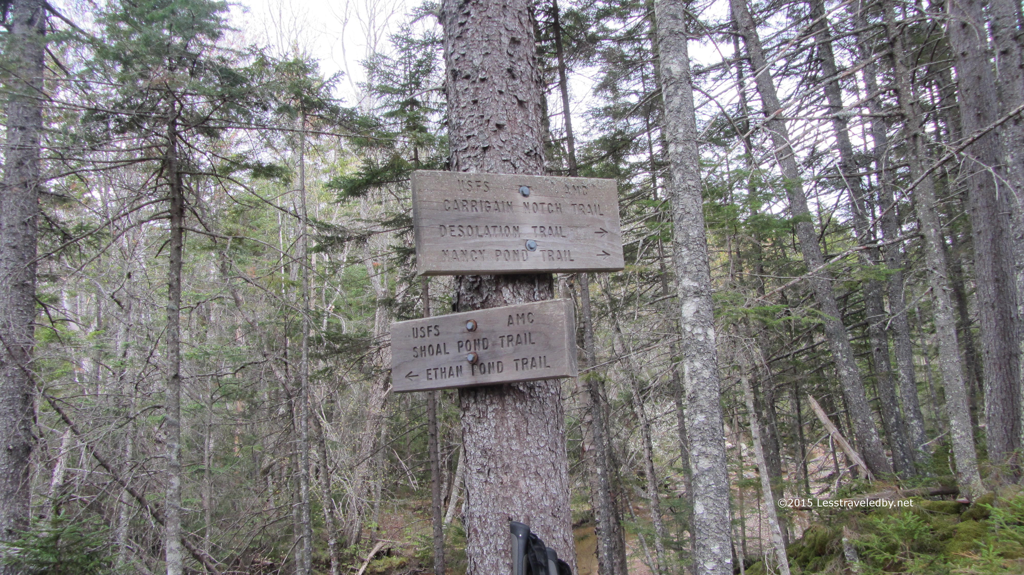
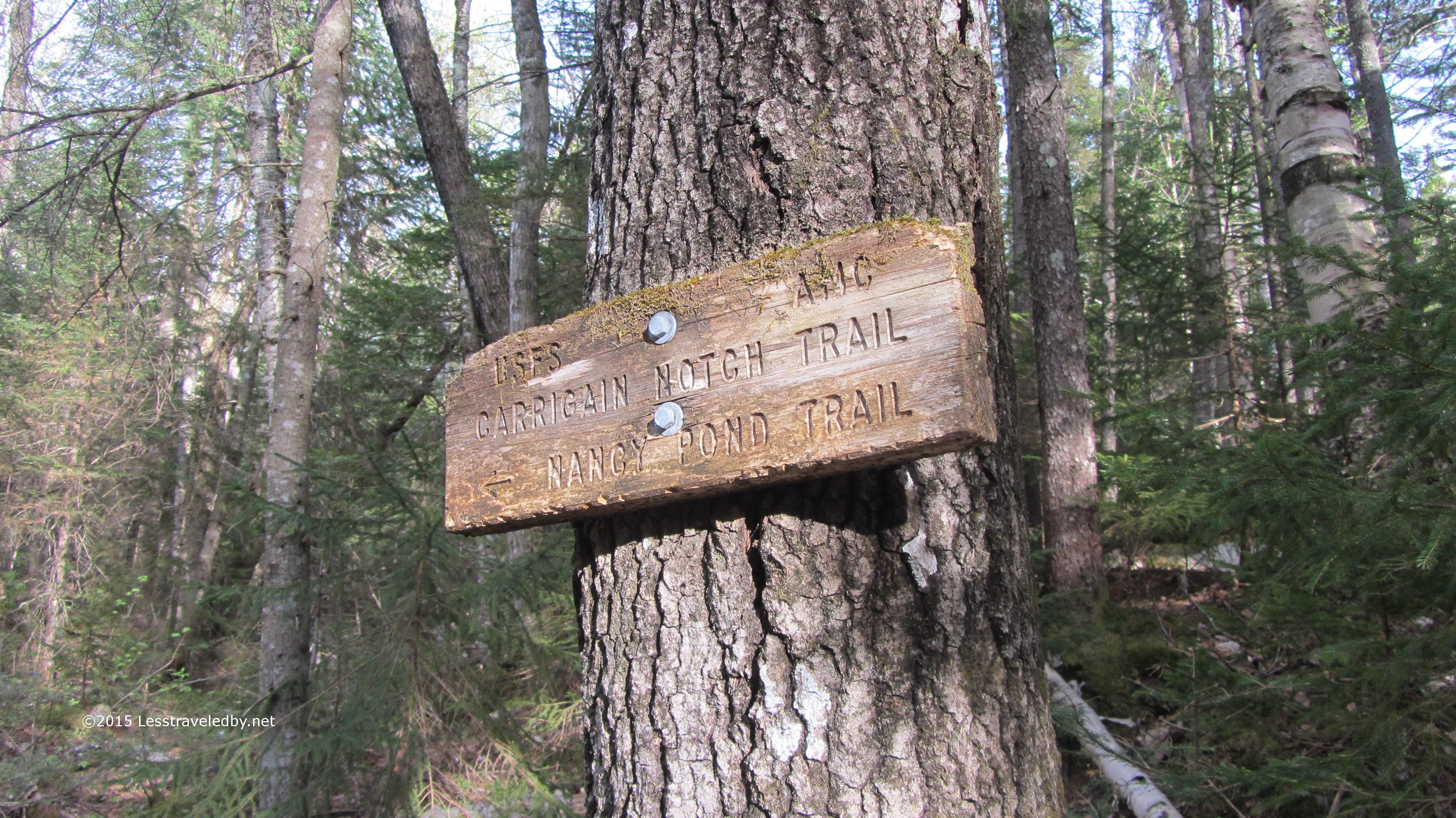
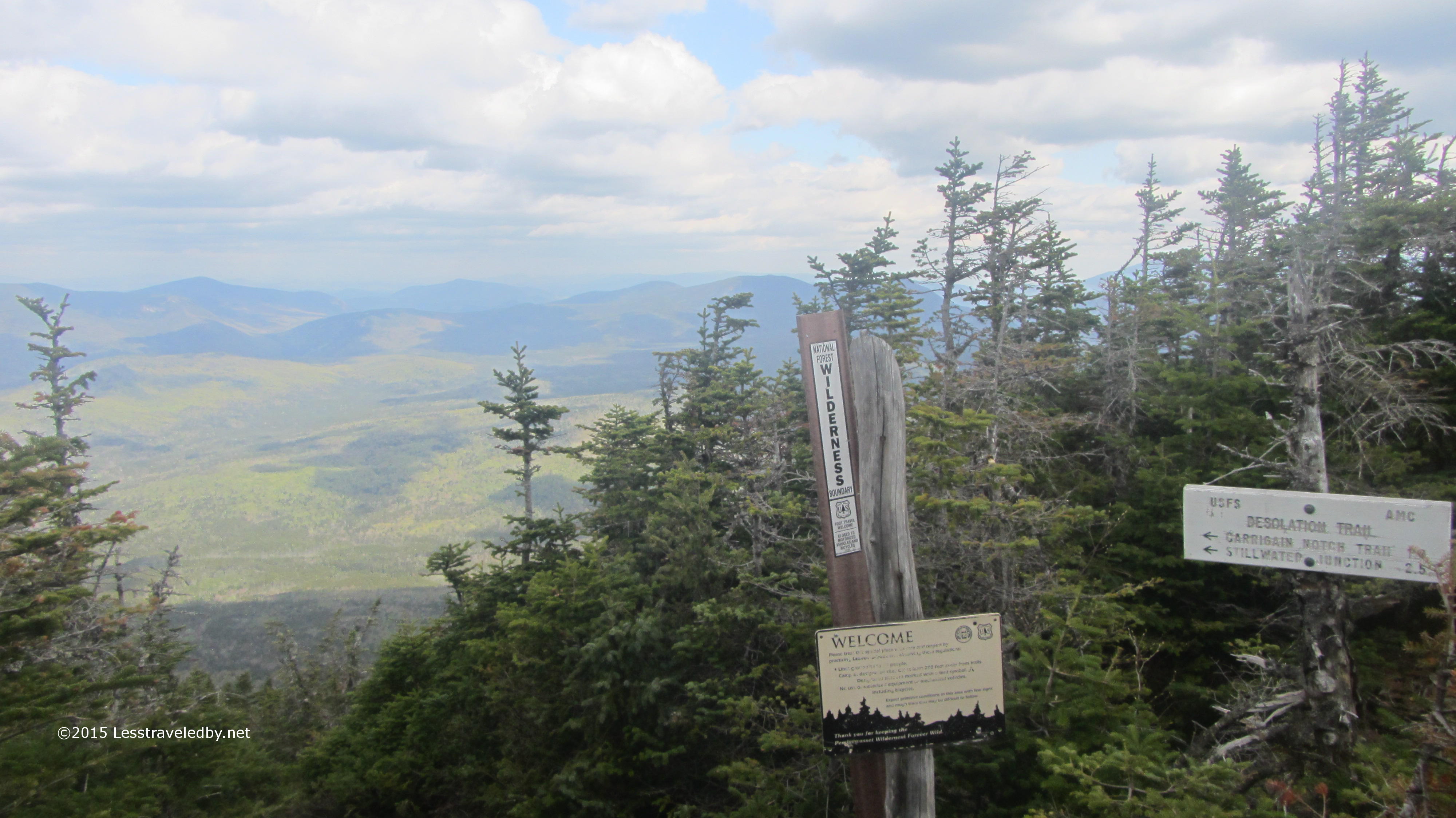
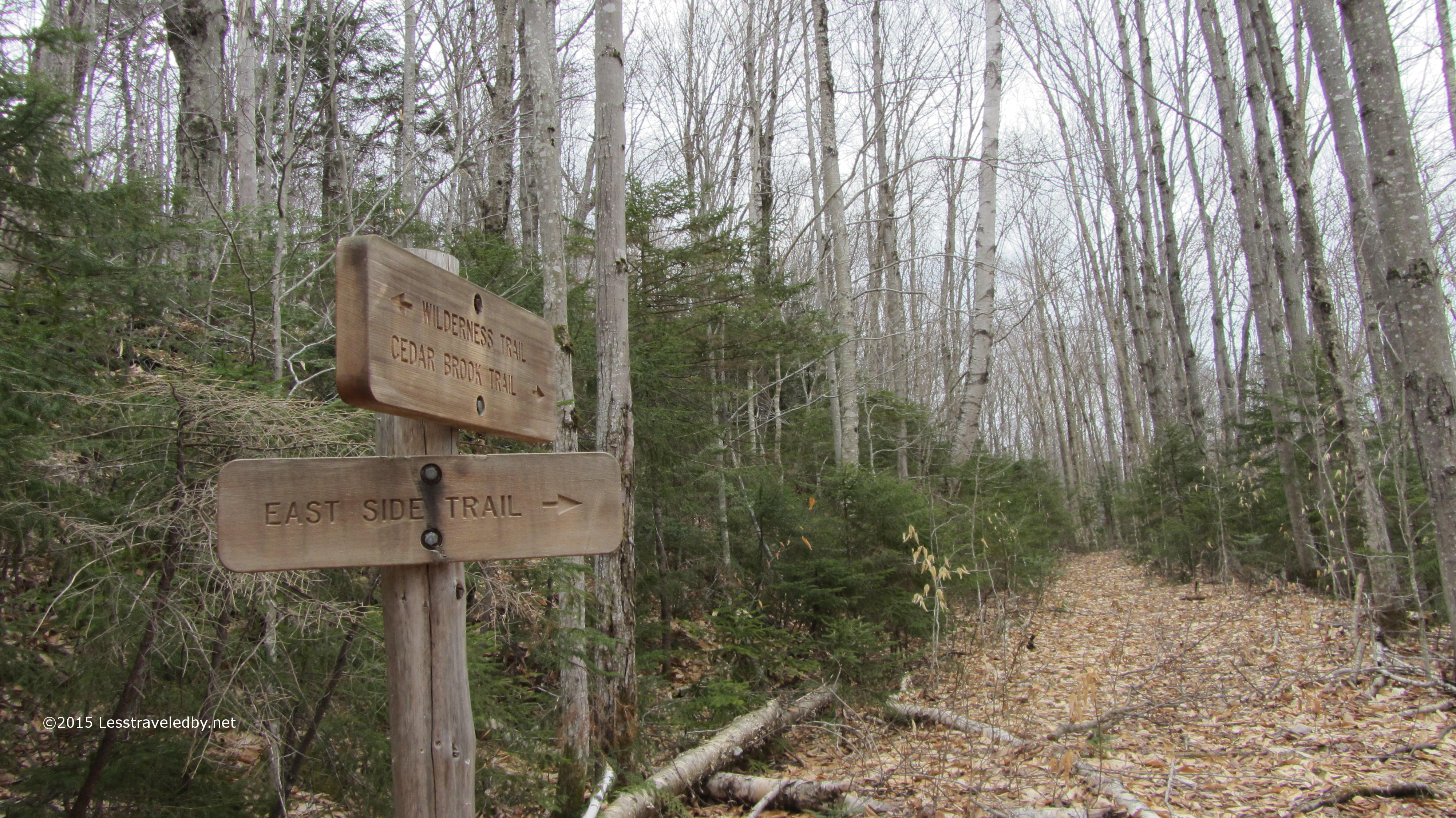
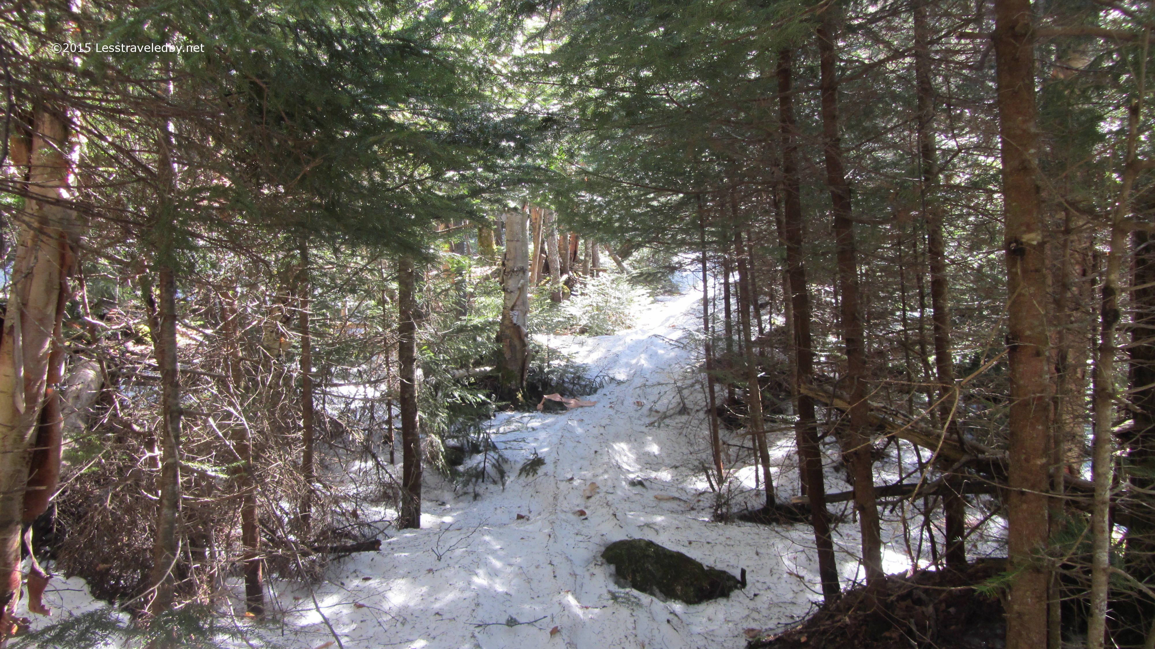
Every time I’ve come down this trail headed out deeper into the wilderness I’ve always stopped and looked up this path. The sign I’ve talked about before because it is so odd to see this new of a one in the wilderness. This time I made the turn and headed up around that bend to see what I’d find. As much as I love going to places I’ve been and know I like, I really enjoy stepping around the corner into the unknown.

IMG_4198a
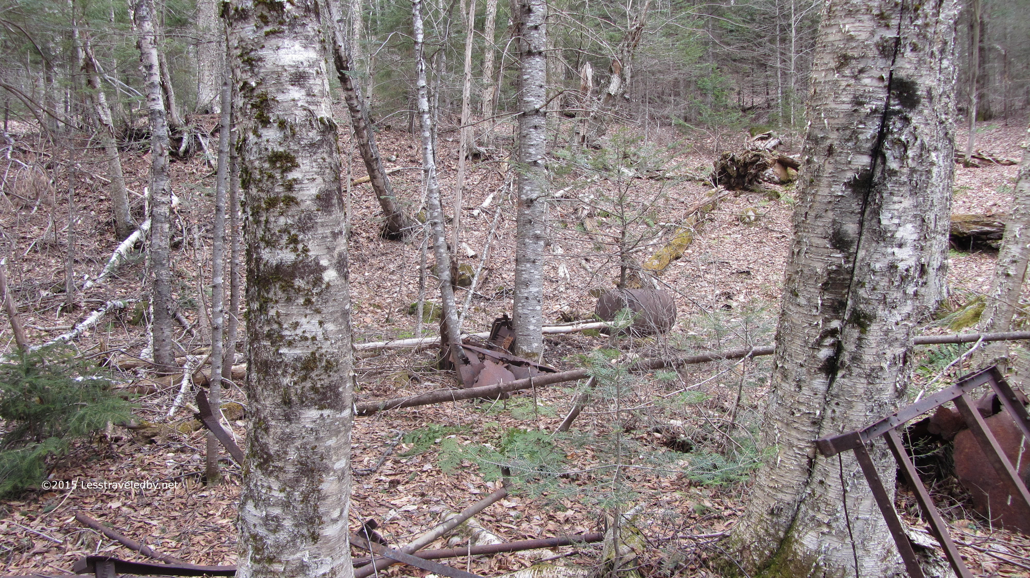
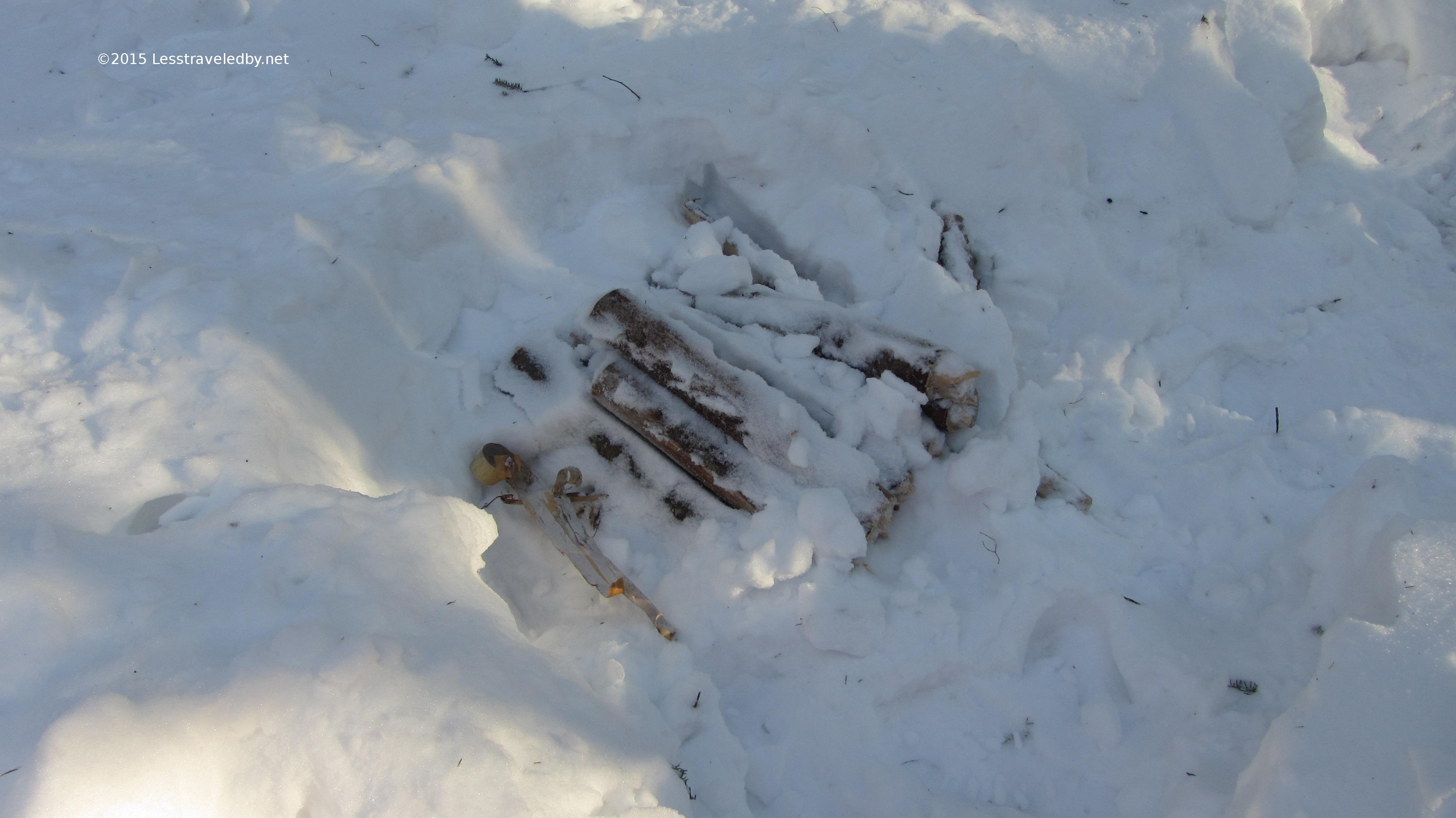
Clearly I wasn’t the first human to walk this way heh. Most of the wilderness hasn’t been wilderness that long and there were all sorts of camps established out there in previous times.

IMG_4199a
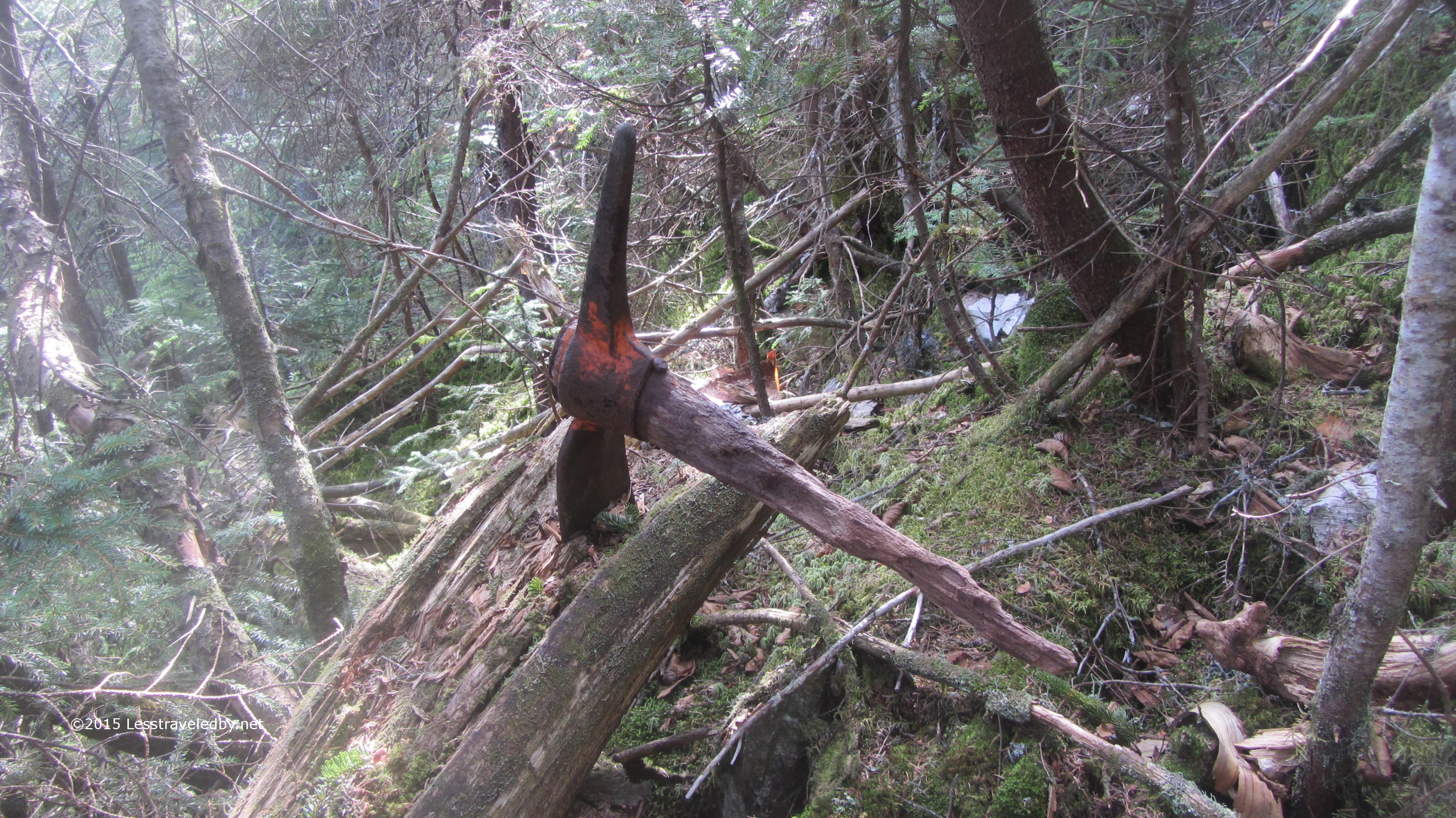
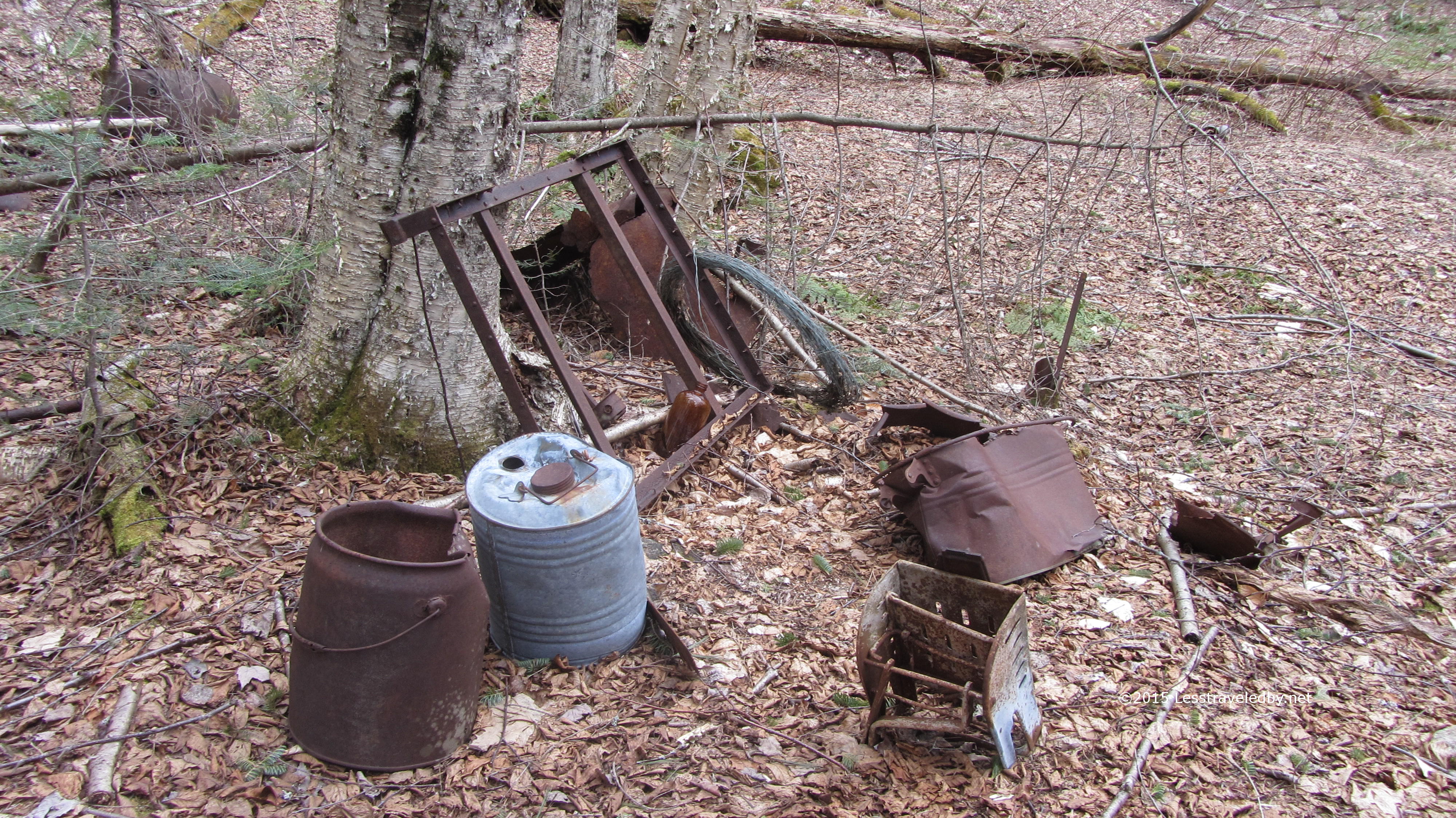
This was one of the most extensive areas I’ve seen before and there were several different collections on display along the trail. These things are to be looked at and photographed but otherwise should be left alone as they are considered artifacts now.

IMG_4200aIt was neat to see and realize how active this place had been before in contrast to the reclaimed wilderness it was today. Still, garbage in the woods is garbage in the woods so it made me a bit sad to see how folks just chucked stuff out in those days. I guess some still do since I picked up a bit of hiker produced trash on this trip.

IMG_4202a
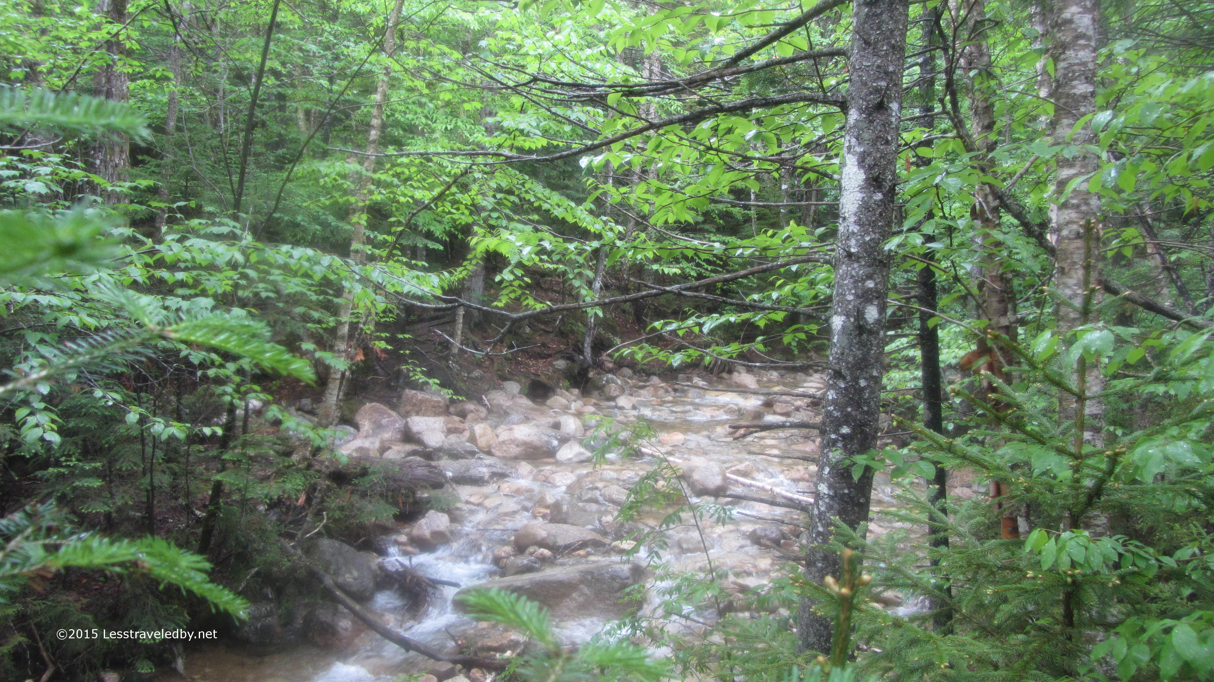
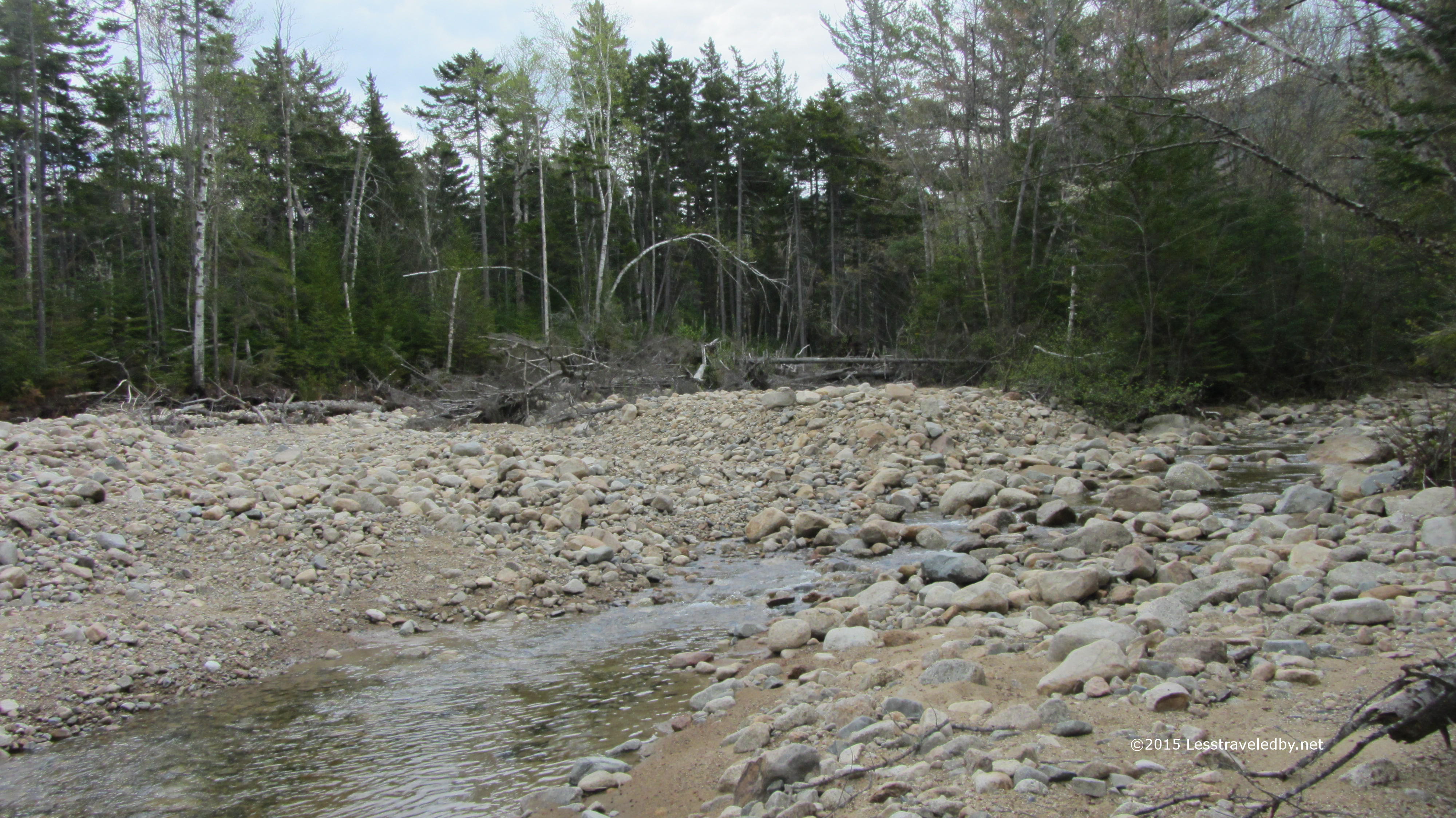
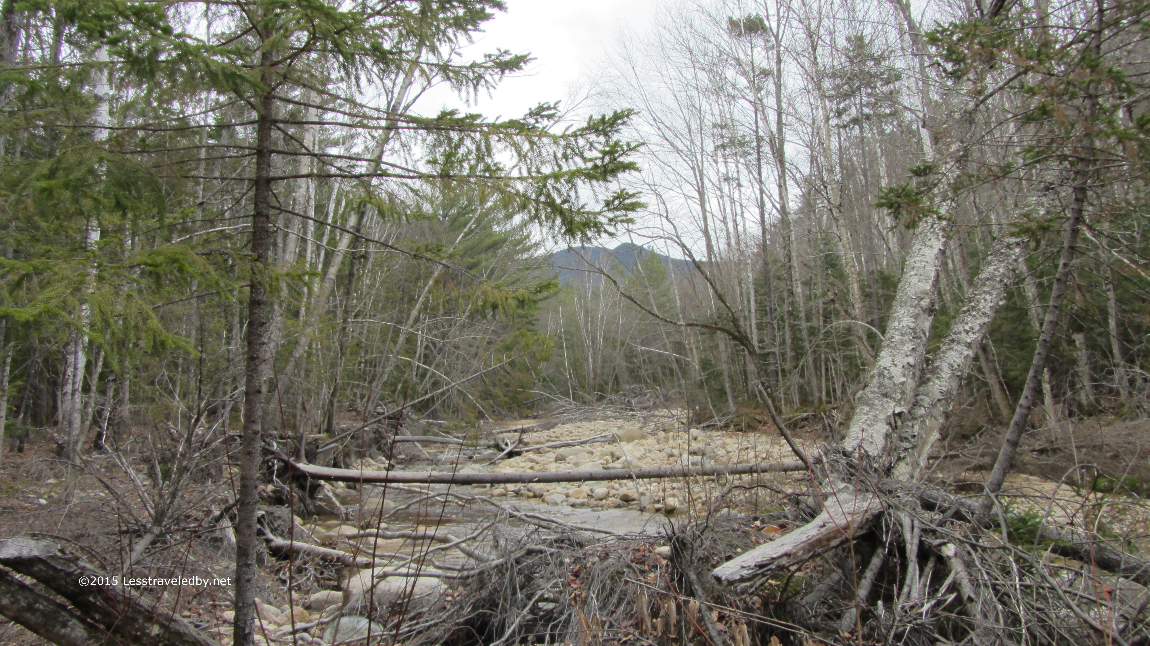
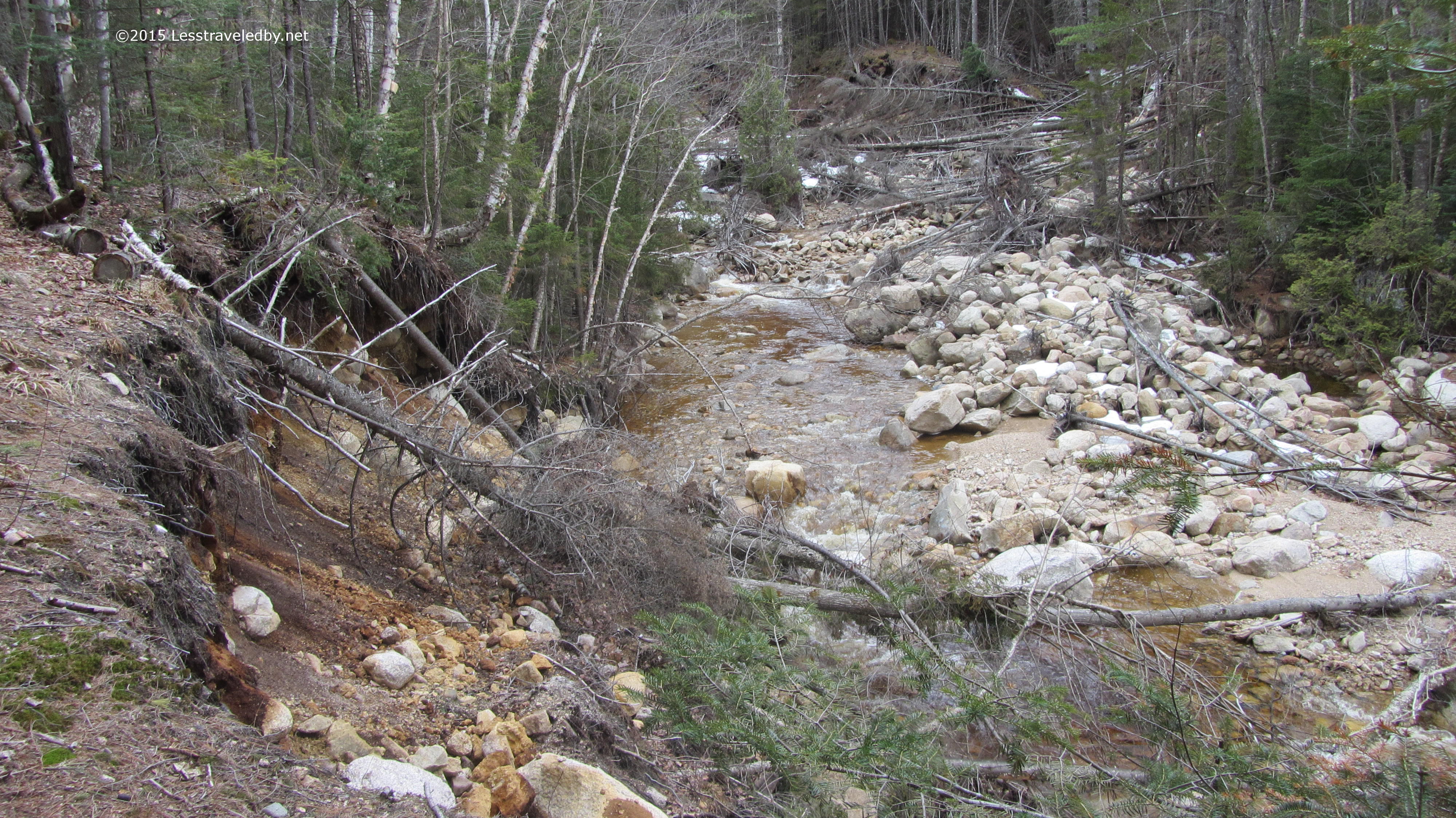
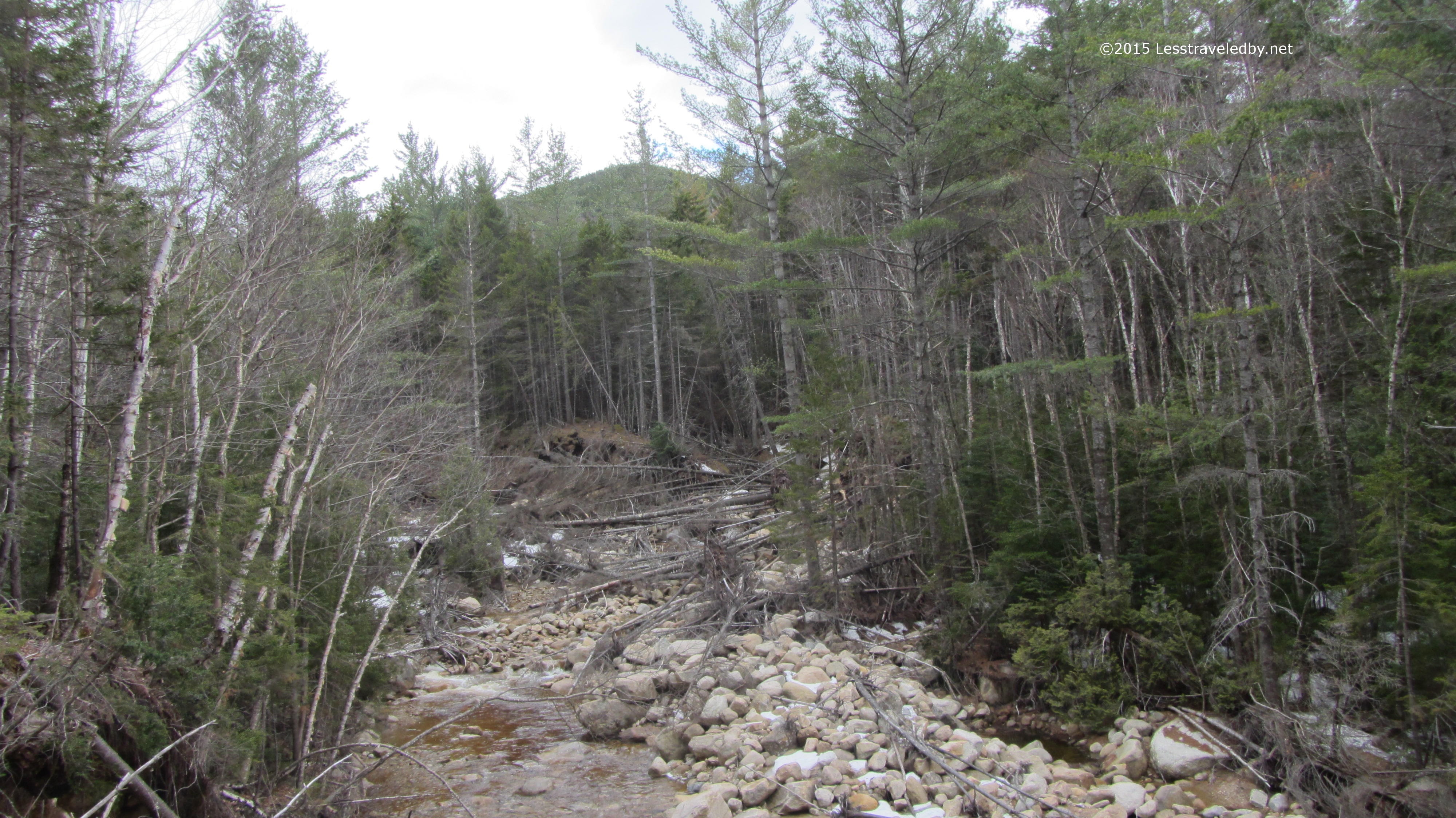
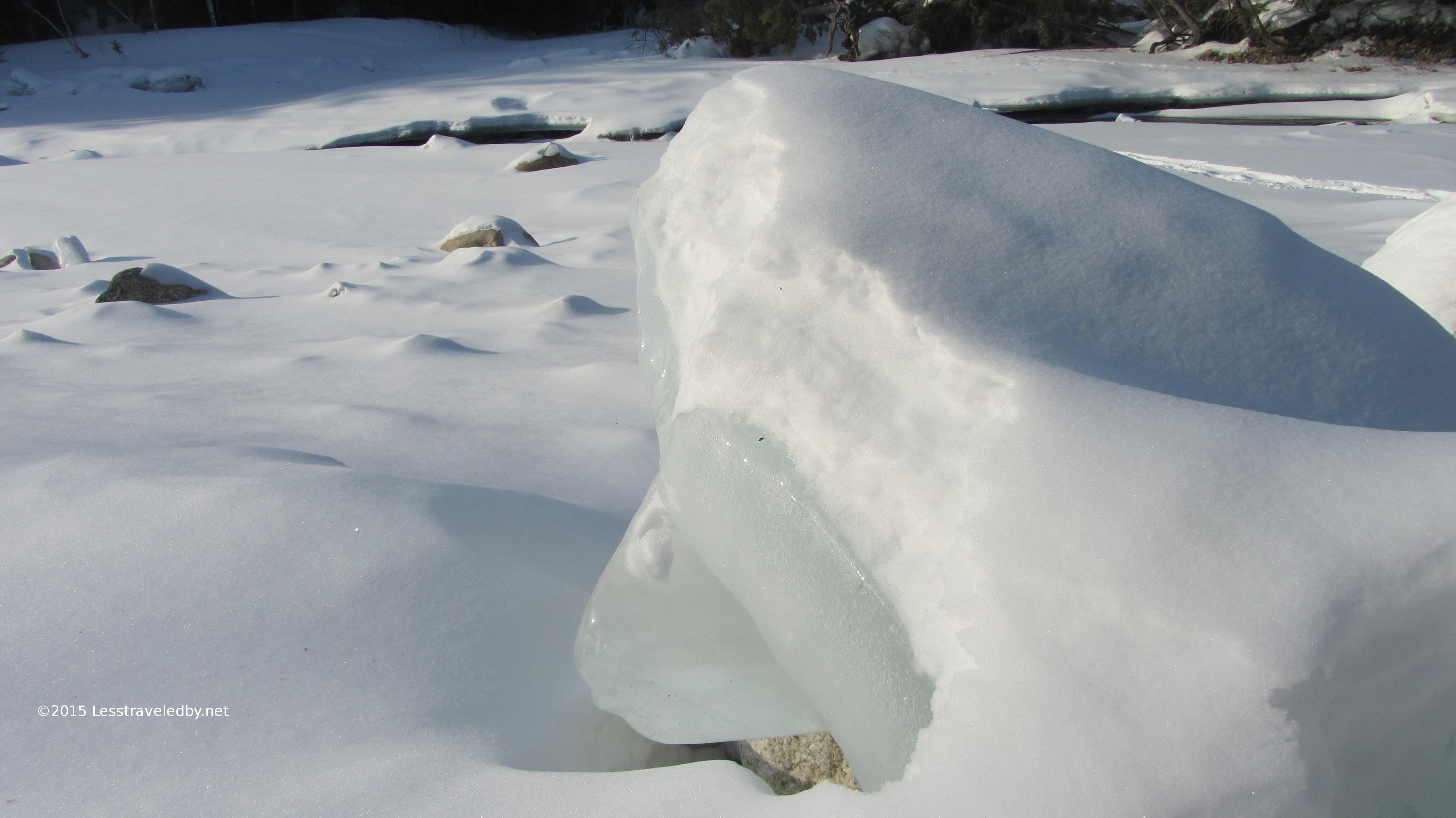
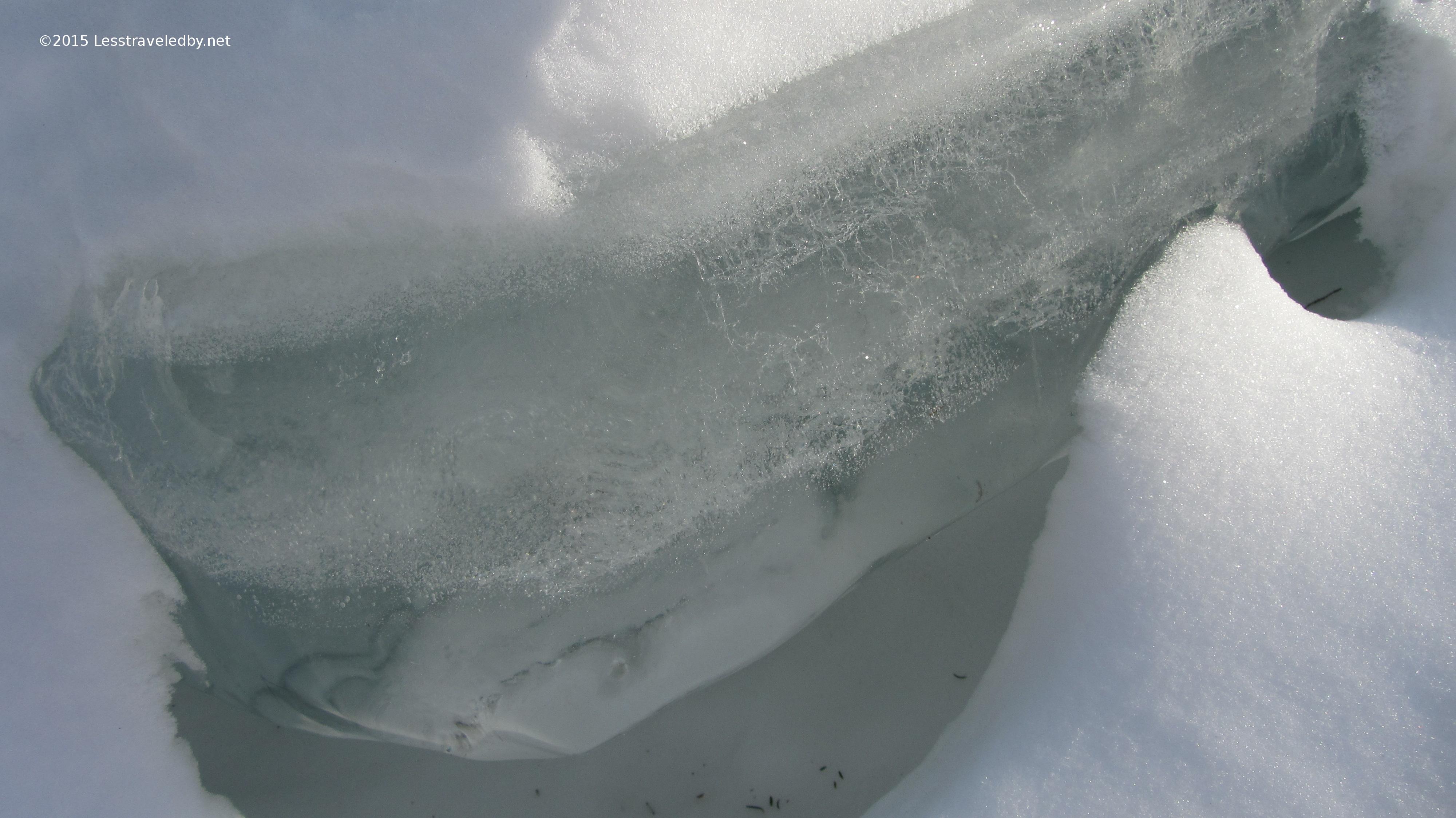
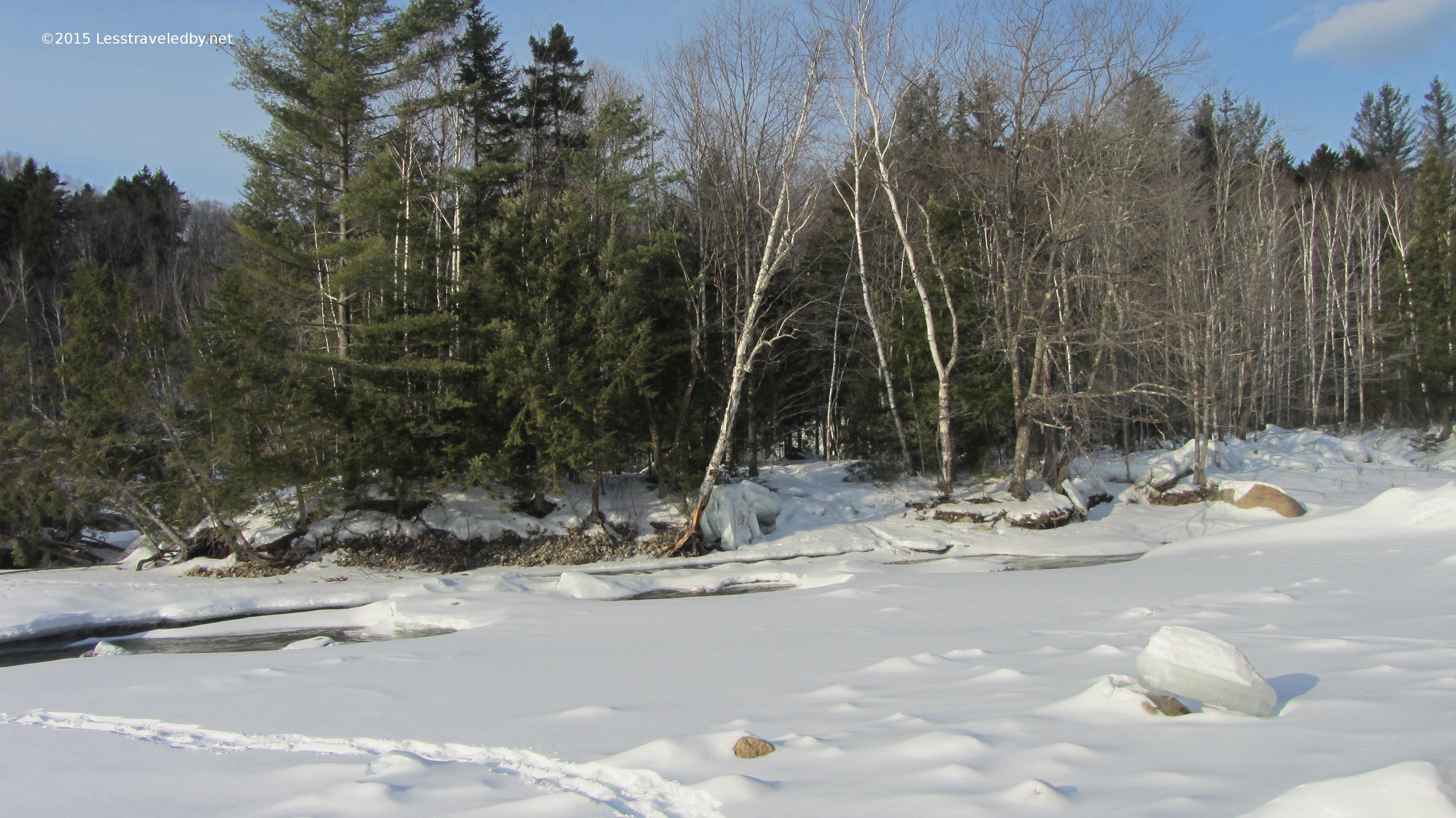
Cedar Brook may not look that big now even with the spring melt still going on up above, but you can see from these couple of pictures that it has had its moments. These mountains are great at scraping the sky so when a storm front or hurricane runs into them deluge is the best word to describe it.

IMG_4203aAll of the brooks and rivers in this area have extra wide channels that show where the waters reach when real floods come. The trees are stripped back as the channel undercuts the banks and eventually rocks of all sizes are rolled in. Most of the time the waters run in narrow channels, but the warning is clear what can happen. You really don’t want to camp too close to the water in this area, especially if it is raining.

IMG_4205aI kept headed up as the trail swung away from Cedar Brook. I went past my planned camp altitude mostly because I couldn’t find a spot that looked comfy. Between the increasing pockets of snow, areas of run off and a well littered forest floor the pickings were slim. I did come across some large bear tracks in a few patches of snow on the trail. I’d guess somewhere around 4″ across which may or may not be large, but any prints I see headed the same direction as me always look bigger heh.

IMG_4206a
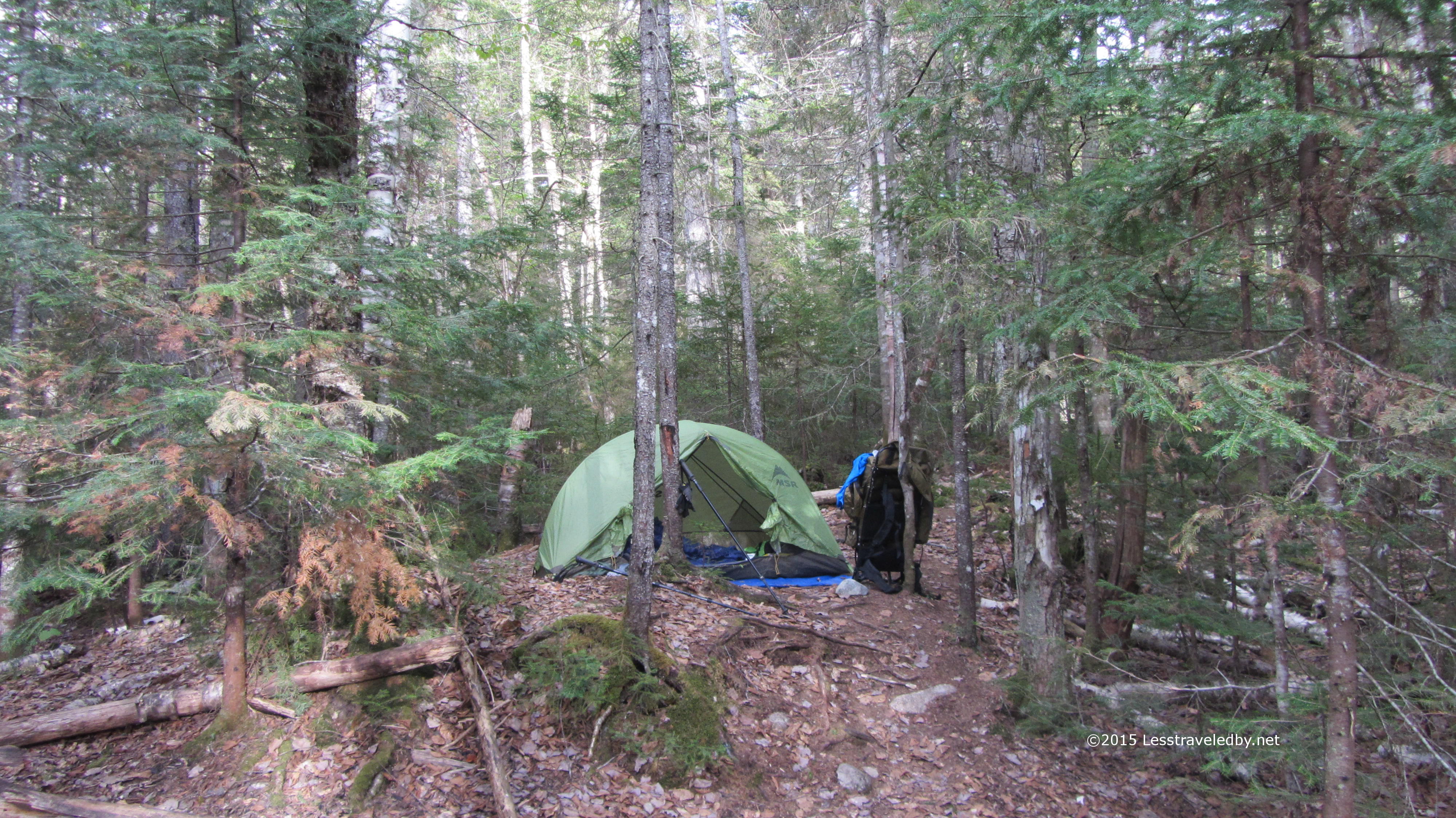
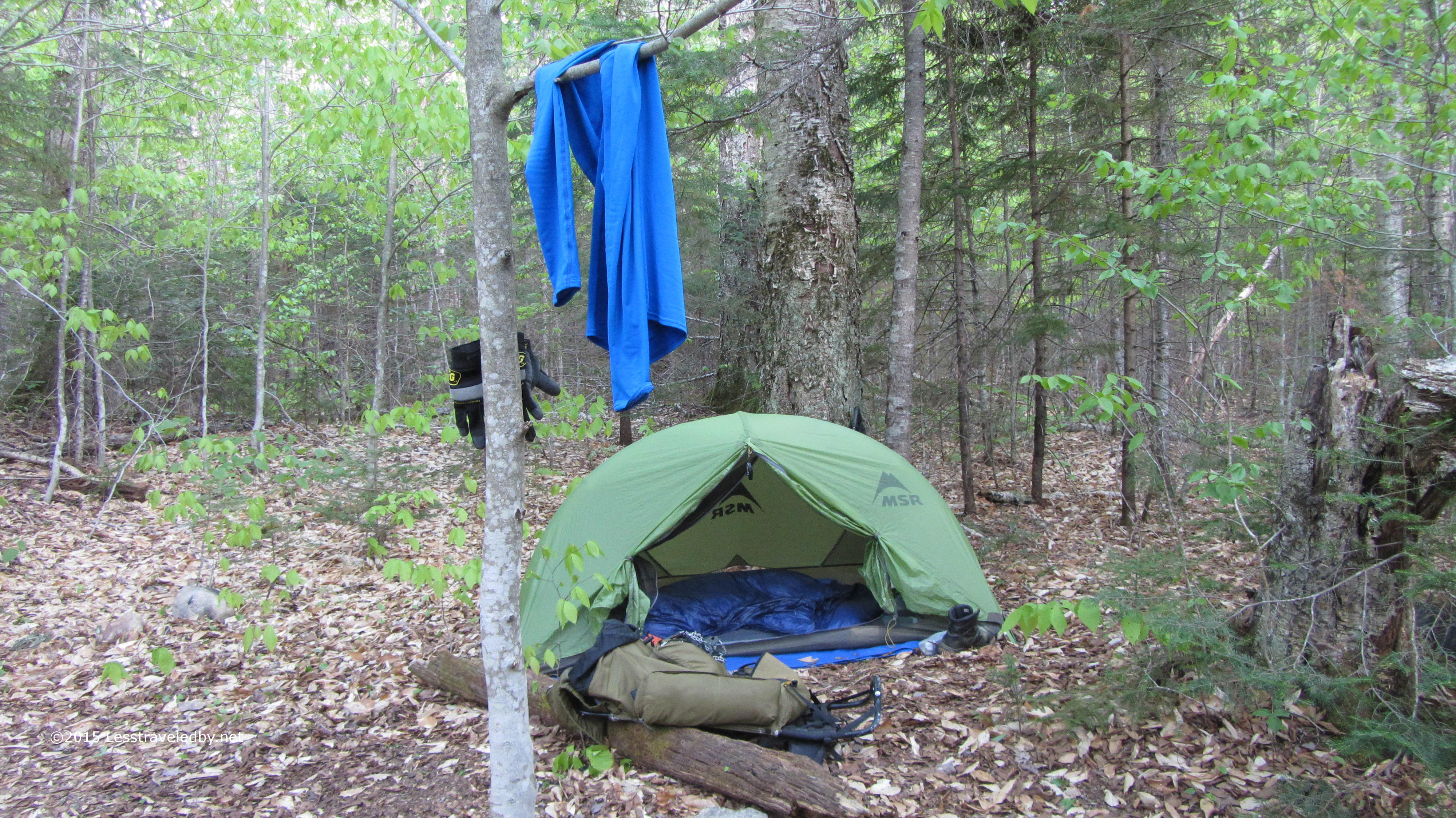
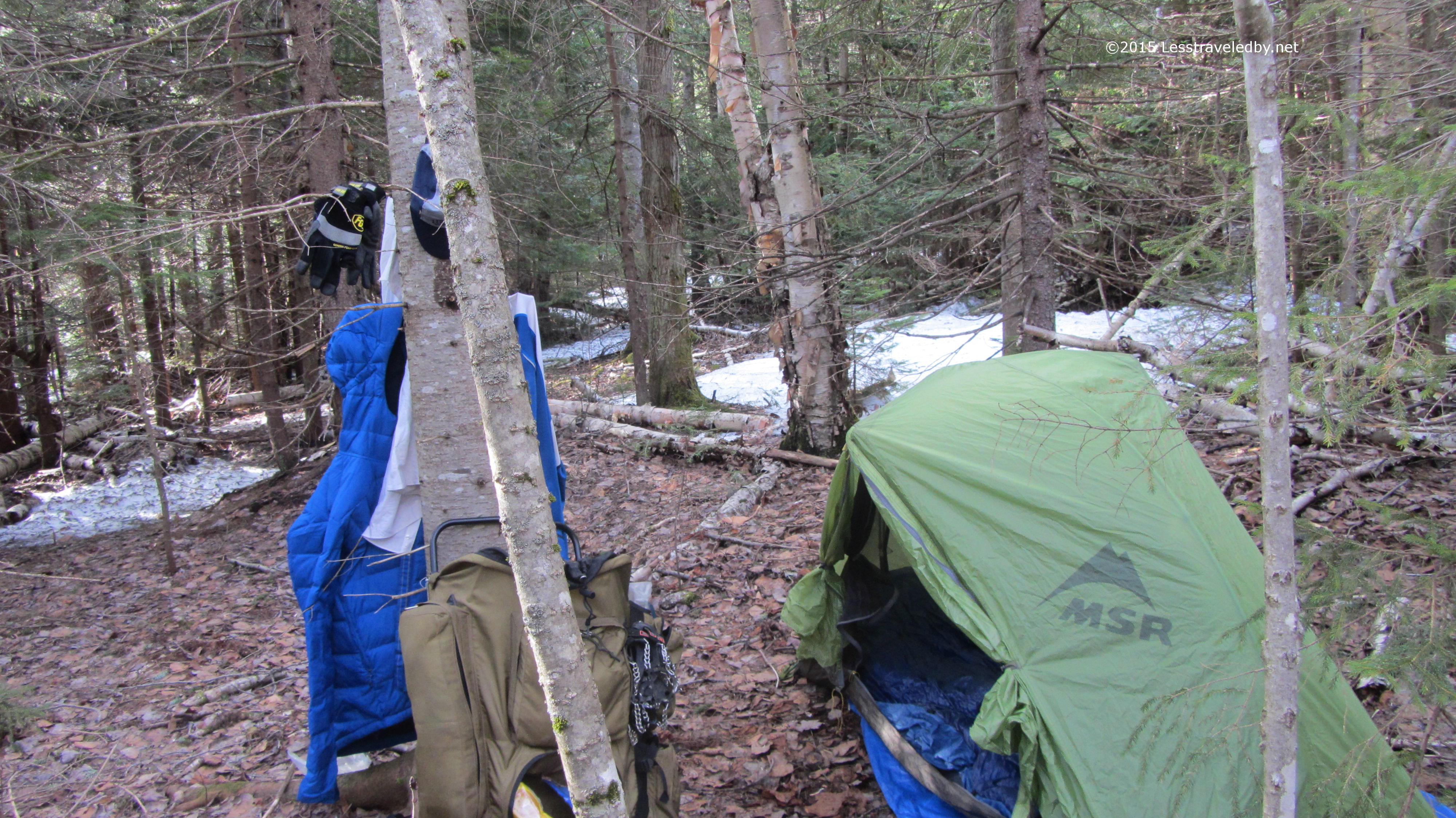
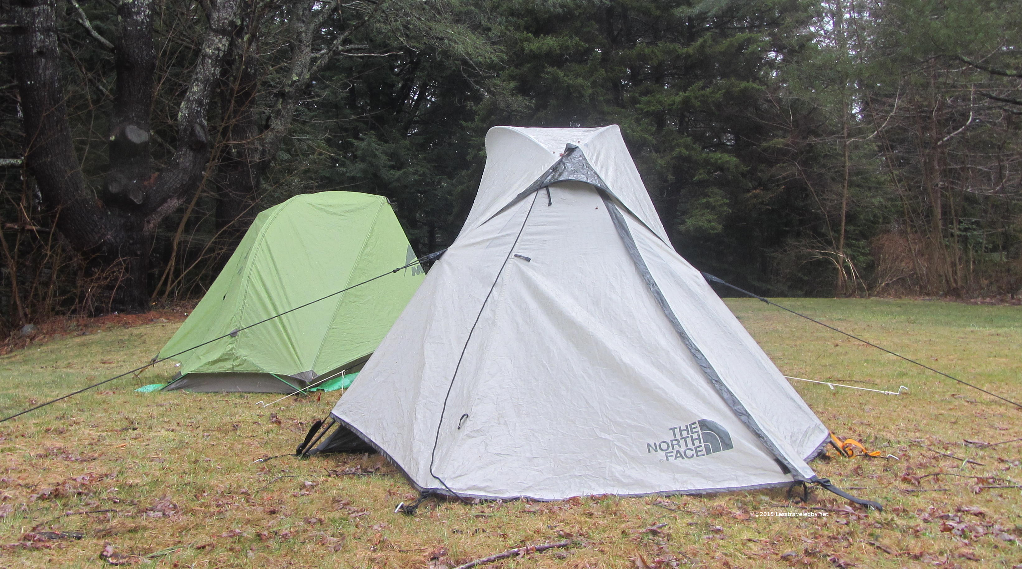
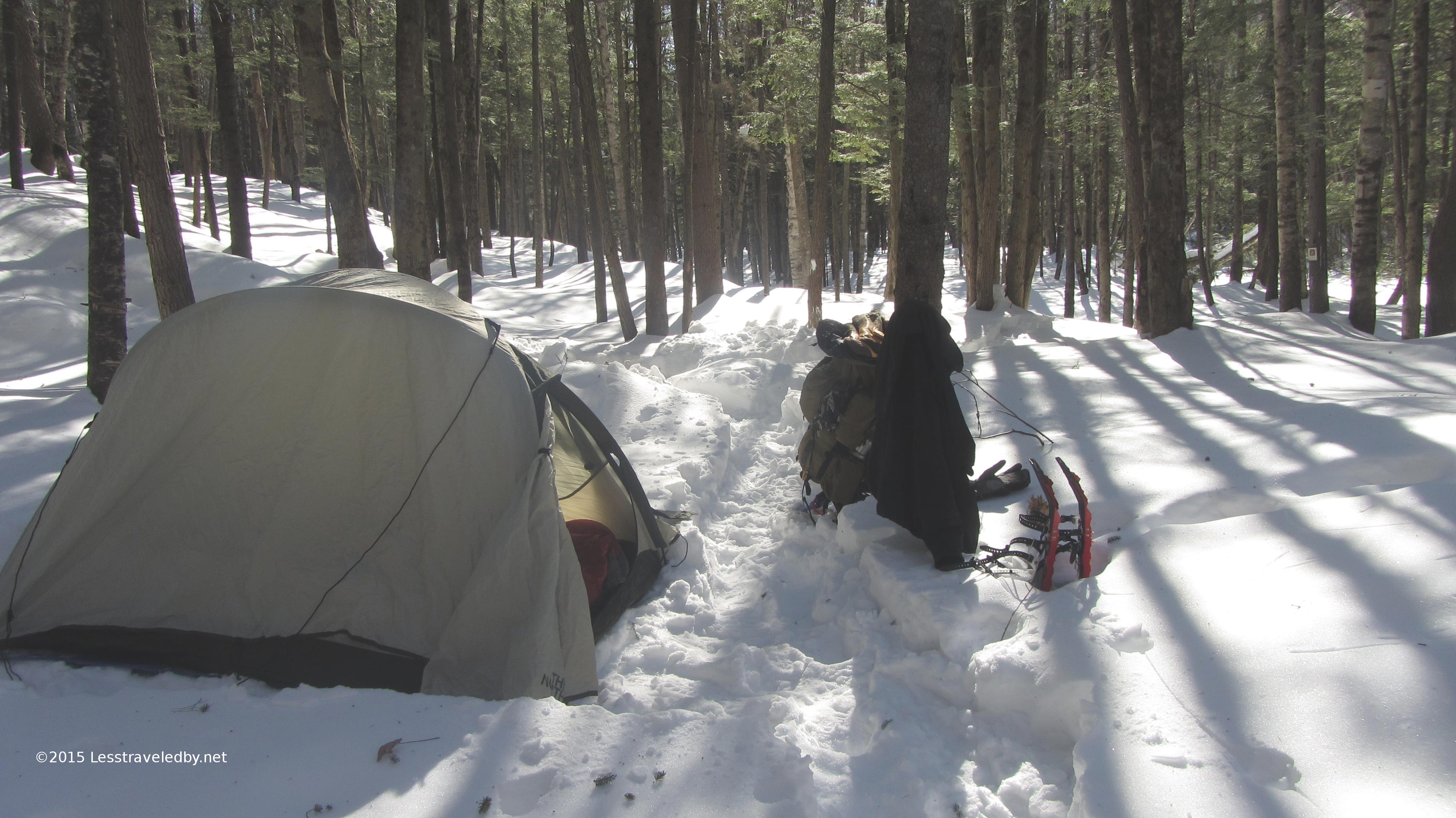
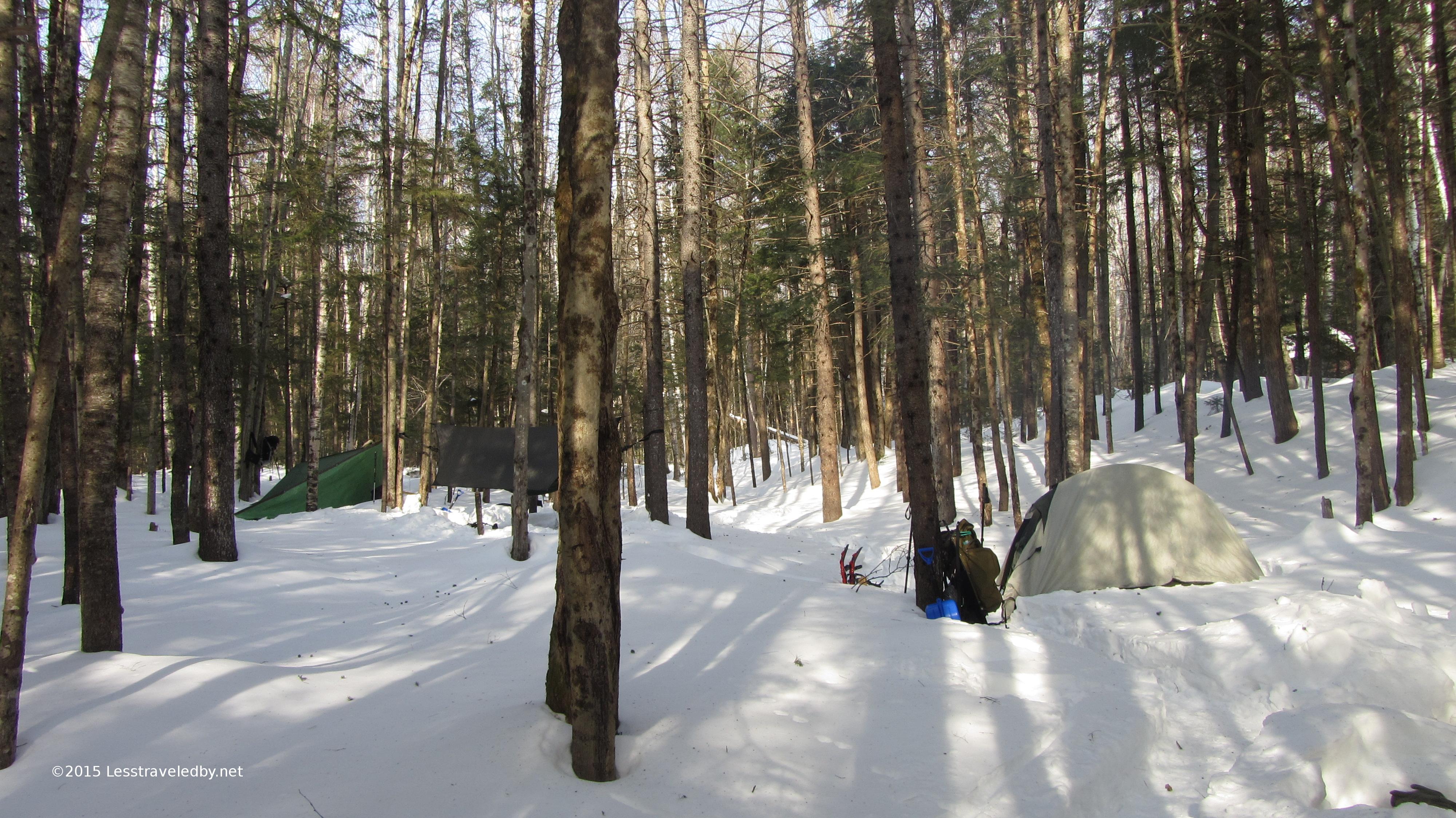
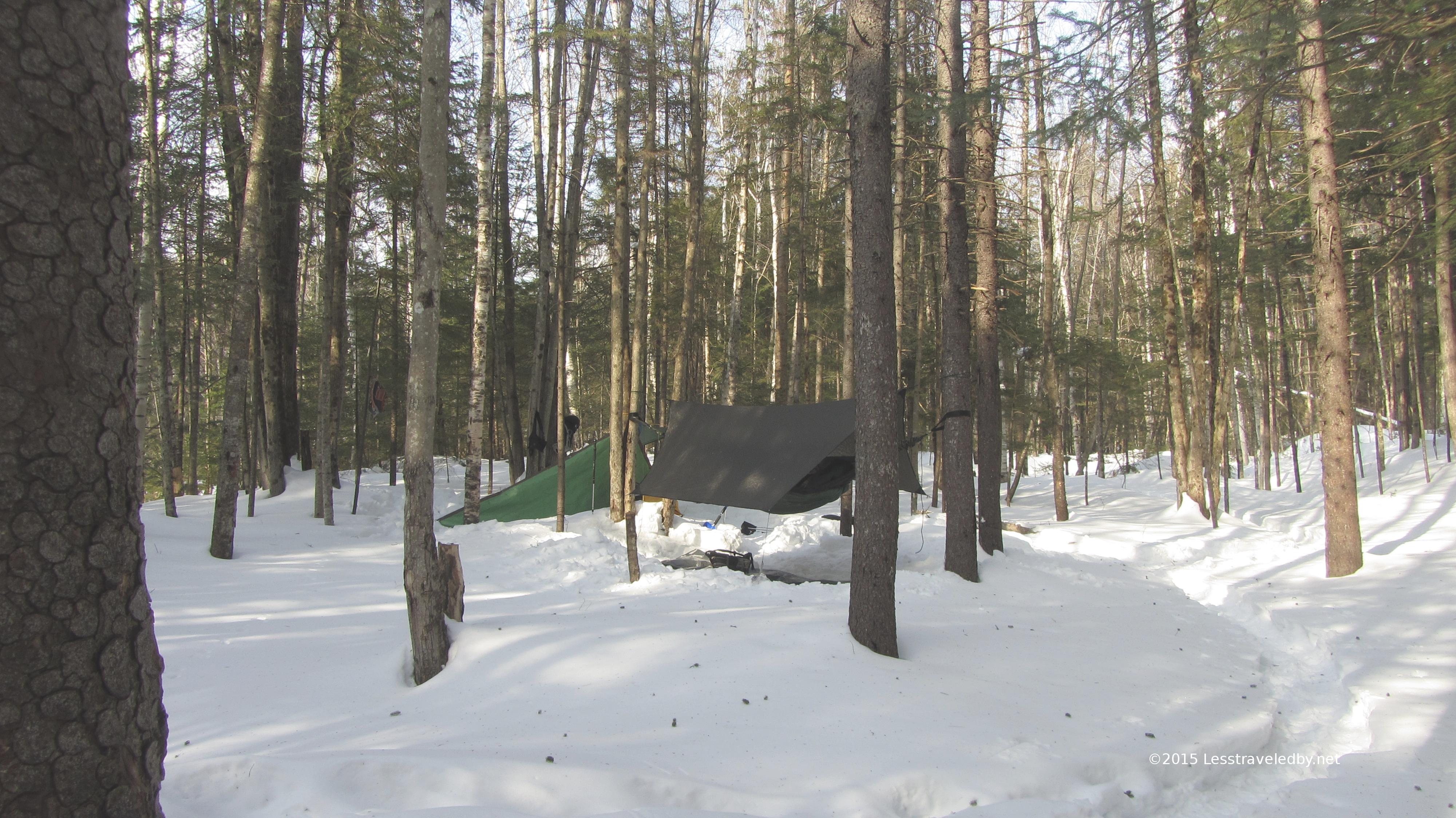
I came across this little gem and didn’t take more than a couple of minutes to decide to take off my pack. Based on compass heading I took I’d guess it was about 2600 feet. Not exactly flat but enough room to squeeze the Hubba between the trees. Pretty sure it was flood swept from a near by drainage so another bad spot if it was raining, but a smooth enough spot to lay my head and the leaf litter told me it didn’t flood often, just well.

I made camp with plenty of time to get out of my sweaty trail shirt and into a nice dry fleece for camp and sleep wear. The puffy was hung out just in case but ended up only being used as a pillow until morning. The temp started dropping pretty quick after the sun set so I settled in to do some reading before bed. I brought along my Long Trail Guide and enjoyed the first five divisions along with a few pecan short bread cookies. The folksy Vermontese of the guide paints such a vivid picture of the trail that I always enjoy rereading it.

Not sure if it was the bear tracks in the snow or the dinner I ate but I had a very vivid dream about being harassed by a bear that night. In the dream I was in a larger tent with some others and we were trying to scare off a bear. It didn’t work and the bear started pushing our tent. As we went flying I woke up to the very definite sensation of being pushed squarely in the small of my back. The first thing I did was to check to see if there were claw marks in the tent heh. Then I pondered for a moment and decided to say “Hey!” in a manly voice just in case there was a lonely beast of some sort trying to cuddle up to me. Then I laughed about it and went back to sleep. In the morning I could see no sign of anything big having been there so either it was a chipmunk or all just a dream.

IMG_4208a
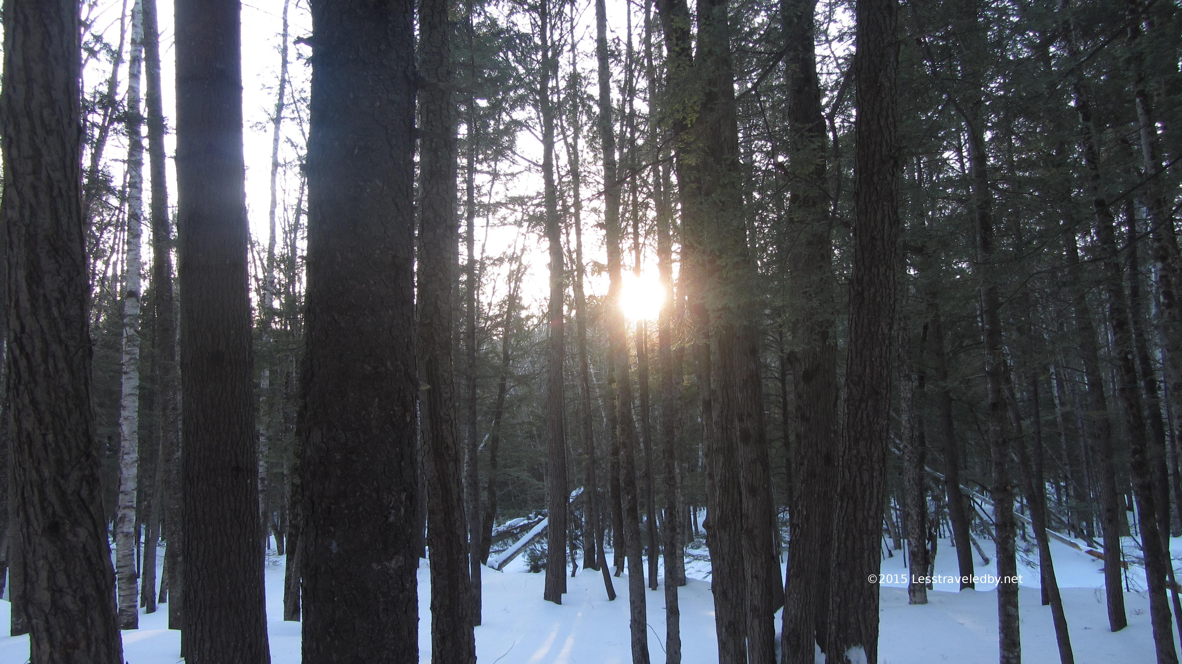
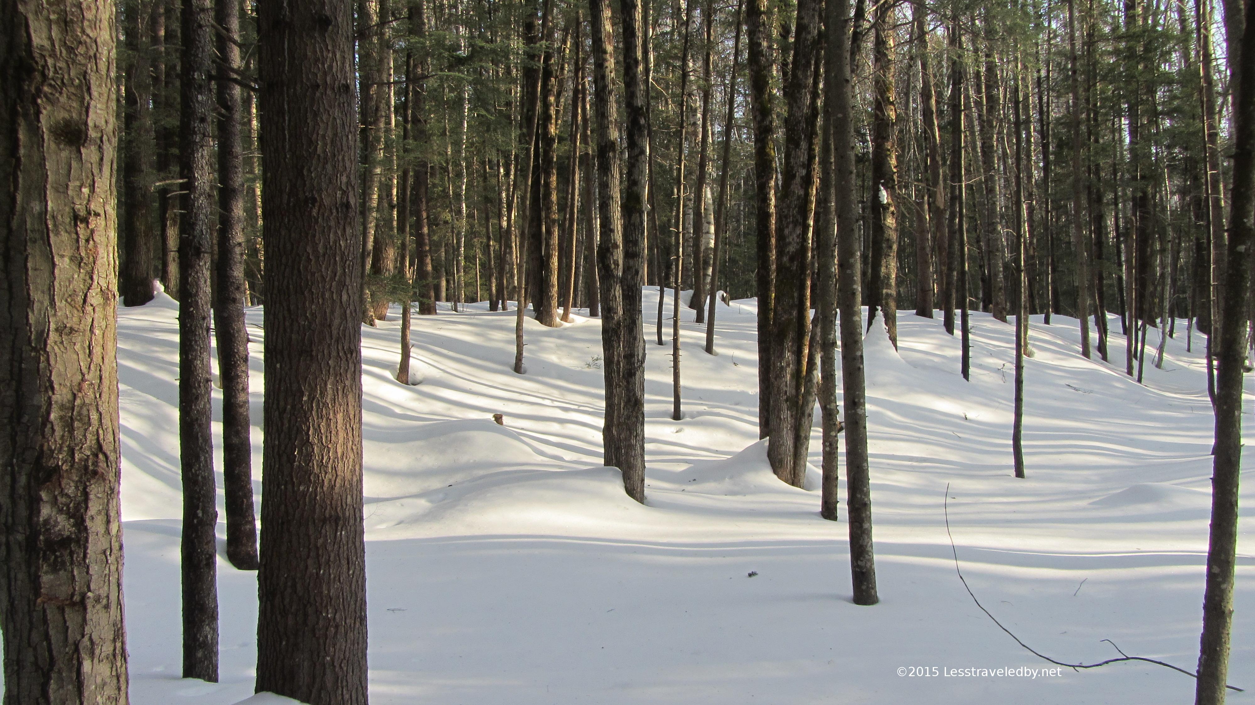
The morning was beautiful though a bit chilly. It had gotten down to around 35°f. Not quite freezing, but close enough that handling the water bag to make coffee was cold on the fingers. I’m not sure if I got up late or just puttered around a lot but I know I wasn’t on the trail until a bit after 8. There was coffee to drink, granola to eat, a tent fly to dry out and of course the morning light on the snow meant lots of pictures.

IMG_4211a
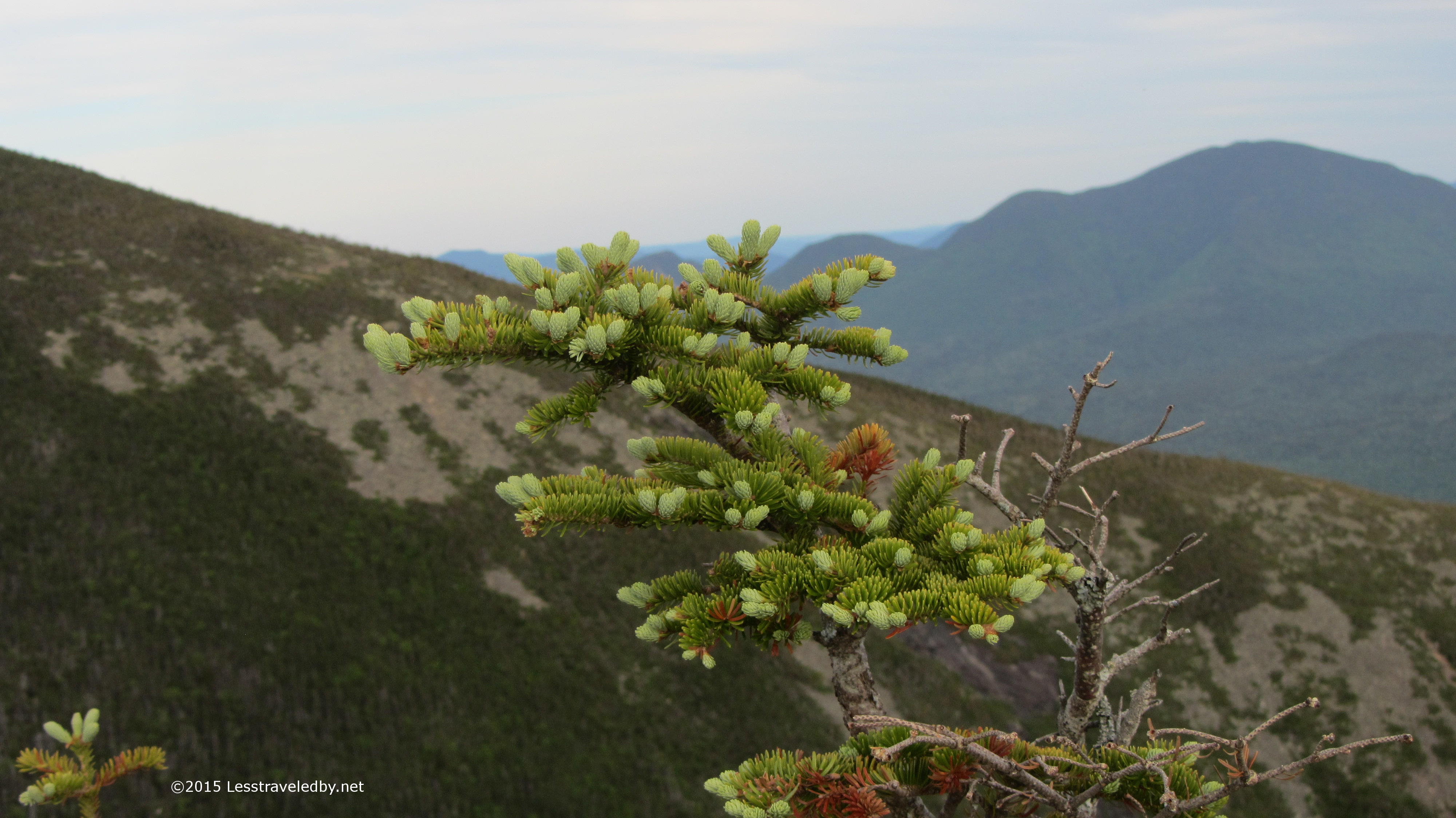
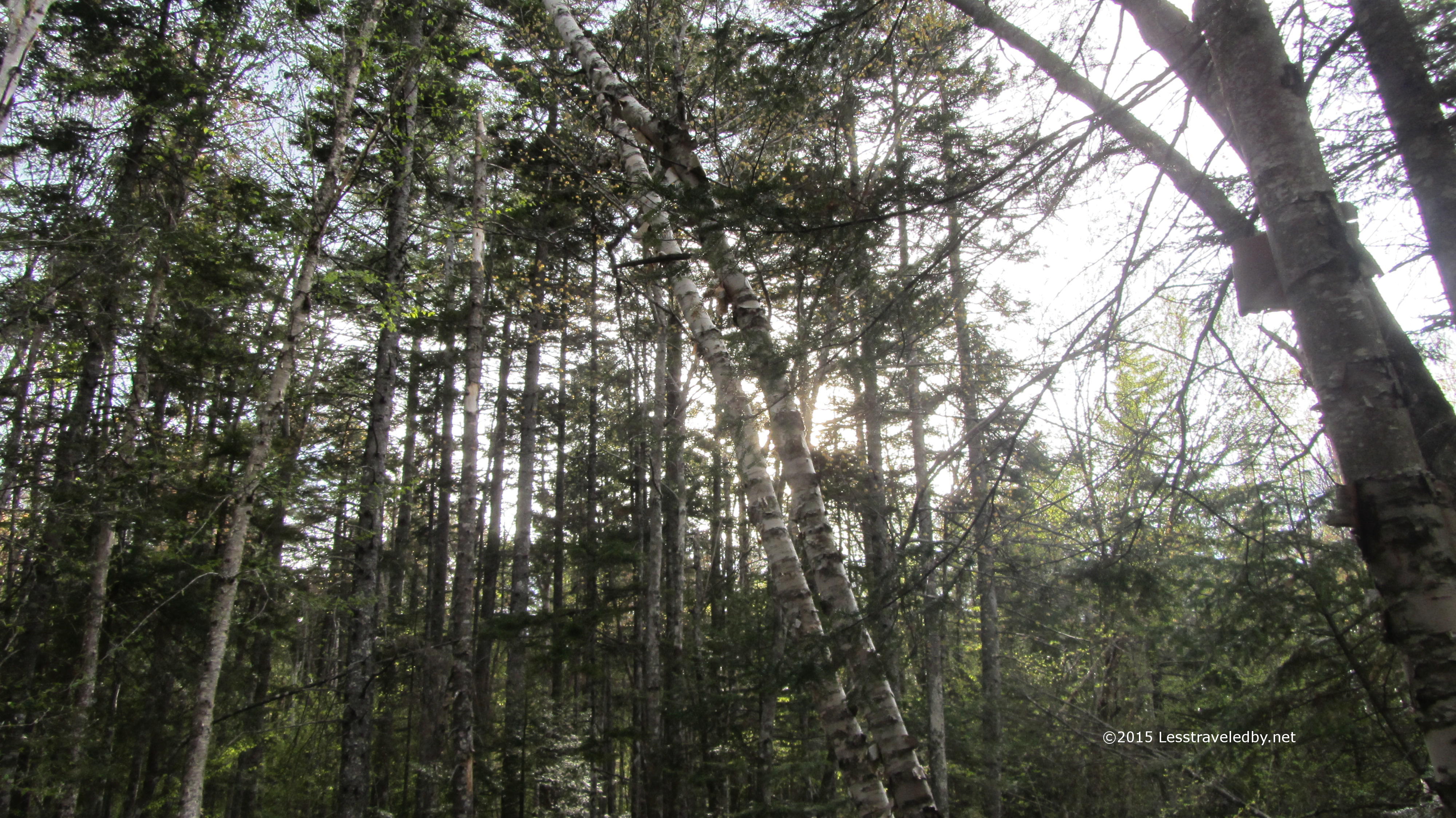
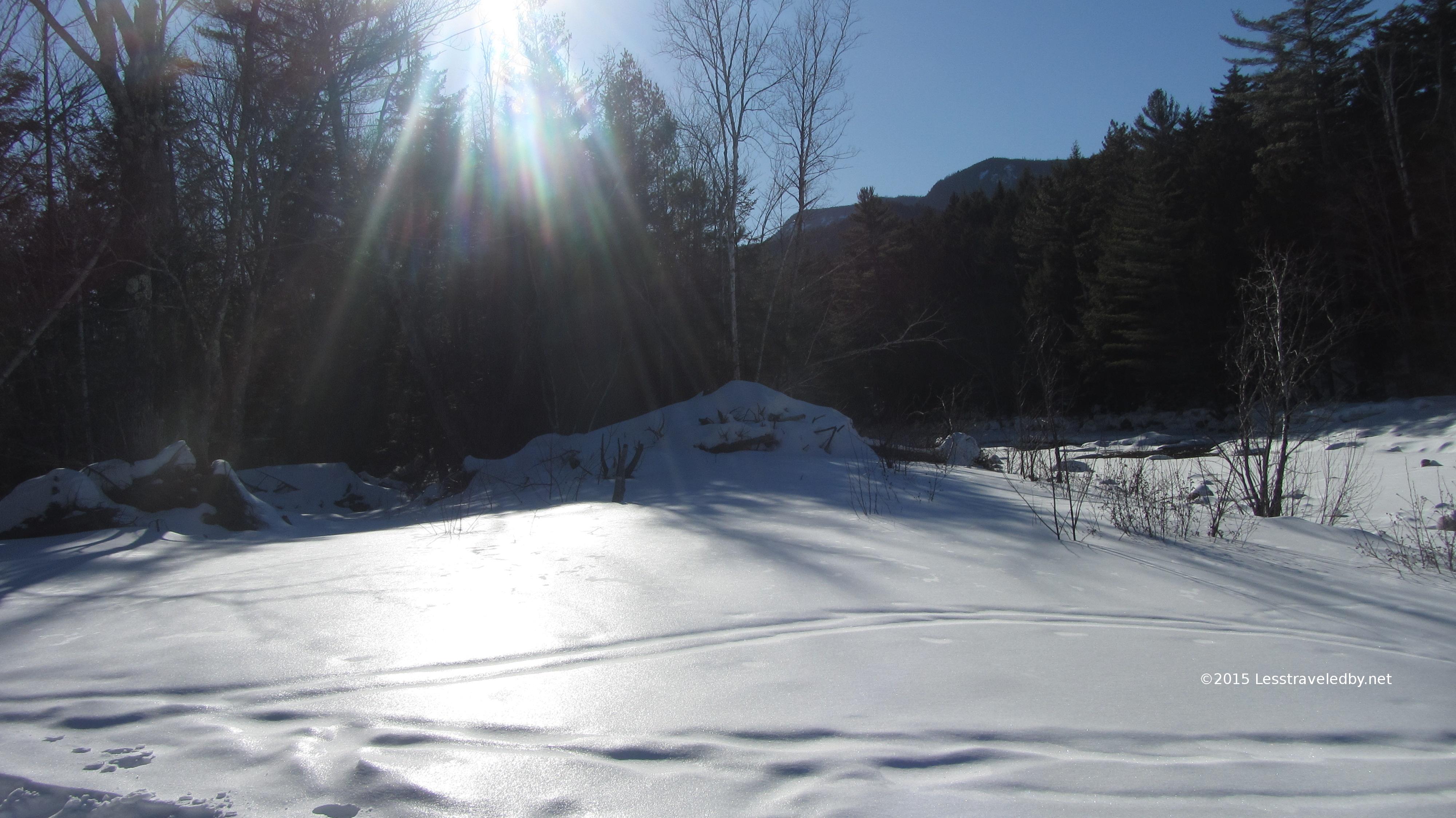
The early May sunlight on the littered and fading snow seemed to be saying it might be a chilly start, but there would be less snow around by the end of the day. The morning light always seems to do interesting things in these mountains. Any season I find the Whites to be a great place to wake up.

IMG_4213a
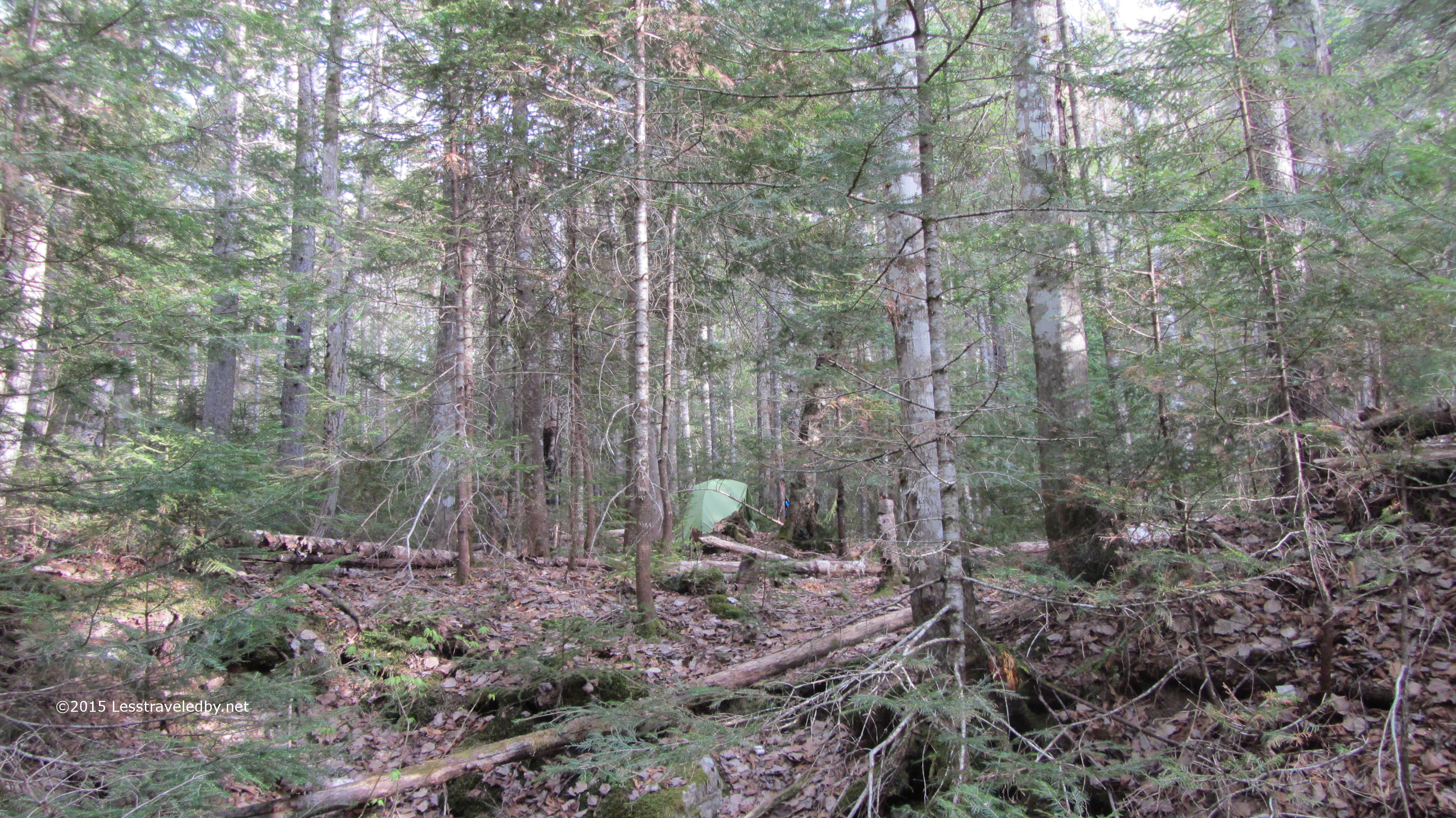
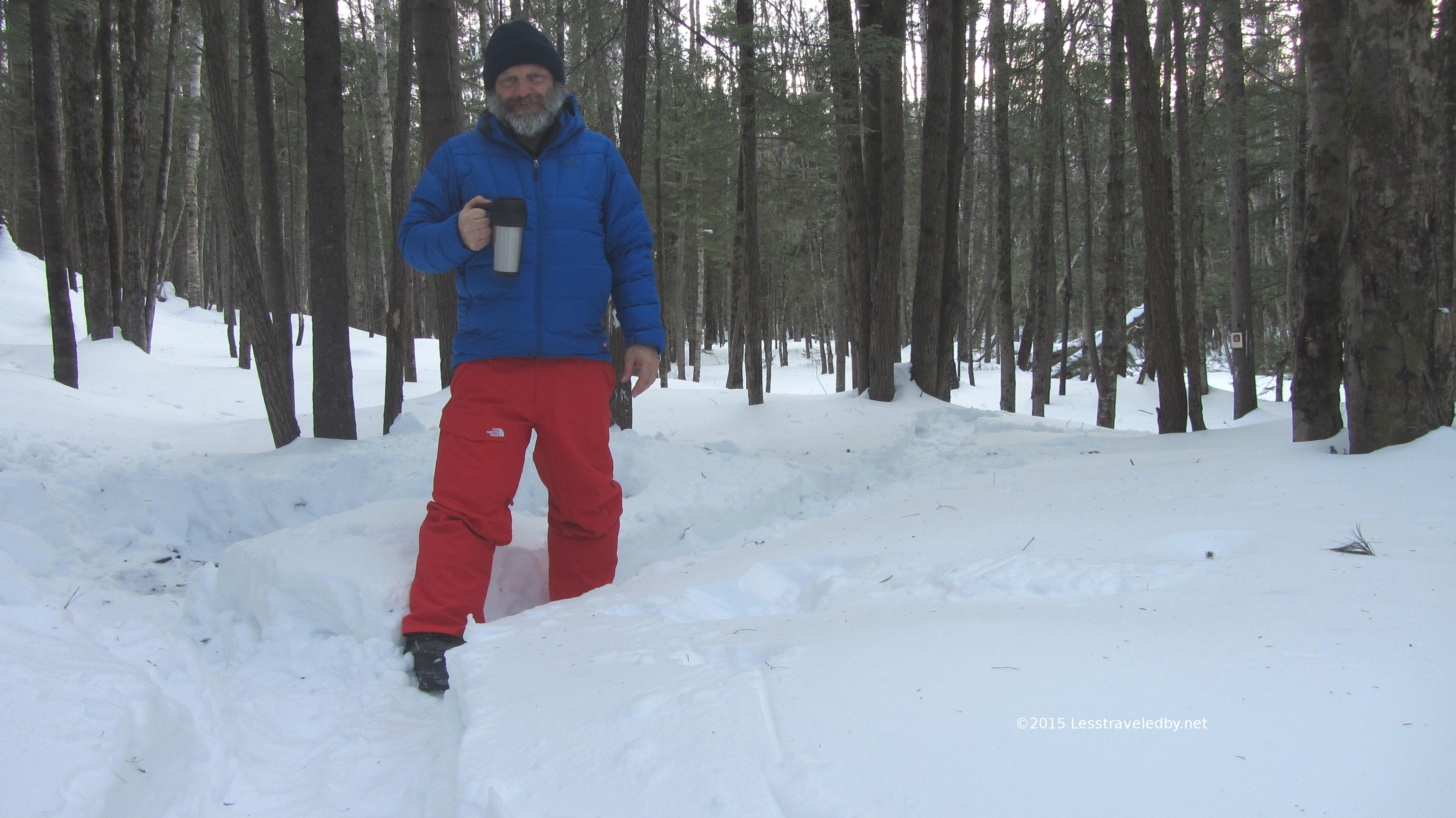
My bag is packed, I’m ready to go. Well, maybe just one more pic. Once I pick up that pack you’d never know I’d been there. I love passing near previous camp spots and knowing that I’m the only one who knows I’d been there.  On this trip I found two spots where folks had built a fire right on the trail which seems to be the opposite approach.

IMG_4214aEnough of my complaining, lets get back to that beautiful morning light. I headed up, postholing for a bit in various depths of snow and then hitting dry patches of trail for a while. I continued to see bear tracks now and again and at times I could see remnants of a set of ski tracks. I seem to recall reading a trip report from someone who had climbed Hancock from the other side and skied down this way and now I could vouch for it heh.

IMG_4216aOther than the bears and that one skier the trail was unbroken. I began to hit more snow and went straight from bare boot to snowshoes. The day was heating up and the snow was falling apart under my feet. Even with snowshoes I would sink to my knees and even my hips at times. Seeming solid surface would suddenly give way making for a very adventurous climb.

IMG_4217aBased on the time and progress I seemed to be making I pretty much gave up on making the summit on this trip, but I was hoping to have lunch up at the intersection with the Hancock Trail so I kept stomping on up the notch. All the time I spent on the snowshoes around home and the couple of trips to NH paid off as my legs were up to the task. The knees were a little displeased as postholing is not kind to them, but despite some grumbling agreed to continue.

IMG_4221a
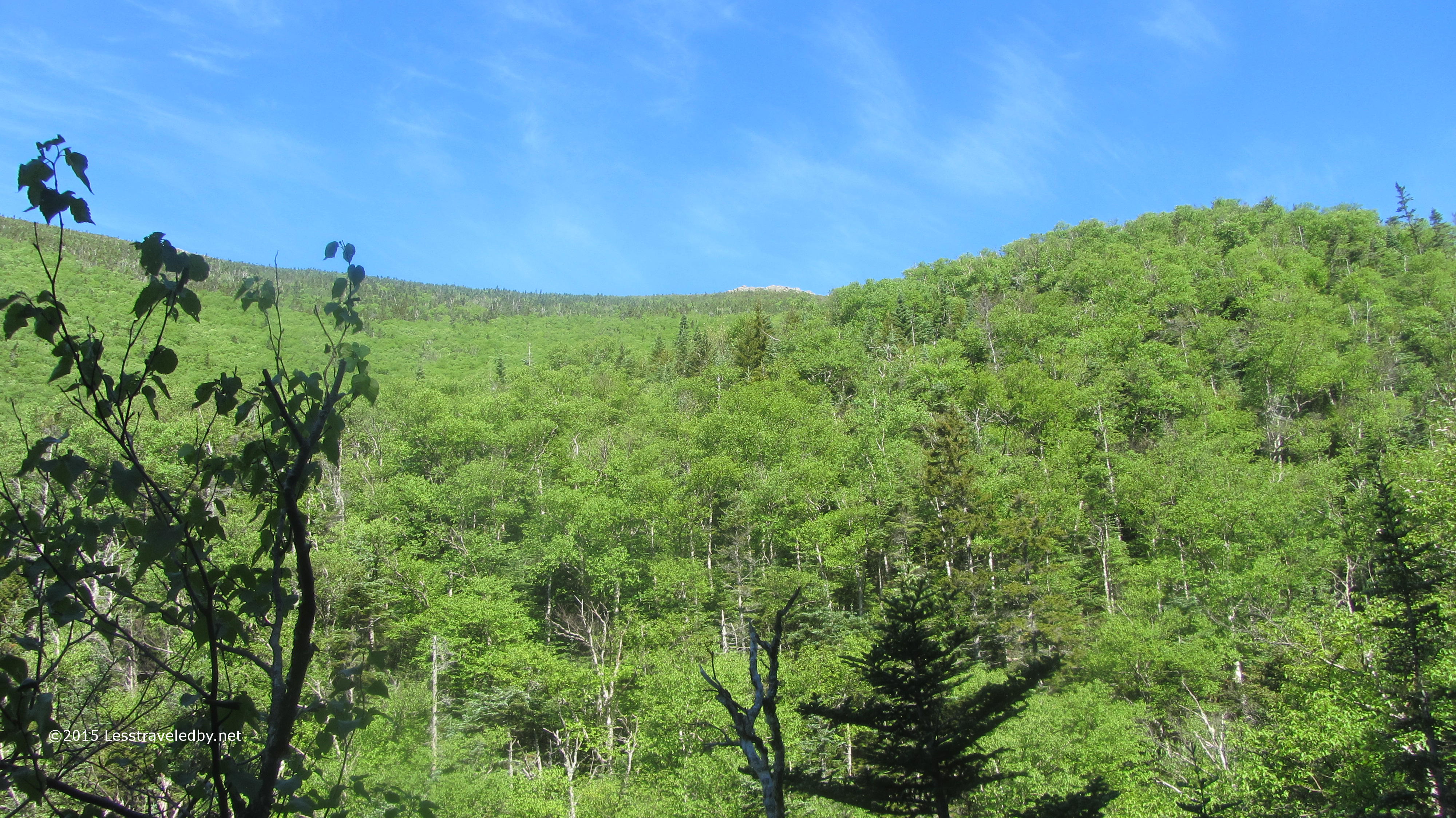
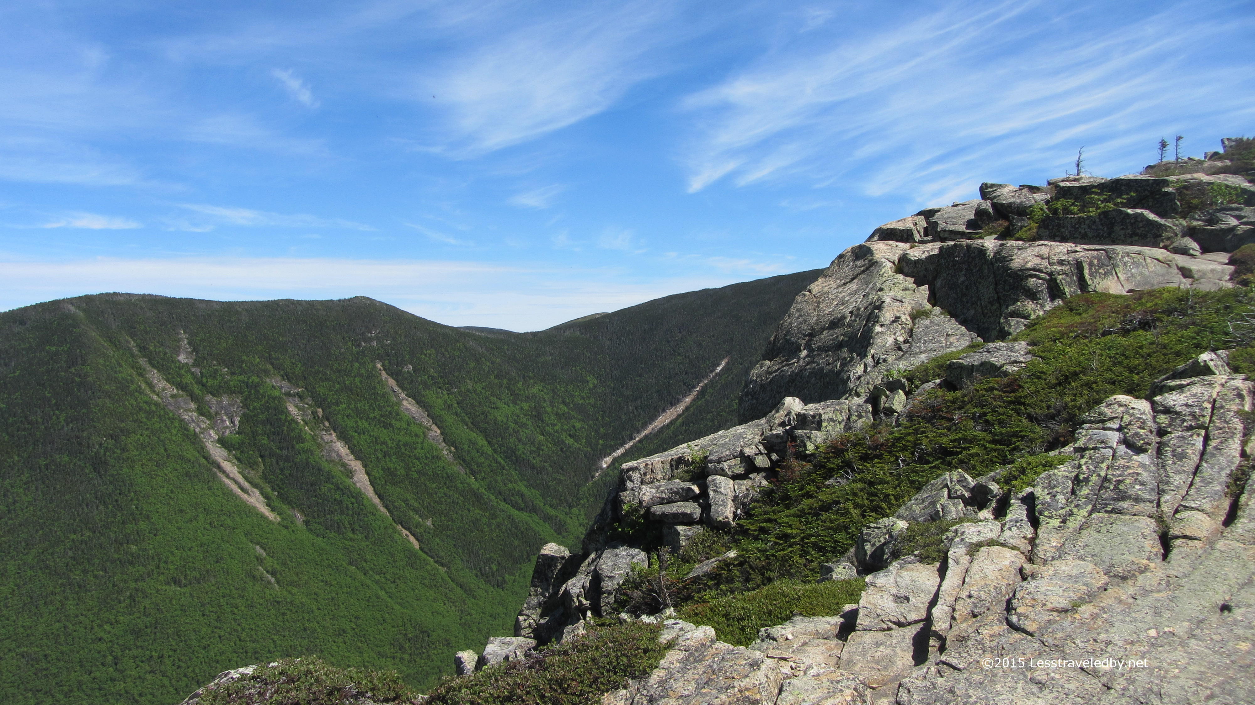
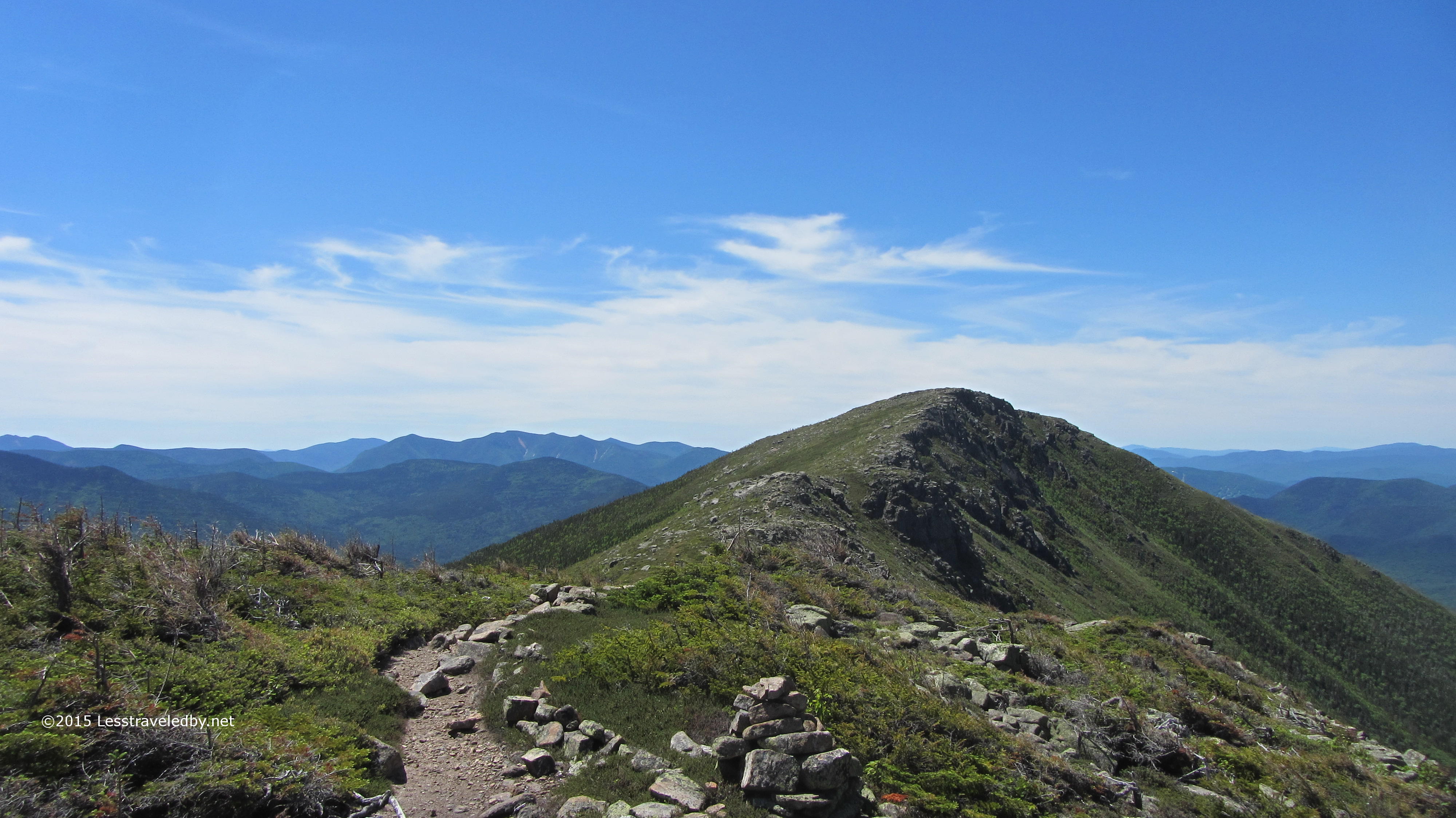
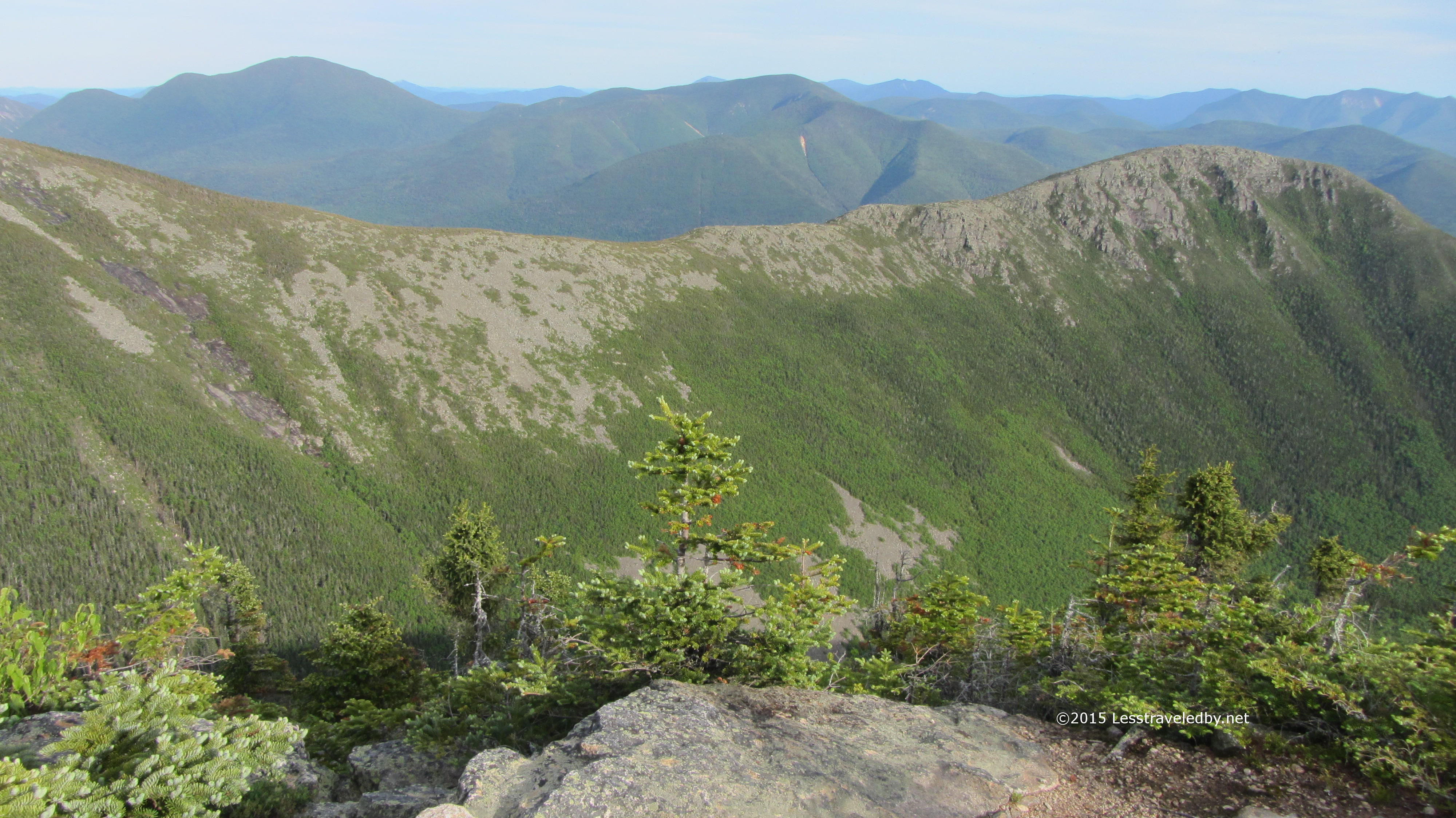
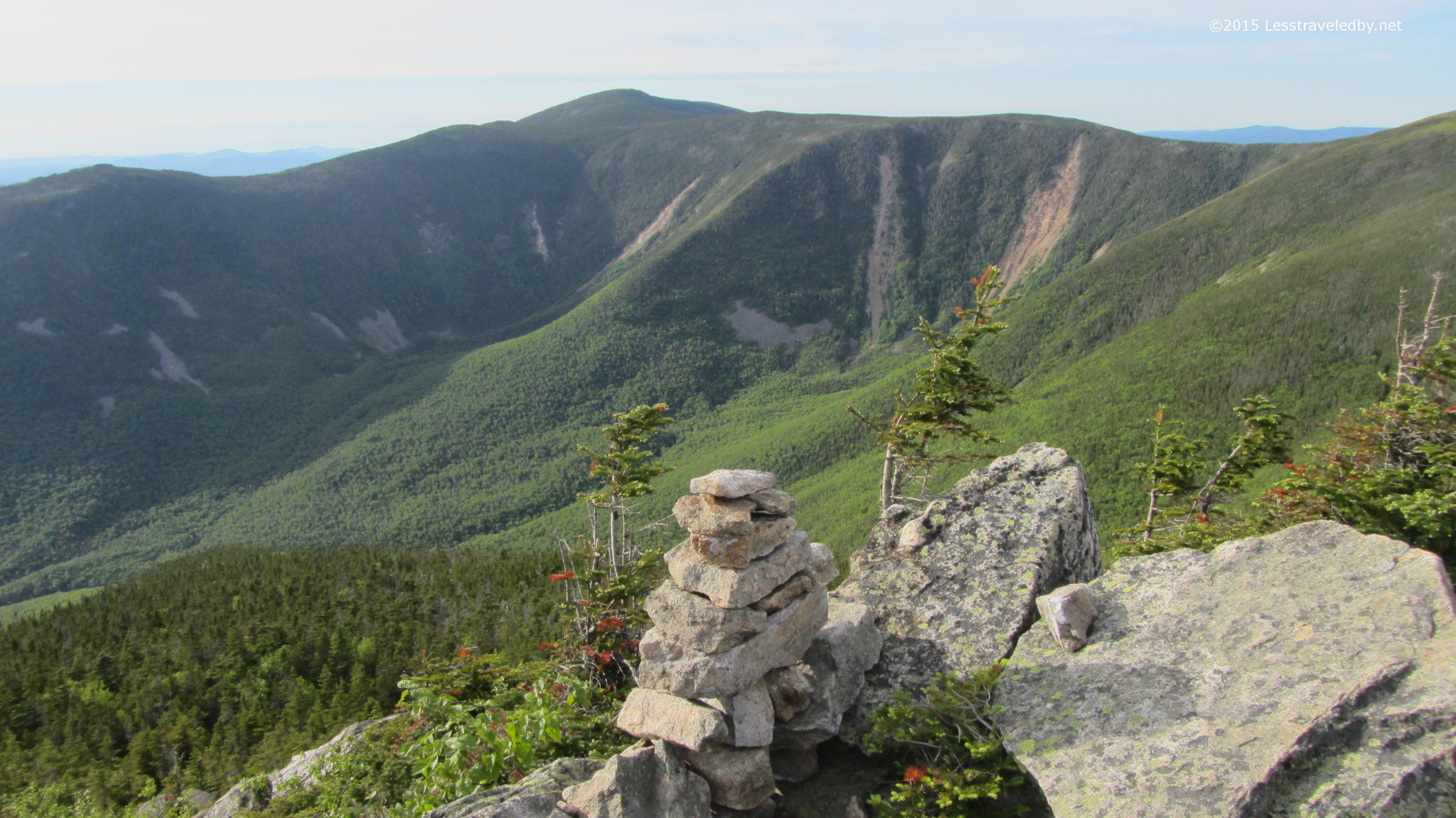
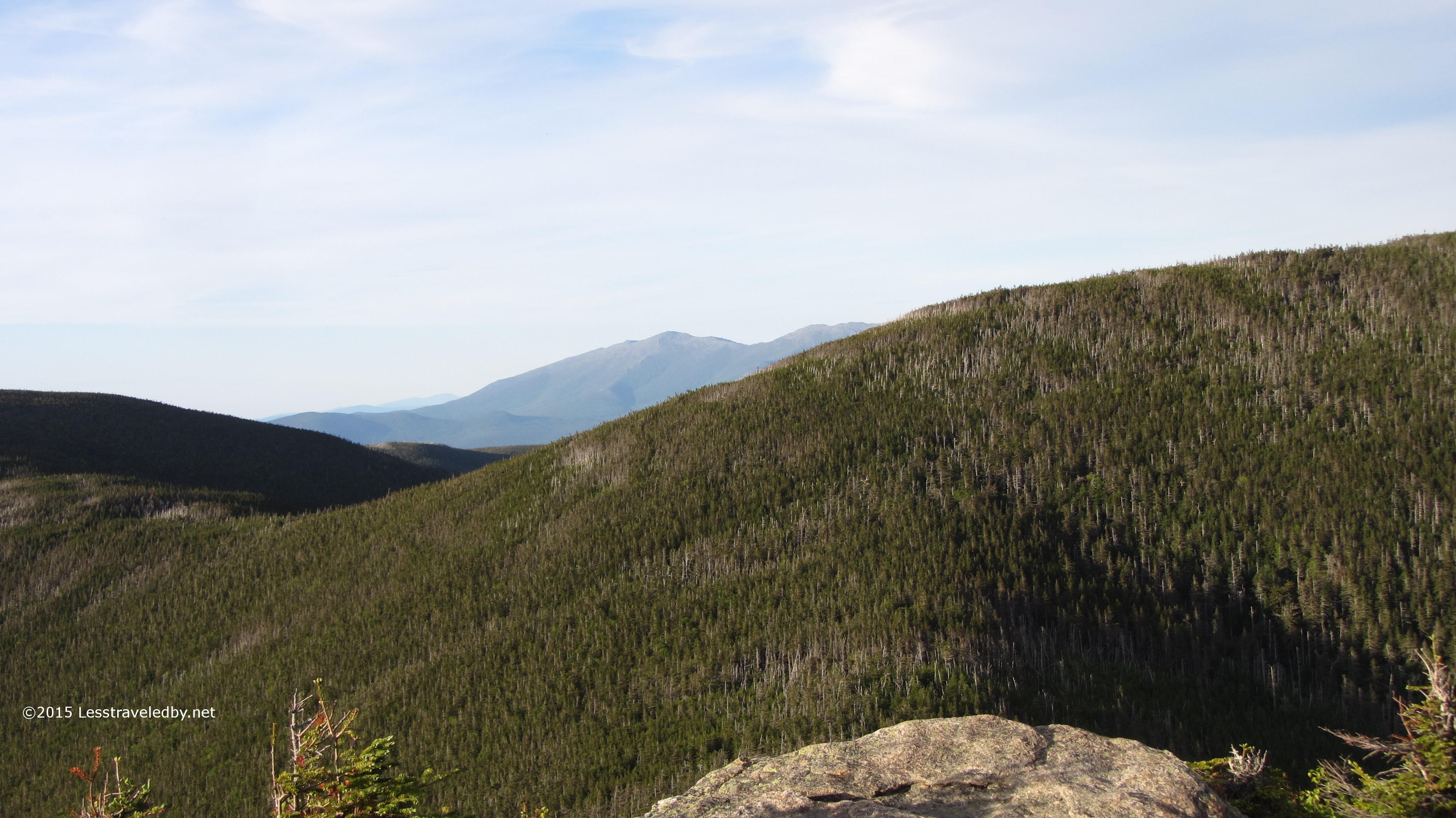
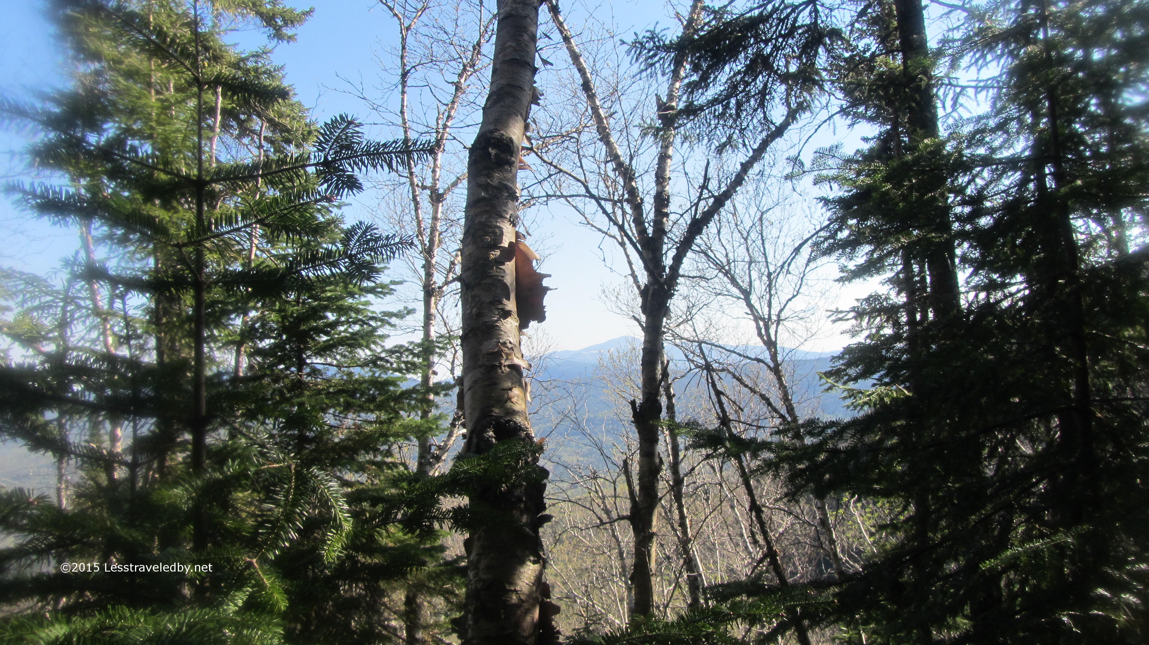
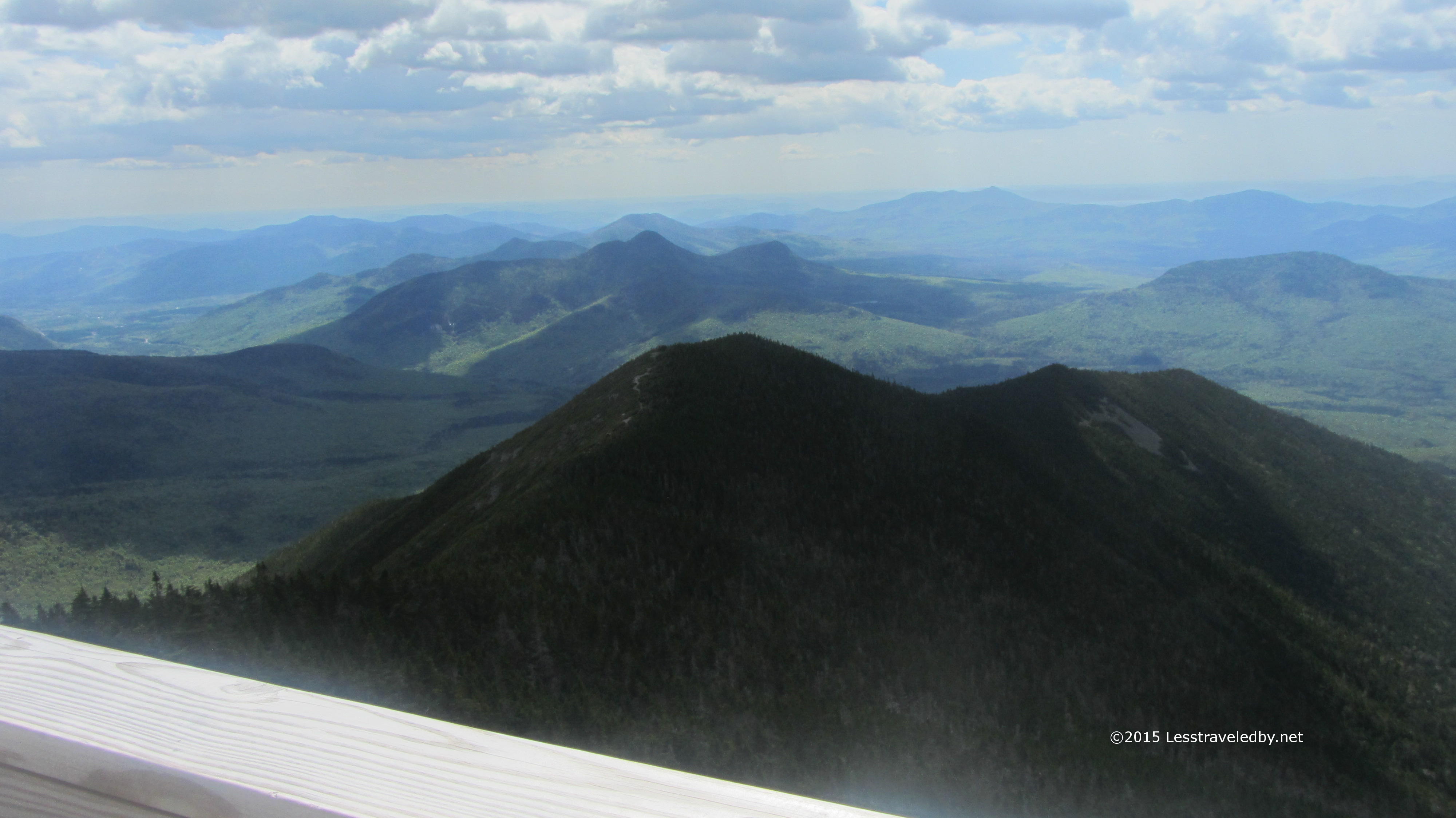
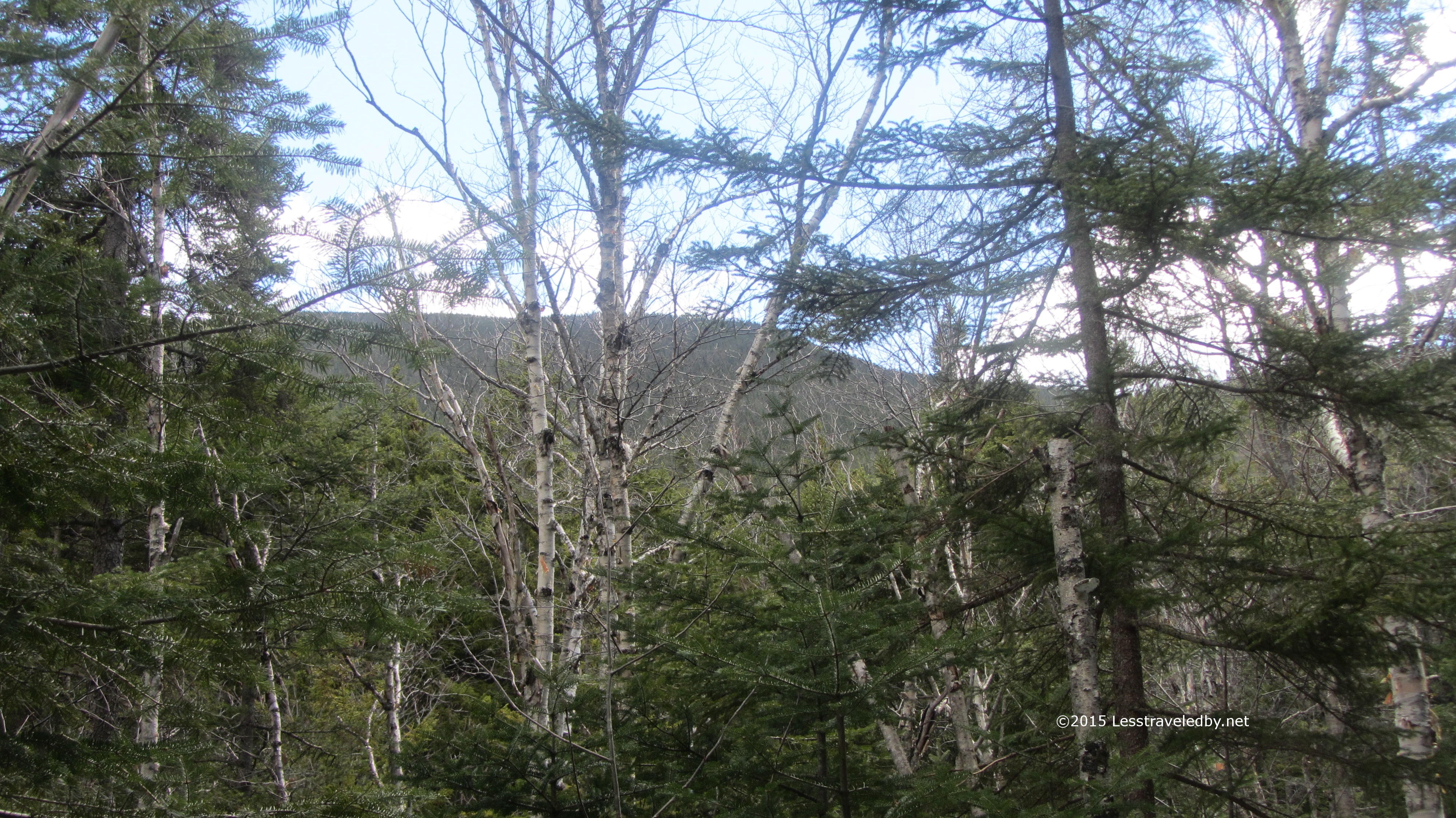
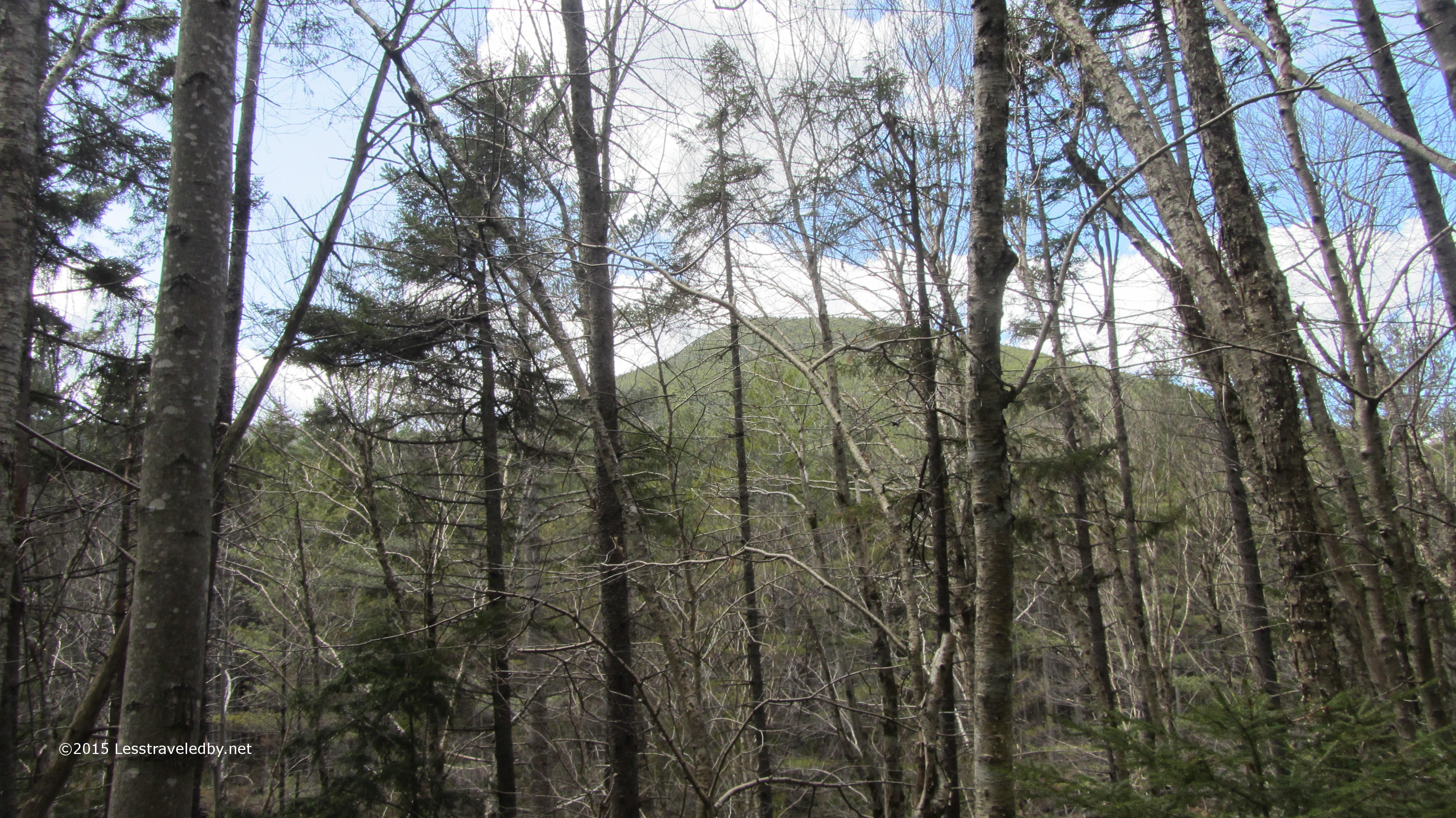
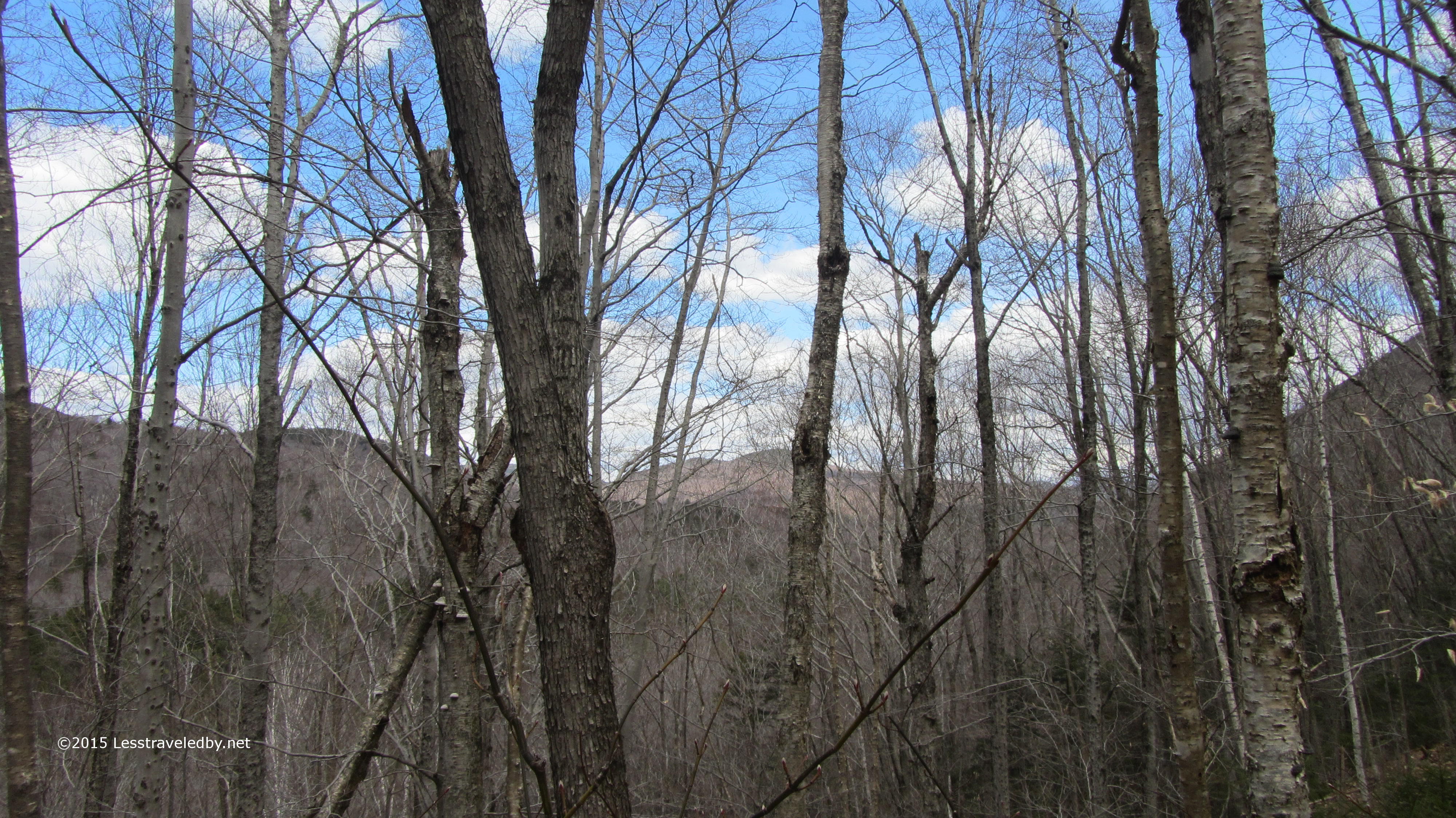
I can’t find a name for that ridge on any of my maps, but I could get a glimpse of it with my camera. Hancock was looming right over my head, but with trees in the way it wasn’t very photogenic even if it was easy to identify.

IMG_4222a
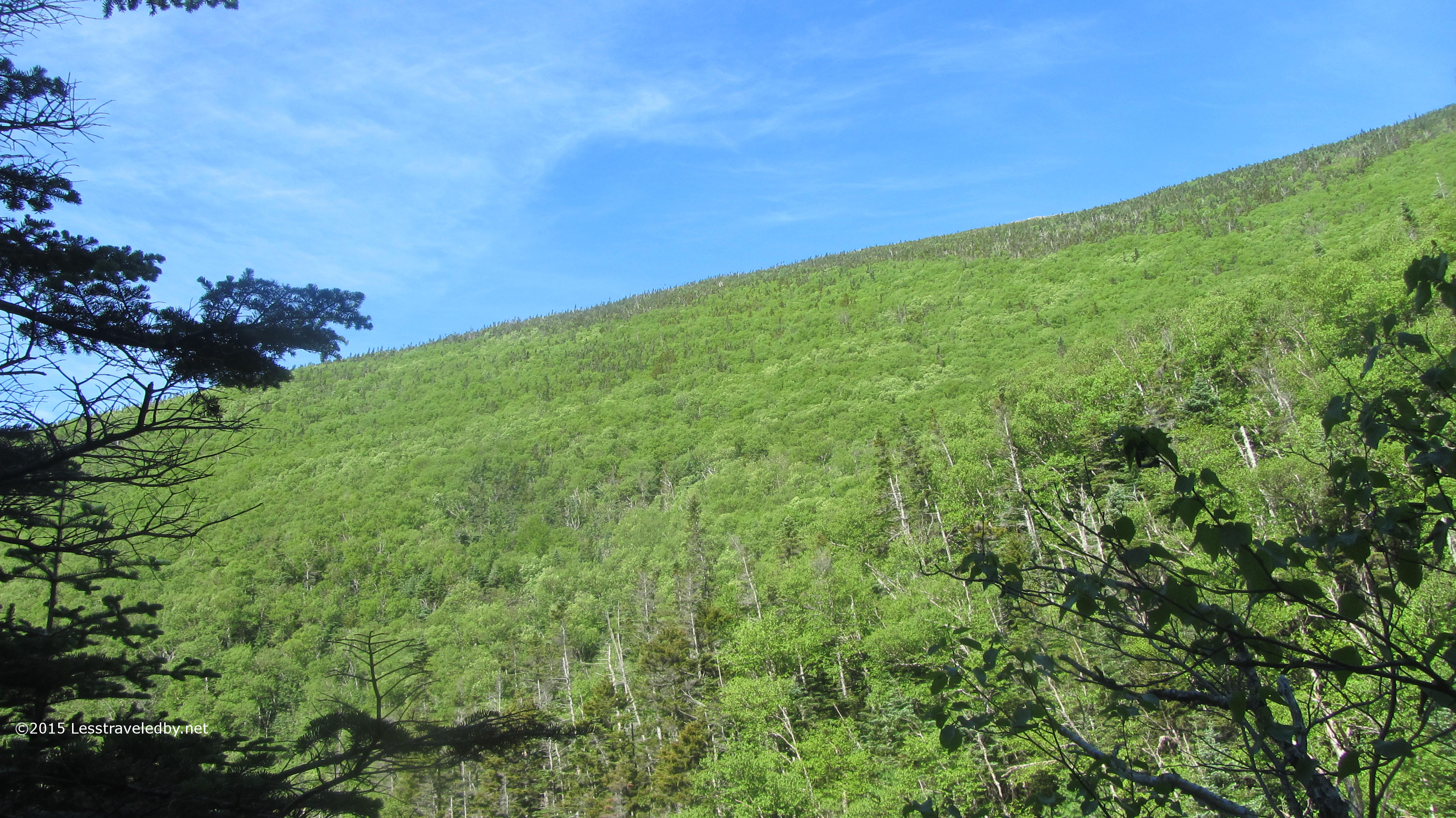
It seemed I was making some progress and was looking forward to lunch up ahead. I had this beautiful day all to myself and if things weren’t going exactly according to plan they were still going pretty darn well.

IMG_4224a
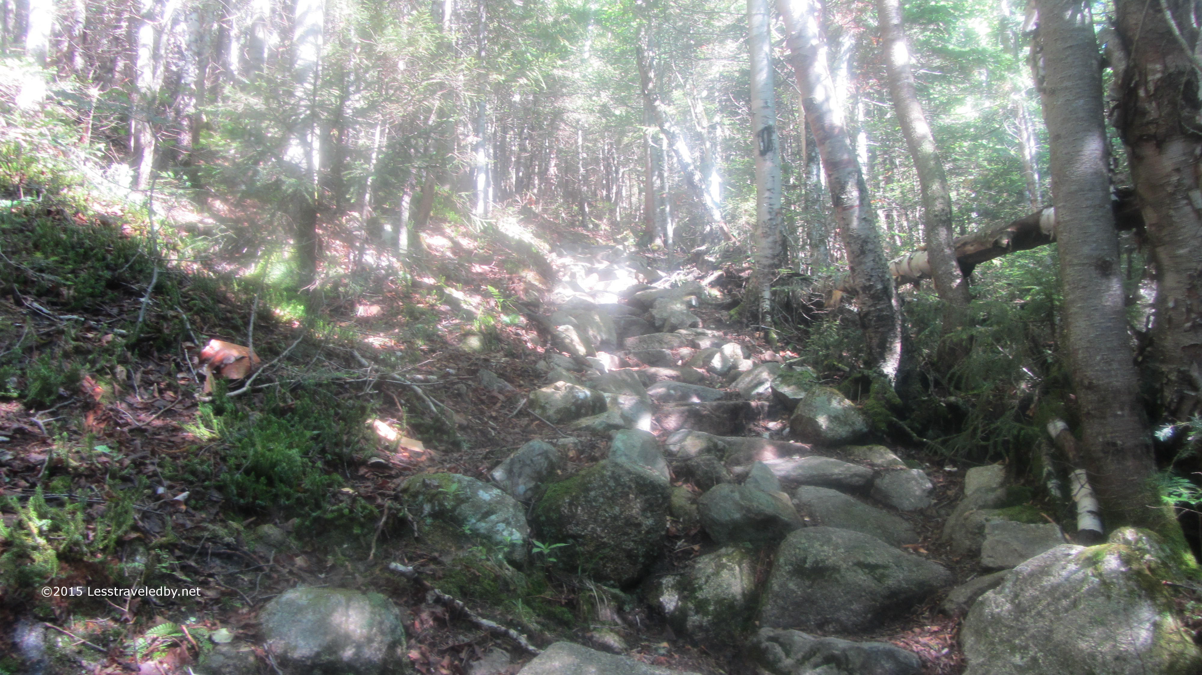
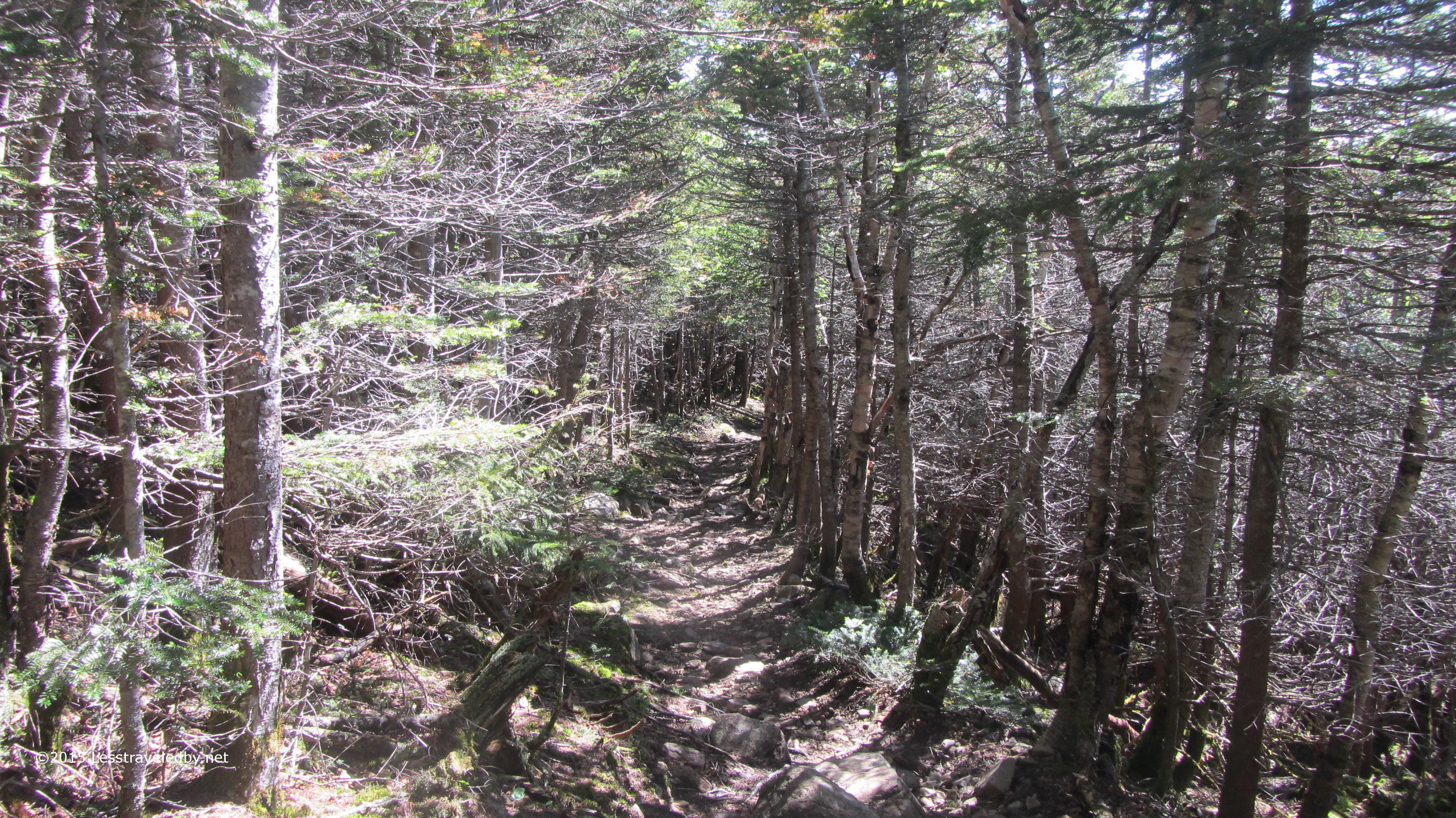
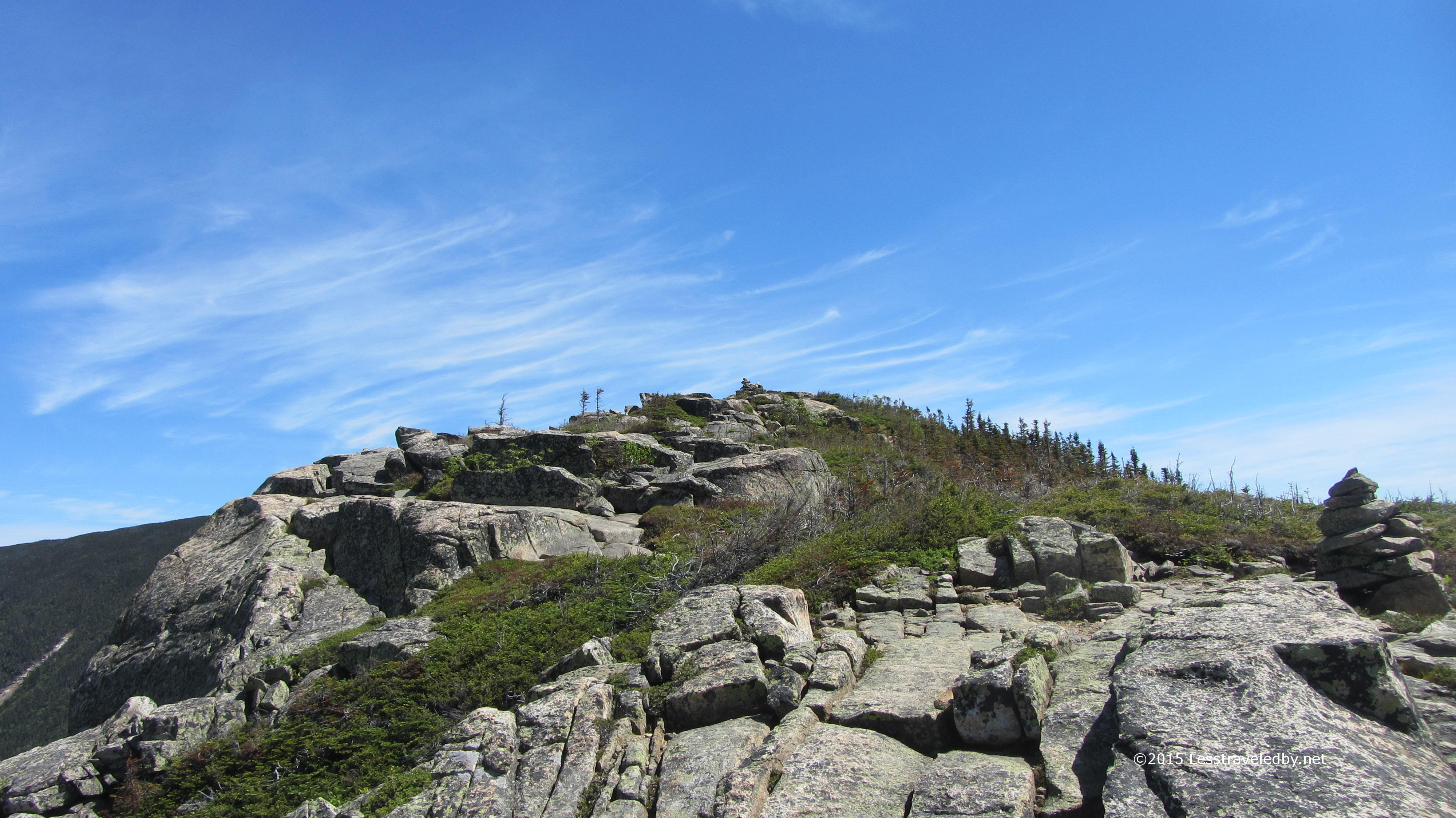
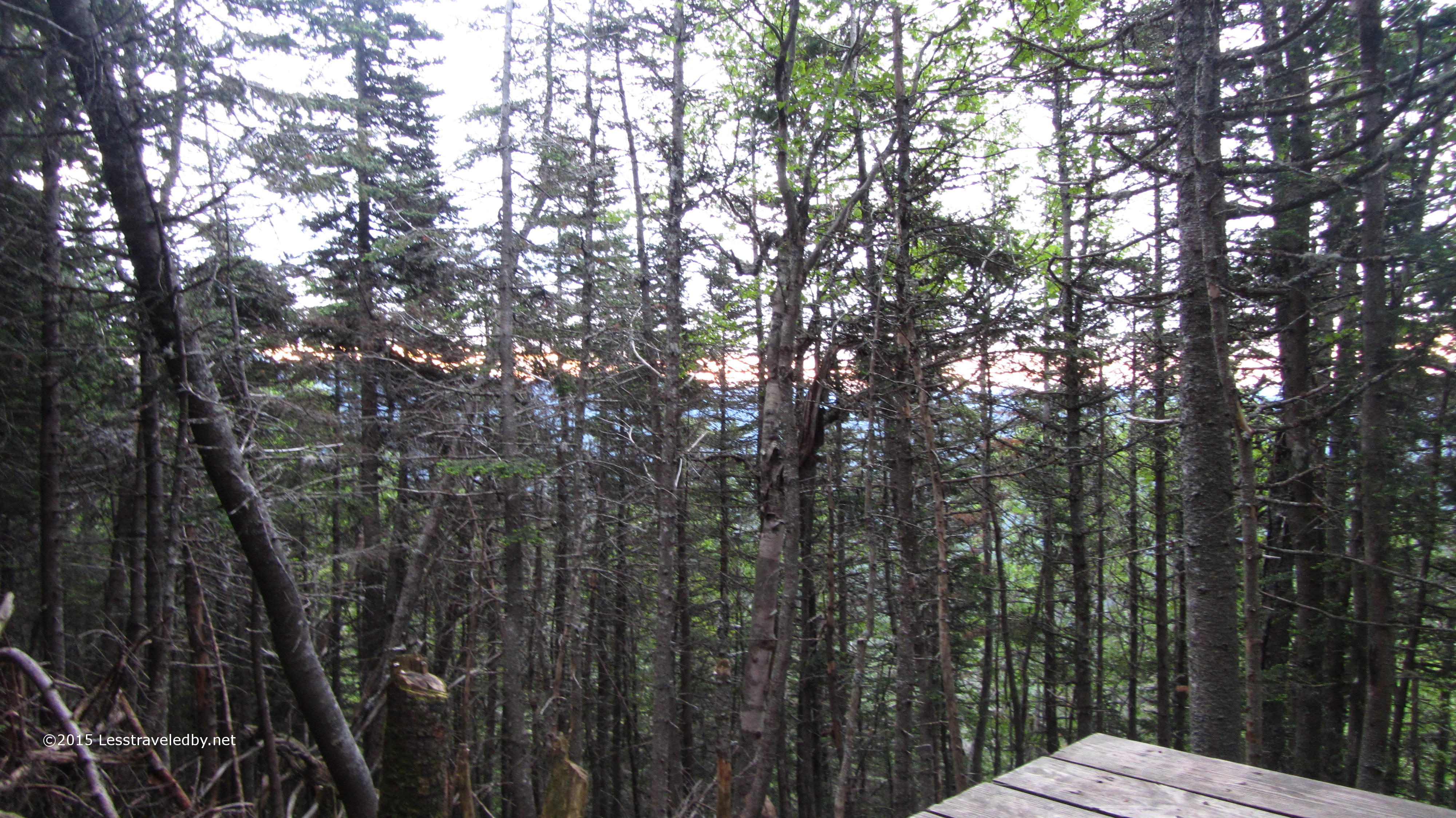
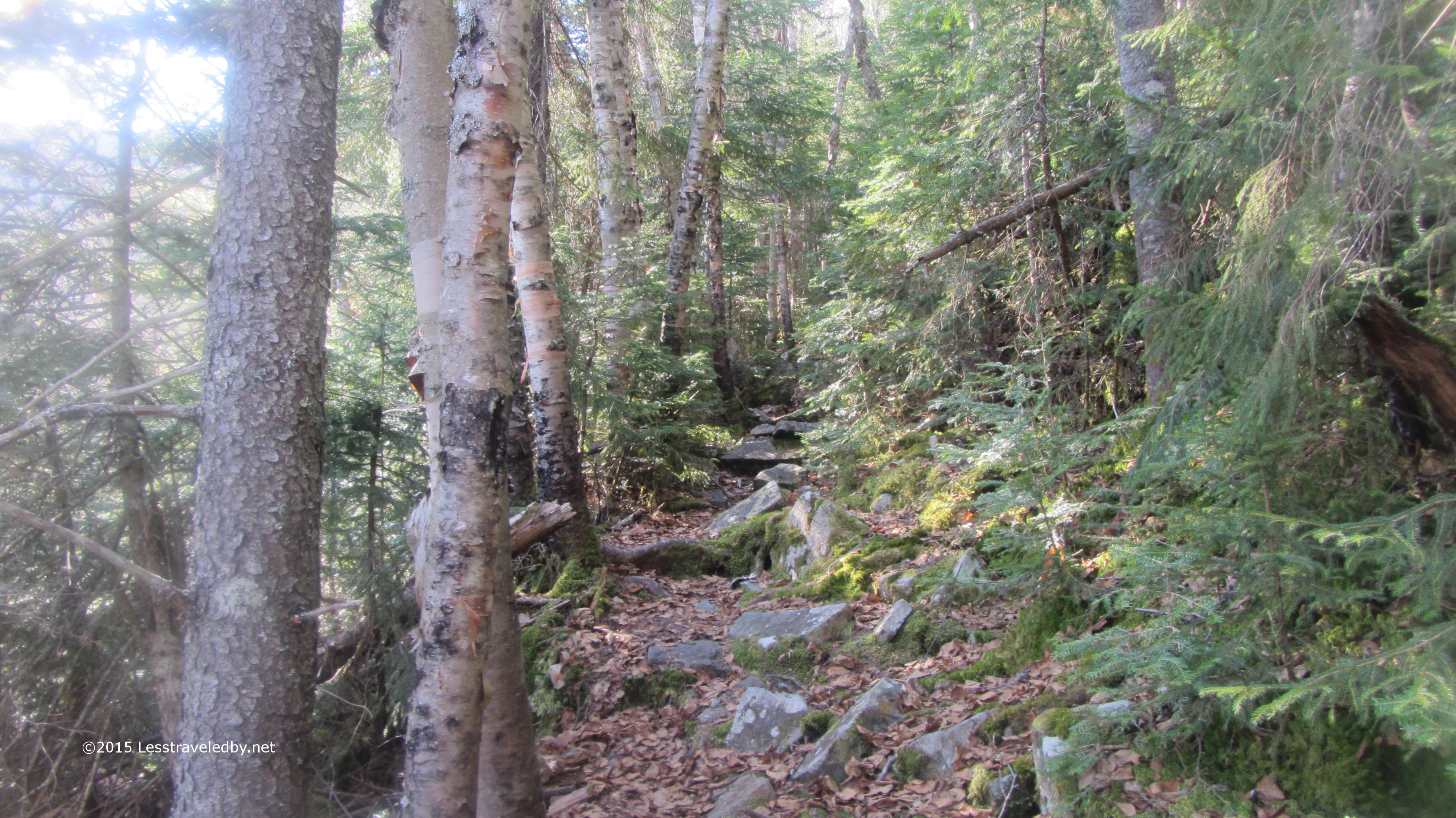
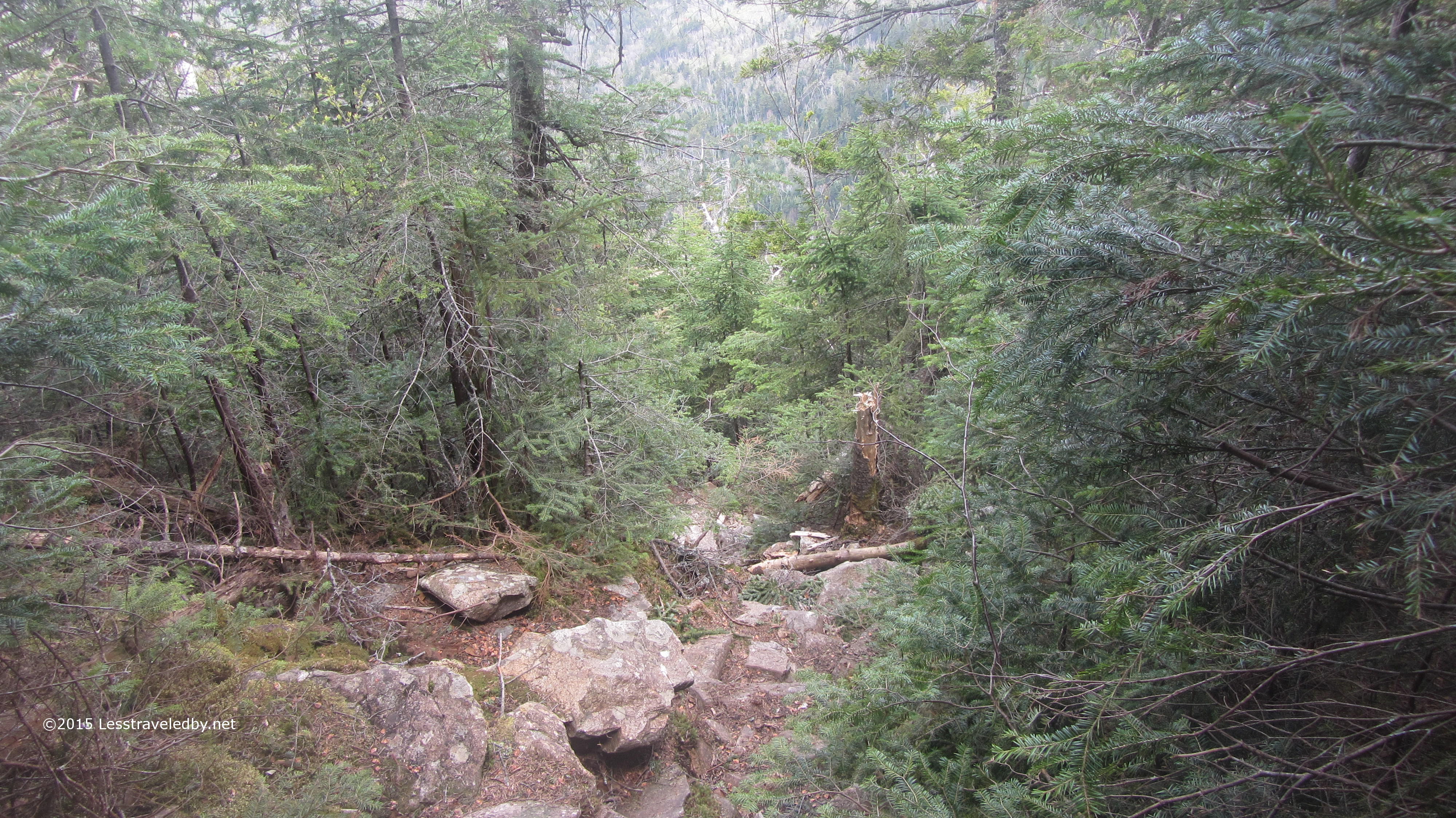
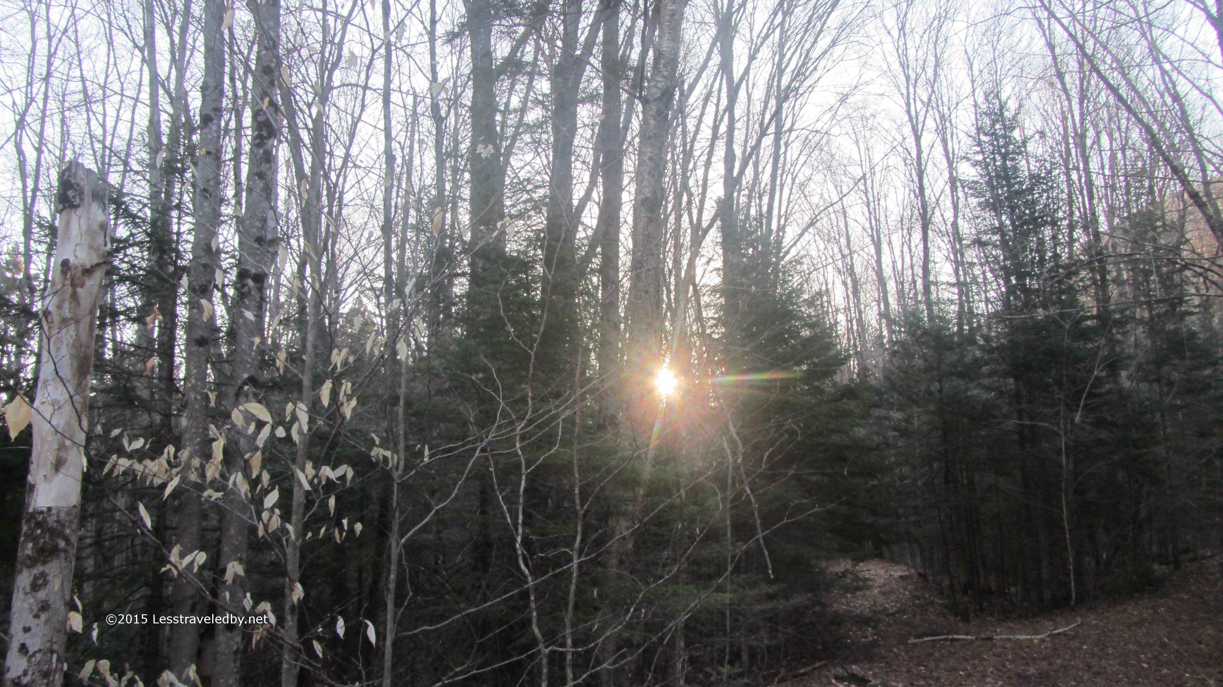
Unmaintained wilderness trails are interesting enough in the summer. In fall,when the leaves cover the ground and in winter with the snow, you really find out how well you can guess which way to go. There are no blazes so once the path is obscured all you can do is sort of follow the gaps.

IMG_4225aNo really, just aim for the gaps heh. It was all good fun, but then it was time to turn around. I came to a point where the stream I’d been paralleling came boiling out of the unbroken snow in front of me on the trail. I could see where I’m guessing the trail was supposed to go, but no clue where the stream was coming from. It only took one look to know that going on would be a case of each step being a crap shoot as far as when I’d find myself in the creek. I used to enjoy playing craps in Vegas, but not alone on a mountain trail in these conditions. My only regret is that I didn’t get a picture of the spot where I turned around.

IMG_4227a
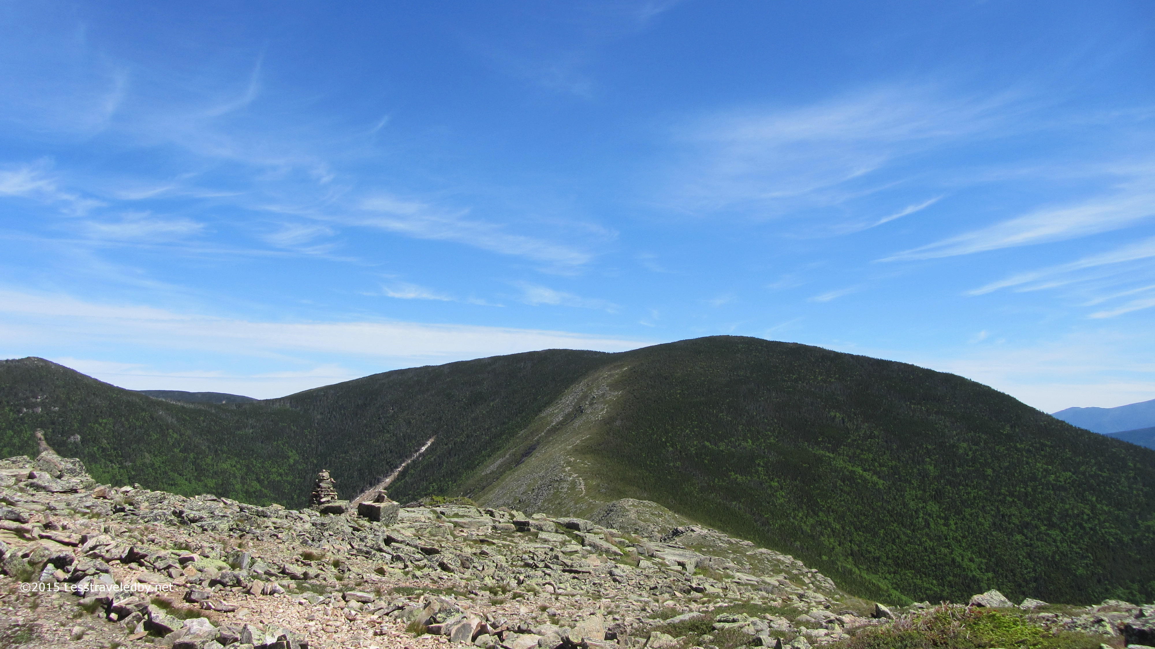
What took me a little over two hours to climb up took me an hour to climb down. It helped that I could use my tracks, but even those weren’t stable. Snow that held me on the way up gave way heading down at times. Still, just knowing where the big holes were made things much easier.

IMG_4231a
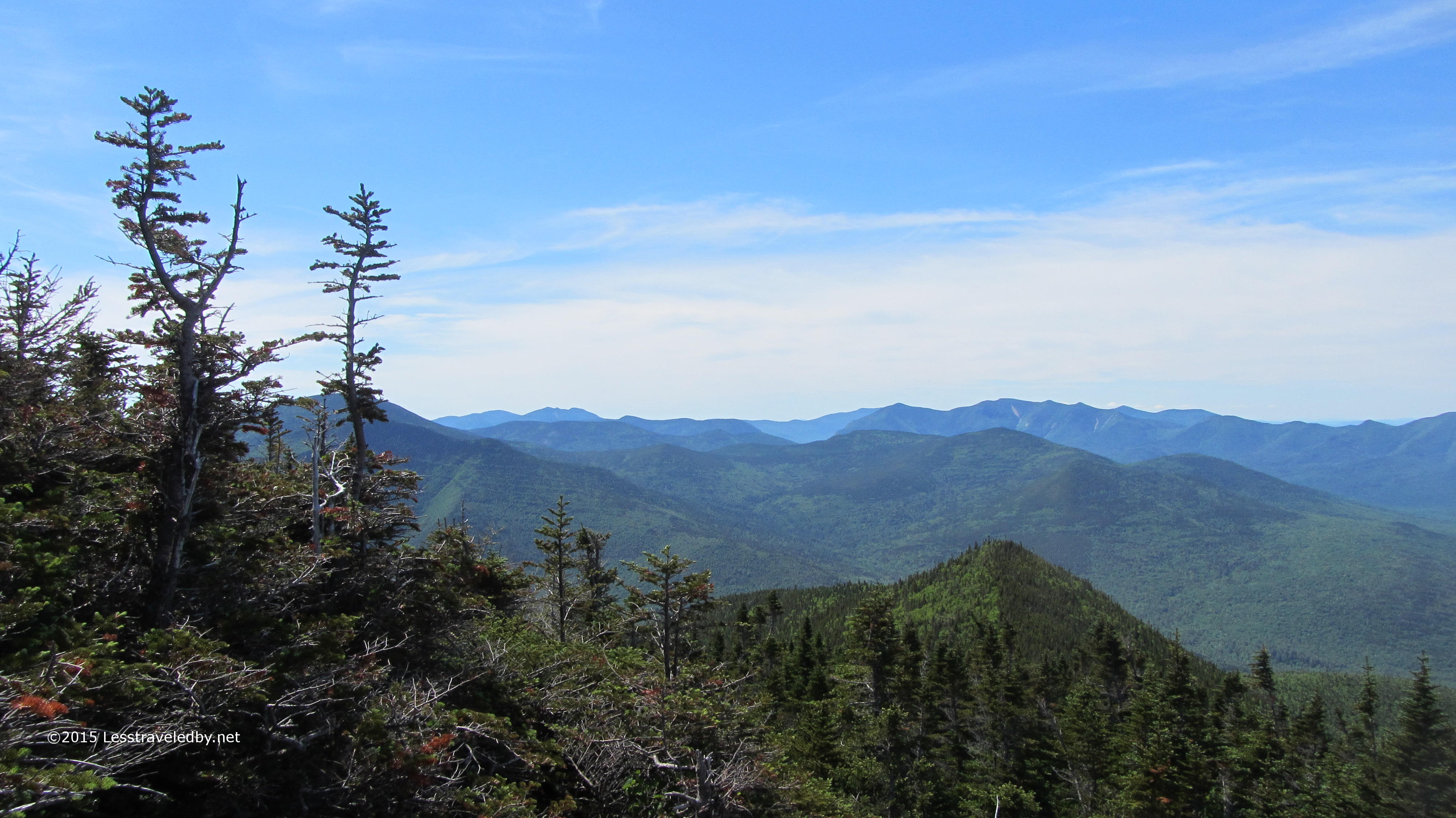
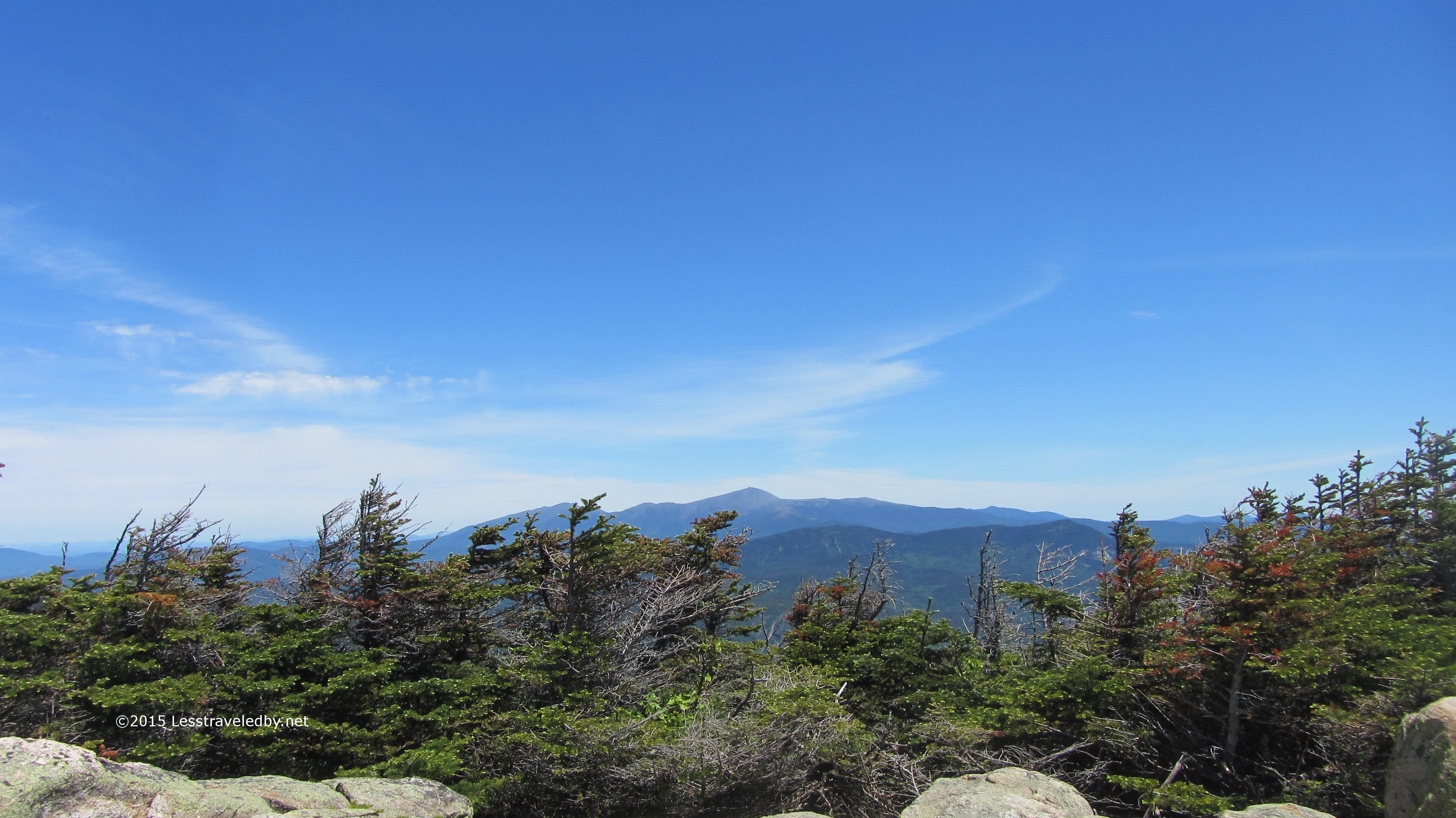
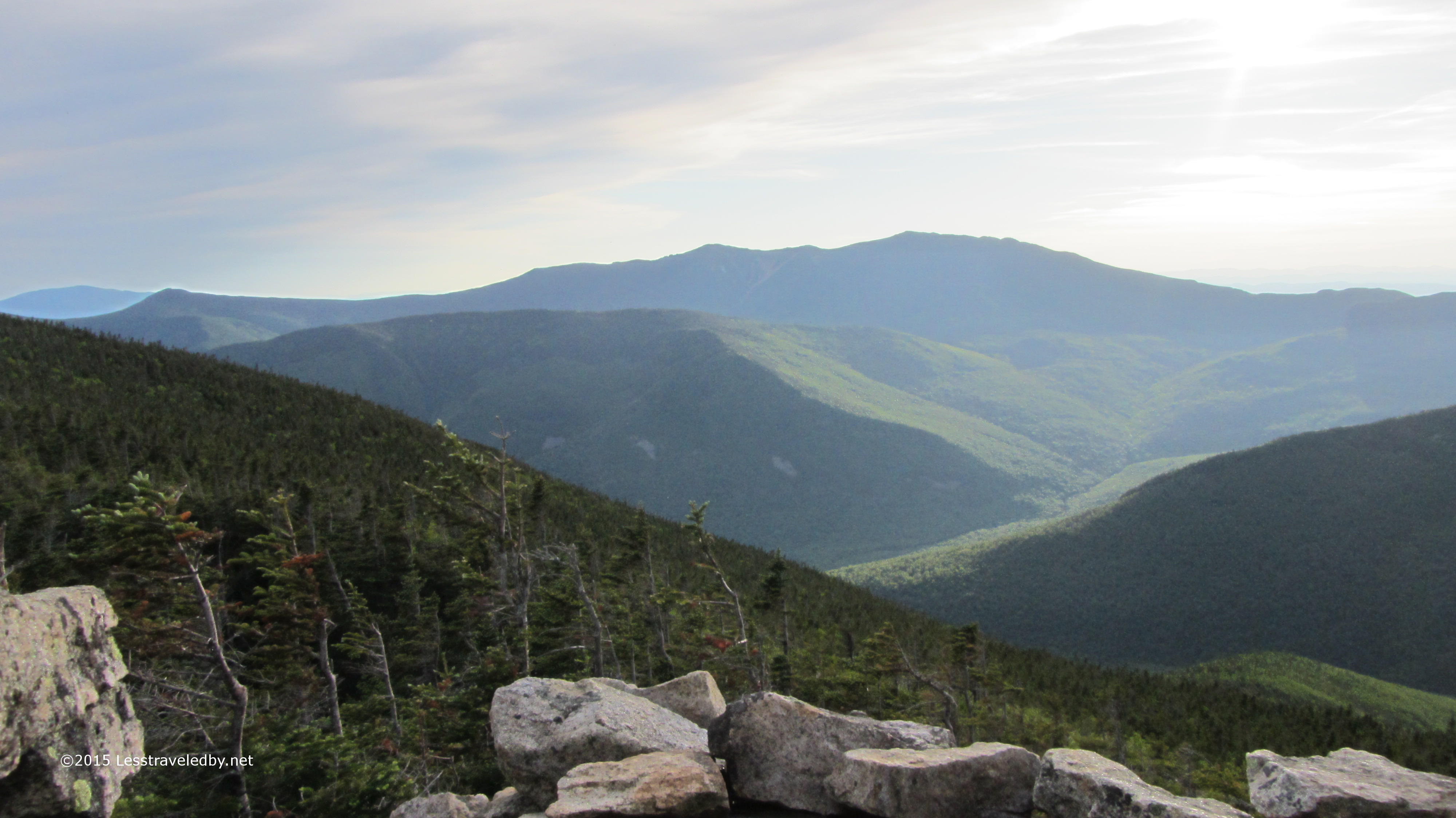
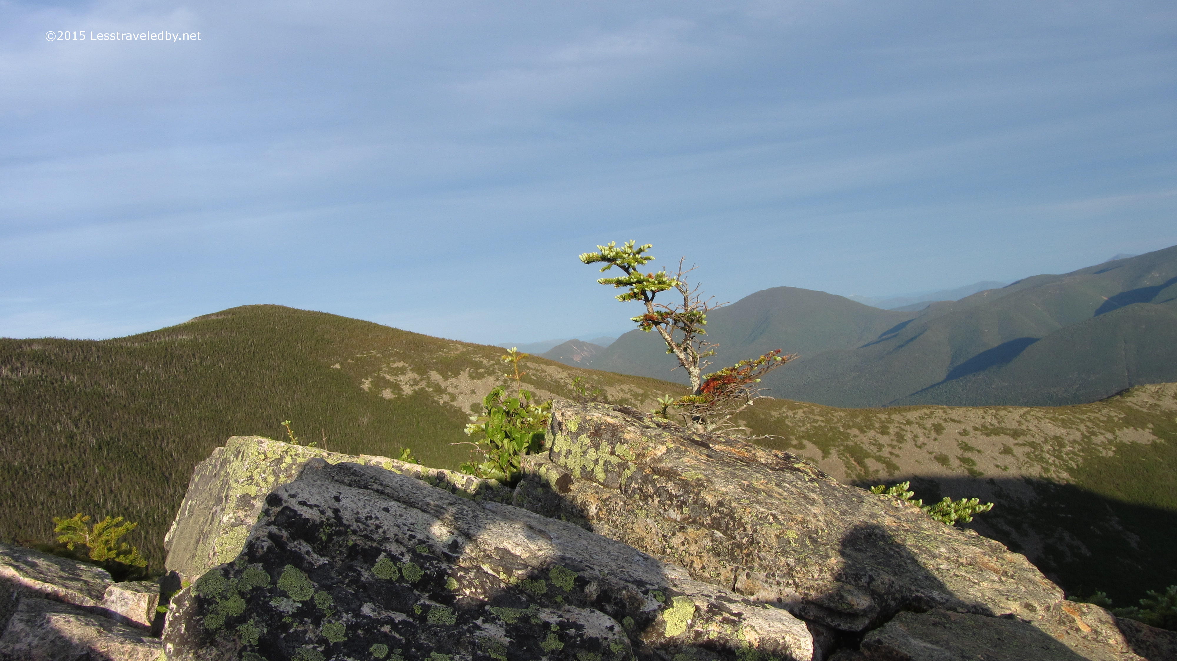
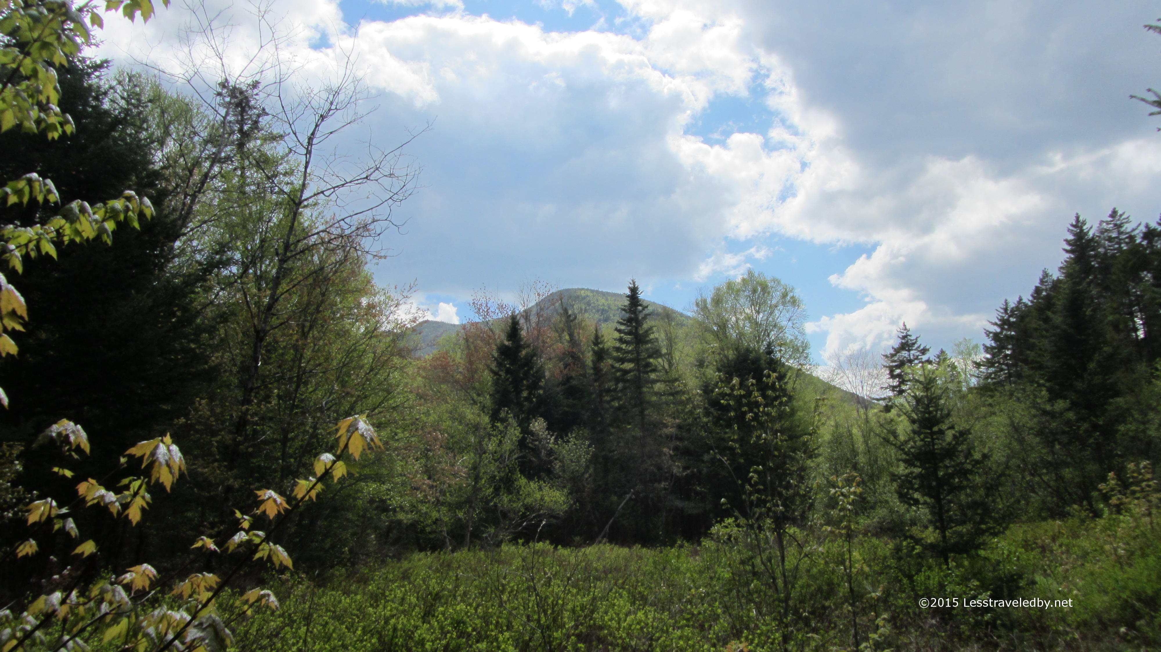
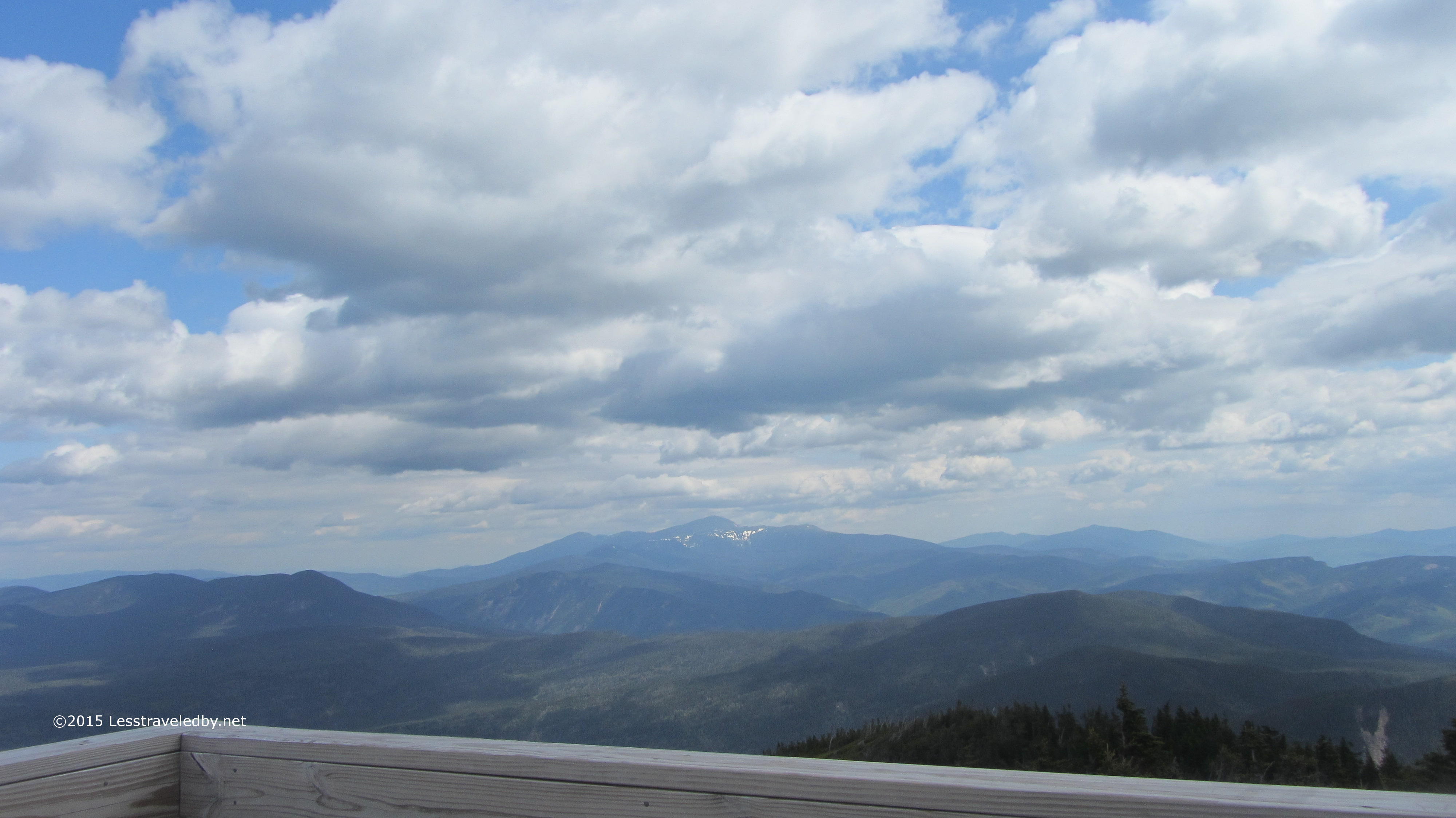
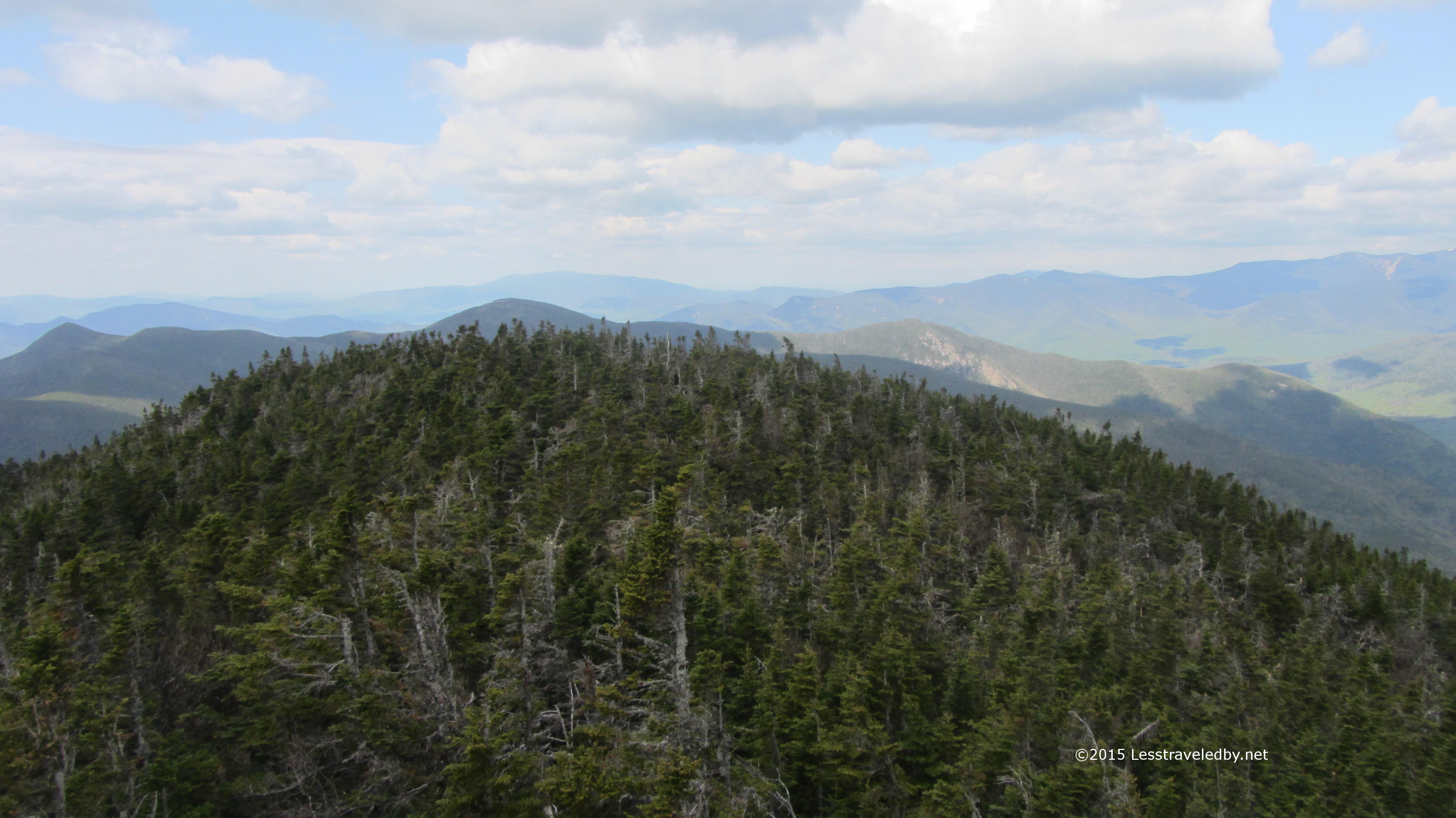
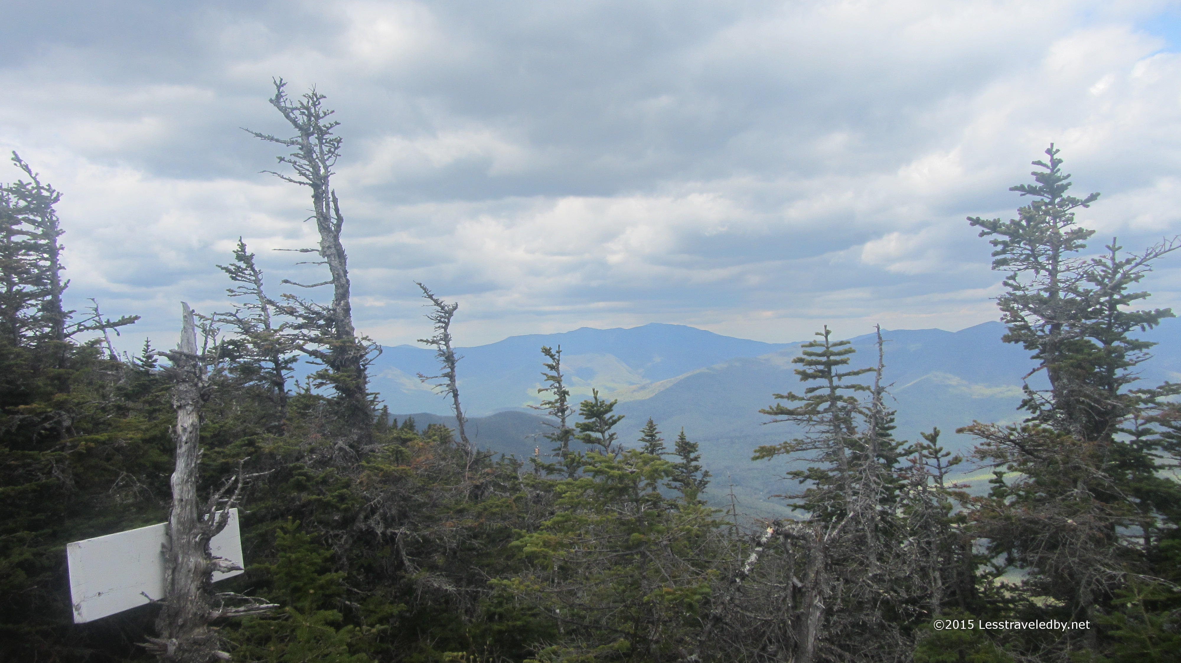
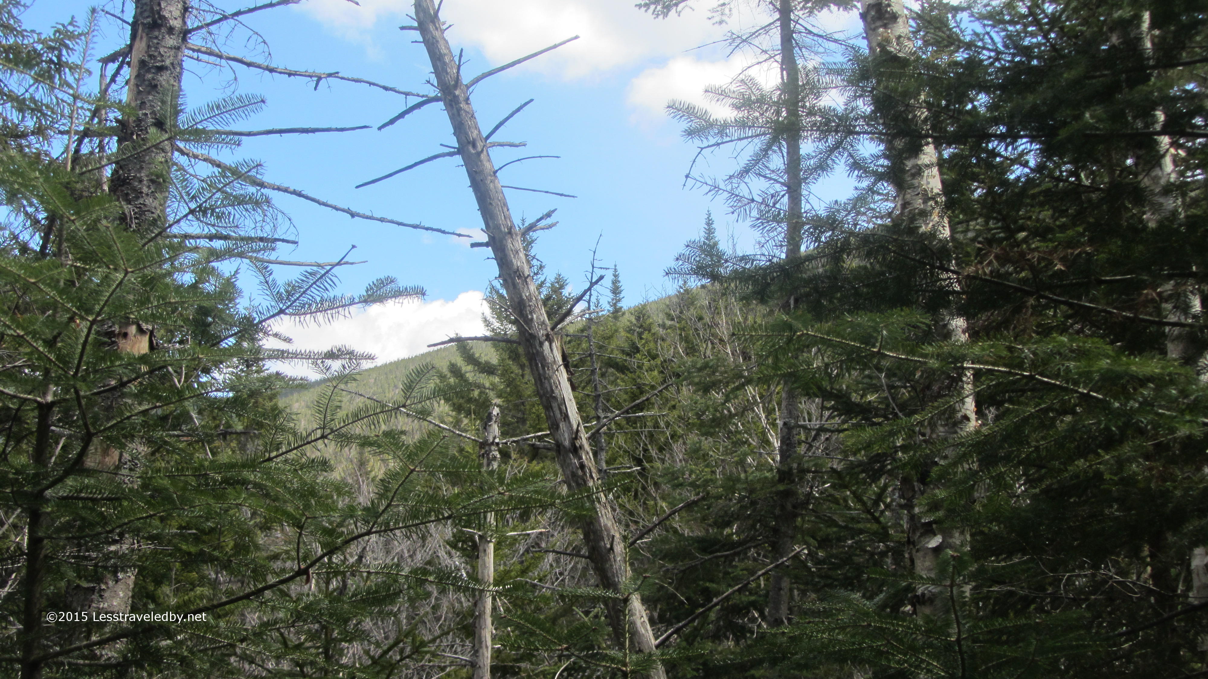
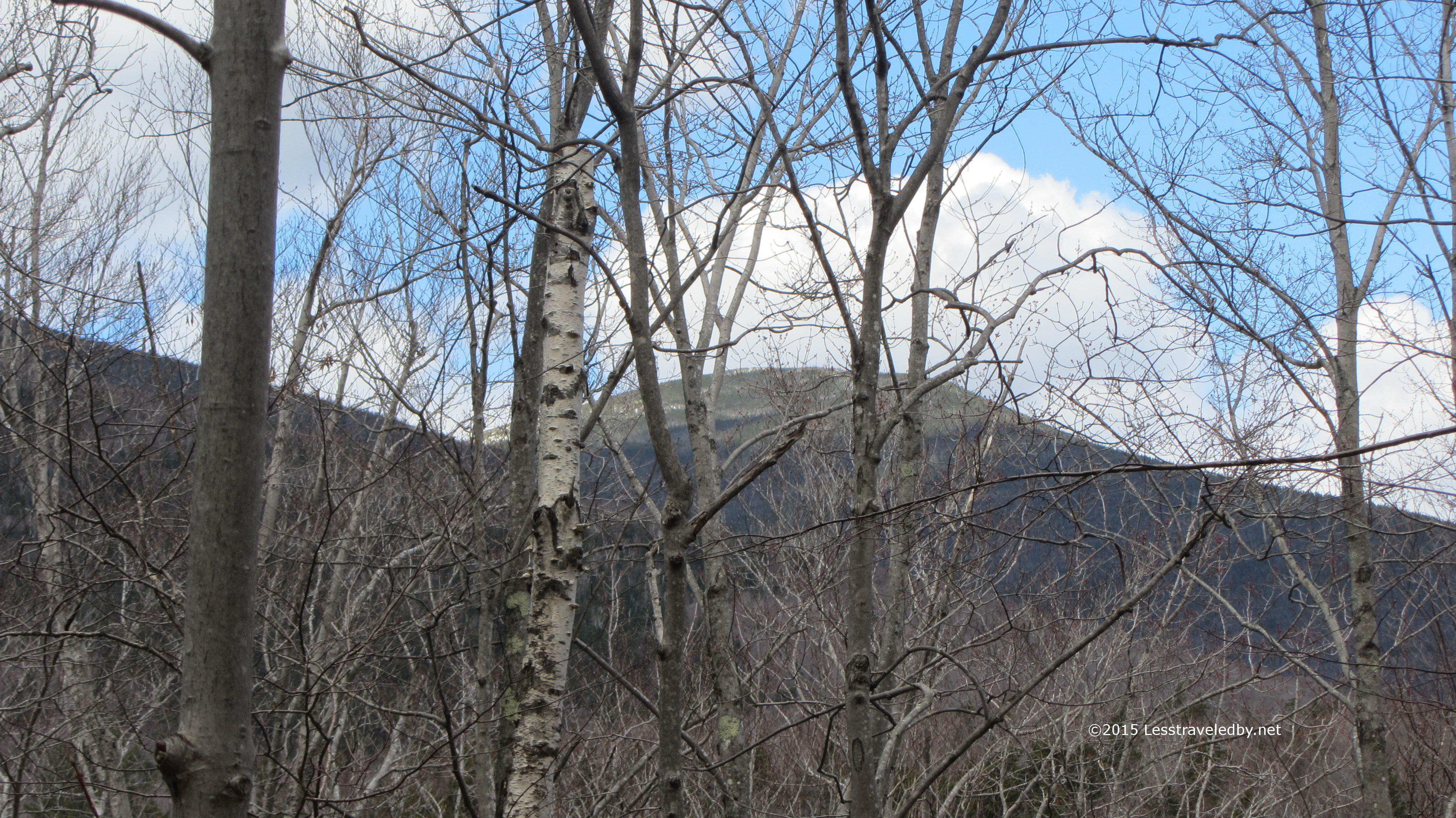
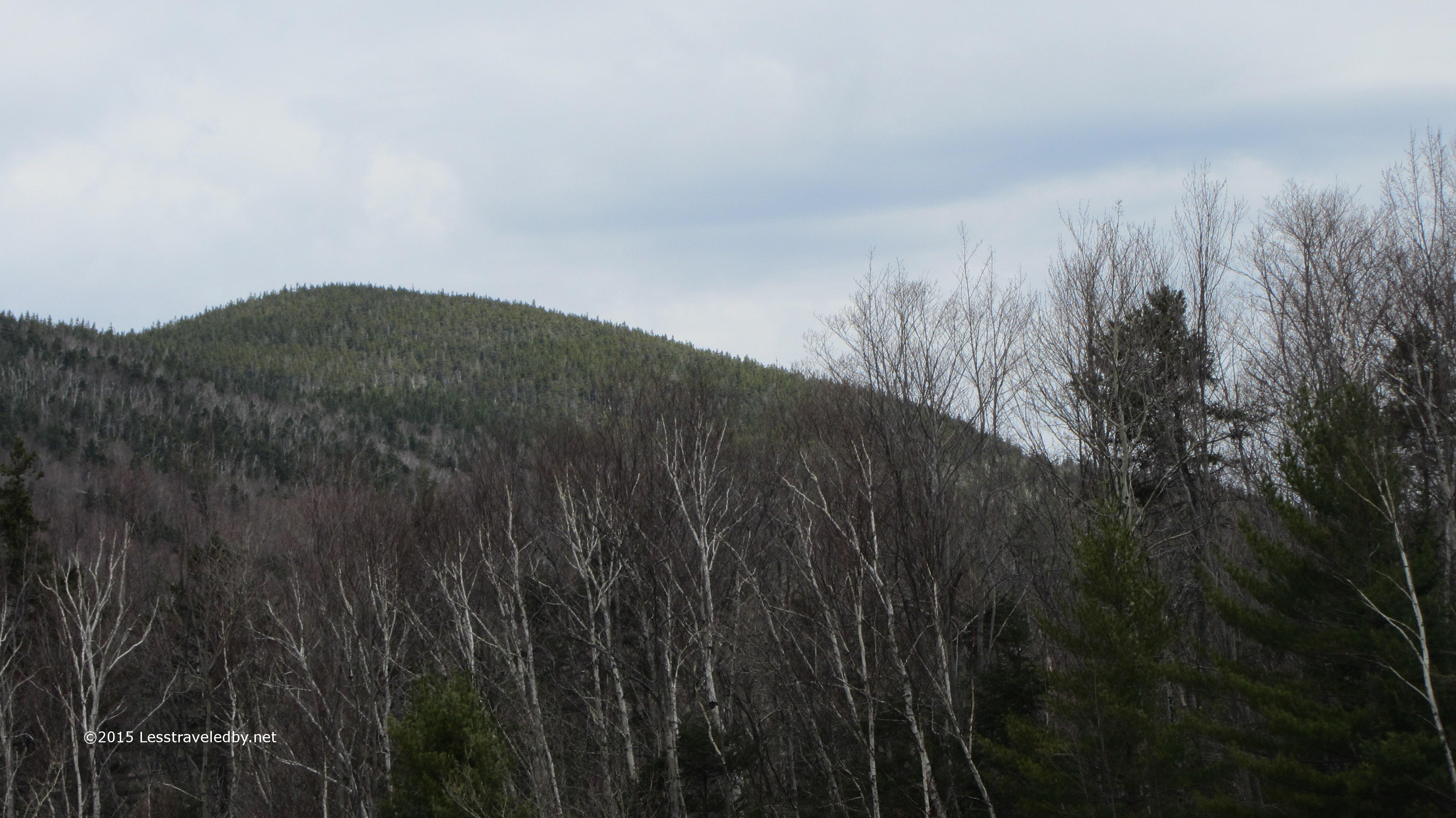
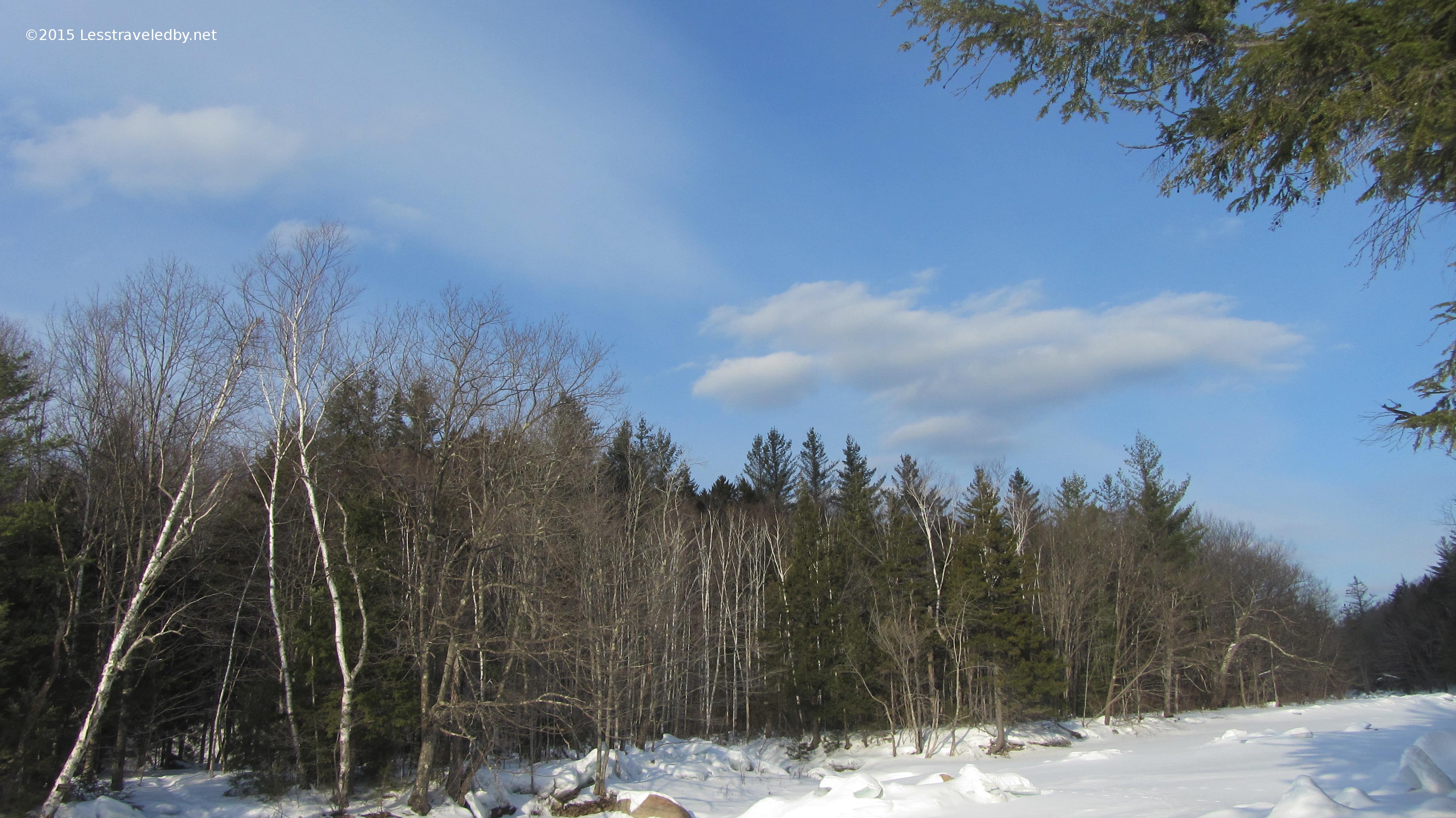
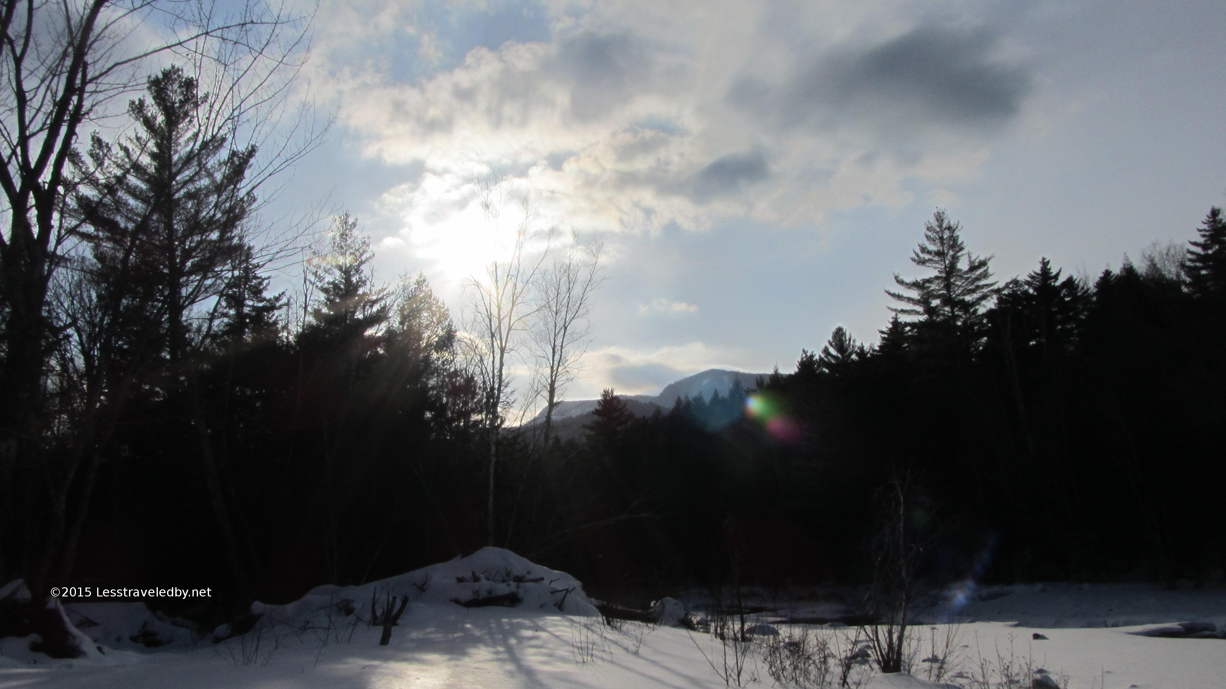
Pretty sure that is Hitchcock in the distance through the trees. Buds were just starting to form so leaf out should be soon if the weather stays nice. Last chance to see some of these views until fall. Once the leaves come in it is just a walk in the woods.

IMG_4236a
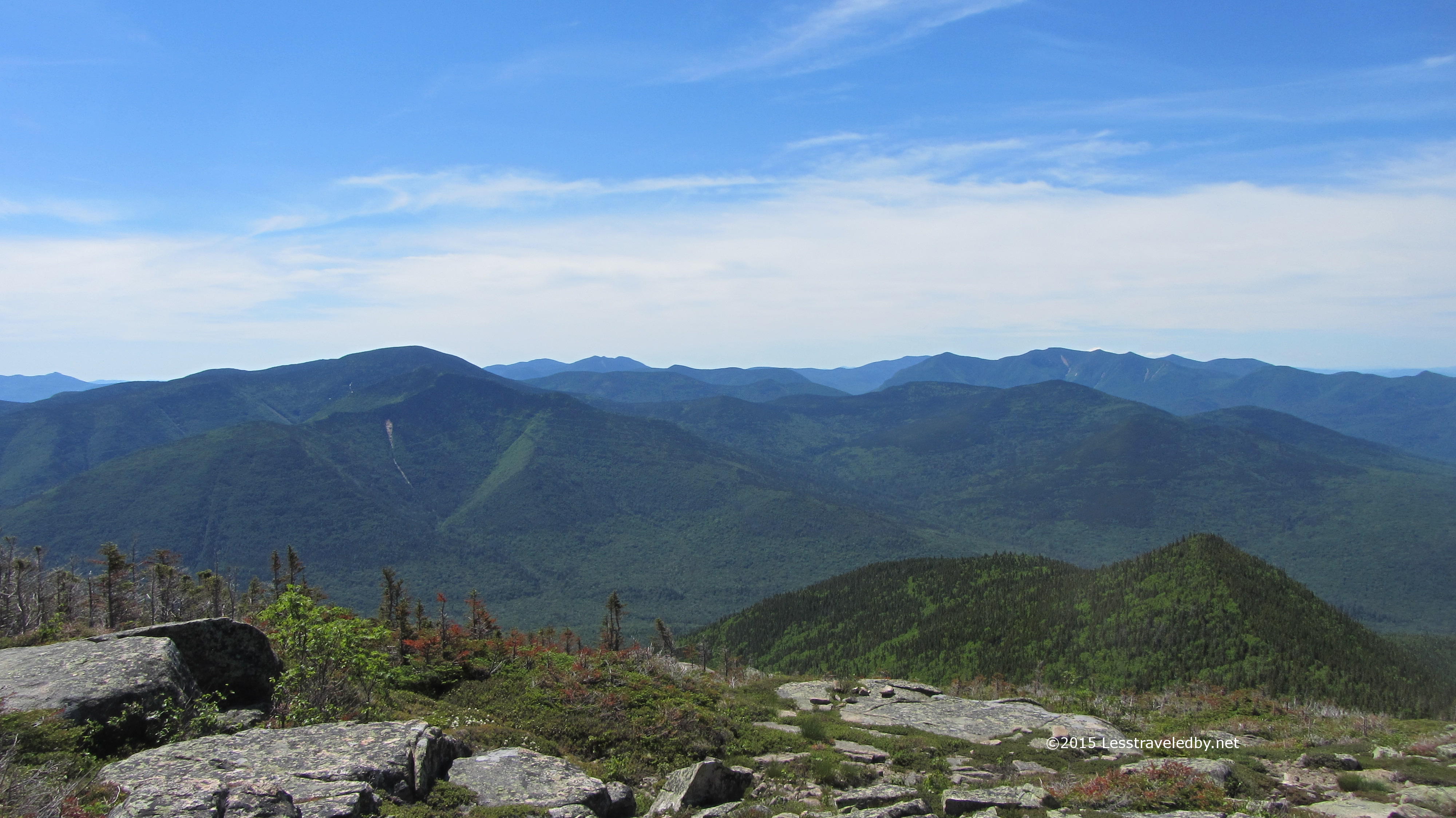
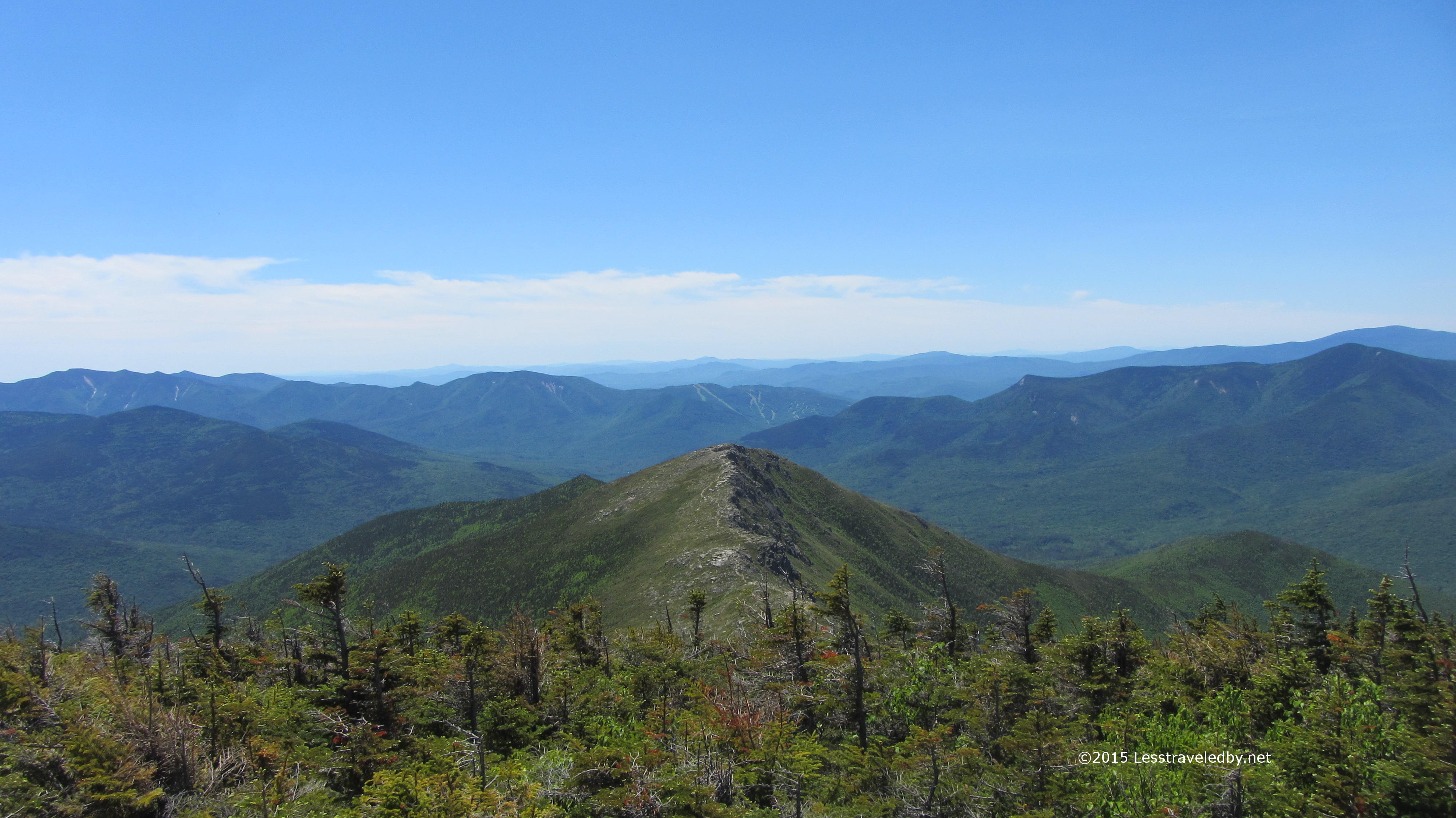
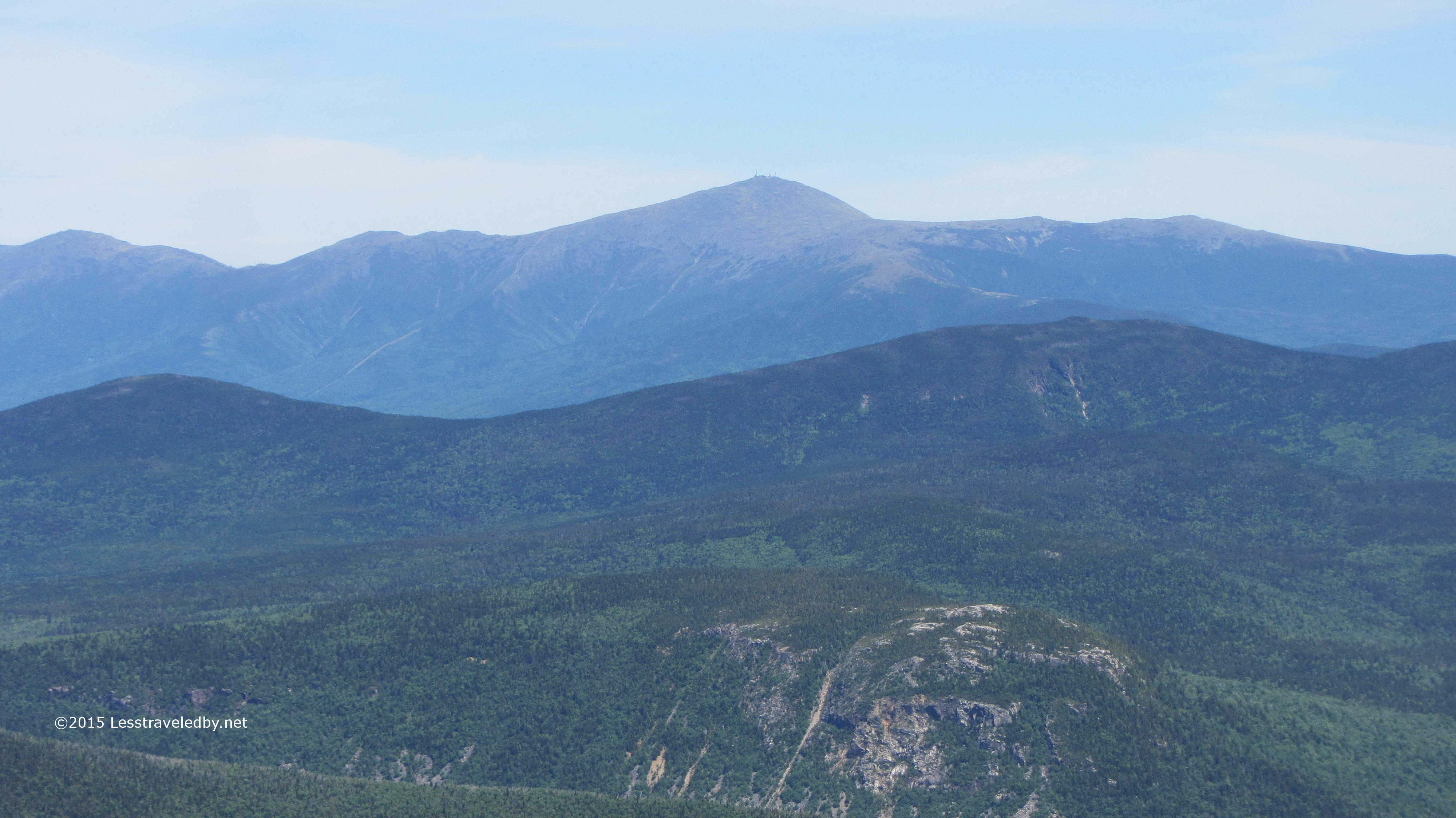
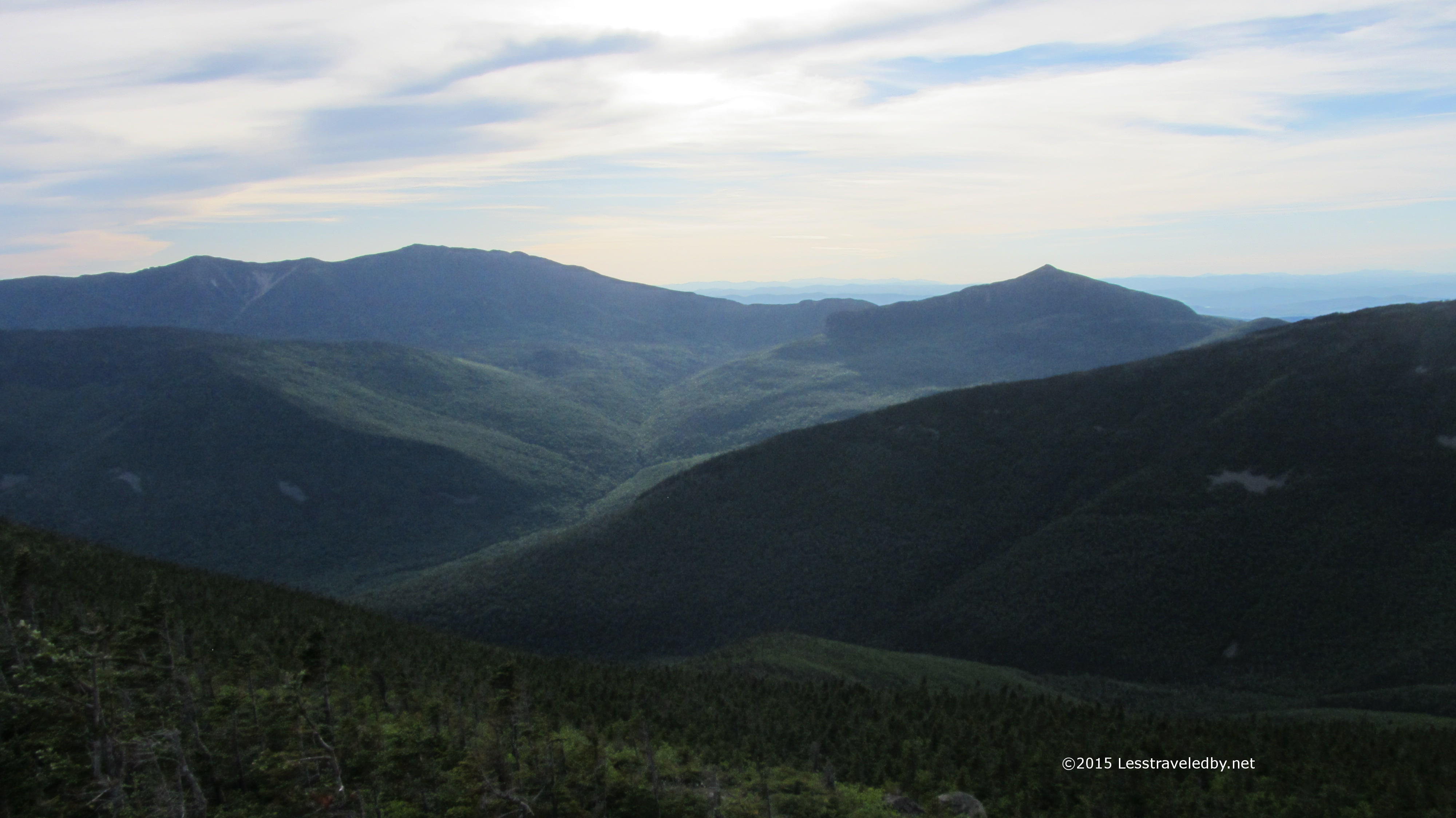
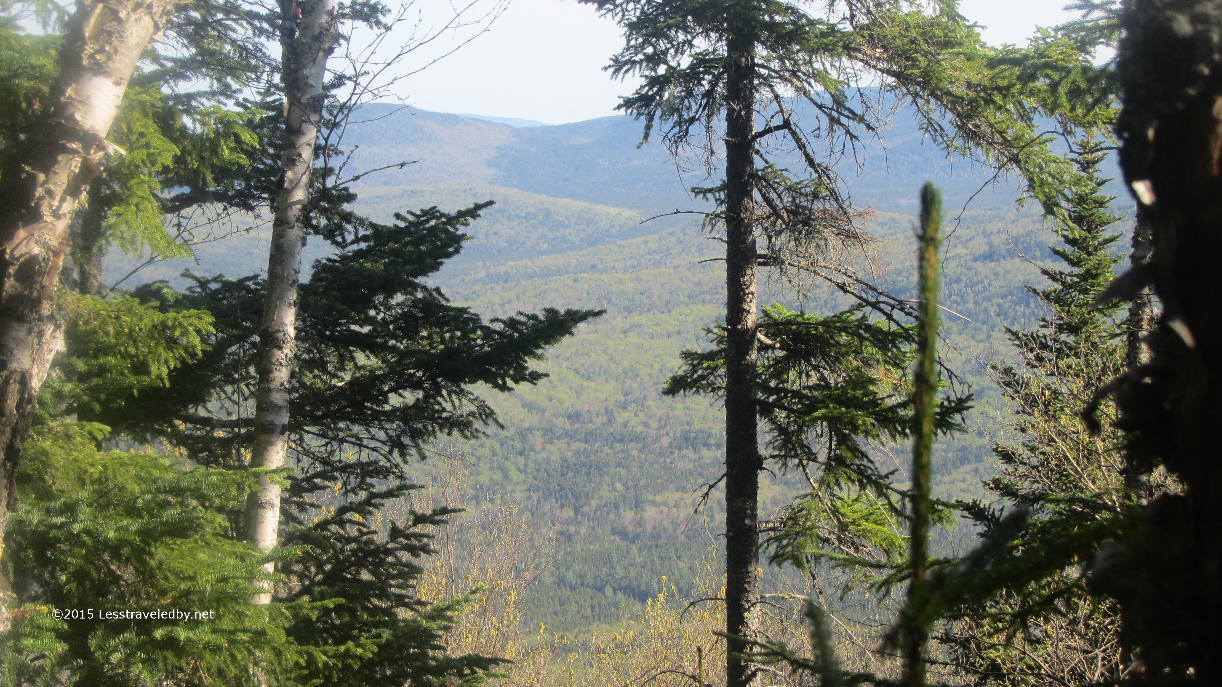
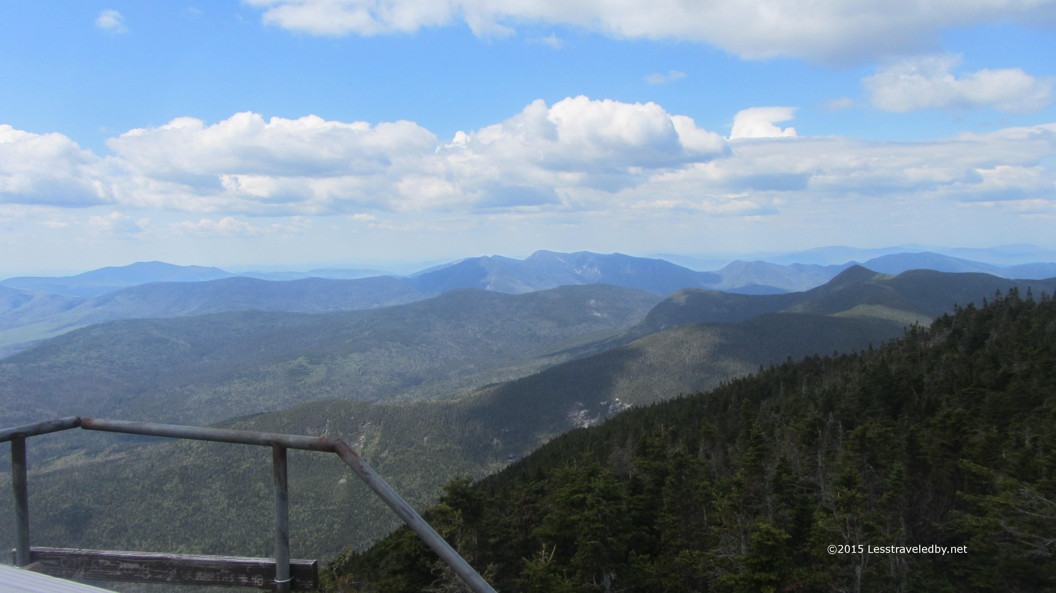
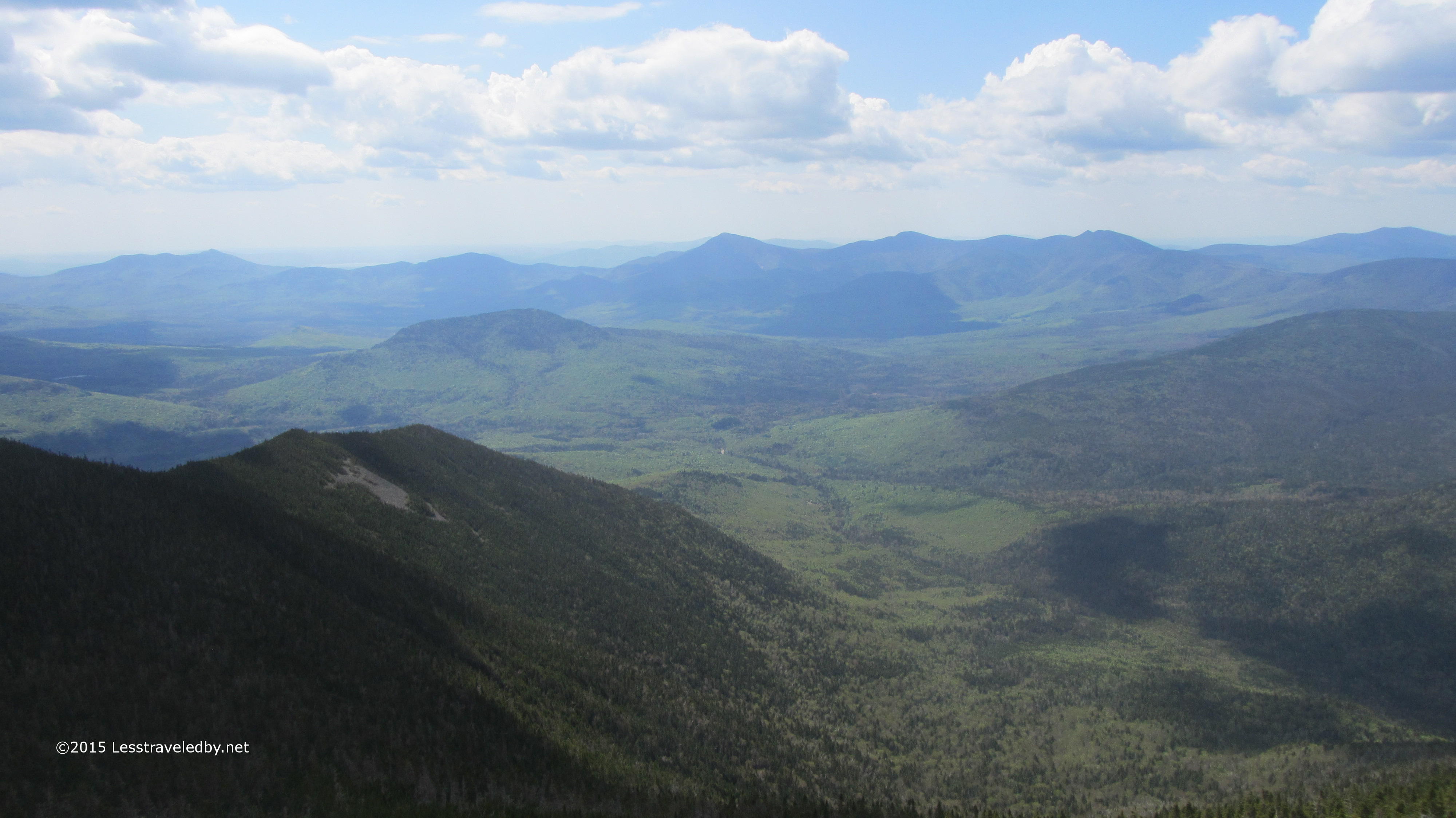
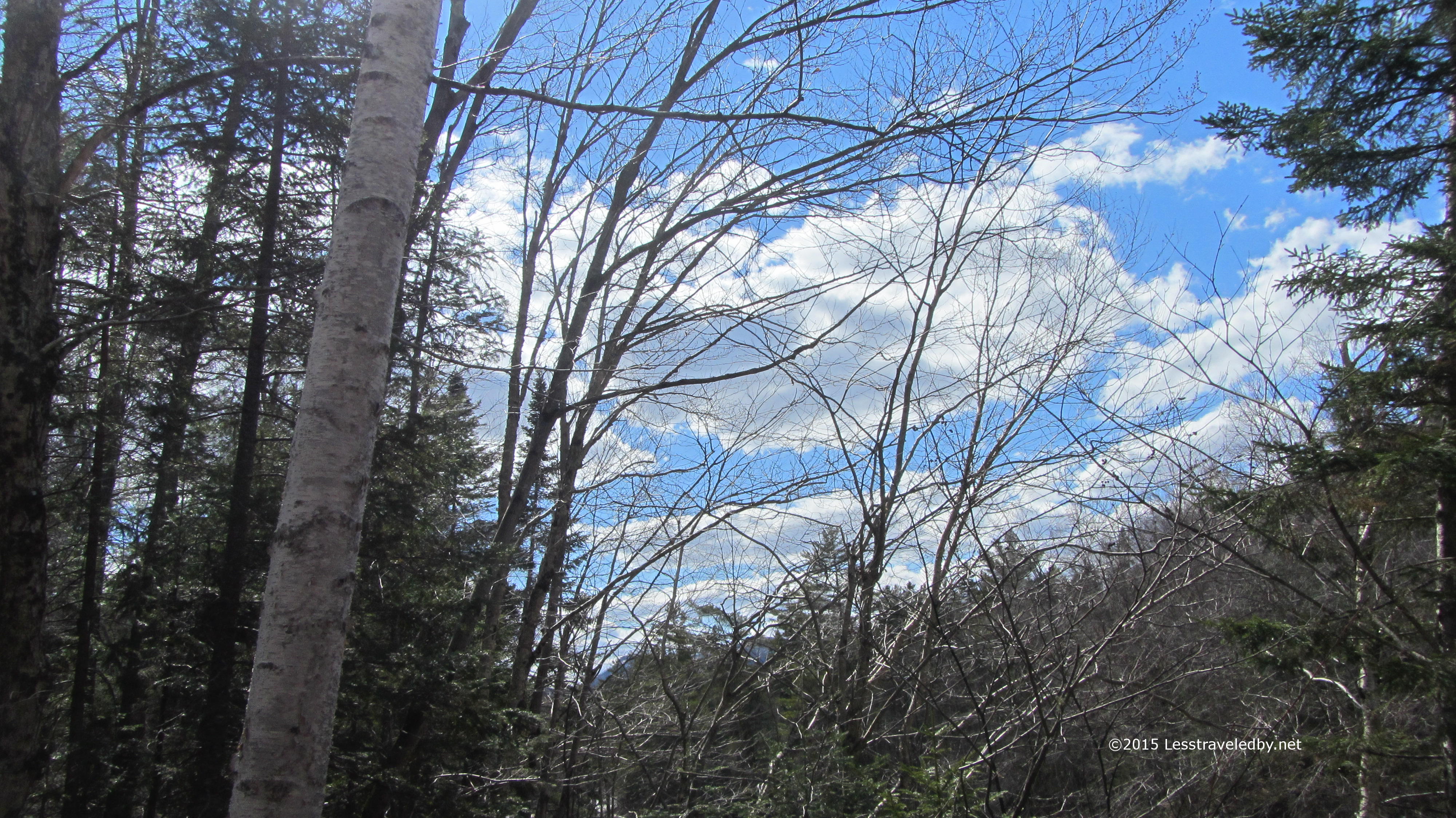
Down lower the day was quite warm. I was looking forward to setting up camp early, but I stopped to get a few more shots. This is looking towards Zealand though that may be the Wileys poking up beyond. Without a compass heading and map they all look alike to me; pretty!

IMG_4237a
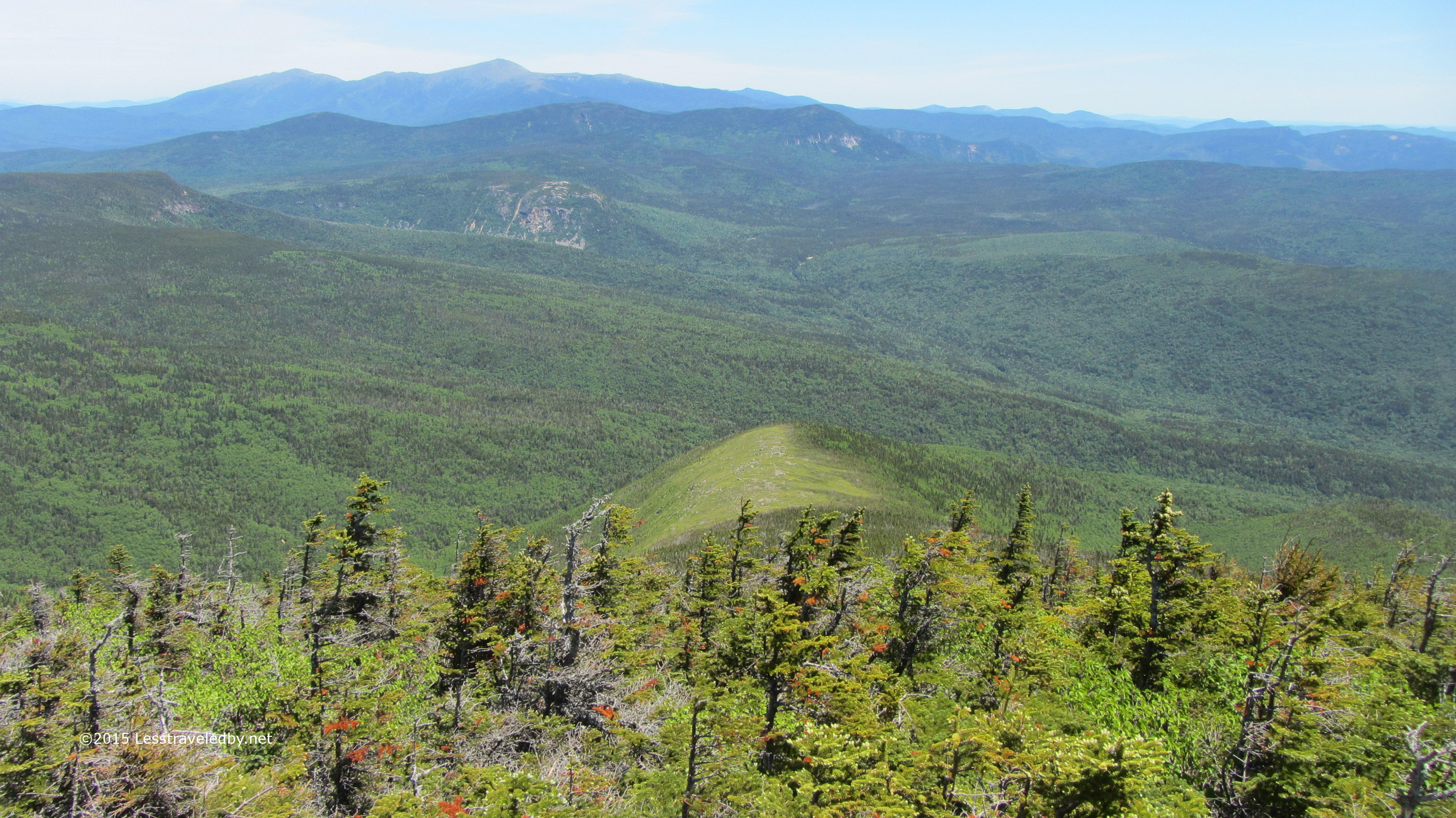
Well this one was close enough that I’m pretty sure I can identify it as the Bonds. Incredible views up there I’m told but while I’ve come through on the AT I didn’t take time to visit. Have to find some time during the week to sneak up there and try to snag a tent site at Guyot so I can take in the sunset. Very busy spot but I’ll put up with people for a great view if I have to.

IMG_4239a
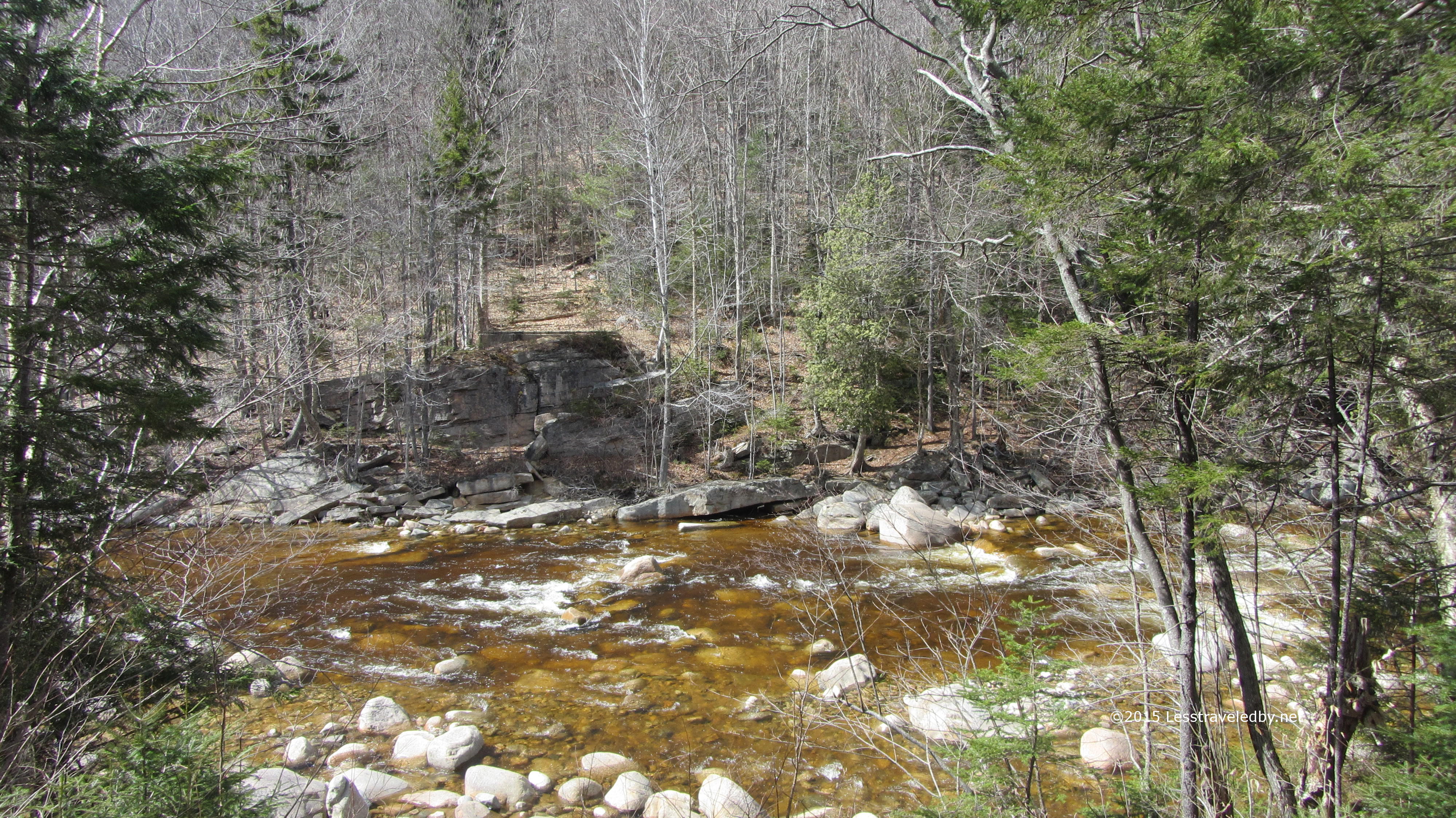
Down at the river it was a beautiful afternoon. I found a spot that only had one tree that looked like it might be thinking of falling on me which is pretty good for these woods.  Filtered a bit of water and thought about how much easier that was compared to melting snow. I broke out some spicy beef jerky I made recently and really noticed how it perked me up. Probably too much black pepper, but it made for a nice recovery snack before dinner.

IMG_4240aThere was time for a few pictures too of course heh.  If the water wasn’t so cold I might have gone for a swim, but I knew better. Instead I broke out a few sips of Irish which was good because my home made dinner came out a bit crunchy. Afraid I may have over dried my pasta, but it might just have been not enough water in the bag. Making your own meals is an art, not a science and sometimes the picture isn’t all that pretty. Have to eat it though, otherwise you have to carry it out.

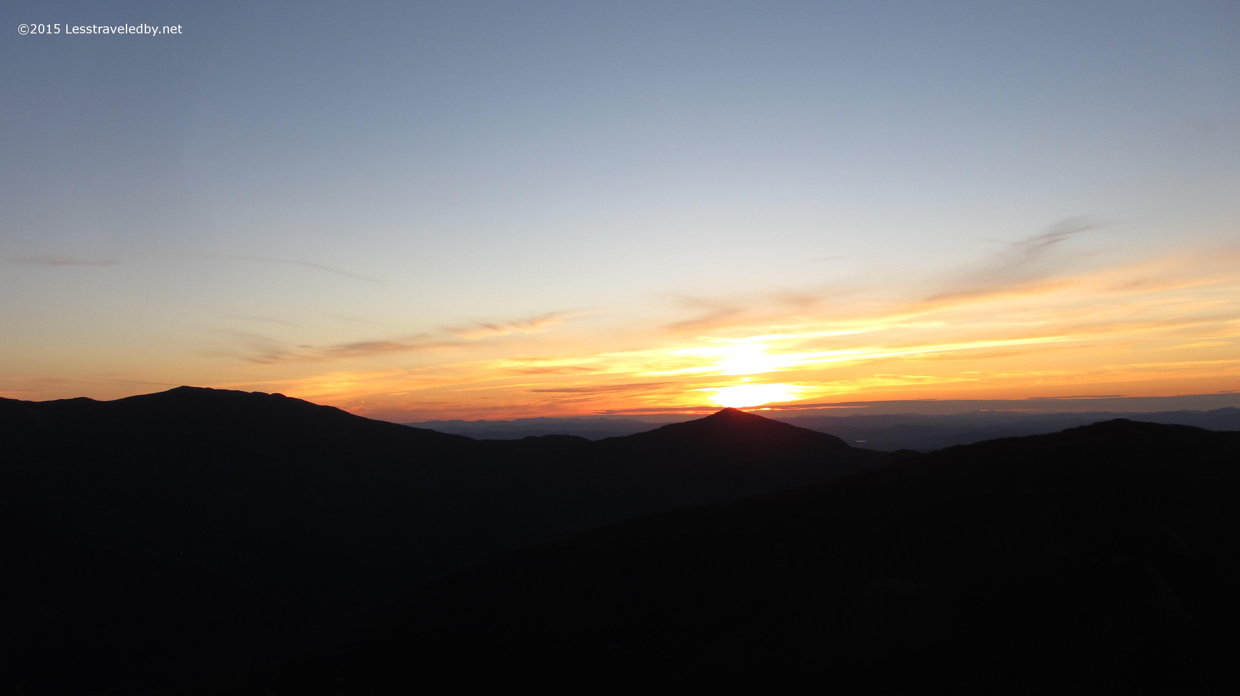
After dinner I settled in for divisions 6 through 9 of the Long Trail Guide and of course a few more shortbread cookies. This site was much  more open so I could appreciate the full moon better. The previous night I could tell it was out there, but hiding behind trees and mountains. Stepping out of the tent in the middle of the night made for alternating gasps at the temperature and the way the whole woods was lit up like daylight.

IMG_4242a
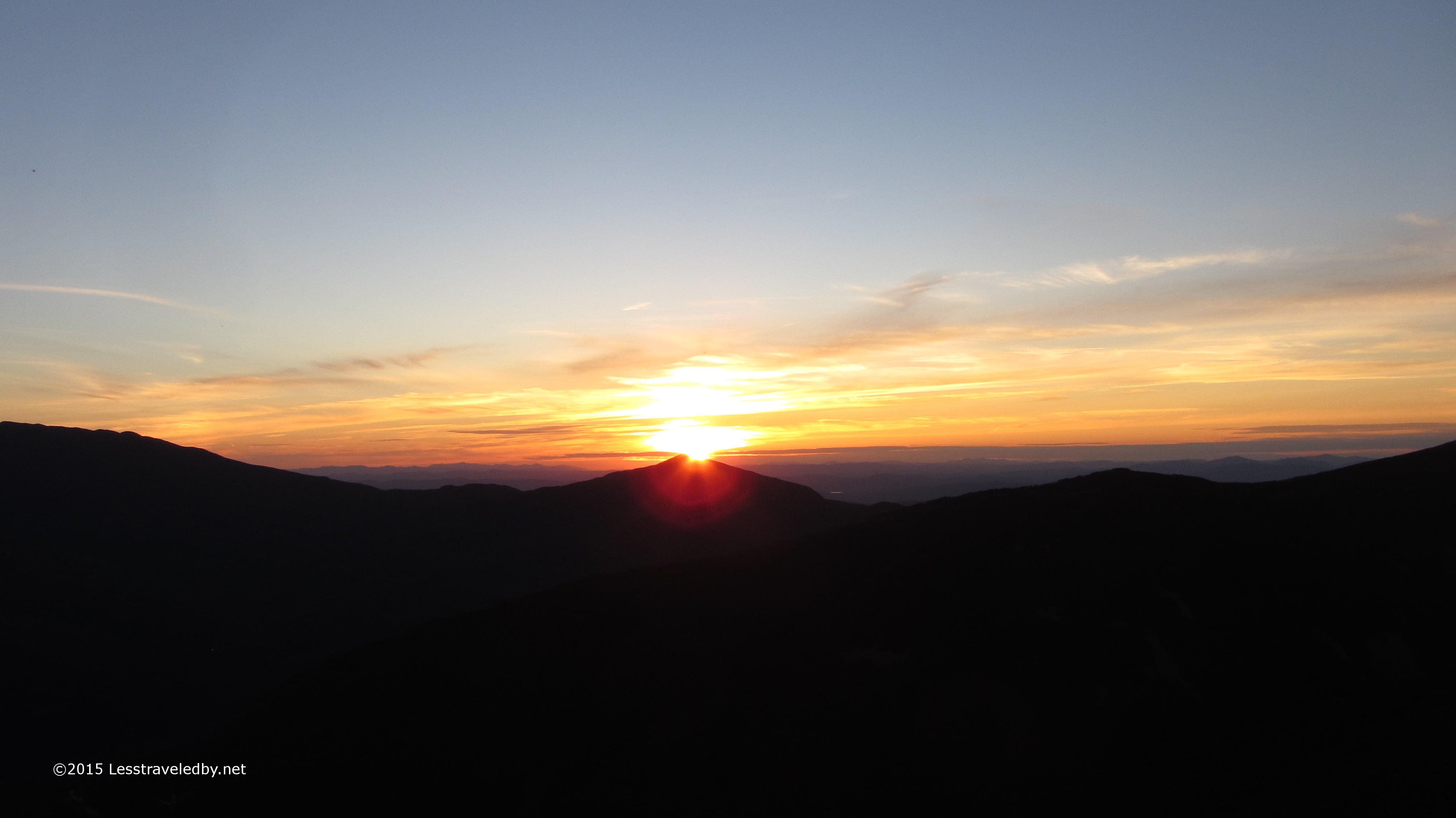
The sunrise was pretty nice too. Again the temps were down in the 30s. Maybe a tad warmer than the previous night, but not so it really mattered. I put on my puffy, froze my fingers fishing a bag of water out of the river, made coffee and some hot cereal for breakfast. Cereal was thick and the coffee was thin, but that didn’t take away from the morning one bit.

IMG_4244a
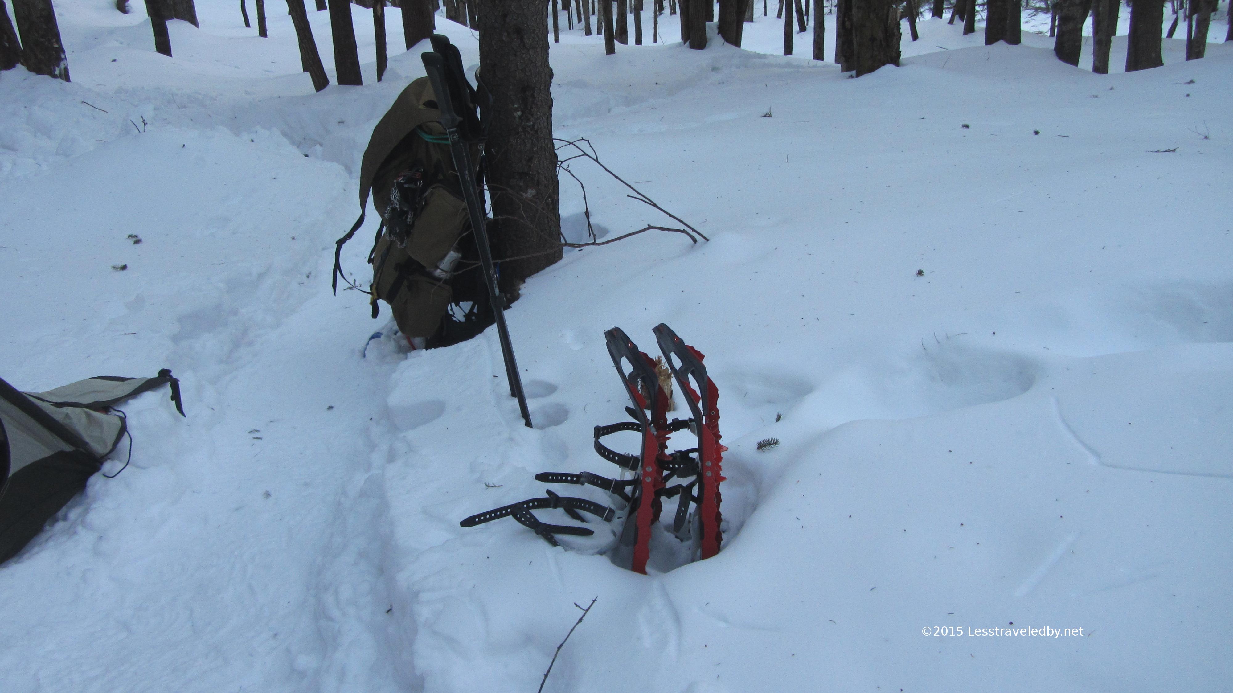
I was faster out of the gate by over an hour the last day. I think it was because it was a bit warmer, but the practice of the previous day probably helped some too. Changing back to more standard kit, but still carrying cold weather gear and snowshoes means having to stay on top of things. Summer pack up is done in ten minutes without a thought if need be, but shoulder season is complicated.

IMG_4248a
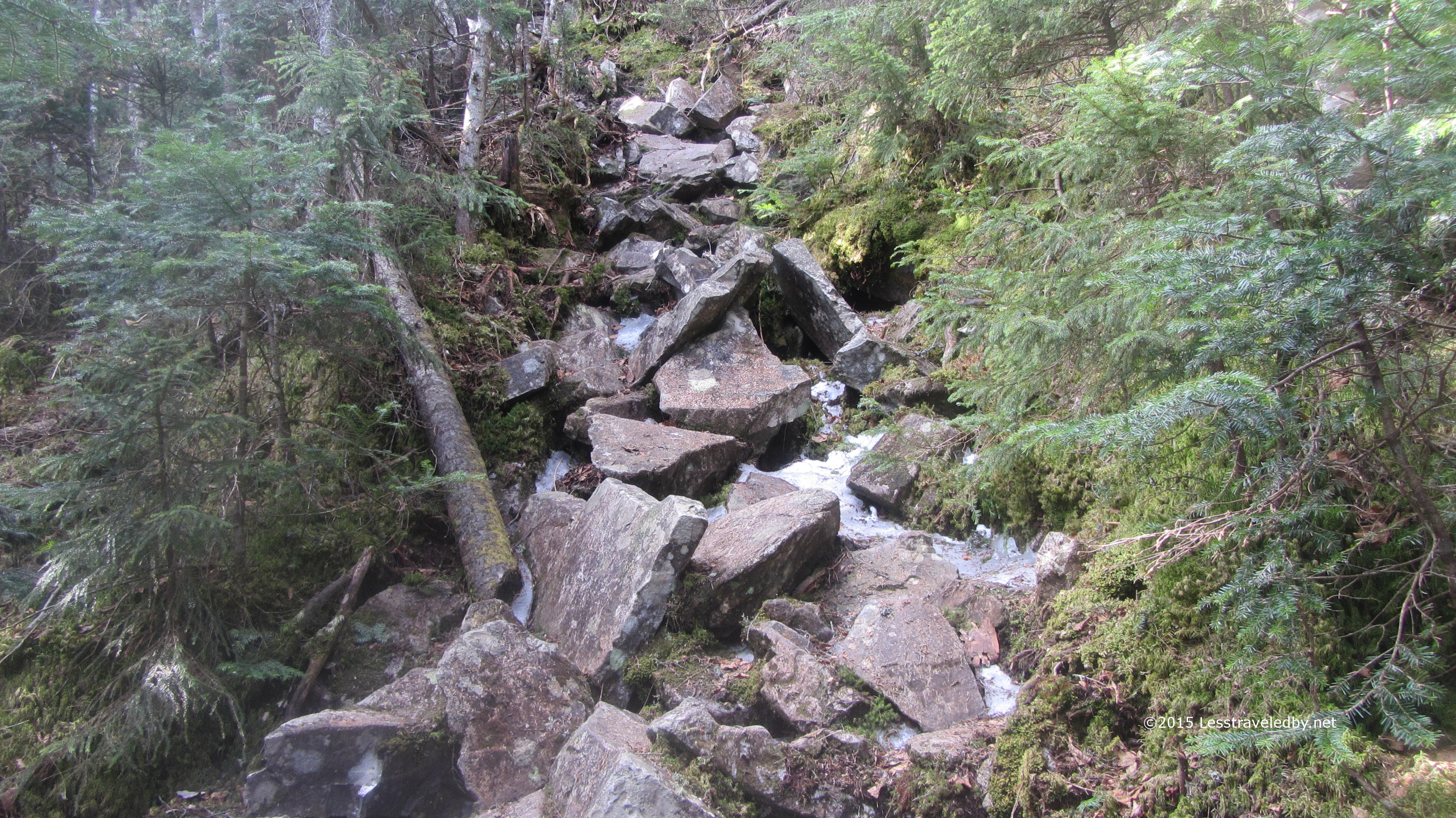
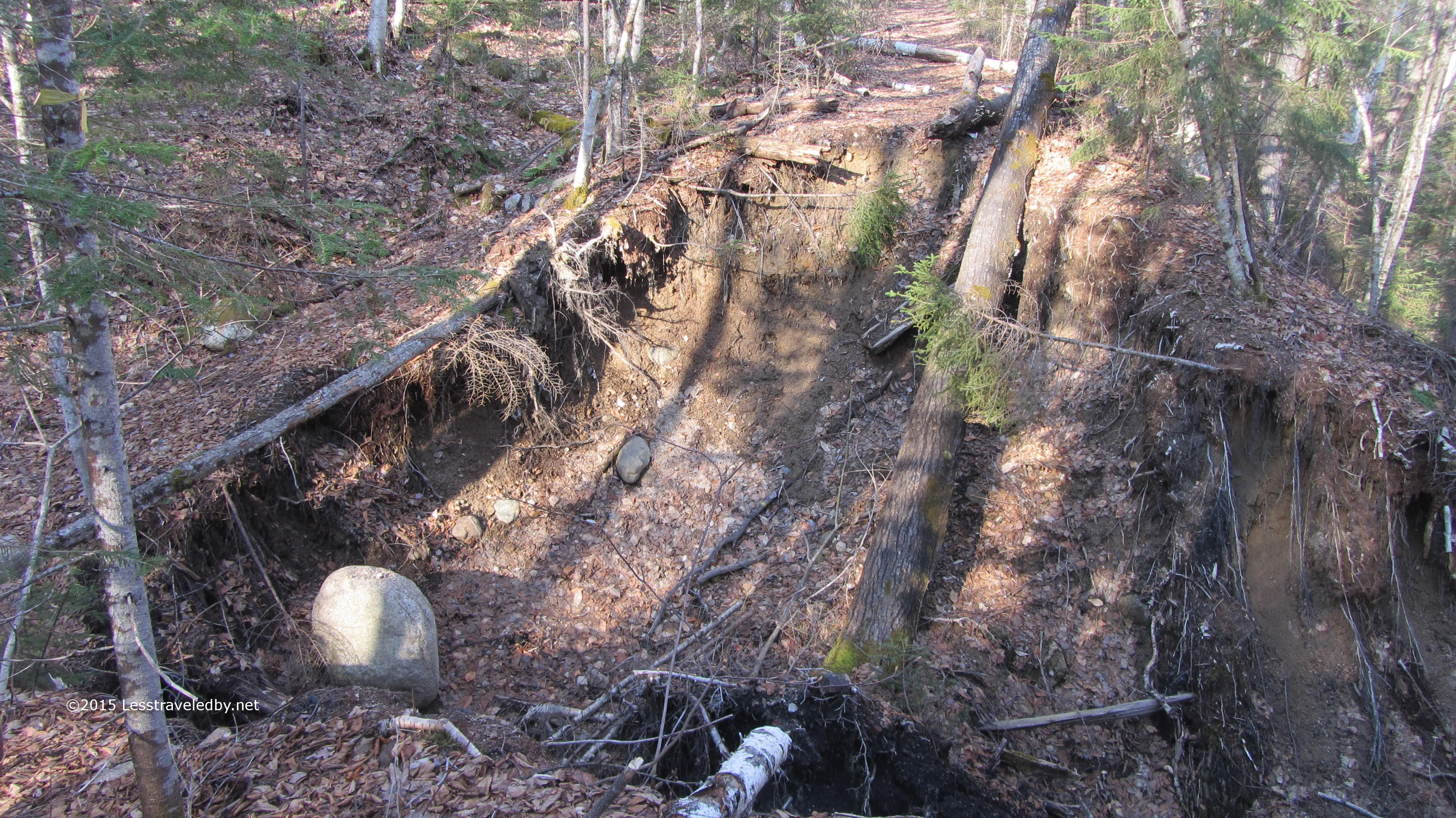
This is what it looks like when a maintained trail fades into a wilderness trail. There will be no trail crew to build a bridge. This washed out years ago and a new footpath has formed around it to the left. It is a bit wet at the bottom some times, but there are worse spots out there.

IMG_4252a
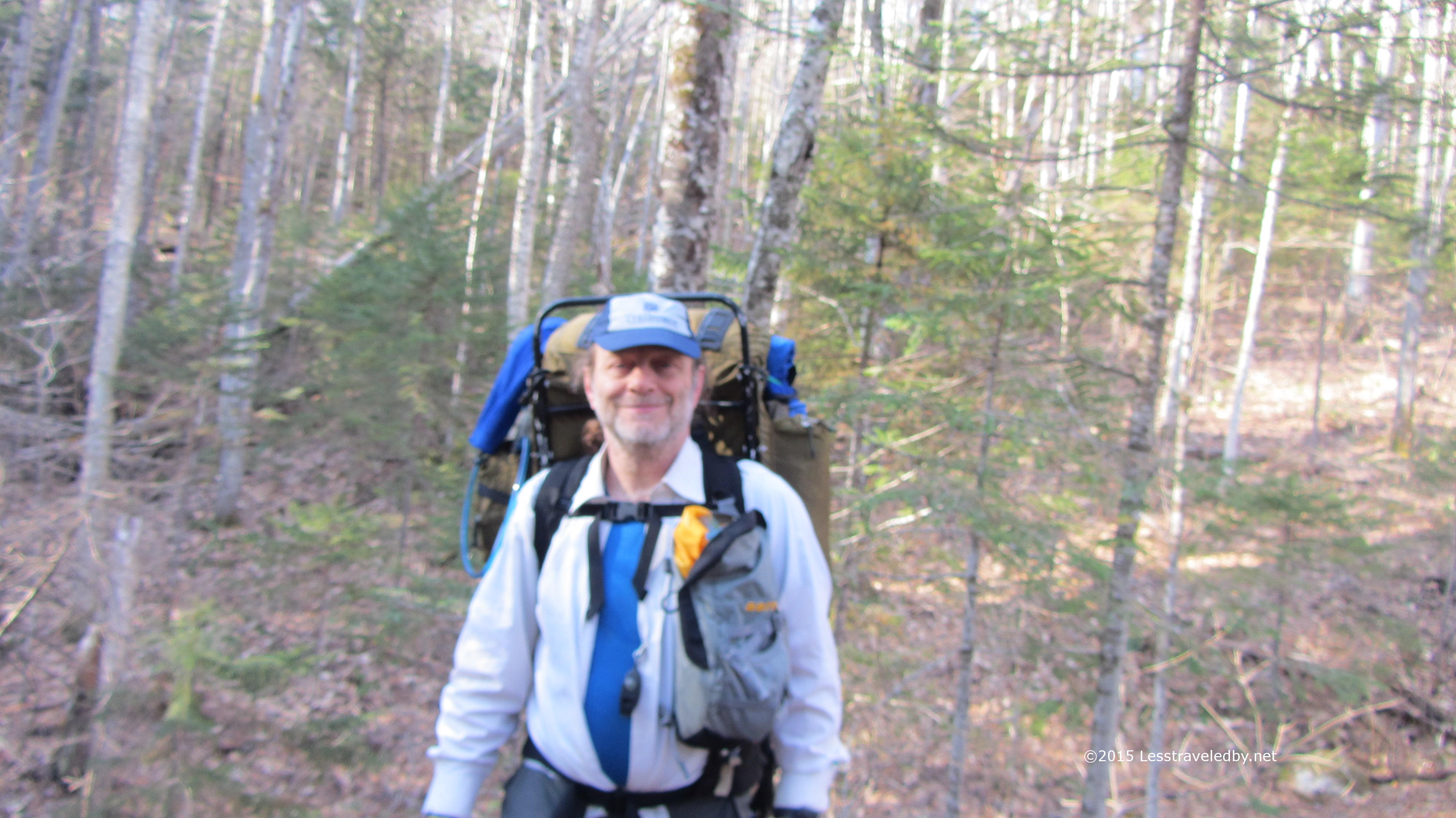
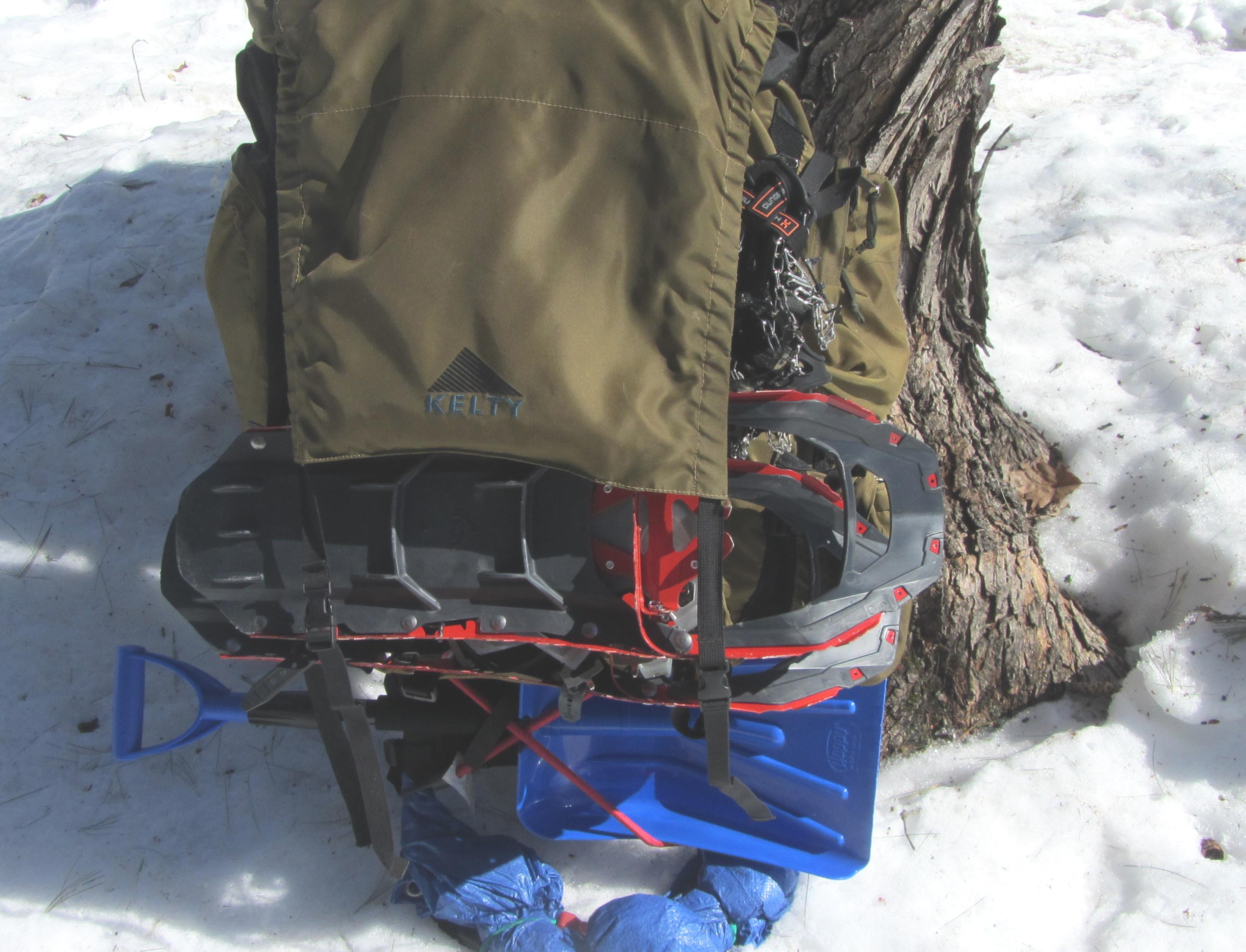
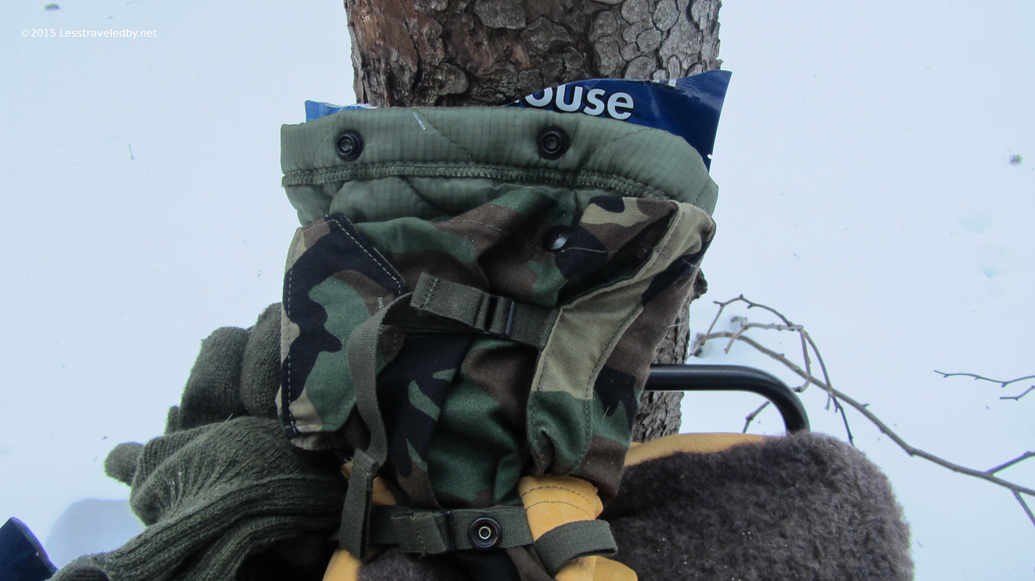
This isn’t a very good photo, but I wanted to show a shot of the Aarn balance pocket. They are meant to work in pairs and as part of a pack system that uses bags in front to balance the load. I just bought the front pockets and crafted my own system to mount them on my backpacks. I found it really convenient for carrying my cameras as well as snacks, lights and other small items. I’m not sure if using only one bag unbalanced me or not, but I am concerned that using both bags will cut down on ventilation in the summer heat. Neat product idea. They have a full line from giant expedition systems down to tiny sets for endurance runners. I can’t afford a new pack right now, but I’ll be keeping an eye on what those folks are up to.

IMG_4258a
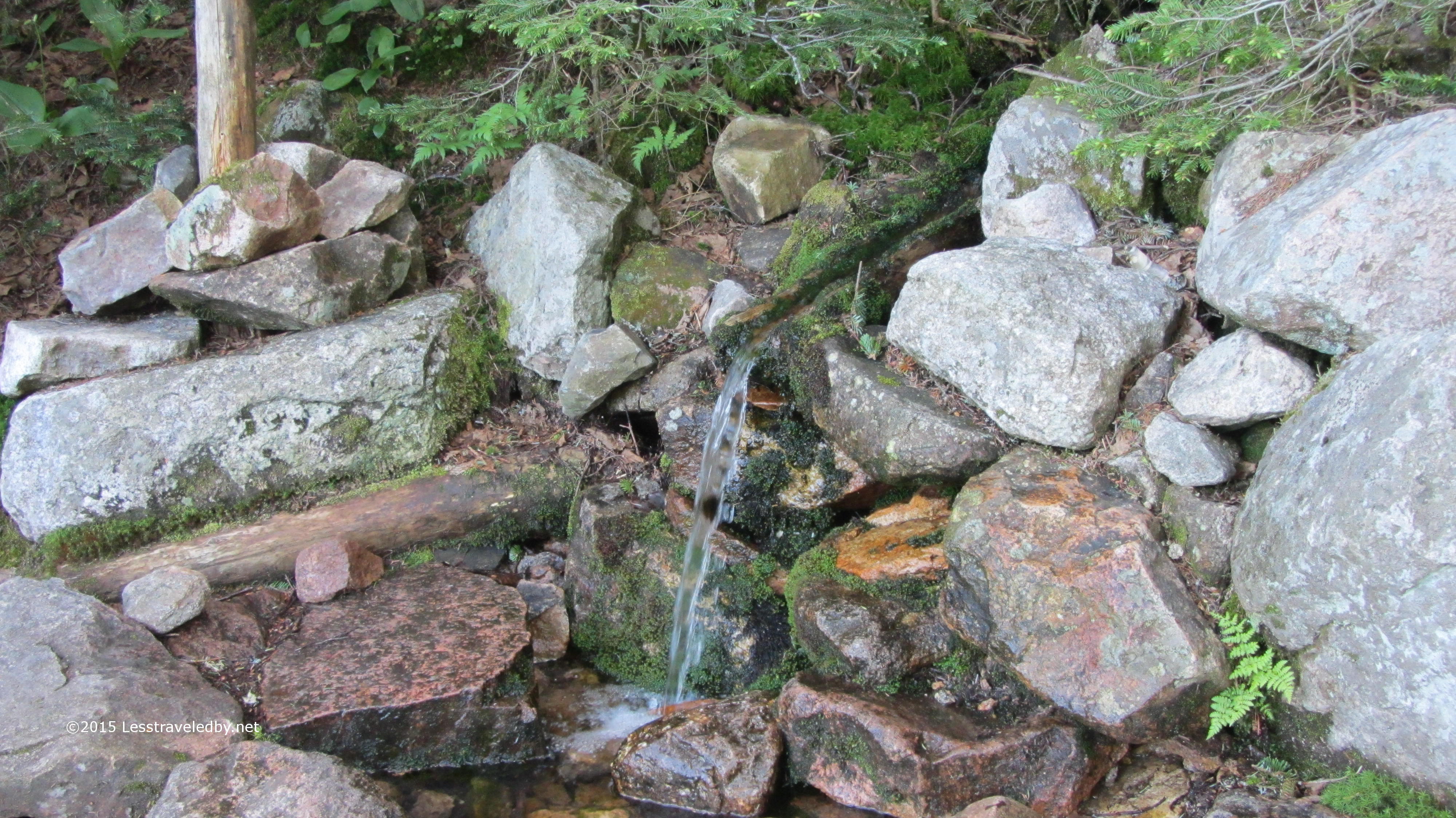
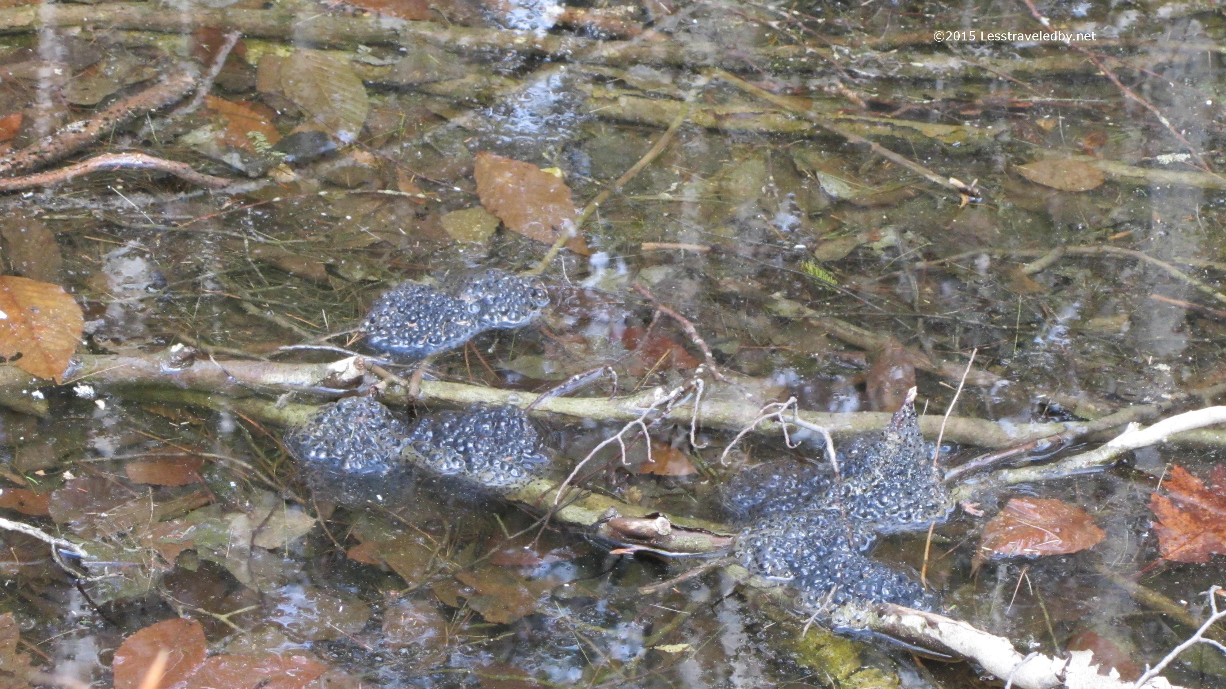
Some frog eggs I believe. Looks like there should be a good crop at least at this hole. This forest always seem to be short on squirrels, but there are plenty of frogs singing in the wet areas. I guess the lumberjacks who cut timber here were hungry enough to eat squirrel but not hungry enough to eat all the frogs.

IMG_4259a
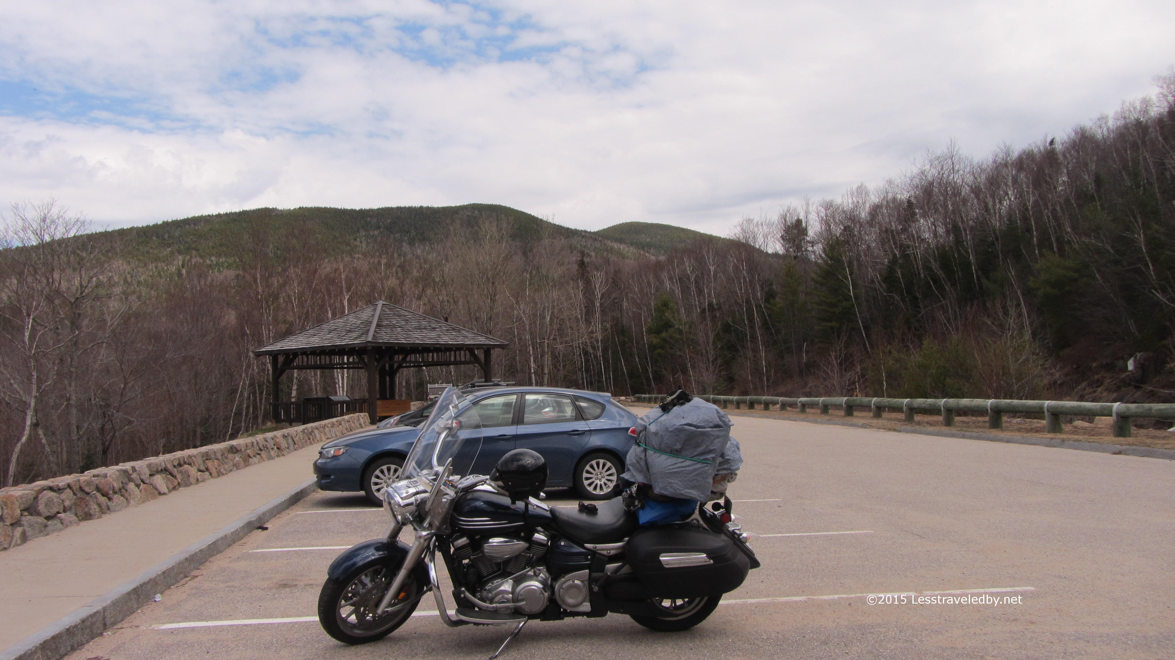
On the way out I pulled over at the Hancock Trailhead parking area so you could see what the mountain looks like from where most people start their hike. It’s about 4.5 miles to the north peak from here and makes for a nice day hike I’m told. Of course I never do things the easy way so I’ll probably never know heh, but I do think I will be going back to try the route from the Pemi side again. I ran into a guy headed in as I was almost back to the parking lot who told me he was headed out to see if he could do Carrigain from the back side so I know I’m not the only one who prefers the path less traveled. That route is definitely on my list as just the name Desolation Trail has me smitten. Maybe this summer if I can squeeze it in.

IMG_4260a
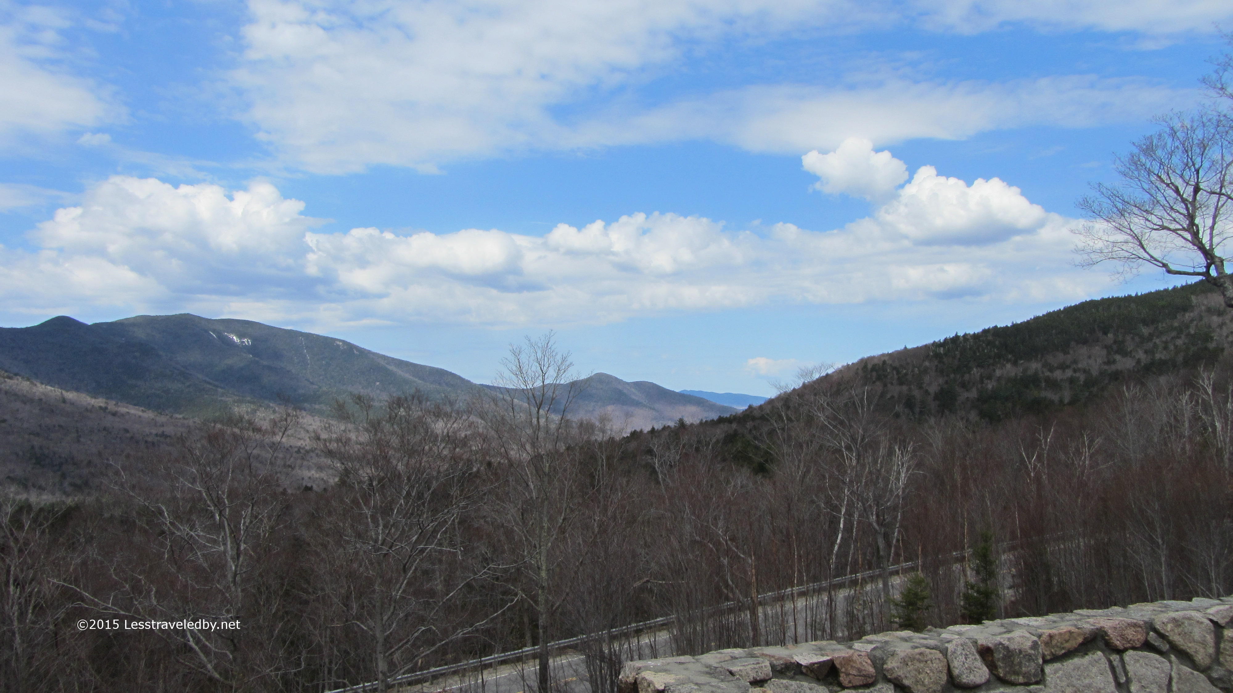
So many mountains. So little time. It was a pretty nice day out on the highway, at least on this side of the pass. I’d hit some rain on the scoot in a bit, but for now I had time to enjoy the views.

IMG_4261a
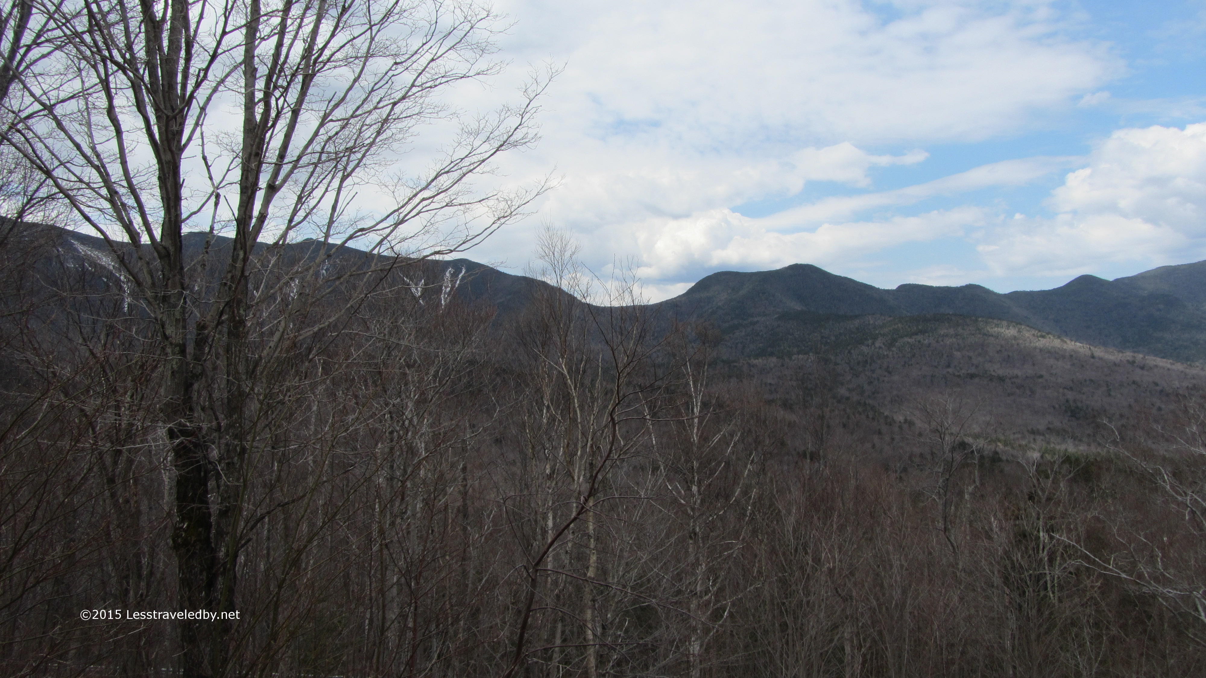
I have spent the last few years exploring the Pemigewasset and I still have miles of trail to cover with many spots as yet unseen. It doesn’t help that I have so many other places I like to go that distract me, but even just this tiny bit of the Whites is quite the undertaking to digest. Then I look around at all these other peaks and valleys and realize I’d better get going if I’m going to see them all in person. Hmm sounds like another one of my unobtainable goals, but chasing those always seems to take me to the most beautiful places.

IMG_4262a

Spring Tent Testing

IMG_4190aWith a big storm forecast for overnight it seemed the perfect time to put a few tents through a serious rain test. I set up my last generation MSR Hubba which I use for most of my trips and the 10 year old TNF Tephra22 that has only been used for winter trips in the last 5 years or so. With 30 mph winds expected along with an inch or two of rain conditions were perfect for making sure these tents were ready for the upcoming back country season.

Both of these tents are free standing and I rarely use stakes when I take them out on trail. Considering the weather and the fact that they were both completely empty I opted for a full array of stakes on both of them for this test.  I even staked out a few of the guy lines just to give them a fighting chance of still being there in the morning.

The storm came through over night as promised with some roaring winds and waves of downpours that just kept coming. By dawn the time between showers was getting longer and the winds were dropping a bit, but there was plenty of standing water in the low spots. Looking into the yard I noticed the vestibule of the Hubba had come loose from its stake, but other than that both tents were pretty much as I’d left them.

In between morning showers I pulled my boots on and went out to see the results. Looking into the Hubba I was very pleased to see there wasn’t as much as a drop of water to be seen. The floor and the bug netting were perfectly dry despite the fact that I’d pitched the fly for maximum ventilation rather than protection.

Feeling optimistic I peeled back the fly on the Tephra and tried to see through the bugnet door, but couldn’t quite make out what I was seeing. Once I opened the door it was clear there was definitely water inside. It was pooled around the edges though the floor looked as though it had drying wet spots throughout.  The fly was pitched to more than adequately protect the inner tent so I can only assume it has lost its waterproof qualities. Having only been out in the snow with it I had no idea, but now I’ll have to do some further testing to see exactly what the issue is and what can be done about it.

Rather than sit around going crazy waiting for the trails to dry I like to keep busy making sure I have everything ready for the season. If you’re waiting out mud season yourself, or even if you aren’t, now is a great time to do some testing at home. Making sure your gear works as expected and refreshing your skills at using it can be time well spent, leaving you a better shot at a trouble free trip down those paths less traveled by

Turn Turn Turn

IMG_4188aThe planet circles the sun, Winter melts away to Spring, the cycle continues. Some follow arbitrary dates on a calendar, but by that measure Spring arrived several hefty snow storms and a lot of frozey nights ago. My thoughts may have turned towards planning Summer adventures, but I’ve kept my Baffins close and my long legged base layers closer even if it is April.

Now though I think we are ready to really turn the page. The snow has gone and returned more than once, but I’m pretty sure we’ve seen the last of the last of it. So much so I officially declared a change of season yesterday and held the changing of the baskets ceremony for my hiking poles. The big snow baskets that have kept me from poking in too far all during the snowy months have served their purpose. Keeping them on into mud season is risky, as those same over sized baskets mired in the Spring muck can pull a man under if he doesn’t know when to let go.

I stay off the trails for a few weeks this time of year to let them dry a bit. When I do go back out I’ve learned to test suspicious looking spots with a pole before putting a boot into them. I’ve had what looked to be an inch of mud take my leg to the knee and have had trust issues ever since. Still, a pole will do you no good if it gets stuck so having the right baskets for where you are headed is worth taking a moment to consider. Boots too for that matter heh. Mud season is no time for minimalist shoes as far as I’m concerned. Mesh uppers breath well in the Summer heat, but breathing mud is another matter.

We are getting a late start on our change of season up here. Yours may be well under way, but whatever you’ve got going on outside your door today I hope you are making plans and getting ready to get out on what adventures the coming seasons bring. It will be time to put those Winter baskets back on before you know it so don’t miss a single chance to get out somewhere less traveled by

Winter Packs

IMG_4120aWinter packs are very different from the packs we carry the rest of the year. Mine definitely are at least. It can be the same physical backpack, but the things that need to be carried are so different that it really changes the whole concept of how the pack is used.

The most obvious difference is all the extra gear that needs to be carried outside the pack; shovel, snowshoes, spikes, skis, ice axes… Most of these are things you need easy access to at times you need to use them, but they need to be secured in a way they won’t be lost in the snow. Sharp edges mean you have to be extra careful that they don’t cut themselves free of whatever is holding them on, other gear or the pack itself. Even with all that going on you still want to have access to things inside the pack too. It really can become a puzzle to figure it all out, but putting some thought into it ahead of time certainly pays off when you’re wading through deep powder and won’t find a dropped item til spring.

My pack changes a lot on the inside as well for winter. Most of the year, in terms of cubic inches, I’m carrying more food than anything else. In winter that changes as insulation takes up so much more space. Normally I bottom carry my sleep system, keeping food and sleep clothes in the main compartment and most everything else in side pockets. The winter pack flips that around with the top quilt needing about twice as much space as the Ventra, extra clothes and of course puffy outer insulation for camp. These items take over the main compartment with additional insulation such as hats and multiple types of gloves invading the side pockets. Food, stove, fuel and insulated mug get relegated to the bottom pouch, but since so far the trips are all really short that hasn’t been an issue.

What has been an issue I’ve found is odd moments of confusion. Normally I instinctively know where every item in my pack is without hesitation. Everything always goes where it belongs until used and once used returns immediately to that same place leaving no doubt where any item is. Then, for the short cold weather months everything is some place else heh. Instead of instantly being able to reach out and grab whatever I need I have to wait til my first instinct is overridden by my second.

It has been a fun winter of playing in the snow, but I’m glad to see it go for more reasons than getting my regular pack in order again. Planning is off to a slow start this year, but the rumblings have begun. I can feel the trails pulling at me and I know I will answer. Family trips with the girls, the annual week with the guys from Texas is almost set and an old friend from California is threatening to come back for another adventure. Hopefully I’ll find some time for solo trips or I may have to find a new trail name. Hmmm, maybe Vermont?

Whether you know where you’re headed or just feeling the pull of the trail now might be a good time to think about how you pack your packs. A little thought to organization can pay off in any season on the path less traveled by

Patagonia Nano Puff Pants Review Posted on Trailspace

Patagonia Nano Puff Pants Review Posted on Trailspace

IMG_4152aMy latest effort for the Trailspace Review Corps went up this morning and I thought I’d share. I have loved testing these pants over the last few months and used them just yesterday on a frigid walk down to the river. Look for some shiver inducing pics from that later this week in a post dedicated to winter’s last gasp.

Meanwhile you may want to check out the scoop on these Patagonia Nano Puff pants. The review includes lots of pics and even a short video so you can see the pants in motion. Please up vote the review on Trailspace if you think it worthy.

http://www.trailspace.com/gear/patagonia/nano-puff-pants/?review=33315

Thanks for reading and I hope you enjoy!

MSR Revo Ascent Review Posted on Trailspace

IMG_4081aI’ve been slacking on updating my review links here on this site but thought some of you might like to see this review I published on Trailspace today. I know winter is almost over but that means after season sales!

http://www.trailspace.com/gear/msr/revo-ascent/#review33285

If you like the review take a moment to up vote it there on Trailspace. It always makes them happy to know someone stopped by 🙂

Pemi Winter Weekend

IMG_4065aIt took over a month but I finally got a chance to get back to New Hampshire for some more winter fun. Weather and other obligations had conspired against me, but now I could finally get out to enjoy all that snow instead of just shoveling it at home.

IMG_4069aIt was only about 20°f on Friday afternoon’s hike in but hauling a full winter pack a few miles on snowshoes was enough to get me plenty warmed up. The sun was noticeably brighter than on my last trip here in January though.

IMG_4070aI didn’t really need snowshoes on the way in as I was only breaking a few inches of fresh snow on a hard packed trail, but they really came in handy making a nice path in to my camp site.

IMG_4073aThe sun was low but bright on the snow. You really could feel that spring was approaching despite the fact that it was still a bit chilly at the moment.

IMG_4077aI managed to dig out my unused pile of firewood from my last visit here. Bringing a shovel along worked out great for digging out the fire pit as well. If I felt the need I was ready for making a fire in the morning.

IMG_4079aEven before the sun fully set the air began to turn a bit sharper edged making it clear it wasn’t going to be a springtime evening by any stretch. I made a point of starting the dinner process early since it was my first time in the field melting snow with the new stove.

IMG_4080aAlso new on this trip was a large thermos bottle so I could be sure to have some liquid water in the morning. Last time even the bottle with warm water turned slushy overnight. With the thermos the water was actually still warm over twelve hours later in very cold temps.

I also brought along an insulated cup so my hot beverages would actually be hot. Tea was served after dinner to get the body charged up with heat to bring into the tent. Getting all that insulation warmed up is hard work.

I read for a few hours in my bed and then fell asleep just as the moon was rising over the ridge to my south. My tent was facing away from the moon because I knew it was going to be bright. The times I woke up throughout the night were amazing with the trees throwing shadows on the snow like it was day.

As the night wore on I could tell that it had gotten what I refer to as “pretty gosh darn cold”, one of the lower temperature levels on my scale. In my cocoon of insulation my indicators were the way a direct breath of air felt in the lungs and the crunchy feeling at the corner of the eyes as they try to freeze over heh. I slept the last part of the night with the rabbit fur bill of my bomber hat flipped down over my eyes.


IMG_4081aBy the time it started to get light out I was looking forward to getting out of bed. That many hours of laying down gives a man the incentive he needs to get up and stay out there in the cold.

IMG_4086aFirst time I have lit a sport fire that wasn’t needed for fish roasting or marshmallow toasting in quite a few years. The effort was good for taking my mind off of the cold by giving me something to think about. Starting a fire in the snow is a good time for a top down fire and this one did the trick.

IMG_4097aNot sure what the weather had in mind, there had been talk of snow squalls, I decided to hang around camp rather than head out into the wilderness for the day like I’d planned. Up to this point I’d had the place all to myself with the exception of a few skiers who had passed by on their way out. It was amazing to enjoy the quiet and just relax.

IMG_4100aThen people started to appear. First this group of three guys set up next to me. Then a few other groups of folks came in to camp for the night as well. I was quite surprised, but between the full moon and the warm weather moving in perhaps I shouldn’t have been.

IMG_4099aOne of my new neighbors hung a hammock while the other two set up in big bivvy bags under and on top of a tarp.

IMG_4102a

IMG_4104aThe afternoon sun through the trees made for great shadows. The light this time of year just seems to hint at the promise of the season change to come.

IMG_4106a

IMG_4108aThe thick slabs of river ice from the last trip now had heavy snow blankets and the sun had polished any exposed edges. They clearly said that winter was still in charge around here for now, even on the nicer days.

IMG_4110a

IMG_4111aEven with all the campers and day hikers on both sides of the river no one attempted to test the snow bridges on the river all weekend. No one tried to access the flowing water either. As much as I didn’t enjoy spending time melting snow I wasn’t about to risk falling into that water. My old heart would give out I’m sure or at least I’d probably wish it would.

IMG_4113aNot as quiet as the first day, but definitely another beautiful afternoon in the snow. The squalls never appeared and the winds were reasonable throughout.

IMG_4114aOne of my winter gear additions was a pair of ECWCS mitts which I have found many uses for including as a cozy for freeze dried meals. They came out of the mitt piping hot after soaking for 15 minutes. I’ll be talking about these mitts and more in the future. I’d like to do a post or two on the winter kit I’ve put together now that I have things pretty well figured out and winter is over 🙂

IMG_4117aThe walk out on Sunday was beautiful. The day hikers were not out yet and I did the three miles mostly alone until just before the parking lot. That was of course a zoo even at this time of year.

IMG_4119aI did stop to get a rare shot of myself without a hat. You can see the weekend sun has left my exposed skin a bit red, but thankfully most of my surfaces are protected by my thick, winter pelt. Much like the snow, the days of that bushy beard are numbered. Warmer temps will melt them both away soon enough I’m sure, but this winter has been so much fun out there I’ll miss them when they are gone.