
Things came together for another run into the Pemigewasset Wilderness and this time the weather was perfect. Relatively cool, mostly clear and best of all no rain forecast. I couldn’t see wasting the chance so planned a three day, roughly 28 mile loop. The first and last days would be reasonable but the middle day was a bit ambitious with some amazing views as bait. Always one to push myself a little too far I jumped at the opportunity.
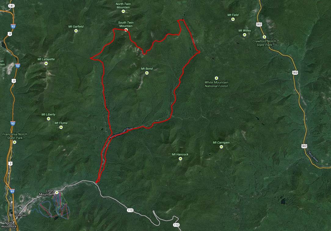
The planned itinerary:
Day 1: Lincoln Woods TH to Franconia Brook Trail to the 13 Falls campsite. Roughly 8 miles of gentle climb
Day 2: Up the Twin Brook Trail to Galehead then along the Twinway (AT) Trail up to South Twin, past the Bond area, across to Zealand Peak and down to Zealand Falls. Picking up Ethan Brook (AT) out to the Thoreau Falls Trail. Roughly 12 miles with some serious ups and downs.
Day 3: Thoreau Falls Trail to Wilderness Trail to Eastside Trail back to Lincoln Woods TH. Roughly 8 miles
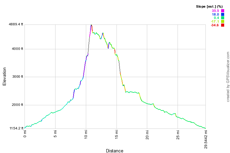
Distances worked out a tad longer but the elevation profile certainly didn’t disappoint. The up really went up, the down really went down and in between there were still plenty of changes. Almost like I was in the mountains or something!
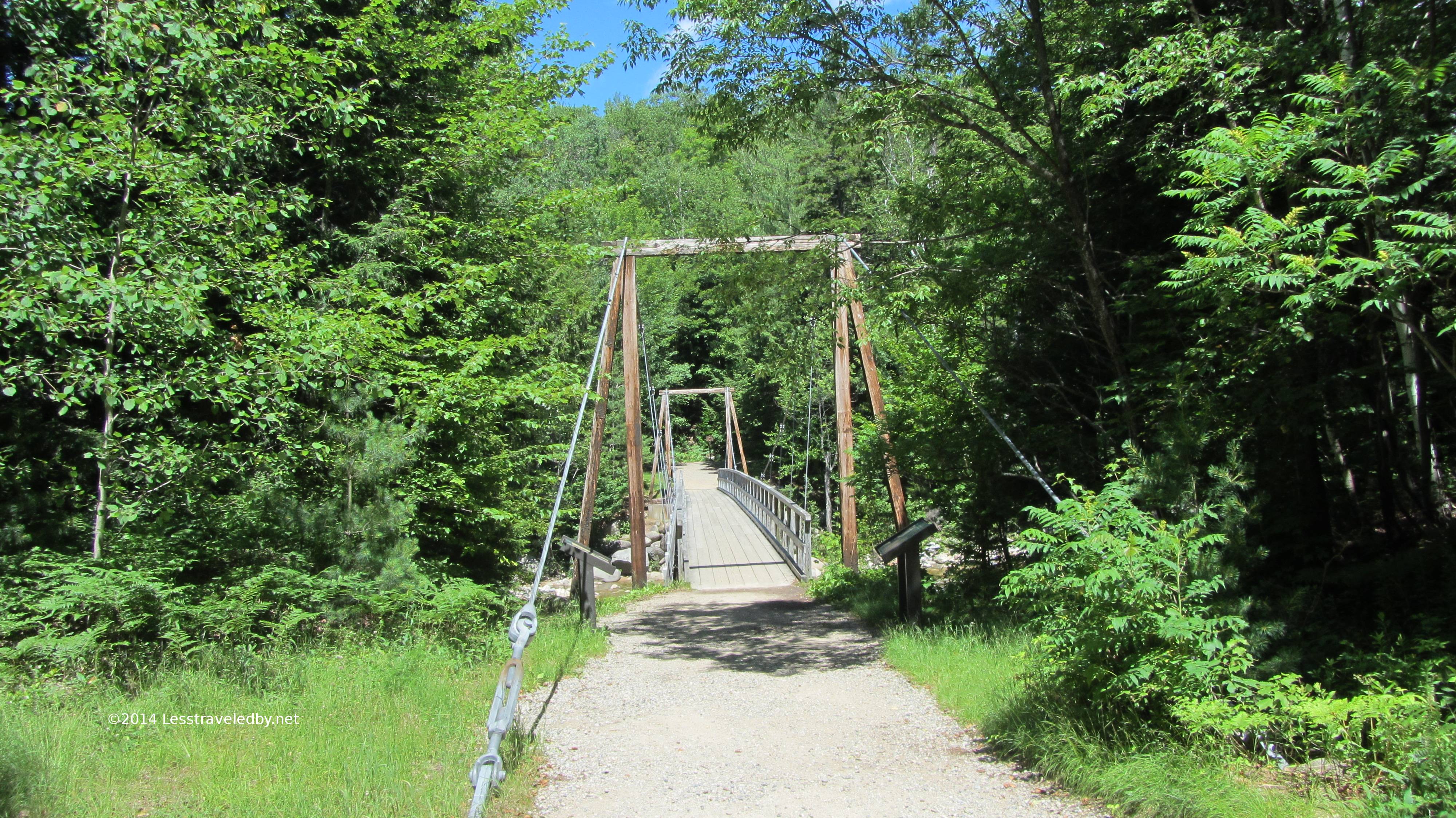 The adventure started out easy enough as most seem to. The Lincoln Woods TH is a heavily used day hiking spot with access to the Pemigewasset River and Franconia Falls within easy reach. I arrived before noon on a Thursday but the lot was about half full. This is the footbridge that takes you from the east side of the Pemi towards the Lincoln Woods Trail.
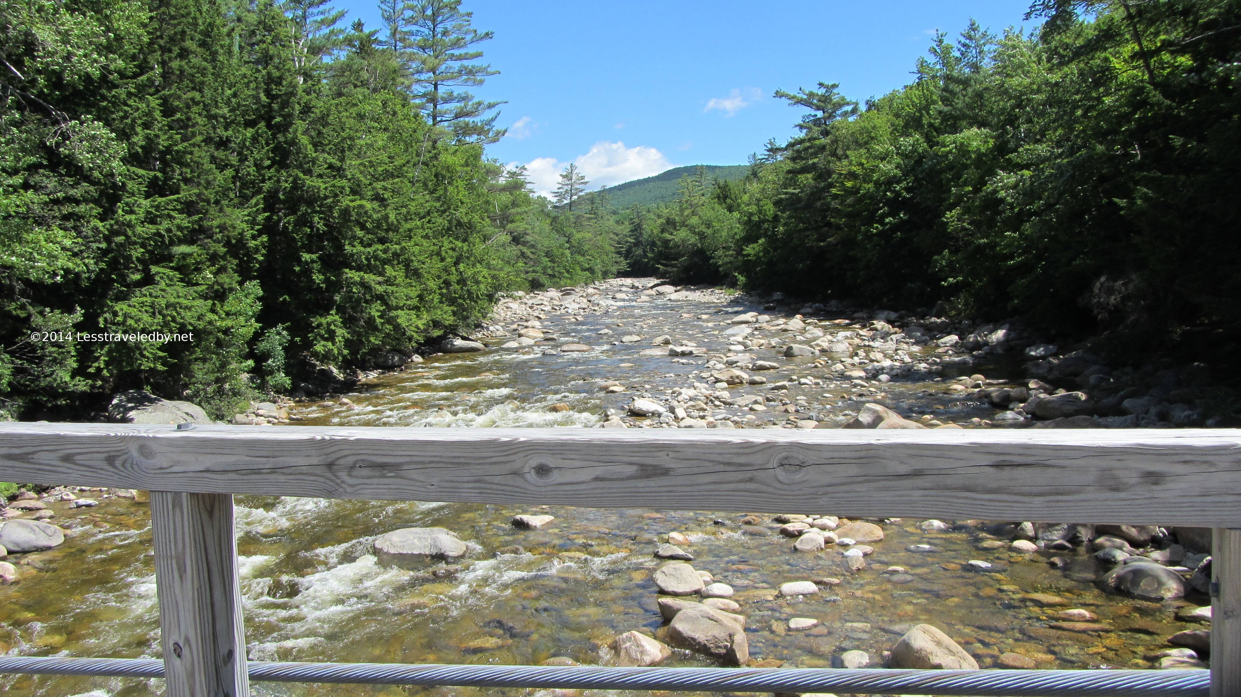 Much less water than when I was here last month. There had been some rains but nothing like the storm I rode out that trip.
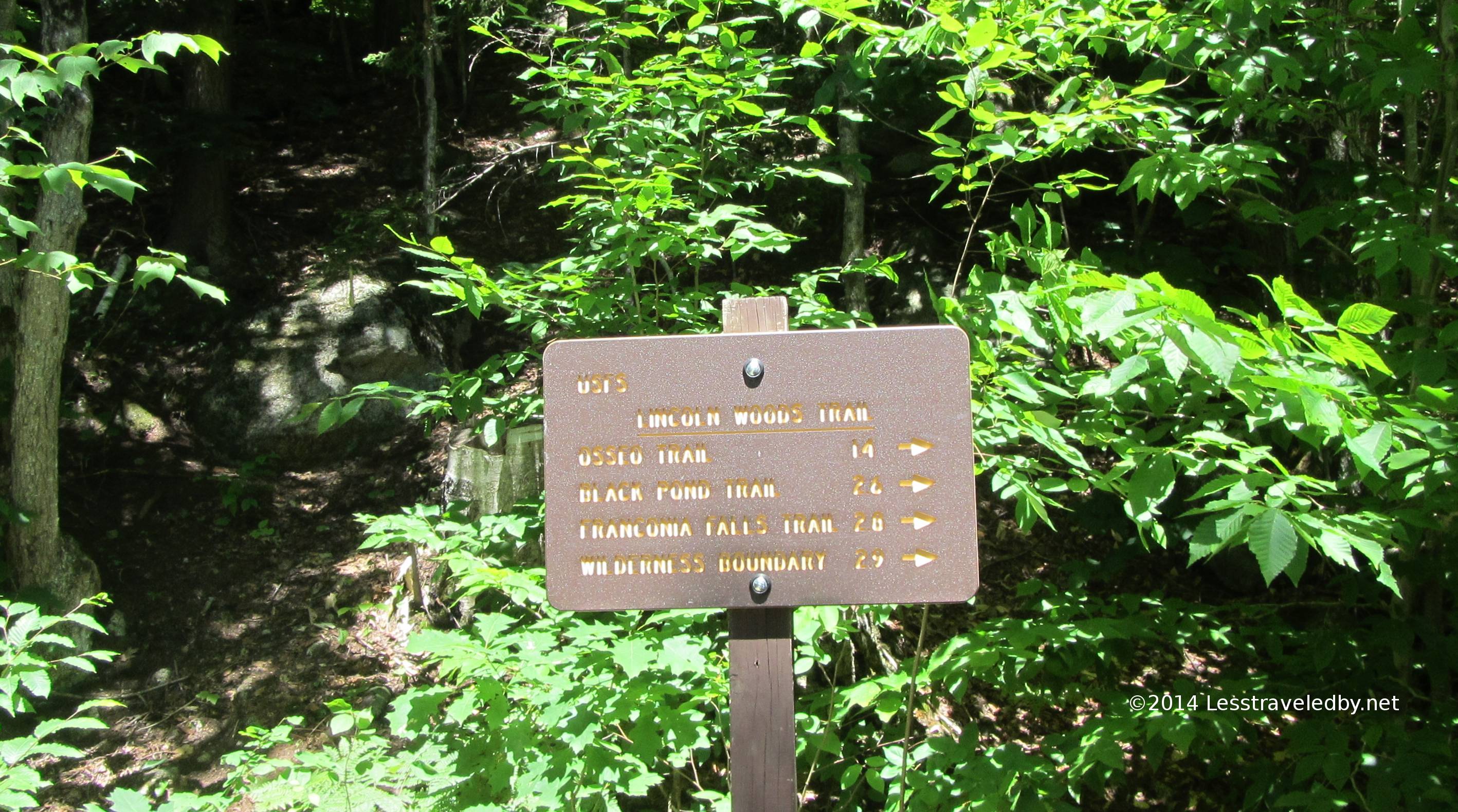 As you can see by the fresh paint this area is not inside the wilderness boundary. I always notice the difference between the signs you see near trailheads compared with the ones deeper in, but wilderness areas take rustic to a whole new level some times.
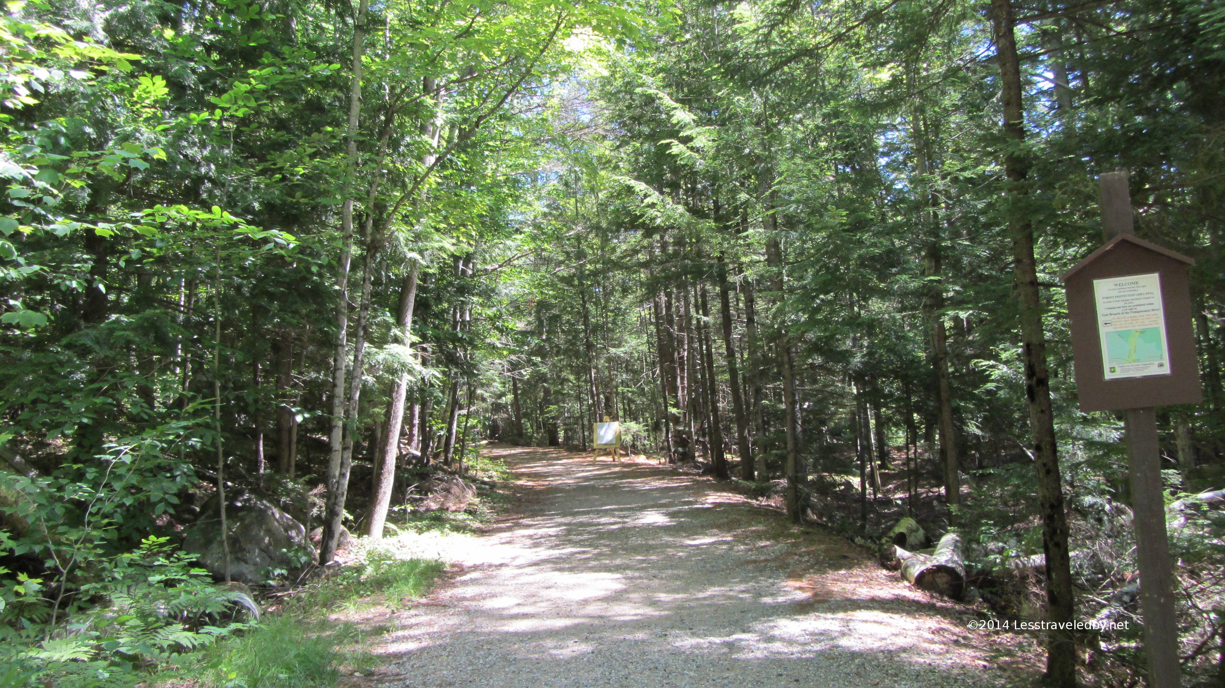
Much like the Eastside Trail the Lincoln Woods Trail starts out very well maintained. It is very popular with people of all ages able to get out and enjoy a bit of the woods even if they can’t handle real trails.
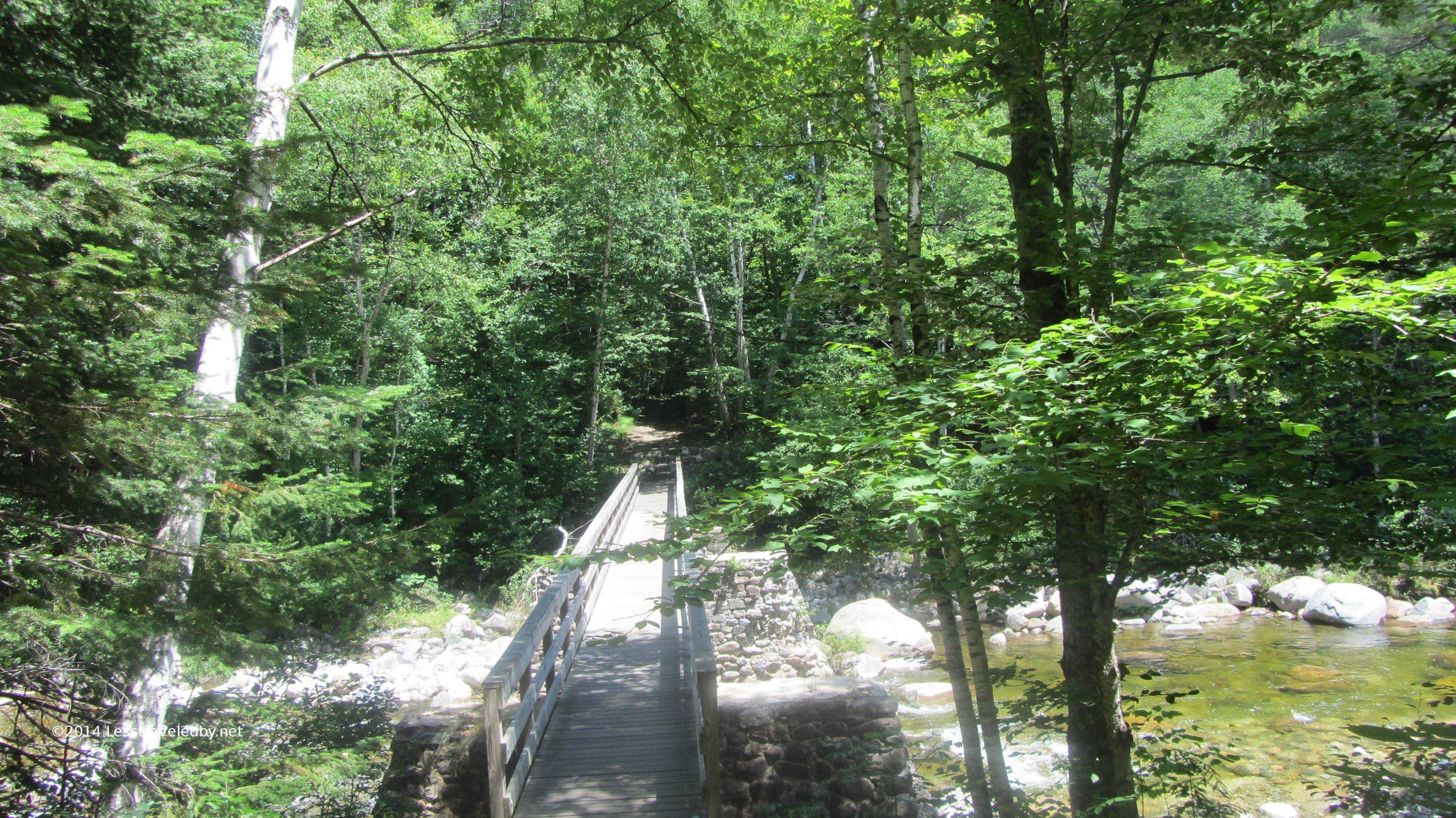
This pretty footbridge just below Franconia Falls is where things start to turn a bit more wild. The trail out this far is built on an old rail bed so remains pretty level but soon becomes more rustic as the wilderness begins to close in.
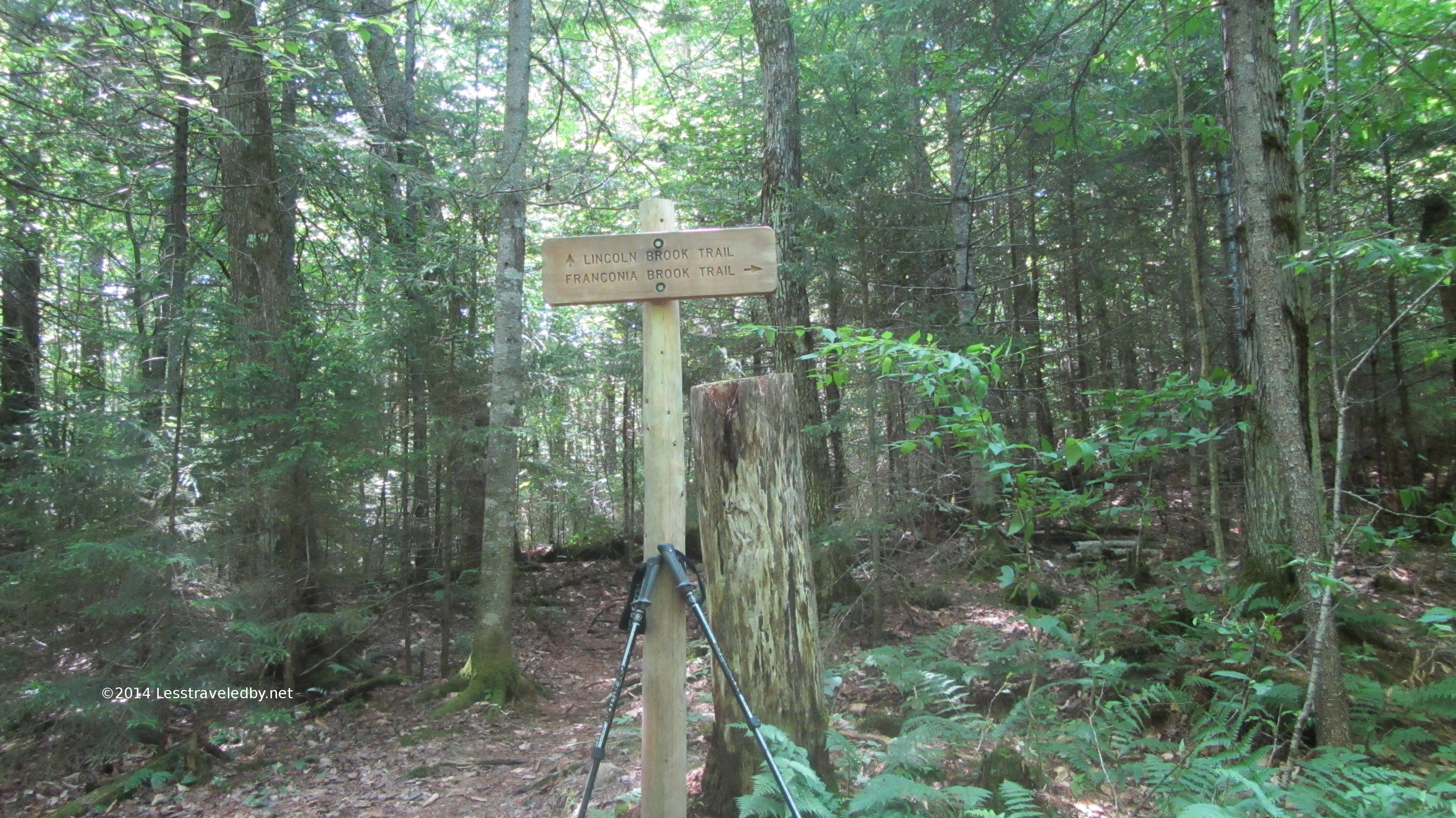
I stopped for a break at the Lincoln Brook Trail intersection. Passing into the wilderness this sign is unpainted but looks pretty new. Signs, like trails, always seem to get more attention when they are easier to reach.
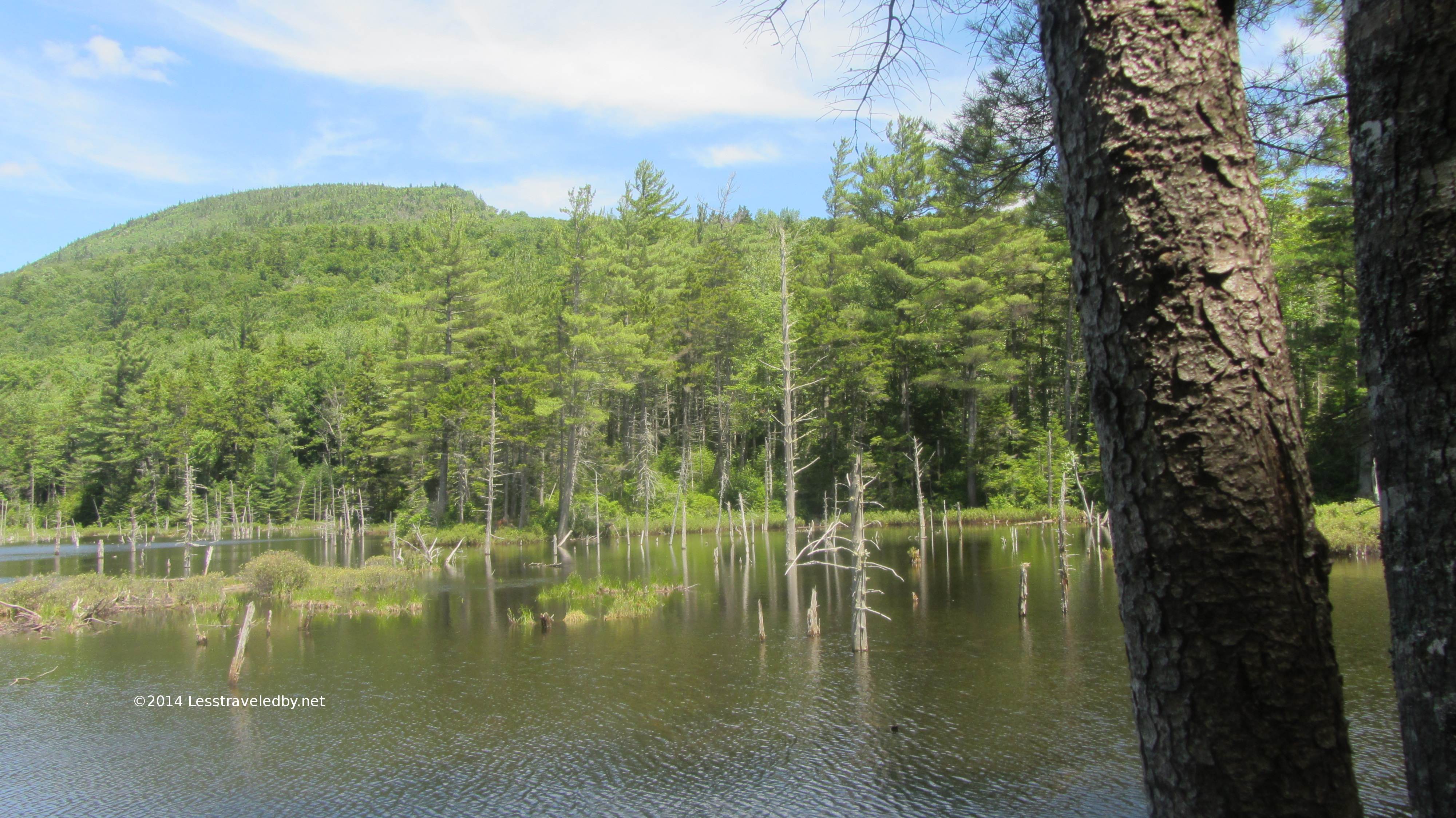
I can’t find a name on my maps for this pond but it was a New England classic. A noisy lady duck tried to get me to follow her so I’m guessing she had little ones in the reeds near me hidden away. Otherwise a very peaceful spot.
The sound of the brook was pretty constant though at times it was impossible to see through the forest. Other times there were little views like this made perfect with summer sunshine.
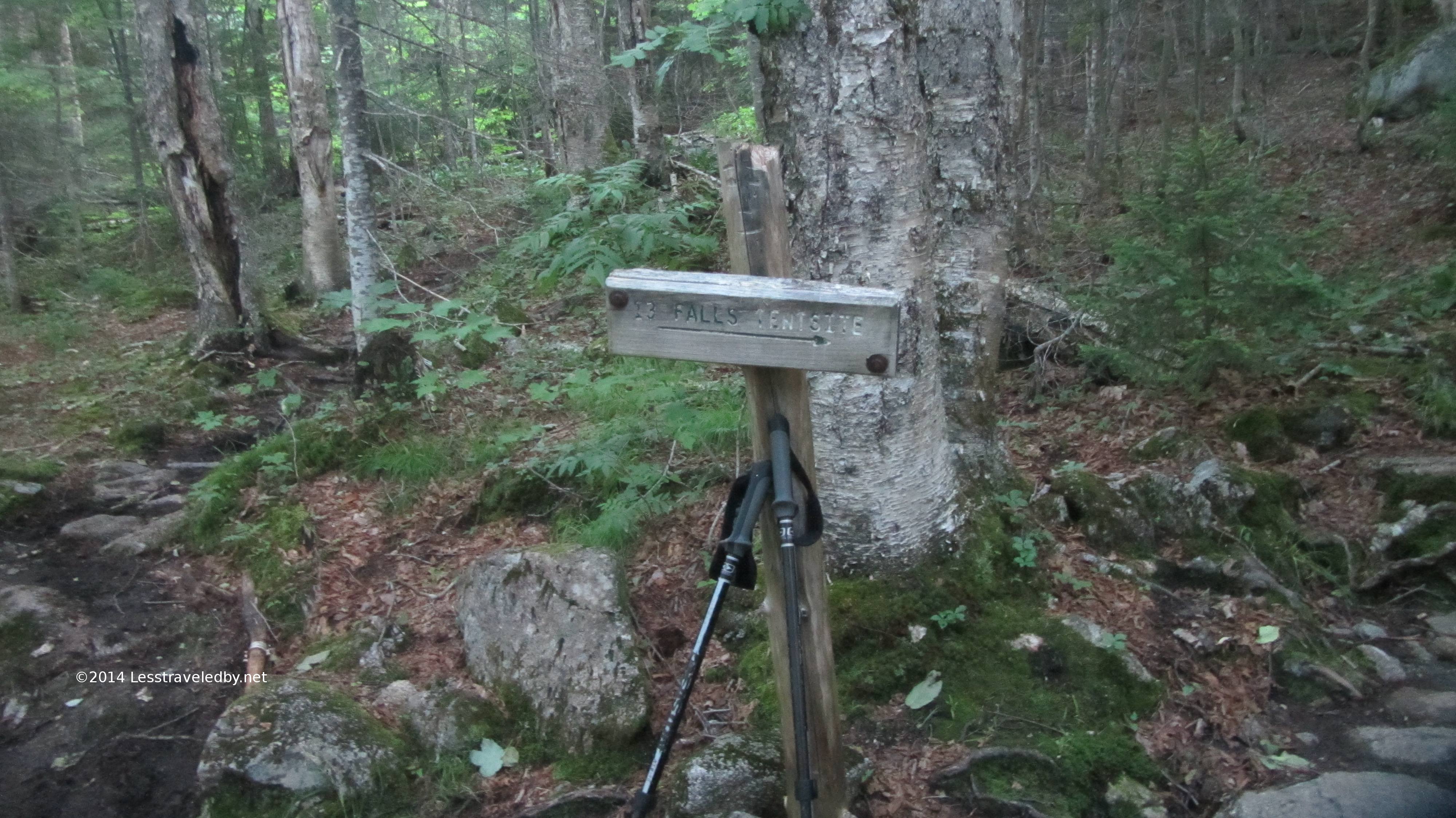
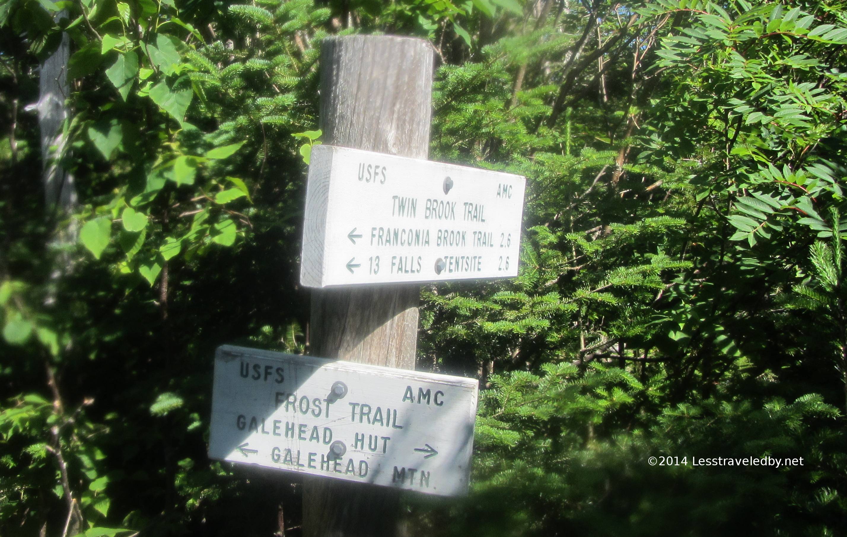
Now this is a sign worthy of being in the middle of the wilderness. Despite being right outside the AMC’s 13 Falls campsite they haven’t felt the need to put up anything flashy or keep it painted. I have never stayed at one of the official camps before as I prefer to camp far away from other people, but this one was right where I wanted to be when I woke up so I took a chance on it. From all the whooping I was hearing down by the brook I was afraid I’d regret it, but the AMC host said it is usually a pretty quiet place at least during the week.
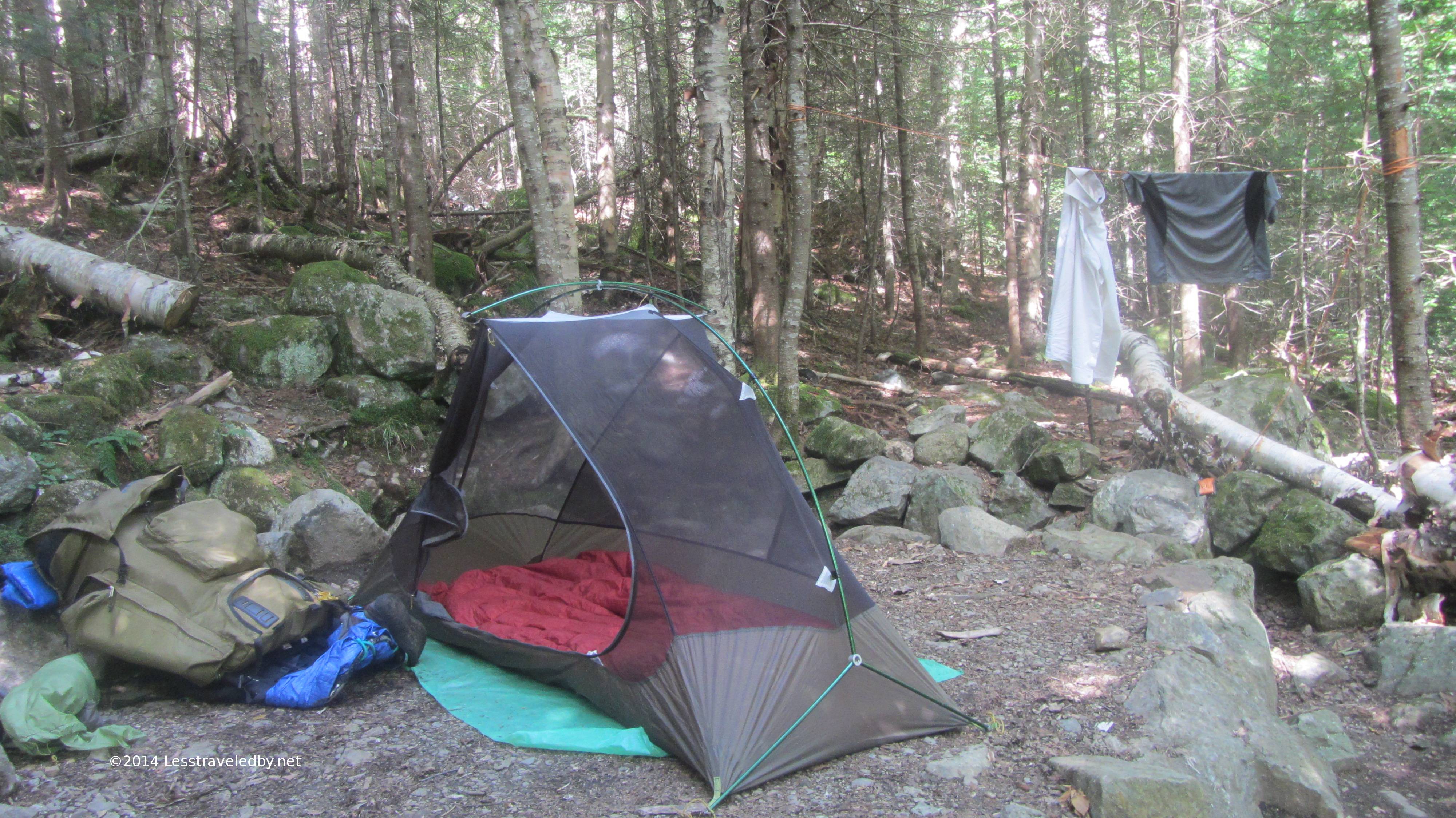
Seeing my doubts she led me out to the farthest tent site and I handed over my $8 on the spot. As usual the AMC builds great tent pads with serious drainage to handle the weather the mountains get. Being on the end this spot was more removed from the other sites.
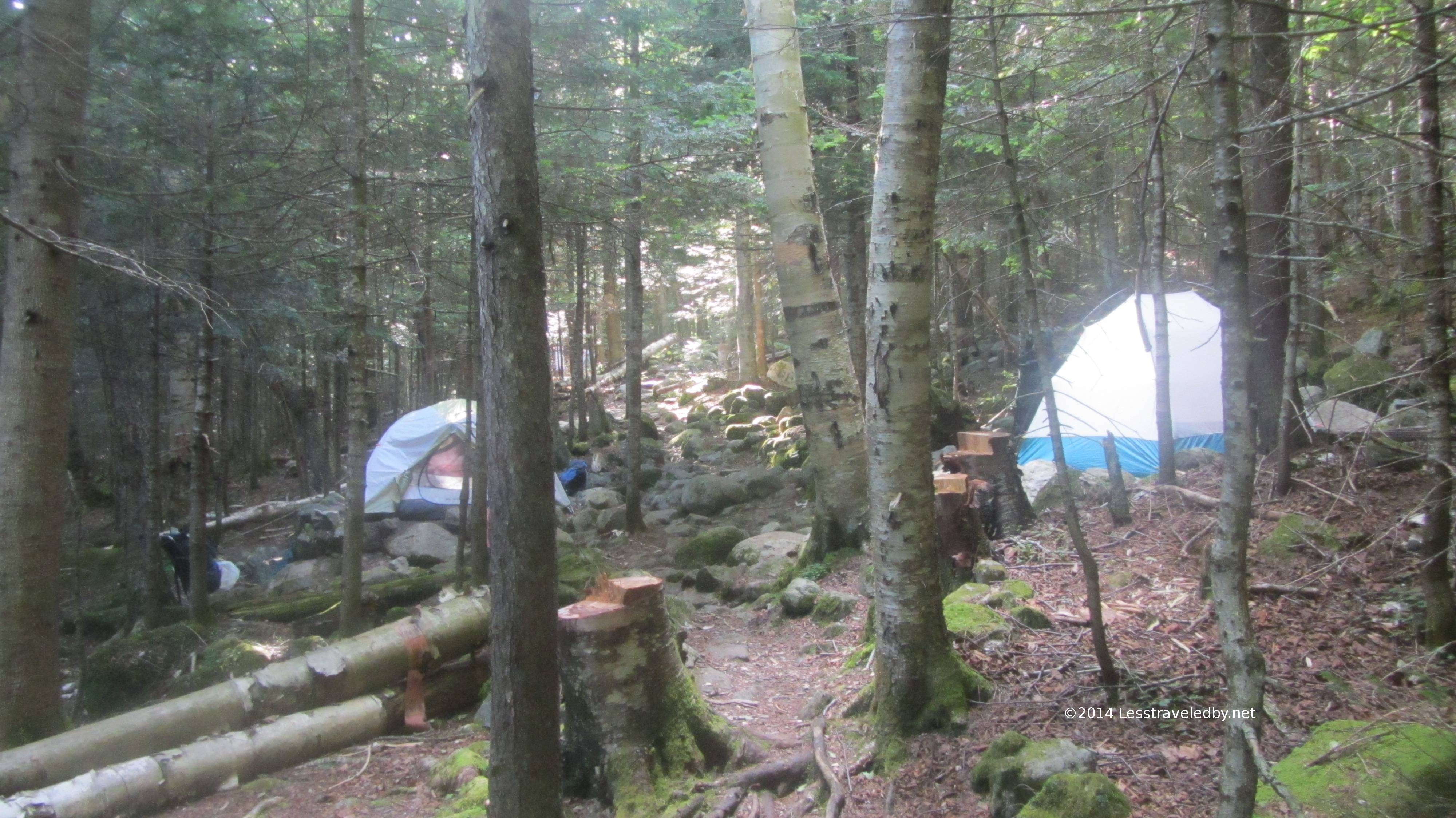
Which was good because the rest of the sites were set up so they were right on top of one another. That isn’t a two tent party, that is two parties stuck camping on top of each other. I was glad I had my camp shoes on when it was time to tip toe between these camps to get my food bag in the morning.
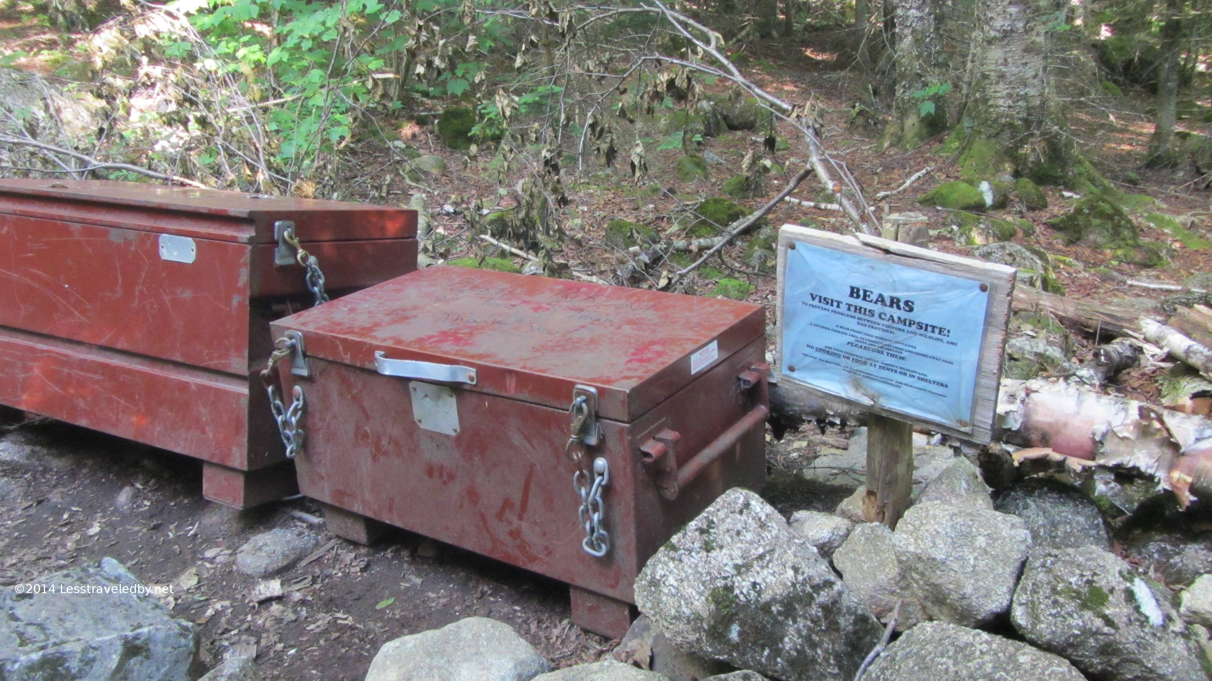
Plenty of communal bear box space was to be had. Good thing too because despite the warning signs and equipment there were signs some folks weren’t all that careful with their food. That is to be expected at established camps I guess, but definitely reminded me why I usually camp where people don’t usually go.
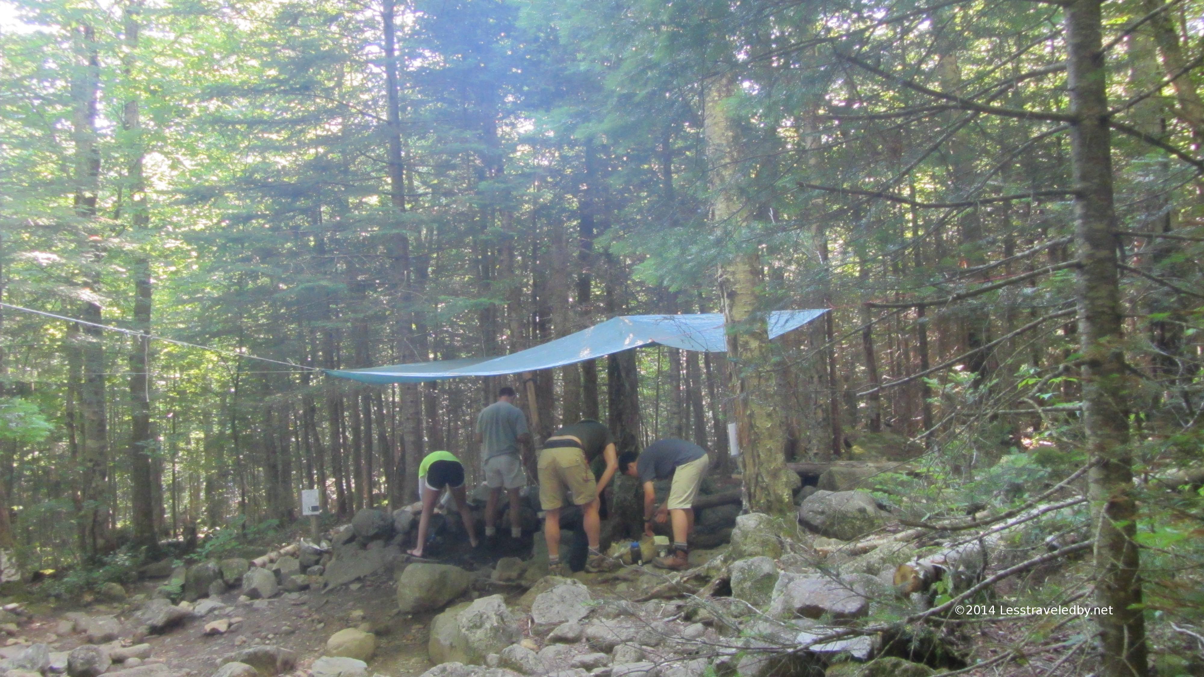
This is a classic shot of the communal kitchen area. No open fires were allowed so everyone is bent over their stoves or digging in their kit. I sat down on a rock to use my stove and on a log while I ate my dinner, but maybe they needed to stretch their hamstrings after a long walk heh.
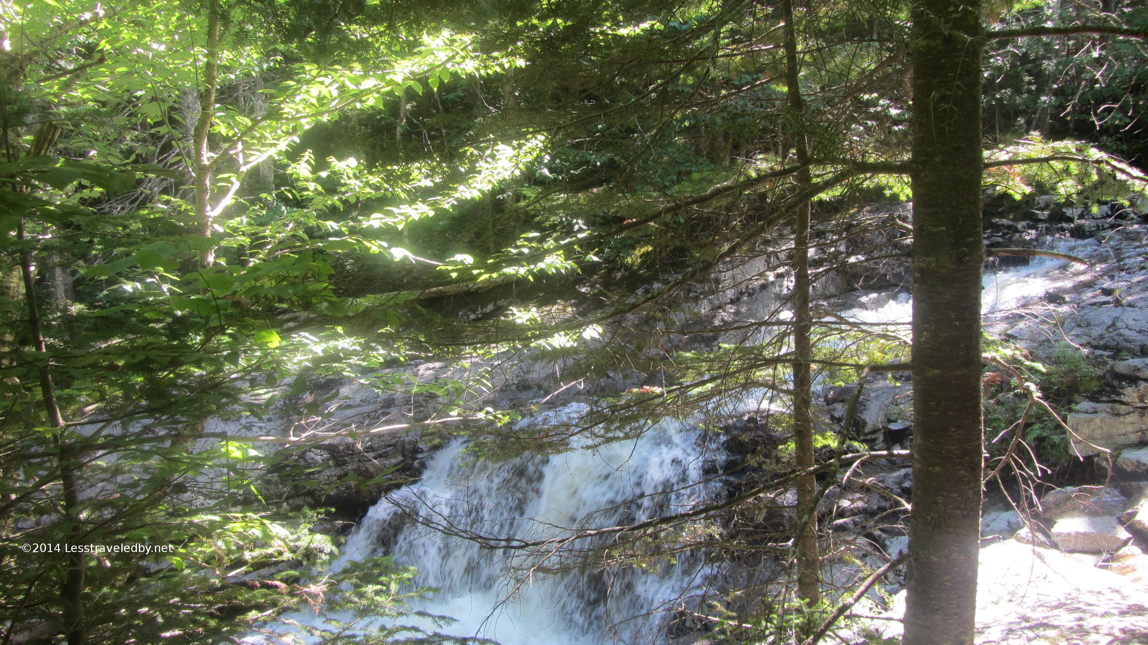
Part of the 13 falls that give this area its name. This is where the Lincoln Brook Trail crosses over the Franconia Brook and rejoins the trail after skirting Owls Head. I saved that option for another day.
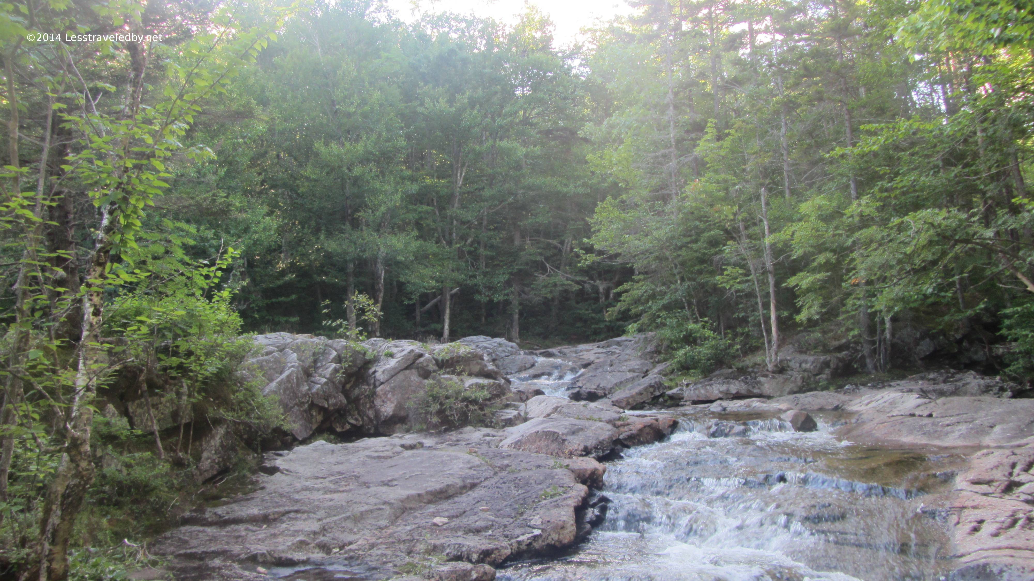
With only about 1100 feet of climb from the parking lot this area is pretty accessible with no real climbs on the way. It seemed a nice place to bring kids old enough to be trusted around the water with plenty of places for playing and keeping cool.
The dark of the forest really made it easy to forget it was a bright sunny day above. This would turn out to have been the best day to be on the peaks, but it was pretty nice down here as well.
There were just a few happy little clouds out and between the lack of climbing and nice temps it just seemed nice to hang out and watch them float by.
I managed to walk all the way through the camp to my food without waking anyone up. I had my breakfast, broke camp and was on my way out as the first heads started to appear from their tents. It was a tad before 7am and cool. Perfect climbing weather for me so I got on my way headed up.
A family I talked to at the kitchen area the night before had told me of their trip down the Twin Brook Trail that day. They said it was very poorly maintained near the top and they had to do a lot of bushwhacking. My guess is they must have followed a runout off the trail at some point because I found this trail in great shape. Like the rest of the Pemigewasset Wilderness there are no blazes, but the trail was pretty easy to see compared to some others I’ve seen.
It also had dirt most of the way up with only some rocky sections near the top where it also climbed a bit more steeply. Still this was a great trail for an early morning climb. It was about 1600′ of climb over 2.6 miles but most of it was pretty gentle.
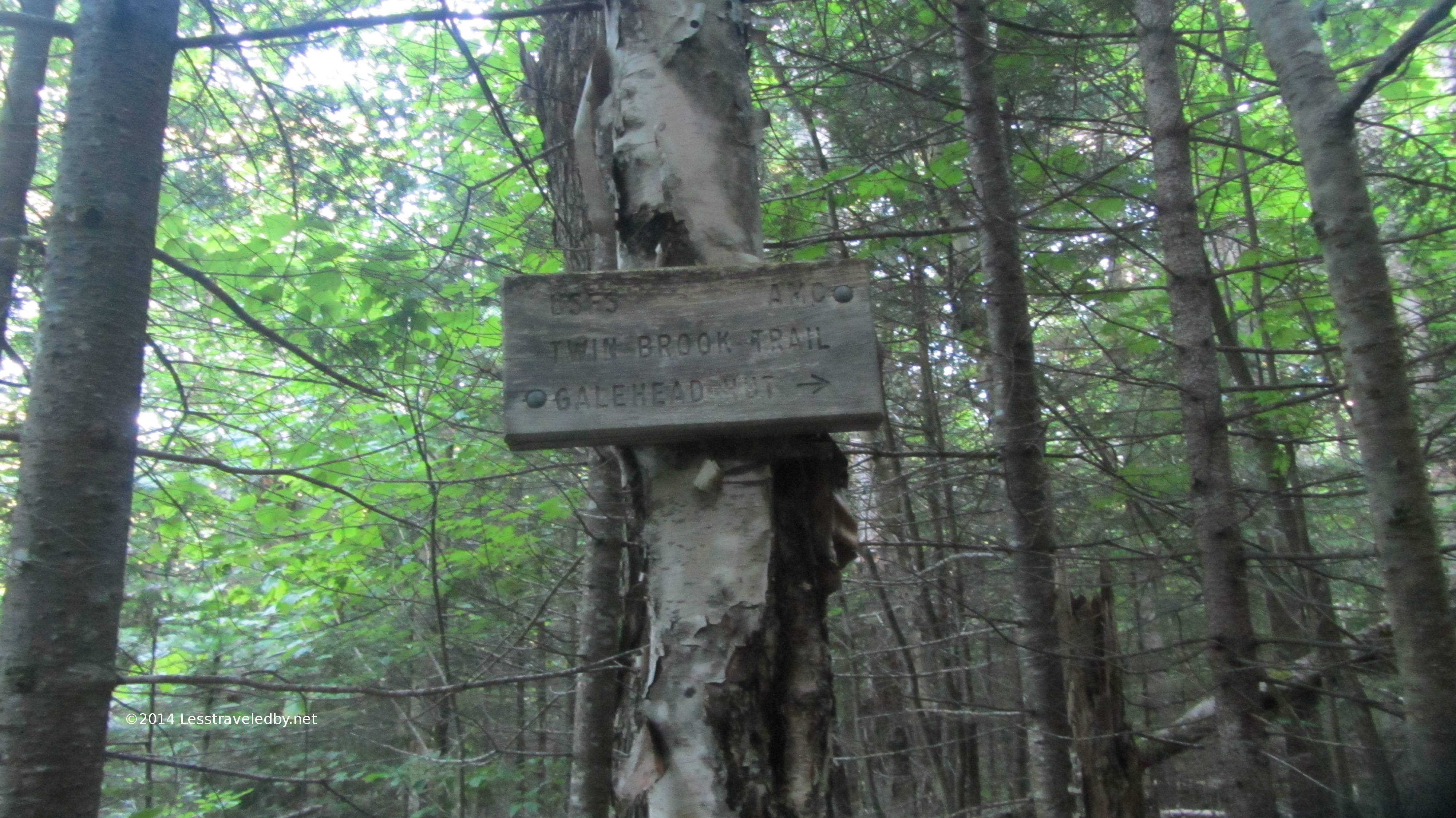
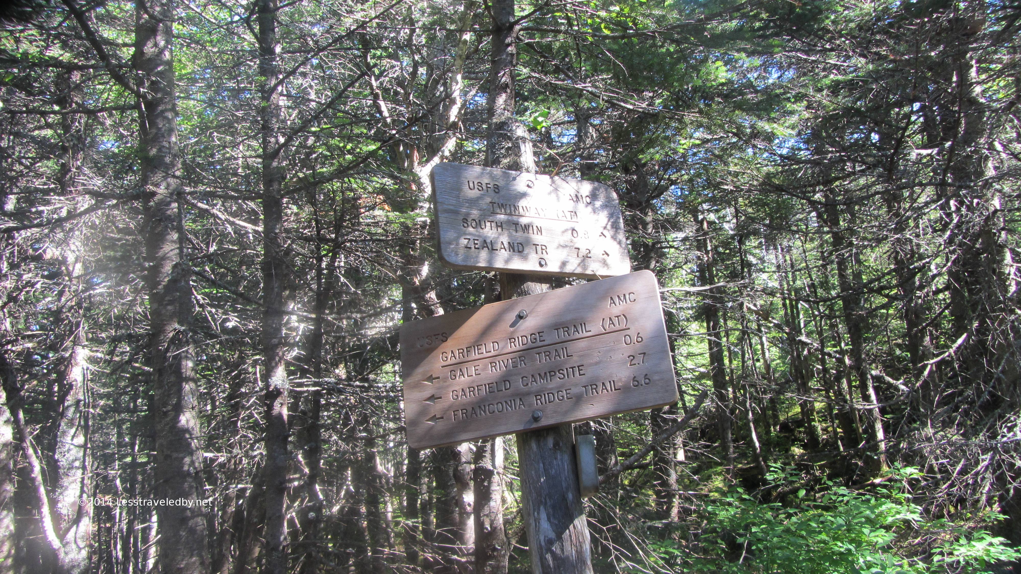
Seeing these signs I knew I’d crossed out of the wilderness and into the “civilization” of the AT. From here until late in the day I’d be seeing a lot of people on the trails. From day hikers and peak baggers to thru hikers there was a lot of traffic by my standards. Many places I go I won’t see anyone for days so this was hard for me to get used to.
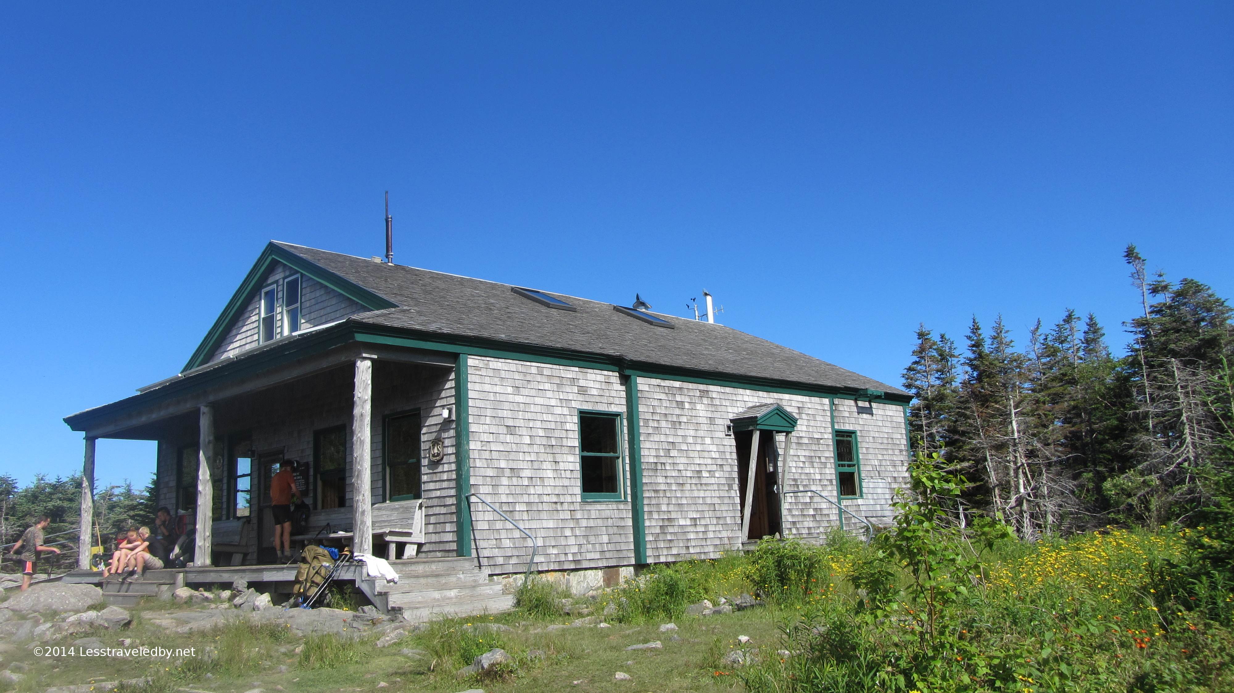
This is the Galehead Hut run by the AMC. They have a series of these buildings where they rent out bunk space which comes with full dinner and breakfast service. Their rates are a bit much for the average hiker, but a person could travel from hut to hut with a day pack or use one as a base camp for day hikes. The folks who work at these huts seem to be invariably friendly and polite young people who make you feel welcome even if you aren’t a paying customer. They will let you use their bathrooms or fill your water containers from their taps and I’m told that in some cases hikers may be able to work for a meal or a place to sleep.
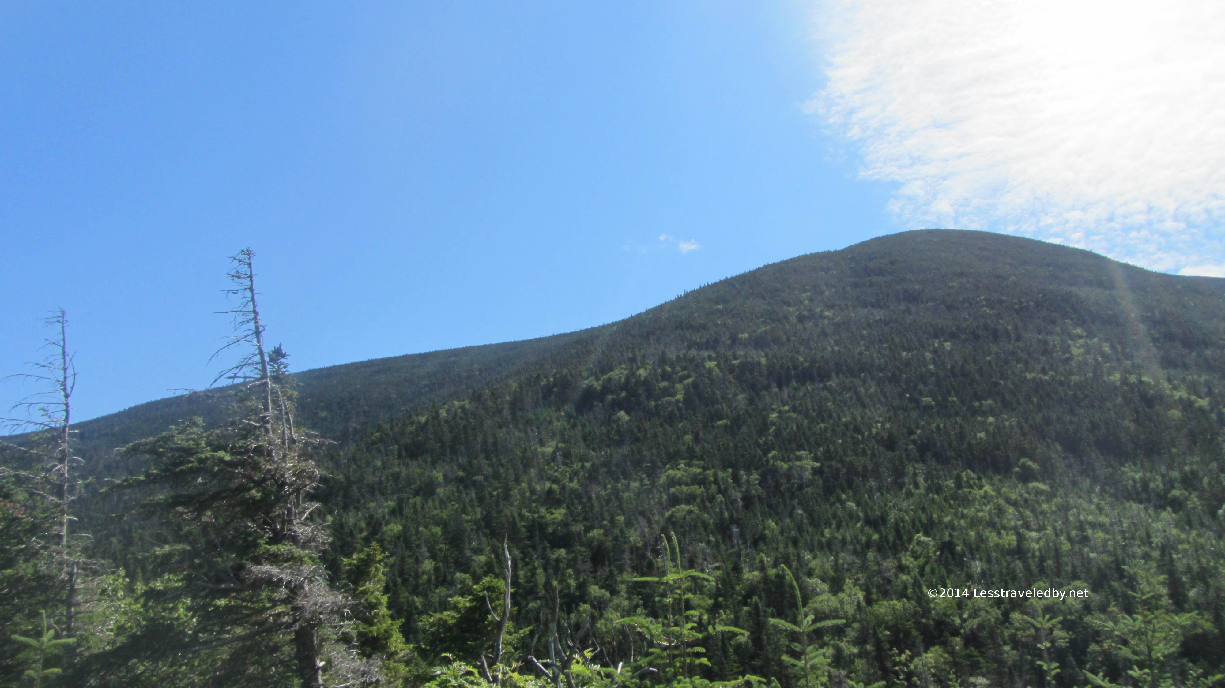
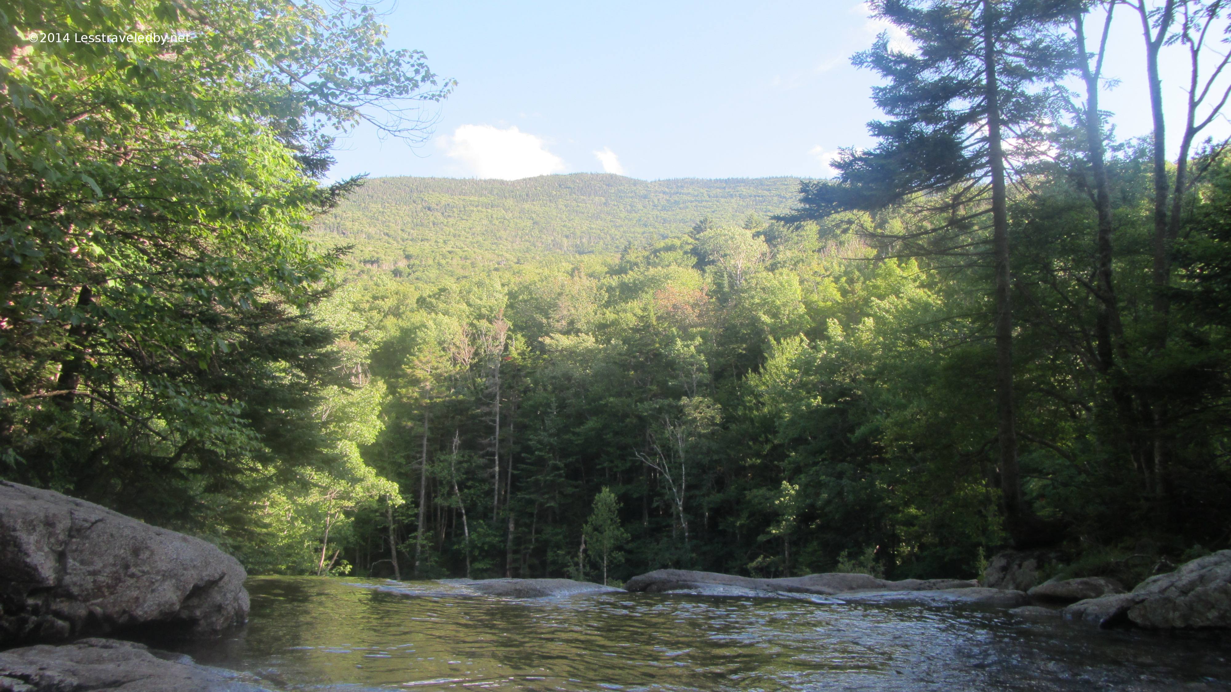
This is the view from the hut looking up at South Twin which was the next step on my adventure. From here it looked like a pretty big step so I took time for a snack after I snagged some water I didn’t have to filter myself.
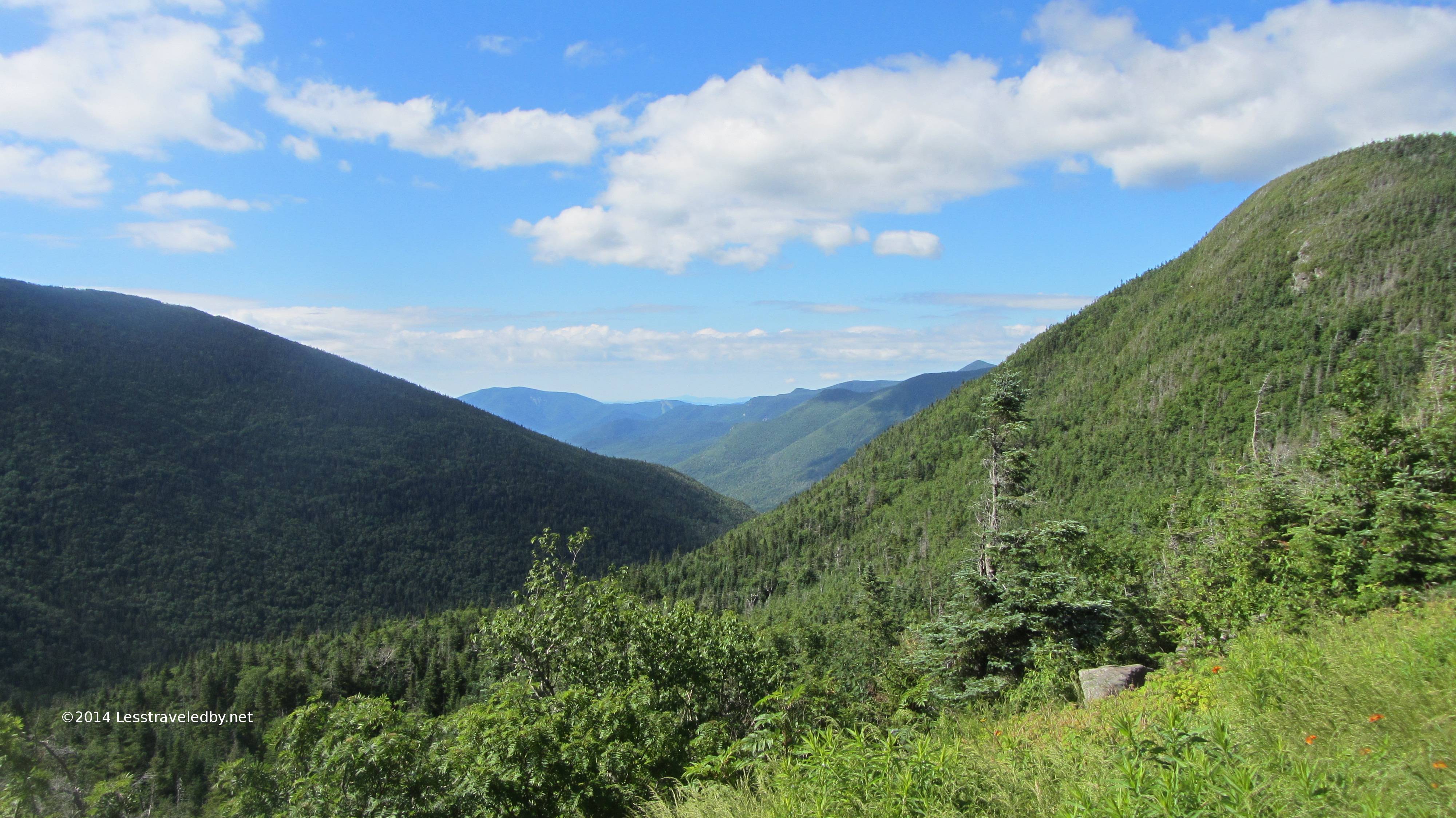
Just in case the next climb sapped my will to live I also stopped to enjoy the view looking back towards where I’d come in the day before. I came up the right side of the valley in the foreground that morning, but that large valley beyond is where Franconia Brook runs and the trail I’d been on the day before. In the far distance I believe that is Loon Mt ski runs that can just barely be made out.
I was so glad I didn’t look closely at this sign when I took this pic. I snap intersections out of habit but generally just make sure the arrow points where I expect it to. If I had known this climb was only .8 miles as I was puffing my way up it might have seemed harder. I was surprised when I looked at this picture after the trip and saw that distance.
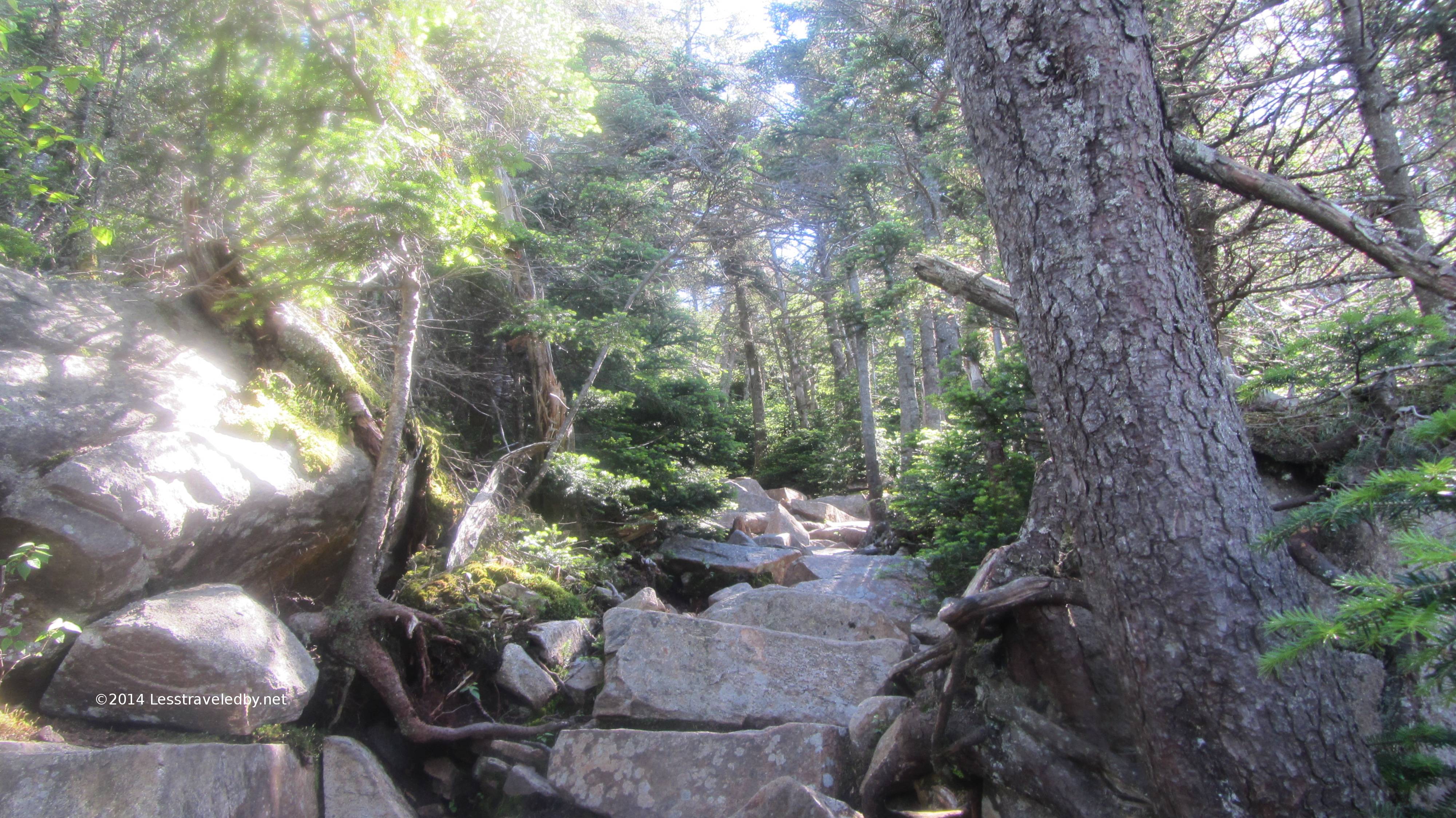
This being what the trail looked like might have something to do with that heh. It was steeper in parts but invariably just a big pile of rocks all the way up. Much of the AT is like that through the NE states due to erosion. The heavy foot traffic combined with the weather wears away any surface dirt. In good areas you get staircase like rock piles. In bad areas you get boulder puzzles you have to figure out how to get over, under or around. This trail was actually pretty good by those standards.
There were puffs of breeze at times that hinted at cool high elevation air. The higher I got the more often there were also peeks at the views soon to be had.
Then surprisingly quickly I reached this open spot just below the peak. A perfect place to take my “summit” break in peace as opposed to at the true summit where I could see there were other people.
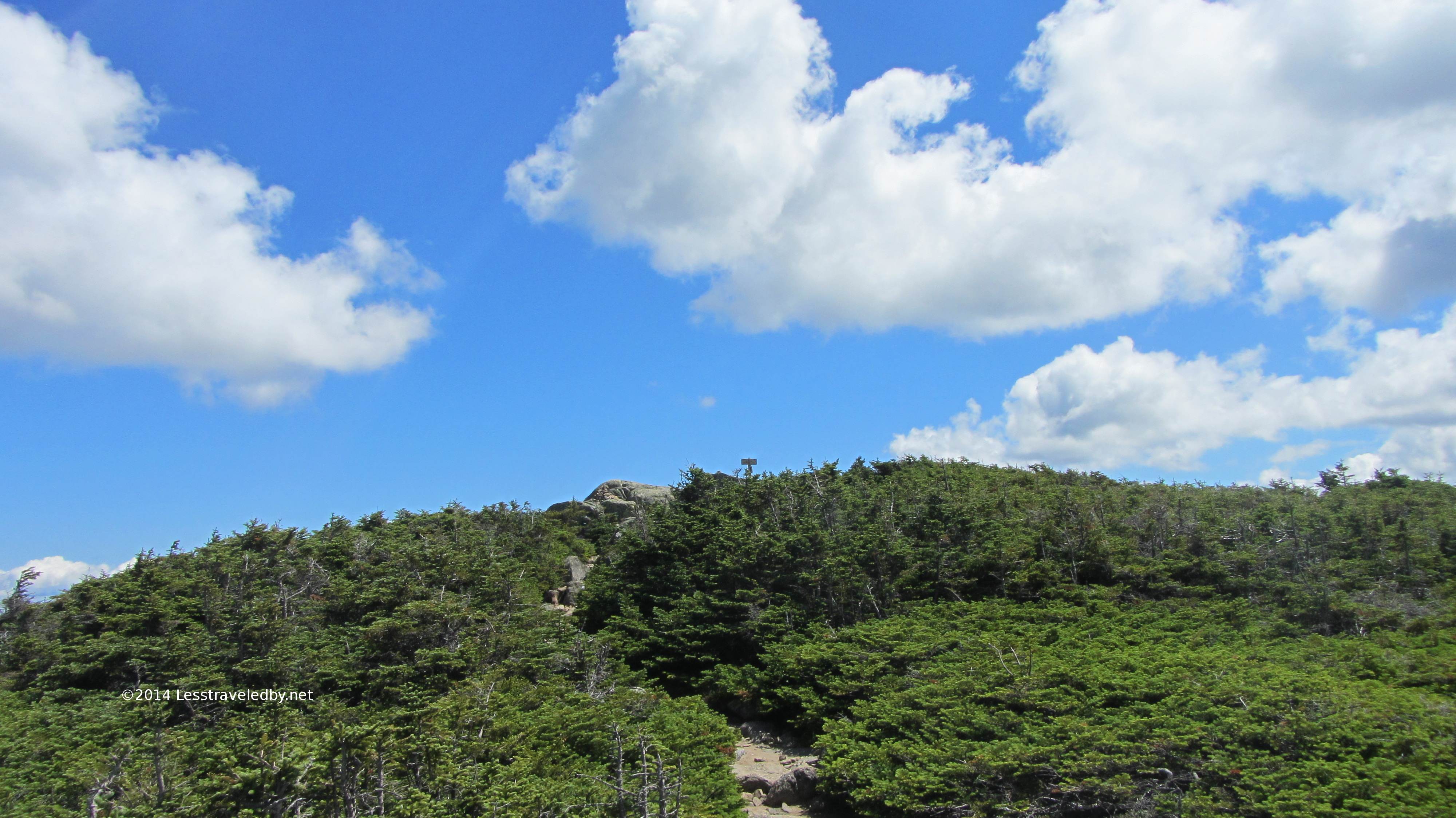
That sign up there in the middle is the real peak. I went up and took some pics from there before coming back for my pack so technically I get credit for summitting twice heh.
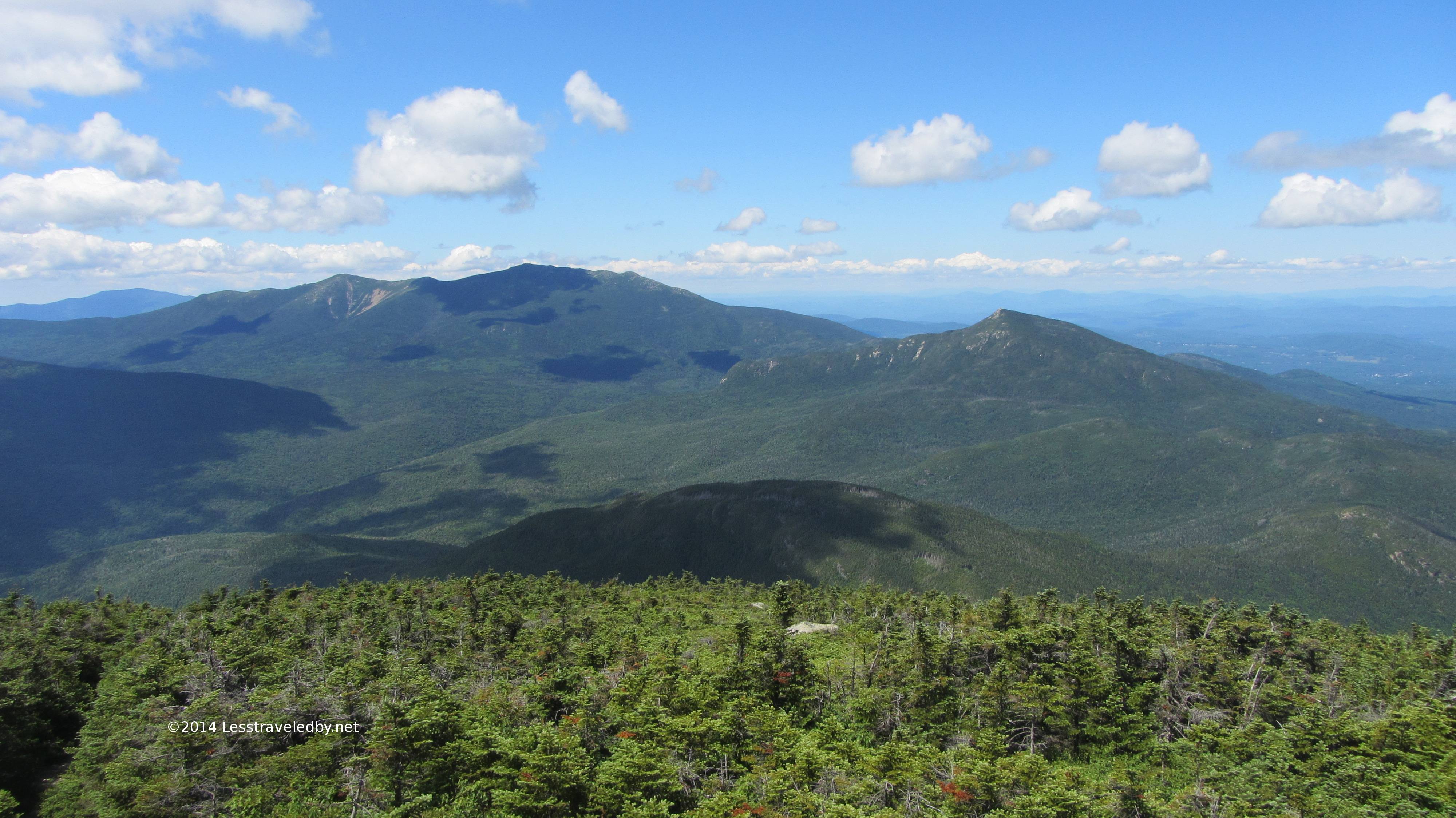
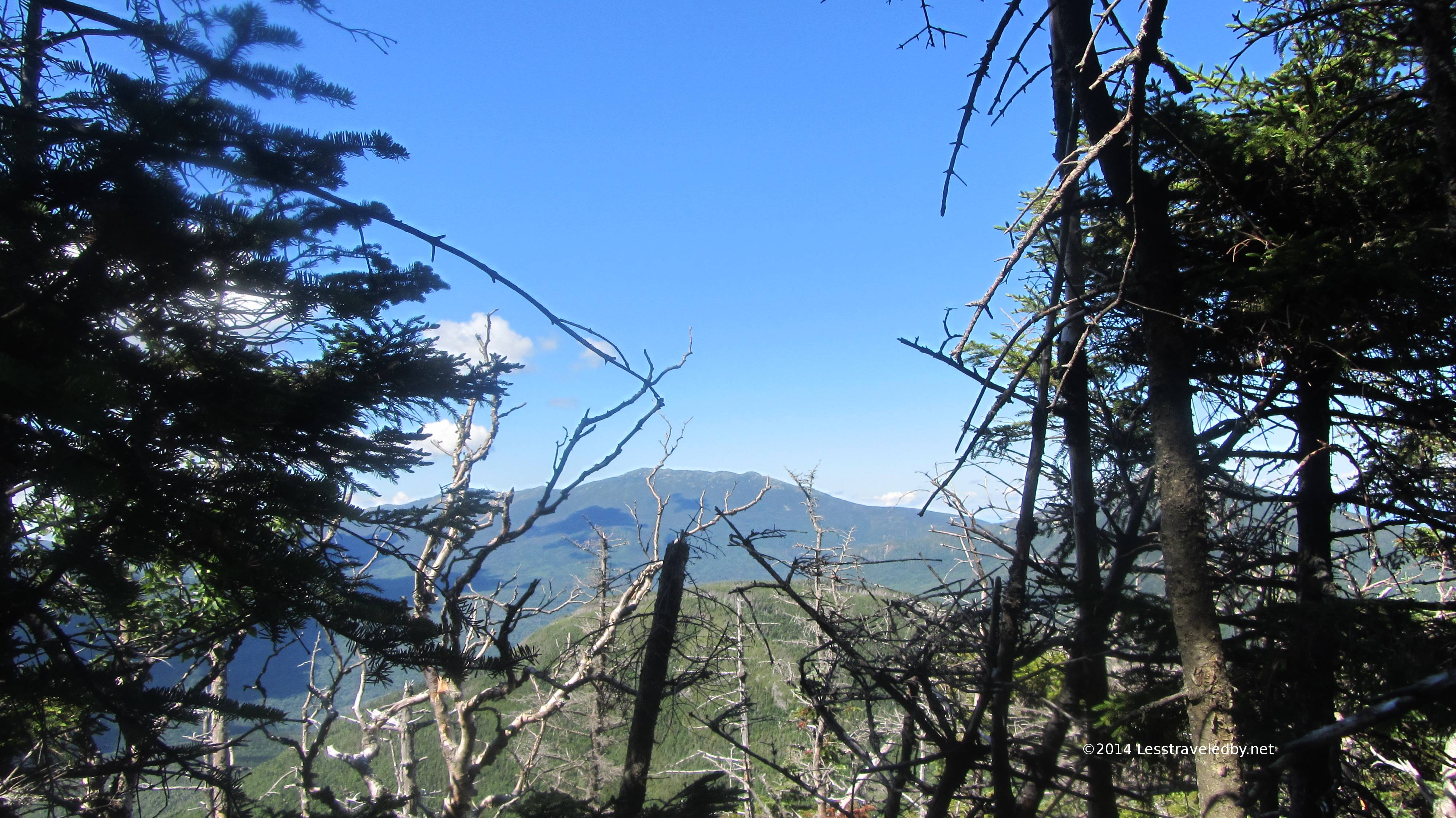
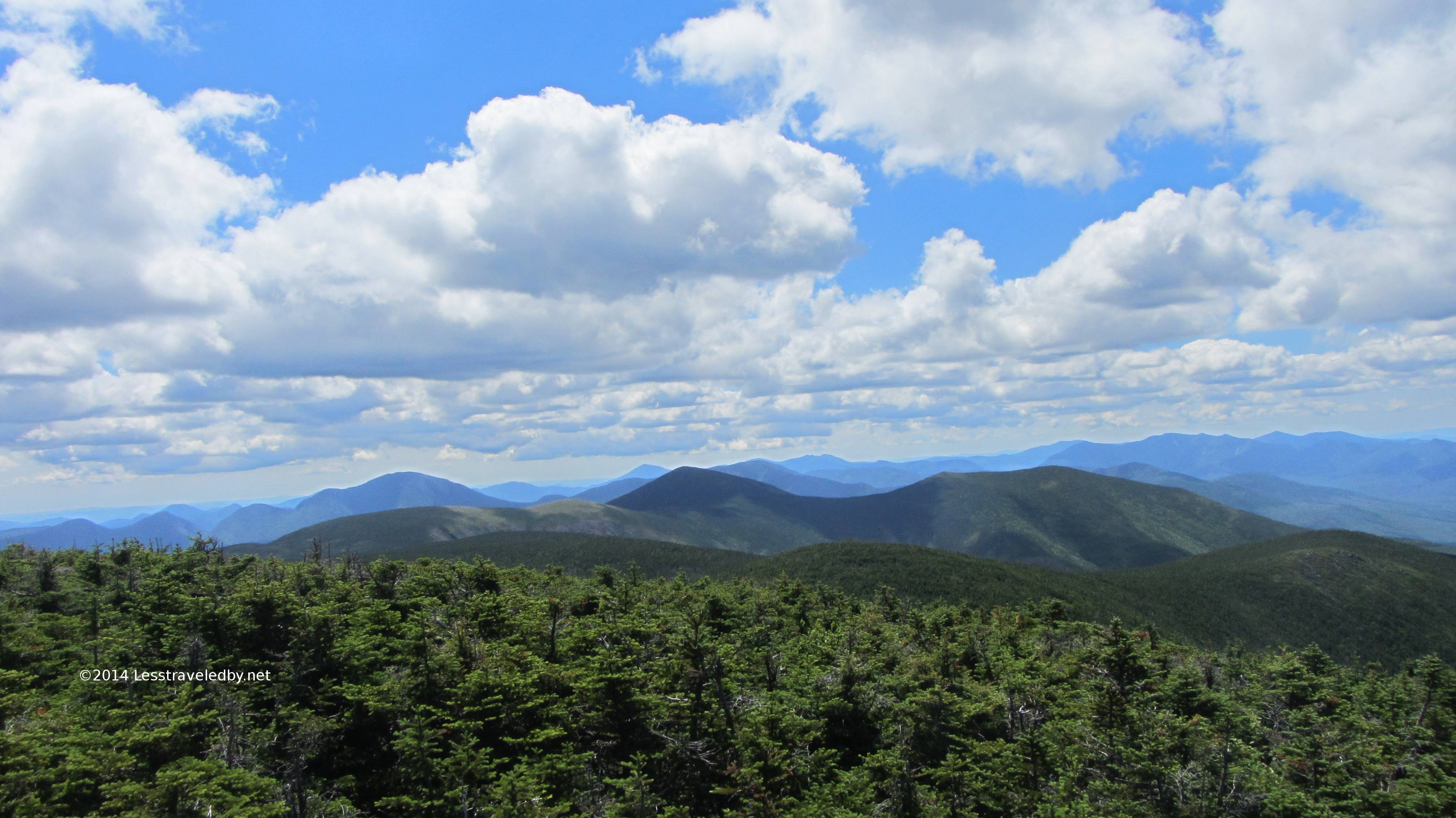
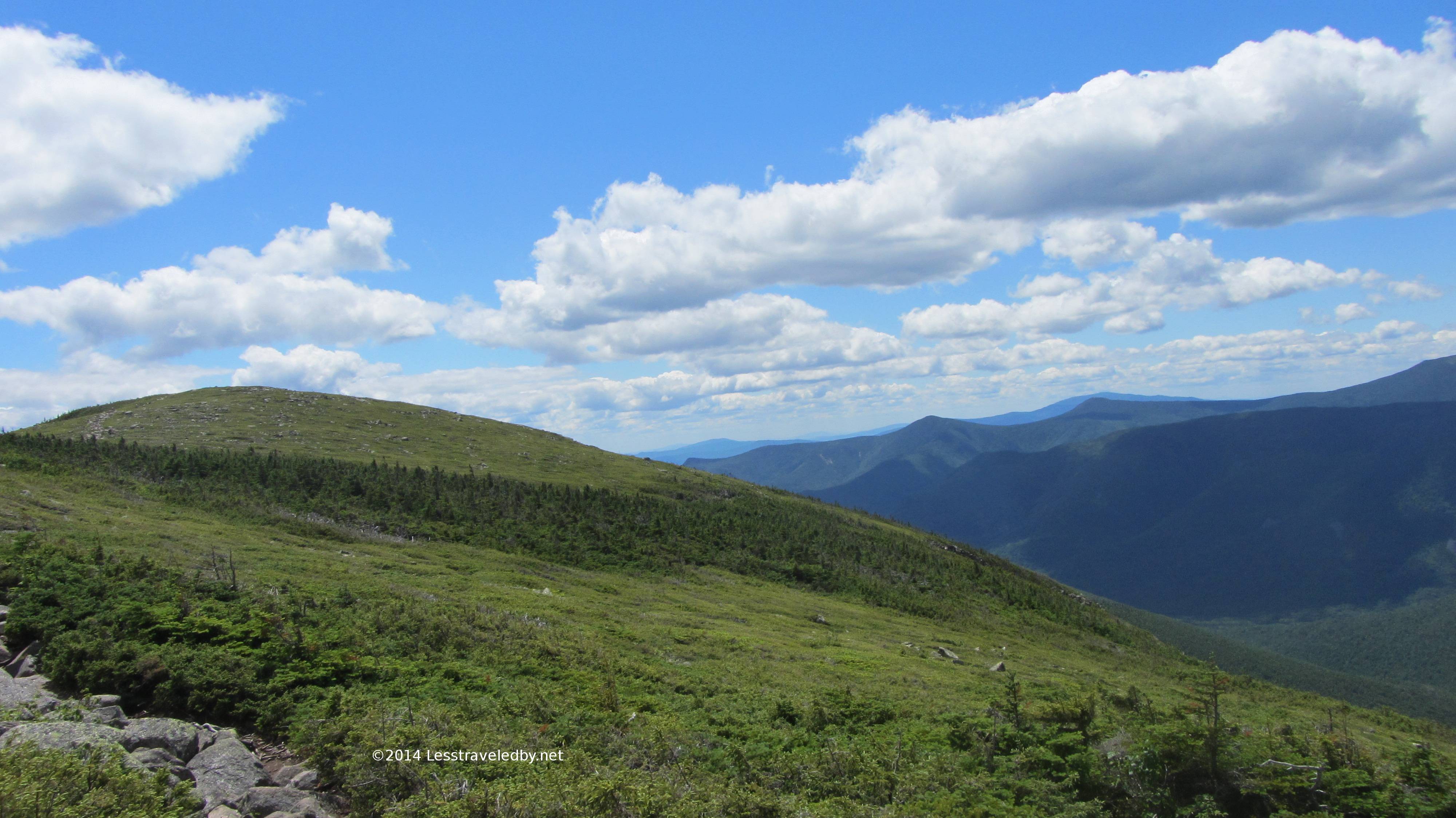
This is looking back down towards where I’d been earlier in the morning. The knob in shadow there in the middle distance is Galehead and the hut is below the near horizon in the col. Beyond Galehead is Garfield on the right and then continuing on Franconia Ridge with Lafayette and Lincoln.
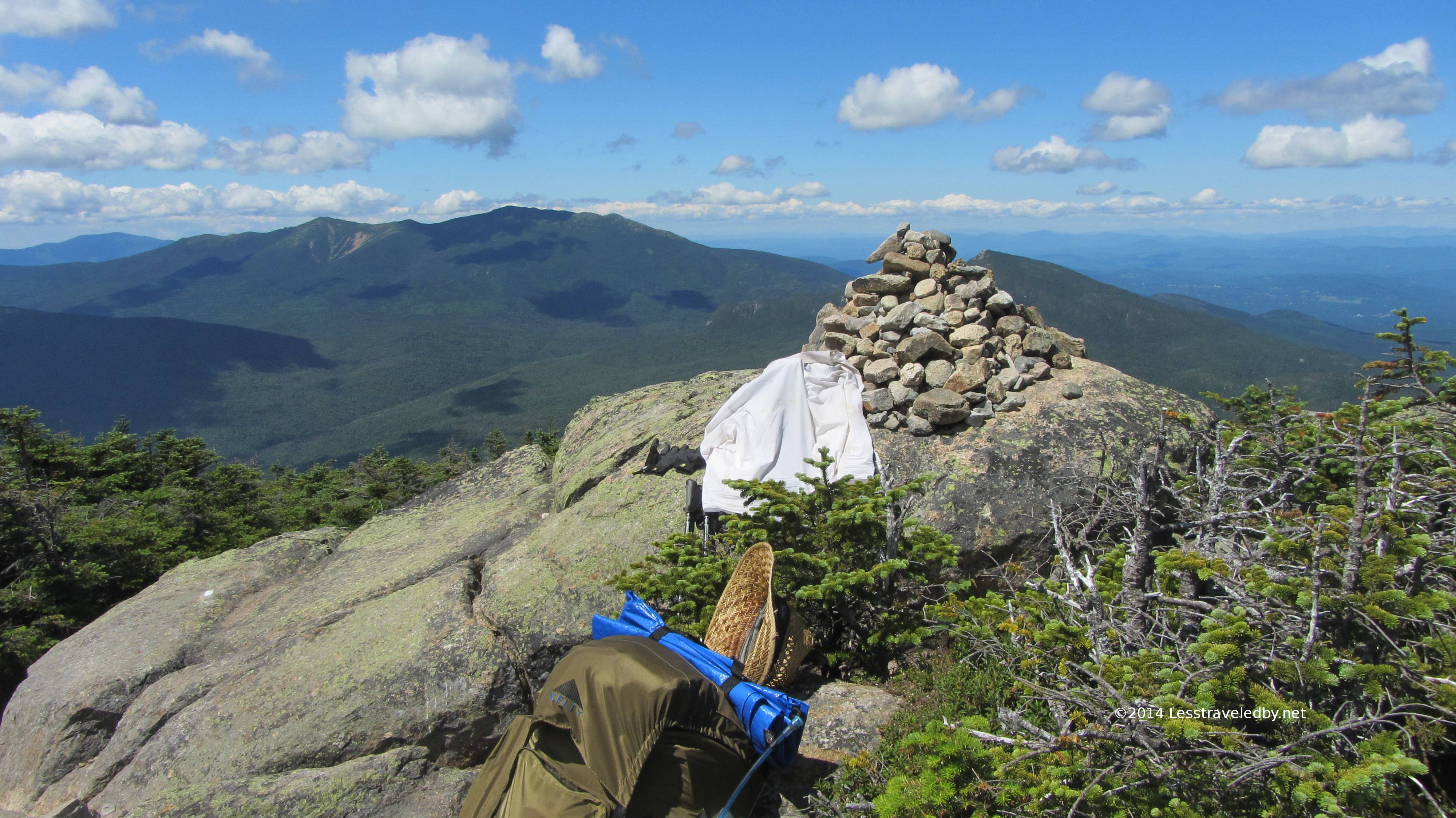
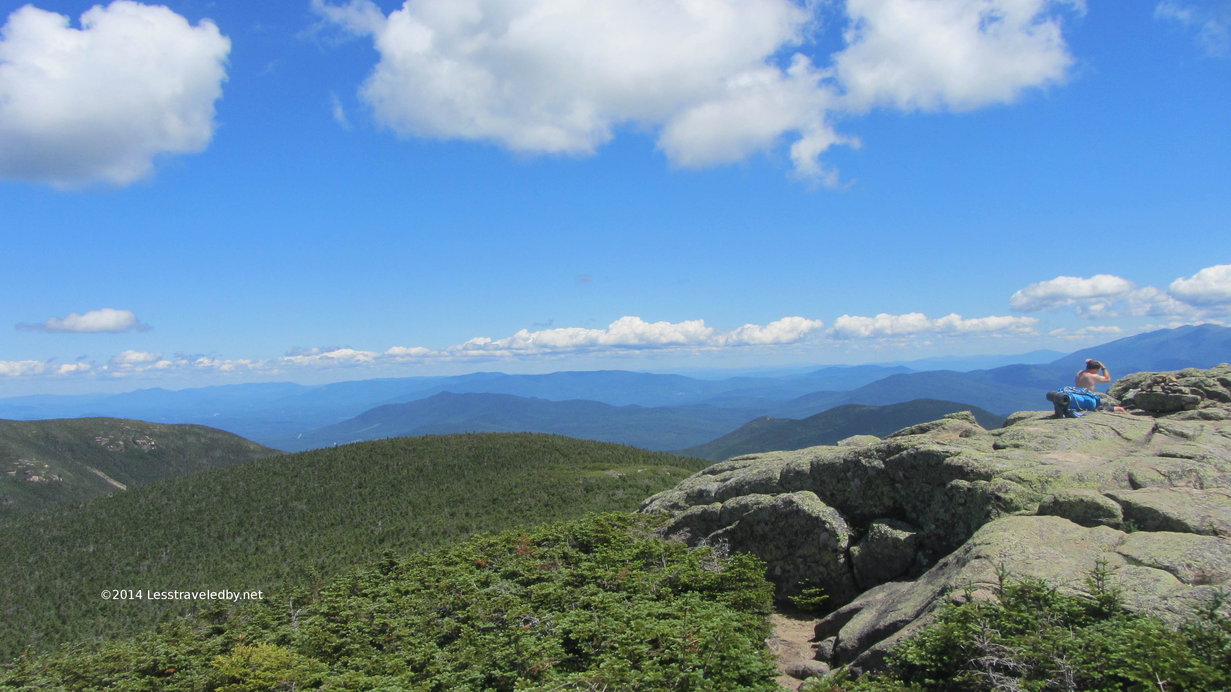
These next pics are all from on top of South Twin. Too many peaks to name them all, but really they are pretty enough that names aren’t important. I was definitely rewarded for my efforts so far on this trip!
That pile of rocks is indeed the AT here as evidenced by that white blaze. Exposed like this any other trail would be washed or blown away, but these rocks seem like they aren’t going anywhere soon.
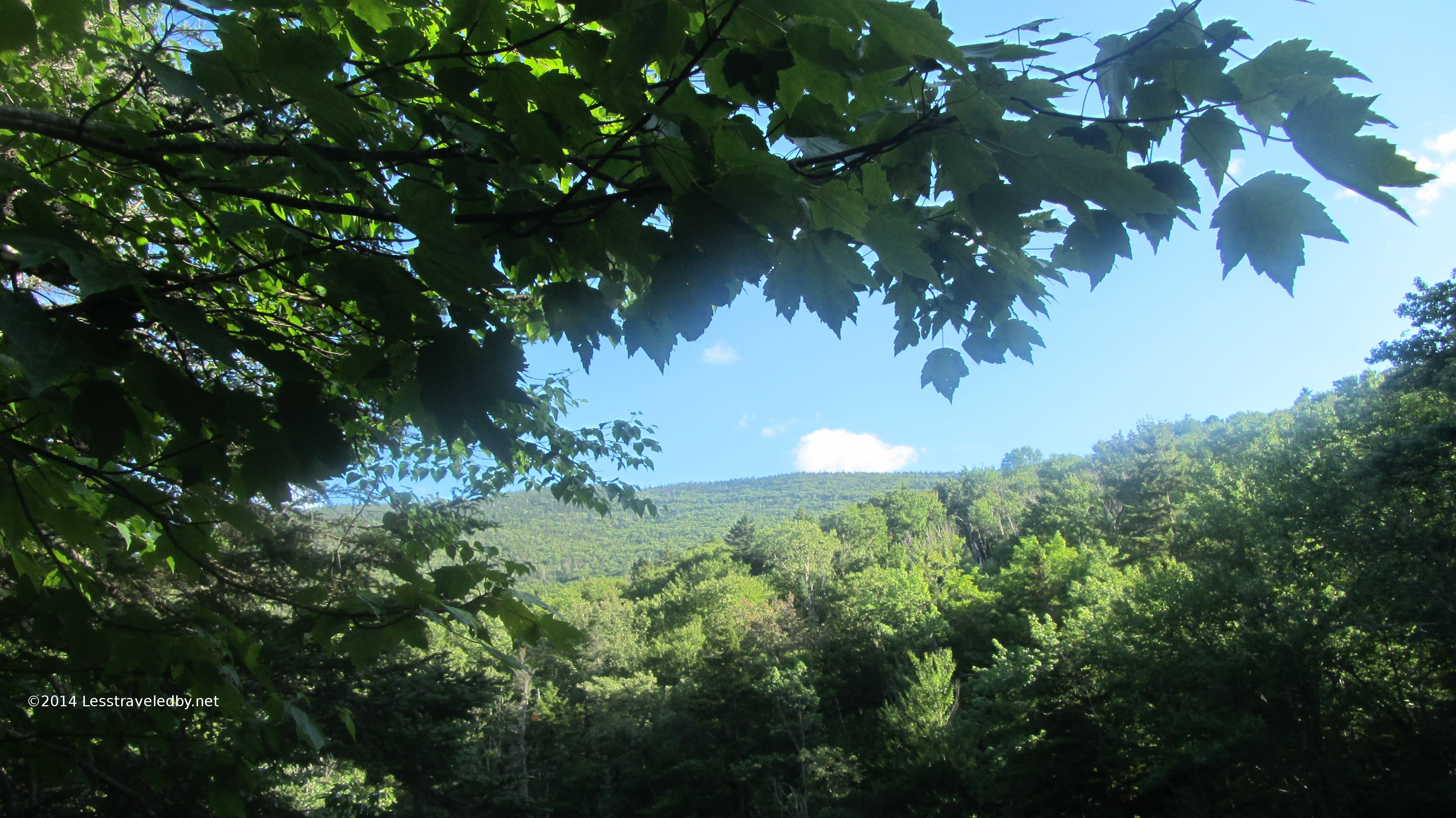
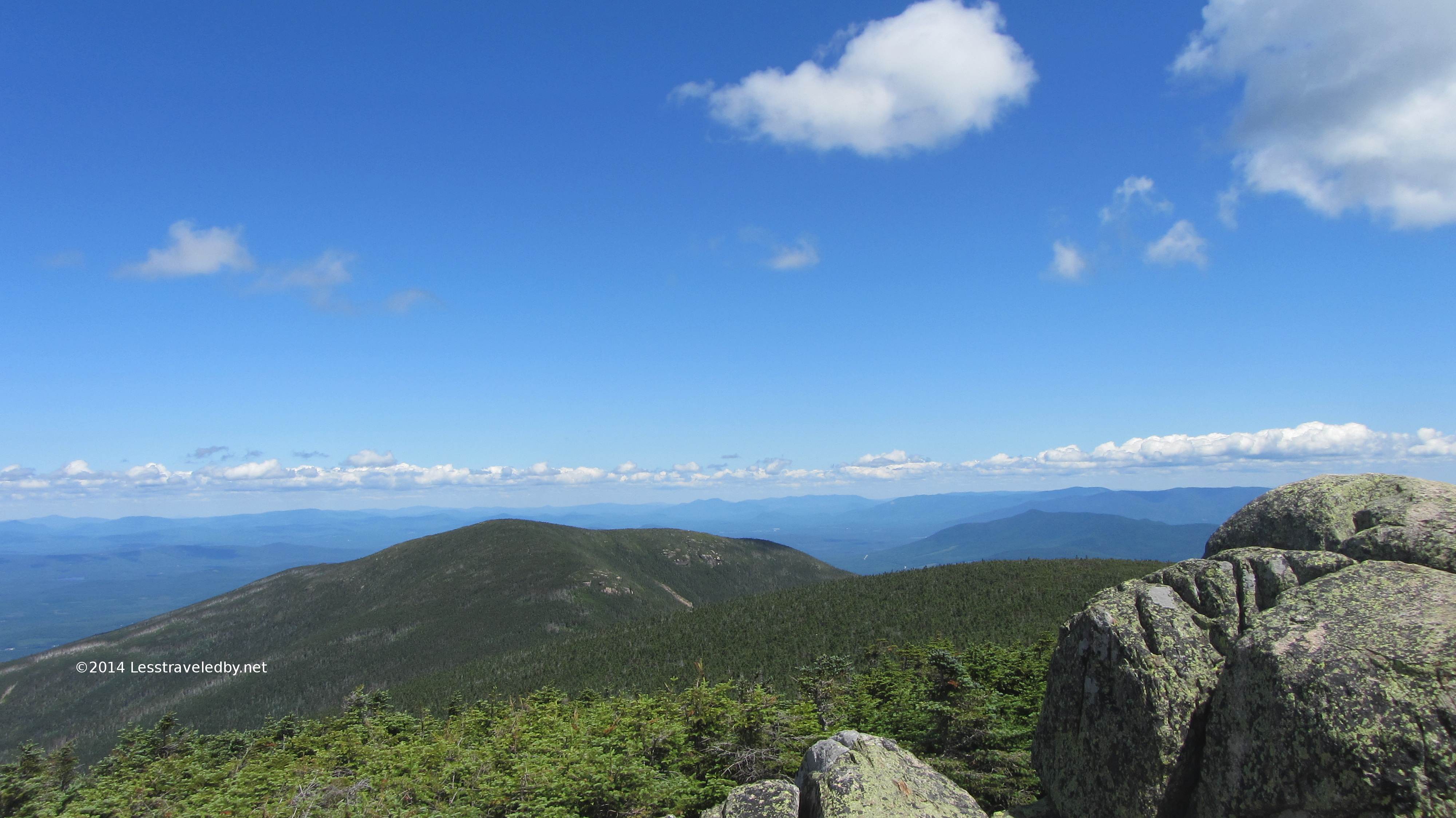
That bald there is the back side of the Bond area. The Bondcliff Trail branches off here and can just be made rising up towards Bond itself. A little more takes you to the well known Cliffs that hang above the Pemigewasset below. Many folks doing loops here will combine Franconia Ridge the the Bondcliff Trail. I guess that is why I made the plan I did to avoid all of those folks heh.
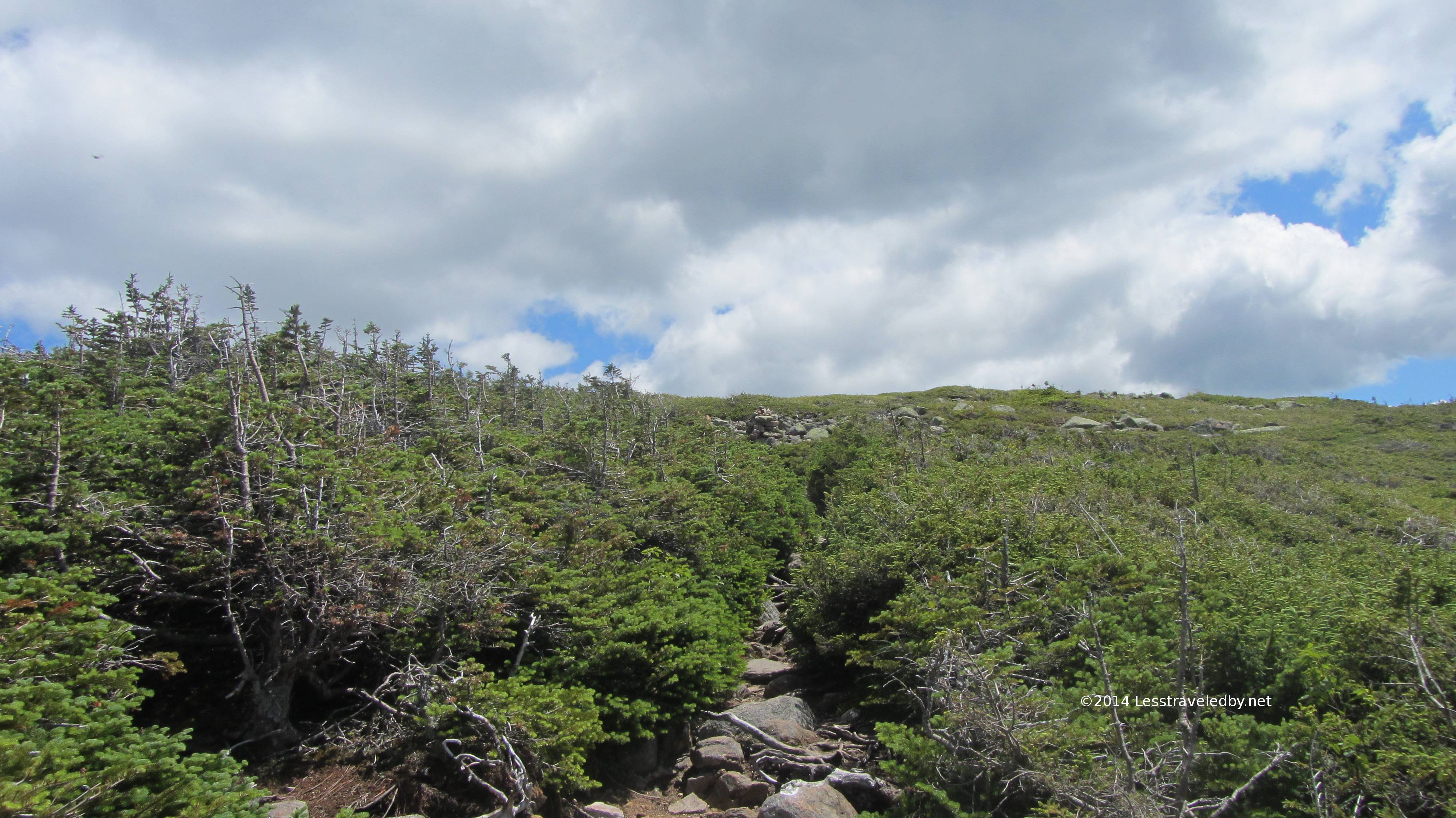
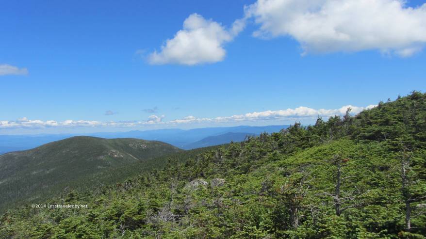
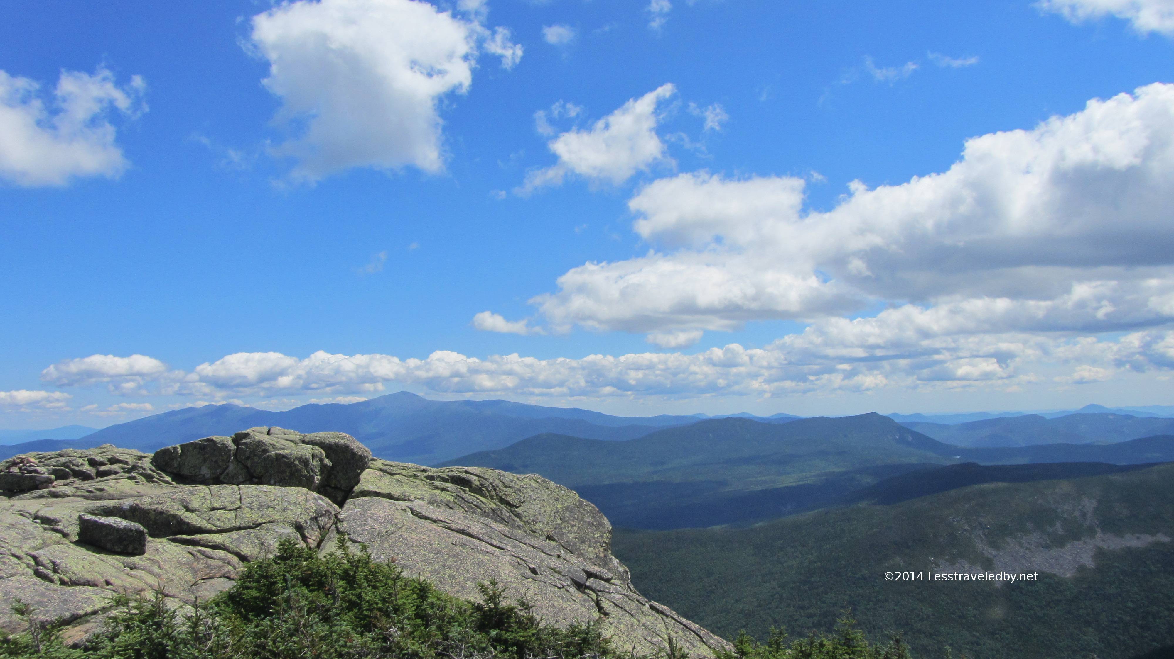
Amazingly enough this is actually the AT as it heads away from the Bonds toward Zealand Ridge via the continuing Twinway Trail. This scrub is not only tough enough to handle the exposure to the elements it seems to hardly be bothered by the traffic.
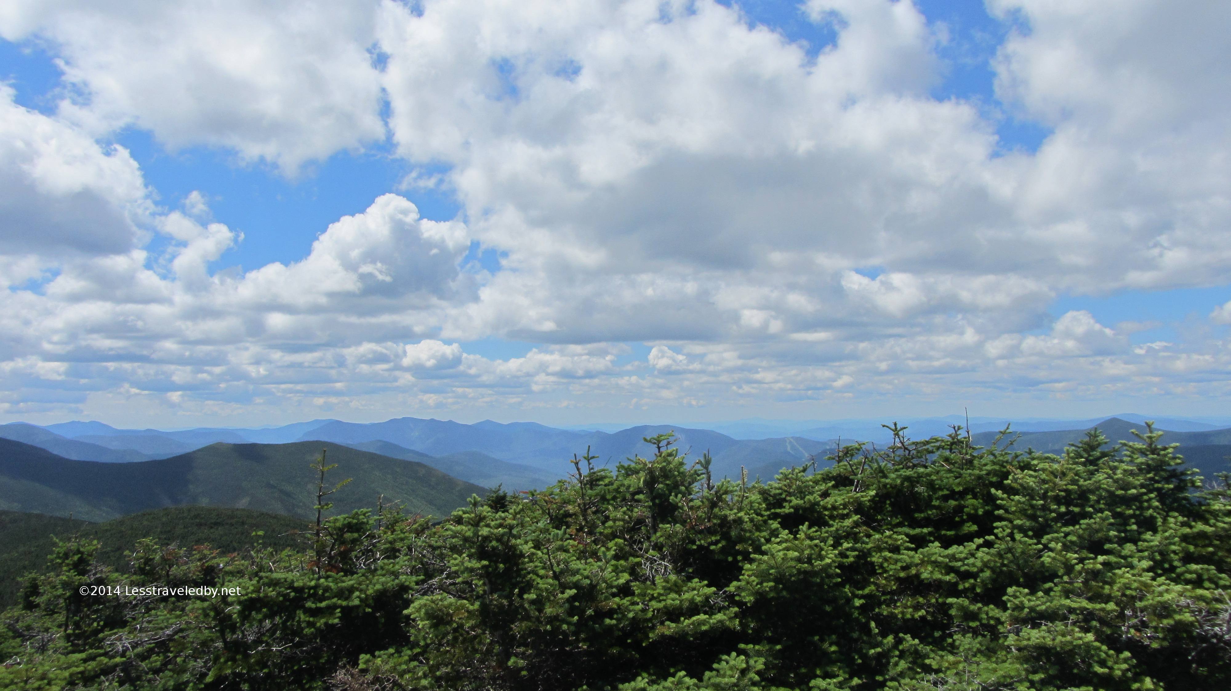
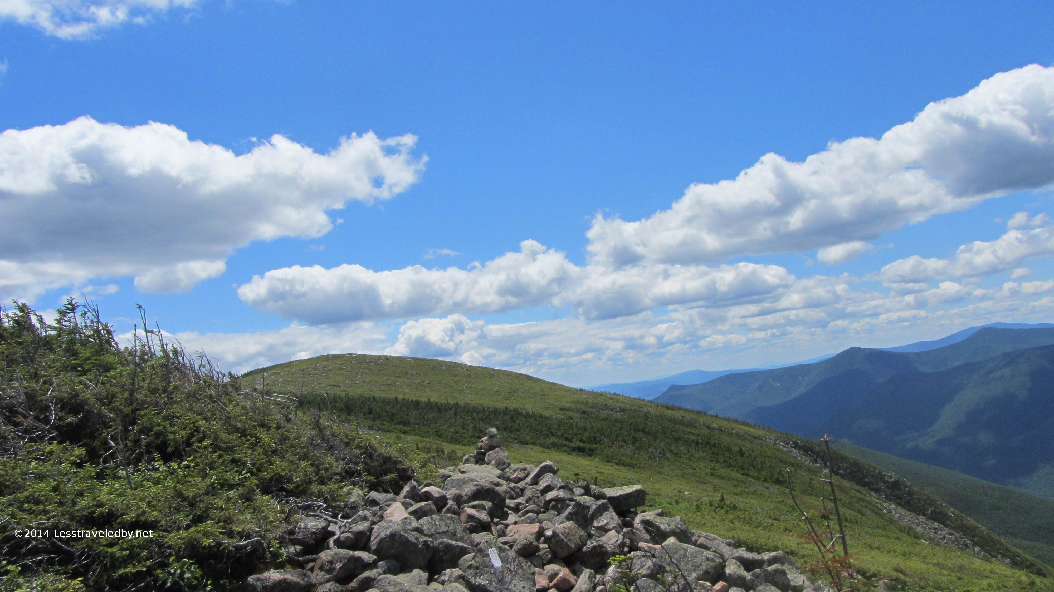
The section between the Bond area and Zeacliff at the end of Zealand Ridge seemed to really drag on. Looking at the elevation profile now I can see that what felt like going up and down was indeed so. I met a steady series of hikers coming towards me while none came up on me from behind until I took a break near Zeacliff.
I met a very nice couple with a good sized dog which they made the effort to take under control as we passed. I thanked them heartily for being such good pet owners and they seemed happily surprised to be appreciated. Having dealt with dogs cursed by lazy owners before I like to make sure the good ones know someone notices them.

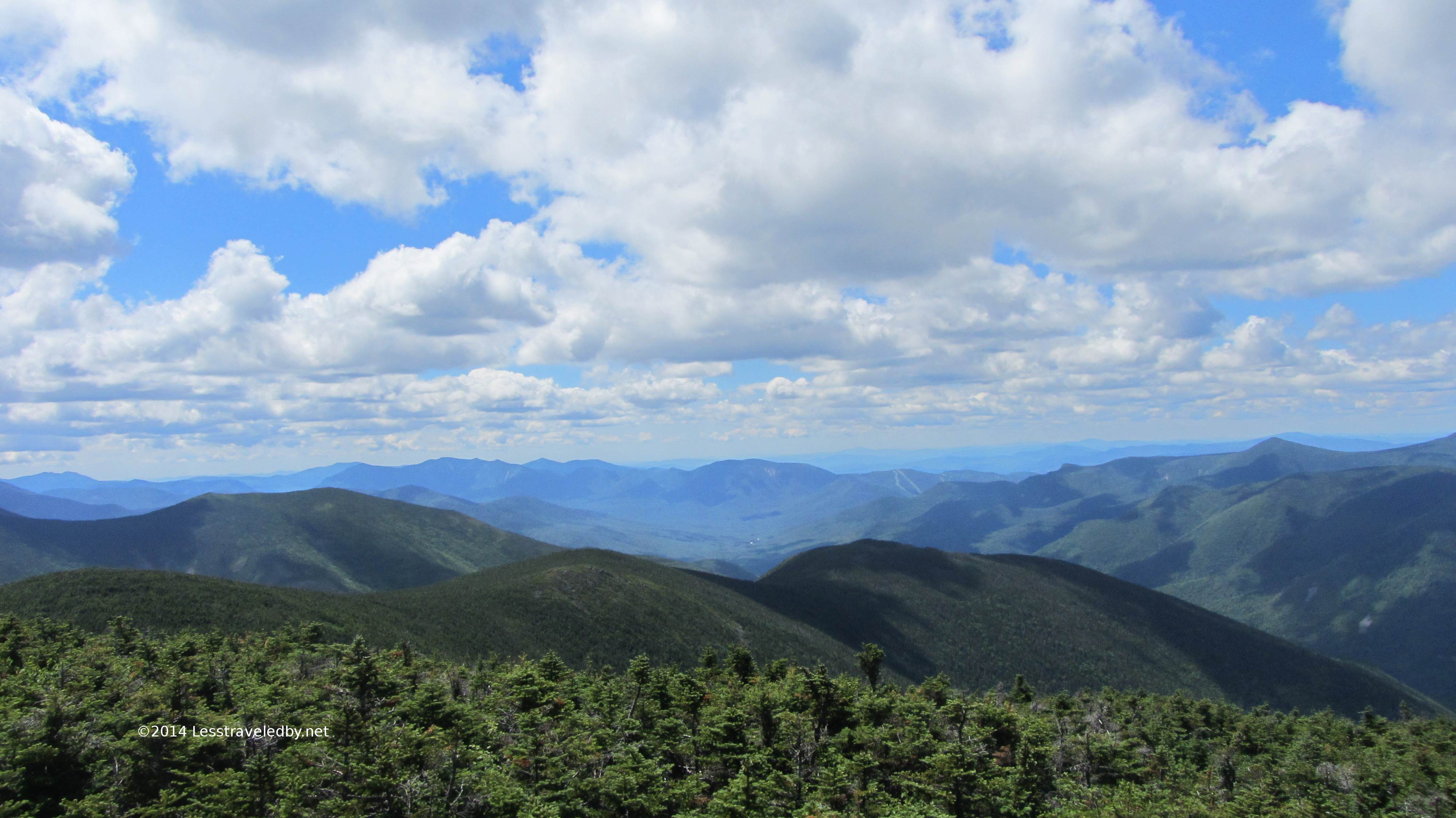
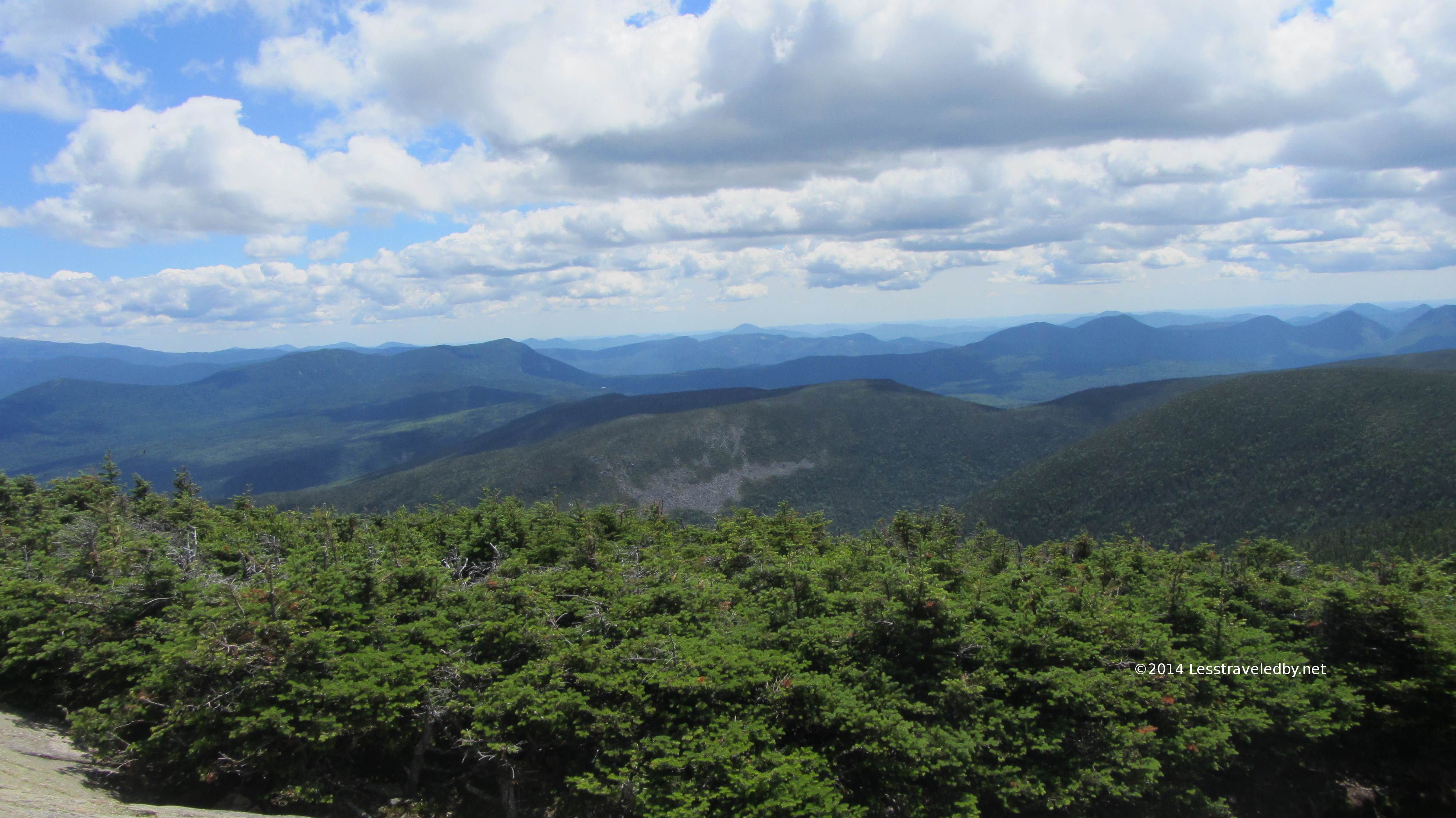
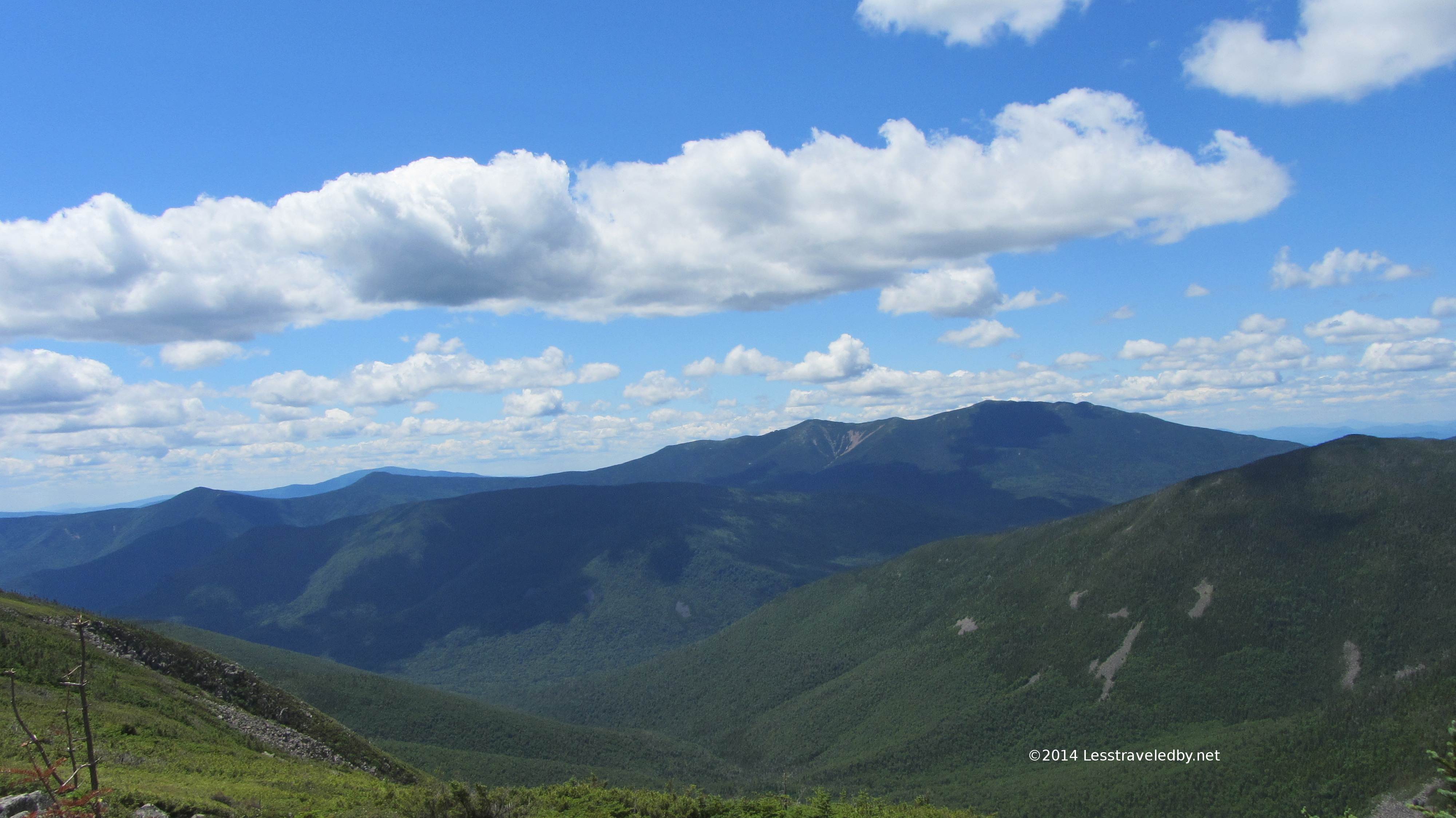
I think this was just before Zeacliff looking towards Carrigain, but I think this is about the time of day I started to feel the effects of too many Clif bars and too many rocky footfalls. The climb down from Zealand wasn’t as rocky as coming down Old Speck in Grafton Notch, but it was definitely a time to use the poles for speed braking. Somewhere towards the bottom I began to notice a twinge on the outside of my left knee. By the time I reached the Zealand Hut at the bottom I was feeling pretty thrashed. I might have been tempted to pay for the royal treatment if not for the large number of guests already there. This hut is reached via a pretty short and easy trail and has a nice waterfall to play in so is popular with families and those less inclined to scale mountains. The workers were getting ready to serve dinner as I scored some more water I didn’t have to filter and I have to admit it looked and smelled great. I didn’t though heh, so I skedaddled before I ruined anyone’s appetite.
I was getting pretty hungry and starting to limp a bit but first there was a camping restriction for the hut and then another for the Thoreau Falls with only a stretch of uninviting terrain between. 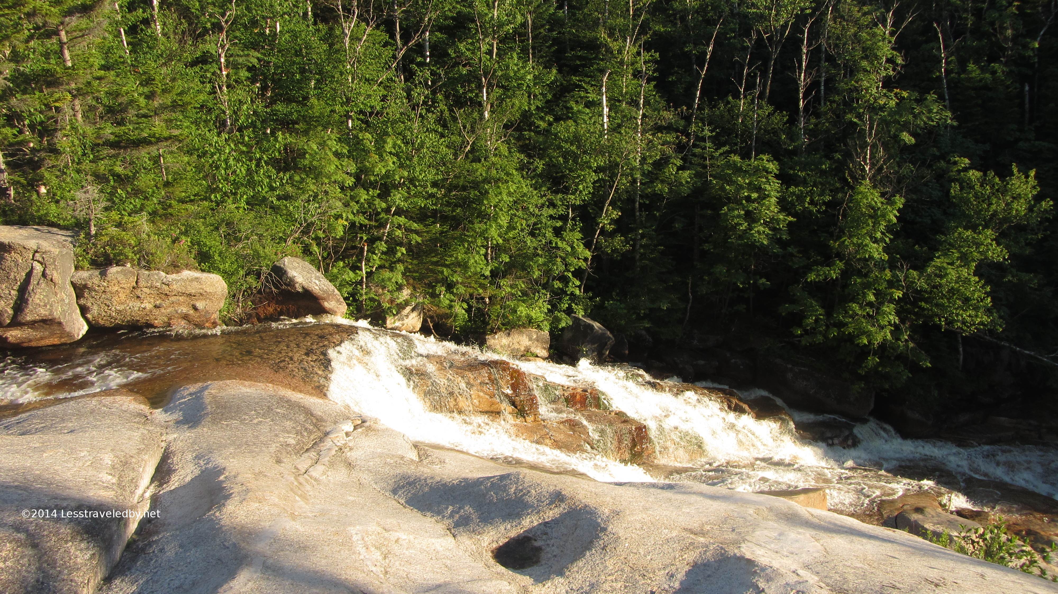
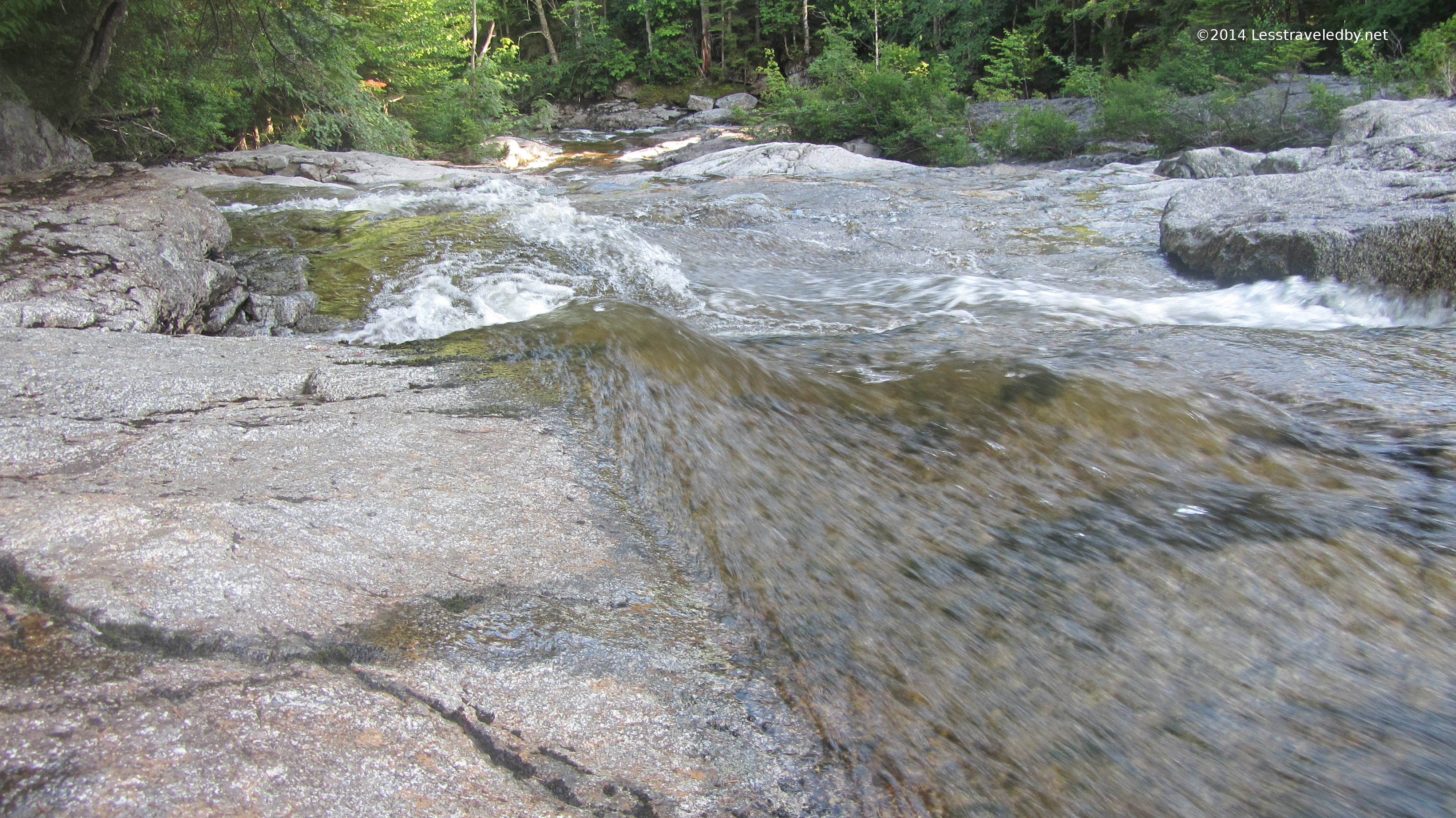
Finally I heard and then saw Thoreau Falls. The late afternoon sun made the rocks and water take on a great color.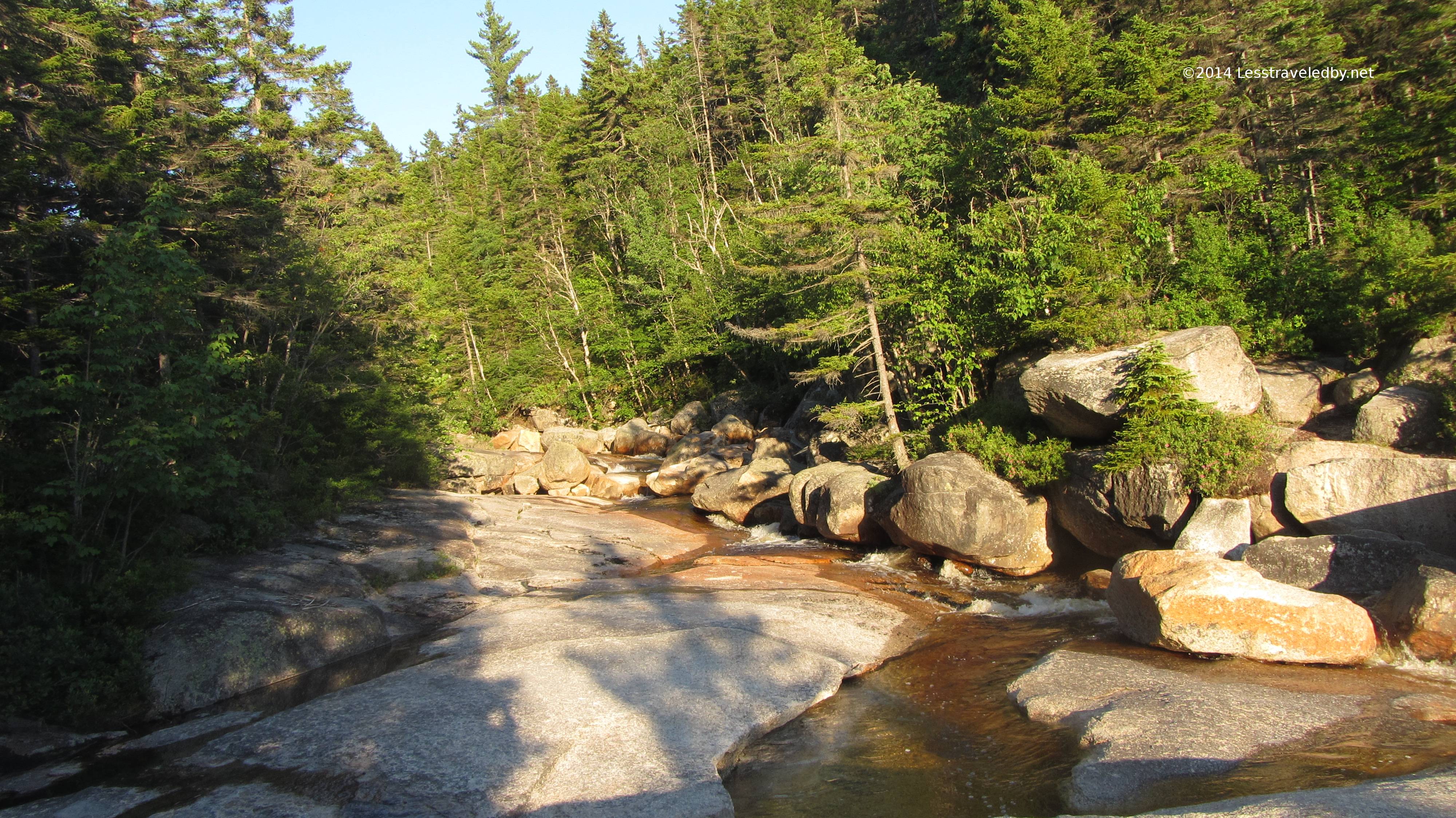
Looking at the up stream channel I’m thinking this would be a tricky crossing in high water but those rocks on the far right were easy enough to scramble up even with the pack on.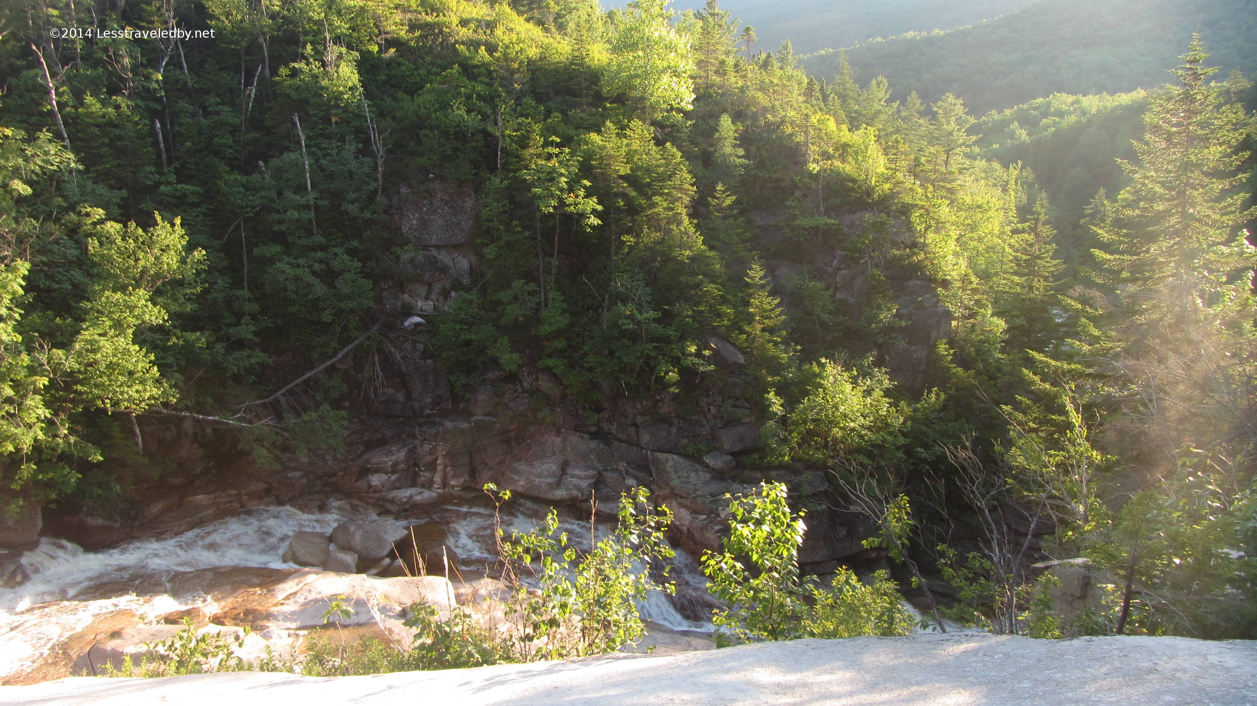
I will have to go back and take more pictures of these falls. Daylight was fading and I didn’t want to spend too much time finding angles for the best shot so just fired off a few frames in all directions. This is looking down at a steeper section below the crossing.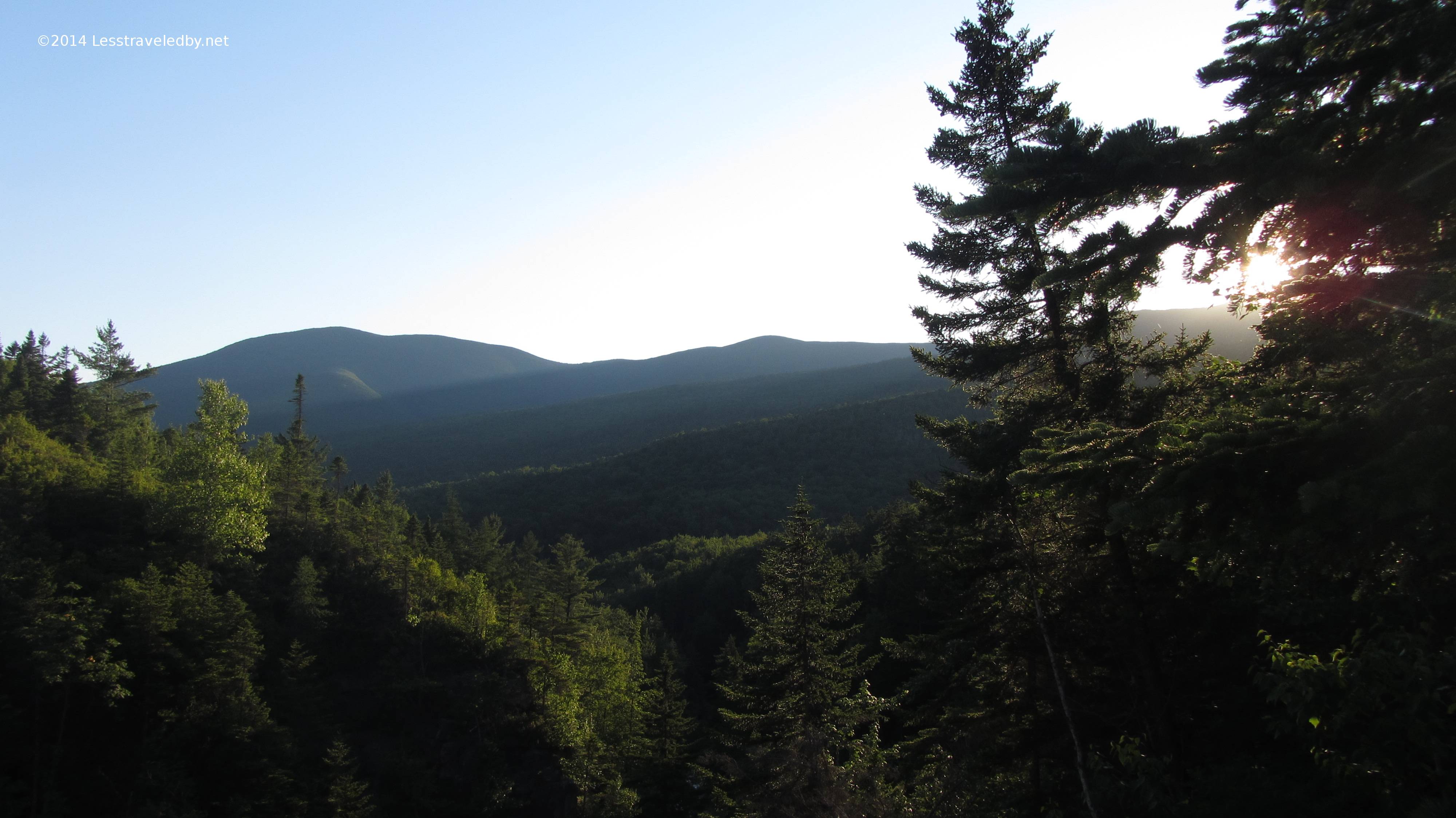 This is where the sun sank slowly in the west behind the Bonds and Zealand Ridge so thankfully there are no more pics from this day heh. I finally found a spot big enough to park my Hubba when I could go no further and darkness settled in. I hung my trail clothes, made my bed and had a snack based dinner laying inside my tent without the fly on as I looked up at the trees and sky.
I woke up a bit later with a cookie still in my hand just in time to enjoy a magical mountain moonrise. The nearly full moon just barely cleared the ridge to my east and only a couple of moonbeams could penetrate the trees to reach me. Somehow they landed on a tree right in front of me creating a beautiful glow. All the other trees were dark, but this one birch had two wide glowing bands of light on it. If I was a real photographer I may have been able to shoot that but instead I just gaped in amazement.
The rest of the night I woke up periodically to check on the moon’s progress as it crossed the sky very low it seemed to the south. That illusion was created by the mountains but also kept it from being so light it interrupted my sleep. Despite the somewhat painful ending to the day before this was a pretty darn good night.
I woke in the morning, ate some peanut butter and made a coffee with cocoa to get me rolling. The first step surprised me with how much my leg hurt and then I realized it was going to be a long walk back to the parking lot heh. I was actually fine on the flats I found and climbing wasn’t too bad, but any sort of down slope made each step be paid for. There not being much else to be done I headed on out.
The rest of this trail was covered in a previous trip report, Pemigewasset Wilderness May 2014 which has pictures and video of the footbridge as well as the rest of that adventure’s fun. I didn’t bother taking pictures this time and focused on walking instead.
It really was another beautiful day and for the first time I actually met someone else on the Thoreau Falls Trail. A nice couple with what looked to be packs for at least an overnight were headed up and probably very confused why this scruffy looking guy was grinning at them like that. I have just seen footprints out there but never actually met any people. While running into someone on the AT happens all the time, running into someone on less traveled trails seems a bit more special.
I met another guy who appeared to be headed out for some privacy after I joined the Wilderness Trail. He mentioned how full the parking lot had been and asked of how many others I’d met headed in before him. Hearing of just the one couple he seemed encouraged and headed on alone after getting a quick rundown of my route.
After that foot traffic picked up especially once I left the wilderness as the trail reached the tent campsite area. I recall last time I raced down this trail headed towards a cheeseburger but this time it dragged due to my knee. Despite that it was hard not to appreciate the beautiful day. I got my cheeseburger eventually and made it home for dinner too.
I’m starting to think I may have to just stick to climbing mountains and give up the coming down part. It really doesn’t seem to agree with me much which is just fine since I like it up there heh. One way or another I’m pretty sure I’ll be headed up into these mountains again because it is just too beautiful up there not to make the effort. Perhaps in the Fall after the bubbles have passed I’ll go up and see if even the AT here is sometimes a path less traveled by

Pingback: Pemigewasset July 2014: Lincoln Woods – Galehead – Zealand Loop Adventure Report | Less traveled by