Testing Tonight?

testingtemps

With a little dusting of snow this morning and a nice cool night ahead it looks like tonight will be great for testing out a few things in preparation for winter camping. I set up the new four season tent when I bought it a few months back, but I’m curious to see how well it vents in the cold. It is an Easton Torrent 2P with full double walls and large, zippered vents in the inner to move the moisture out.  Well that is the idea anyway, but finding out will require sleeping in it on a cold night like tonight.

Just as well I suppose as it will give me a chance to refresh my memory on how well the Enlightened Equipment 20°F Prodigy quilt did at its rated temperature. Combined with my down quilt and lots of other insulation I took it sub zero last year, but I can’t recall how it did by itself. Getting ready to review that quilt for Trailspace and while I have been very happy with it as I’ve used it, that bit of data is important to include.

Trying to get back up to speed with writing reviews and writing here, but it seems hard after a long season on trail. I have almost caught up on trip reports though and have managed to post one new review last week. Hopefully the logjam is breaking and I’ll be more productive now…well unless we get some good snow and I get my sled together and my wife gets her new snowshoes…OK, if you don’t see me here you may have to find me out there!

Traditional Pemi Loop – September 2015

Traditional Pemi Loop – September 2015

It wasn’t easy, but I culled several hundred shots down to 37 pics for this post. I can see why this loop is so popular, but I have no idea why folks rush through it so fast. Planning a leisurely five day trip, I had plenty of time to stop and pull out my cameras. Well and to stop and snack or just to stop and soak in the views.  Definitely some challenging terrain, but by keeping the miles reasonable and the feedings frequent it made for a fantastic adventure.

IMG_5241aI’d gotten a nice early start and arrived in time to enjoy a little morning light on the Osseo Trail. Gently at first and then steeper at times it soon took me up a few thousand feet, but views were limited as the forest was thick around me.

IMG_5242aNoting a sign for a view I stepped a few feet off the trail and was rewarded with my first sight of the land opening up below. This view is to the east with Owls Head and Bond the first few bumps.

IMG_5246aFinally I could see I was breaking out of the trees, but getting up there didn’t look to be easy. Actually with open sky and a little breeze inspiring me it wasn’t that bad.

IMG_5248aYou may need to enlarge this picture to see the blue blaze, but that is where the trail was headed next. Walking along that fully exposed rock section with my pack filled with five days of food was invigorating to say the least.

IMG_5249aAfter crossing over Mount Flume I headed on towards Liberty. There was a bit of a col between the two and as usual I cursed every foot of descent knowing I’d soon be having to climb back up. It is all part of the fun of course.

IMG_5256aGetting to the top of Liberty made it definitely seem worthwhile. There is an interstate down there, but if you can overlook that the view was amazing. The light was fading in the late afternoon with some haze giving everything a soft edge in the distance. I lingered here for a bit and was soon joined by a few trail workers enjoying a hike on their day off.

IMG_5258aSame shot but with me in the way this time. I was afraid to set up my timer and jump out there, but one of the guys was nice enough to take this one for me. It really was a neat spot with a nice breeze blowing, but I was looking forward to camp and dinner up ahead.

IMG_5259aYou can spot a couple of folks headed up the way I needed to travel down. Beyond this open rock section the trail would fall away to another col.

IMG_5263aThese trails are heavily traveled and very well maintained. Despite all the up and down sections the going wasn’t that bad. The trail down to the tent sites at Liberty Springs was a bit steep and knowing I’d have to climb back out in the morning made it seem longer than the signs claimed.

IMG_5266aIt was worth the effort though with a friendly caretaker who was a enjoying a late season change from being a trail worker. There were a number of other folks there but it wasn’t a very social scene. I ate dinner in the cooking area and headed off to my private platform for the night.

IMG_5274aThe next day was spent almost entirely on the exposed Franconia Ridge. The sky was cloudy all day, but the ceiling was high enough that there were still views. With a constant series of peaks there was a steady stream of climbs followed by victory celebrations that required pulling out a snack or two.

IMG_5276aEach peak gave views of the next with the trail clearly visible between. Very relaxing to enjoy a break while pondering the next short climb knowing there will be another excuse to stop soon enough.

IMG_5280aThe Greenleaf Hut seemed a bit out of place, but I’m sure the views are pretty nice on the front porch after one of their big dinners.

IMG_5283aI hit Lafayette just in time to meet the lunch hour crowds. It seemed a lot of day hikers had come up to spend some time at the summit so I snapped a few pictures before moving on to the next unimportant peak to have lunch alone.

IMG_5284aThe views were too nice not to stop for a bit though. Time enough to dig out the video camera for some panorama shots too.

IMG_5287aThere are the Bonds again. The angle is changing as I make my way around the loop. I enjoyed being able to see where I would be in a few days, especially because I had budgeted an extra day to just hang out when I got over there.

IMG_5288aFirst I had to get to Garfield Ridge Shelter and that meant getting over Garfield. Not a lot of miles left in my day, but Garfield is a pointy bit of mountain and I’d need most of the remaining daylight to get there.

IMG_5292aOf course before I could climb Garfield I had to descend. Sure I was above it now, but they don’t let you start climbs at the top.

IMG_5298aIMG_5301aThose two pics are for my wife. She has a thing about tiny flowers growing out of rocks and will often stop to take pictures of them when we are hiking. I felt it was my duty to bring her home a few shots of these because they were very tiny and the rock was very big.

IMG_5308aNearing the top of Garfield looking back towards Franconia Ridge. Again it was neat to be able to see the day’s route, this time from near the end tracing where I’d been.

IMG_5310aOne last pic on the sunny side of the mountain and then it was over the top and down to the tent site. Well down to the trail that leads up to the site at least. Definitely get your water before going up or you’ll end up making the climb twice like I did. Not fun after a long day of going up and down mountains.

It was a nice enough spot with a big shelter and a lot of large group tenting platforms. Thankfully I got a small one to myself as there was almost no one there that night. I did eat dinner with a lady from New Zealand who was doing the entire loop in two days. I’d met some others on an earlier trip this year doing the same. Seems way too nice a place to rush through like that, but I guess folks do what they enjoy.

I was visited by a camp host after dark who had just climbed up the mountain. After jokingly giving him a hard time about being late I paid the fee without getting out of bed. Talking with him in the morning he said he was late because he had to hitchhike to the trailhead. Late in the season the shuttles don’t run and he’d had a hard time getting a ride.

IMG_5314aI refilled my water supply at the spring and headed down the trail towards Galehead. Well you could call it a trail, but I had my doubts at times. This section was really just a pile of rocks. The only way to know it was a trail was that there was nothing better to be found so it had to be the right way.

IMG_5319a

On my way down I began to catch glimpses of the Galehead Hut. Not sure if the terrain between me and the hut was more intimidating or South Twin looming beyond. The climb up that mountain last year did some serious physical and mental damage so I was already thinking about it. Now I was wondering how I’d feel when I reached the start because that hut looked pretty far away.

IMG_5325aOnce I got off the rock pile and the trail evened out a bit I was able to make great time. I soon found myself sitting in front of the hut looking back towards where I’d started the loop days earlier.

IMG_5326aWell I snuck a few peeks at South Twin while I was sitting there too. This time I knew I’d have to really work for my next snack break.

IMG_5328aWhich is why I spent a while sitting on the porch, soaking up the free water from the hut and fueling up for the climb. There was a steady stream of people coming and going so some conversation to be had as well. Finally it was time to do what needed to be done…

IMG_5331aSo I stomped up the mountain. The effort was well rewarded with a nice breeze and clear sky. The view of the Presidents from this spot is even better than from Bond Summit I think. Not nearly as crowded as Lafayette had been the day before it was a great place to relax for a bit.

IMG_5332aAgain I have to question the folks who race around this loop. I was glad to have time to stop and take it all in. Really taking some time to look at where I was and what could be seen. The chance to be in a spot like this doesn’t come along every day. It should be savored.

IMG_5333aI briefly considered hitting North Twin, but opted to head down the other side towards Guyot and the Bonds. I knew I was probably too late for afternoon coffee with the caretaker and was hoping I would be in time to get a good tent platform.

IMG_5343aNo need to worry. My latrine view suite was all mine for two nights. With the season starting to change the forest was thinning out and the latrine did seem closer, but still a fine spot to rest and relax. The Guyot site was very busy as usual. Watching all the various ways folks cook dinner is always entertaining and there is often some good conversation to be had.

IMG_5346a

The next day I enjoyed a late breakfast followed by some time laying in my tent watching the shadows on the leaves. Thankfully the caretaker began to do some composting work at the nearby latrine which encouraged me to get up heh. I packed a lunch and headed up to Bond Summit for a few hours. I knew I’d have to climb it again the next day, but I figured the walk would do my legs some good.

I almost fell over when I put my pack on. After a few days of tossing the full load up on my back I was used to, the nearly empty pack was a shock. It certainly seemed a lot easier climbing the mountain with that load.

IMG_5347aIt was another gorgeous day up top. I shared the summit with a couple of folks for a while before they headed down, then had it alone for an hour or so before going down myself. My timing for this trip was really lucky with great weather and lots of solitude despite being on popular trails.

IMG_5351aAfter a second night of listening to a lonely moose calling down below it was time to head home. On my way across Bondcliff I caught a pic of these two having second breakfast a bit head of me on the trail. We chatted when I caught up; they’d been at Guyot the night before as well and were from the UK I believe. They were on a series of hikes in the Whites and rattled off trail names like locals which sounded funny given their accent.

IMG_5354aLast time the summit was hidden by clouds on my way out, but this time it was easy to trace the trail almost all the way to the top. This is a bittersweet view while headed down. I hate to go, but at least I don’t have to climb up there today. It is pretty to look at, though a bit steep towards the top.

IMG_5356aOne last look back towards Washington and then it was down into the forest for the hike out. I’ve spent a lot of time in this area over the last few years, but doing this loop added another perspective on the place. It is clear why so many are drawn to do this hike. It isn’t easy, but there are so many rewarding moments that you can’t really find time to suffer.

A little technical information:

PemiTradMap

Roughly 32 mile clockwise lollipop loop starting from the Lincoln Woods trailhead, traversing the western edge of the Pemigewasset Wilderness via Franconia Ridge, the northern edge via Garfield Ridge and the Twinway, then cutting down through the middle via Bondcliff. This route bypasses the entire eastern portion of the wilderness, staying on the high ridges for views for most of the time.

PemiTradProfile

My hand crafted elevation profile doesn’t reflect the mileage accurately, but it does give a pretty good picture of the major climbs and descents. What it can’t show is how rough the terrain is. This heavily traveled trail is well maintained and quite smooth in spots, but there are some rocky areas that can be challenging to say the least. No ladders or actual climbing required other than the 20′ or so vertical section of the Bondcliff. That spot, as I’ve covered in previous trip reports, does require the use of hand holds.

Both the big climb at the start and the big descent at the end are done via relatively gentle trails. Lots of elevation, but they seem much easier than they look on paper. The ridges in between however do go up and down steeply, often via large boulder hops. With lots of loose dirt and scree those with low shoes might want to think about gaiters.

Unlike the trails that pass through the middle of the Pemigewasset Wilderness, the trails on this route are all well blazed and maintained. Route finding was not an issue other than one spot on Garfield Ridge that looked more like a dry creek than a trail and had no blazes. There being no other option visible I took my chances and found that it was indeed the trail a few minutes later.

If you go, be prepared for changing weather. With so much exposure thunderstorms or just a good wind can make things pretty dangerous. Keep current on the forecast and be aware of where your bailout routes are to get down off the ridge just in case.

Redlining Zeacliff – August 2015

Somewhere along the way I noticed that all of these trips exploring the Pemigewasset Wilderness were starting to add up. Looking at my map I could see I had covered a large portion of the trails. From there it just seemed natural to try to cover the rest of them. Hitting every trail within an area like this is known as redlining from the act of marking completed routes on a map.  My version includes a caveat that the trails have to be walked as part of a backpacking trip rather than day hiked. This sort of thing is a fun game to play with yourself, much like peakbagging, but without the summit crowds. Redlining will take you to the popular summits, but it also takes you to a lot of other places where folks don’t usually go.

The downside to redlining is that it takes you to trails that you may have previously decided you’d never be crazy enough to do. This is the story of such a trip. When I first started visiting the Pemi a few years back I noticed the Zeacliff Trail and did some research on it. From what I found it sounded like my worst nightmare and I laughed at the idea of ever climbing it at all, let alone with a full pack.

ZeacliffAug15mapThe plan was simple enough…head out from the Lincoln Woods TH and up the Thoreau Falls Trail to spend the first night at the base of the cliff. The next day I just had to get to the top and head to the Guyot tent site where I’d spend the second night before heading down via Bondcliff.

ZeacliffAug15profileWith days of roughly 12, 5 and 11 miles it sounds simple enough unless you look at the elevation profile. As an old fat man I always look at the elevation profile when planning a trip so I knew what I was in for. I packed light in terms of clothes and gear, but made a point of bringing good food, including a special treat that will come up later in the story.

I left the scoot in front of the ranger station in what has become my regular spot and headed out at a good clip. I knew 12 miles was pushing it with the late start I get after my long ride, but I really wanted to camp right at the cliff to get an early start on it. I’ve covered the East Side / Wilderness route numerous times so no pics to share on this trip.

IMG_5182aAlways have to include pics of the Thoreau Falls bridge though. There has been talk of removing this old beauty due to one of the stringers being damaged. Hopefully that will be reconsidered and a suitable replacement can be built. As the only viable high water and winter crossing it is vital to allowing hikers and skiers to visit and enjoy the wilderness.

IMG_5187aHopefully they can create one rustic looking as befits this spot deep in the woods. The old one with its giant tree supports and weathered deck boards certainly looks at home here. It definitely has become an old friend over the years and even if replaced I’m going to miss this old one.

IMG_5188aThe falls still were running higher than usual for the time of year due to a recent storm, but you could see signs the water had been much higher the day before. A couple of Forest Service surveyors caught up with me taking a snack break here. They were out tracking forest growth, but were headed out after a long day of bushwhacking.

IMG_5190aI stuck around to enjoy the view for a few more minutes. Well and some more snacks too of course! There has been a lot of progress made on improving my menu between breakfast and dinner this year. Have to admit I’ve replaced dinner with snacks a few times because they are tempting, but that is better than not eating.

IMG_5196aEven with snack breaks I’d made pretty good time. The sun was still above the mountains to my west as I walked along the Ethan Pond Trail where it opens up below Whitewall Mtn. The late afternoon sun looked great on the jumbled pile of rocks and the cliffs above where they’d started out.

IMG_5198aThis trail is always a joy to walk on. Smooth and level, you’d never guess it was in the middle of the White Mts. I could see the shadows gathering down below so didn’t get to spend as much time enjoying it as I’d have liked. Never having camped at the spot I was headed to I figured I’d better not linger.

IMG_5200aWhen passing this sign before I’ve always stopped to look at the pile of rocks that counts as the start of the Zeacliff Trail. A narrow break in the low scrub and scattered signs of human traffic were the only guides. This pile of rocks was both unstable and very steep in places making for a very slow descent. By the time I reached the bottom the light was going fast so I didn’t stop to take pictures.

First I headed off the trail to the south where I’d been told there were some good sites. Along the way I found some bad sites where lazy people had camped and crapped right next to the trail. Then I came to the spot I’d been told of and while I could see it had been used many times at least the folks who came this far didn’t leave their poop laying around.

It took some effort to find my way back to the water I could hear nearby, but eventually I followed the right herd path to reach the Whitewall Brook. Despite looking clear and pristine I followed my usual protocol and filtered a few bags of water since I knew animals had been pooping in the woods upstream heh.

The night was very restful other than a bright full moon that actually woke me up a few times. I had to face the other way until it finally disappeared behind the mountain. Leaving the roof off to enjoy the view has downsides too sometimes I guess.

IMG_5201aThe next day I was treated to the sound of early morning hikers passing above my head on the AT. They had no idea I was still tucked under my quilt envying the flat trail they had ahead of them on their way towards Ethan Pond. I on the other hand was headed up. There aren’t a lot of pictures of the climb because pictures really don’t convey the reality very well. That and I was sweating pretty good and didn’t want to short out the camera heh.

There were two definitely steep sections separated by some easier climbing, but no real respite until the top. Thankfully it wasn’t a very hot morning because I was working hard. This was my first trip in about a month due to a long family road trip. The legs had lost a lot of strength from the lay off and weren’t very happy about having that pointed out.

IMG_5207aI just stopped and laughed when I got to this spot. The first ledge was about head high so wasn’t my first guess as to where the trail would be heading. Then I noticed an old blue blaze on a rock several ledges higher. Luckily there was a crevice I could get some hand holds on so I tossed my poles up and did some actual climbing.

IMG_5208aI’d like to say that it was over all too soon, but really, I was pretty dang happy when I got to the other end of the trail at the Twinway intersection. Sitting down to celebrate my successful ascent with a well earned snack I was soon greeted by the first of many folks I’d meet on this busy trail. There were families out for a day hike from the Zealand Hut down below, thru hikers headed towards Maine and a fair number of folks headed towards the Bonds as I was.

The weather was acting up a bit as I approached the top of Guyot Mtn with low clouds and a bit of mist at times. Clearing the summit the wind was pushing the clouds right into the ridge so I was glad when I made the turn off of the AT and put it at my back. By the time I reached the tent sites even a hot hiker like me was feeling the wet chill.

The same nice caretaker I’d met on my previous visit was on duty which I was glad to see as I’d come prepared to repay her kindness. Since she had been nice enough to share her coffee with me last time I returned the favor by making her one of my famous cocoacinos. Then just to show I’d been paying attention, I gifted her with a couple of Snickers bars I’d picked up for her since she’d mentioned they were a favorite. Food makes a very nice gift for someone stuck on top of a mountain so if you ever get the chance, bring them some!

IMG_5212a

The next day the sky had cleared some, but there were still a few clouds bumping into the mountains. I enjoyed coffee and breakfast in the communal area and then headed up to the Bond summit. My legs were very cranky, especially the quads. The long layoff followed by the hard climb had really taken a toll on them. Mercifully the climb to the summit is less than a mile and not that hard other than the climb up to the trail from the camp.

IMG_5215aEven my cranky legs were happy with the summit views. The clouds were near, but not on my head. The shadows made for great patterns on the already interesting landscape. It would have been a great day to linger there, but as the saying goes, I had miles to go before I could sleep.

IMG_5217aLooking down from the summit toward the cliffs always puts things into perspective. The stone cliffs seem very different from here than they do up close. Whether I’m headed up or down I always trace the trail over the ridge and thinking about being there looking up this way.

IMG_5220aThis area really has become a new favorite spot for me. The views stay almost entirely within the mountains. Other than the Loon Mtn ski runs and the towers on Mt Washington when you can see that far, civilization is obscured by the wilderness peaks and valleys.

IMG_5236aThe cliff face in shadow shows a bit more depth to the cracks. This is another spot I could spend some time watching shadows move if I didn’t have to keep moving. Some extended time up here is in order I think. It might take a few days to really see it.

IMG_5237a

Looking back to the summit the clouds had moved back in. Just as well I had only time enough to enjoy the view and move on it seems. This was a quick trip and as planned quickly over. My goals had been to climb that cliff trail and to test out my legs. Both were met, though I wasn’t happy to find out my legs were no longer the stomping machines they’d been earlier in the season. Oh well, I guess that means more hiking trips need to be scheduled. Maybe some more redlining?

Pogy Pond Rain

Quick video from the BSP/IAT week long loop. This was just the tail end of a whopper of a storm that caught me a few miles out from Pogy Pond. Never been wetter in my life even in my surfing days heh. Sorry there is no video of the thunderstorm that preceded this rain but I was too busy racing down the trail to document properly.

Baxter State Park / International Appalachian Trail Loop – July 2015

Baxter State Park / International Appalachian Trail Loop – July 2015

About time I started working on getting the adventure reports up to date. It has been a great year so far and this trip was definitely one of the highlights. Some of you might recall I tried to do this loop last Fall and was hit by a freakishly hot day that just about did me in. Not to spoil the suspense, but while there were some serious challenges along the way, I didn’t die this year either!

IMG_4753a

As is so often the case, things started out looking calm enough. I again made arrangements to park my scoot with the folks at Matagamon Wilderness Camp. They let folks park for free in their lot along the road, but I feel safer leaving the bike with them and it gives me an excuse to have an ice cream cone while I’m there.

From there it is just a short road walk to Baxter’s north gate. Amusingly, the ranger at the gate was the same lady I registered with on this trip last year. She recalled meeting me then but was surprised to hear about the trouble I’d had. I figured that was a good sign that the park rangers weren’t all sitting around laughing about my previous debacle and set off towards the trailhead.

IMG_4756a

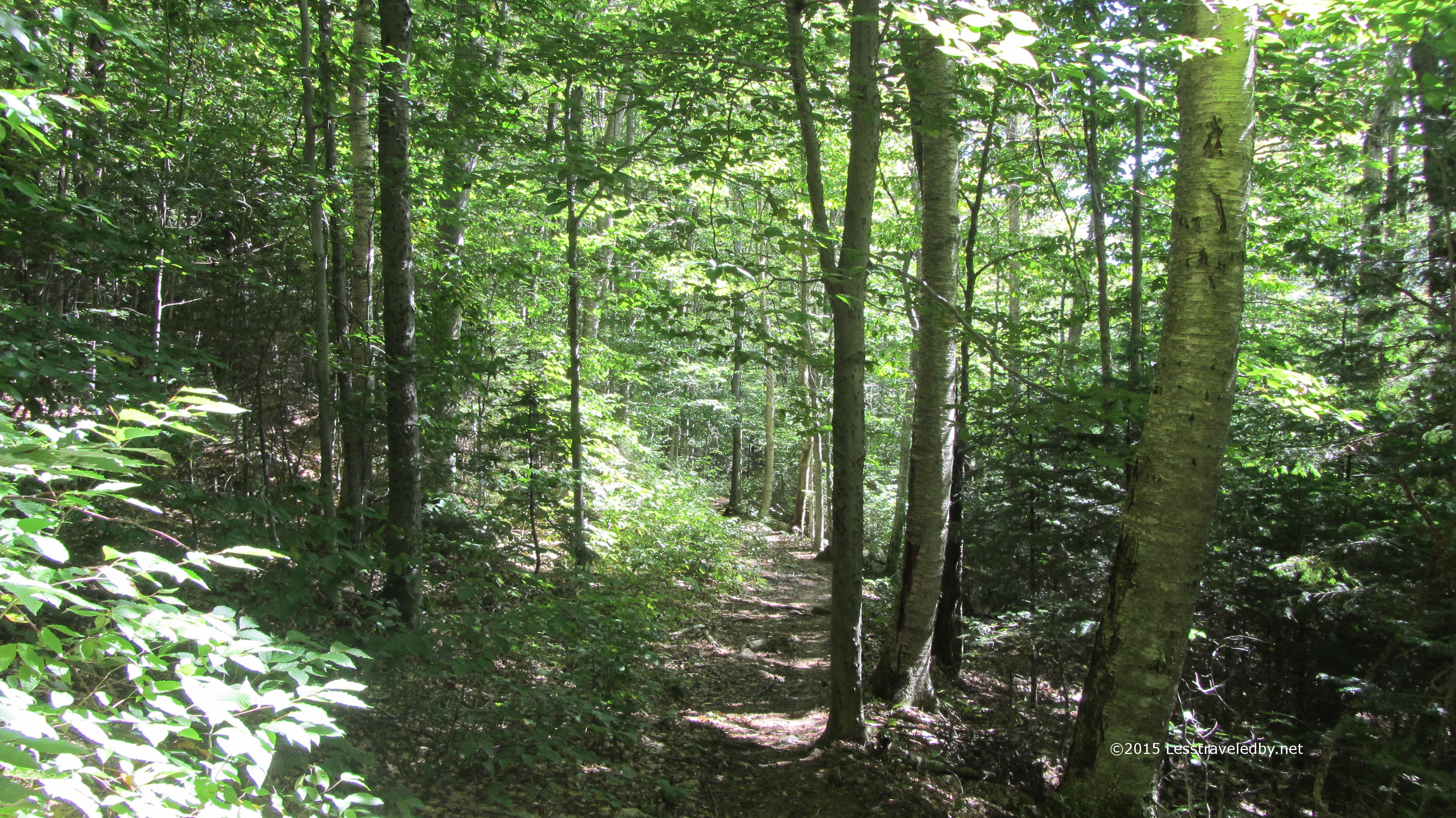
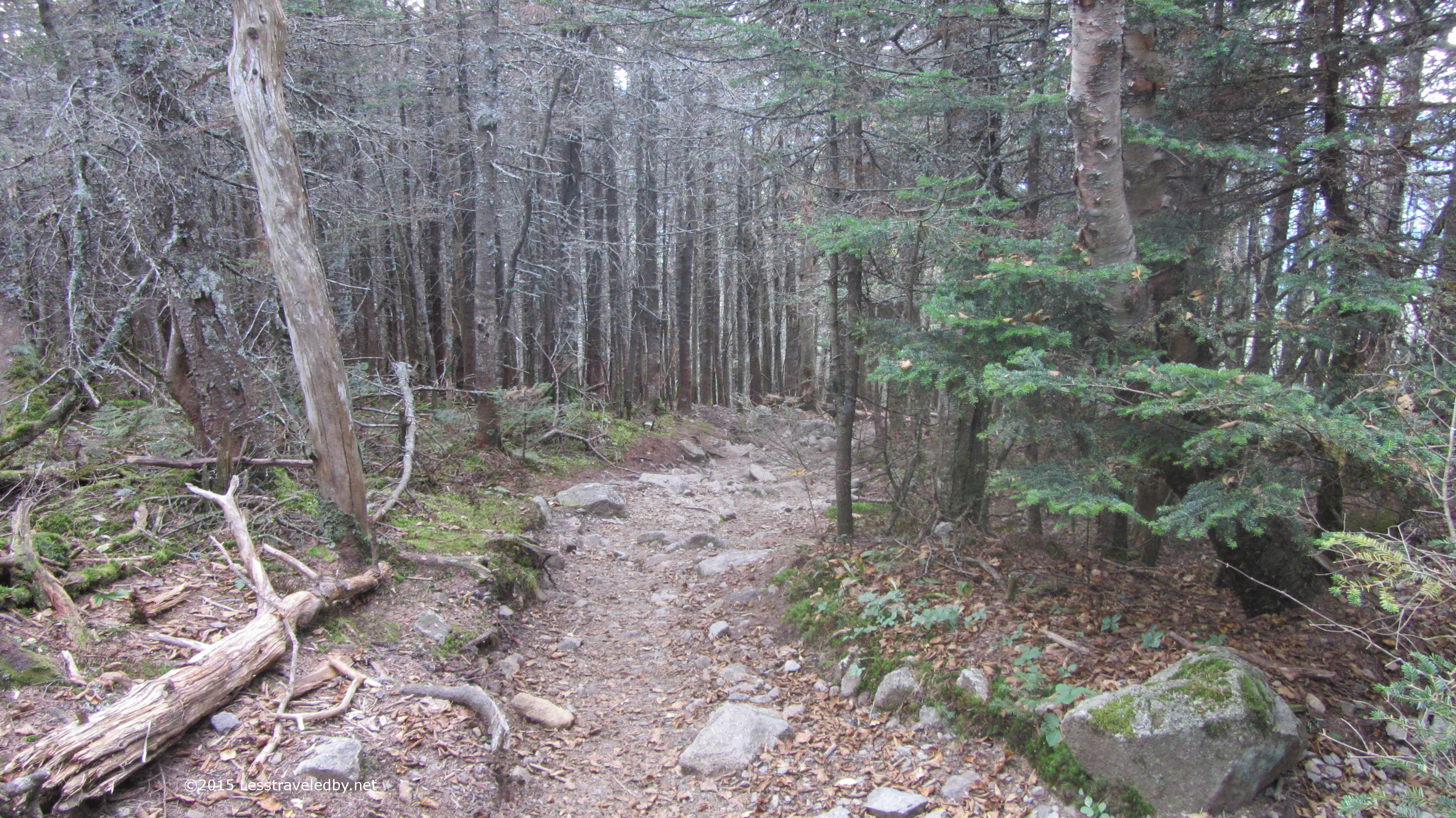
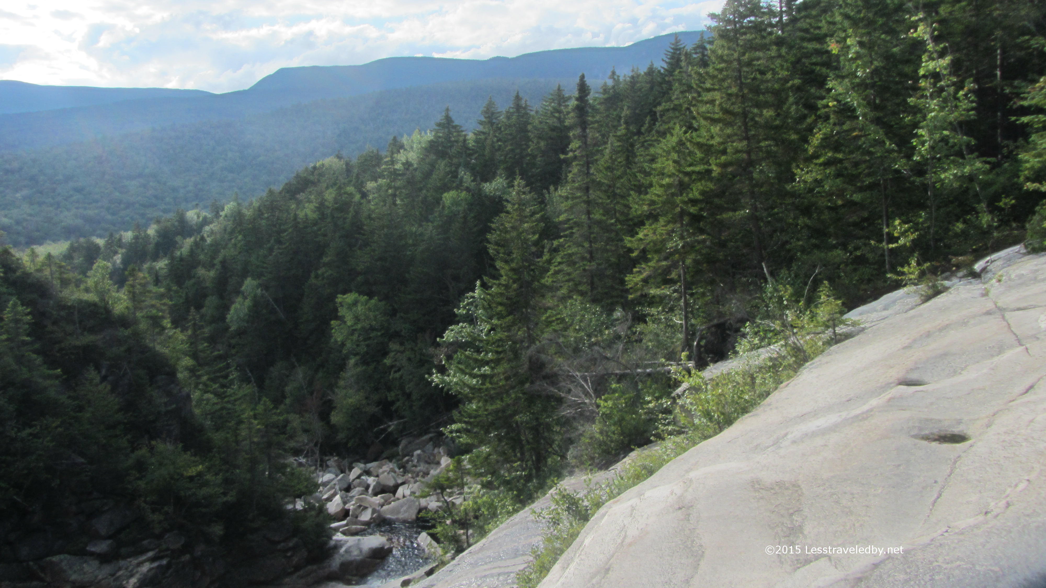
The weather was on my side this time it seemed. Much cooler and while things were on the dry side the forest was inviting after a long motorcycle ride and a few miles of road walk.

IMG_4759a

After spending so much time in New Hampshire, the forest here seemed very different again as it had on the trip with the boys from Texas. Pines and birches dominate both areas, but they don’t feel the same. Something about the density of the woods and how sunlight comes through it I think.

IMG_4761a

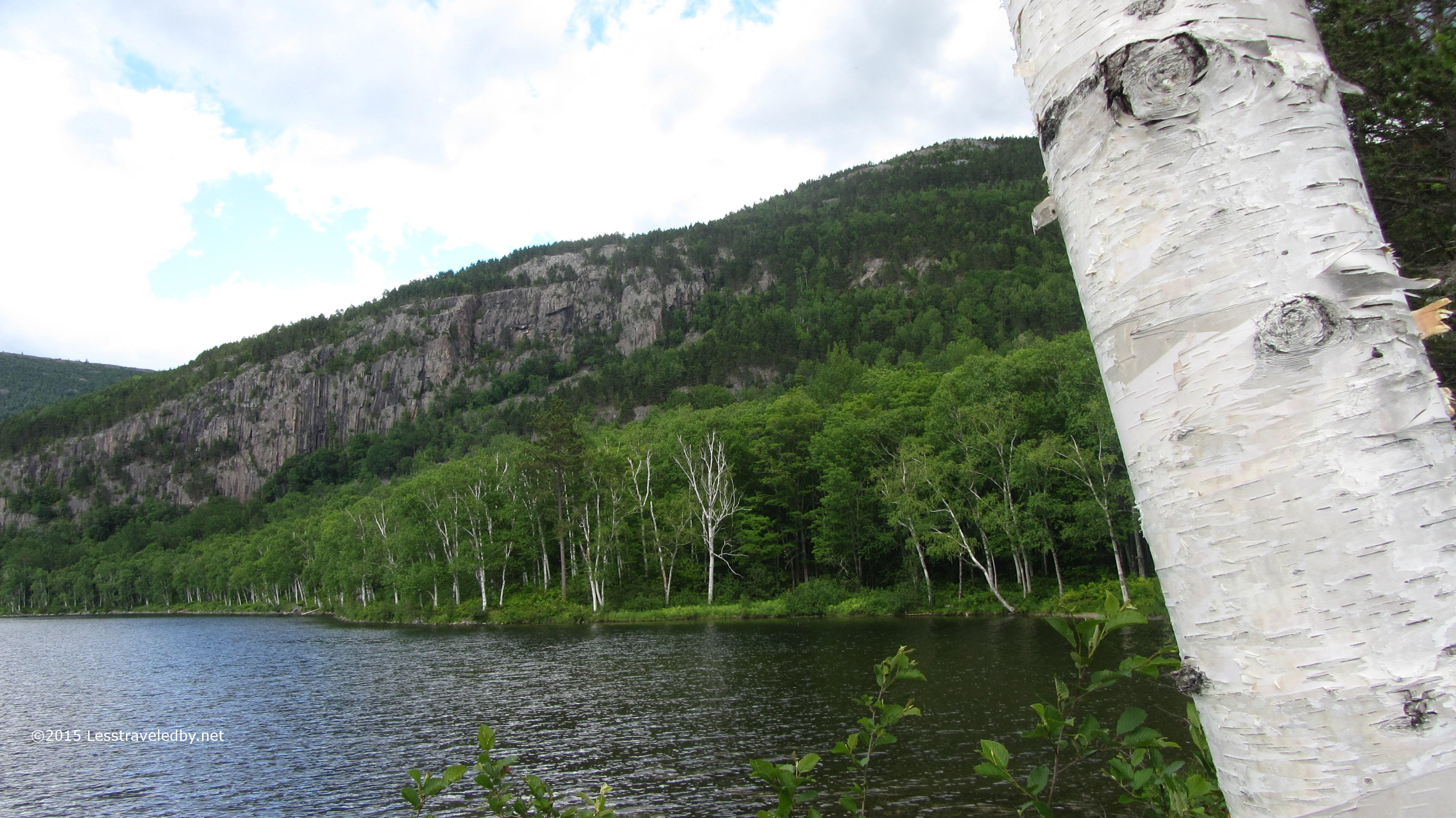
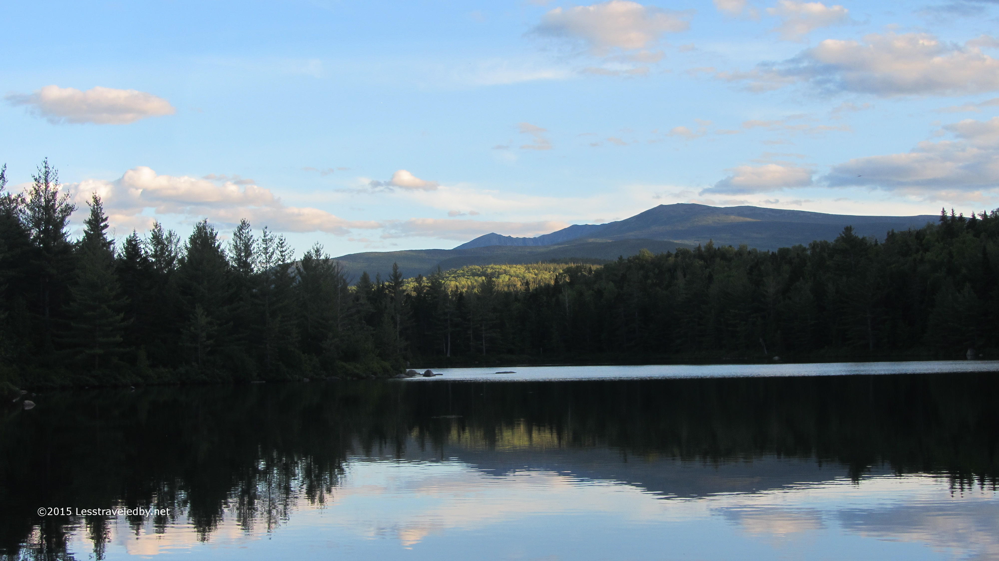
Horse Mountain was just a little bump as my legs warmed up and I hit a good stride. I found myself down the other side and enjoying the cool breeze coming across Billfish Pond in no time at all. There are in fact no billfish in this pond or on Billfish Mt beyond. Seems the area was named Bill Fish long ago and somewhere lost the space in the official records. There is a campsite here that is rarely used and pretty easy to get to, though it isn’t right on the water.

IMG_4764a

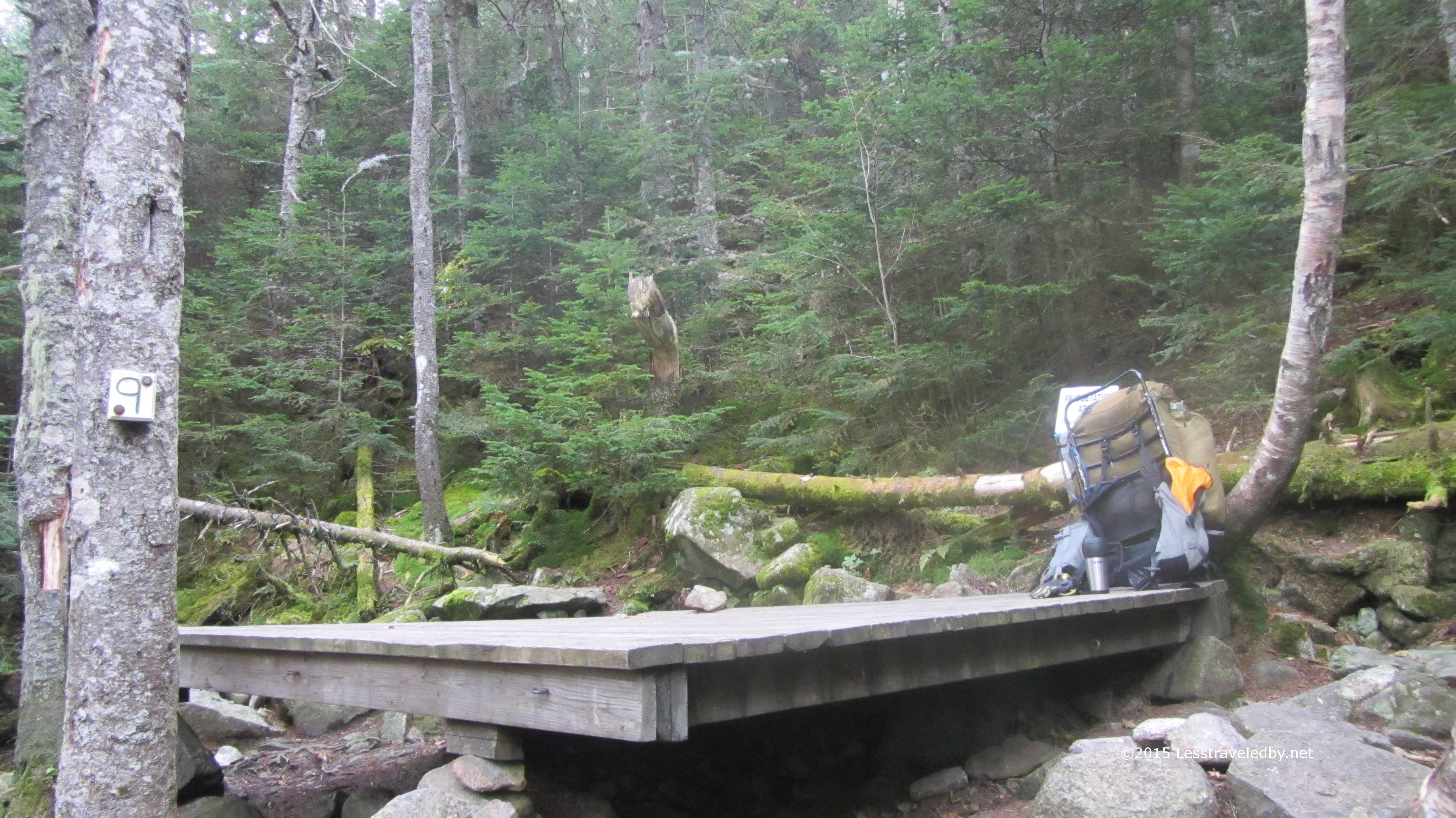
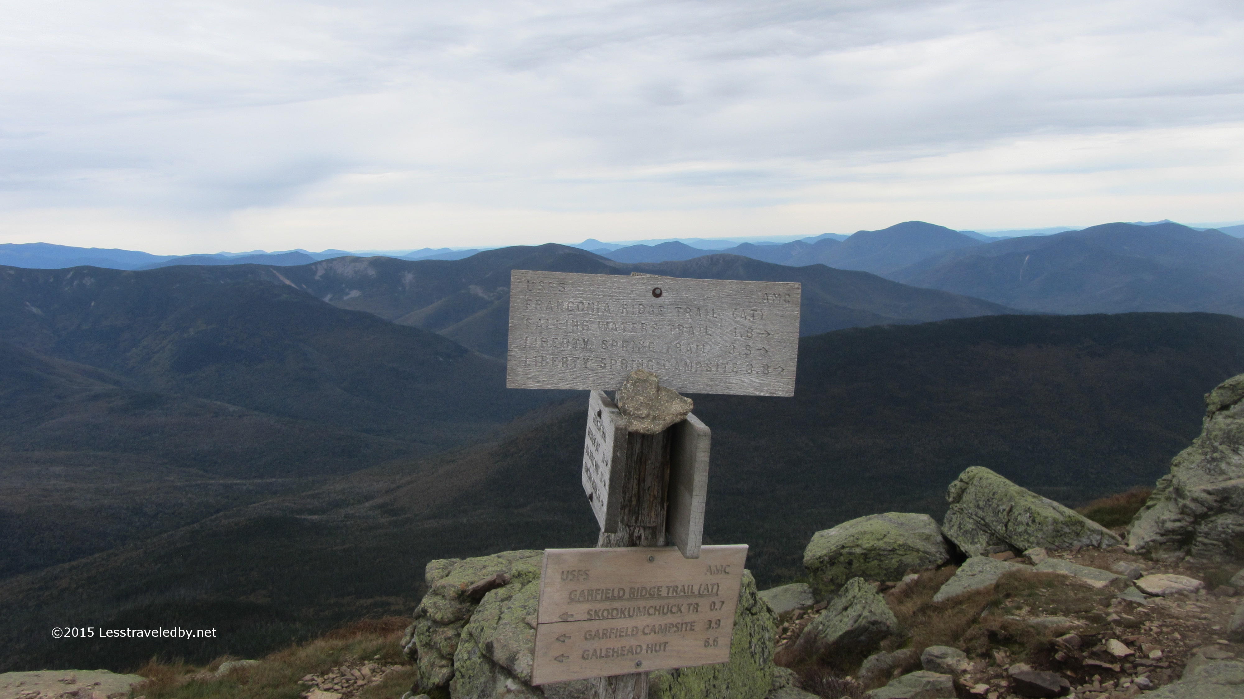
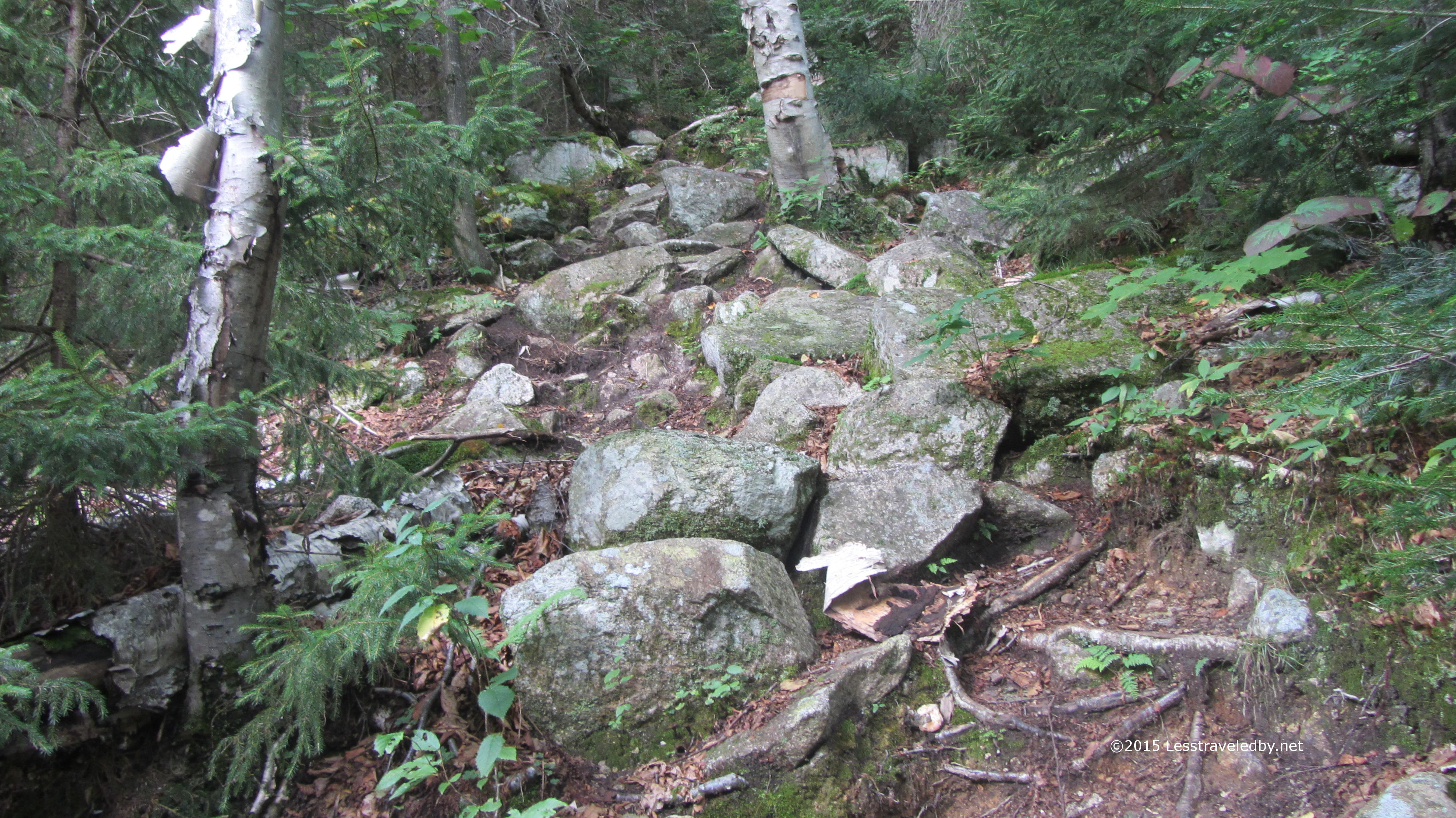
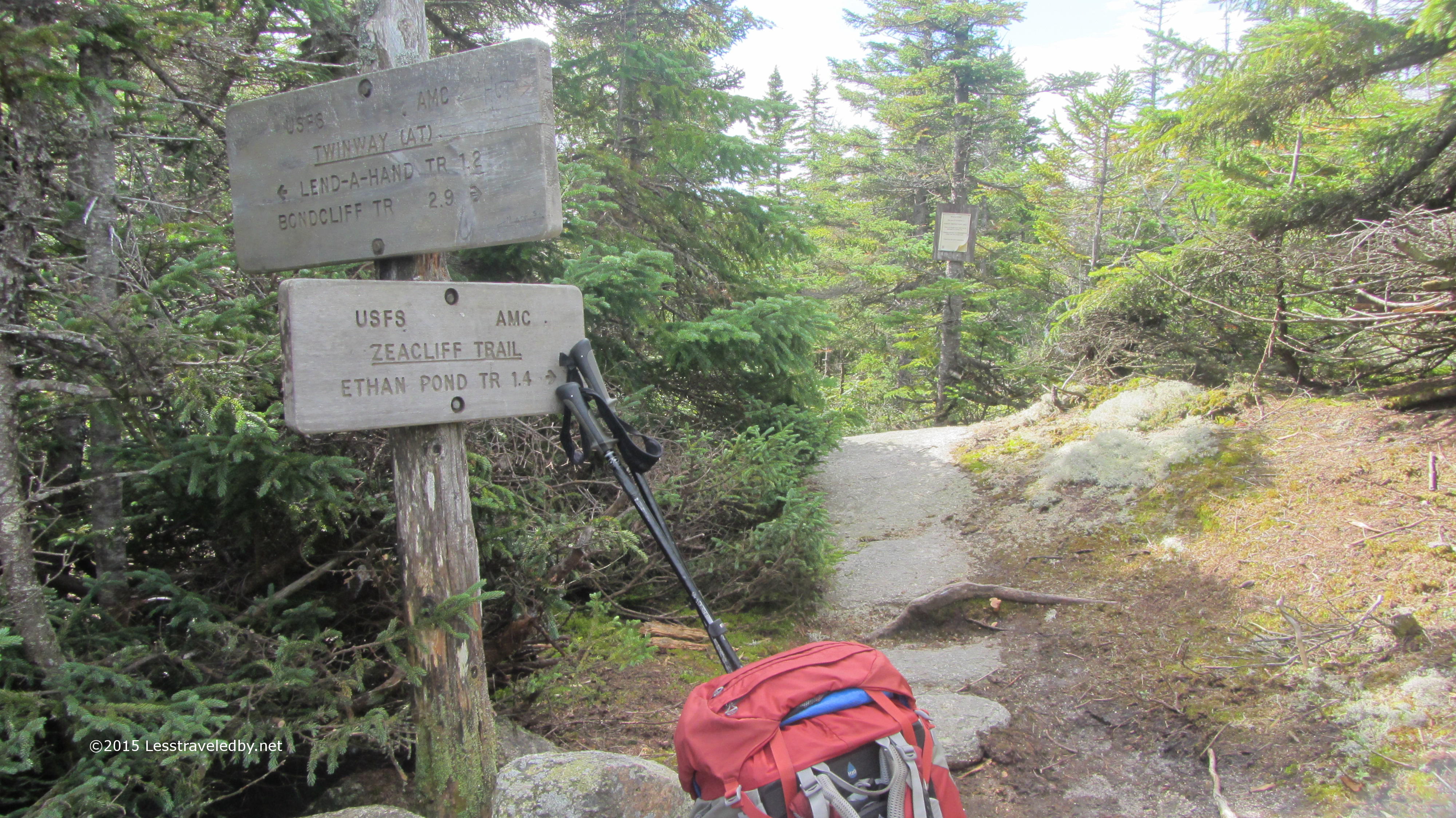
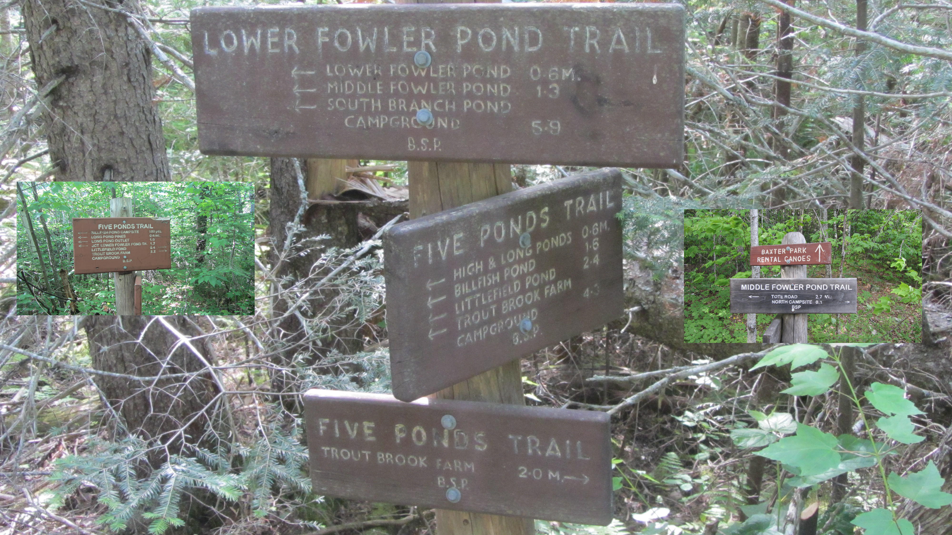
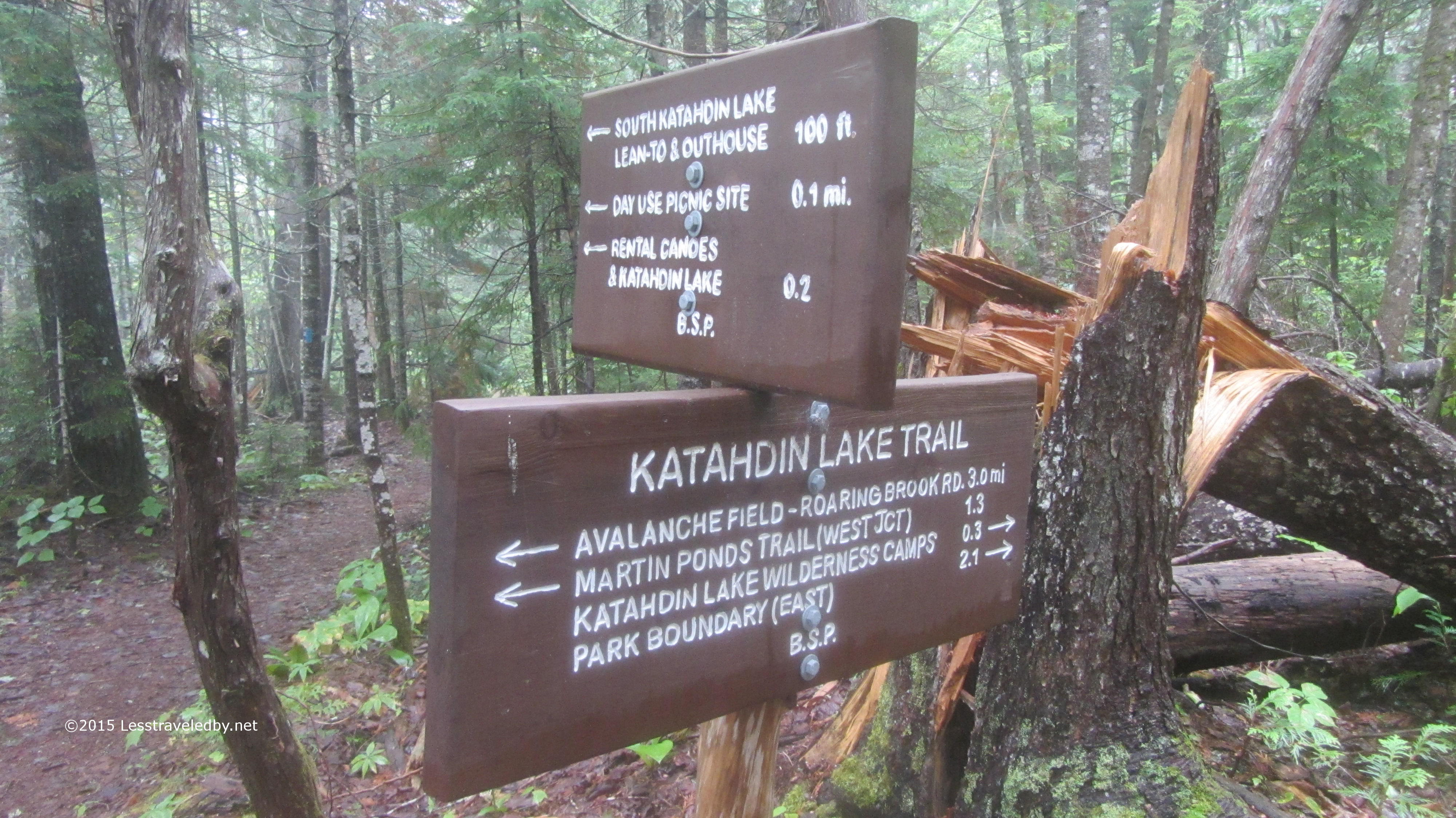
This route took me through lots of intersections. I’ve walked through this area enough on solo and family trips that there was no confusion, but I can only imagine a novice hiker coming across that signpost in the middle and being overwhelmed. Definitely a good time to break out the map if you aren’t totally positive as to which way you’re headed.

IMG_4769a
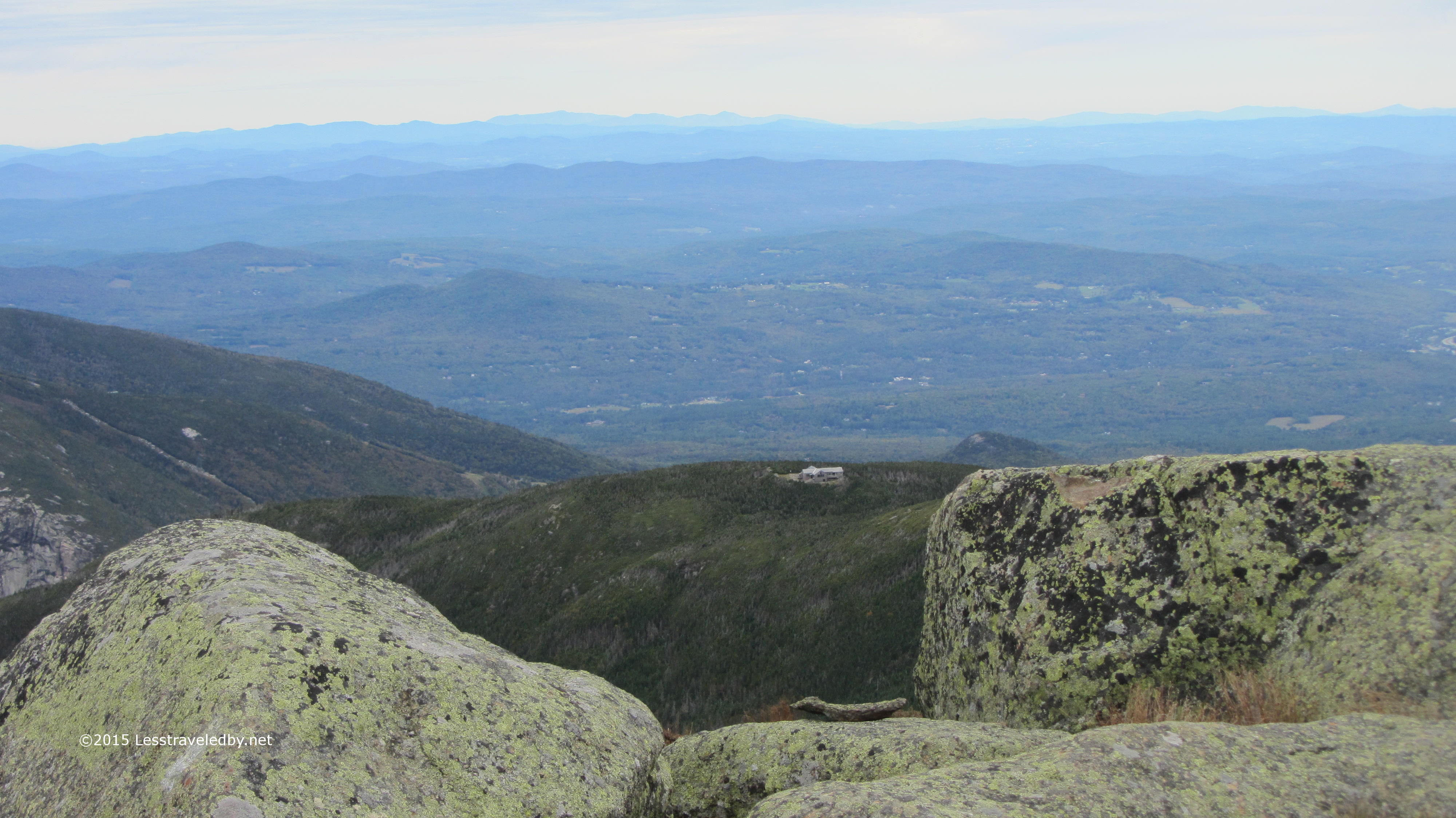
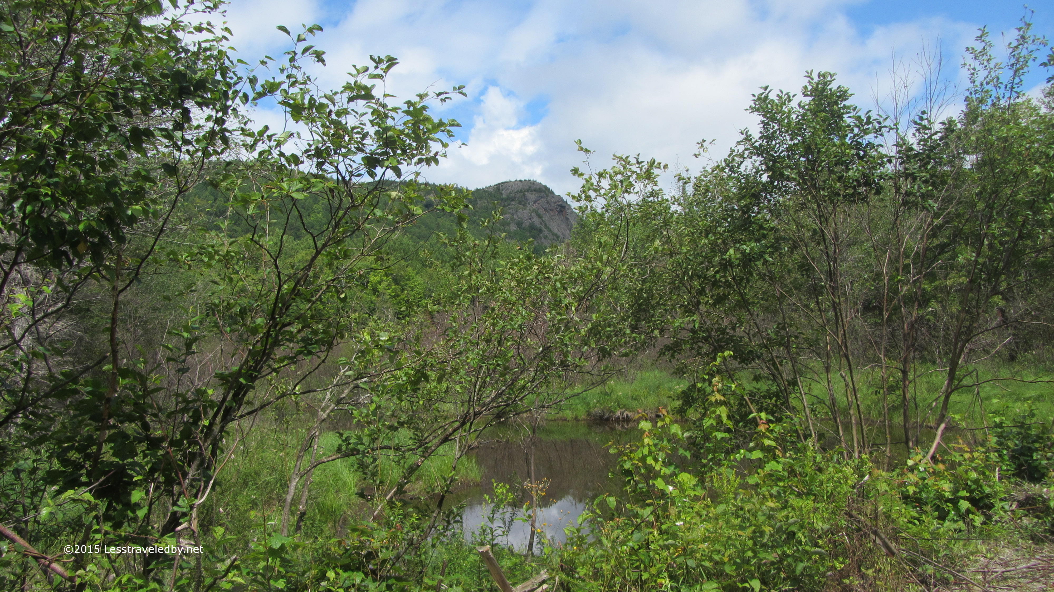
This is where I was headed. North campsite on Middle Fowler Pond looking towards the outlet. The site was very overgrown and looked as though it had seen very little use this year. The entire Fowler Ponds area is lightly used and often available to reserve on short notice. Great spot for family trips or anyone looking for more relaxing and casual terrain compared with the nearby mountains.

IMG_4774a

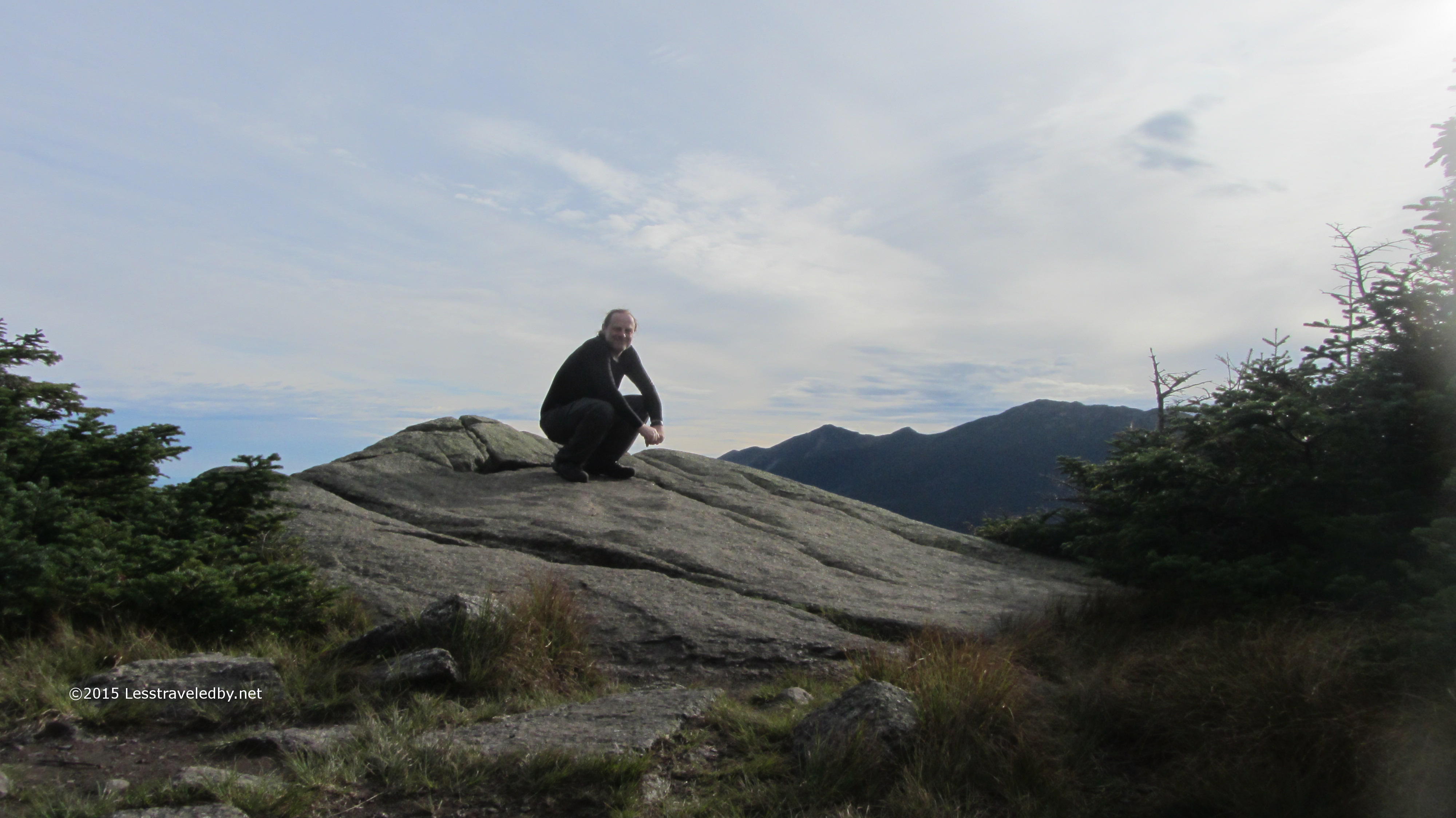
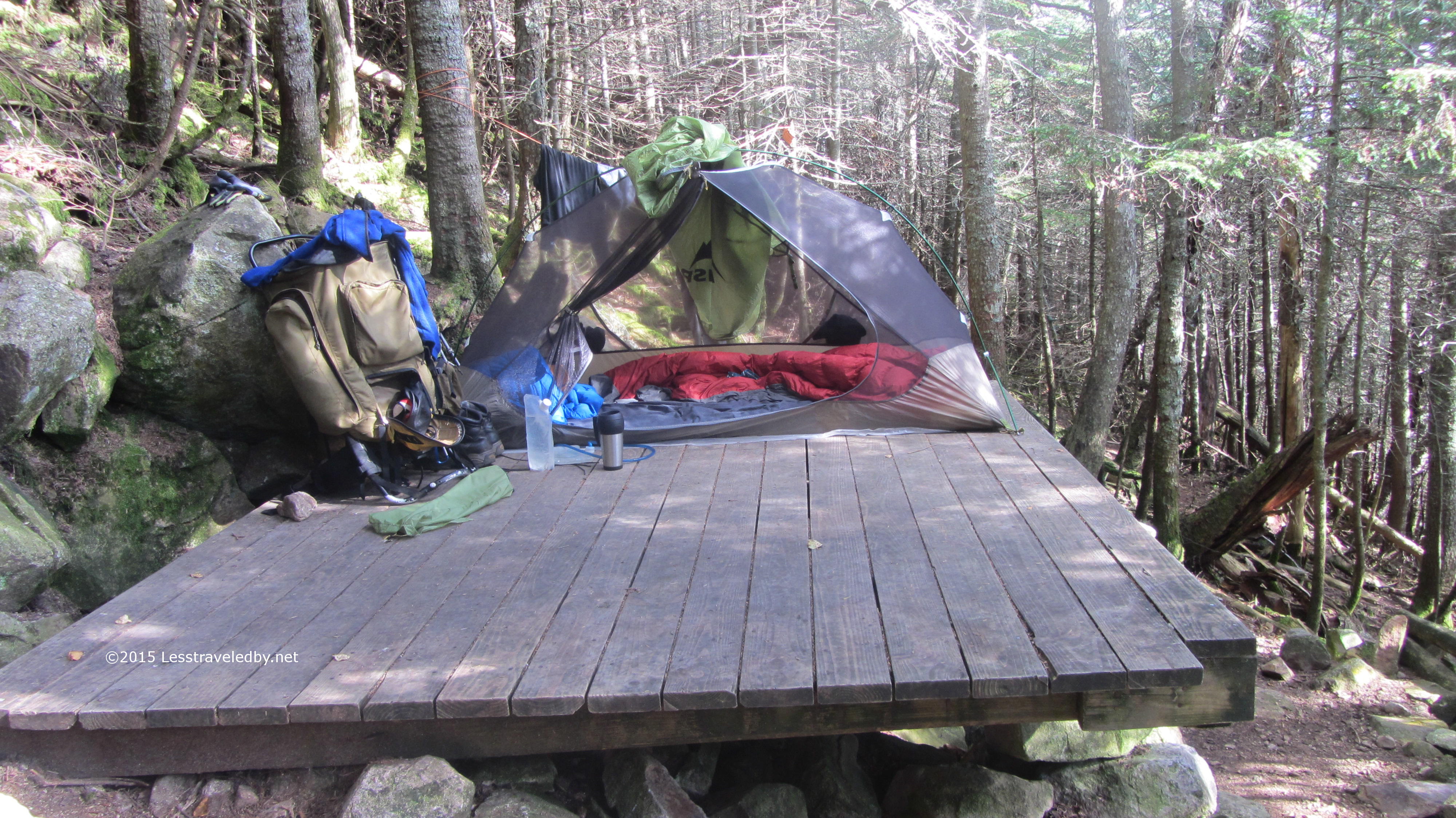
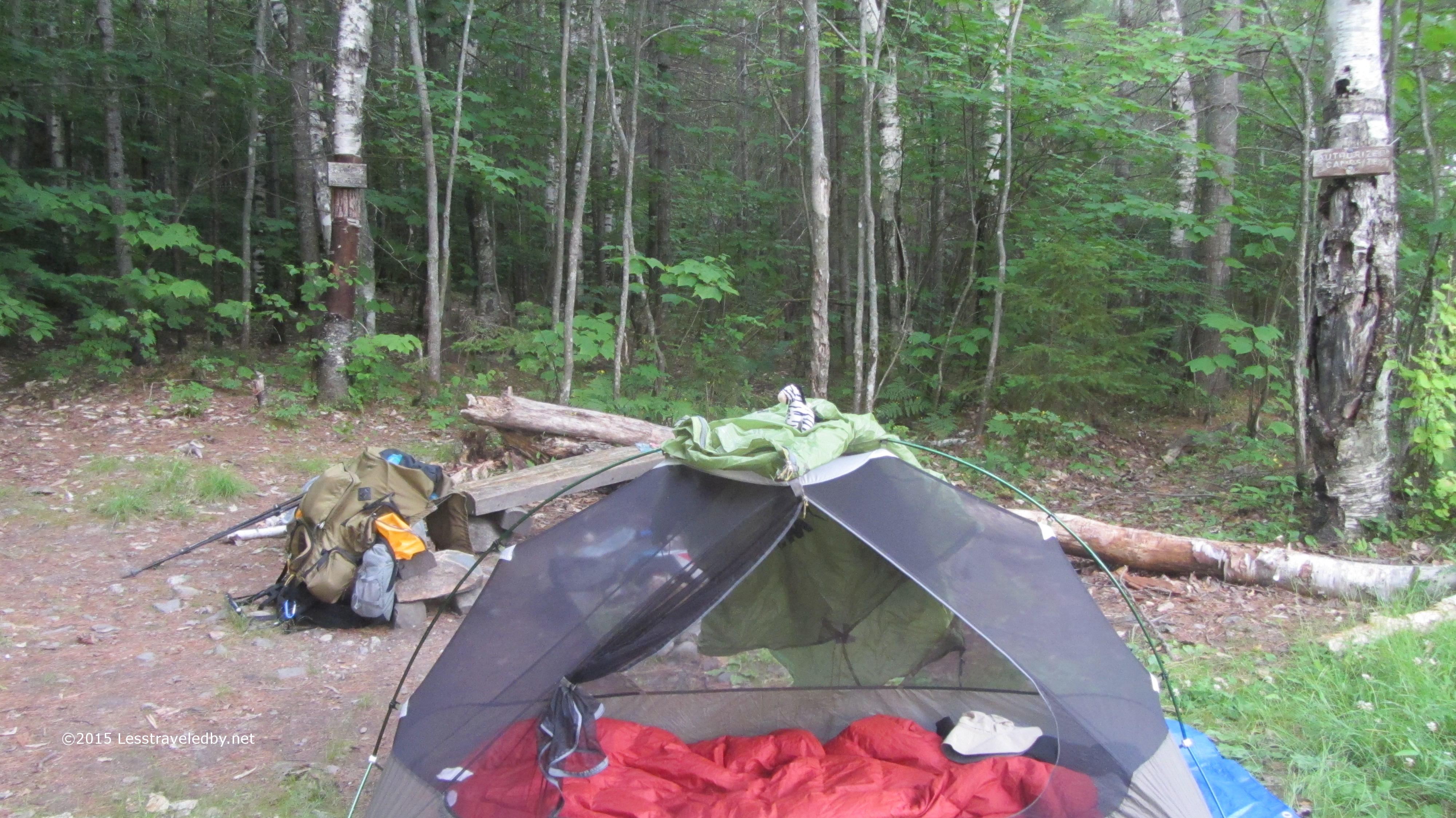
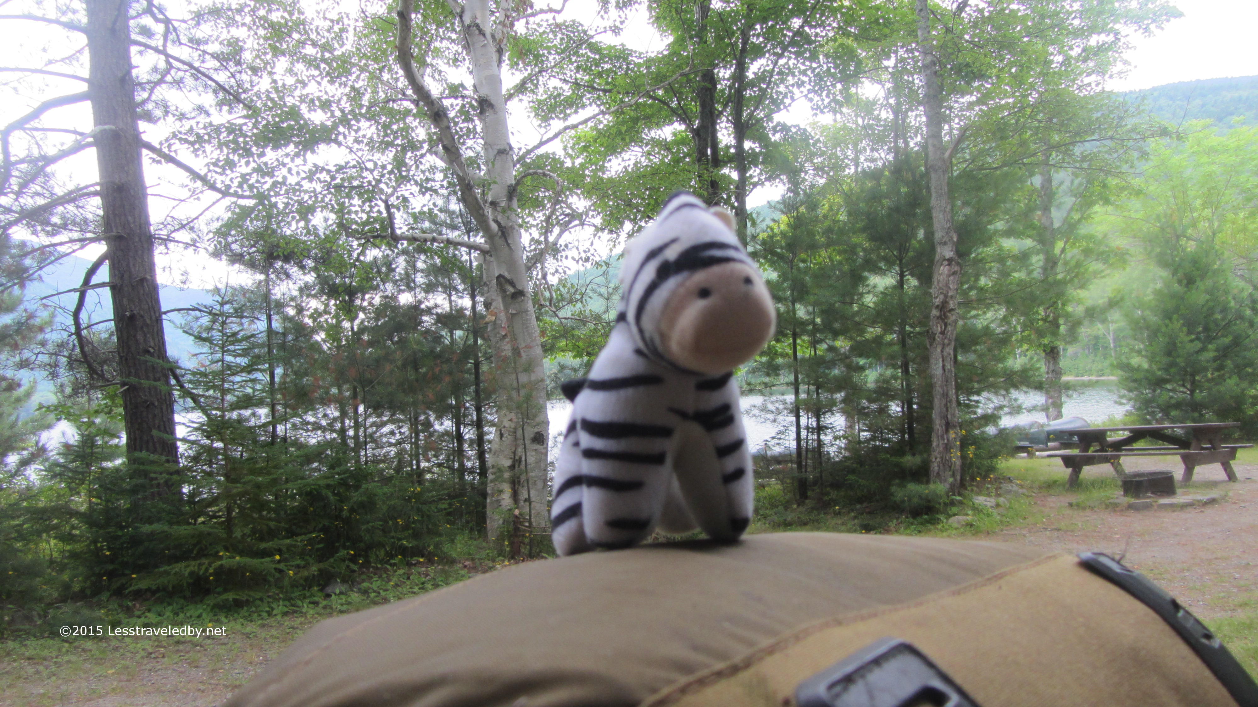
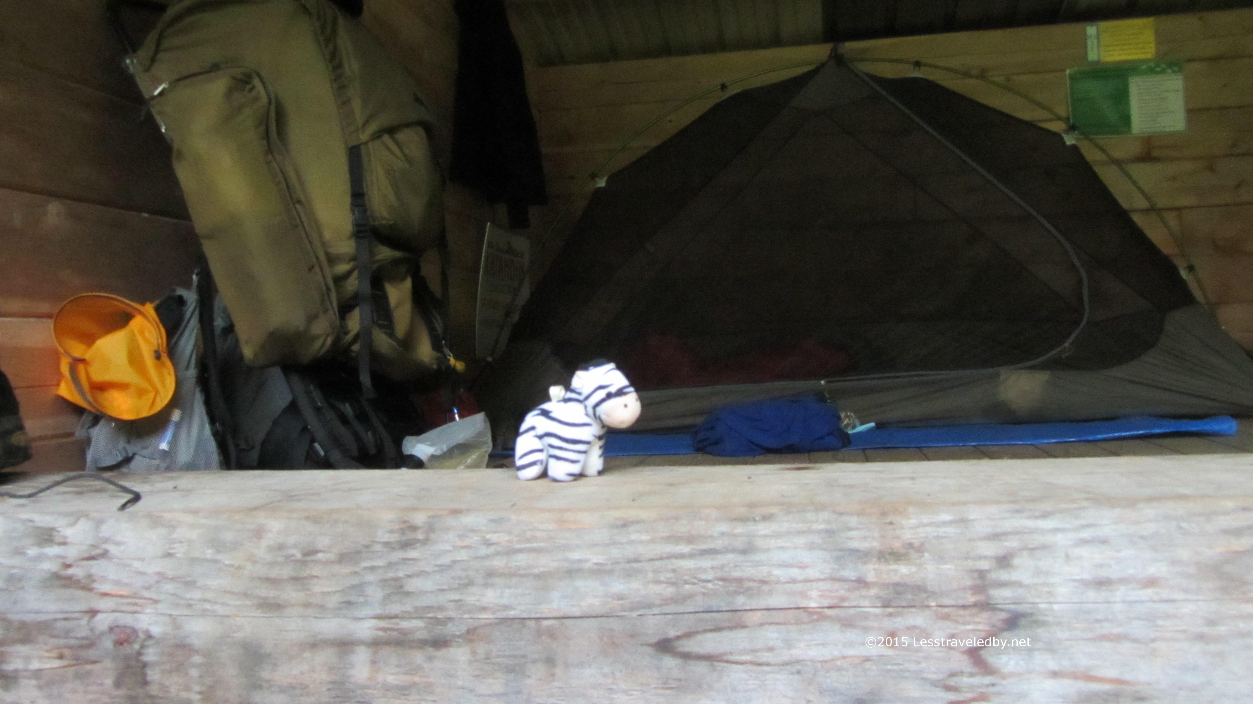
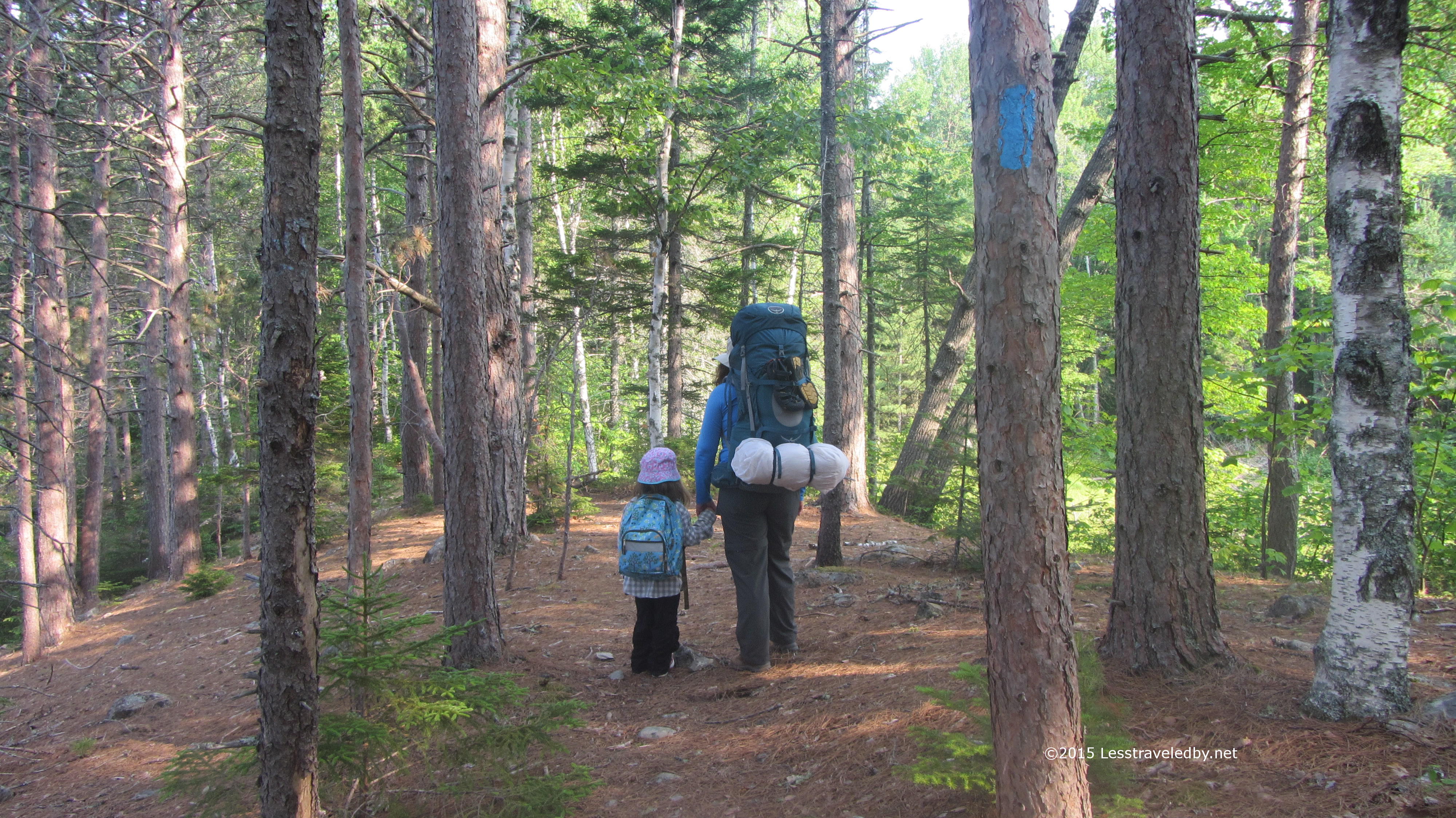
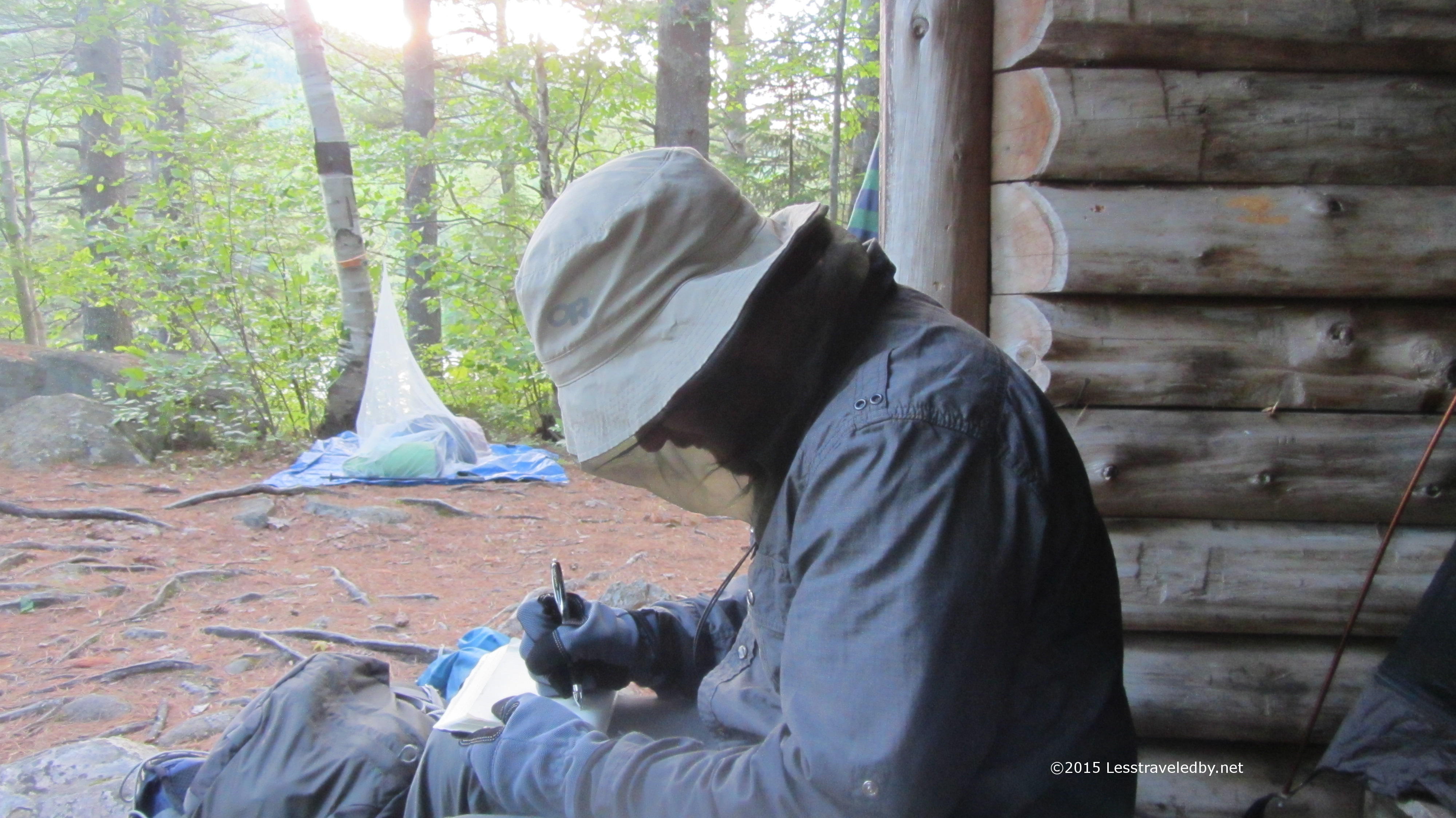
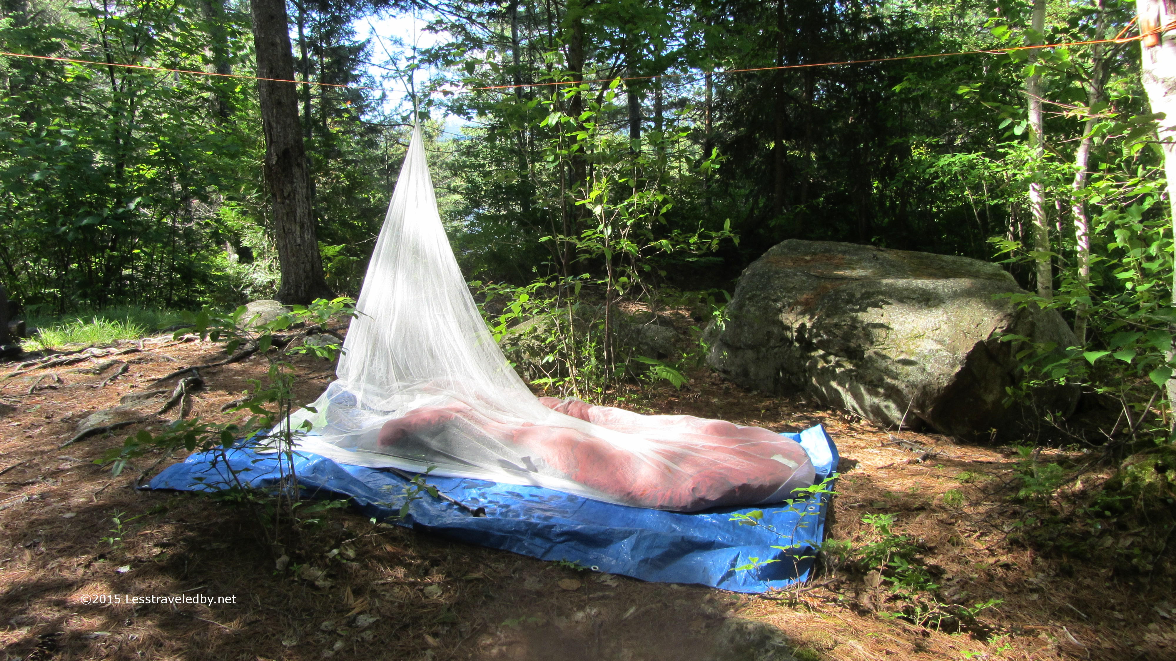
My daughter sent this little guy along at the last minute. She was worried I might be lonely and need someone to snuggle with. I told her I’d bring back pictures so she could see the adventure it went on.

IMG_4776aA few years ago I reported to the rangers that the tree they had tacked the campsite sign to was in danger of falling. It still makes me chuckle to see it there right where they pushed it over after moving the sign to a new tree. Very peaceful little site with the rental canoes just down the trail and I’ve seen locals hiking in to fish here so might make a nice place to hang out for a few days.

IMG_4778a

Morning came with some expected cloud cover and a light mist during breakfast. I lingered a bit and let it blow through before heading to the other side of the pond and beginning my climb up to Barrel Ridge.

IMG_4782a

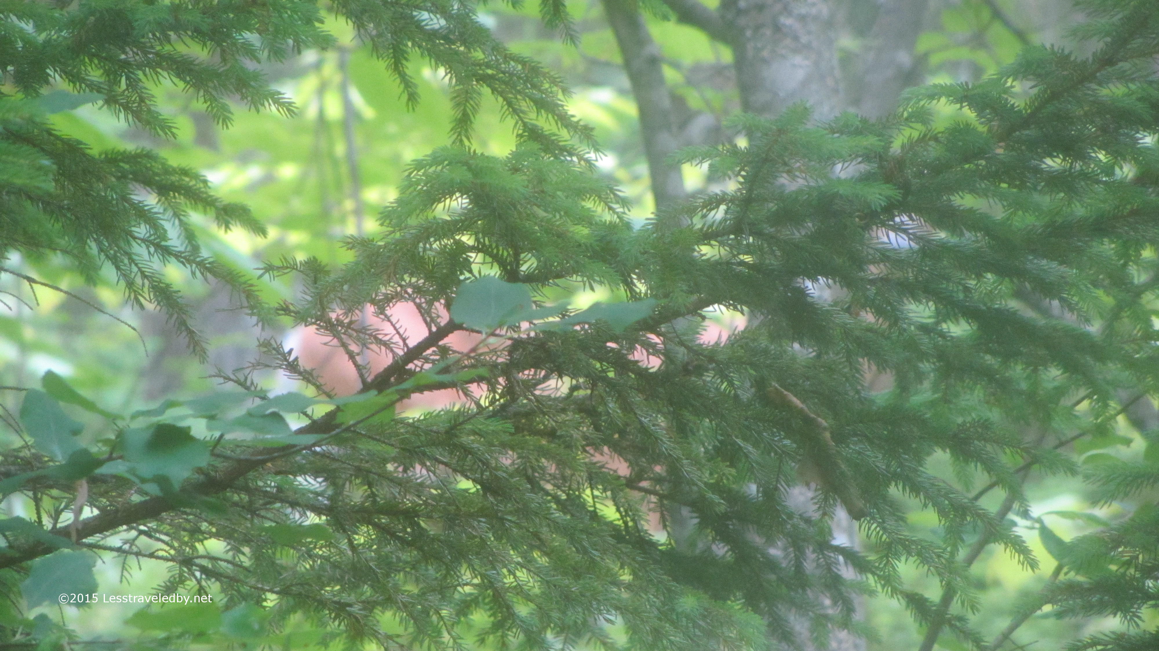
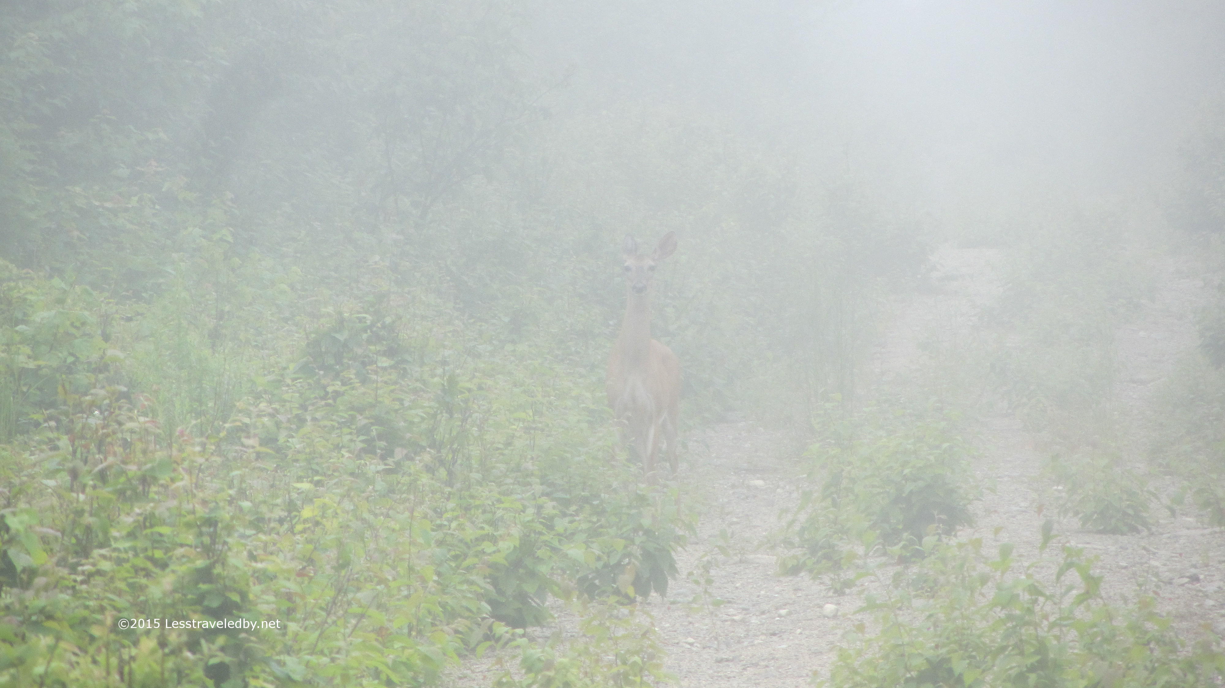
If you look between the pine needles you can just make out this beautiful white tailed doe on the other side. I was glad I was able to get this glimpse on camera because as soon as I tried to move to get a better shot she was gone.

IMG_4785a

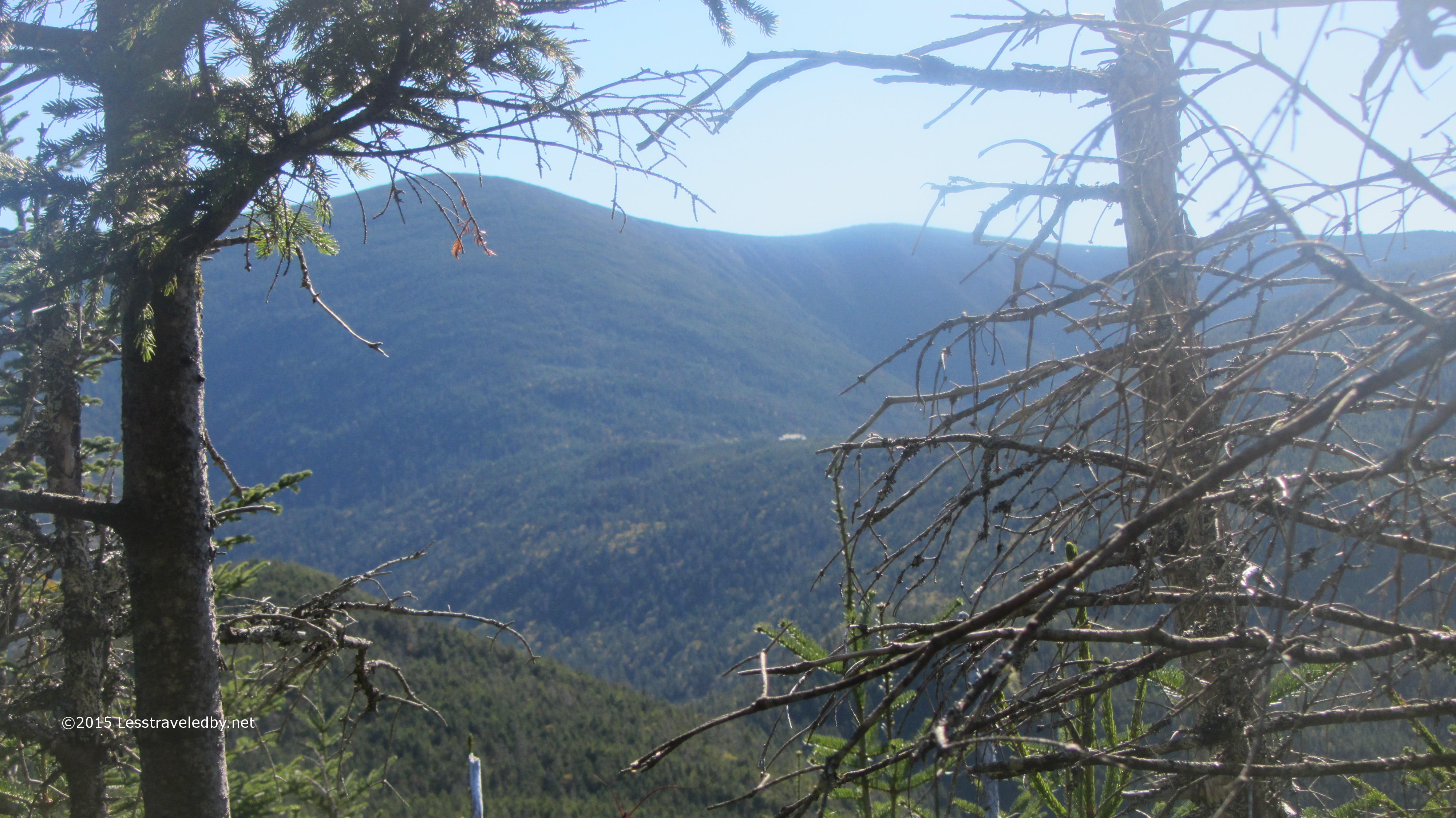
Last year this was a very wet sub-alpine bog, but on this trip it was bone dry. Well at least when I was passing through…

IMG_4786a

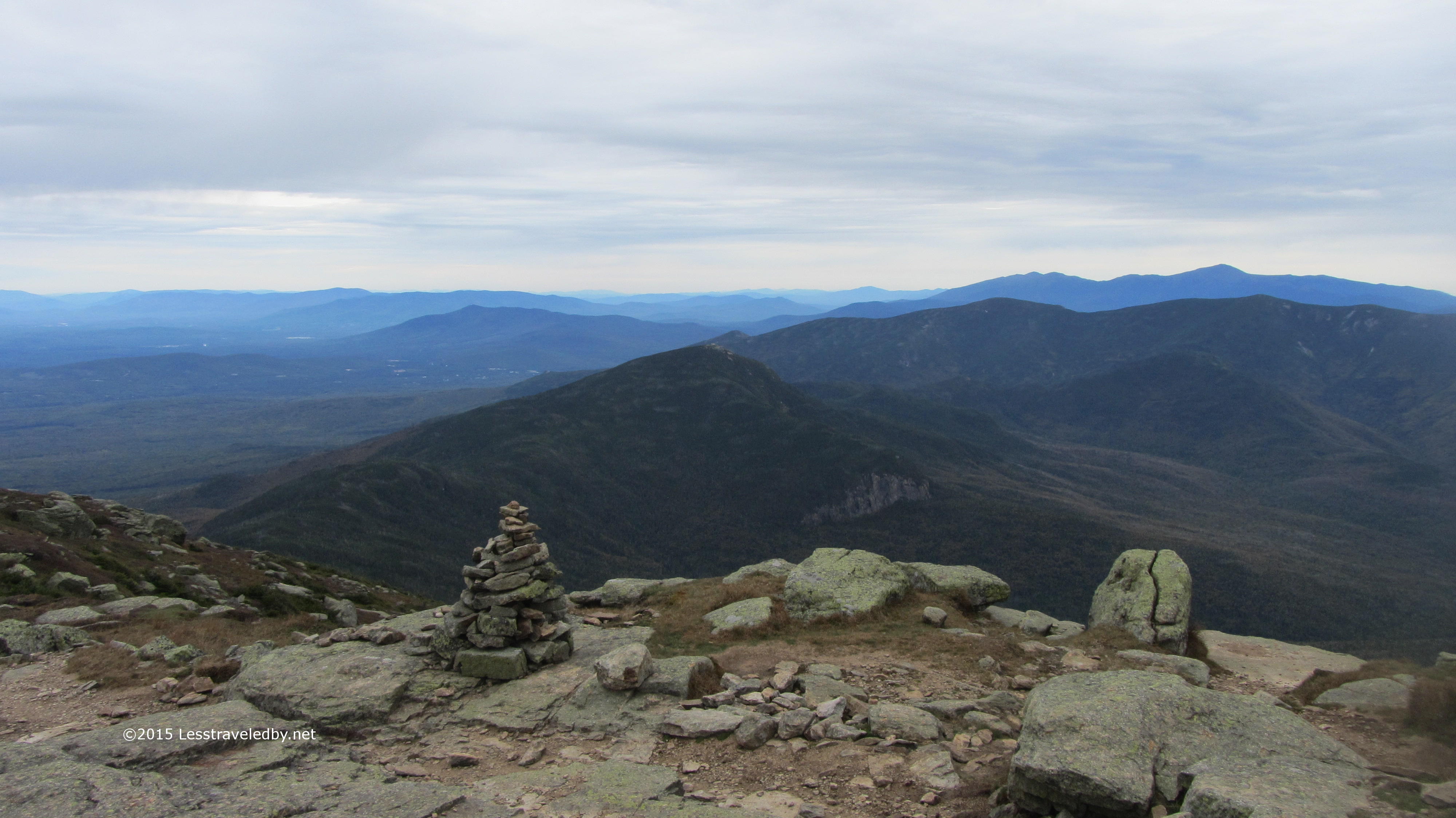
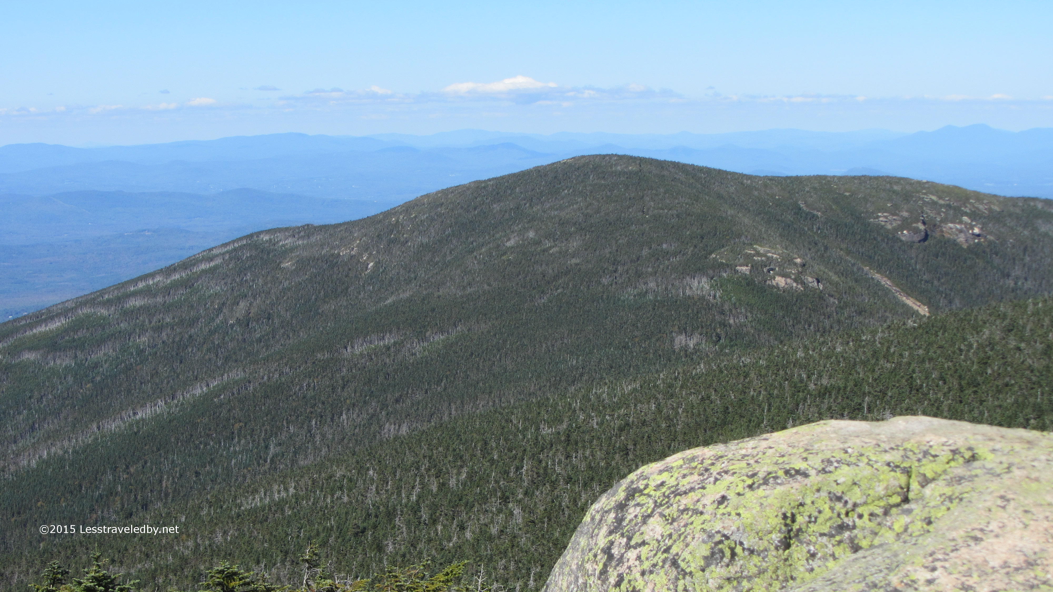
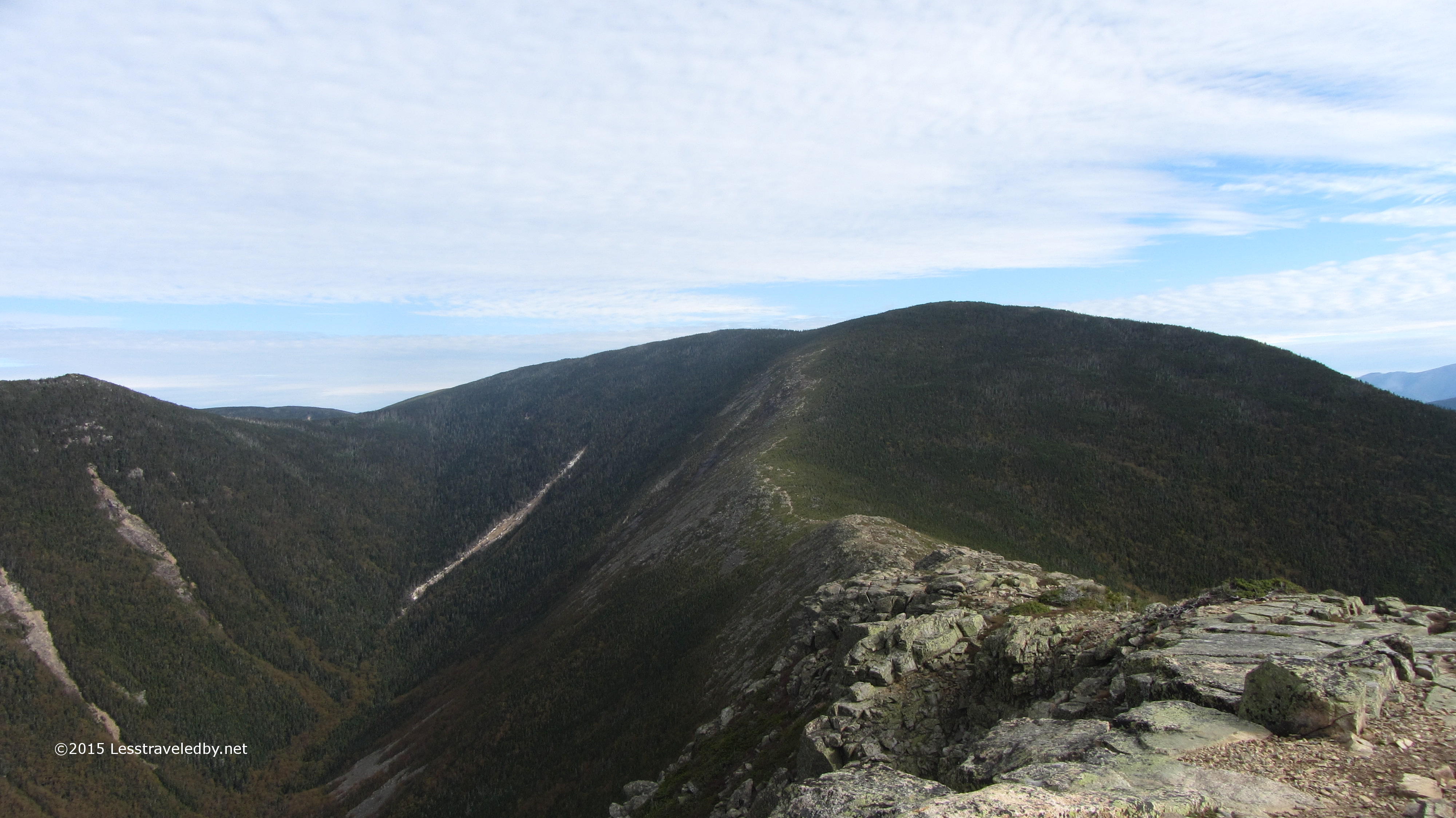
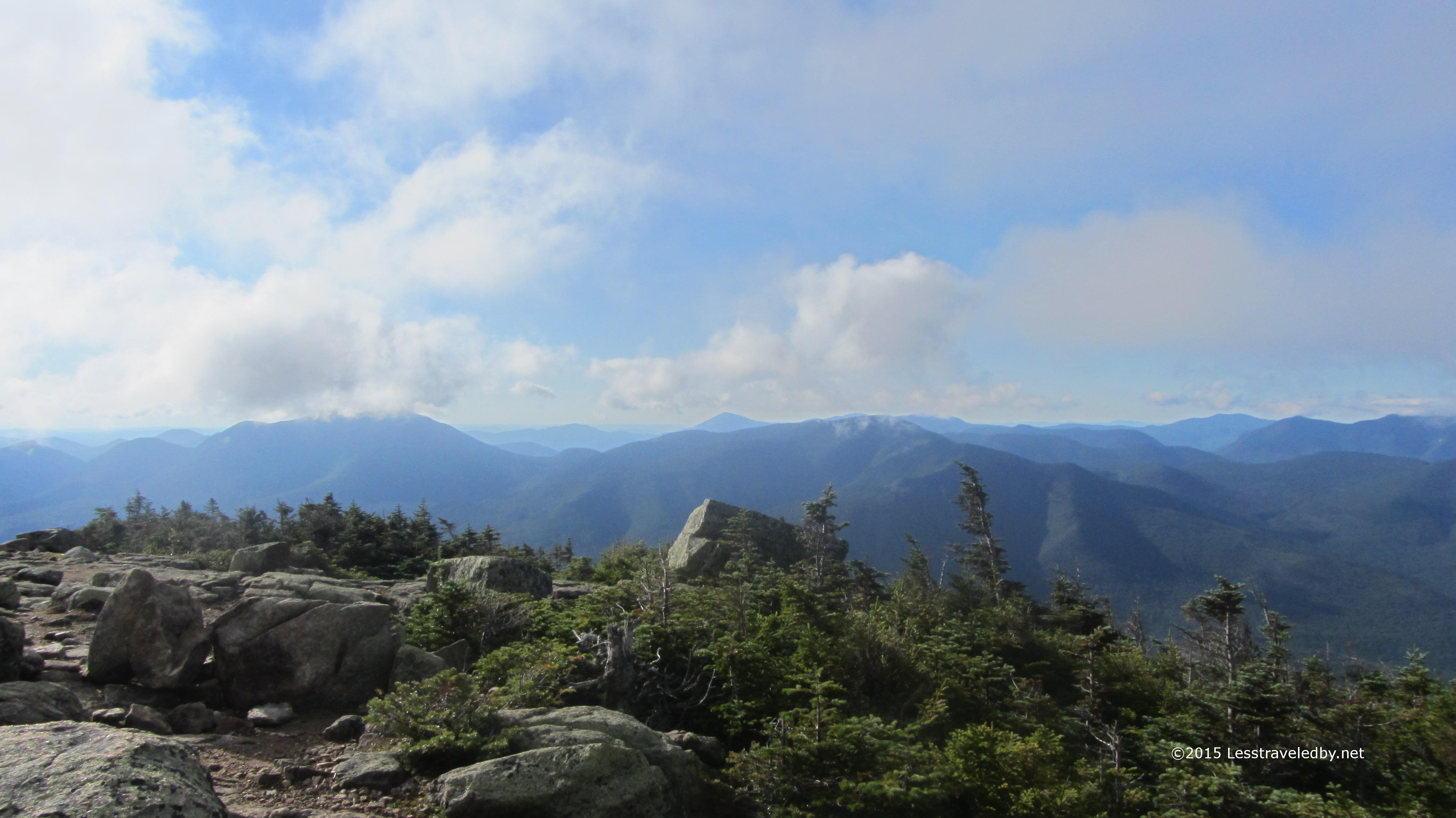
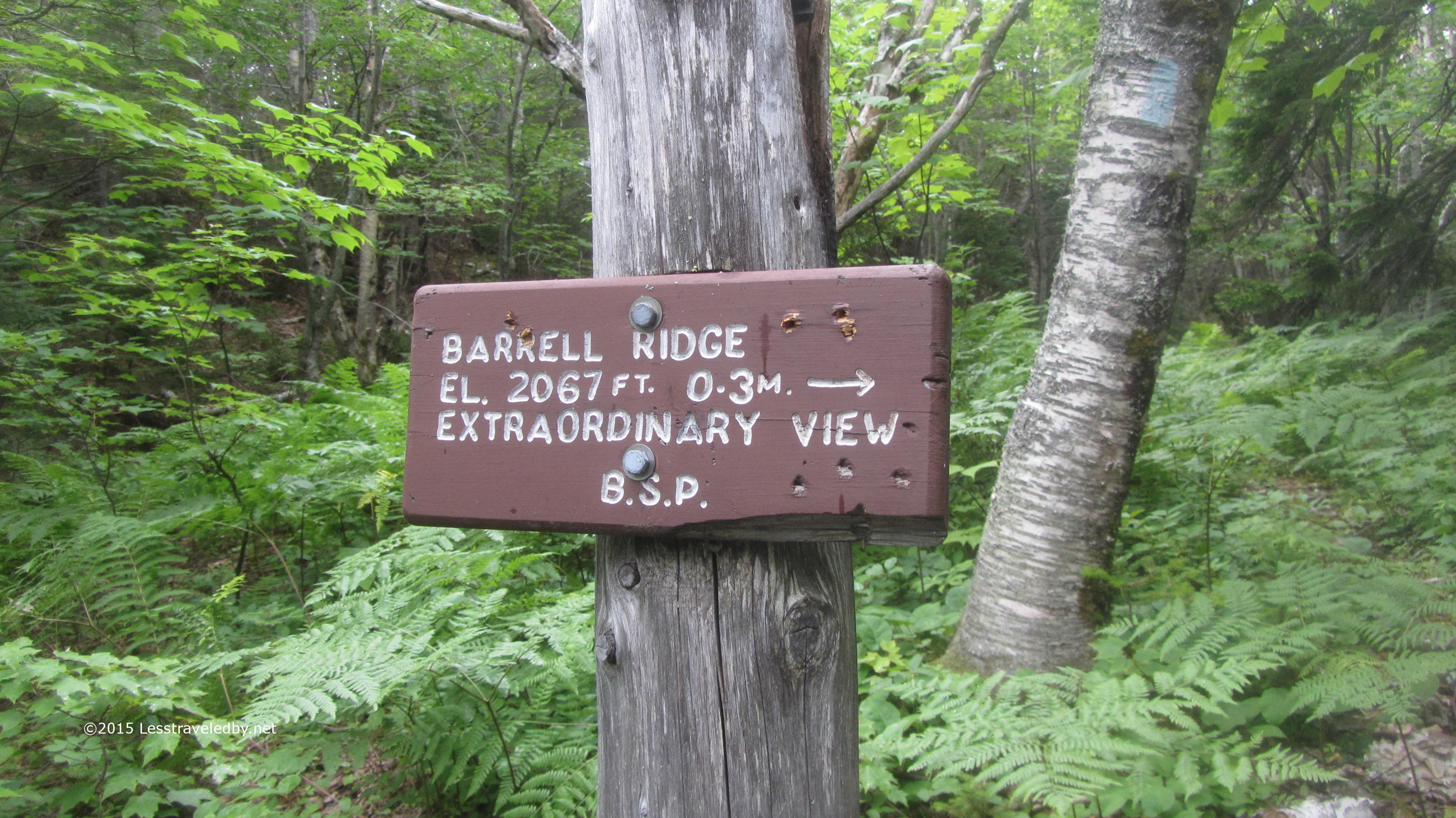
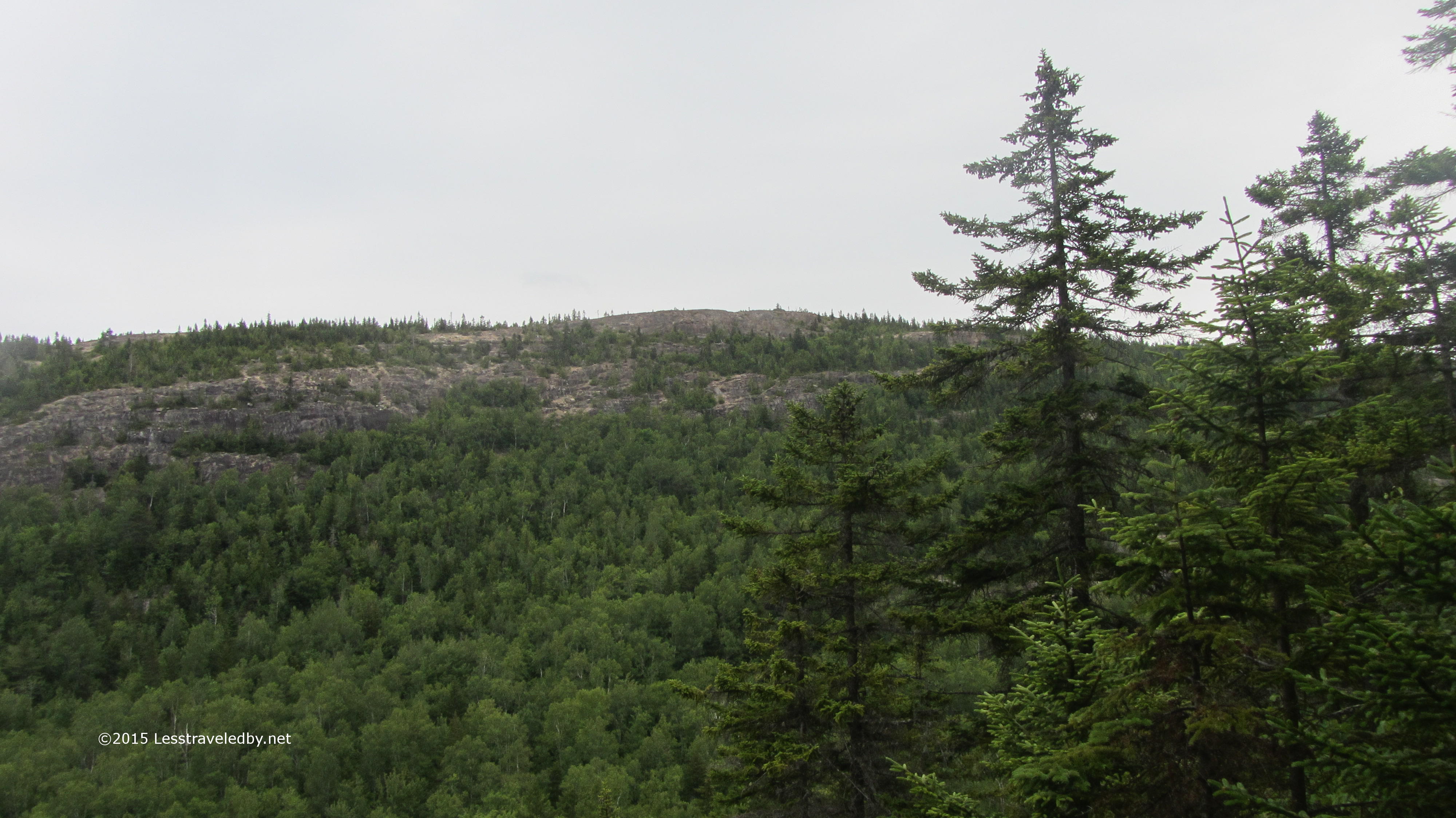
Last year I skipped Barrell Ridge because of the heat. This year I figured I had plenty of time because I’d made camp three miles farther along and the weather seemed nice enough.

IMG_4789a

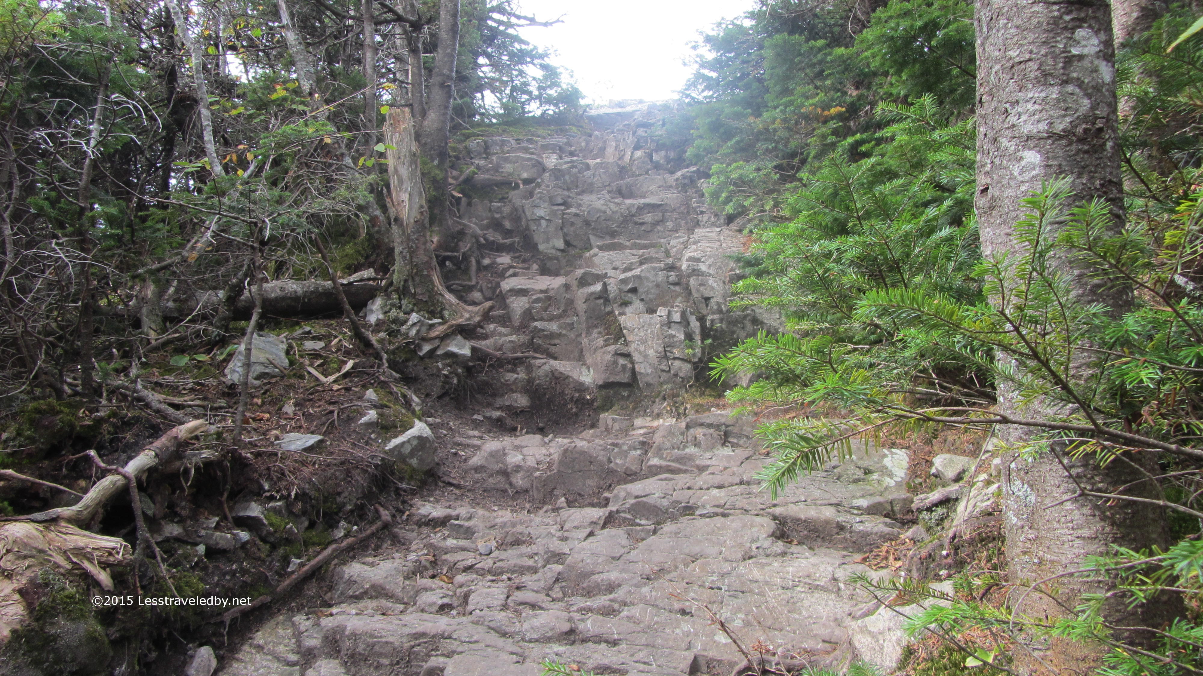
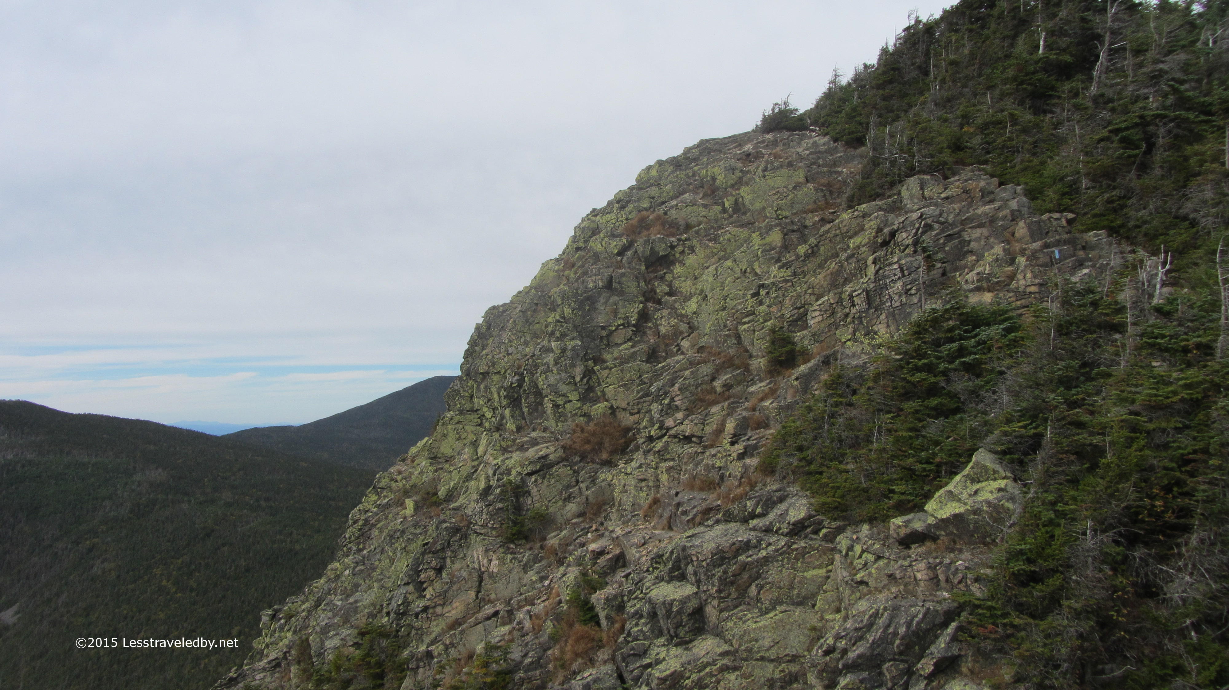
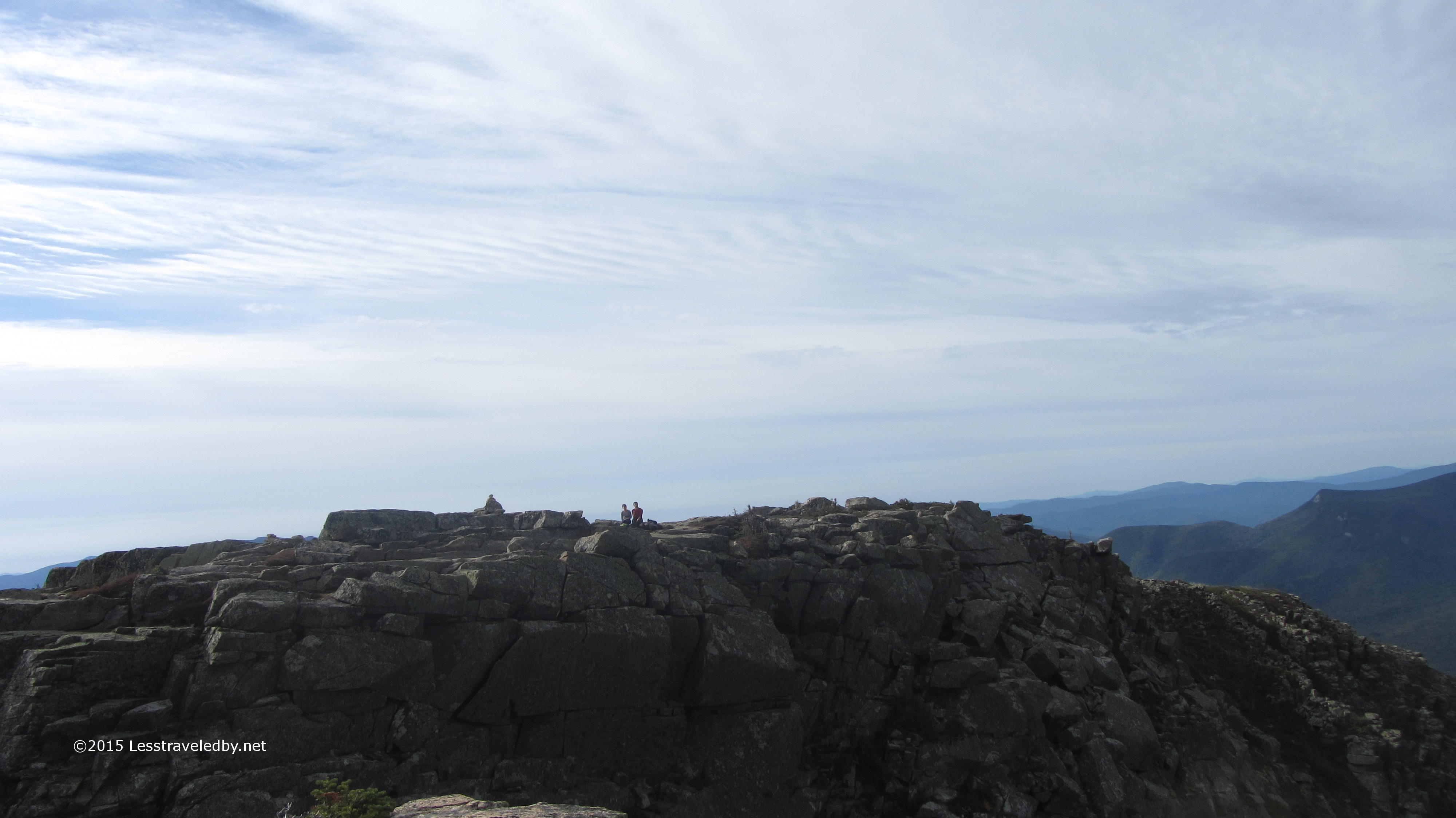
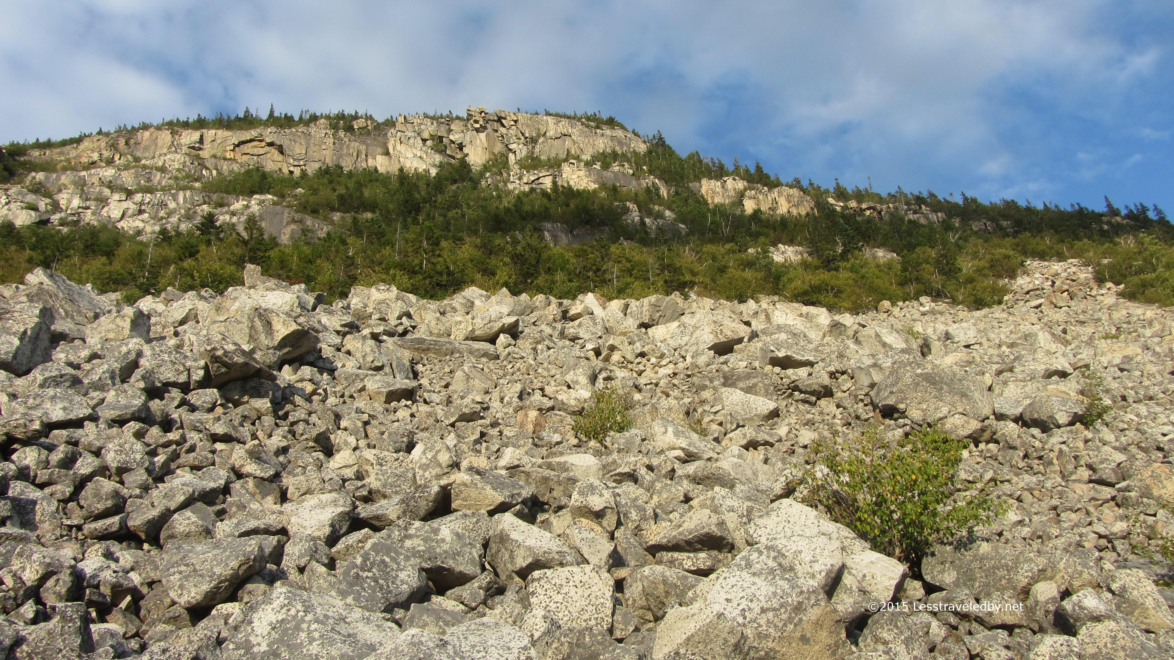
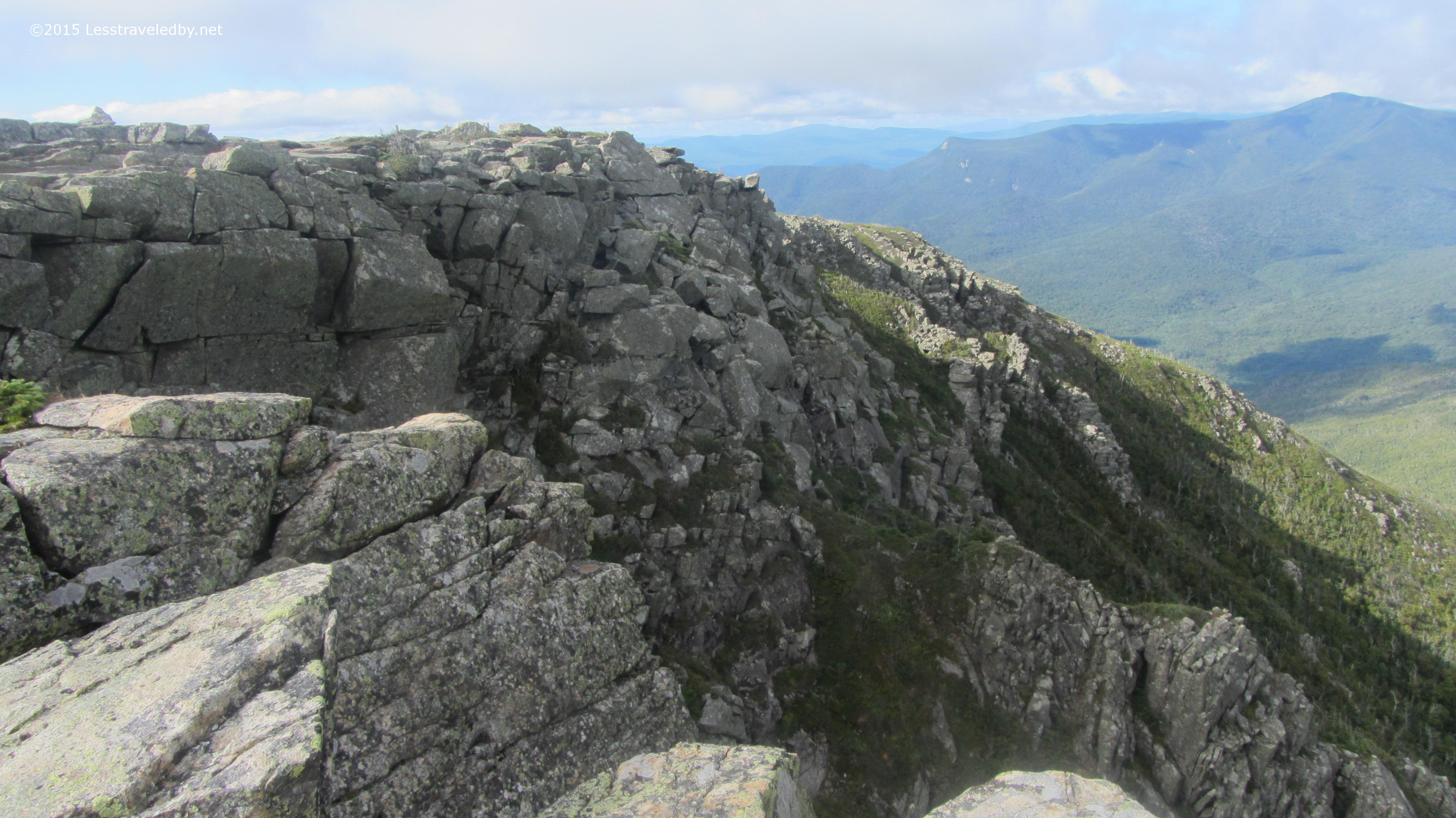
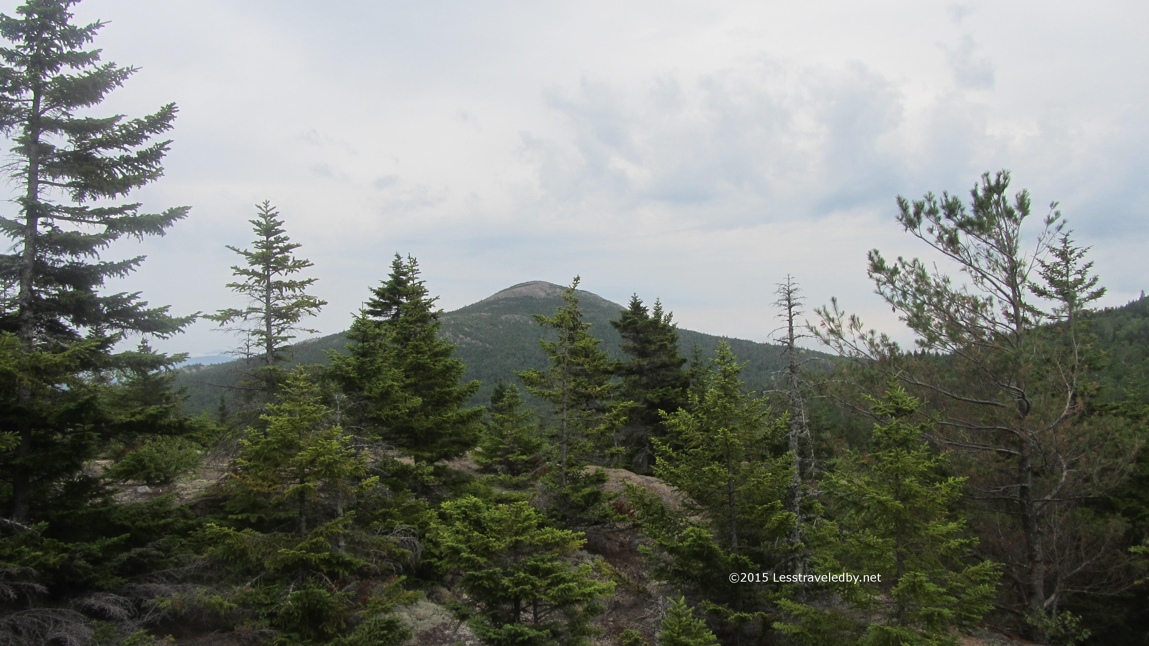
A few ridges of mossy rocks brought me to a nice ledge where I took a break and looked around. About that time the mist started up again and I noticed how slippery the lightly traveled rocks were becoming. Rather than push on to the top of the ridge I started back down just to be safe.

IMG_4796a

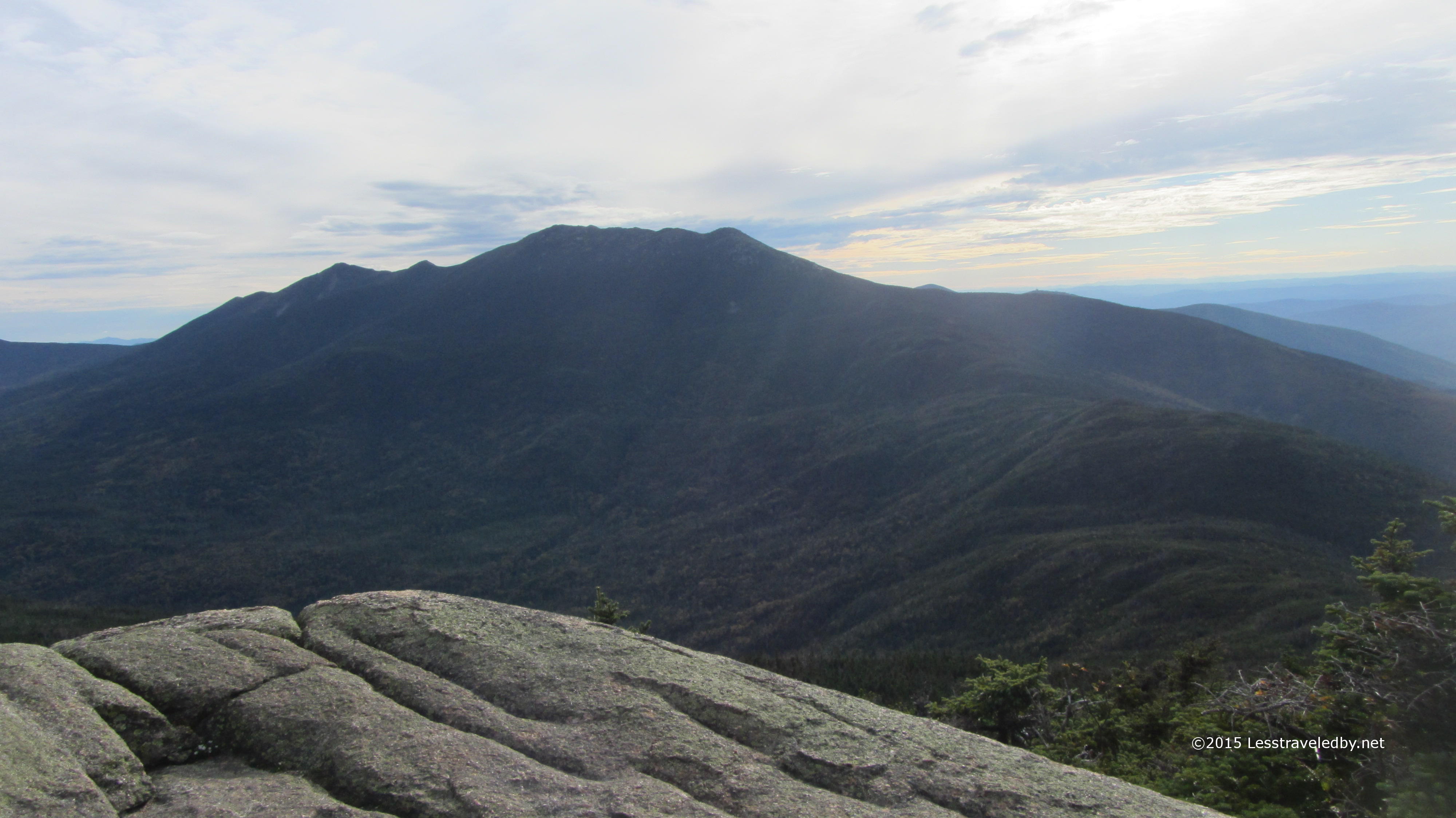
Looking back up at the ridge from a distance I could see where I’d stopped and the steep section I’d skipped. I’m thinking that this place will make a great day hike in a few years when my daughter can hike up there from the pond below.

IMG_4802a

I stopped for a nice long break at the South Branch campground.  There was plenty of time for snacking and photographing wildlife.

IMG_4803a

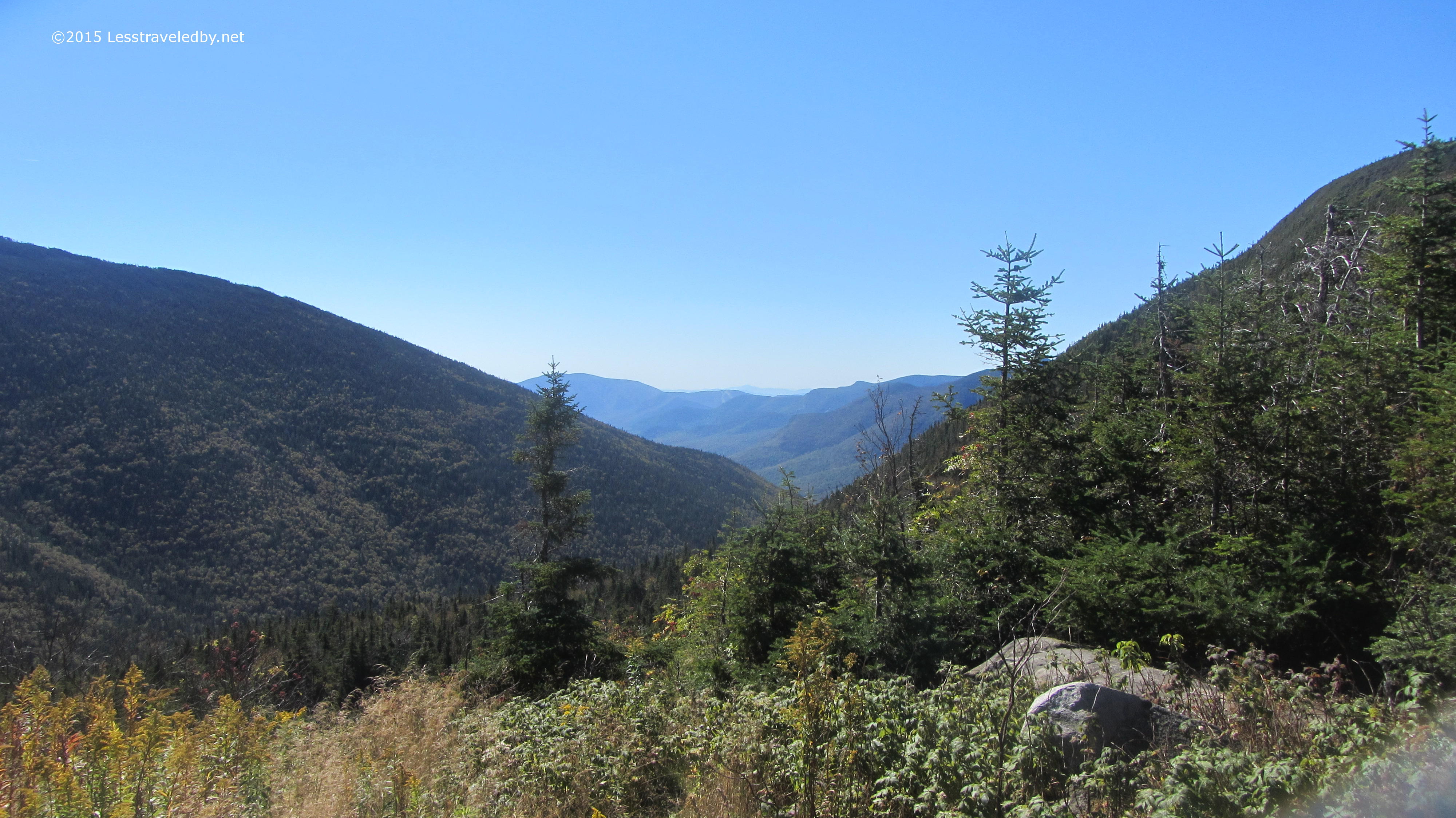
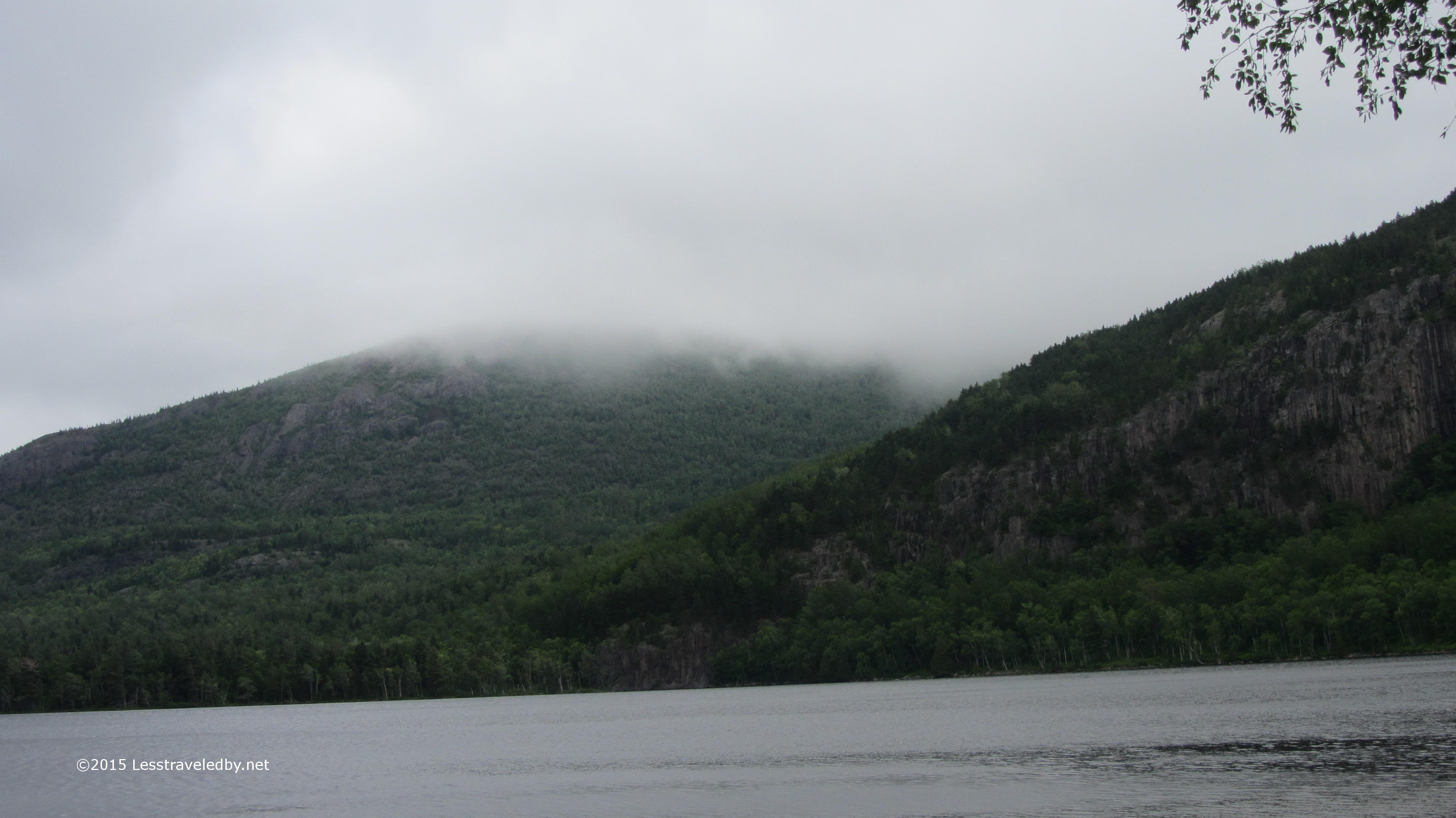
Things looked a little gloomy in the direction I was headed, but there wasn’t any sense of impending doom. Of course there rarely is heh. This is one of the last pictures I’d take for the next two days, but oh the stories I have to tell!

The mist turned to a light shower about half way through the six mile hike to Pogy Pond. Another mile on and it was a hard rain headed towards downpour. Then things got serious. The last mile and a half were done at almost a running pace through a white wall of near solid water with lightning flashing through the trees at times for added incentive.

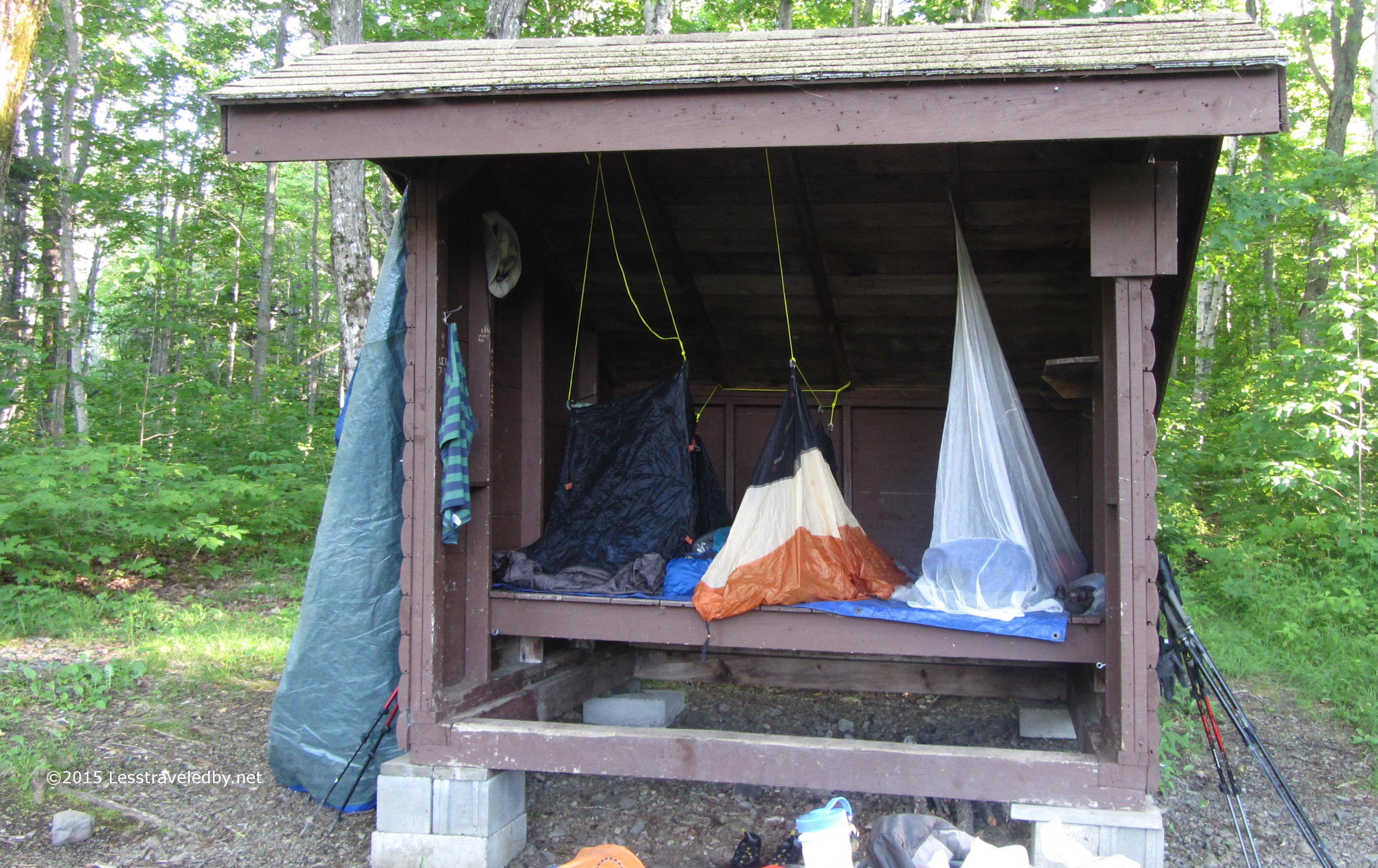
By the time I reached the LT at Pogy my boots were literally filled with water that had run down my body. Thanks to good packing and organization I was able to quickly get the wet clothes hanging from the rafters with warm, dry clothes covering my bones. The rain continued for another hour or so with great intensity. I captured a little video I’ll be sharing later, but you really have to be inside a good mountain storm to truly understand how impressive they can be. Thankfully the wasps that had been in the LT on my visit here the previous month were gone so I had the place to myself.

The next day was cloudy and while there was no rain in the morning the woods was wet from the previous day. My trail clothes were wet when I put them on and only got wetter as I walked. An hour in I hit Russell Pond and swung by the ranger station there just to say hi. They made a note of my name which was the point of my visit and I was back on trail. I took the more direct Russell Pond trail towards Roaring Brook which I don’t recall taking before. Very nice trail, easier than the Wassataquoik Stream trail I always take I think, though perhaps not as pretty.

With little elevation to deal with I made good time to Roaring Brook, signed the register at the rangers cabin there and headed out through the parking lot. It seemed strange to sign in and then leave rather than enter the park but the Katahdin Lake trailhead is a few miles of road walk along the narrow park access road. If you’re doing this walk keep your ears open for traffic and be ready to jump off the road as many folks ignore the speed limit on their way in to the park it seems.

The trail follows old logging roads and is quite easily navigated. I was nearing the end of a roughly 16 mile day but making good time until the light mist rapidly turned to another downpour. Again I arrived at camp totally soaked with boots full of water.  The LT at South Katahdin Lake was huge so I soon had wet things spread out all over and dry fleece all over myself. Mother Nature was throwing everything she had at me this trip but other than some very wrinkly feet I was holding up pretty well.

IMG_4809a

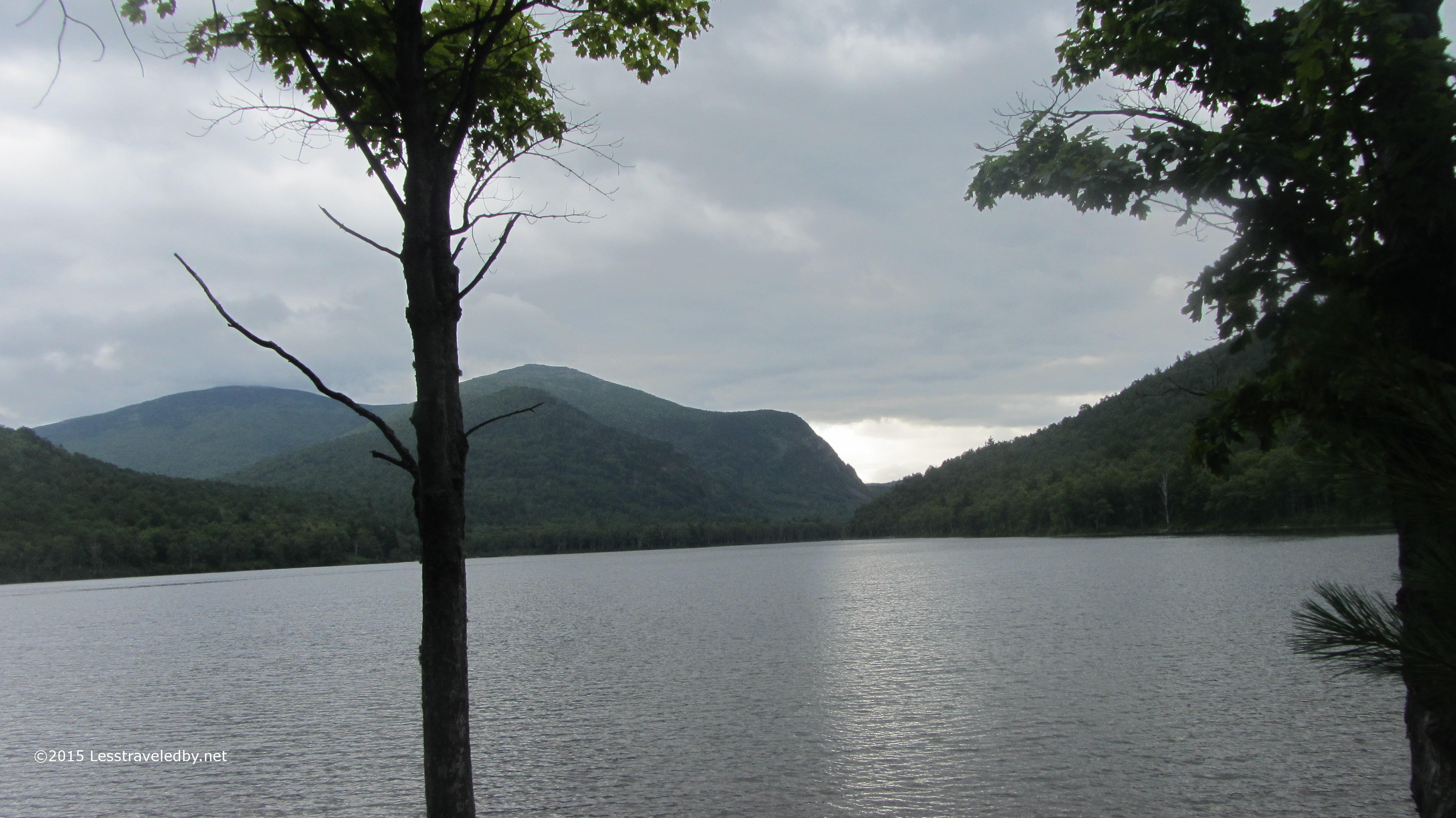
The rain let up enough for me to finally unwrap my camera. Here is my luxurious abode at Katahdin Lake. This site is super easy to access, about three miles of easy trail and is right on the lake. Lots of day hikers and proximity to the camp next door seem to keep this place underused it seems.

IMG_4810a
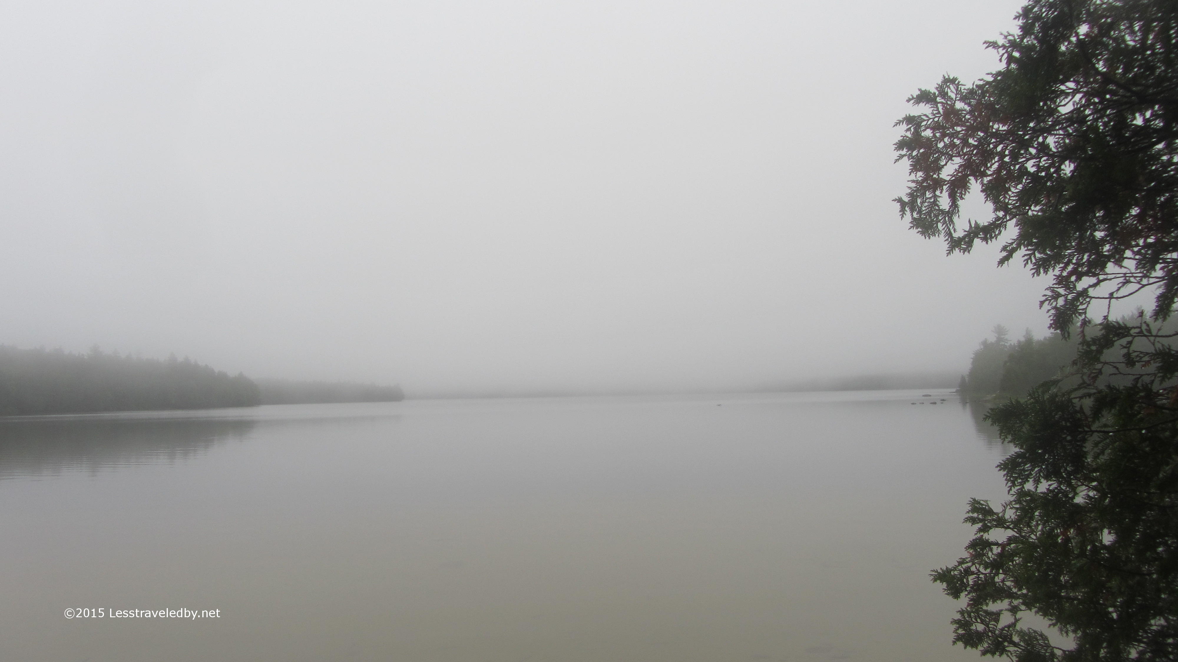
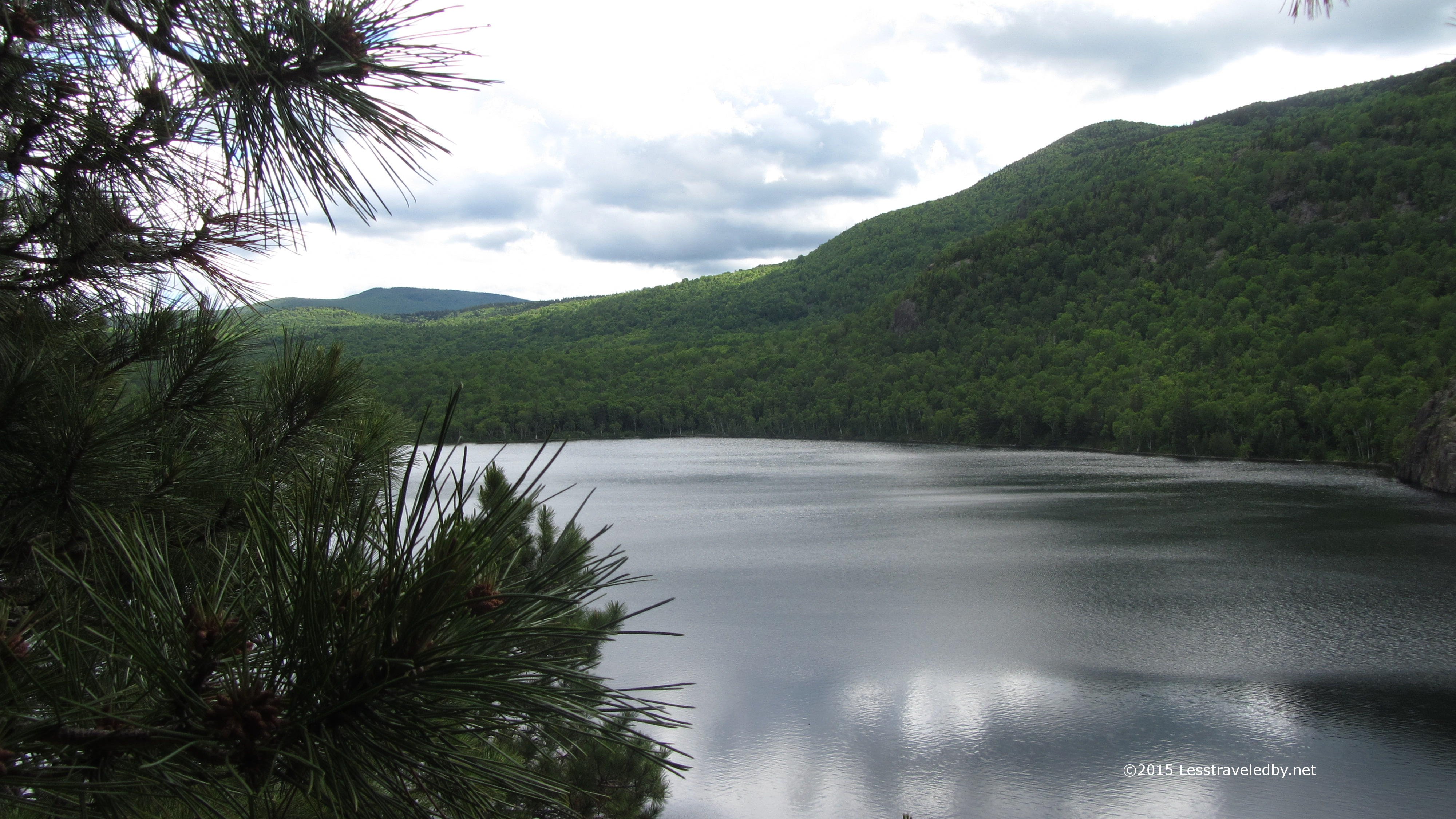
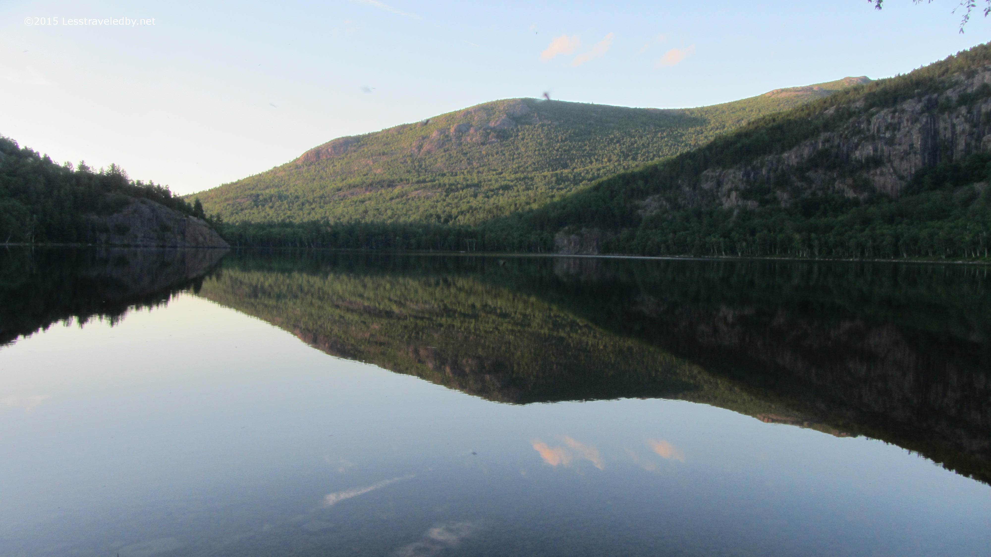
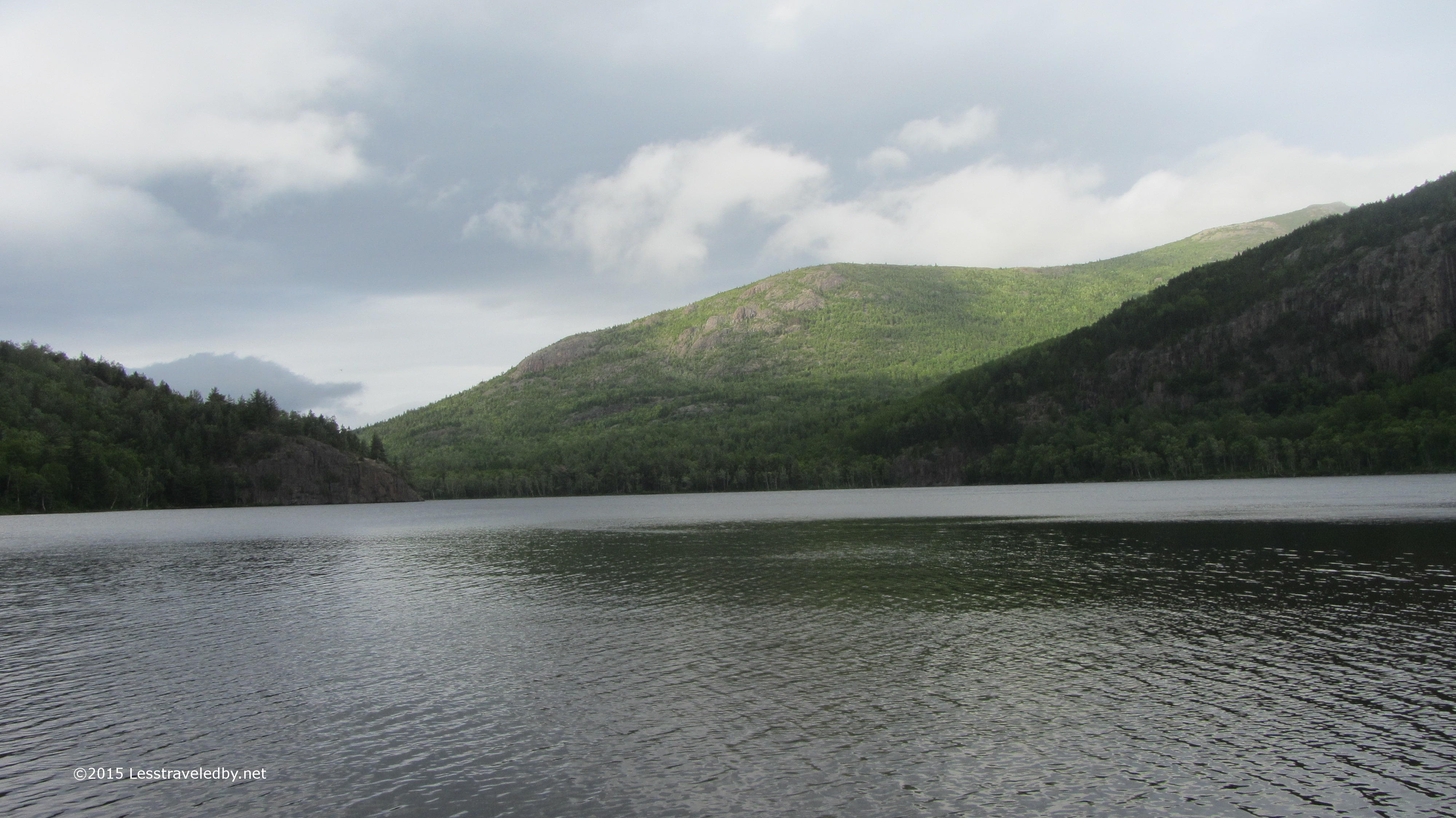
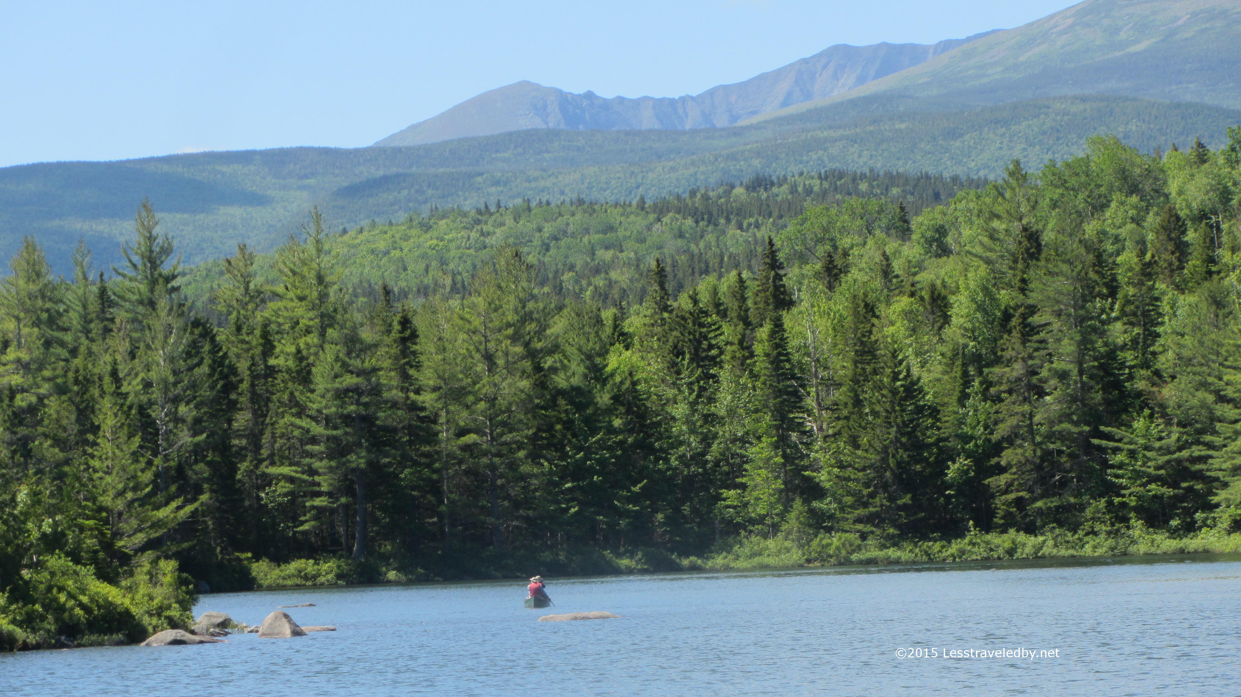
The lake was shrouded in mist so it was hard to get a sense of how big it really is. I know from the map it is a lot larger than what I could see.

IMG_4811a
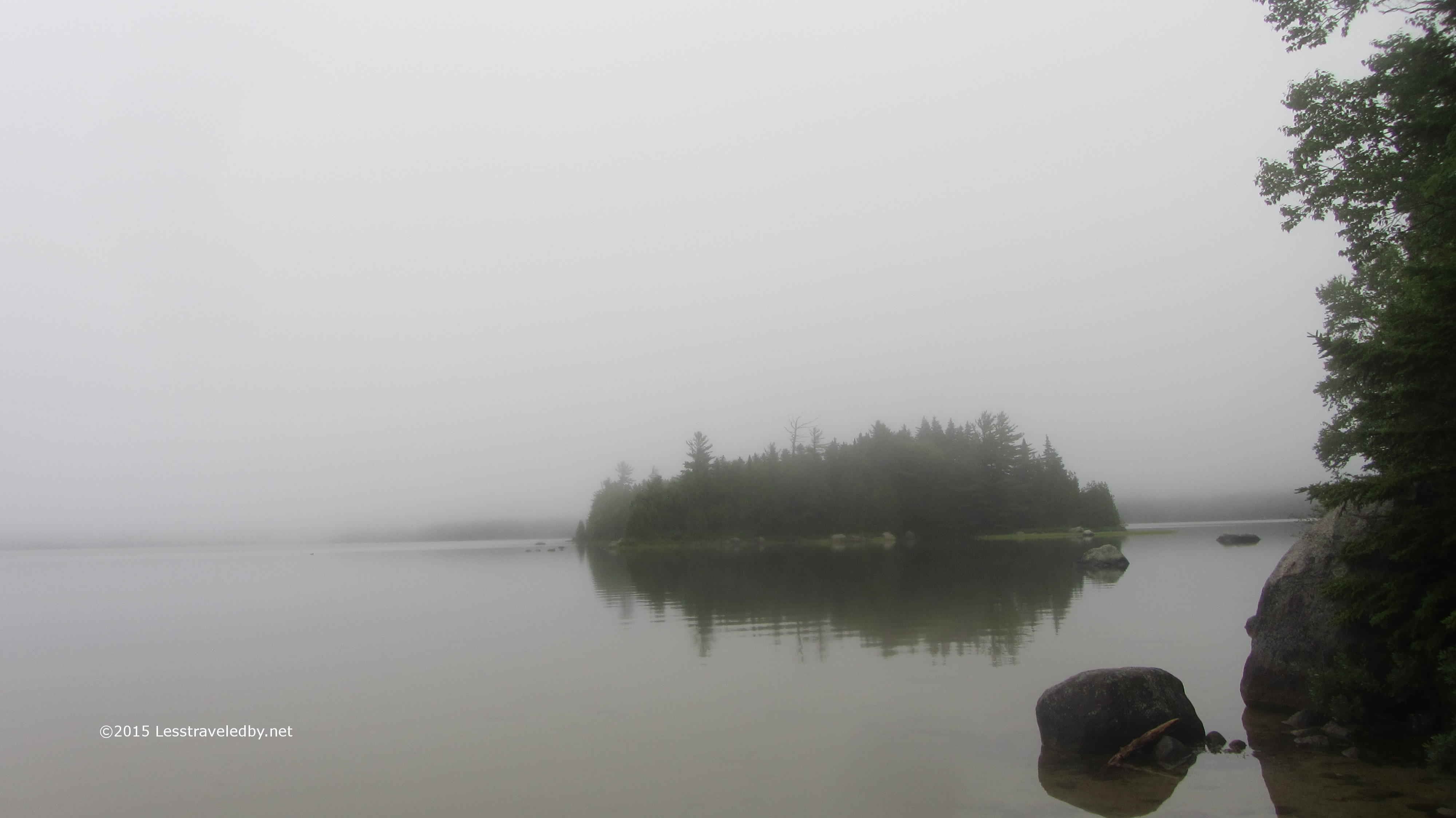
The sky seemed to melt right into the water and after two days of rain it seemed that everything, including me, was all wrapped up in one big cloud of moisture. Some parts were less wet than others, but nothing could truly claim to be dry at this point.

IMG_4812a
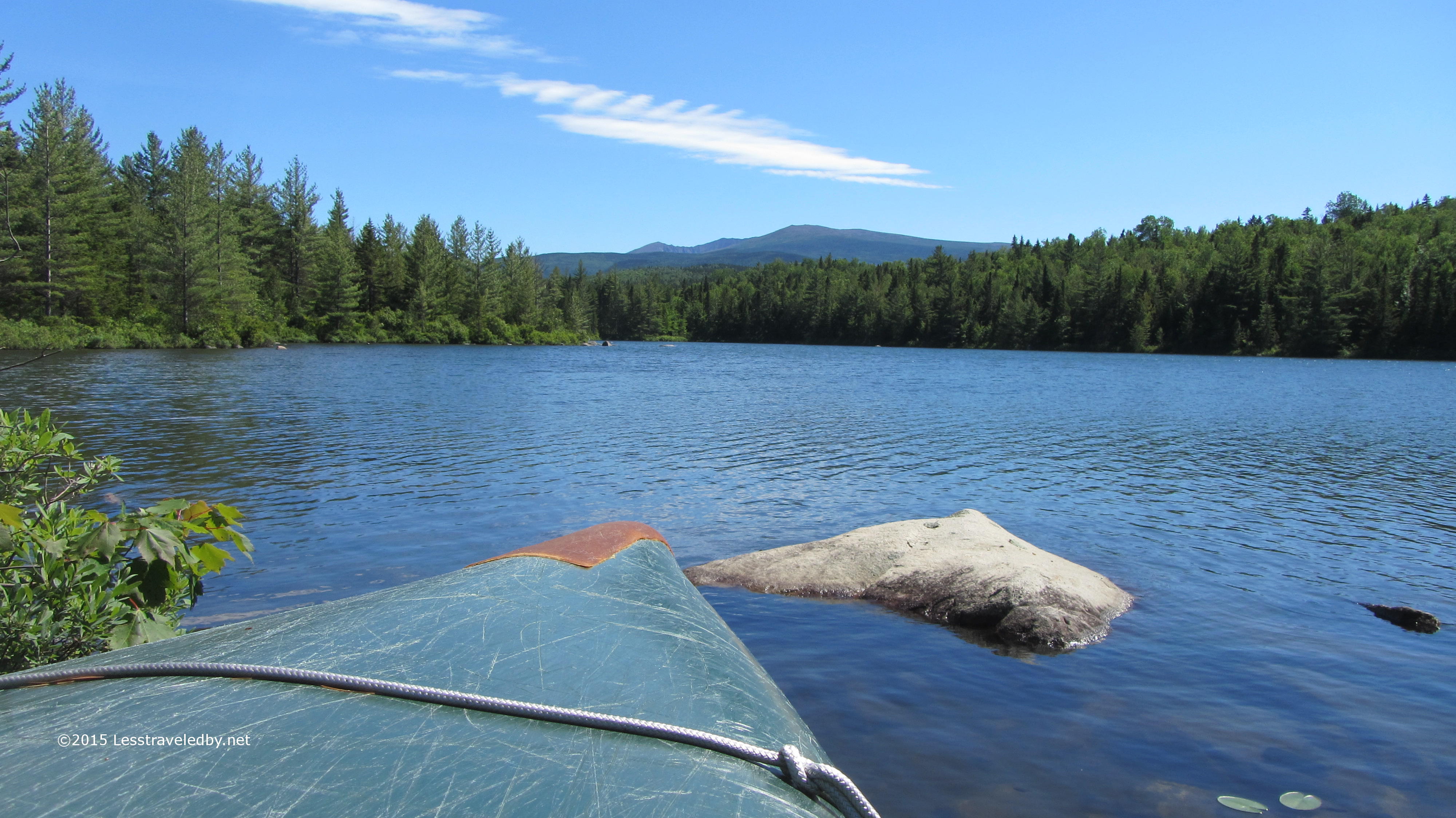
With a canoe right there in camp this looks like a place to come do some exploring on the water. Might make a nice family trip next year if I can convince my daughter to stay in the canoe for more than twenty minutes at a time.

IMG_4813a

This is your standard trail sign documentation picture until you notice that tree in the background. Guessing there might have been a bit of wind gusting off the lake to snap that trunk like that. Neat to see after the fact but probably a bit scary to listen to in the dark.

IMG_4815a
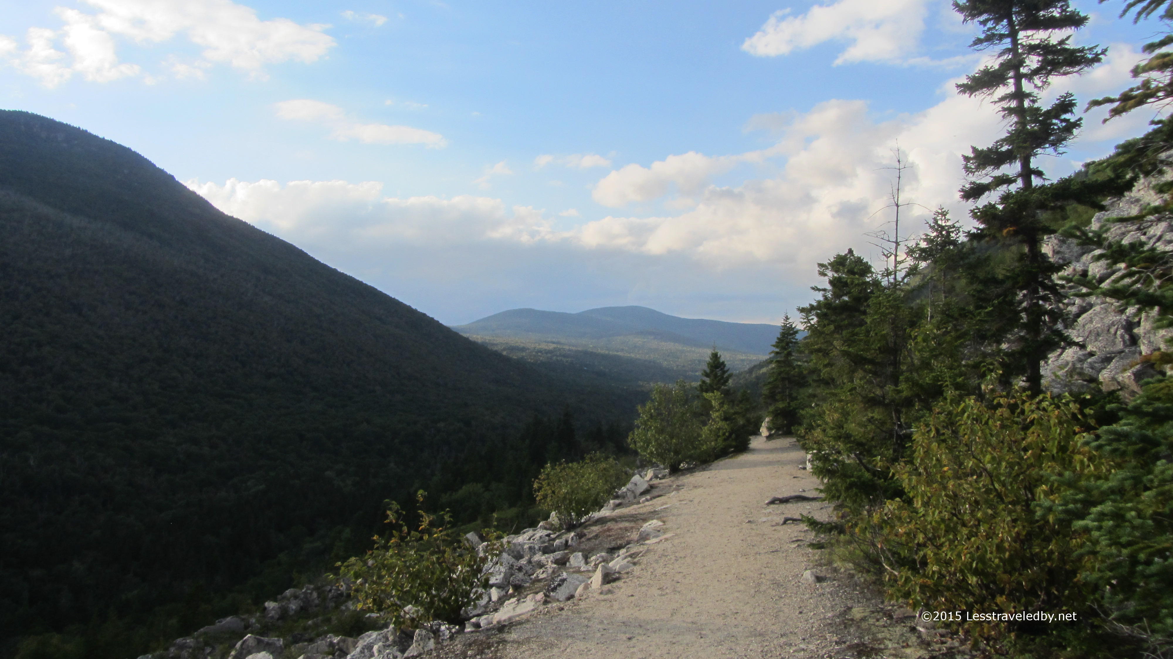
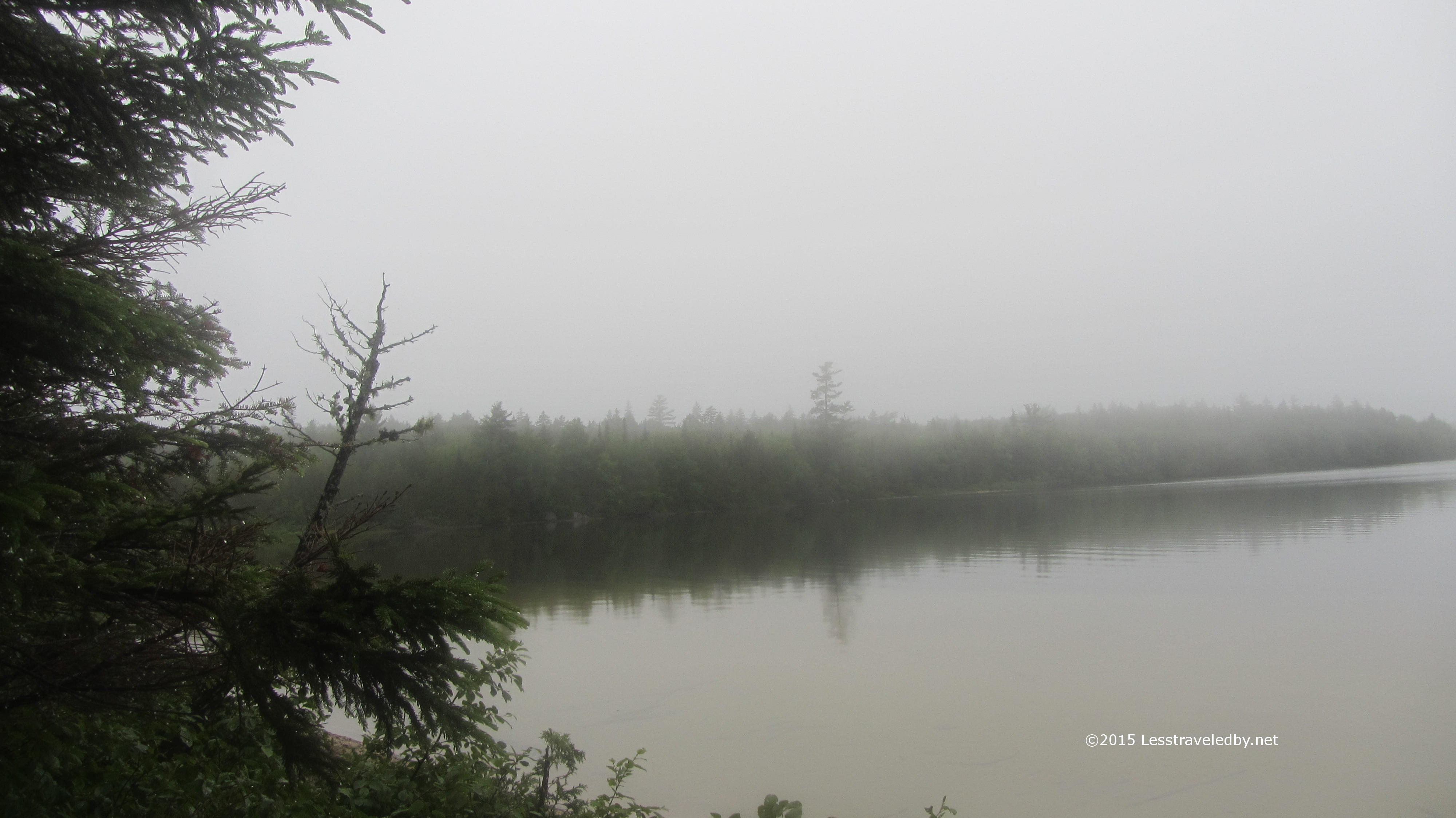
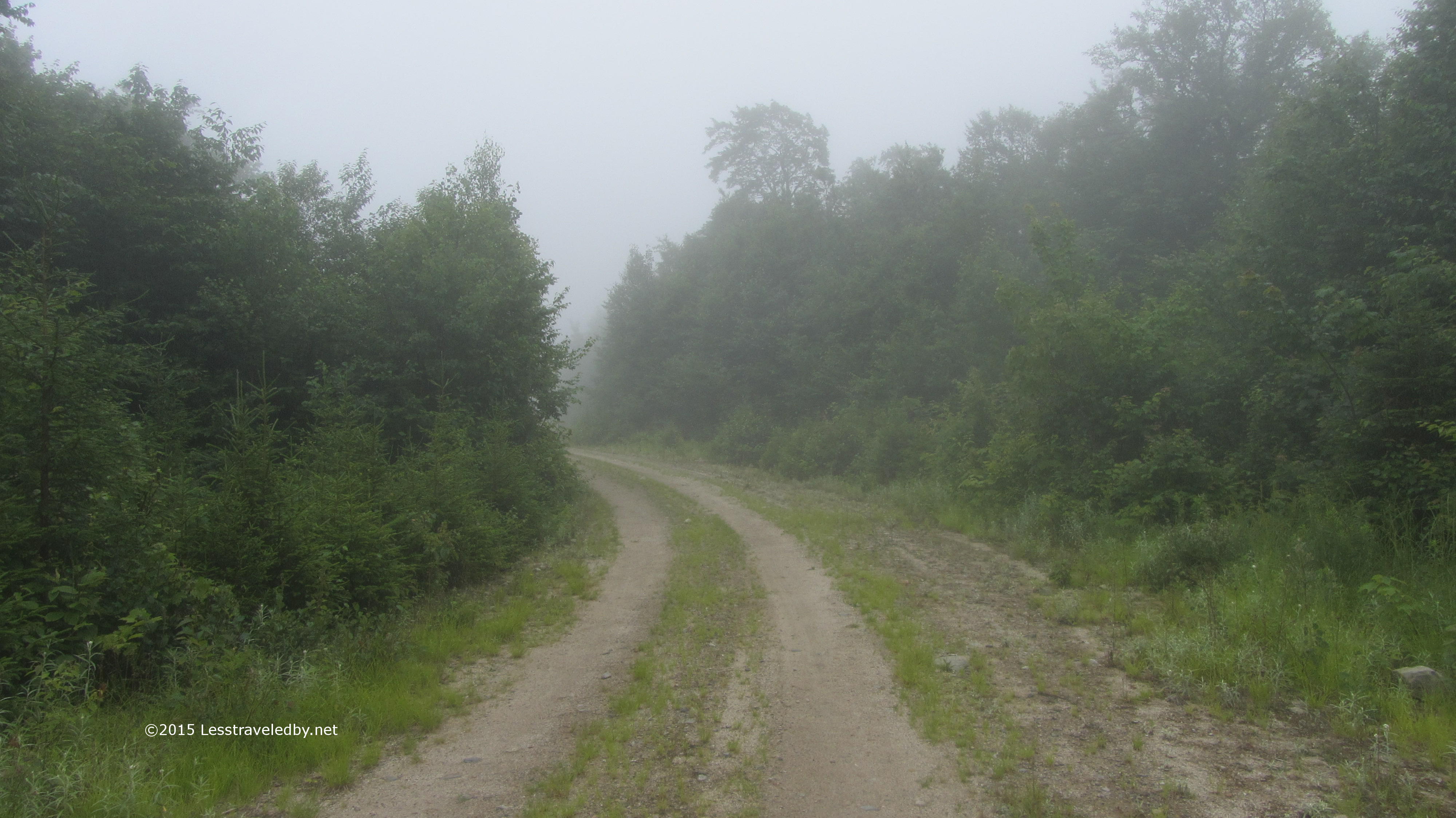
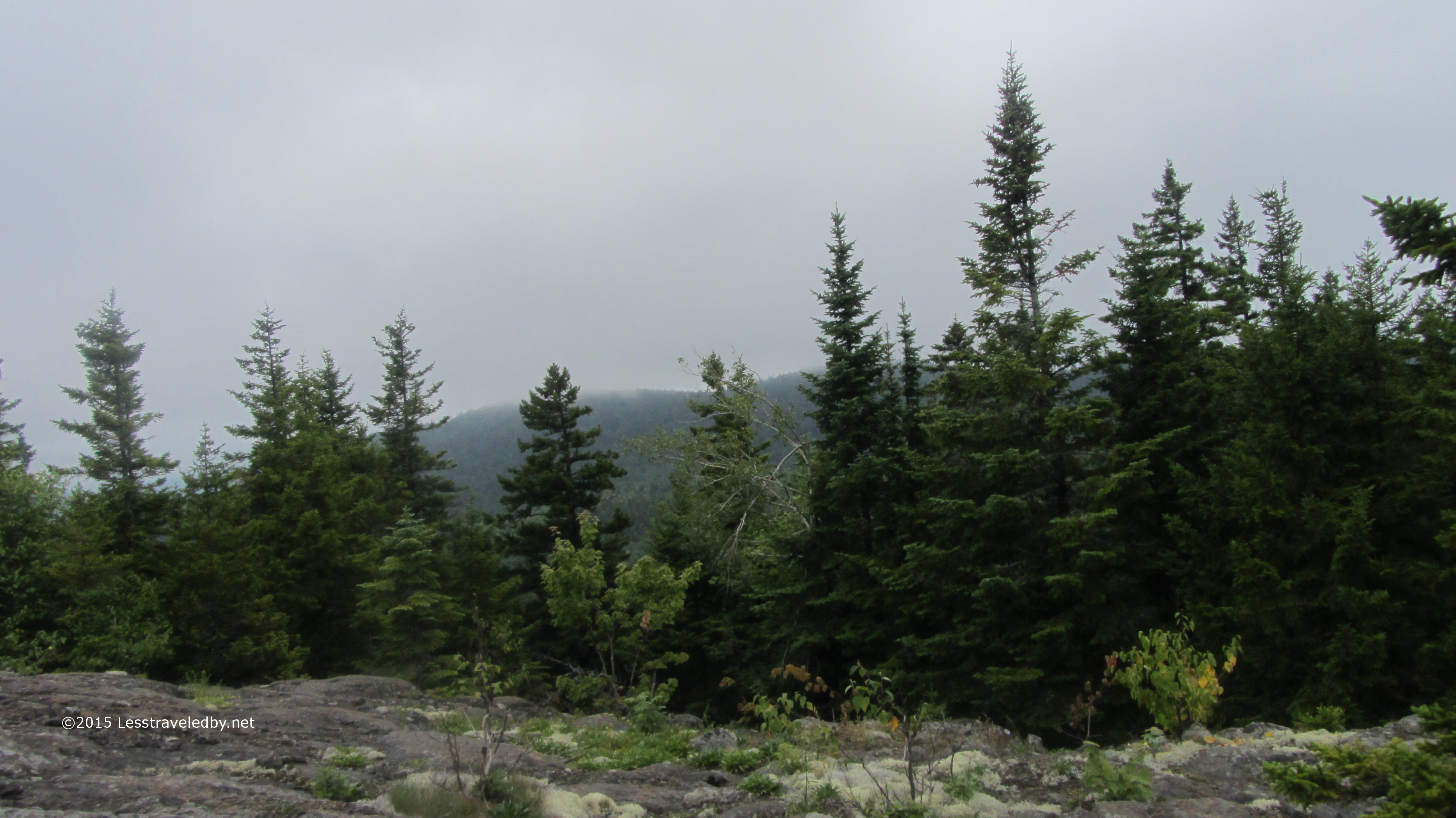
Day four again started without rain, but also without sun. The clouds seemed to reach all the way to the ground and everything was still dripping. Reaching the border between Baxter State Park and the start of the International Appalachian Trail I found an old logging road disappearing into the fog.

IMG_4817a

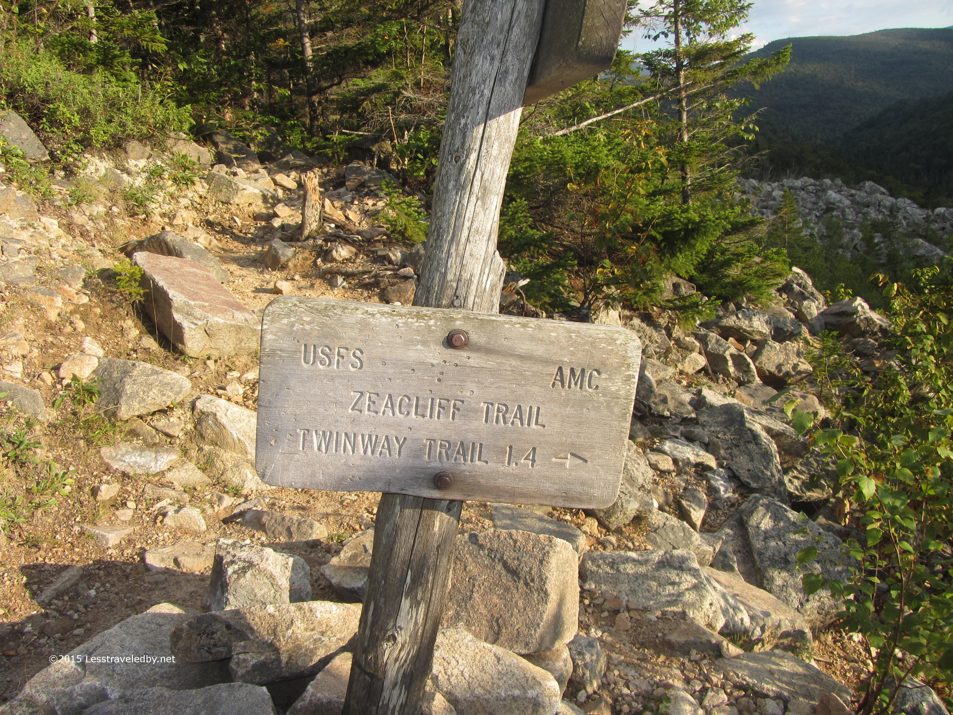
The mileage sign laid out my itinerary pretty well, listing the shelters I’d sleep at, the highest mountain and finally, thirty miles on, the road where I’d finish my week long hike. I remember now thinking with a grin that it would be easier to go forward than to go back so there was no need to worry about failure any longer.

IMG_4819a

This section of road was pretty open, but there were other areas where the berry bushes have reclaimed most of it. Between the thick fog and the heavy brush I found myself instinctively breaking into song to warn the bears I was coming. The number and size of the bear scat piles was a clear reminder that this was their turf.

IMG_4823aThe first LT on the IAT seemed functional, but without much character. There was a small stream nearby for a water source and it was peaceful enough, but with another shelter a few miles farther on it doesn’t seem to get much use. About this time the showers started up again.

IMG_4826a

Much like my previous deer picture this one will require some sharp eyes. If you peer through the fog you may see a doe peering back at you. We studied one another like this for a while before I edged too close and she darted off into the mist.

IMG_4827aThankfully I only got wet rather than soaked. When I got to the Wassataquoik Stream IAT shelter it was filled with gear much to my surprise. A crew of trail workers soon arrived and informed me they’d been camped there for a week, but were just about to move off. Me and the zebra were just getting settled in for the night when a couple of IAT hikers arrived. Gen and Emmanuel were from Quebec and planning on heading all the way to the Canadian border. Considering they were on their first night out and I’d been hiking in the rain for three days at this point I thought they were pretty brave to share the shelter with me.

IMG_4830a

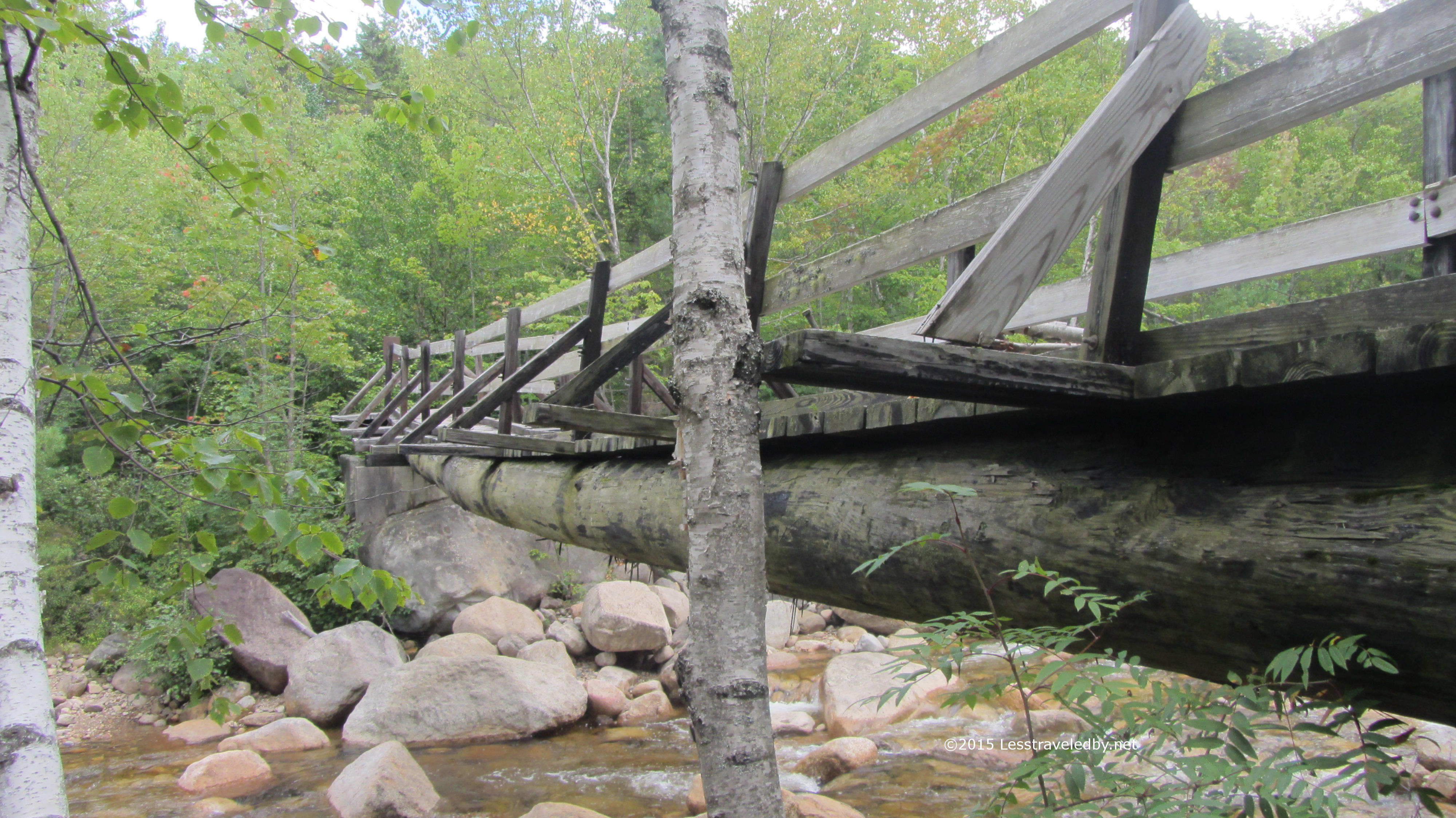
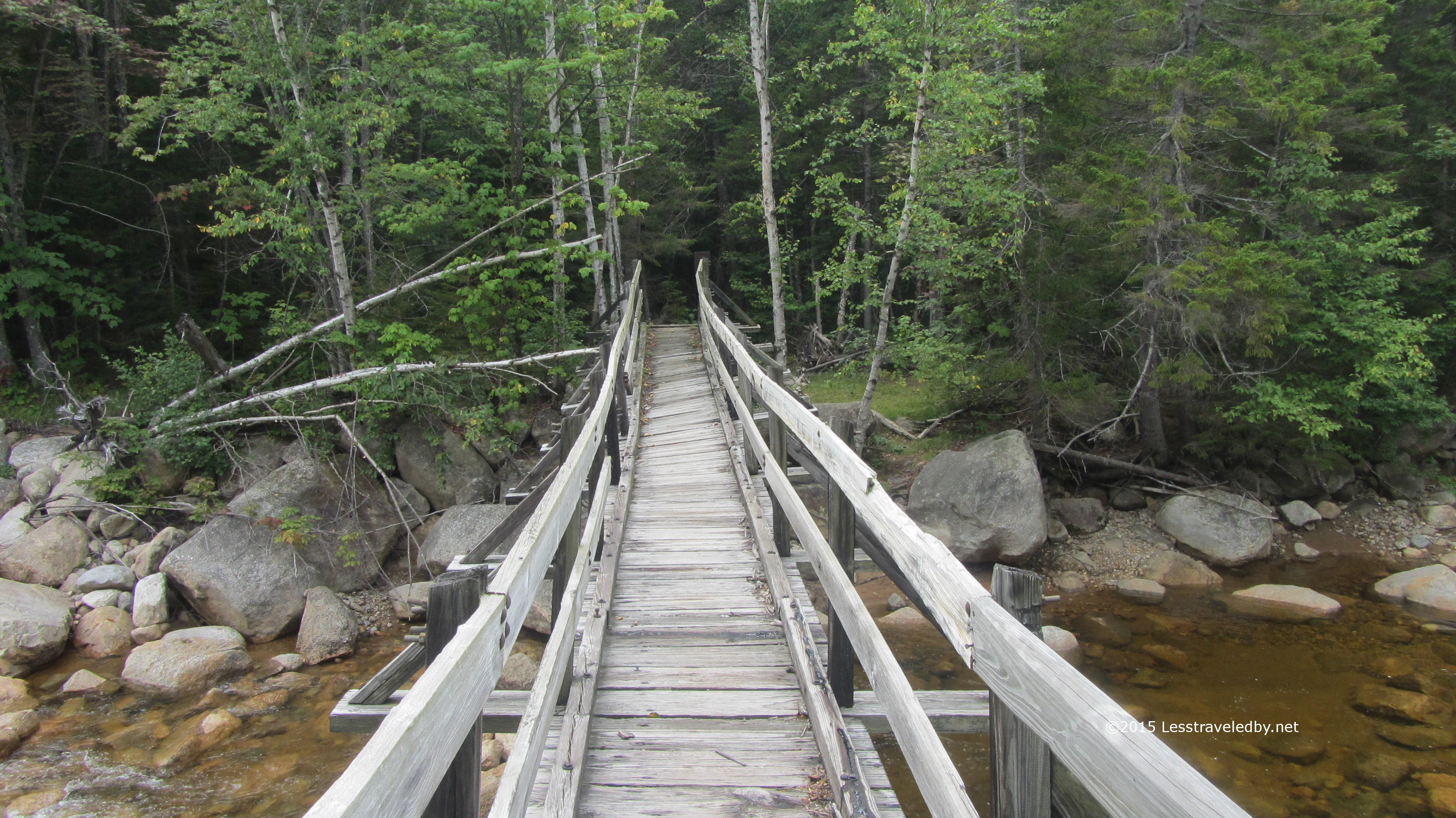
The next day we set out together and did the big stream crossing to start our day. If you look closely you can spot him putting his shoes back on while she looks back over the ford we’d just completed.

IMG_4832a

Just in case you were thinking you didn’t have to cross this stream they made it pretty clear. There is a high water route that adds about eight miles of hiking if you really want to skip this crossing, but it was only a bit above knee deep on this trip so not a big deal.

IMG_4835aJust before the Deasey Mountain climb begins in earnest the trail passes the remains of the old lookout cabin. They are slowly dismantling this and seem to be crowdsourcing the removal labor. There is a box of construction debris bags and a sign explaining that volunteers can hike out a bag of debris to help out. The goal is to completely restore the site eventually.

From this spot to the top of Deasey is listed as .8 mile, but it is a rough, up hill section that was slippery in spots. My reward on reaching the top was to be totally socked in. That is why there are no summit pics from Deasey.

IMG_4840a

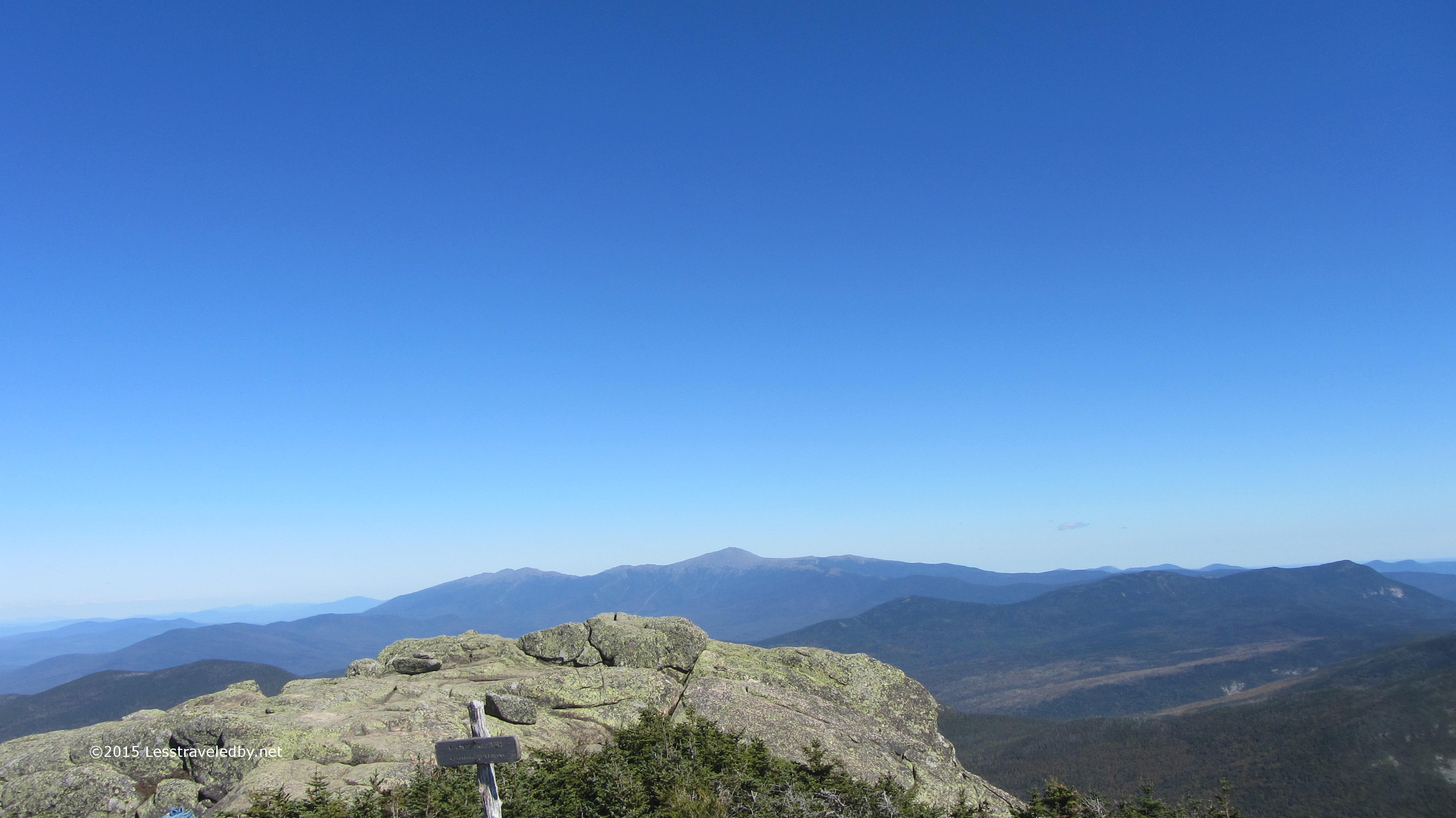
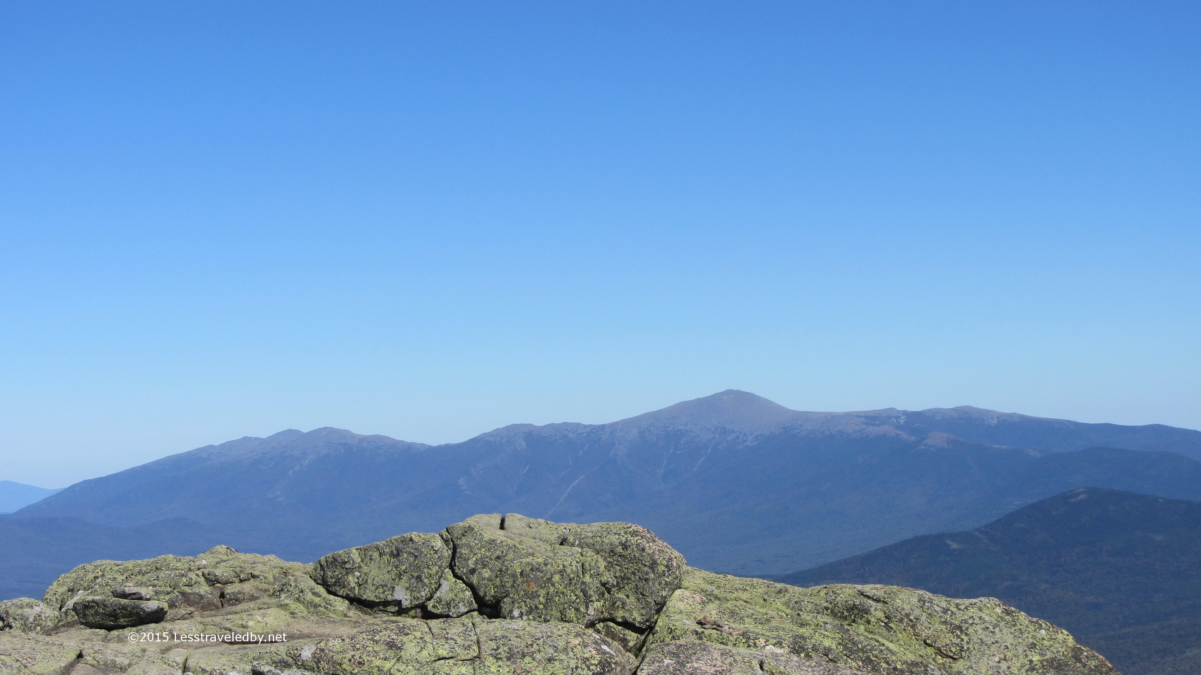
After descending into way too deep of a col and slabbing my way up to the top of Lunksoos I was at least allowed a few minutes with the clouds above me before they settled back down stealing the views.

IMG_4842aI just barely had time to snap this zebra shot before a gust of wind nearly tossed him off the top of the mountain. I headed on down to the Lunksoos shelter to see if my Canadian friends were there, but they had apparently headed farther on.

IMG_4851a

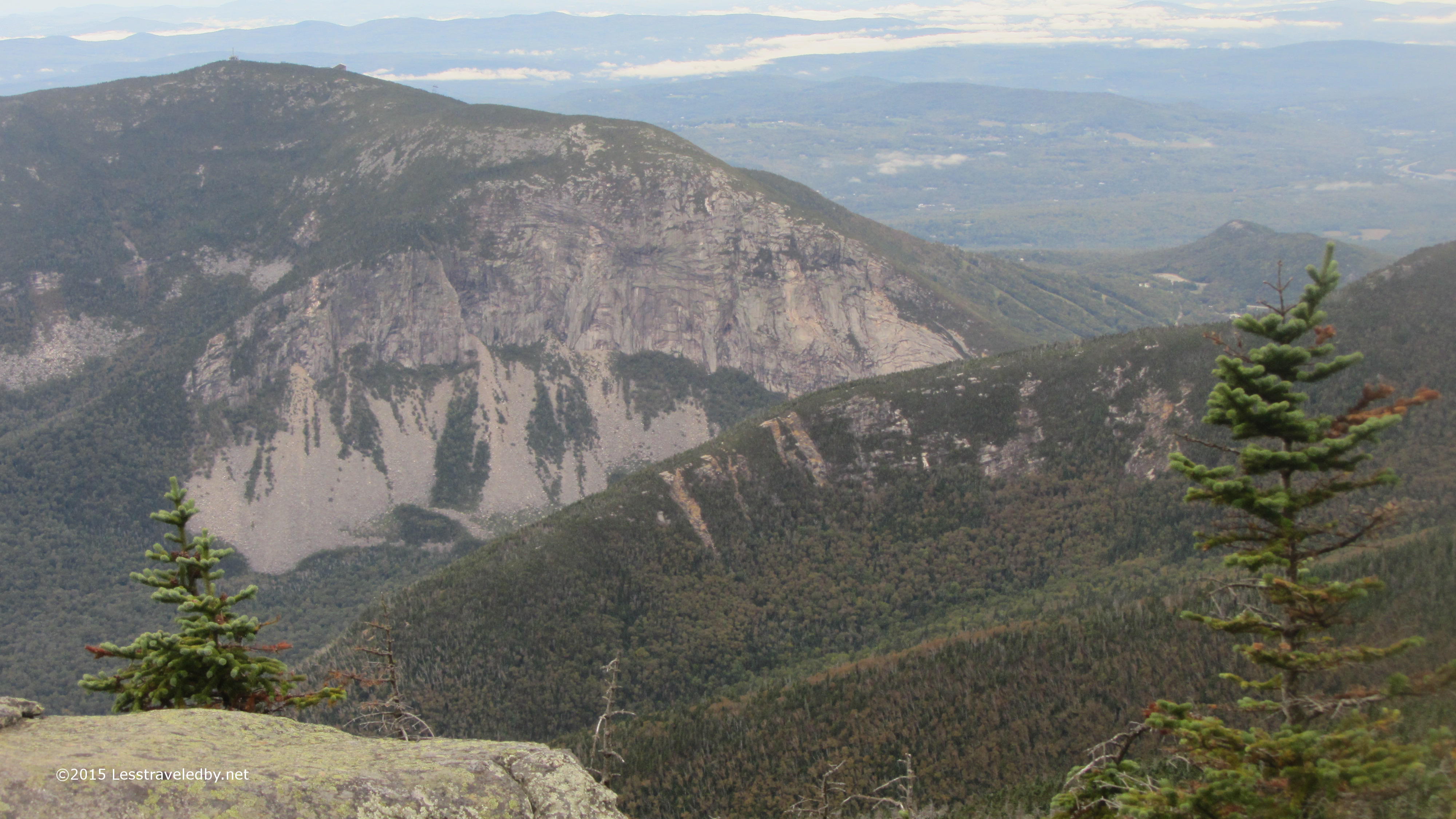
A pity as they missed some wonderful views the next morning. The folks who built the Lunksoos LT seem to have tossed LNT ethics beside and chopped down some trees to open up the view of Katahdin in the distance. Since the damage was already done I figured I may as well enjoy it.

IMG_4852aAfter three days of hiking in the rain I was thinking today might finally be the day to break out my dry socks. With luck I might keep my feet from falling off over the 17 or so miles I had left.

IMG_4856a
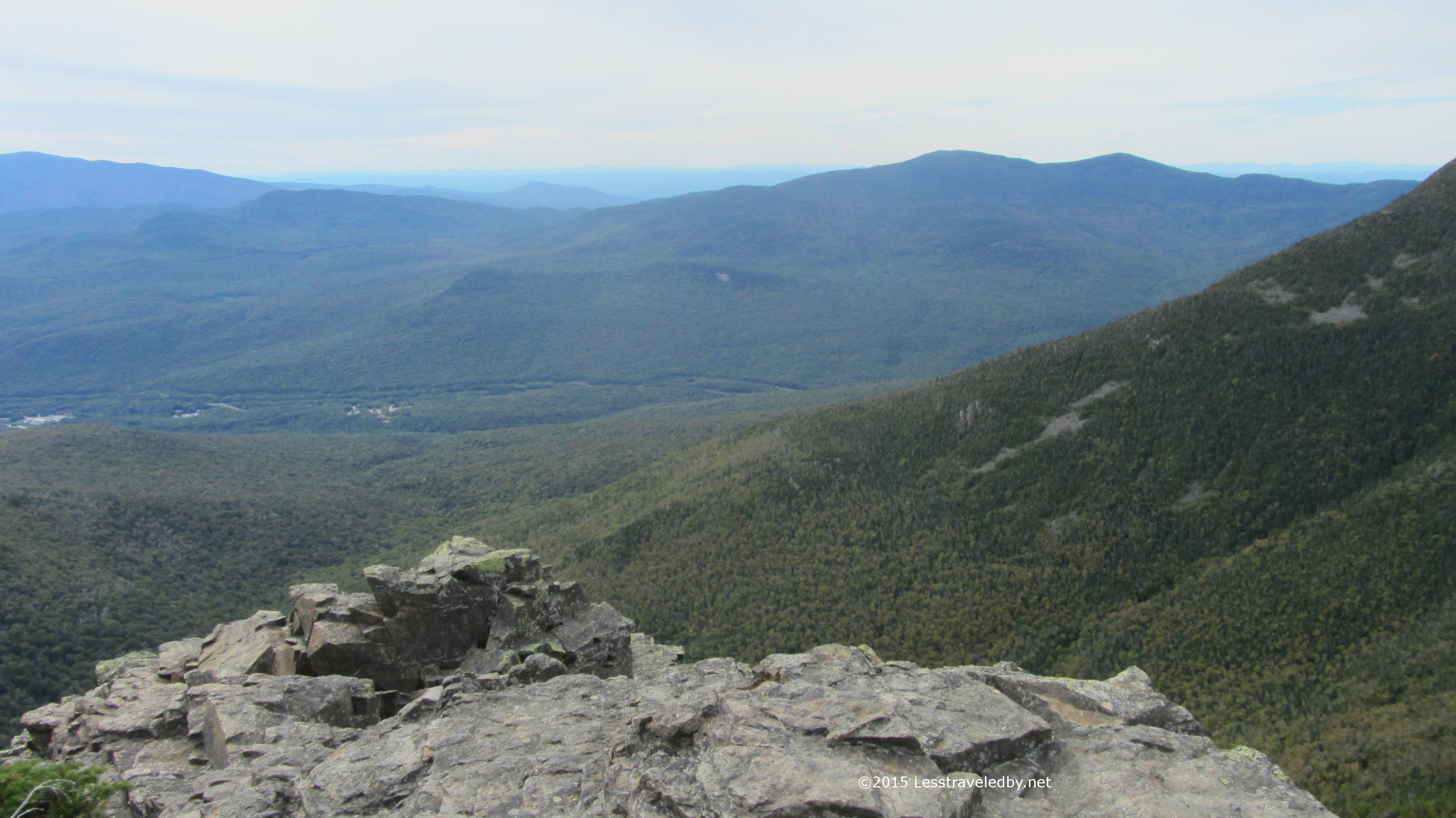
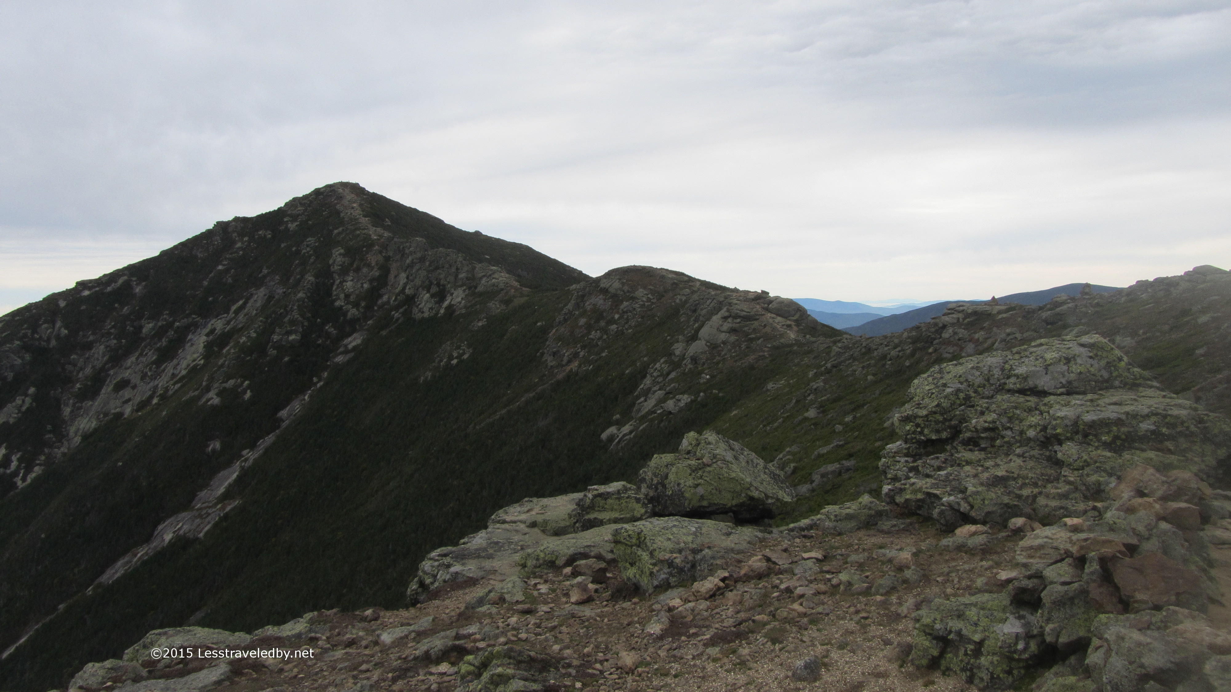
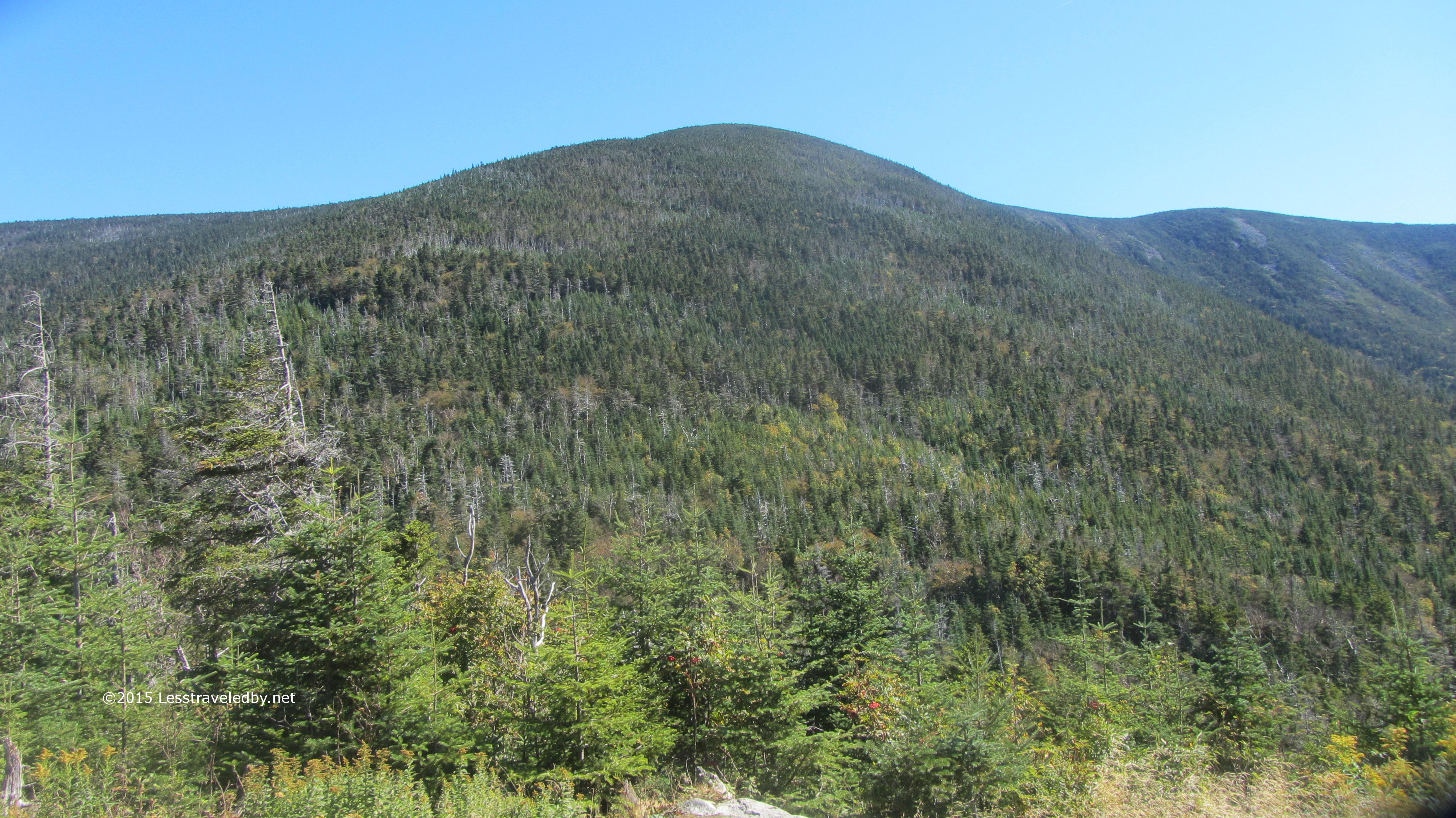
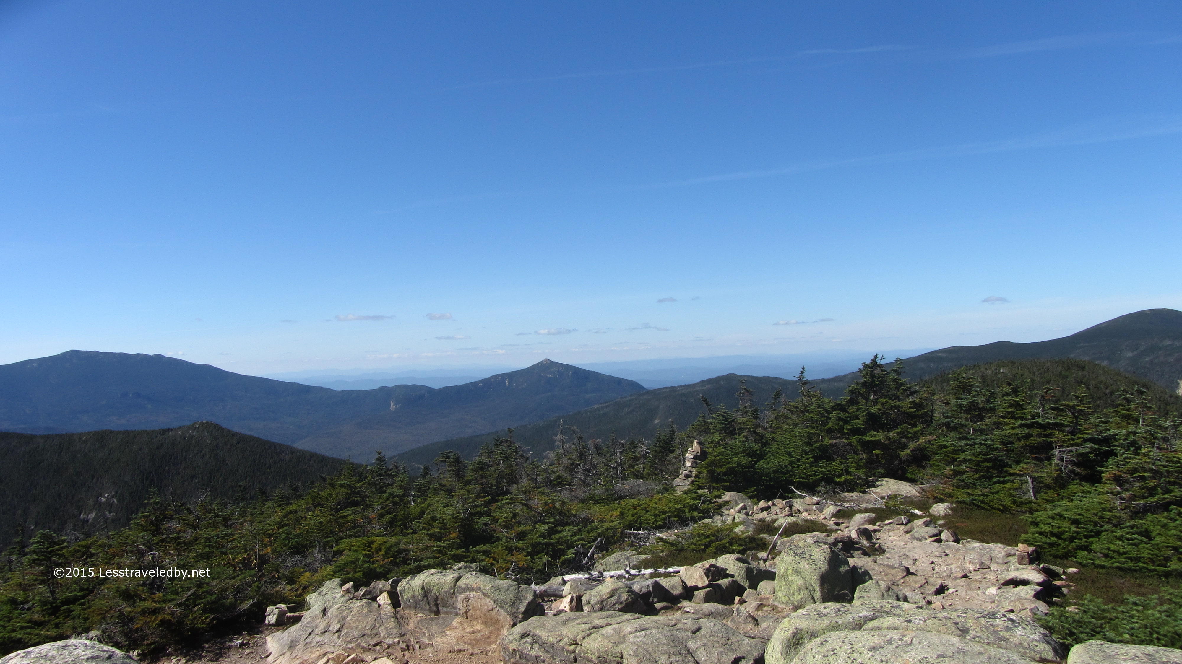
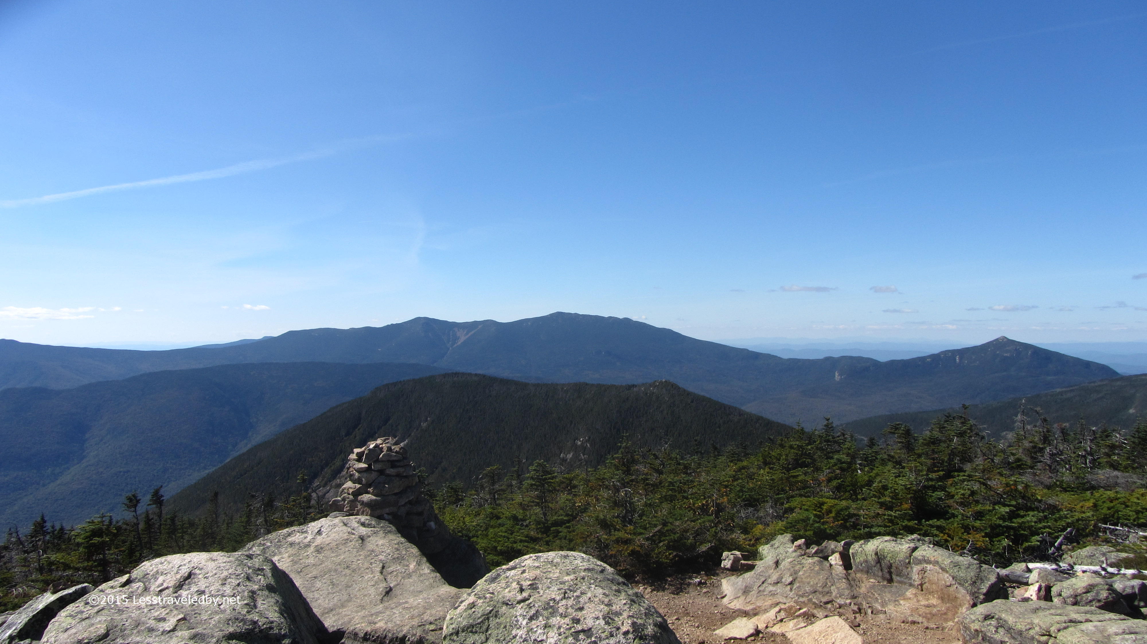
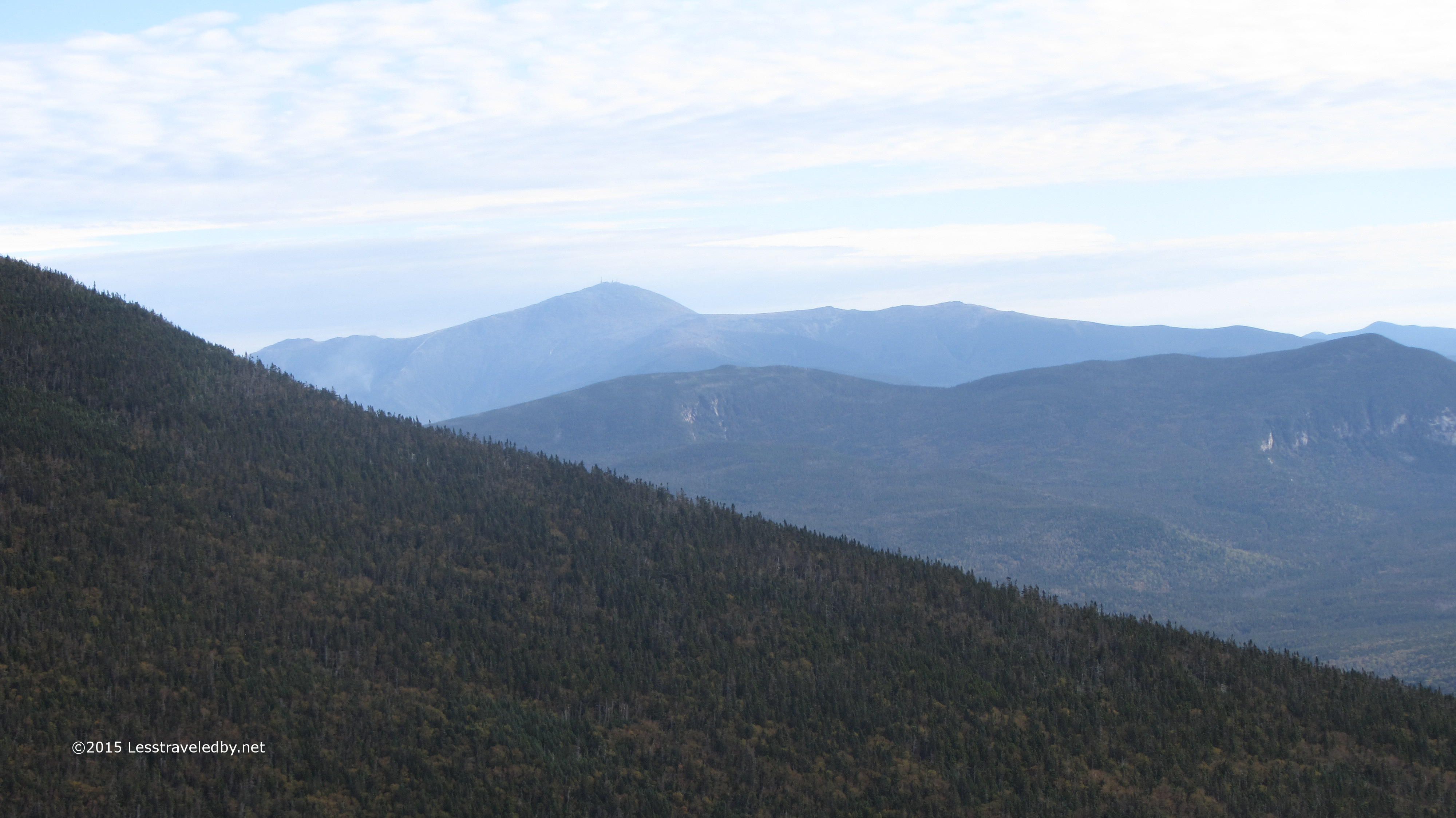
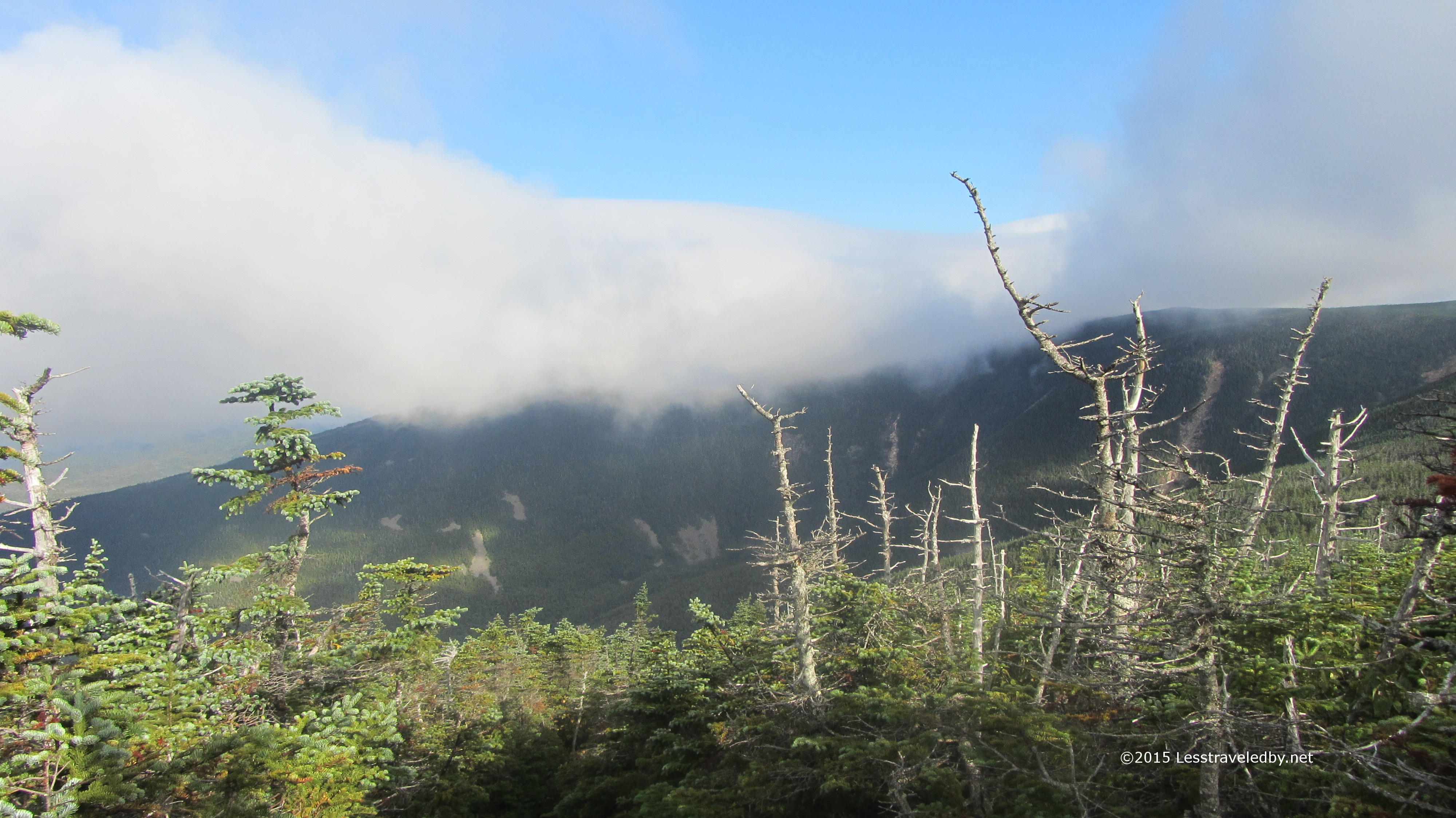
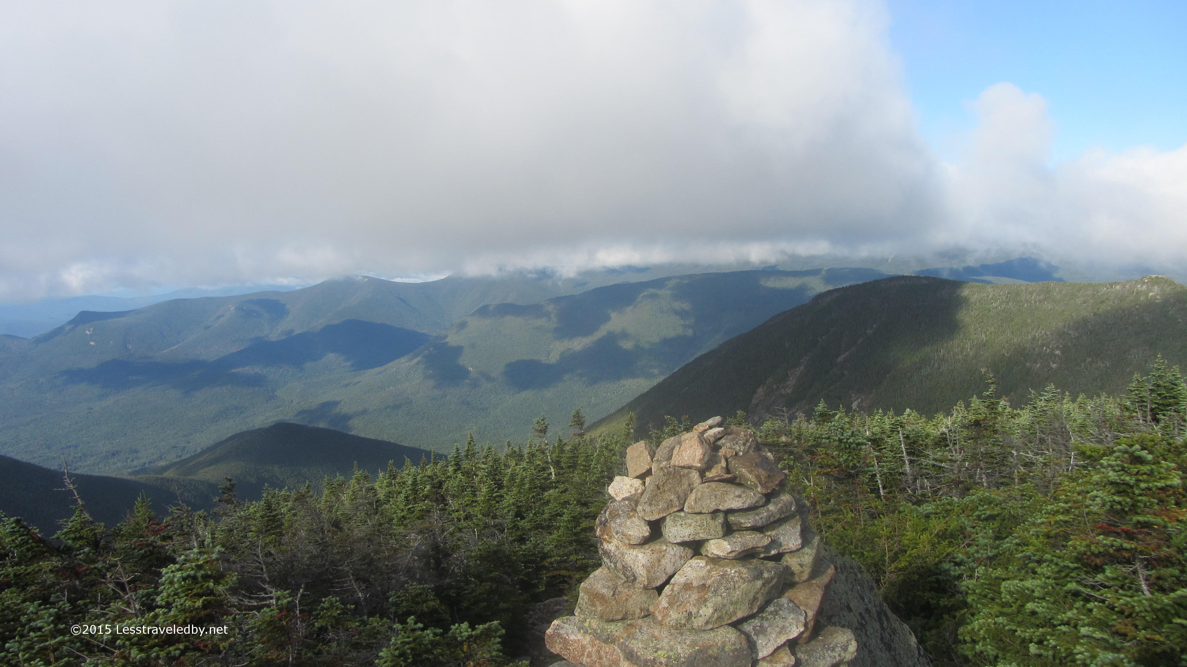
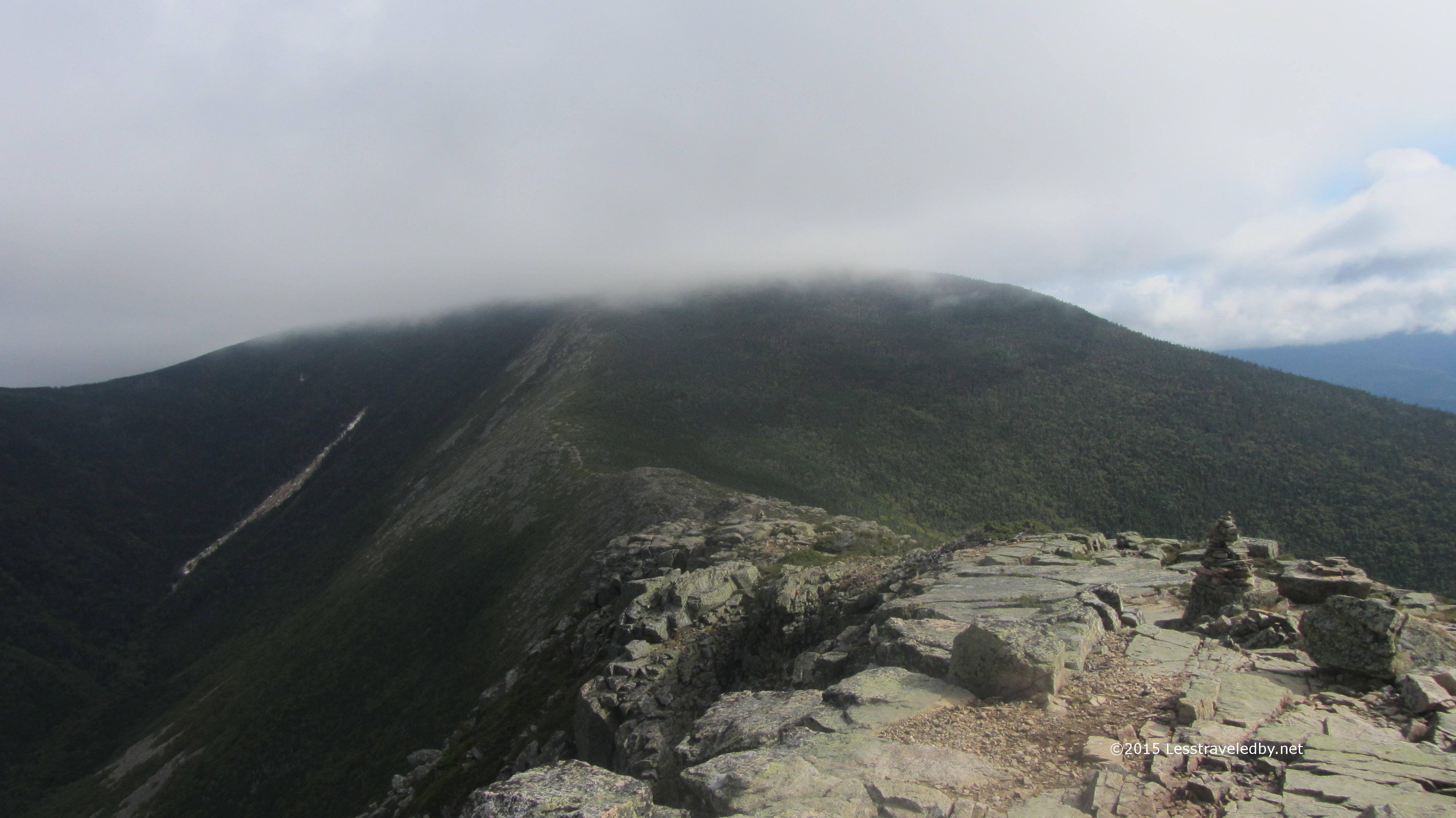
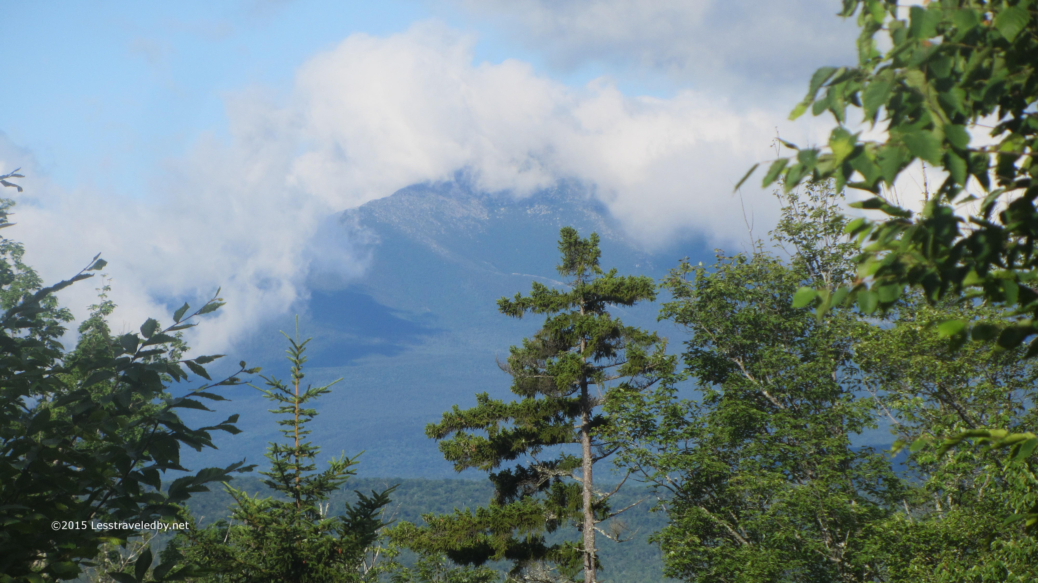
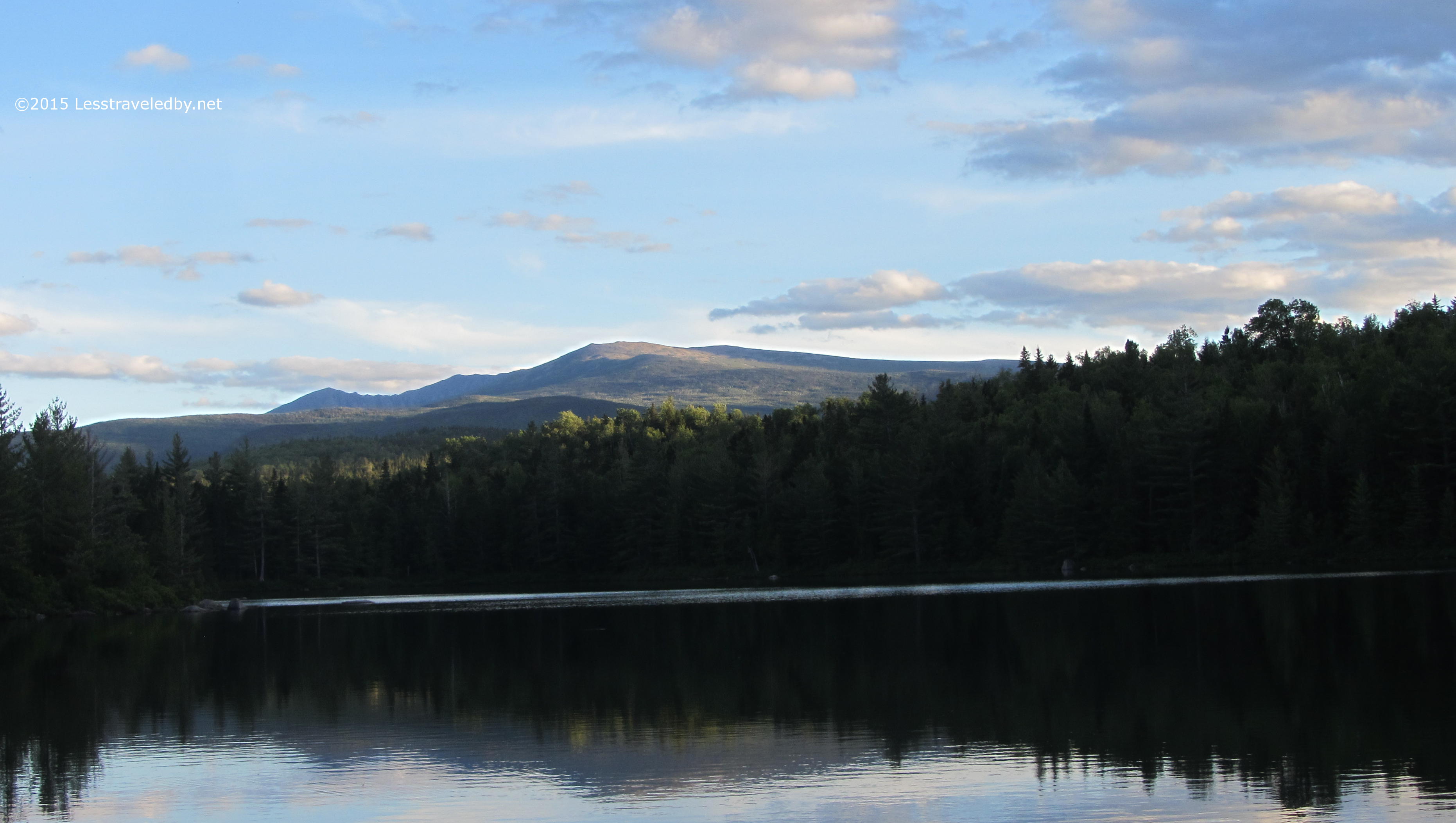
The mountain looked like an exciting place to be that day with clouds coming and going rapidly. I was headed the other direction so enjoyed it while I could and then hiked into the forest again.

IMG_4858a
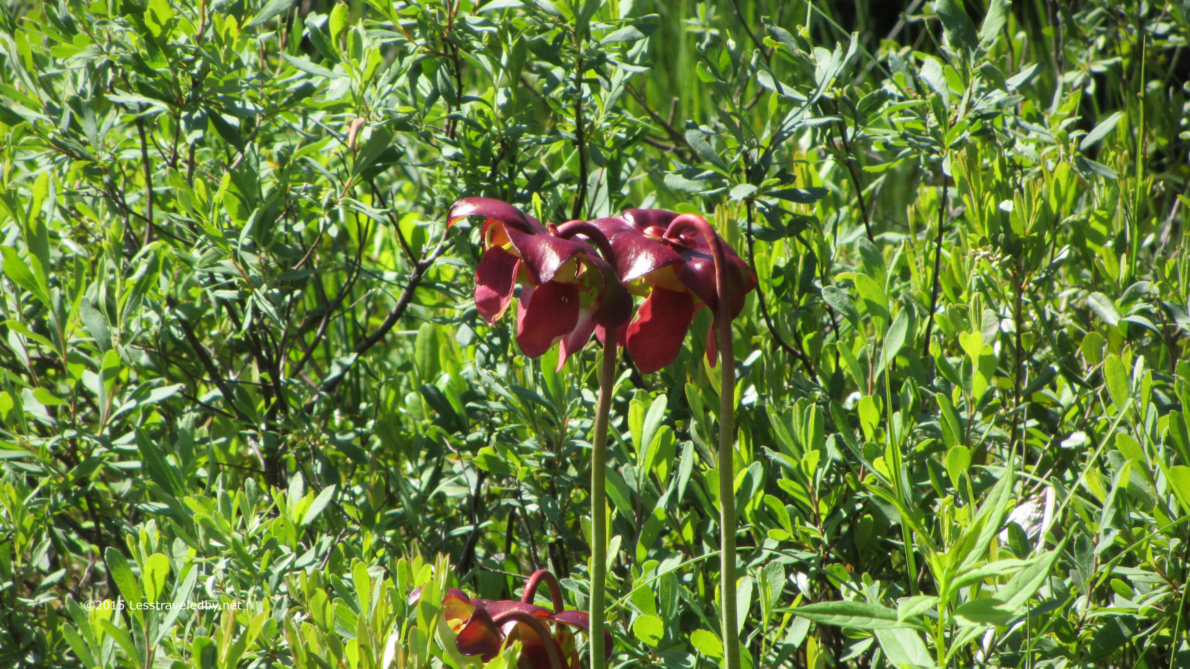
Of course the sun soon changed to clouds and I was getting rained on a bit, but these flowers kept my spirits up. Later I had my first ever bear sighting right on the trail. What looked to be a yearling was foraging until he noticed me approaching. Before I could even think of pulling out my camera he was bounding off away from me. Thankfully flowers can’t run!

IMG_4859a

This is the bridge across the East Branch of the Penobscot that leads to Bowlin Camps. I had a nice chat with the caretakers there and will be devoting a post to my visit with them in the future.

IMG_4869a

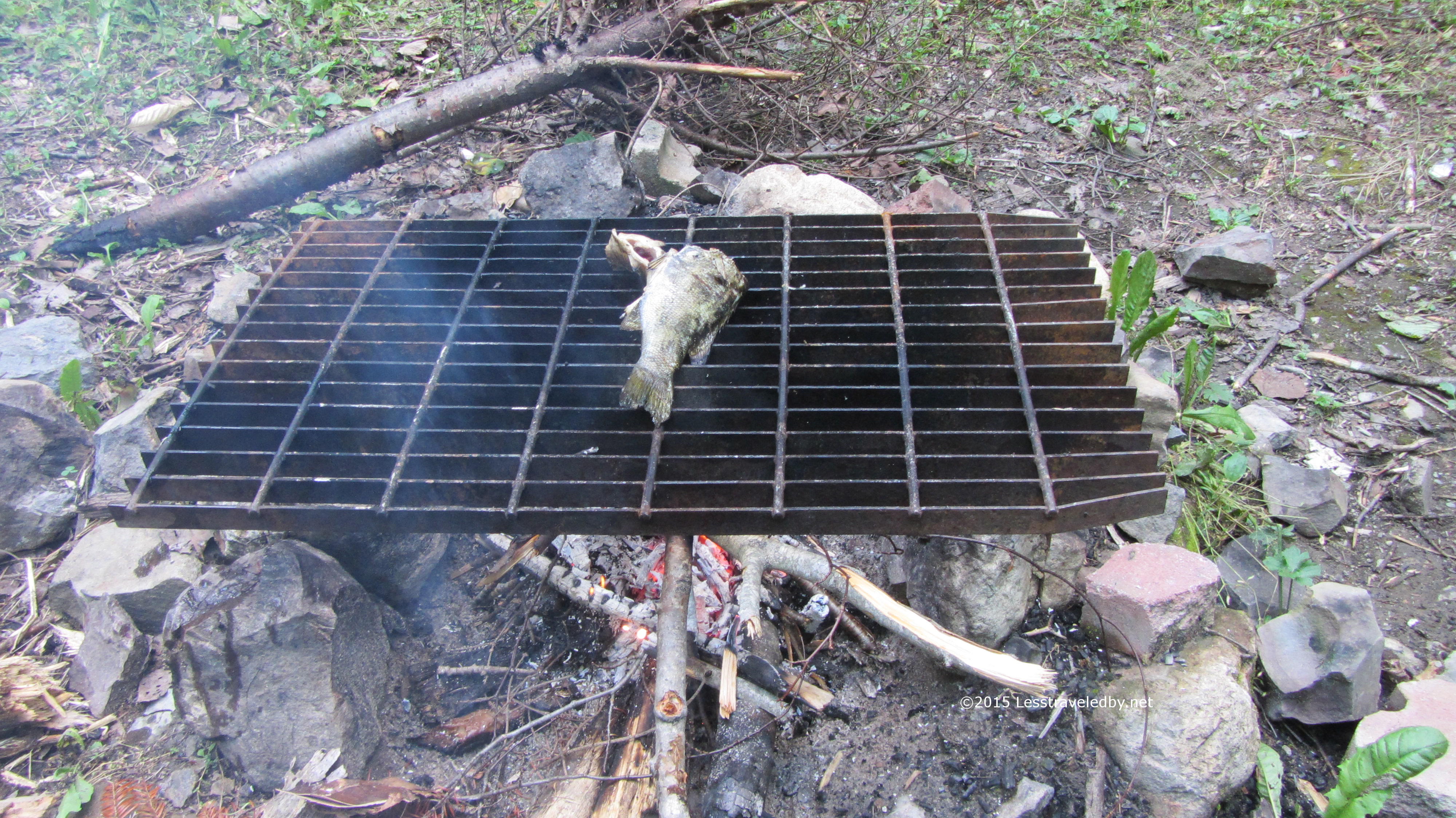
After setting up camp at the Grand Pitch shelter I took advantage of the opportunity to break out my fishing pole. I didn’t feel like fighting my way down to the pool right under the falls and settled for this one a bit farther below.

IMG_4871aMy efforts were amply rewarded with this good sized trout. One of his smaller cousins swallowed a hook and had to join him for dinner, but this one would have been a meal in itself.

IMG_4873aOf course after four days of rain making a fire was a bit of a challenge. Being in a well used campsite didn’t help as the easily foraged kindling had already been gleaned. Thankfully my fire skills were up to par and despite wet wood and gusting winds I managed to get a cooking fire started. I’ll admit there was a moment when it was getting darker and I was starting to wonder if I could make trout soup in my kettle.

The fish were fantastic! I’m sure six days on the trail whetted my appetite, but fresh trout with a little garlic and dill roasted over a fire is darn fine eating any day of the week.

IMG_4876a

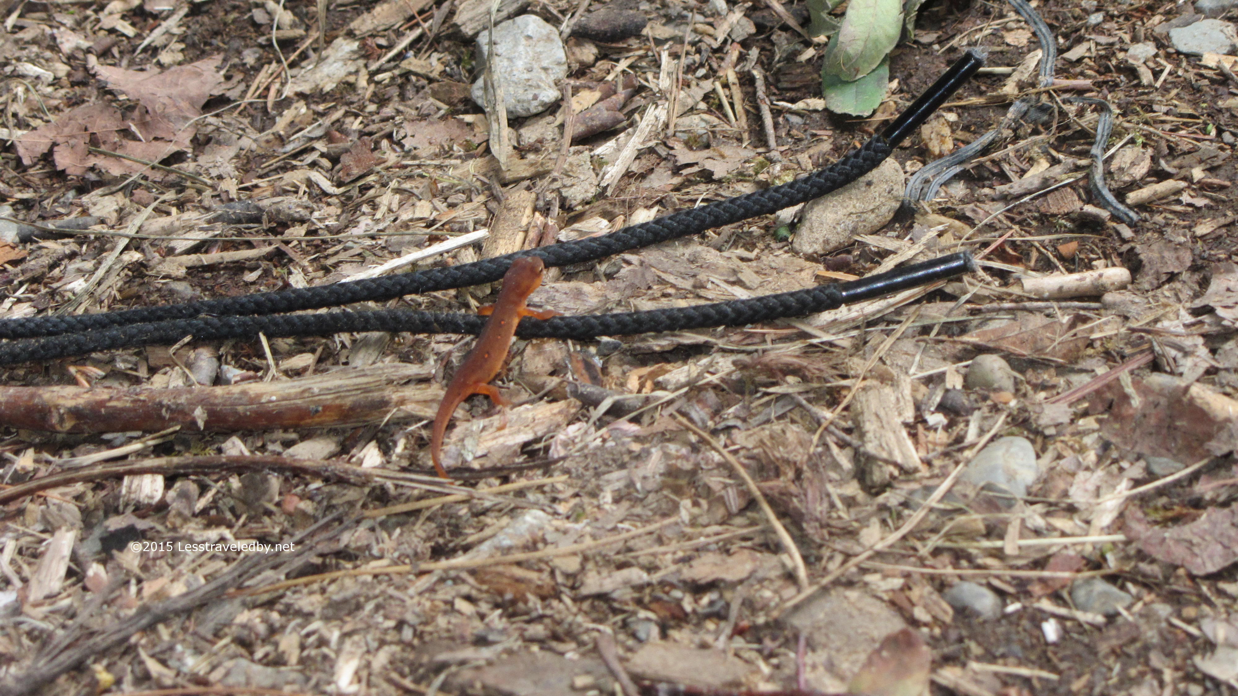
This bit of wildlife was for viewing only. Not sure any amount of herbs and spices would make that taste good. Pretty to look at though!

IMG_4877a

They seem to have some bird nesting problems at this shelter. Guess it is better than wasps, but I was glad they didn’t seem to be around while I was there.

IMG_4878a
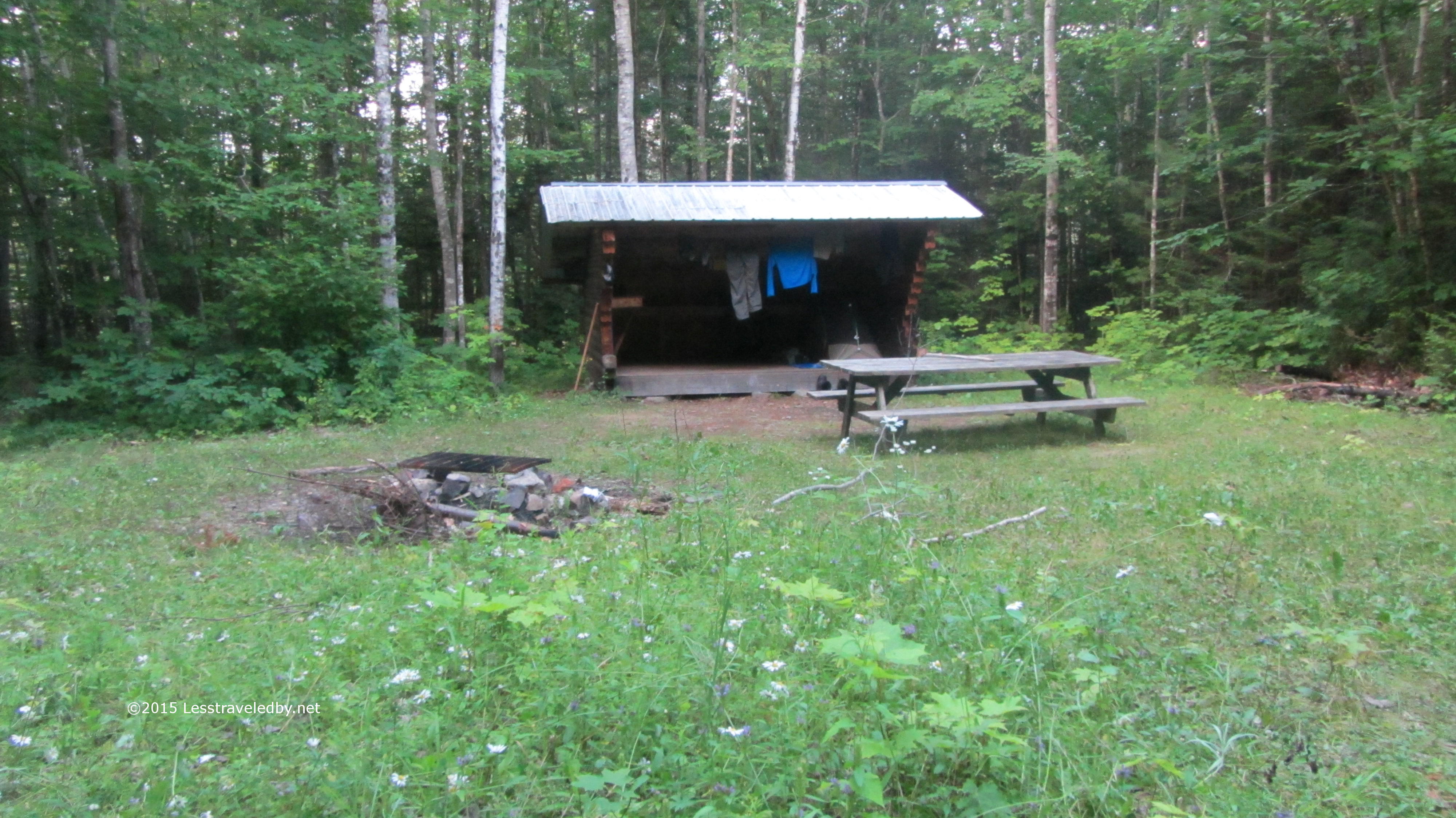
This shelter was on the small side, but with plenty of room to set up tents around it. With the river right near by it seems like a great place to set up to do some fishing or paddling.

IMG_4887a

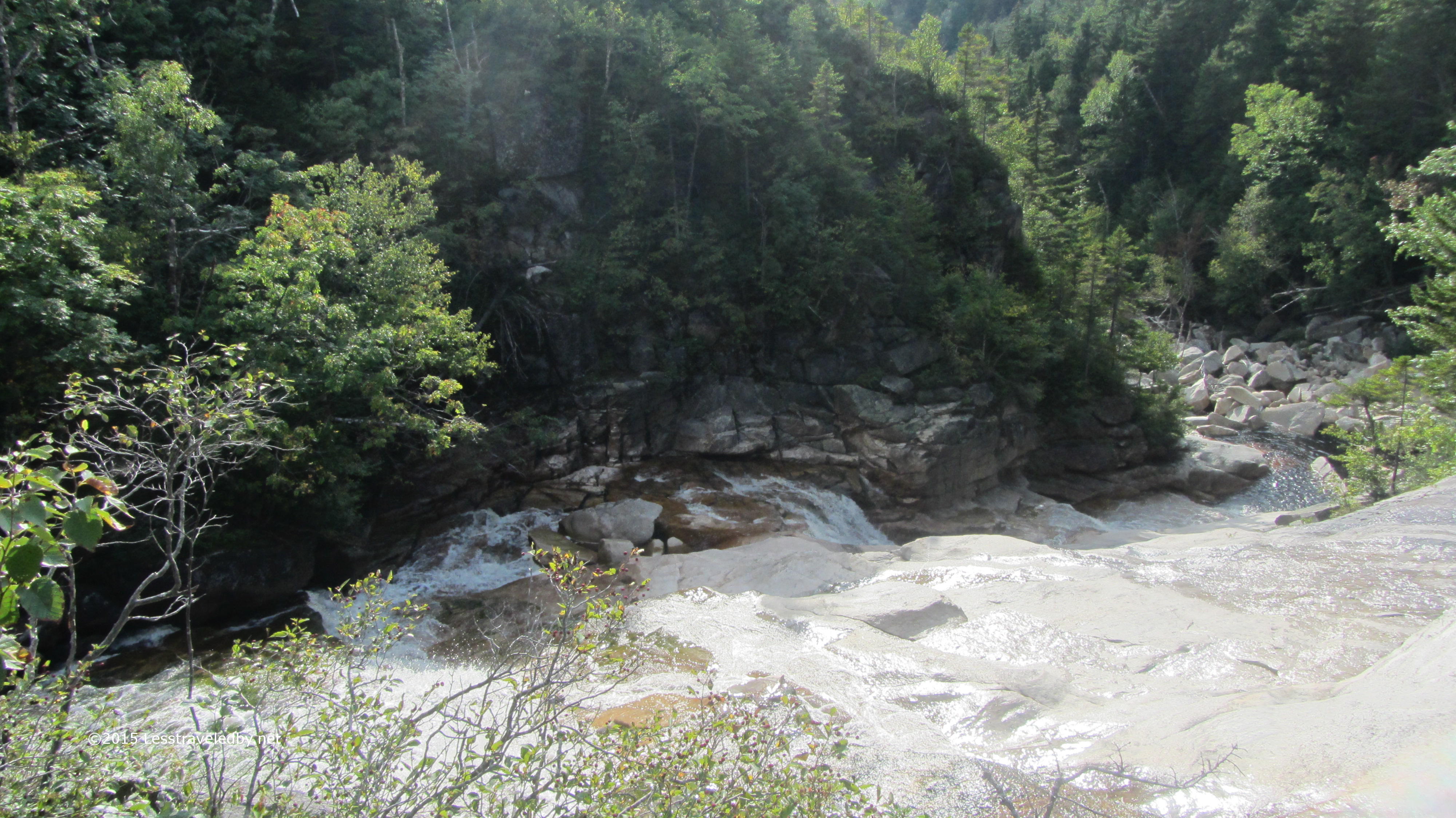
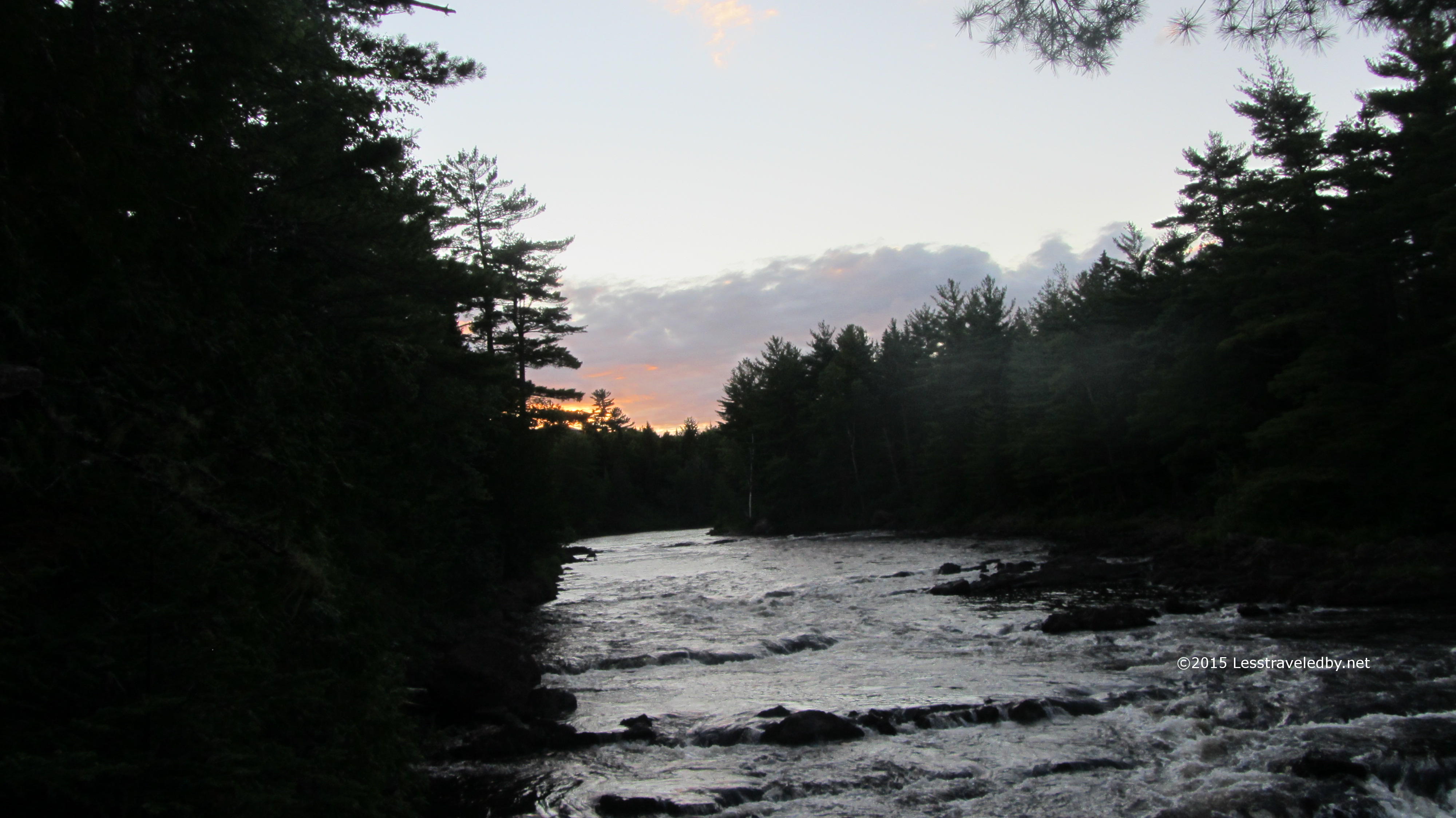
I took the portage trail down to see the falls near sunset. Even in a dry year there was plenty of water headed down river.

IMG_4888a

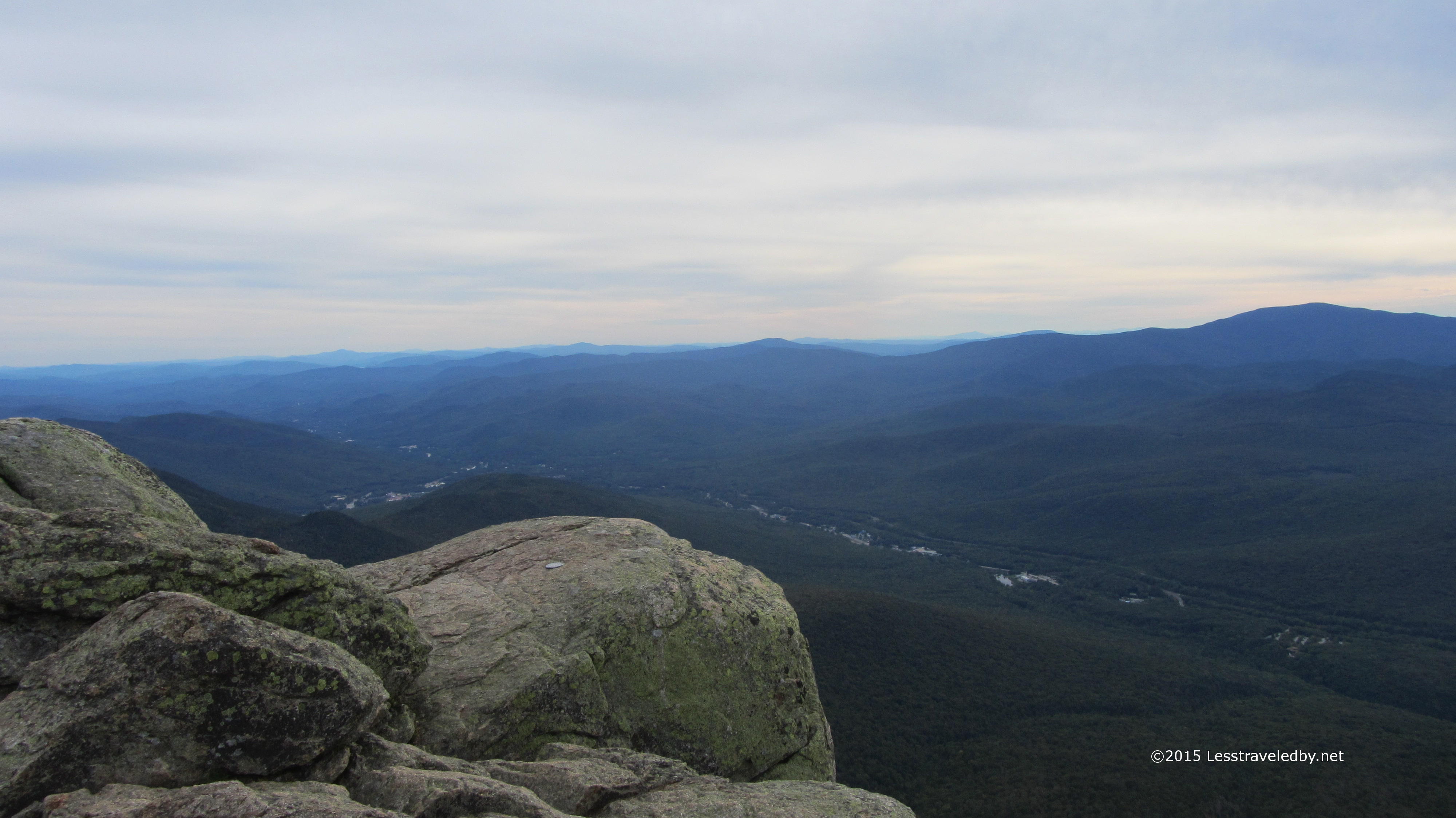
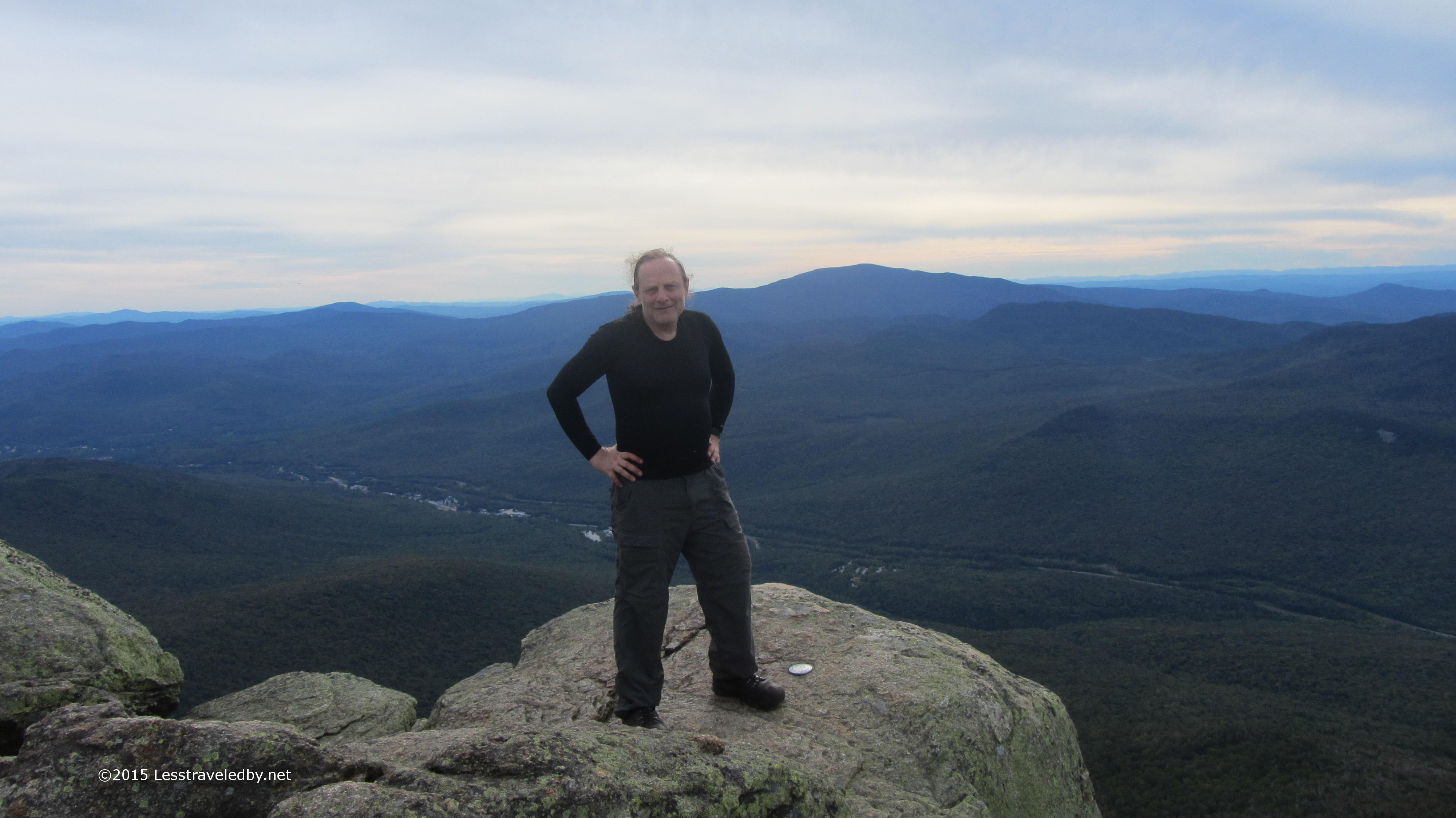
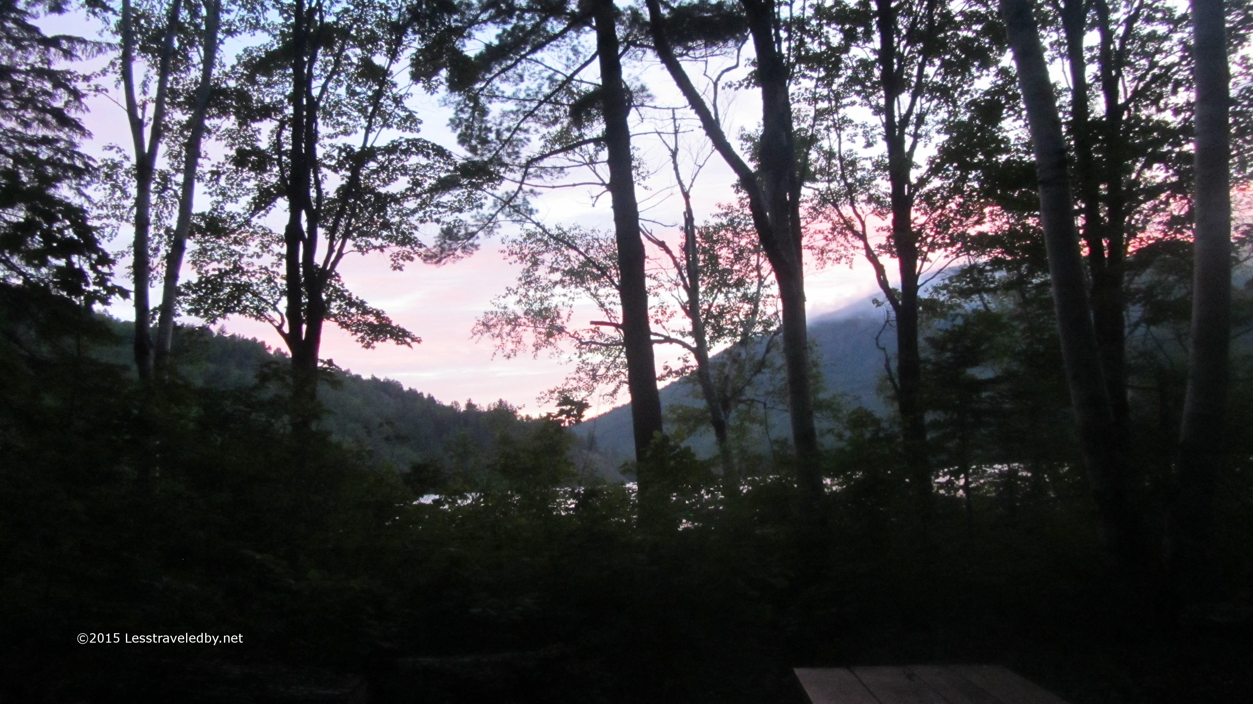
I had the place to myself and with the sunset slowly coming on it was a great place to spend my last night on the trail. The weather hadn’t made things easy and I still wasn’t convinced my feet wouldn’t fall off, but it had been one heck of a great trip as far as I was concerned.

IMG_4906a

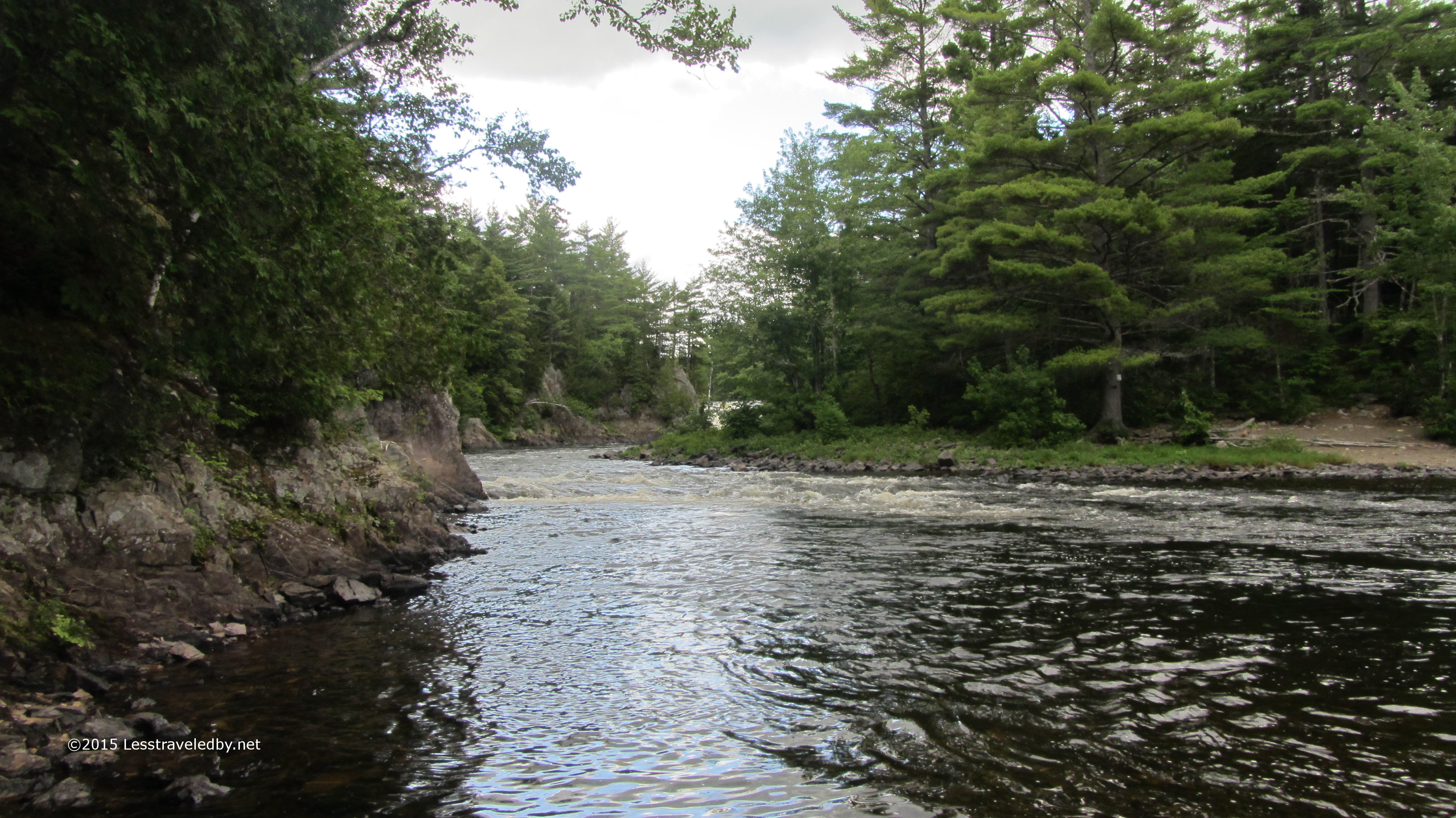
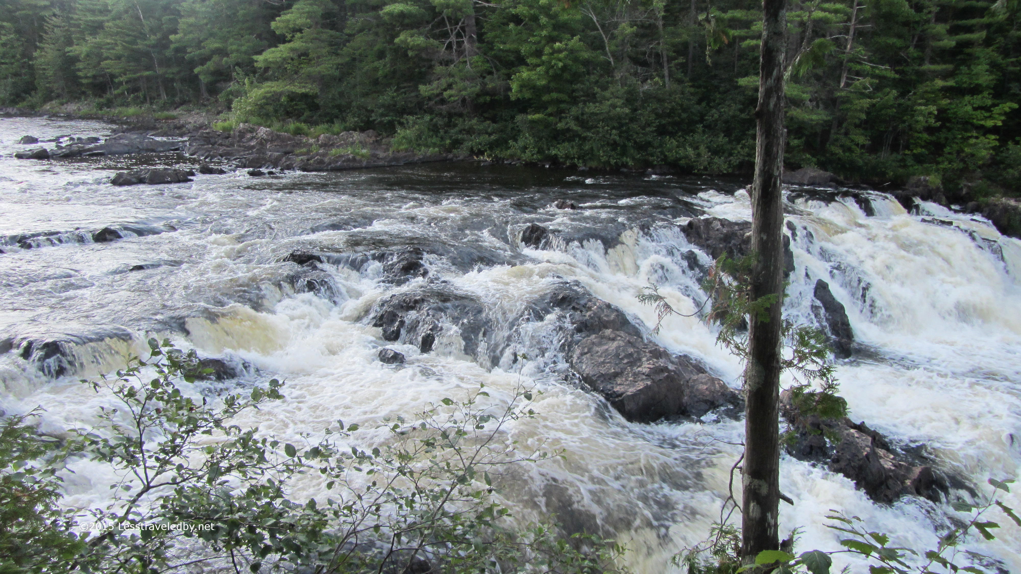
This rock in the middle of the river is iconic enough to have a name; Haskell Rock. Looks like it has been there a while and try though it might the river isn’t moving it any time soon.

IMG_4907aI believe this is the section known as the hulling machine. An eater of canoes and kayaks that has led to more than a few rescues over the years.

IMG_4909aAnd of course on the final day we had to have at least one shower. The clouds came down and did their best but I knew I was getting close so didn’t let it bother me.

IMG_4912aHorse Mountain coming up on my left confirmed I was just about back to Grand Lake Road. This area showed signs of having a lot more traffic, but I only met one person the whole day.

IMG_4915a
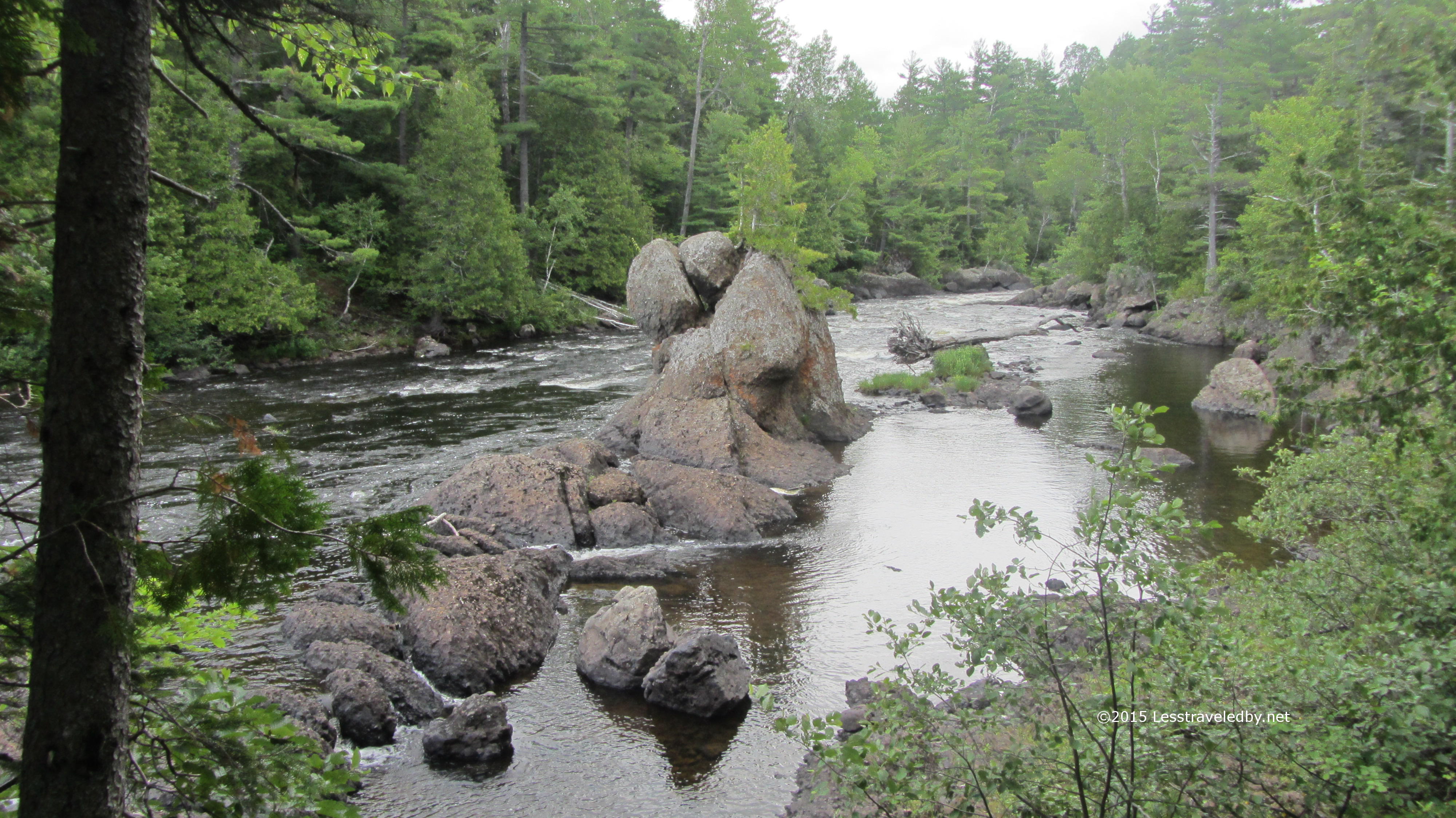
Back on the road I was treated to great views of the river. Well and if you look closely you can see the ice cream cone shaped sign up ahead telling me I’d finished my loop. Time for one of their giant cones full of vanilla! Roughly 70 miles,  much of it in the rain and I’d totally do it again. Maybe next year?

As a bonus, on my ride out I spotted Gen and Emanuel hiking down the road. The next section of the IAT is a long road walk so they’d be dodging logging trucks for a while. I stopped to chat with them and found they had put in a 20 mile day after we parted, then did a very short day and camped at a Matagamon Wilderness site to recover. These two were always smiling it seemed and I hope the rest of their adventure went well.

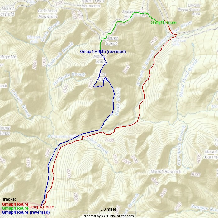
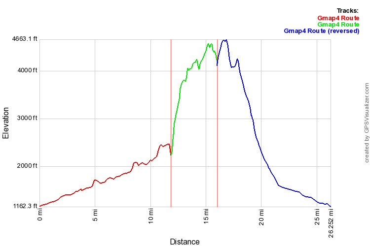
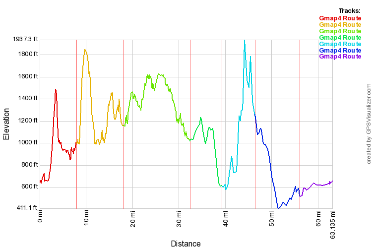
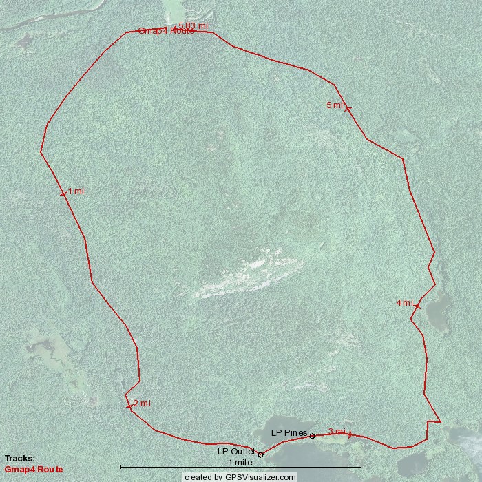
A little technical info: Rough mileage worked out to about 70 actual trail miles. The Baxter trails are pretty well maintained and easy to follow. The IAT is sparsely blazed in places and the lack of foot traffic can make following the trail a bit tricky at times. Good path finding and navigation skills will come in handy when the trail just seems to disappear. A lot of the IAT section follows old logging roads and is very easy to follow. Most of the difficult sections were between the Wassataquoik Stream ford and Deasey Mountain.

Reservations are required for Baxter State Park camping so some planning is required. Keep the miles manageable so you can be certain of reaching your intended sites. Once on the IAT  it seemed wilderness camping was allowed between shelters so you can be more flexible, but the shelters are nicely spaced.

This route traverses some lightly traveled areas and has some challenging terrain. Definitely not a good first trip, but if you are looking for adventure this is a great route to find some.

BSPIATmap

BSPIATprofile

Long Pond Family Trip – Baxter State Park July 2015

Long Pond Family Trip – Baxter State Park July 2015

This impromptu family trip came together on just a few days planning. There was some time between the trip with the boys from Texas and my upcoming second attempt to put together a Baxter-IAT loop. Rather than sit home thinking about that looming over my head, a few days of relaxing at one of our favorite spots seemed like a great idea.

Whoops! Our spot, Long Pond Pines, was only available the second night, but we soldiered on by booking the Long Pond Outlet for the first. The plan called for starting from the trailhead near Trout Brook camp and looping around Trout Brook Mt counter clockwise. This trail was new to all of us, but we knew the distance was in our daughter’s range.

LongPondLoopThe trailhead seemed a bit confusing with three different trails leaving directly from the parking area. The girls actually started up the wrong trail that would have taken them straight up the mountain, but I caught them before they took more than a few steps.


IMG_4706aThe trail was moderately even with rolling ups and downs. It sees enough traffic from day hikers to keep it well trod and easy to follow. In one of the low sections we came across this beaver dam just up from the trail with a small pond forming behind it.

IMG_4715aIt was a warm and muggy day so we were happy to find the short side trail to our camp. There was plenty of room for tents at the site, but it didn’t seem as open to the breeze as the spot on the other side of the pond. We went topless to catch what breeze we could in the tent and to watch the stars.

IMG_4711aUnlike previous trips where we paid for canoe use by the hour the ranger at the gate asked us for two days worth of fees. Since it was paid for I hiked over to where they are stored and paddled it back to our camp. Well first I made the mistake of exploring the pond a bit and had to fight a strong, afternoon headwind to get back to where the girls were. It has been a while since I paddled alone and the wind had some fun with me before I eventually returned to camp.

IMG_4716aThe outlet looked to be barely flowing, but the air was filled with the sound of frogs, birds and bugs. This looked like a great spot for a moose to wander through, but family trips tend to be a bit too noisy for them to get close.

IMG_4720aOnce the afternoon breeze died down the pond became like glass. I love the reflections the mountains leave in these ponds. It is hard not to feel peaceful when looking at the reflections and listening to nature’s music.

IMG_4728aWe went out for a family paddle in the morning. Then later when it was time to move camp the girls walked over while I took most of the gear in the canoe. It certainly seemed like a relaxing way to travel.

IMG_4729aSpeaking of relaxing the plants around the water’s edge were certainly easy on the eyes. That feeling didn’t extend to the ears though due to some unusual “barking” frogs that lined this side of the pond. I’ve never heard this particular sound before despite having camped at this pond several times previously.

IMG_4736aStill it is hard not to feel at peace when looking at floating water plants. The girls spent some time splashing in the pond to cool off, but I was happy to just sit on the hill and soak in the day.

IMG_4746aThe roof was on the tent just in case, but furled to preserve the view. The Trail Ridge 3 is hard to fit between the roots at this site, but sleeping next to the pond is always restful.

IMG_4738aSpeaking of which, after a long hard day of play our daughter decided a nap was in order. Good thing she got her rest because the walk out the next day seemed a bit harder than the walk in. Maybe it was the heat, but we were all ready to be done by the time we reached the car.

IMG_4748aDefinitely worth the effort though! These moments when we all are out there together are so special. The downside is that my solo trips feel much more alone after one of these family adventures.

I’ll leave you with this quick video of moments from this family adventure. Hope you’ve had a chance to get out there with those you enjoy spending time with this summer. There is never enough time, but that is all the more reason to get out there when you can!

Early Winter Testing

Early Winter Testing

It may be a late Summer swelter out there for most of us, but that doesn’t mean I can’t start testing out my new Winter tent. A great deal on an Easton Torrent 2P came up a few months ago, but so far I’d only set it up in the living room. I bought it for snow camping as it has full double walls and extra structural supports to carry a snow load, but they claim it ventilates well enough to be used all year.

IMG_5181a

We have great weather to test that out today with high humidity and light, intermittent showers. Hoping for some heavier stuff later to test out the seam sealing.

IMG_5180a

This vestibule design with two stakes holding the side panels in place makes for a lot of options in using the door. I can imagine rolling it all the way up and peering out through that at the winter stars while snuggled in my quilts. For now I have the bottom open to pull air in with all inner and outer vents opened up top.  I’ll sleep out there tonight to test how well that chimney effect works.

Started catching up reporting on previous adventures, I have my eye on the weather for a possible trip next week plus the coming Fall season to plan for, but that doesn’t mean I can’t get a little excited about snow camping. Going to be a while before I can try this tent out in those conditions though so don’t expect a full review any time soon.

Hope you are getting out there when you can. I know I’m ready, but I’m pretty sure I’ll be carrying something lighter than this tent next week 🙂

Upper South Branch and Pogy – Baxter State Park June 2015

Upper South Branch and Pogy – Baxter State Park June 2015

As usual the boys from Texas came up looking for adventure in the wilds of Baxter State Park. Once a year they arrive freshly steamed from the south to enjoy our pleasant climate, eat lobstahs and try to find a mountain to make them appreciate their flatland home for another year. Time constraints forced us into an early date in mid June and we hit the trifecta as far as bugs go. The black fly bloom was at its peak, but there were already plenty of mosquitoes and deer flies as well.IMG_4577a

The plan was actually quite tame compared to some years. We had reservations for two nights at the Upper South Branch LT in hopes of doing the Traveler Loop followed by two days of relaxing at the Pogy Pond LT.IMG_4582a

We had great weather to start and enjoyed the relaxing two miles or so we had to hike in to our site. Mostly flat with a big ridge in the middle it provided lots of different views of the pond. This view is from the camp site looking at the ridge we came over which sits at the base of the main part of the mountain and would be the start of our climb the following day.IMG_4604a

The lean to at Upper South Branch is advertised as having room for four, but it definitely is one of the smaller ones in the park. The boys used their tents as bivies while I hung my bug net. I had a tarp prerigged so it could easily be deployed if a storm came up overnight as was expected, but we left thing open to enjoy the view and the breeze.IMG_4605a

Sunset brought a period of complete stillness as I often find to be the case in these mountains. No matter what afternoon breezes blow there seems to be at least a short period of rest before the evening comes on.

IMG_4610a

There had been talk of a front coming through over night, but the red in the sunset made me think perhaps it had fizzled out. We’d have to see what the morning brought because this loop would not be safe to do if wet. Things certainly seemed peaceful as dark fell.IMG_4620a

That peace didn’t last too long though. During the night the wind began to blow through the trees with gusto. It wasn’t as loud as being in the White Mountains when the wind comes up, but it made for restless sleep.  Morning dawned to wind driven clouds covering the mountain. We never really saw much in the way of rain where we were, but we could see the peaks were scraping the clouds and at times the entire mountain disappeared from view.IMG_4629a

Being wise old men with slow healing bones the elder block voted to stay safely below and watch the storm roll by. The youngster was wise enough not to argue. Based on how slippery the rocks were on the Pogy Notch trail the next day I think we made the right choice. Later in the year there is enough traffic to wear some of the moss off, but even on level ground it was pretty slippery at times so I’d guess that ridge would have been mighty treacherous.IMG_4646a

So we moved on to Pogy Pond on day three. The storm had moved on leaving lots of sunshine and a pretty strong breeze. The bugs were bad here as well, but the views were fantastic.IMG_4656aThe wind made fishing a bit pointless so I kept up with the relaxation theme. Between swatting at bugs I found time to enjoy some of the good things Nature has to offer. These water plants had some very impressive blooms.

IMG_4658a

The pond also had some wild life. There were a lot of these giant tadpoles swimming about near the shore. I’m not certain if they are related to the booming bull frogs we heard later, but those sounded big as well.IMG_4668a

The youngster studies bugs as part of his college program, but has a strong aversion to feeding them. He often relaxes completely covered from head to toe for protection. I tend to rely on swatting as much as possible so I don’t have to wear all those clothes.IMG_4672a

We did have one bug issue I couldn’t abide by. There were a couple of wasp nests inside the lean to. I’m a pretty big stickler for following rules, but opted to be an outlaw in this case and sleep outside. The price was a vicious no-see-em attack on the second night, but I’d never have been able to sleep next to those wasps.IMG_4677a

The boys took the canoe out for a spin and tried some fishing but the wind made both a bit challenging. Darn pretty place to paddle around though. I did some casting from a rock near shore, but the wind made it seem more like a comedy routine than fishing. IMG_4692a

I did get this shot of a huge dragon fly. Always happy to see these guys around as they love to eat mosquitoes. No wonder it was so big when you consider the food supply it had access to.IMG_4695a

The wind finally calmed down towards the end of our last day. Watching the sun set light up the mountain without having to climb it seemed a bit too easy, but still wonderful to enjoy.IMG_4698aNot the trip we had planned, but so much more relaxing than our previous struggles with roaring floods and gravity. The talk is of trying to get back to more serious efforts next year, but to tell the truth, I’m ok with this style once in a while.