A few minutes of fun culled from some stuff shot in New Hampshire last week. It comes with music so turn it up or down as needed before play.

A few minutes of fun culled from some stuff shot in New Hampshire last week. It comes with music so turn it up or down as needed before play.


Not sure if it seems like more or less than three years since I started this site, but it seems hard to believe. I actually had to check the dates and do the math to be sure. Guess I just don’t think about things like that and they take me by surprise sometimes. The whole experience has been a surprise I’d say and a good one at that. Time at home can be spent thinking about where I’ve been and out on trail I look for things worth sharing here. Not sure what this year’s plans will include, though we were discussing them just this morning. There is talk of another grand family road trip and mutterings have begun in distant places about various escapades that need to be scheduled. I know I’m looking forward to getting out when I can.
To those of you who just come here to look at the pictures I say thank you, but let’s be honest, you looked at the pic and left long ago. To those of you who read all the babbling I do about my little adventures I also say thank you. What I do and how I do it continues to evolve and those of you who’ve been reading since the start are probably as surprised as I am about some of the things I’ve done along the way. Stick around to see what happens next and we’ll find out together.

Lone Stranger
A few minutes of Fall leaf walking from the Pemigewasset

76 pictures from a killer Pemigewasset trip along with the usual random thoughts that came to me along the way. Bonus video will be posted in a few days. For now enjoy the sights, but thankfully not the smells, of this beautiful four day visit to New Hampshire for some of the best backpacking the White Mountains have to offer.
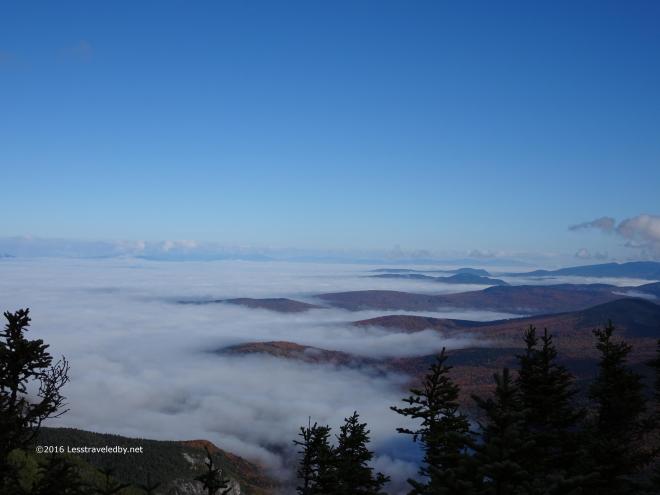
 By the second week of October the days were already getting short fast. Getting on the road early meant a chilly ride on the scoot, but I didn’t want to get caught on the ridge come sunset.
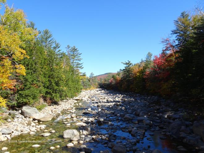
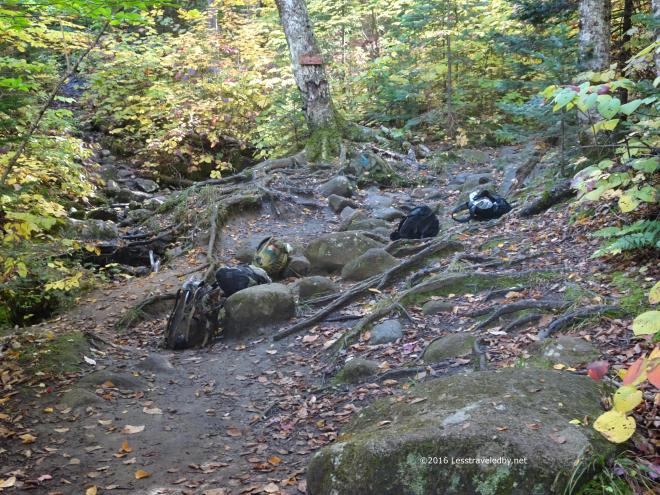
The East Branch of the Pemigewasset River was looking mighty low, but despite the lack of water the trees had some pretty good color going on. I flew down the flat section that starts the trail covering about a mile and a half in twenty minutes even with my pack fresh from the parking lot and full of goodies.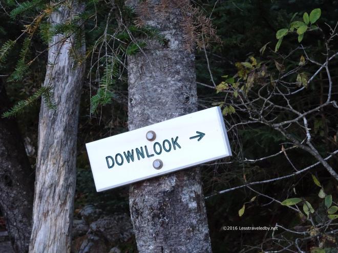 Then I slowed down as the Osseo Trail began its ascent towards Mt Flume. The first sign of real progress is literally a sign. It made no sense the first time I read it, but now I know it means what it says.
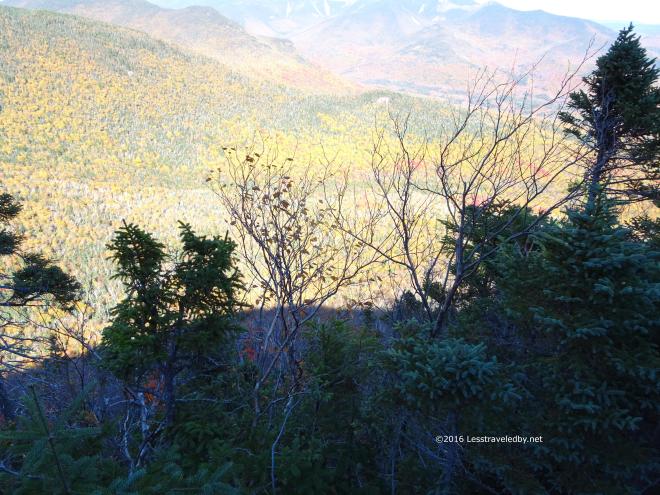 The trees here block the view a bit and I’m not one to get too close to the edge, but you definitely can look down at this spot.
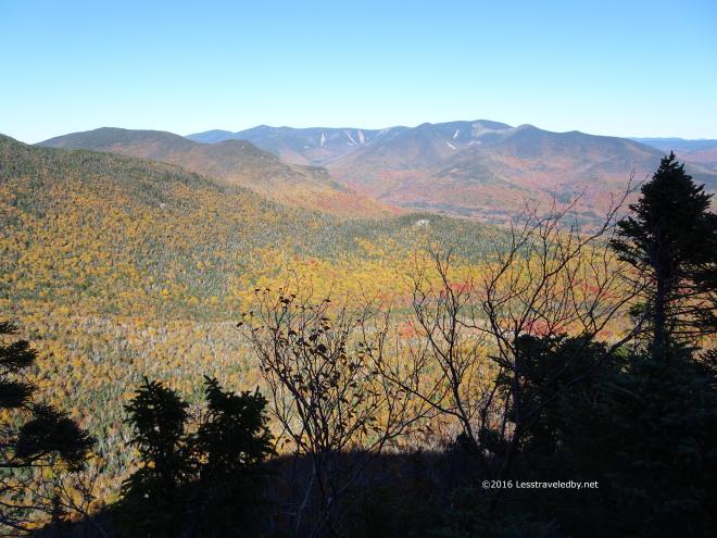 You can look out as well, but that is common in these mountains. Common enough that the down is what was worth noting on the sign at least.
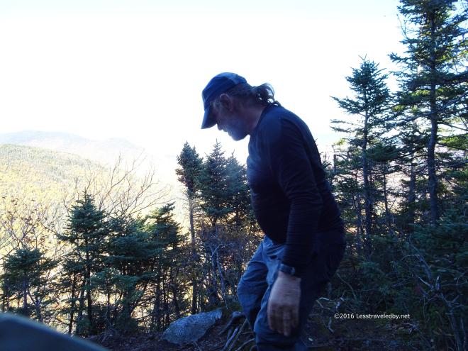 I didn’t get any pictures of me enjoying my lunch here, but I did get this shot of me looking down at the downlook.
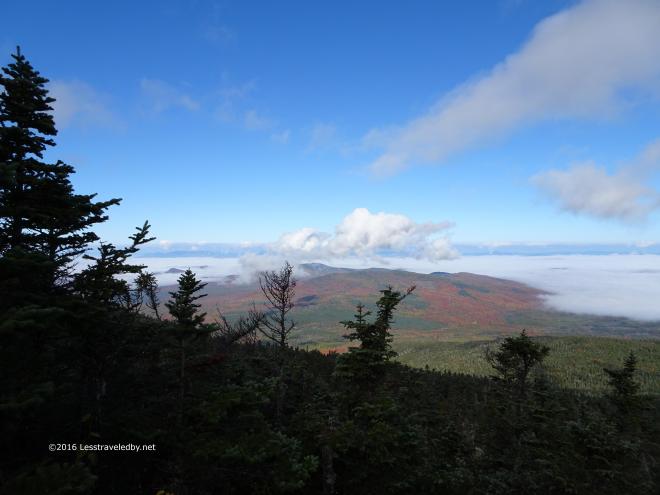
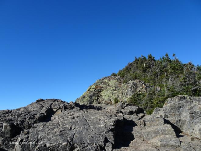 There is a bit more work in the trees before breaking out to this sight which welcomes you to Mt Flume’s rocky summit. Thankfully the wind was light so heading up this open, rocky section was fun rather than terrifying.
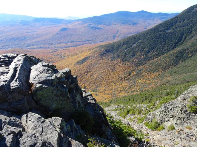 You can see how the deciduous color gives way to the evergreens as the elevation climbs.
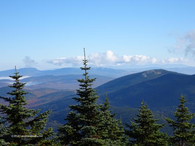
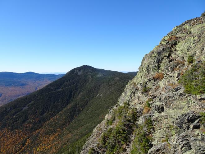 Evergreen gives way to rock in the higher and more exposed spots. From here on Flume I could see Liberty waiting for me next. Previous experience kept me from thinking it was as close as it looked and I knew I’d drop down into a col before having to climb up to reach that peak.
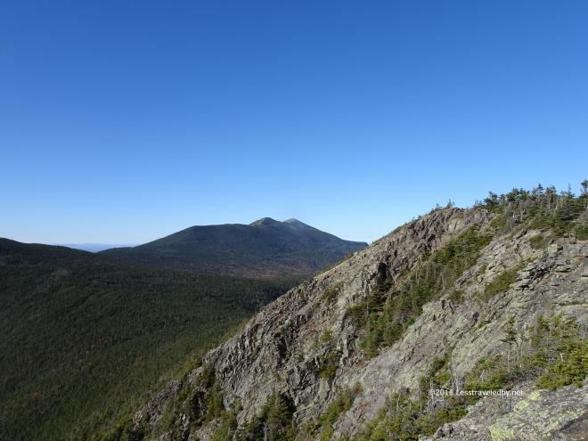 Looking a bit beyond I could see Franconia Ridge waiting for tomorrow. That view really leaves me anticipating the following day but there is little time for daydreaming with the sun already heading towards the mountains in the west.
 Well maybe a few minutes longer to soak up that golden colored sun that Autumn brings.
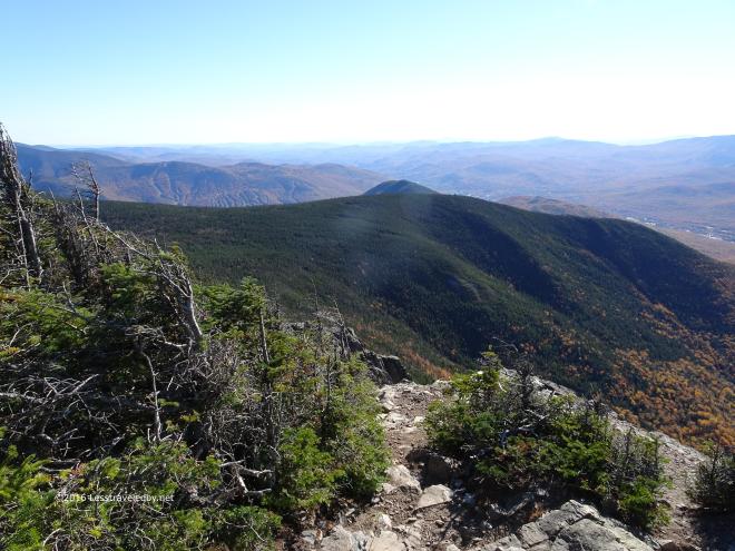
 Up on Liberty the light was even better though it hinted that it wouldn’t last long. There were only a few people on the trail this being the middle of the week. It would have been relaxing to sit here and just think or even be thoughtless which seemed odd as this summit is often full of people.
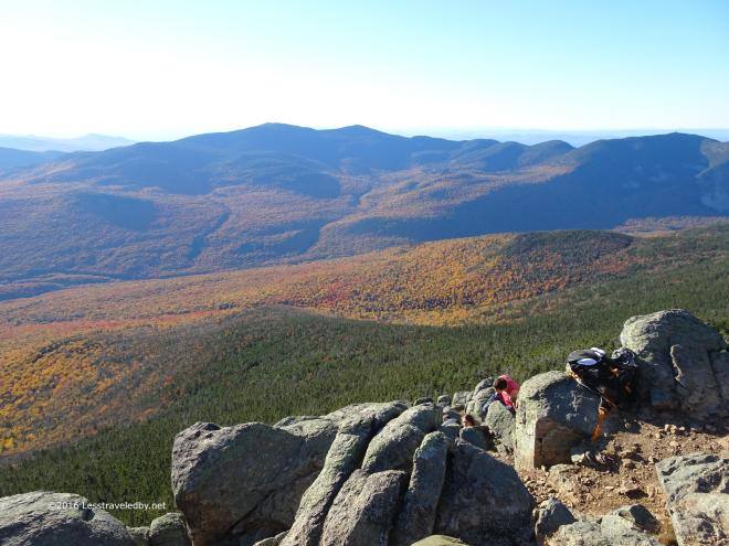 There was one group of day hikers who climbed down to a spot out of the wind. They said they’d spent hours up there though they were going to have to leave soon.
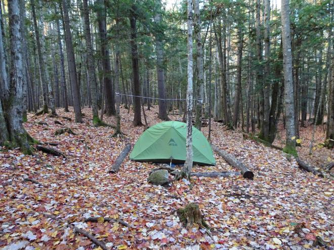
I did as well and headed on to make camp at the Liberty Springs AMC site. The caretakers were gone for the year, but I do believe we filled up every platform that night with late season backpackers. I met a family that was almost done with their loop and a couple of younger guys from Texas who were just starting on theirs.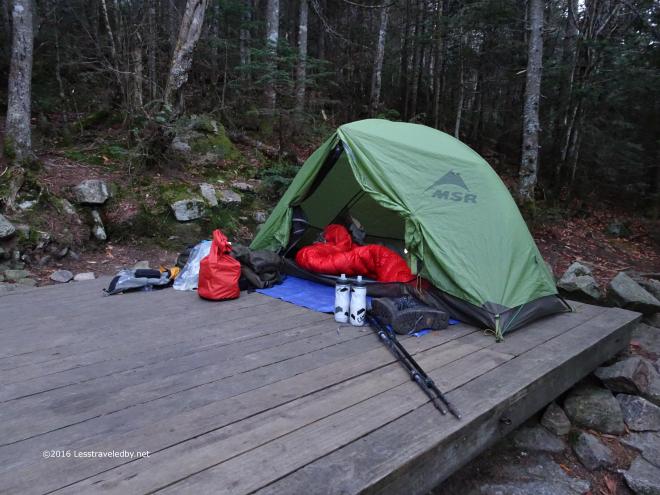 I left room in case anyone needed a spot as my tent doesn’t take up much space, but had no takers. It was a cool night in the upper 30s so most everyone seemed to turn in early.
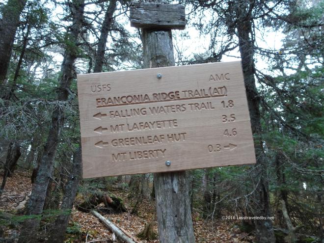 After the incredibly steep ascent back to the ridge from the campsite the legs were warmed up and ready for the day. I was happy to be on the ridge which is challenging, but a lot easier than most of the trails that get you up there.
 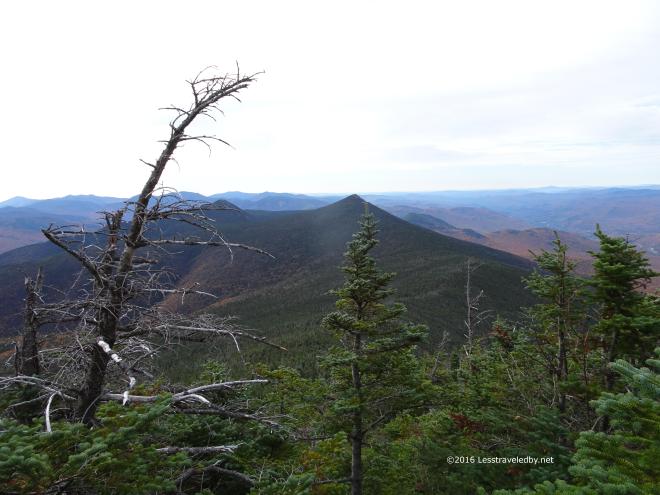 Working my way up Little Haystack there was a nice view looking back at the previous day’s peaks. Flume is sort of hiding behind that tree and Liberty in the center looks pointy from this side. That might explain why it felt that way going up.
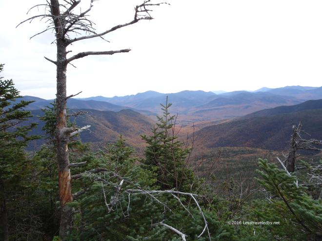 Looking right down the notch of valley that separates Owlshead from the ridge up here. There is a little piece of trail down there that remains in my quest to redline the Pemi.
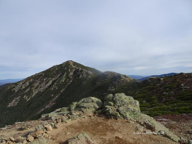
 Topping out on Little Haystack I met the first intersecting trail and my first day hiker. This is a great spot for second breakfast before the real climbs of the day begin. One of the benefits of a popular trail with lots of people is that folks can take turns taking pictures of one another. So much easier than trying to set up selfies on a mountain without falling off.
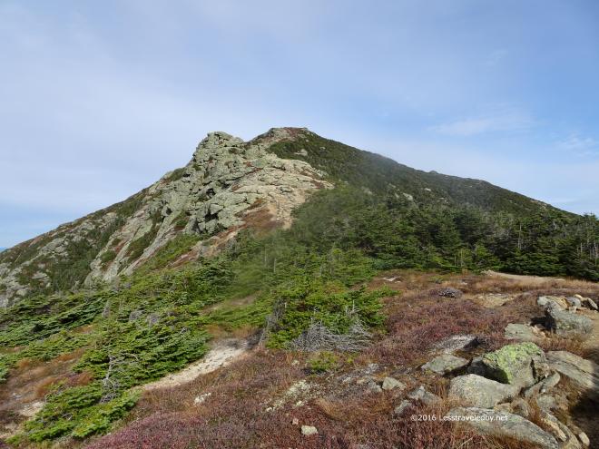 This climb up Lincoln is harder than it looks I find each time I come up here. After the big rocky section there is a steep final pitch up to the top. Thankfully there is a great place to get out of the wind behind a big rock just over the ridge because the wind was really picking up by this time.
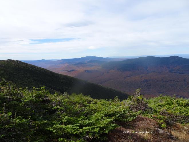 It was getting harder to hold the camera still so I wasn’t taking much time to set up shots. Literally point, shoot, put the camera away so I could grab my hiking poles to keep myself on my feet.
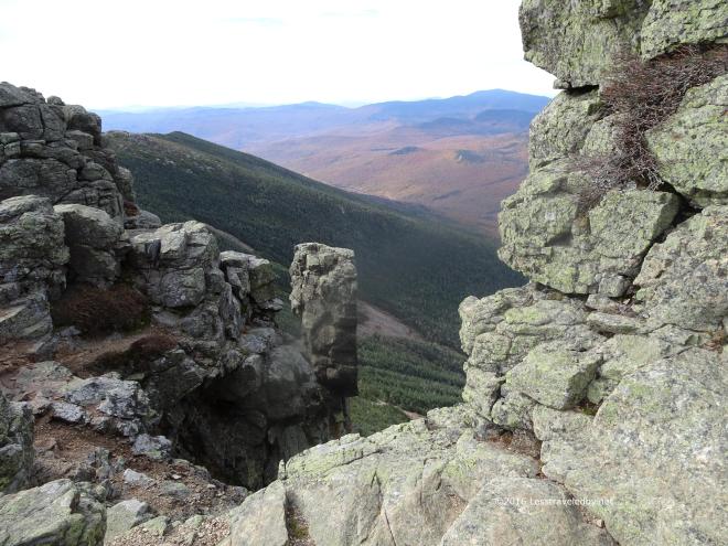 Coming around these rocks and suddenly being exposed to the full force of the wind was almost enough to knock you over. Thank goodness for a heavy pack to keep me on the ground!
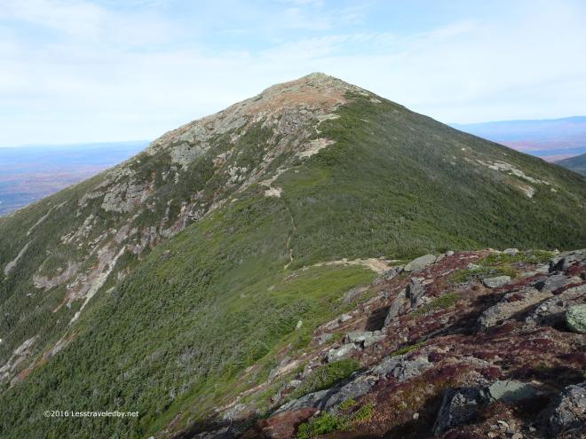 The climb up to Lafayette from Liberty is easier than it looks or at least I feel that way about it. Mostly it is just a gentle slope with a few sections that tilt up a bit more steeply.
 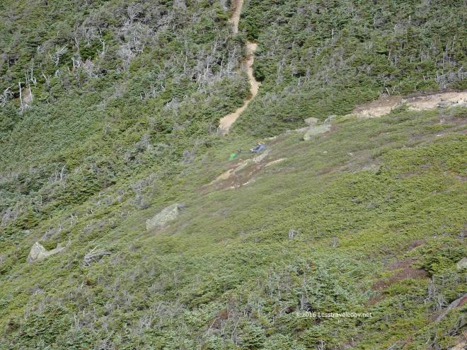 If you look carefully you can spot these two folks eating lunch in the col if you scroll back up to the previous picture. They were tucked into the scrub trying to stay out of the wind while they relaxed in the sun.
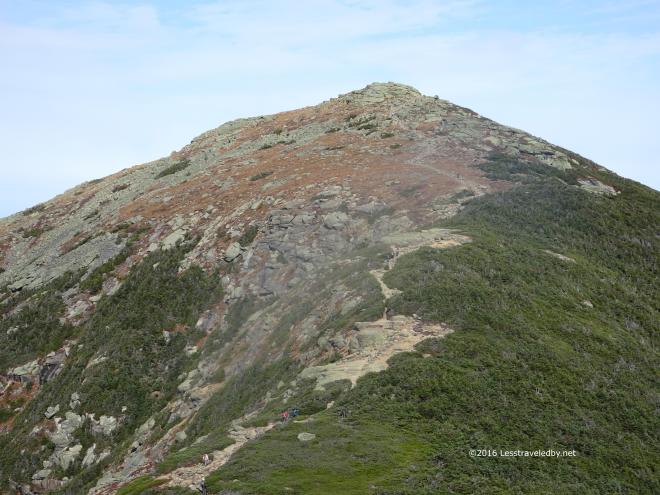 I’d just had elevensies on top of Lincoln so had no excuse to stop again though I’d have liked to sit there for a bit. Instead I took advantage of a quartering tail wind as I ascended the open slope of Lafayette.
 Nearing the top there was nothing to block the wind and it was a constant challenge to keep pointed in the right direction.
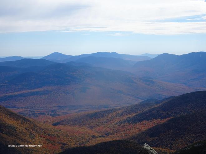 Pretty sure I was hiding behind a rock to stand still enough to get this shot of the valley below.
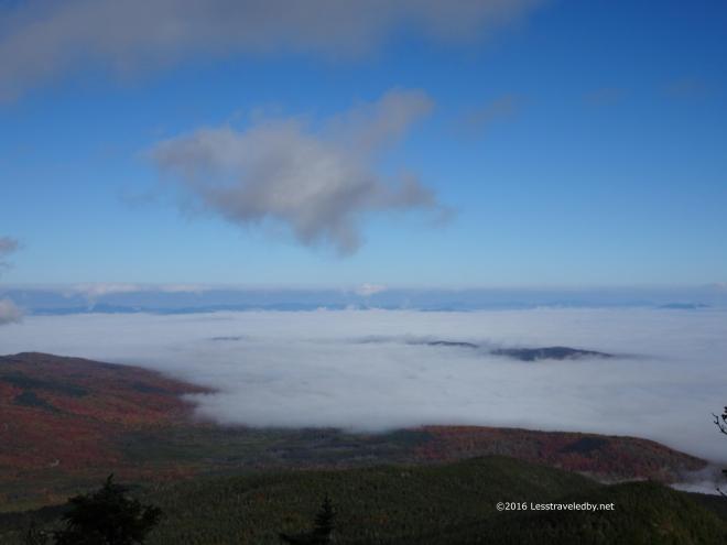
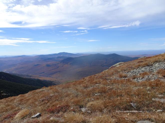 Everything was dry up there. I mean crackling brown and dead. Very strange for a place that is often wrapped in clouds. Hopefully we have a good snowy winter to get things wet up there again.
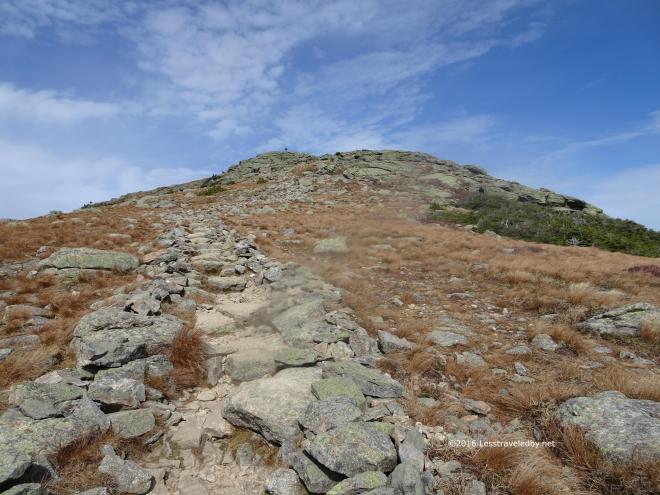 Just this final section of rock to climb. The wind was strong from my left as I worked my way up. I was glad that it was a wide slope rather than a spiny ridge I was ascending. Plenty of room for error 🙂
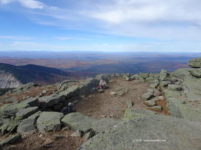 Only a few hearty souls were hanging out at the summit. Usually you can’t find a place to sit up here but I noticed that almost everyone who arrived kept moving. A few stopped to take a picture or two, but these folks hiding behind the rocks were the only ones who stayed long.
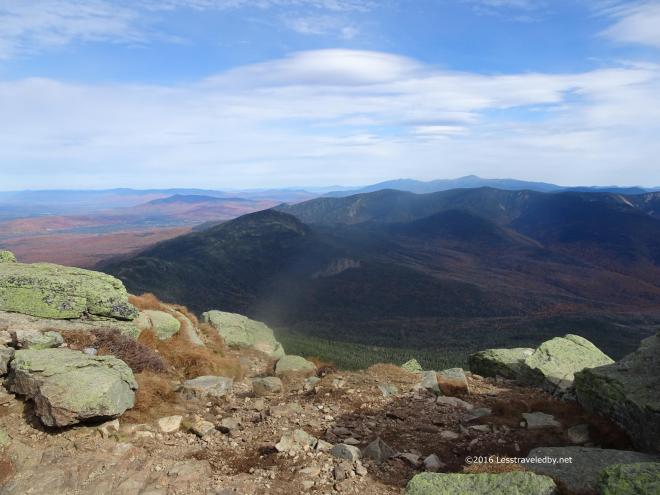 Again it was really hard to hold the camera still so I was just pressing the buttons and hoping for the best.
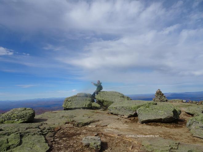 This guy was taking an epic selfie with his beard and hair flying back from his head. He looked pretty stoked about it too 🙂
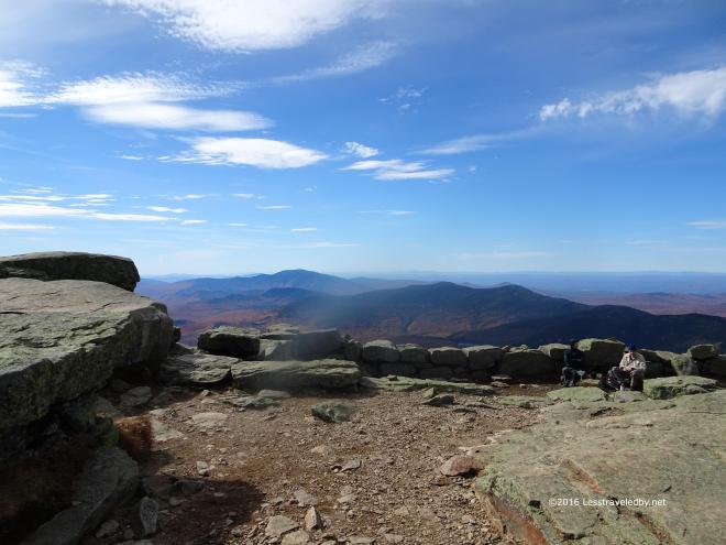 The wind was clearing out the sky some, giving better light. One of the reasons I was making this trip was because it was cloudy the last time I was up here. This wasn’t a perfect day, but it was definitely worth the effort.
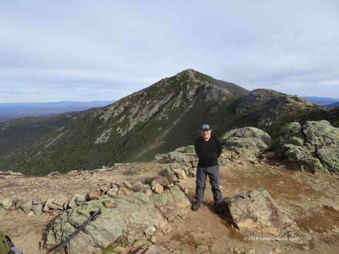
 Again enlisting help from a day hiker I got this pic because I have almost no pictures of me wearing the Unaweep. This pack rocks and I intend to do a Trailspace review on it soon so getting some action shots was nice.
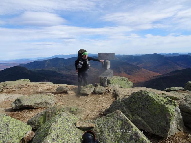 Another great action shot of the pack for my review. Shame it is blocking Mt Washington, but the rest of the view isn’t exactly terrible.
 Garfield peak lies tauntingly close from here at the end of the ridge. Only about a mile and a half as the crow flies, but I’m an old fat guy with a backpack so my route would be a bit longer. First down off the ridge via a steep descent, then a couple of serious PUDs on the knobs in the middle before the final steep ascent of Garfield.
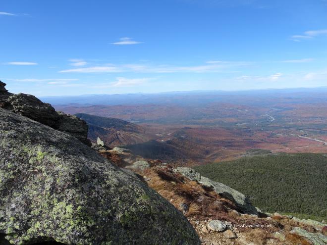 Time to enjoy the views up here before giving up the high ground. The trail is mostly tree shrouded once you descend so good to soak up the sun while you can because the other side of the peak will be in shadow.
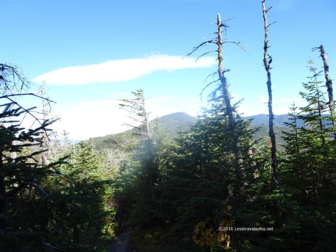 About half way to Garfield from the end of the ridge and it looks at least twice as far away as it did before. Thankfully I had a nice Fall day with cool temps so overheating or running out of water were not an issue. Just a matter of keeping the legs moving.
 Shot from the same spot with some zoom applied this pic gives a better account of Garfield’s true peaky-ness and the climb that lies ahead.
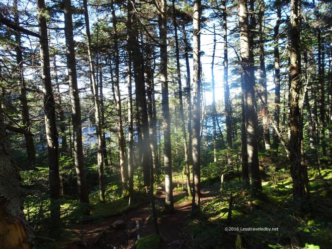 Passing by the pond is always a good sign that progress is being made. I think I’d like to plot a trip that involved staying the night in this area below the mountain some time. It would mean a nasty climb first thing in the morning no matter which direction you were traveling the loop, but it seems like a nice bit of forest after a day on the rocky ridge.
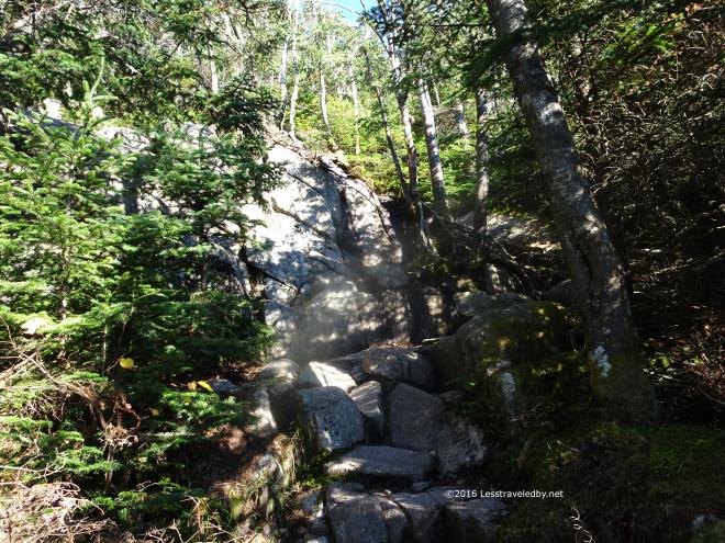 Speaking of rocky…the first time one runs into a “trail” like this it can be a bit unsettling. After traversing this feature a few times I have a longer, but safer route for when it is wet or a more direct and dangerous route for when it is dry enough that I think my feet will stick to it. This time I took the direct route and enjoyed saving the time.
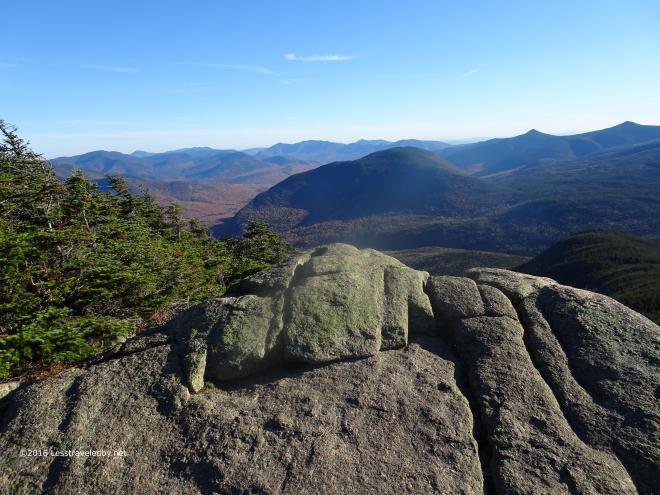 That left me more time to enjoy my time at the top. This rocky ledge is a required stop where food is eaten, pictures taken and the fact that the summit is in sight is celebrated.
 There is still a little more climbing to go, but it can be really windy up there so I always do my eating down below before going up.
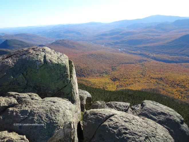
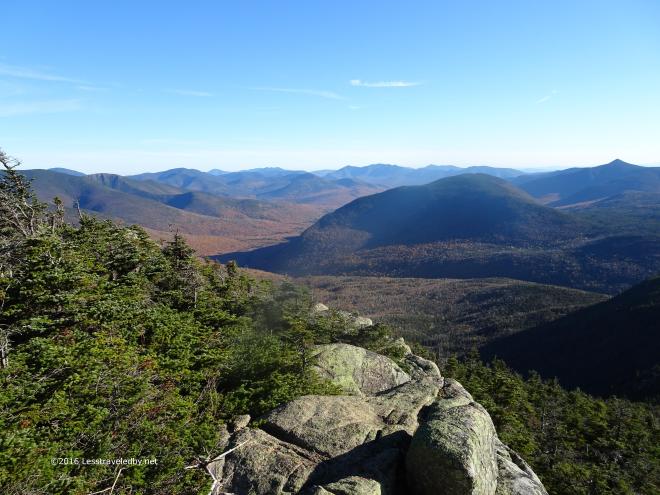 After some time in the trees it is great to be out in the open again. Once again it would be tempting to sit and enjoy this but I know the sun won’t last and the shady side of this mountain always seems to get dark early.
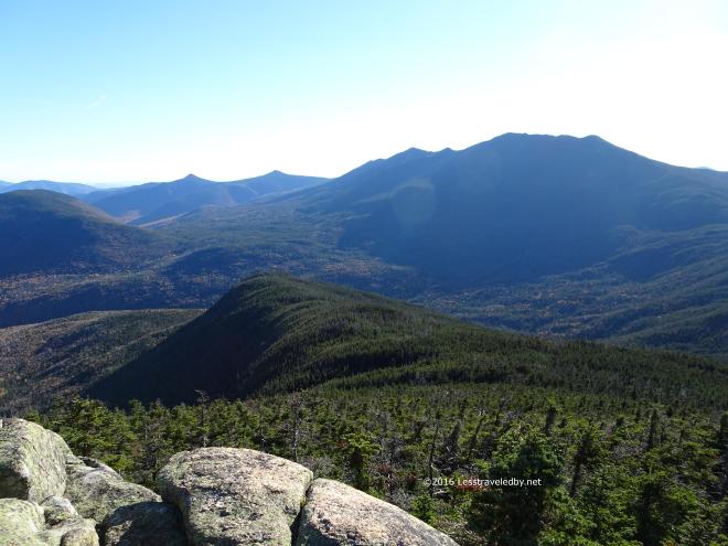 That Autumn light in the afternoon brings out so many beautiful colors and shadows.
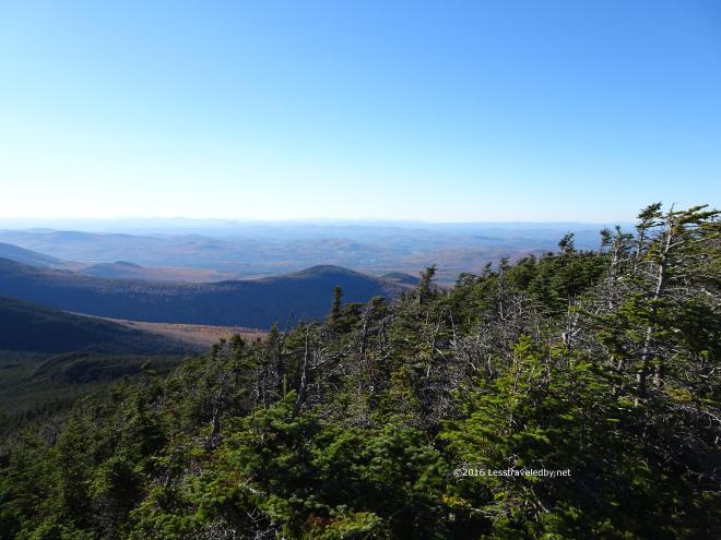 Never know when you’ll be back so best to appreciate these spots when you can. So much effort to get there, but worth every step.
 The boys from Texas that I’d met the night before popped out of the woods and agreed that their efforts had been rewarded. If I hadn’t heard via trail chatter that they weren’t in front of me I’d have assumed they were. Young and strong folks tend to go fast but it seemed they were wise enough to go slow and appreciate the amazing trip they found themselves on.
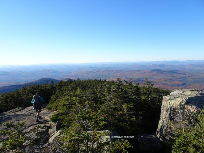 They headed down from the summit towards the campsite below. I reminded them to take water from the spring before climbing the steep trail as I’d learned the hard way last time.
 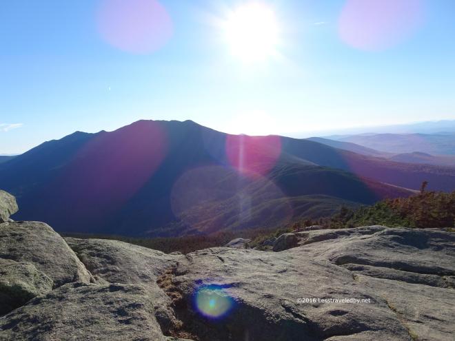 Then I settled back to enjoy a few moments alone in the sun. I wasn’t going all the way around the high loop on this trip so this would be one of my last chances to enjoy this sort of view before heading down into the trees for good.
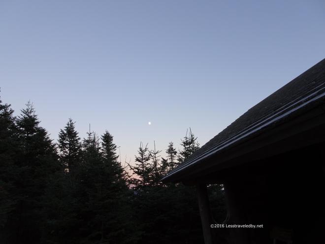 The wind was whipping around the shelter when I arrived. There was a couple there that put up their tent inside the shelter thinking no one else would be around. So long as I could find a spot to lay out my bed I didn’t care, but it seemed sort of silly since there were no bugs and the shelter is almost fully enclosed. Normally I’d prefer to sleep out in the woods in my tent, but that wind convinced me the sleeping would be better inside no matter who I had to share with.
Seeing how happy I looked in there the Texas twosome decided to drag their stuff inside as well. We had another hiker join us a bit after dark, while several other parties poked their noses inside and opted to set up tents rather than keep us up late. Amazing how many people you can meet on top of a mountain even in October. This was also amazing. I took this shot without a tripod. Just elbows against ribs and holding my breath. The image of the moon was dancing back and forth in the digital display as the computer wizardry tried to process the image on the fly. I took one stab at the button thinking it would be a blurry smudge and was amazed to find this when I got home.
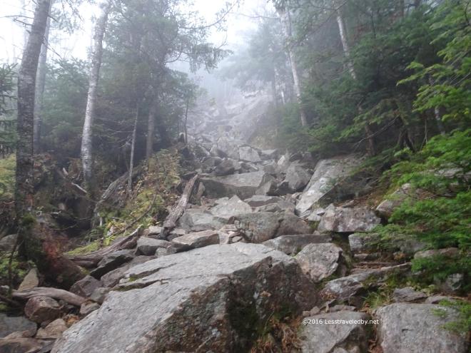 One of the folks in the shelter apparently set an alarm for 5am in hopes of catching the sunrise from the summit. The sky was socked in so I’m pretty certain he didn’t get much of a view, but he did get everyone else moving early which wasn’t the worst thing in the world.
The clouds were swirling around the mountain on gusty winds leaving everything wet. Perfect weather for descending one of the steepest sections of trail on the entire AT. I took my time knowing that my plan called for turning off and heading down from the ridge just a bit further on. No sense in breaking my leg before I get to enjoy the easy trail.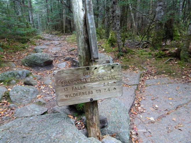 Time to redline the 2.2 miles from here to 13 Falls. Virgin trail to me this was. One of the last few snippets that had been missed over the last few years of exploring the Pemigewasset Wilderness.
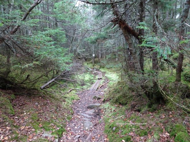 Turning off the rocky AT onto this side trail was a complete change of terrain. Mud and bog boards replaced the rocks except for the spots where there were rocks to stay out of the mud.
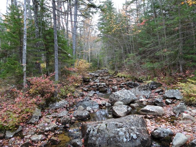 Franconia Brook wasn’t exactly roaring, but at least there was some water to be found. The leaves down at this elevation seem to have taken a beating from all the wind, but there were still some left in the trees.
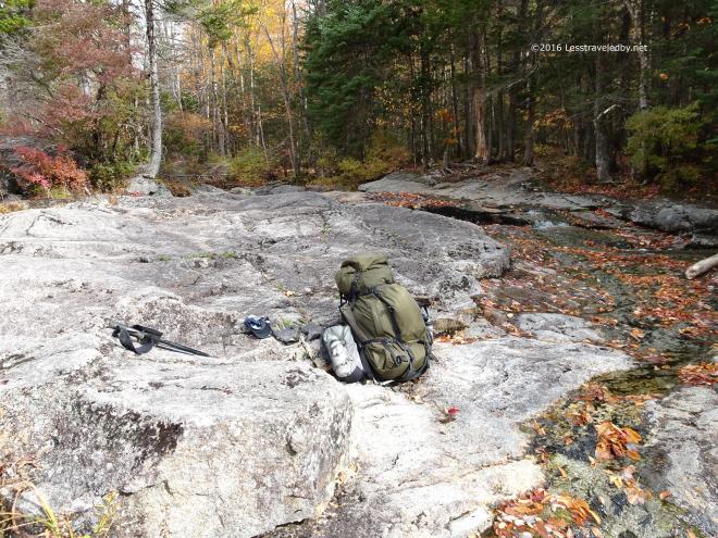 Normally a good flowing series of small falls the Lincoln Brook Trail crossing was almost dry. I sat down for second breakfast on rocks that are often under water.
 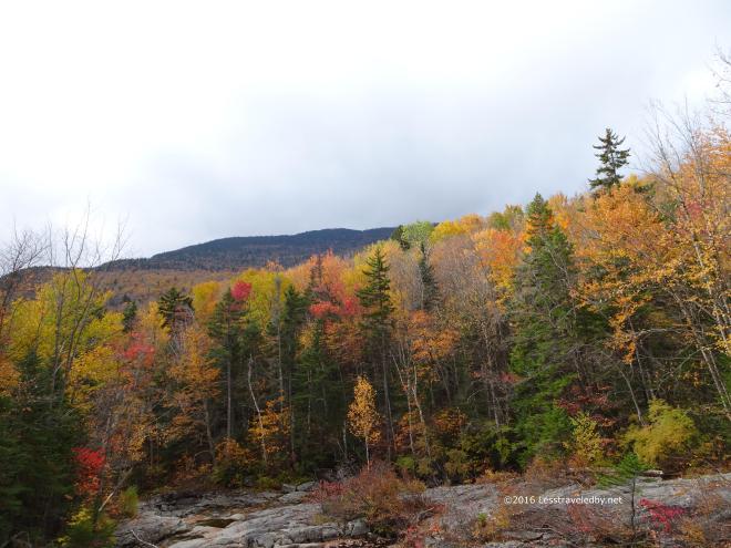 Bad weather was forecast and setting up at 13 Falls campsite was my emergency option if needed, but so far the skies were still looking gray, but not dark. I was debating if I should hike out to my scoot and try to head home, but figured I’d just end up riding in the rain if I pushed my luck.
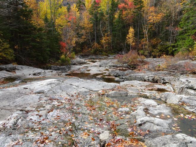 As nice as it was hanging out at the falls I didn’t really want to spend the rest of the day just hanging around camp so I decided I’d head down the trail and figure out what I was doing as I went.
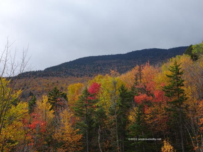 Rather than worry about what was to come I was just happy it wasn’t raining yet. The colors might have been better with sunshine, but it was interesting to see the trees from down below after looking down on them from above the past few days.
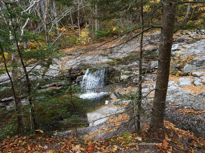
 Since it hadn’t started raining yet I began thinking I maybe should have stayed on the ridge loop and hit South Twin and then Guyot. I still could zip up Twin Brook if I wanted to, but I knew that would probably end up a cold and wet mistake.
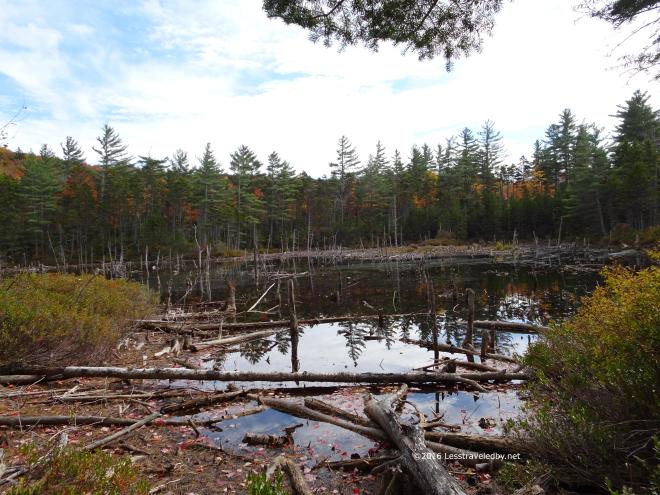 This dismal looking swamp is usually a much more vibrant pond. I’d never seen it looking like this before. Usually I will stop and watch birds here as there are often several paddling around.
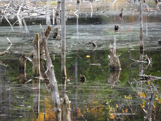 There was something splashing way out in the water but I never saw it clearly. I think I caught the splash in this shot, but not the splasher.
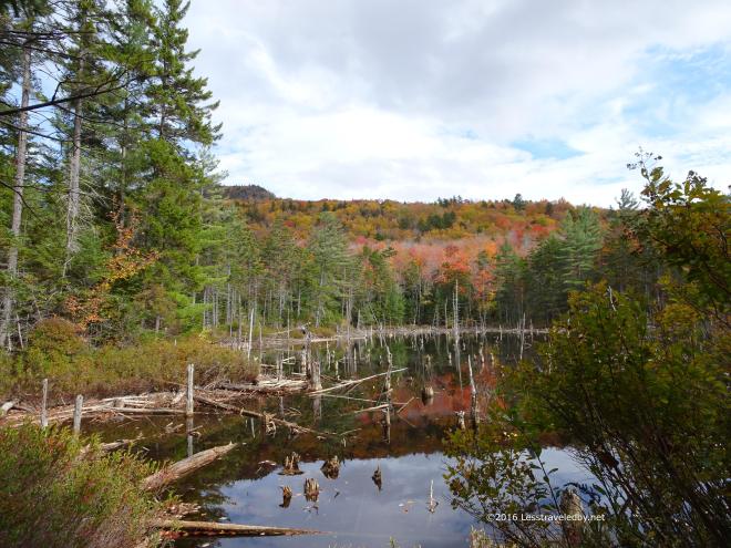 From this side it looks a bit more like a pond. Still, it would be great to have some serious snow to fill these things back up.
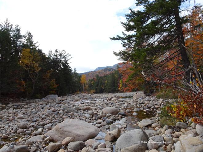 With only a few miles left to get back to the parking lot I realized that I really didn’t want to go home. Inspired by the thought of setting up camp early and eating away the evening I bushwhacked my way towards the East Branch when I hit the bridge. Crossing was easy on the exposed rocks so I didn’t bother taking off my boots. Never done that at this spot before.
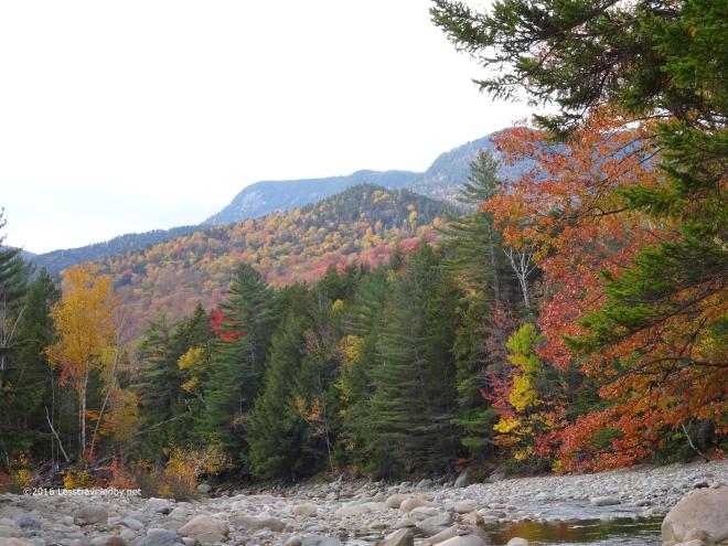 I even stopped to get this pic in the middle of the river. Never been in that spot with a camera before so I thought I’d better document it heh.
 It pays to have a good camp routine sometimes. Setting up my tent before cutting up sausage and cheese for a late lunch saved me from getting wet. I’d no more than put the first bite in my mouth when the skies opened, but I was able to dive into the tent and finish there before taking a quick nap to the sound of rain on the fly.
Later there was a nice break of about forty minutes that gave me time to cook and eat dinner just before dark. Just after it got fully dark I noticed some lights bobbing in the trees so I turned my headlamp on and off a few times to let them know I was there. Nice couple came wandering up asking about the campsites. I was a bit surprised that they bushwhacked and crossed the river without knowing where they were really going. Turns out they had camped at Garfield the night before and I’d pointed them towards the tent platforms when they came in.
 The next morning dawned brighter and the rain had really brought down a lot of leaves. It was a beautiful morning and I only had a few miles to walk so I was in no hurry. Chatted with a guy who’d shown up after dark and set up camp between storms. He was talking about doing some big miles that day on the ridge which made me feel even better about being a short timer.
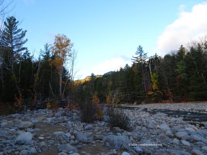 I headed down to the river as the sun was just starting to hit the peaks. Figured I’d best enjoy this season while I can because it will likely be deep winter before I get back to this spot again.
 There were still a few leaves on the trees after the rain, but those were short timers too. Fall is so pretty, but you know it could turn to Winter on a moments notice so it seems fragile. Best enjoyed as much as you can before it gets away.
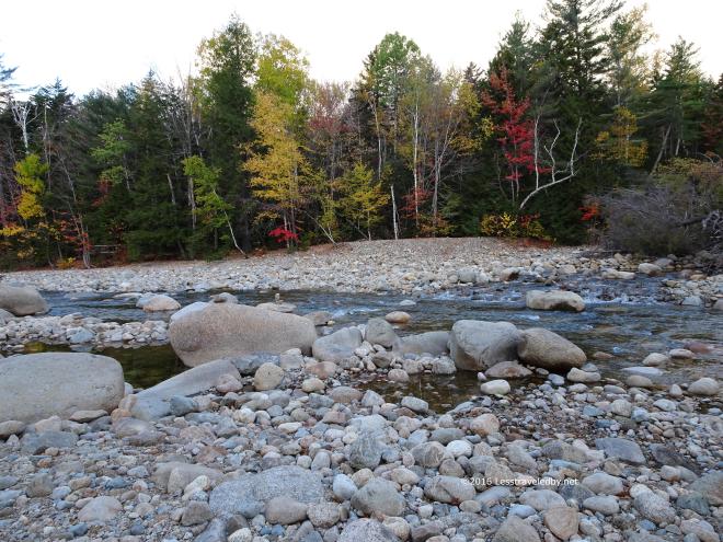 The river doesn’t get any deeper it is liable to freeze solid this year 🙂 No clue what will come, but I know that if this river wants to flow the cold can’t hold it back. I’ve seen car sized chunks of ice tossed into the woods and was glad I wasn’t there when the tossing was going on.
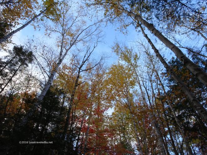 This shot was for my wife, but I figured I’d share it here too. She has a thing about pictures looking up into the trees so I took this one for her.
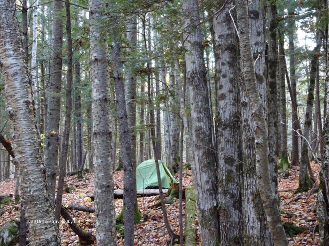 The Hubba does blend into the forest well in all three seasons it is fit for service. The new ones are red, not sure if that is to keep from losing them or what, but I’m not a big fan.
  If I want color I’ll let Nature provide it. The morning sun was certainly bringing out all it could from the remaining leaves. The perfect sky again made me wish I’d stayed on the high route until I thought about descending steep wet slopes in this light rather than the easy trail I was on.
  Yup, I could be content right where I was. Things could always be done differently, but what matters is enjoying where you are right now.
 This was a fine way to wrap up the season if it was the end. I have a feeling I might sneak in one or two more quick trips before the snow flies, but we’ll see. I knew heading out that morning I’d be off trail for at least a few weeks so I took my time. It has been a month now with nothing but day hikes due to scheduling issues so I’m finally caught up on trip reports. I’ll either have to write about something else or go on a trip 🙂

33 Pics and tales of adventure on the GLT / AT
After over four weeks without putting on a pack and very few days with even a good walk it seemed the perfect opportunity to head out on one of the toughest hikes I know. The Grafton Loop Trail is officially listed at about 38 miles and includes roughly 12 miles of well groomed and heavily traveled Appalachian Trail along with lesser maintained sections that are far less traveled.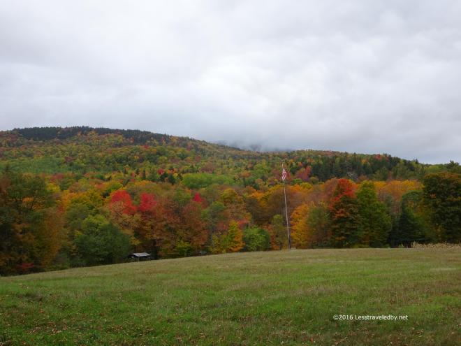 My previous two training trips to this area in August were launched from the state park lot where the AT crosses the highway that bisects Grafton Notch. When I make what has been my annual pilgrimage to head up and try to do the entire loop I prefer to park at the quieter loop trail head lot found on the southern end of the notch. From there I like to do the short road walk and cross the private lands that lead to where the trail heads up towards Bald Mtn for those heading clockwise around the loop.
This area of farm land leads to a snowmobile trail with a bridge across Bear Brook and then eventually the start of the real trail itself. It is a gentle, rolling hike which is a great way to get warmed up before the climbing begins.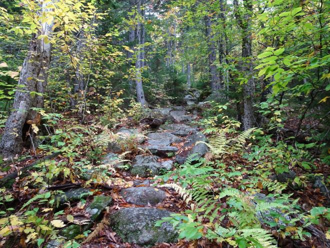 Normally it is also a wet walk with lots of little creek crossings, but this year it was quite dry. I was hoping the water sources were running again as there had been some rain. The empty channels down below made me wonder what I’d find on the other side of the day’s mountains.
 The AMC handles the trails on the west side of the notch and they have built some nice, terrain saving, steps in a few spots. These things really keep hikers from tearing up the ground which lets the rain and snow melt quickly dig down to the rock below. They also make a great spot to sit down and have a snack on a wet day. Climbing up into the clouds I reached the point where everything was wet including me and wished I’d brought my OR Crocs along.
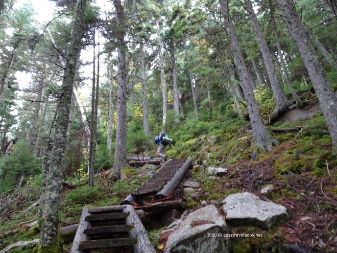 This quick picture of a hiker disappearing up the steps is my only way to know that I didn’t imagine the encounter. I have almost never met anyone on this loop other than on the AT section. We chatted for a bit before he headed on and he mentioned he was planning on camping at either the Slide or Bull Run sites. I never saw him again, but finding this pic on my camera at least reassured me that he wasn’t just a figment of my imagination heh.
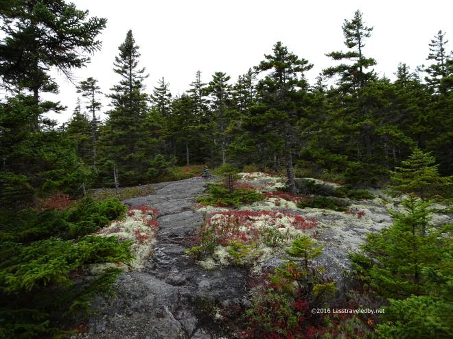 Bald Mtn is not as bald as it once was, but it does provide the first hints of the views to come. It also has some wonderful alpine lichen patches. This means we’re getting up into the sensitive area and its time to start being really careful where we put our feet.
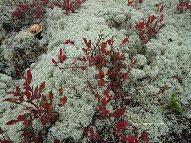 Left untrampled this stuff can have the time it needs to grow which it does very, very slowly. It is great to see a small patch, but when you find yourself in an area with large patches of it all around it starts to feel really magical. To me it signals the entry to the summit areas above the trees and it always brings a smile to my face.
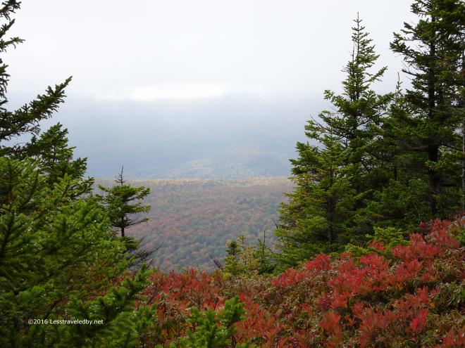 So did the views starting to open out in the space between the clouds just above and the trees below. There were hints of sun sneaking in from somewhere. I was just happy the clouds had lifted enough to be over my head as I was a bit wet from climbing up through them earlier.
 The colors were a bit muted by the hazy air, but those glints of sun were giving me hope things might still clear up before I finished crossing Sunday River Whitecap. Coming up out of these trees on to the summit is one of my favorite bit of trail ever. The views suddenly begin to open up to the horizon which on a clear day can be quite far indeed.
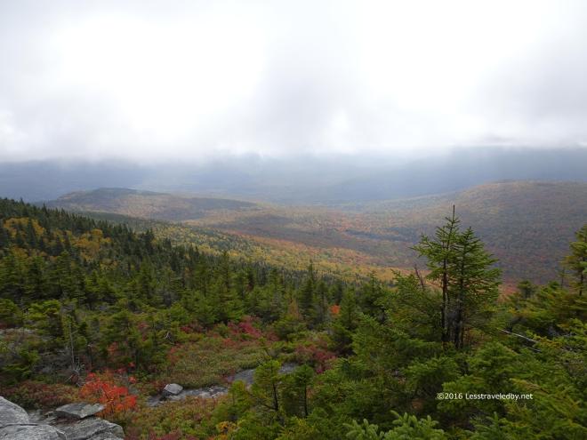 This was a different experience. Interesting in a different way with the muted light and shorter horizon the clouds were creating. So long as the clouds stayed up I was fine with it all. Don’t fall on me…
 Stopping for a break near the end of the summit area I discovered that my legs had something they wanted to say about taking over a month off and then climbing up this mountain with a full pack. What they had to say was, “You will pay for this!!” as I felt the first twinges of cramps tightening up the lower front of my quads. Having expected trouble and well supplied from the aborted LT trip I had some Gatorade pouches along and mixed up a double batch while I was here.
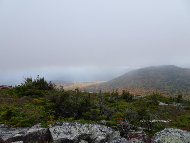 Then it was time to head down the steep pitches that would lead me around Slide Mountain first far off to the right of this view and then across towards the sunlit area to the left of Slide Mtn. This area is relatively casual trail once you get down from the summit, but by this point my legs are always a bit tired. On this trip they weren’t feeling tired, they still were strong from the long summer of training. What they were was angry!! Not only did they start to cramp up in the front of the quads, but I found out that there is a spot in the back of the quad that can cramp up too. Astoundingly painful and a total surprise after a lifetime of football, surfing, cycling and backpacking. I had no idea that was even an option let alone how much it could hurt heh.
Being the sturdy adventurer I am, I of course didn’t stop at the Slide campsite and opted to head another mile or so on to Bull Run as intended. Keeping the legs from cramping up was an interesting exercise in mind over body. No idea if the guy I’d met earlier camped there at the Slide site, but he was no where to be found when I arrived at Bull Run. I have camped at both spots before and prefer both camping and waking up at Bull Run. The water supply is more reliable and you wake up in a great spot to climb Old Speck first thing in the morning, though in that regard the walk from Slide can be a nice warm up before the climb and the side trail there leads down from camp rather than up.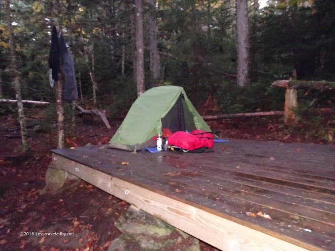 As usual when I camp on this side of the mountain it was a windy night. There were a few branches I heard crashing down in the dark, but the platform was a safe enough spot. It was a bit wet by dawn though with the trees scraping the clouds over night. I was up early that day so only have this quick flash picture before I left camp.
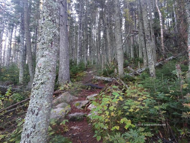 The climb up to Old Speck from this side is much easier than either of the other two approaches via the Appalachian Trail. There is dirt under foot in many places on this side while the huge number of hikers have worn the other routes down to the rock in many places. There are also found here a thing rarely seen in Maine; Switchbacks! The trail really could have gone straight up as it doesn’t seem that steep. I’m guessing they wanted to protect the ground and avoid the deep erosion found on the other side of the mountain.
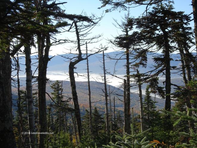 It was a great morning for climbing with cool, damp air. I did stop and take some pictures along the way, but didn’t linger long. The fog in the valleys below certainly was tempting though.
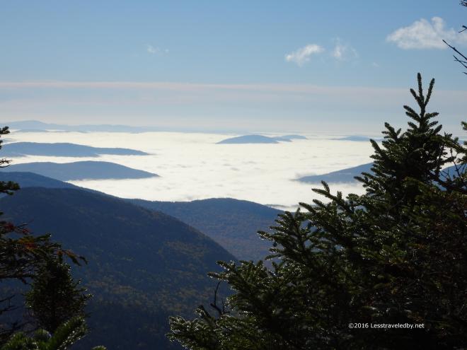 Neat to be in the sun up above looking down on this stuff on such a scale. I was soaked and dripping just like the trees so I really appreciated the open summit.
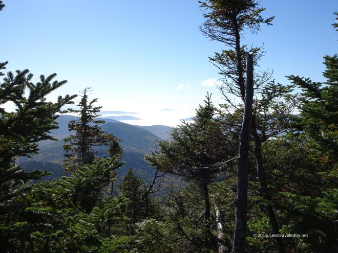 So tempting to just sit here and watch the day go by from this magical viewpoint, but I knew I had the worst of the notch ahead of me so didn’t dare get too comfortable.
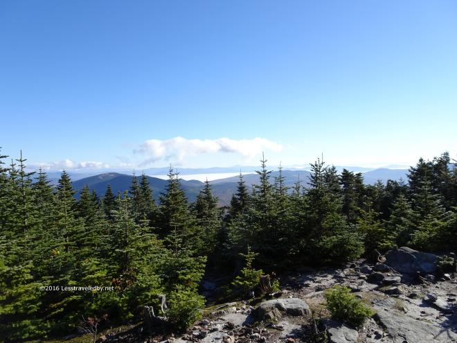 My goal for the day was to get a few miles beyond East Baldpate, the exposed ridge on the left. Not so far as the crow flies, but as seen on the previous trips to this area, the steep notch makes it interesting to say the least.
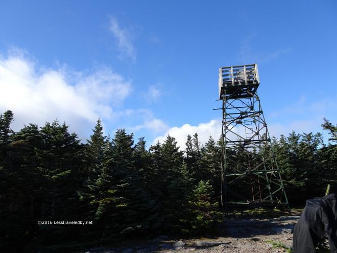 I had my second breakfast with most of my trail clothes laid out in the sun in hopes of drying a bit. That was about as futile as me climbing this dang tower’s ladder or finishing this loop for that matter heh. Still, you have to keep trying. I focused on eating and taking pics rather than wasting any time on the tower this trip.
 It looked like it was a perfect day to be up there on that ridge. Actually it was a pretty good day to be anywhere with a view. Just enough clouds in the distance to make things look picturesque and plenty of blue up above.
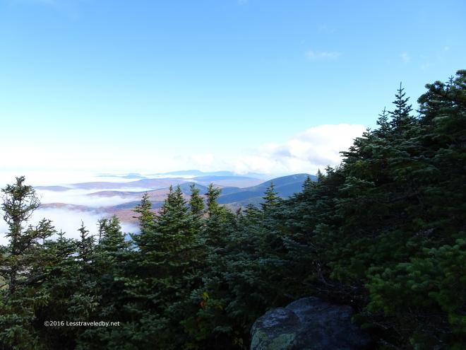
 A few last looks before heading down into the notch.
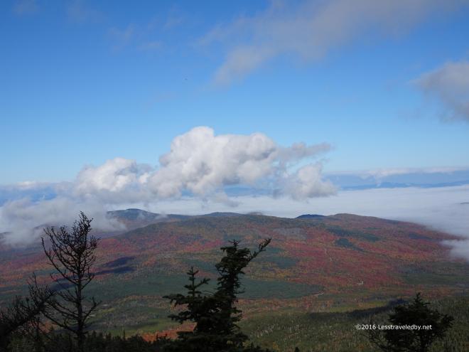
 Well, OK, a few more. Just an amazing day to be out there!
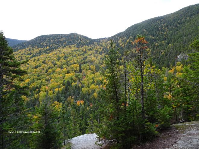 Making my way down towards the bottom but still a long ways to go. This section seems short on the map, less than four miles. The steep, rocky areas combined with some rolling PUD combine to make it both time consuming and tiring.
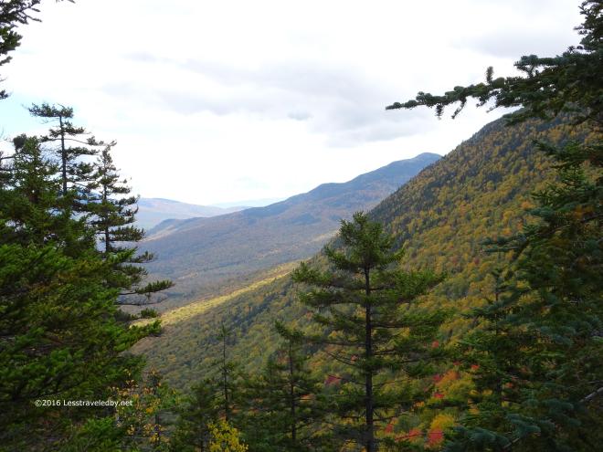 Thankfully there are a few viewpoints that open up on the way down. Color was a bit low as far as the leaves were concerned. Still it gives a person an excuse to stand still for a moment and remember why you put in all the effort.
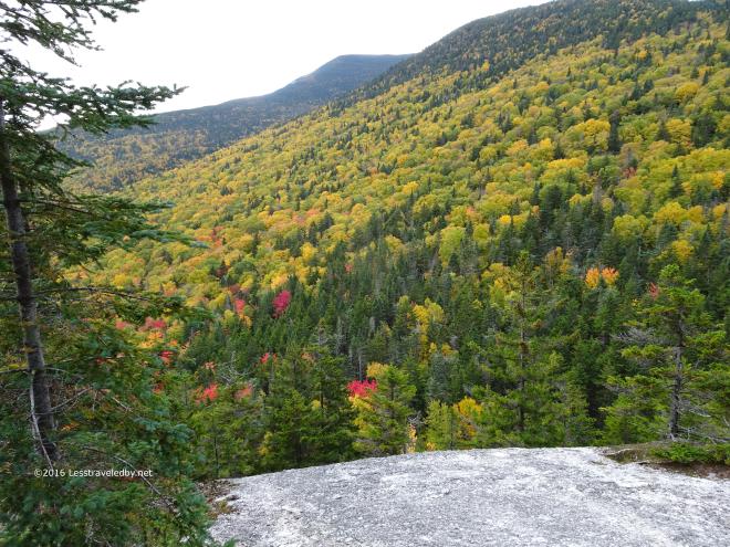 There were a few fiery red maples sprinkled throughout the canopy. I appreciated what I found as I’d come with low expectations due to the dry year.
I guess you could say I came with low expectations about this loop too after all of these years of not finishing it. This time I managed to cross the highway and start up the other side. Watching the clock as I climbed over Hedgehog Hill and towards the Baldpates I could see I wasn’t moving fast enough to make it to the camp on the far side of the mountains before dark. Having eaten my dinner by headlamp the night before I wasn’t excited about doing it again. Knowing the rough trail on the descent the idea of night hiking didn’t appeal much either so I decided to spend the night at the Baldpate Shelter.
The nice brook I’d found there the month before was barely a trickle, but I had the place to myself for a few hours which I used to dry out as much as possible. Well and to eat and eat and then have a snack heh. A couple of section hikers came in just before dark and set up tents nearby leaving me and the mice to the shelter for the night.
I had an extra dinner with me and was thinking I’d change my three night trip into a four night trip. It seemed this might finally be my year to go all the way around this loop. Then I got the bright idea to check the weather report heh. I’ve been carrying a Delorme inReach this year and one of the features is the ability to request localized weather reports. Both that night and in the morning it said I’d be hiking down in the rain and riding home wet on the scoot if I stayed out for two more nights. I don’t mind hiking in the rain that much, but hiking wet and then doing a few hours in the rain on the bike sounded like more than I was willing to deal with. So, I did the “smart” thing and headed back down the mountain the way I’d come up.
 On the way down I was treated to this sight at the upper intersection with the Table Rock viewpoint trail. These folks seem to have just dropped their packs in the middle of the trail and ran off to see the view. Well, either that or it was some sort of mini Rapture, but either way it seemed a bit odd.
 Plenty of other nice things to be seen though. It was a beautiful morning in the forest and I was headed down hill on some steep, but well maintained trail.
 Yup, plenty of time to enjoy the colors and the smells of Fall.
 After my relaxing walk down the mountain I had a wonderful second breakfast at the parking area. While there I exchanged my mud splattered hiking pants for a clean pair of hitchhiking pants heh. Having traveled this highway before I knew I’d stand a better chance of getting a ride if I made the effort.
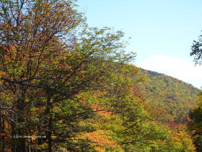 I made it a ways down the road, maybe a mile or two, before a state park ranger stopped his truck and gave me a lift back to my scoot. Time enough to get a few more shots of the leaves. Failing to do this loop had never felt so good! My legs got over their anger for the most part after the first day. I’d been eating like a king since I had LT supplies to use up. Plus the sun was shining and I didn’t have to pay for a tow truck ride home 🙂
Think I’ll actually be a bit sad if I ever actually finish this loop. It has jokingly become my white whale and I think I’d miss it in that context if I go all the way around. Definitely will be back next year to try though!

18 pictures and tales of happiness on trail from the last of my Long Trail warm up trips. Well, at least for this year 🙂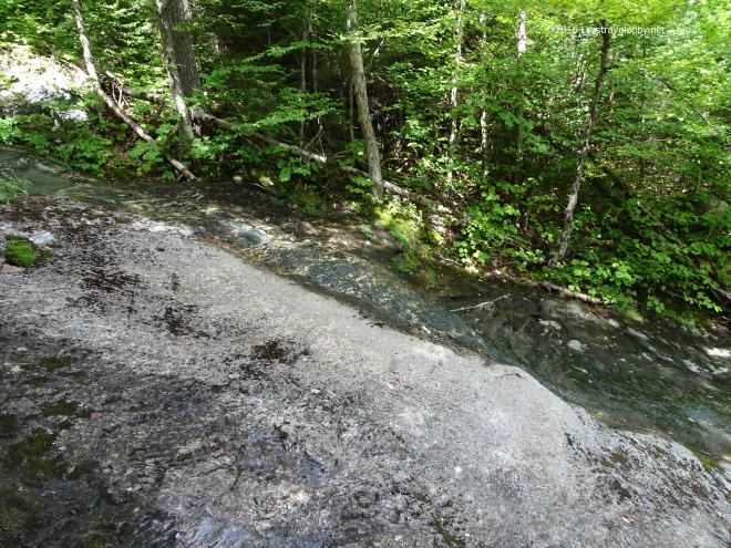 I was glad to see there was still at least some water running down this rocky bed. Most years this is a nicely babbling brook, but with the dry Summer I wasn’t sure what I’d find. Seeing water here reassured me that I’d probably find water on the other side of the mountain where I needed it to be.
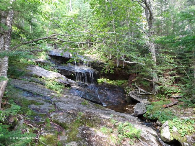 This waterfall looks totally different when the flow is higher. I think this version is actually prettier to look at, but seeing the lack of water always sets off alarms in my head. Water sources are very important to steam engines like me so as much as I hate walking in mud a dry year leaves me nervous.
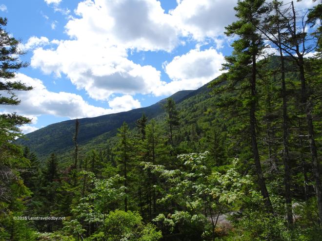 This first view towards the West always marks the beginning of the actual climb in my mind. It is the first chance to see the terrain starting to open up. I can’t find a name for this mountain on my maps but the farther section is listed as Red Ridge.
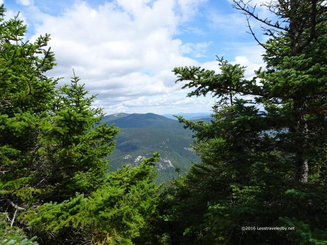 Gaining a bit more altitude and crossing to the other side of the ridge affords a peek at the Baldpates. From here it is easy to trace the route of previous trips, including the most recent, up over Hedgehog Hill, West Baldpate and then finally the exposed slabs of East Baldpate. The climb may go higher on this side of the notch, but looking at that terrain it is understandable that this side seems easier.
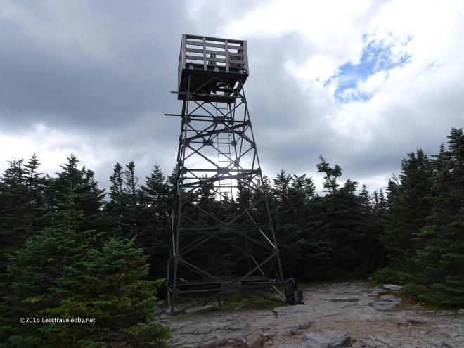 My nemesis, the tower on top of Old Speck. I can climb mountains with little thought of fear, but ladders and even some old rusty staircases on the mountaintop towers I come across can really freak me out. I’ve been trying to get to the top of this tower for years and almost made it this time 🙂 Transitioning from the top of the ladder to the tiny wooden platform proved to be too much, but I was trying to get in shape for the towers of the LT so figured I at least got some practice being afraid.
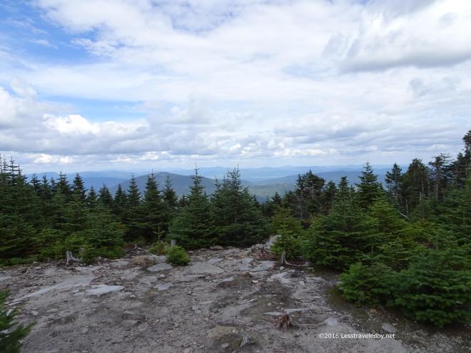 Even from the foot of the tower the view was pretty nice. Looking North the eyes were torn between the mountains fading into the distance and the nature of the gathering clouds. There was some chance of rain in the forecast, but knowing these mountains this sky said it was a pretty sure thing.
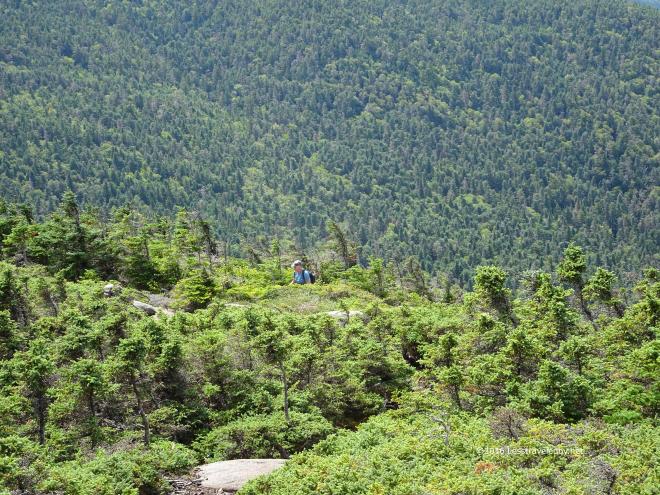 For now though there was sun and I was off to explore a new stretch of trail I’d never seen other than on the maps. Heading to the South on the AT I broke out of the scrub onto a rocky, open area that showed me a whole new view of the world. Then I heard the tell tale shuffling and puffing of a hiker coming up the ridge a few moments before he popped into view.
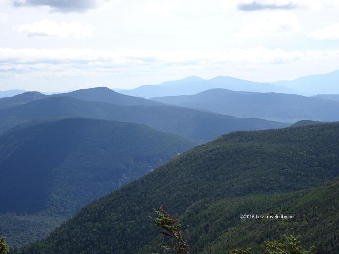 Looking out into the Mahoosucs from up here was amazing. I’d seen this area from farther away and a different angle on my trips up Sunday River Whitecap, but now they seemed so close.
 Some haze in the air limited the views, but considering that Success Pond in the middle of this shot is in New Hampshire and the distant profile of Mansfield and Camels Hump on the LT in Vermont were easy enough to make out I didn’t exactly feel like I’d been cheated out of much.
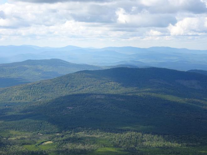 The clouds continued to gather, but I was content to take my time and soak up the amazing views. I knew I didn’t have far to go to reach Speck Pond so stayed up above the trees while I had the chance. The late Summer light on the forests below was making me very happy I’d gone to the trouble of climbing up there.
 Now was time for climbing down though. Looking back up one last time before sinking into the trees I could see the rocky spots I’d stopped at earlier up near the top. This section was filled with very steep, rock wall bits of trail. The sort you need hands to climb up and tend to slide down on your butt either on purpose or by surprise.
I ran into an older couple of thru hikers who were slack packing NOBO at the base of this rocky section. He was smiling patiently as she cussed up a storm about how much she hated Maine. When she asked me to tell her that she was almost to the top I felt terrible having to let her know the worst was yet to come. Seems she had run out of joy for the trail, but they weren’t about to stop so she was left banging her head against mountains. I wished them luck and moved on reminding myself to walk in joy or not at all, as she certainly didn’t seem to be having a good time.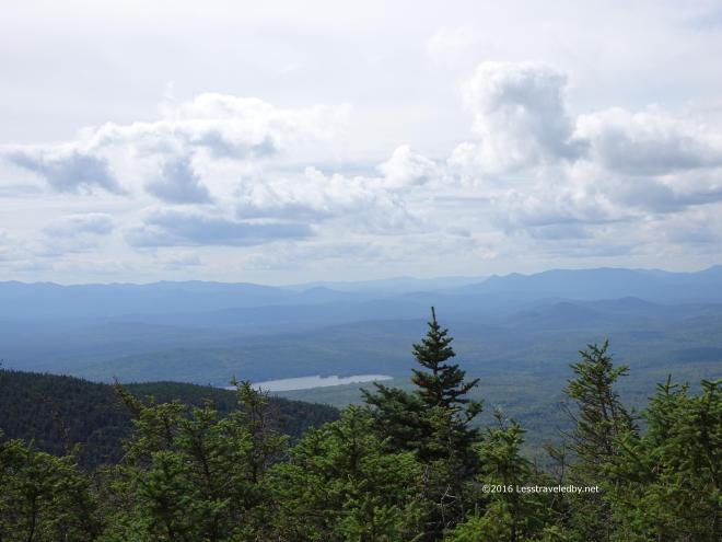 As much as I looked forward to getting to camp I hated to go back into the trees. Even with the hazy sky, being above the trees and being able to see the world out there is always such an amazing experience. It sort of seems that way even if you drive to the top of a mountain, but the slow process of climbing up there enhances the experience in my mind. You get to see the world from angles that folks stuck on the roads never will too, making the views and the memories of them more personal.
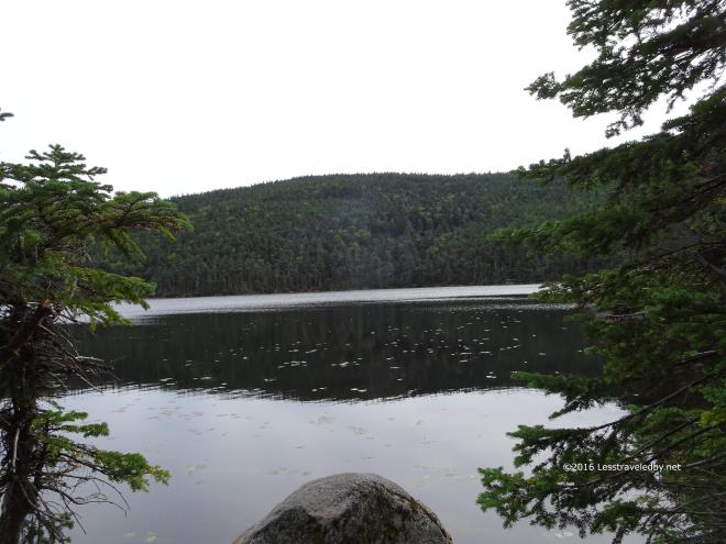 By the time I reached Speck Pond the overcast had pretty much filled in. Looking at the water made me wonder if there was a spring at the camp. Filtering pond water is usually a pain, often requiring a backflush on the filter to clear out the scum that builds up from the particles in the water. Turns out there was a spring and it was even running. The downside was that a recent hard rain had washed a heavy load of tannin into the source and it was coming out on the brown side. Tasted fine enough once filtered, but pouring brown water down your throat tends to set off instinctive warnings in the brain, at least for the first day or two.
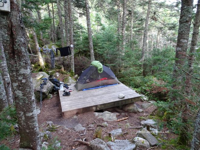 I found this lovely tent pad available and set up to one side in case things filled up and I was asked to share. Easier to plan ahead than move everything later is what I’ve found when staying at the AMC sites. On this night I had the spot to myself, though nearby neighboring pads were all filled up. Oddly enough the two guys camping next to me were also carrying MSR Hubbas. We all had the older, green, preNX model and had arrived from our various directions in this one tiny spot in the Maine woods at the same time.
 Despite the forecast and looming skies there was only a single woman who chose to stay in the shelter that night with the rest of us choosing to tent. She was the only one who packed up a dry camp in the morning as the rain finally started about 3am and came in waves throughout the early morning. I’ve heard this shelter has been entirely dismantled and a new one built on this spot just recently. After all these years of wondering what it was like down there at Speck Pond and finally getting a chance to see I now find I have to go back because it has changed. I’m OK with that 🙂
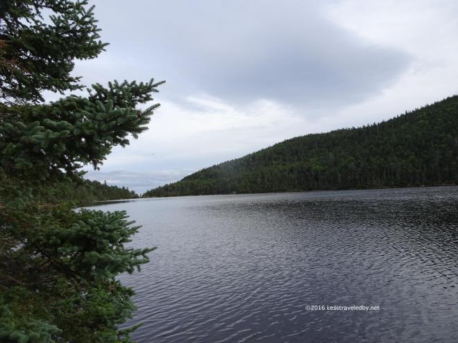 Looking out across the pond I was surprised that I kept hearing people talking. It seemed like such a peaceful spot, yet these voices kept intruding. My natural instinct when I’m in the woods is to whisper or speak in very quiet tones. Hearing these people, wherever they were, reinforced that philosophy as wise. I’d hate to be the person responsible for disrupting someone’s peace and quiet.
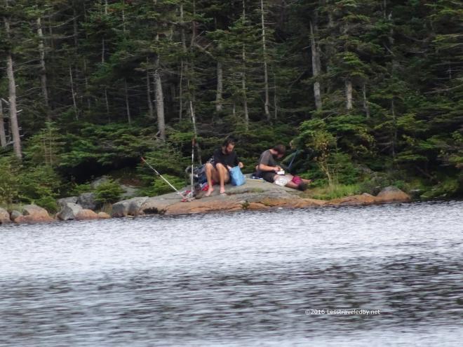 Thanks to the new camera I was able to figure out where all the noise was coming from 🙂 These hikers had opted to camp next to the pond on the far shore rather than pay the fee to stay at the AMC site. Scroll back and look at the previous picture, they were camped where the treeline comes down to a V, way across the pond. Voices carry.
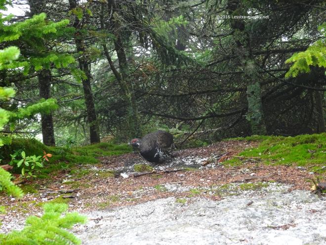 The next day started out wet and stayed that way all the way back down to the scoot. The only pictures I took were of this Spruce Grouse which seemed to have staked out a natural hiker resting rock as a begging spot. Beautiful bird, but a shame that people feed the wildlife and change its behavior.
Sadly, this last trip prior to leaving for the Long Trail was my undoing. Well, the undoing of the rear tire on the scoot to be more specific. On getting back to the bike and loading up I noticed that the tire was totally worn down to the belts in a strip that ran all the way around. Apparently the rubber had been unwinding on the trip up and now I was faced with a long ride home on a sketchy looking tire. I didn’t need to worry about that for long though as the tire failed completely after just a few miles heh. Thanks to the help of some very nice ladies who live on a farm along the highway and a large sum of money paid to a towing company I made it home that night. A huge, unexpected expense right before heading off on a month long trip was too much. It was hard to cancel the trip with it being so close at hand, but I think I made the right call.
My only regret is that I had my legs in primo condition at the time of this trip. There followed almost an entire month of not getting out on trail that saw them fade quickly. Missing those legs now and especially on a few trips I’ve taken since. Have to remember not to take such a long break once I get them back in shape!

24 pics from a quick training trip over and back one of my favorite mountains in Maine, East Baldpate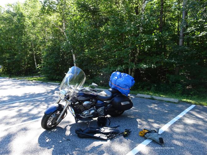 Unloading in the Grafton Notch State Park lot I was excited to be getting back out on trail. Early August was devoted to family stuff but now I was ready to spend some time going up and down some mountains to see how strong the legs really were. At this point I was just a few weeks from starting the Long Trail with bags and boxes of food piling up at home. It seemed a good idea to make sure to spend some time keeping the legs warmed up too.
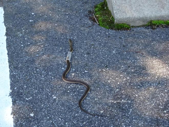 This good sized snake had apparently hitched a ride all the way up there inside my rolled up motorcycle cover. Near as I can tell he must have gotten in there at some point in the garage trying to peel off that old skin and ended up bungee corded to the back of my scoot for a ride across the state of Maine.
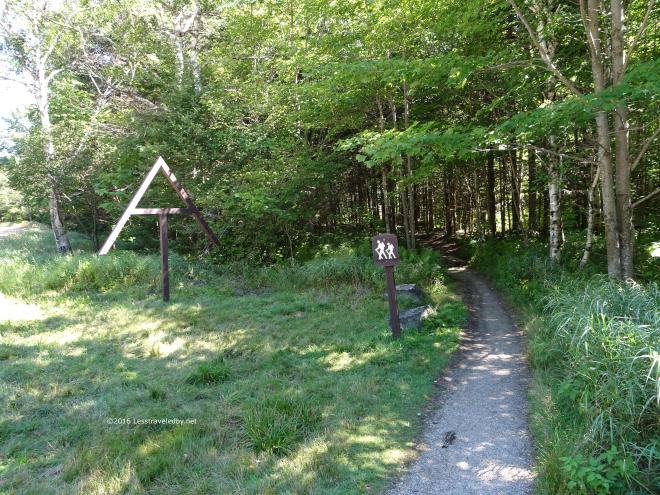 He headed off into the woods to the south while I crossed the highway towards the woods on the other side. The well marked and groomed trail head usually makes me giggle a bit. It seems like a baited trap if you know what follows.
  On a warm August day the shadows of the forest were welcome, though they do hold back any sort of breeze. The first part of the trail climbs a bit, then rolls for a while before reaching the Baldpate shelter.
 I had never taken the time to visit the shelter before despite hiking past the sign for it many times. I stopped in to eat lunch and do some exploring since I wasn’t in any hurry on this trip. The metal roof was noisy, but it seemed a nice enough spot. The stream behind the shelter was running nicely thanks to some recent rain.
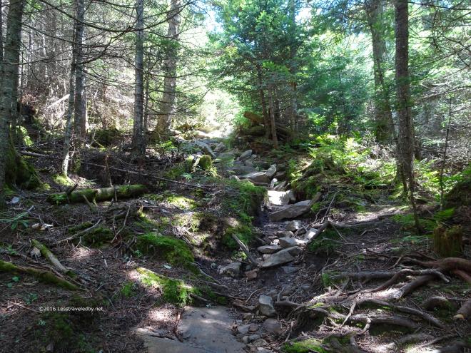 Then it was time to start the actual climb of West Baldpate. Right past the shelter turn off the trail starts a series of stony ascents.
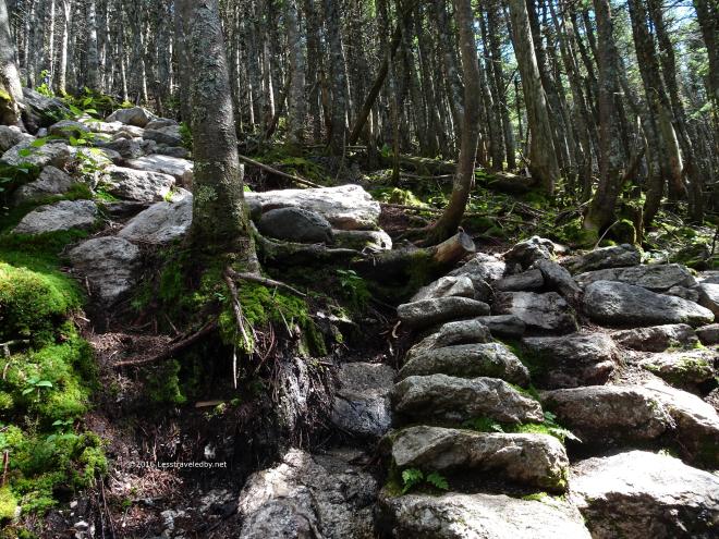 Thanks to the efforts of some dedicated trail workers these stones have been organized in many places to create a staircase affect.
 Perfect trail for testing out the legs. This sort of climbing requires high knee lifting and taking on challenging foot placements without losing stride. Thankfully I’ve done this climb enough to know how short it is because on a hot day it is definitely one to get on top of and put behind you.
 Breaking out of the trees near the summit meant losing the shadows but gaining a nice breeze.
 Also some nice views of the mountains ahead for those staying on the AT. Pretty sure I could see at least as far as the section I’d done back in June. A view like that makes a person want to just keep walking to reach that horizon.
 One step at a time though, so first it would be time to traverse the shallow col and head up the exposed side of East Baldpate. Again having done this route before I know how much fun that will be rather than being concerned about how big it looks. The first time I stood here I was a bit nervous about it, but the slabs make an easy ramp compared to the rock pile trails I’m used to.
 The col is a neat alpine bog and thankfully most folks are pretty good about sticking to the trail. The rock bowl here traps water keeping the ground wet even in a dry year such as this one. I always get a kick out of passing through alpine bogs just because it seems strange to have wetlands on top of a mountain.
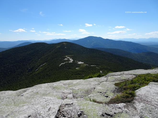 Soon enough it was time for second lunch on top of the slabs. The actual summit is a bit farther down the trail, but the big open ledge at the top is a great spot to take in the views to the west and south. Here you can see the west peak where I stood earlier with Old Speck rising up behind.
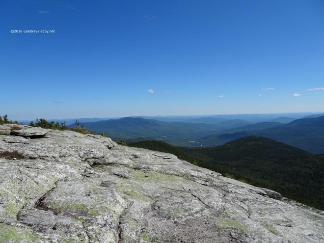 Looking to the south where the mountains give way to rolling hills of farms and forests. Just a great day to be on top of a mountain with no place to rush off to.
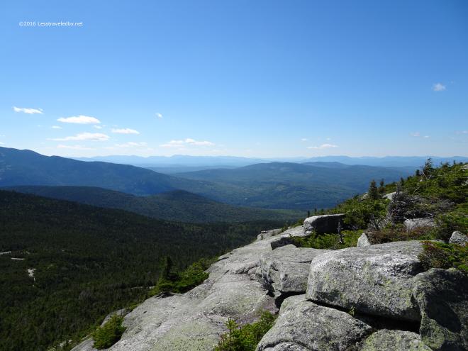 The northwest view towards NH and VT. With the LT trip on my mind I recall looking at the shape of the mountains on the horizon and trying to match what I saw with the elevation profile in my head.
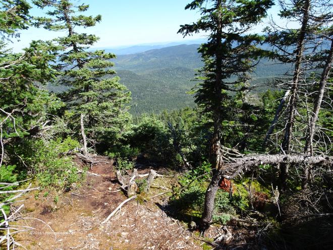 Then it was time to head down the back side of the mountain onto the Grafton Loop. Once you leave the Appalachian Trail on top of East Baldpate things change quickly. With little foot traffic the ground under foot is actually ground in many places, rather than rock.
 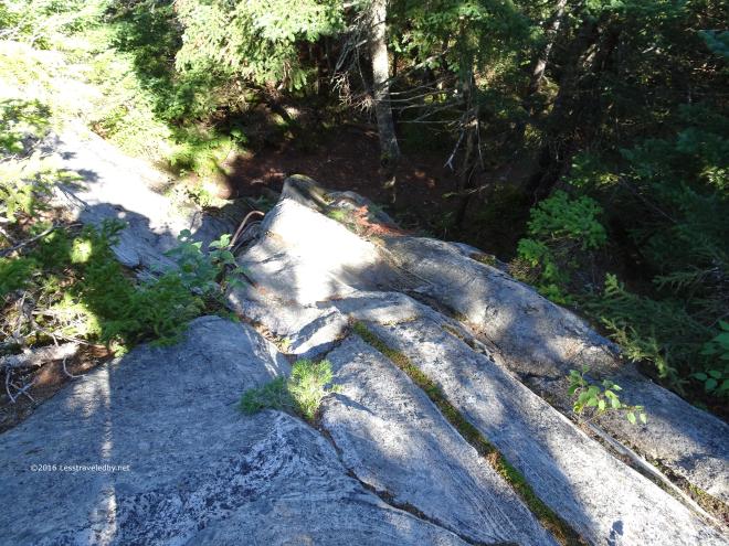 The view from the top of this rock is hard to capture on a camera, but when you stand there in person you can see just how far down you are heading. I’m glad the trail maintainers saw fit to build the rungs into the rock to encourage folks to take the direct route. This is just the sort of spot folks will do a lot of damage to trying to find easier ways around.
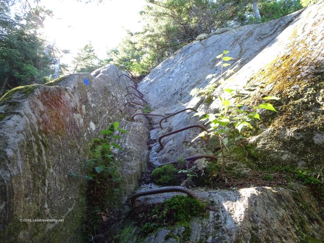 The view from the bottom gives you a better perspective on what a person would face without those rungs there. Not the worst notch I’ve ever had to wedge myself into to climb, but coming down would be dicey, especially when wet.
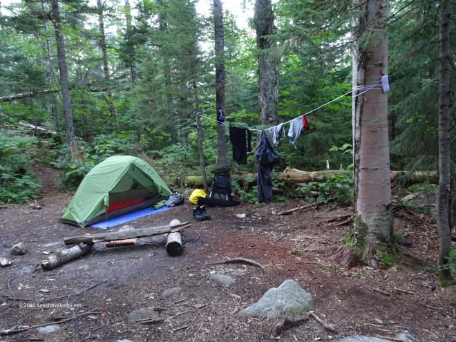 My usual spot at the East Baldpate campsite which despite the name is well over two miles from the summit. The sites on this side of the loop are under the care of the MATC and only lightly improved. There is a latrine and a network of paths leading to some open spots for making camp. No fires are allowed anywhere on the Grafton Loop so be sure to bring a stove if you come here.
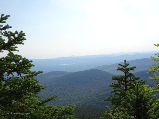 After a peaceful night it was time to head back up to see what the morning views looked like.
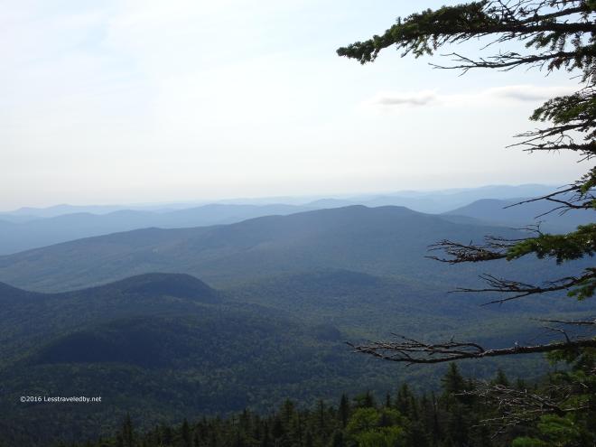 It was a bit hazy so the horizon was a bit closer than the day before, but it was a beautiful morning indeed.
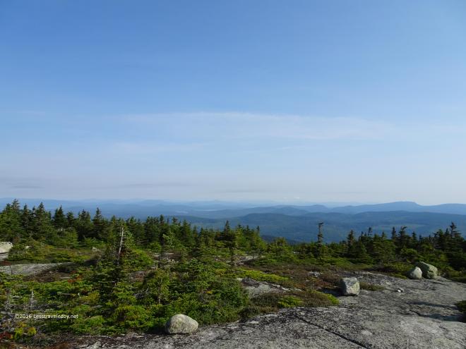 Up top at the east summit the wind was blowing strong. I’d worked up a bit of a sweat steaming my way to the top and despite the views didn’t stay long in fear of freezing to death.
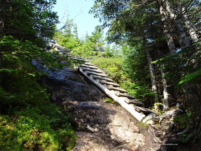 Heading back up from the col to the West Baldpate summit taking advantage of another nice ladder. This spot had some moisture on the rocks and would be quite treacherous without the aid. I take on whatever I find on trail, but always appreciate the effort when someone builds me an easier way.
 One last view before heading down into the trees. Yup, it might be a lot of work to climb up to these places, but worth it to have moments like these.
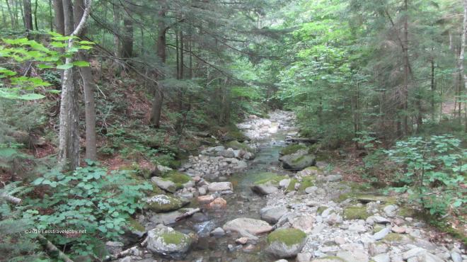
Chittenden Brook near the LT in Vermont
Saturday was supposed to be the start of a four week SOBO adventure on Vermont’s Long Trail. For those who’ve been reading since the start you know I’ve been wanting to do this forever and each year start out thinking this might be the year. Usually by mid Summer I’ve either hiked myself into an injury or had family commitments come up that force me to say “Maybe next year.” This year was different.
When I injured my hip on the June AT trip I walked my way through the recovery keeping my legs strong and discovering that the hip felt better the more it was used. The support I had from my family was amazing and despite some issues with our car my wife was practically pushing me out the door because after all these years she was as tired of me not going as I was.
Things were looking so positive I began to stockpile food and was putting mail drops together in between trips to make sure the legs were primed for the trail. Last week, with the start of the trip only ten days off, things fell apart. I mean literally fell apart, as on the return from a Speck Pond overnighter the rear tire on my motorcycle failed spectacularly. Thankfully I was able to get it off the road safely and even was lucky enough to be near a house full of friendly farm folk who let me use their phone to try to find some help for the bike. Alas, in the far reaches of Maine, help is hard to find. I ended up paying a small fortune to have the bike towed home.
If this unexpected expense was my only issue I’d probably suck it up and chase my dreams, but it really is more the last straw on a tall pile of reasons to call the trip off. Our car, the one the girls would have to use to drop me off and pick me up on either end of VT is circling the drain. After having been stranded on the side of the road in the middle of nowhere its the last thing I’d wish on them. There are a few other things going on as well that had me hesitant about abandoning my post here at home for so long. My wife being so supportive doesn’t make it any easier 🙂 A woman who loves you enough to tell you to go is worth staying home to spend time with!
So here we are again another year later and the same sad story. Fall will come to Vermont without me once again. I’d say “Maybe next year.” but at this point I’m not sure I can say it with much conviction. For now I’ll focus on what is possible rather than what is not. I’ll get to spend more time watching my daughter start kindergarten. My wife will have some help raking the leaves that will start to fall soon enough. Who knows? I might even sneak out to visit a mountain or three. Besides, with the lack of rain this year the leaves will just turn brown and fall off, but next year…

39 pictures from a second attempt at a trip that ended waist deep in a flood when we first tried a few years back. This time we finally got to see the entire loop and no one was at much risk of being swept away.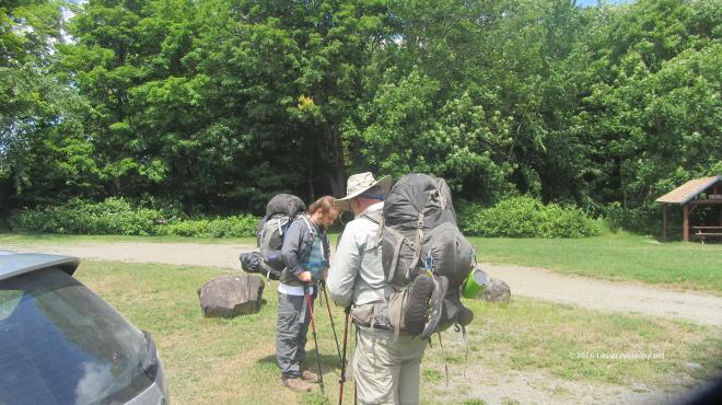 But let’s start at the beginning, loading up in the parking lot. Once a year the boys from Texas fly up to Maine to eat lobstahs and allow me to drag their butts through some mud or over a mountain or two. Like our previous attempt we were headed counter clockwise around the loop, but this time Frost Pond would be our last night rather than our first so we were starting from a different spot in the Trout Brook area.
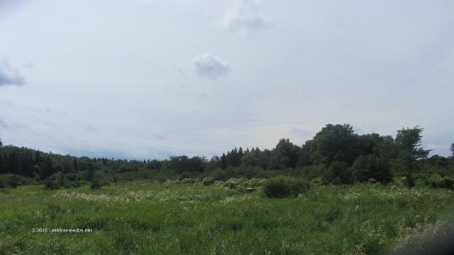 This trip was a month later in the year and we were hopeful the weather would be kinder as the forecast called for little chance of rain during the week. It was warm and a bit humid, but we had only five or six miles of relatively flat trail for the first day.
 On our previous visit to the Little East campsite we’d had wonderful luck pulling dinner out of the brook before the storm hit. We all broke out our rods and got busy soon after reaching camp in hopes of a repeat performance.
 Sadly we were only getting hits from undersized fish for the most part, though my nephew did manage to find a couple of keepers to have for a snack. I felt bad about torturing the little ones that kept taking my lures and decided I’d settle for eating out of my food bag and sleeping better instead.
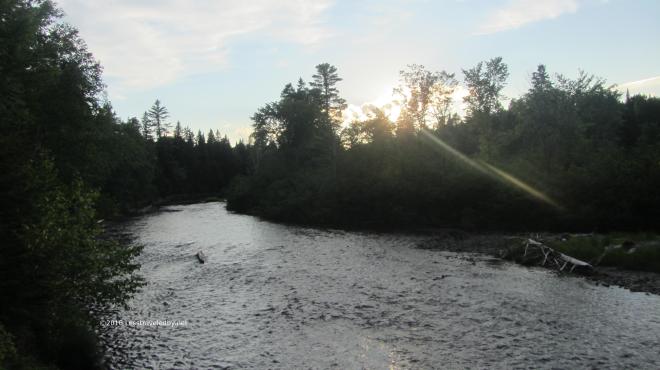 The brook was running quite a bit lower than normal as the Summer had been pretty dry. Certainly a far cry from the muddy and foaming flood that was pouring through here on our way out last time.
 The confluence of the Little East Branch of the Penobscot and Webster Brook was peaceful as evening came on. After a first day of easy trails everyone was feeling pretty good, but I could tell the horrors of the previous trip had left a mark on everyone, leaving us all a bit nervous despite the lack of reason for concern. I knew once we made it to camp the next day that would all be gone.
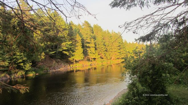 The peaceful sunset continued as sunsets do and we passed a relatively peaceful night. There was a brief shower and the patter of rain on the shelter roof was enough to make us all sleep a bit less easy. Thankfully the morning dawned clear and we were on our way up the brook.
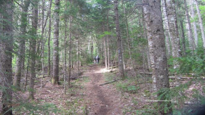 Having been here just a few years ago the trail seemed familiar, yet very different since it was so dry. Last time the rain had been coming down for more than twelve hours by the time we were in this spot and trail was puddling heavily already.
 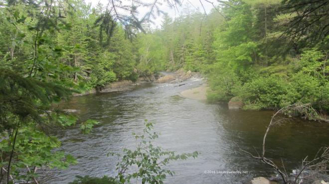 The brook was flowing well enough as it is fed from Webster Lake via an outlet near our next campsite. Last time it had seemed like it wanted to eat us, but now it looked like a relaxing spot to camp.
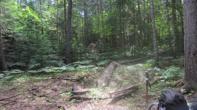 We stopped for lunch where the old Webster Stream LT used to be. I’m pretty certain it stood somewhere right about here. Not sure if they helicoptered out the debris, but the site restoration was so well done that we weren’t really sure if this was the exact spot. I did find a tiny piece of roof shingle to verify it had been here close by.
We took shelter here after being turned back by the flood on our previous attempt. Soaked after a long day of hiking in a deluge and then wading back out of the flood at the Hudson Brook crossing we were happy to spend the night here. In talking to the folks at the Baxter office they said almost no one ever reserved this site and after the tornado it was removed as part of the rehab effort.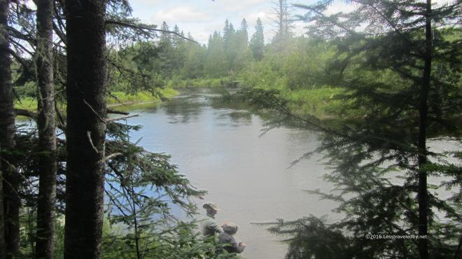 It really was a pretty spot and I’d imagine early in the year the fishing might be good as there is a deep channel here. The boys headed down to filter some water rather than fish as we still had some miles to go that afternoon.
 We passed through this area filled with raspberry bushes and I was grateful to find they weren’t quite ripe yet. I have a feeling this spot is bear central once those berries turn red. As much as I like eating those wild berries I don’t want to have to wrassle a bear over them.
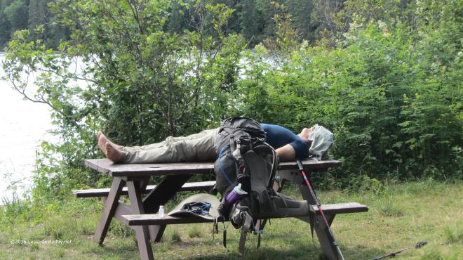 Ahhhh, camp. We found the newly created bypass trail to be an amazing bit of work. Shortly after the flood we enjoyed there followed a tornado that toppled a huge swath of trees. That one two punch left a mess easier bypassed than recovered so a couple of miles of new trail were created from scratch. When we crossed over Hudson Brook it was so tiny we didn’t even realize what it was at the time, but we were moving along quickly in anticipation of finding our campsite.
 Once we found it we were a bit less enthused heh. Clearly this site being so far from the park road and accessible via means other than walking (boat & snowmobile) meant it saw a lot of use and some of it by folks not too concerned with being good neighbors. Most sites with canoes will have a bunch of life vests and certainly more than just one paddle. On the other hand this site came with an old burnt up pan and a latrine filled to the top with trash so there was a trade off, though not in our favor.
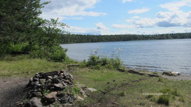 It did also come with some great views. Right on the lake it was exposed to the wind, but there was full sun and lot of beauty to soak up.
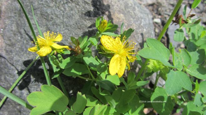
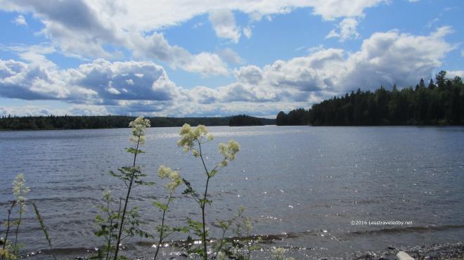
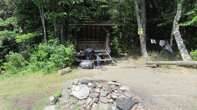 The LT here is pretty small, but this site is also a tent site which is rare, allowing a total of twelve in a party. The boys decided they would set up their tents on the grass to enjoy the breeze leaving me the lean to all to myself. Well except for a shelter mouse heh.
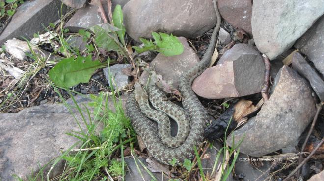 There were two different looking snakes living in the rocks around the fire ring. They would come out to sun themselves, only withdrawing into the rocks if we walked too close. I was hopeful at this point that they had eaten all of the shelter mice since they looked to be fat and happy snakes.
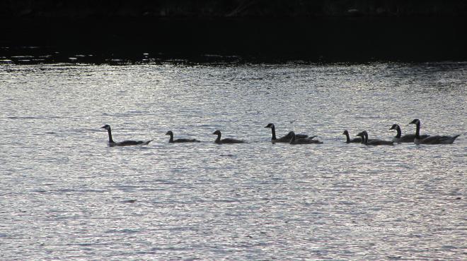 Speaking of fat and happy, this flock of geese swam right through our front yard later in the afternoon. There were also some loons and at least one bald eagle working the edge of the lake.
 The boys decided to see if they could hang their food bags which made for good entertainment. They each took a shot at it and in the end settled for what they could make of the situation. Since mice and chipmunks were our biggest threat they did just fine, but I think a smarter than average bear might have gotten their bags.
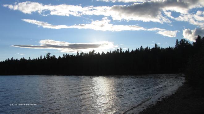 The campsite may have had a bit of a dumpy feel to it, but there was a lot of good to be seen here as well. There was a great moon to enjoy once the sun set, but we were sleepy campers and missed it for the most part.
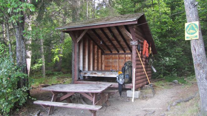 Packing up in the morning I’d survived my night with the shelter mouse. He survived too, but not unscathed. At one point, a particularly bad point for him, he jumped up onto the side of my tent that I’d pitched to keep him at bay. I happened to be sitting in just the right spot that the instant he hit the tent my hand instinctively slapped him off. He flew into the night and didn’t return 🙂
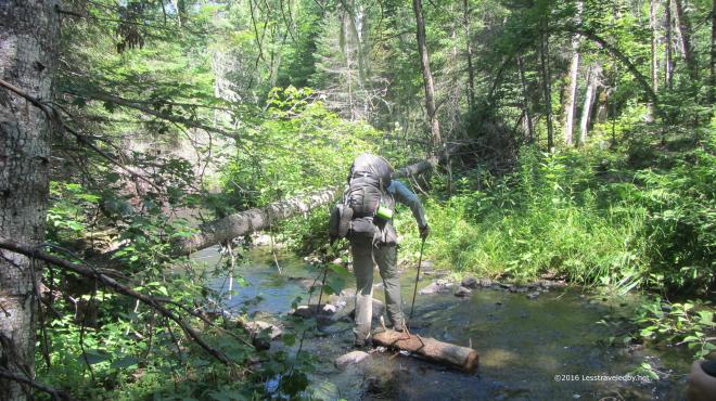 Leaving Webster Lake in the morning headed towards Hudson Pond we found ourselves crossing Hudson Brook again. It was hard not to giggle at the thought that this tiny creek had given birth to the raging flood we found ourselves trapped by on the last trip. Of course that was the nervous giggle that only a man whose found himself thigh deep with a rising flood roaring all around him knows isn’t all that funny, but still, this seemed impossibly small.
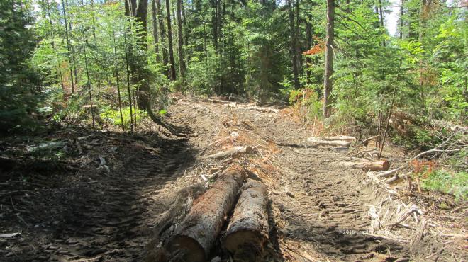 Heading up the hill towards Hudson Pond we entered the Forest Science area of Baxter State Park. First we passed through an area that had been logged some years before. The trail there was very hard to follow at times with few blazes and little in terms of an obvious treadway. Some trees had been cut about ten feet up leaving a tall stump with a blaze on it, but there were areas where we had to really pick our path carefully while avoiding both mud pits and fallen branches hidden under deep grass.
Then we came to a warning sign that we were entering an active area and sure enough we crossed paths with a man hauling logs along a path slashed through the forest.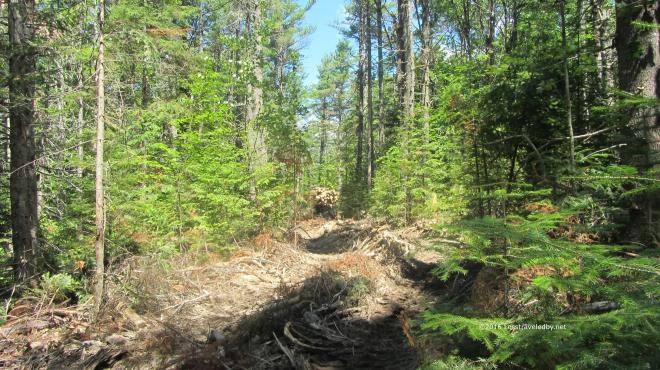 You can just make out the tail end of his tracked vehicle rounding the corner with a full load. The experience of watching and listening to this mechanical beast after several days on trail was most odd. Even stranger than the feeling one gets watching cars zip by at the average road crossing. Soon enough we were out of sight, but we would hear this man working for the rest of the afternoon.
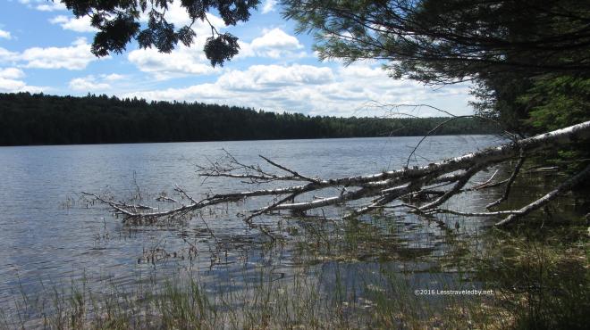 We arrived at Hudson Pond early enough in the day for some exploration, though it was a bit hot for hiking much more.
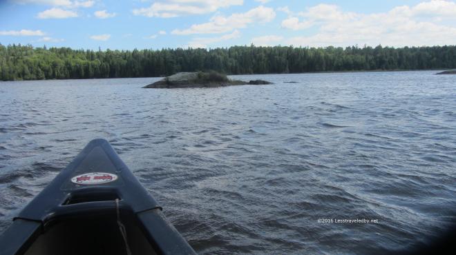 Thankfully this site not only came with a canoe, but two paddles. We took turns paddling with just two going out at a time to avoid overloading the canoe. There was a pretty stiff breeze out on the water though we were able to head up wind first and then coast home.
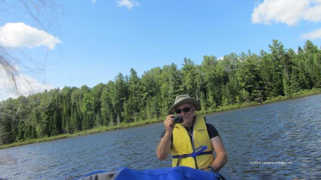 I took a series of wild, over the shoulder, no look shots of my brother with the rest coming out worse than this. Managing a camera and a paddle while bobbing up and down in a canoe is not an exact science so I was happy to have him actually in one of the shots.
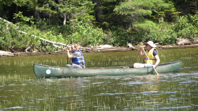 Later he headed out with his son who is studying aquatic bugs and turned our trip into a collecting expedition as well. He brought along numerous containers and a net for hunting down specimens. He also used his collection skills to wipe out a lot of deer flies which never seemed to end up in a collection jar so I’m guessing that was just personal.
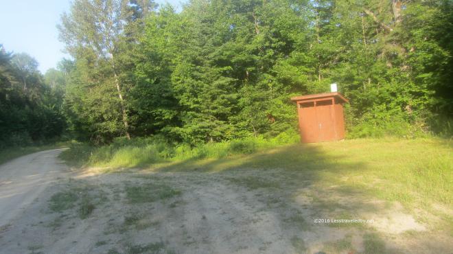 The next day we had a lot of miles to cover to reach our last campsite. We got an early start and soon were passing through a day use area where the forestry people have an open shelter and a privy. Once we passed this road we were back into the Baxter we know and love so well with lots of boggy sections.
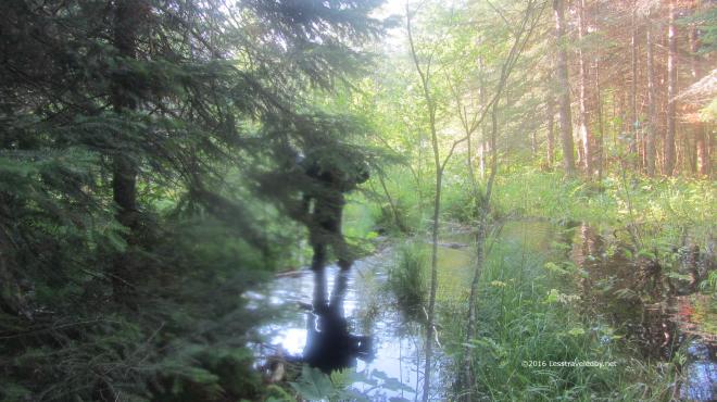 This crossing was one of the best parts of the trip. The trail just ended in this swampy pool being held back by a naturally formed debris wall. The murky water was about a foot deep with no clue as to how deep the mud below might be. The boys started talking about taking off their boots for a water crossing when I spotted the debris just down stream. Walking quickly as my feet were sinking in with each step, I carefully worked my way across. Seeing me on the other side is all it took to inspire them to follow quickly behind and I just barely managed to get my camera out for this shot. I think that is my nephew behind the tree, but it is hard to tell. I do know they both got their feet a bit wet but at least no one got sucked down into a mud pit.
 Gathering our courage for the big climb ahead of us. Well not a really big climb, but the only real mountain we’d see the entire trip. Hot and low on water due to nothing but swamps along the trail all day it was a bit of a struggle to the top.
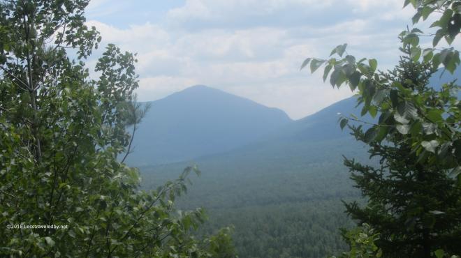 There was a bit of a view from some open rocky areas near the summit and we stopped for lunch. It was hot in the sun and the low water supplies kept us from staying here too long. The boys were very dry by the time we reach our final campsite at Frost Pond and while I drank the last of my water soon before finding the camp I too was ready to soak up a couple of liters of Gatorade.
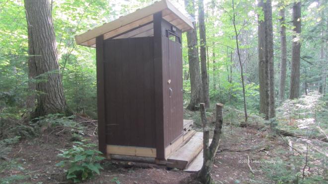 I was astounded to see this fancy new privy on the hill above camp. On our previous visit here the latrine was an open metal cage with a toilet seat bolted over a hole on top. This beauty smelled of fresh cedar and the boys kept saying it smelled like the lumber store. So in two days we went from one of the worst latrines I’ve ever seen to this brand new marvel. I feel bad for anyone doing the loop in the other direction. This is the sort of privy that spoils a person.
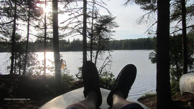 This relaxing late afternoon down by the pond cost me a few bug bites, but it was totally worth it. The canoes here were locked up, perhaps because they are closer to the trailhead. We were content to soak up water, then some dinner and then more water with no need for a paddle around the lake. I have heard good things about the fishing here though and would like to come back next Spring just after the season opens and spend some time with my pole here and at Little East.
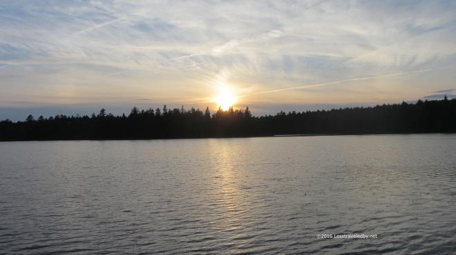
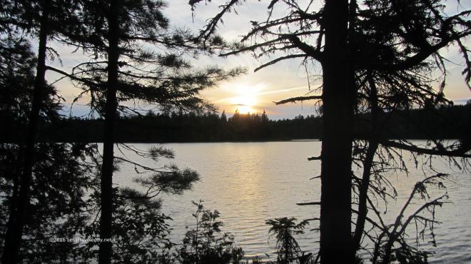 It was a great last night on the trail and with only a few miles back to the car our confidence of surviving this adventure was growing. Of course once you’ve survived everything seems easier and there had been some struggles along the way. Still it was nice to think we’d finally complete the loop that had eluded us.
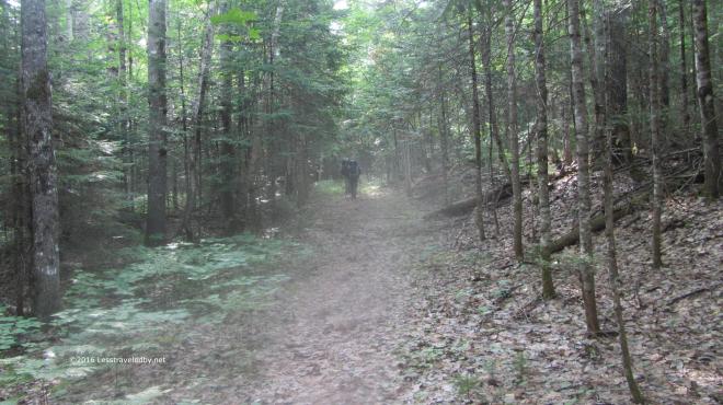 It was warm and steamy, but nothing was going to keep us from finishing the next morning. We all had our thoughts on the cheeseburgers we knew we’d find down the road once we reached the car. The boys were moving right along considering they were on day five of what for them is a rare chance to get out on trail. I’m thinking next year we need to find something with a real mountain in it or they are going to get soft on me. This was a great relaxer of a trip though and I always look forward to getting out on trail with the boys from Texas.
The aborted trip with the epic rain storm was before this site existed. If you are interested in reading the details of that adventure in more depth you can find the trip report I posted on Trailspace here http://www.trailspace.com/forums/trip-reports/topics/146513.html Along with the epic tale of flood survival you can also find a picture of the old Frost Pond latrine 🙂
If you are considering heading out on this loop be sure to come prepared. This is definitely a path less traveled by and you will not find any friendly park rangers out there to assist you. Be prepared to navigate and take your time in the logged out section as that is very hard to follow. Once a person lost the trail there it would be very difficult to find again. Also, during dry years, be wary of the lack of usable water between Hudson Pond and Frost Pond other than possibly Boody Brook after coming down Wadleigh Mtn. In between we found everything to be thickly stagnant and didn’t bother to try filtering. It isn’t a terribly difficult trail, but wilderness should always be respected and despite the forestry science logging this is definitely a wilderness adventure!

18 pictures from a rare car camping adventure in Baxter State Park. I’d made these reservations for a lean to at the Roaring Brook campground early in the year with a plan for the girls to be coming up to meet me at the end of my two week AT trip. They were going to bring lots of food and we’d joked about day hiking. As things turned out we had lots of food and went day hiking 🙂 Car camping is very different from backpacking. Some parts are bad, like having neighbors and overused privies. Other parts are good like a cooler full of food, a full sized propane burner and a percolator full of fresh brewed coffee. My wife and I used to hit the road for weeks at a time when we lived out West and have enjoyed eating well in some very remote places.
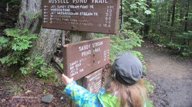 We didn’t let a damp start to the day keep us in camp. With hopes the clouds were about to part soon we headed across the brook via the Russell Pond Trail, but opted to swing off towards Sandy Stream Pond soon after the bridge. The RPT is a bit more rugged and has a rock hop that might have been a bit much for the youngster. Besides, while I’ve gone that way many times I’d never had a chance to try the Sandy Stream Pond Trail.
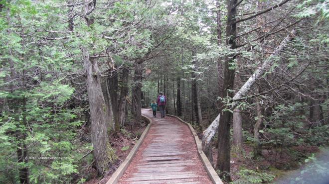 Yup, definitely a bit less rugged this way. The trip out to the pond to look for moose is part of the standard visitor experience it seems and we met many other folks out enjoying the day. My trips to Baxter usually involve rushing away from the trailhead and out into the empty wilderness as fast as possible so it seemed odd to see so many people. I think there may have been a dozen over the four hours we were on this hike, so it wasn’t crowded. I just think of Baxter as empty.
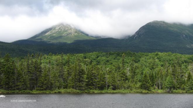 The clouds were starting to lift by the time we reached the first of several viewpoints on the edge of the pond. Hamlin and Pamola were starting to come into view, but Katahdin itself remained shrouded.
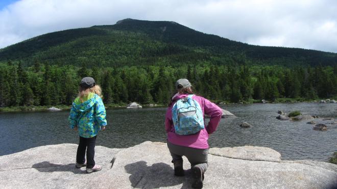 The pond was quite shallow, at least around the edge we were on. The light was constantly changing along with the clouds making it a great day to just sit and look. Backpacking is fun, but there is something nice about not trying to get anywhere too. We had plenty of time to soak the views in before heading further down the trail.
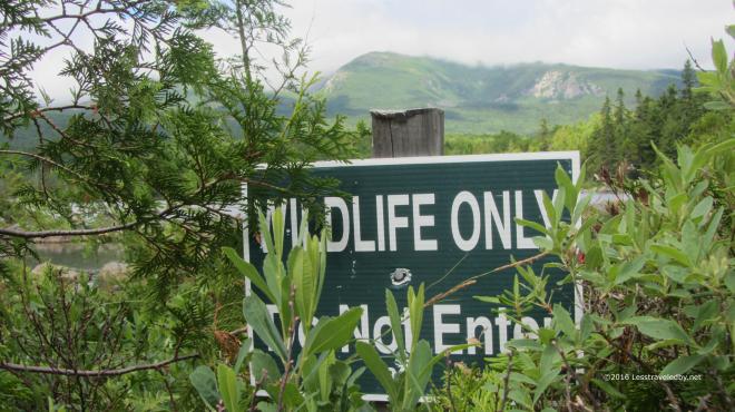 Most folks don’t realize it, but you are free to roam off trail in the Baxter wilderness if you are so inclined. There are a few exceptions though and the area around most of Sandy Stream Pond is set aside to allow the animals a place to be completely free of humans. The signs make me laugh because it seems odd to have a preserve in the middle of a giant park.
 We eventually rejoined the RPT and headed out to Whidden Ponds for lunch. The clouds had continued to linger on the mountains but it was a great day down below.
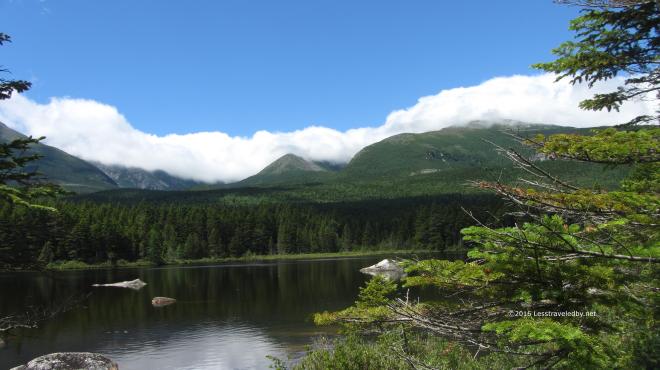 What may have been an annoyance for those hoping for summit views made for a beautiful sight to us. I have stopped at this pond on every trip down this trail to take pictures and probably always will.
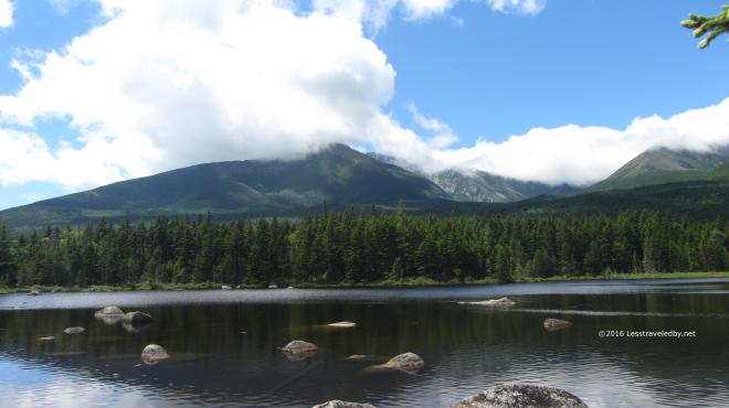 This day was special though because I had the girls with me. Every other time I’d been to this spot I’d thought how nice it would be if my wife could see it. She has had to look at all the pictures I’ve taken from here over the years so it was nice that she finally got to see it in person.
 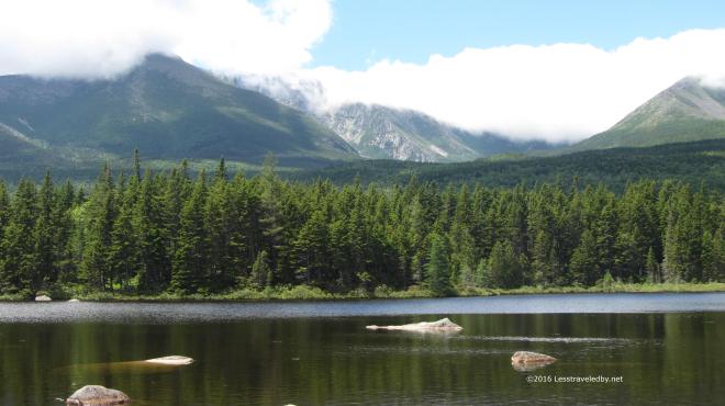 Baxter Peak was starting to be glimpsed through the clouds at times. Maybe the folks would get their summit view yet that day, but we finished up our tuna wraps and started back towards camp.
 Along the way we came across this well hidden toad. Actually we came across quite a few of a wide variety, but this one was so hard to spot at first I decided to take some pictures.
 If you couldn’t find him before this close up might help. Was glad I’d taken this picture to remind me in case I lost him in the wide shot.
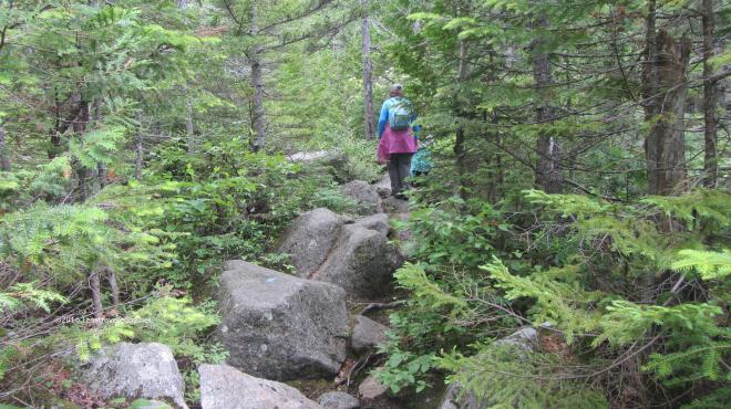 My daughter insisted we were going to climb up South Turner Mountain because the sign said it was only 1.5 miles and she was sure she could walk that far. No matter how much I tried to explain why that wasn’t going to actually happen she refused to be dissuaded. So we went a ways down the trail until we hit the boulder field that marked the start of the actual climb. She didn’t want to admit defeat, but the size of the rocks eventually convinced her we should wait till next year to see if her legs were longer.
 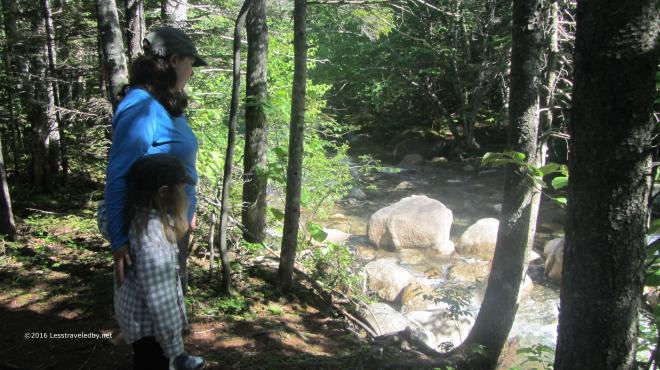 Later in the day we decided to explore the Nature Trail which is a small loop just across the brook from the campground. It wound through the forest, first along the brook and then away from it. Eventually it gave access to two separate boardwalks that let you travel well out into a large bog.
  There were several interesting types of plants to be found. A ranger later explained that there are two types of carnivorous plants in this bog, though they like to eat tiny flies so we were never in any real danger.
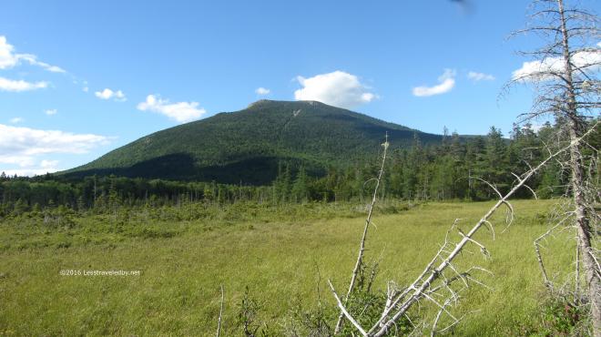 Besides the bog there was also a really nice view of South Turner. My daughter was still saying we should go up there and I think she’s right, we should.
 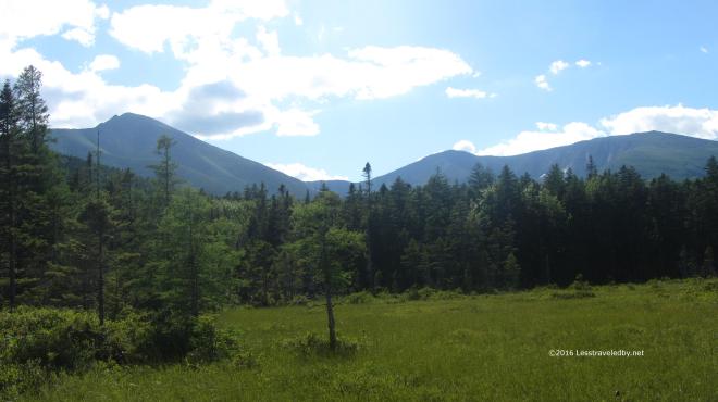 Late in the day to be on the summit, but the views definitely opened up. I’m sure there were a few folks coming down in the dark with their headlamps on with memories to last a lifetime. We had it much easier on this trip. Unless you count the hard work of carrying our gear into our walk in lean to or the challenge of cooking the perfect campfire pizzas we didn’t do much to earn our reward, but we left with memories to last too.
