76 pictures from a killer Pemigewasset trip along with the usual random thoughts that came to me along the way. Bonus video will be posted in a few days. For now enjoy the sights, but thankfully not the smells, of this beautiful four day visit to New Hampshire for some of the best backpacking the White Mountains have to offer.
 By the second week of October the days were already getting short fast. Getting on the road early meant a chilly ride on the scoot, but I didn’t want to get caught on the ridge come sunset.
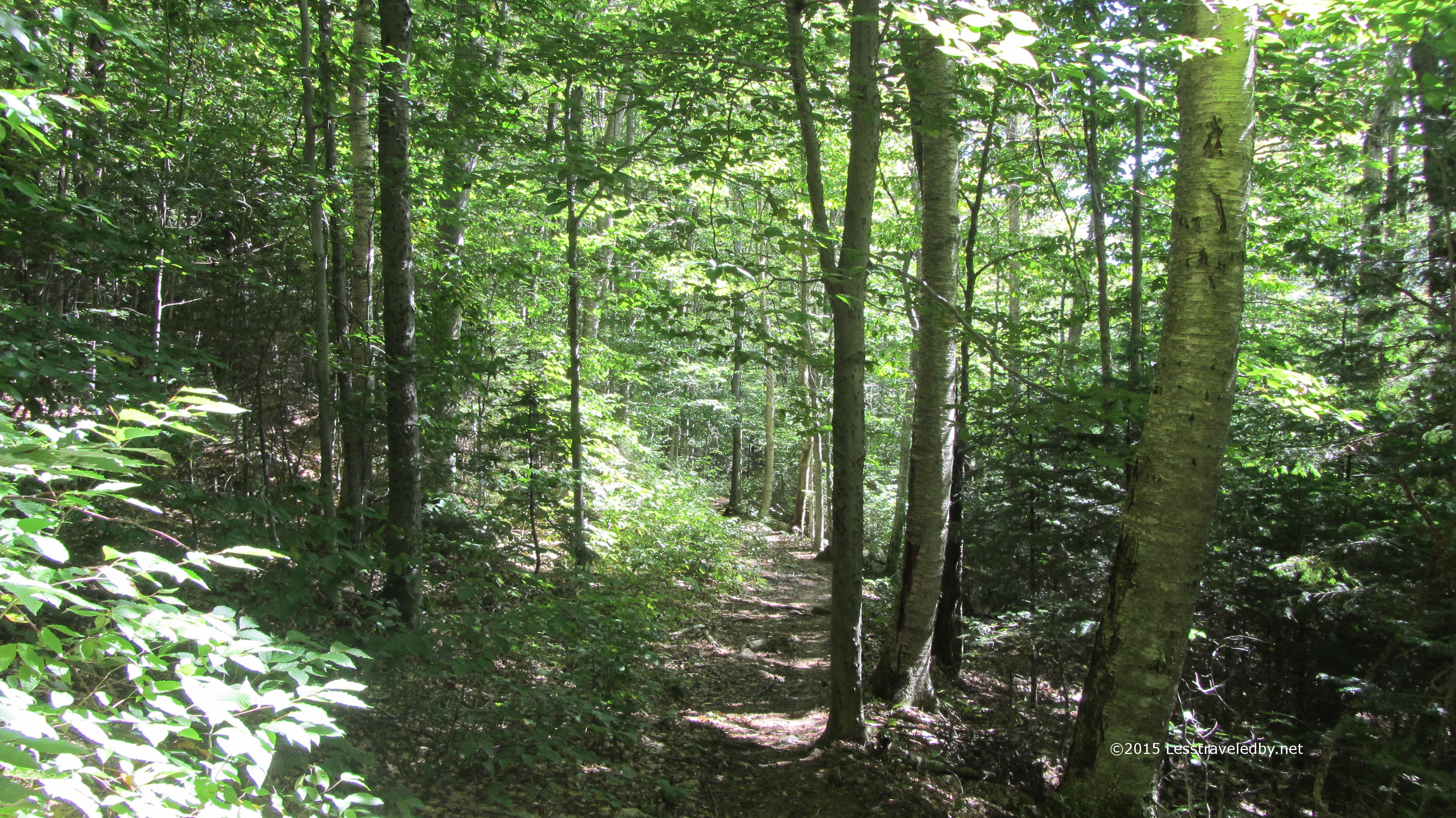
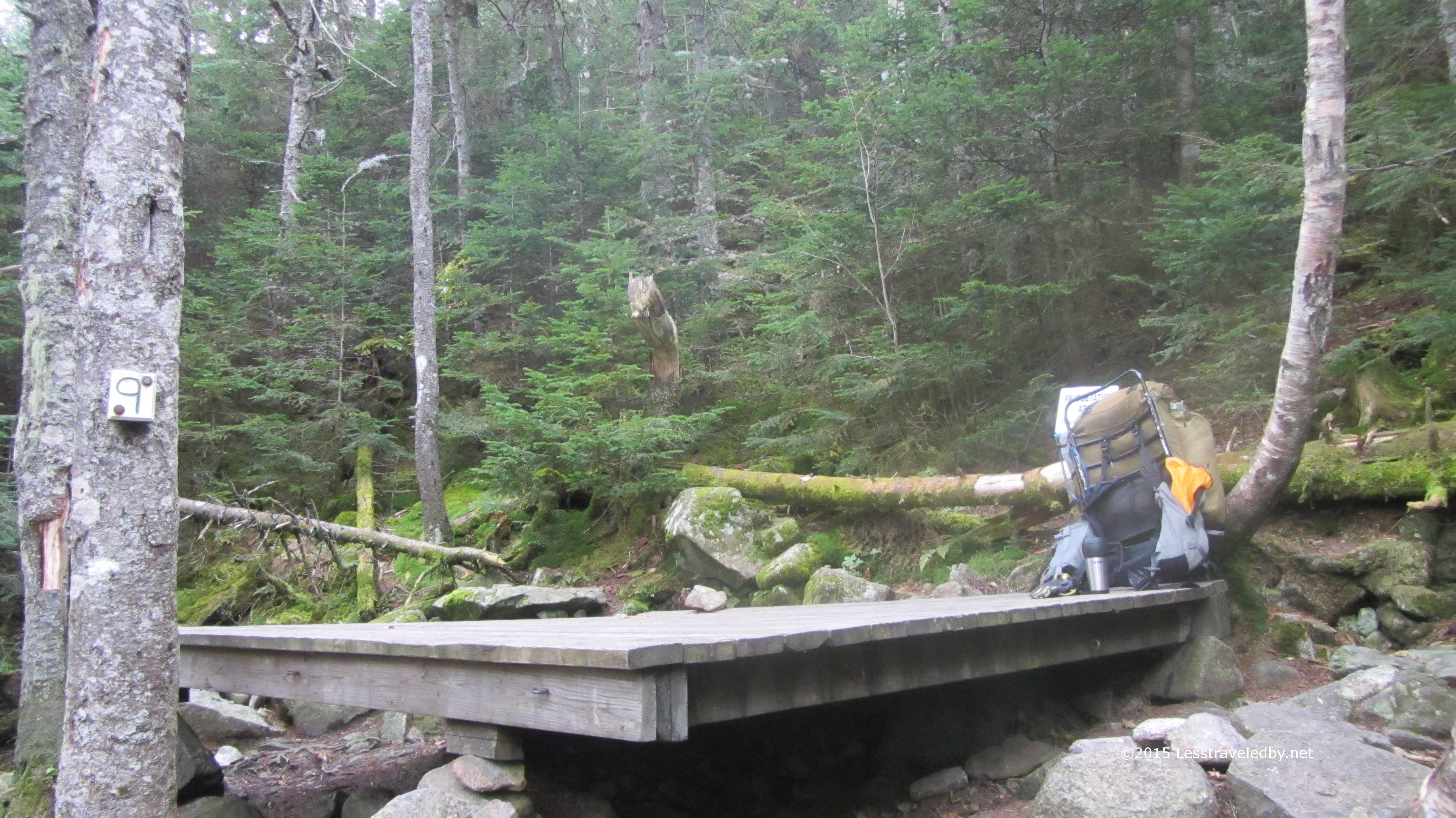
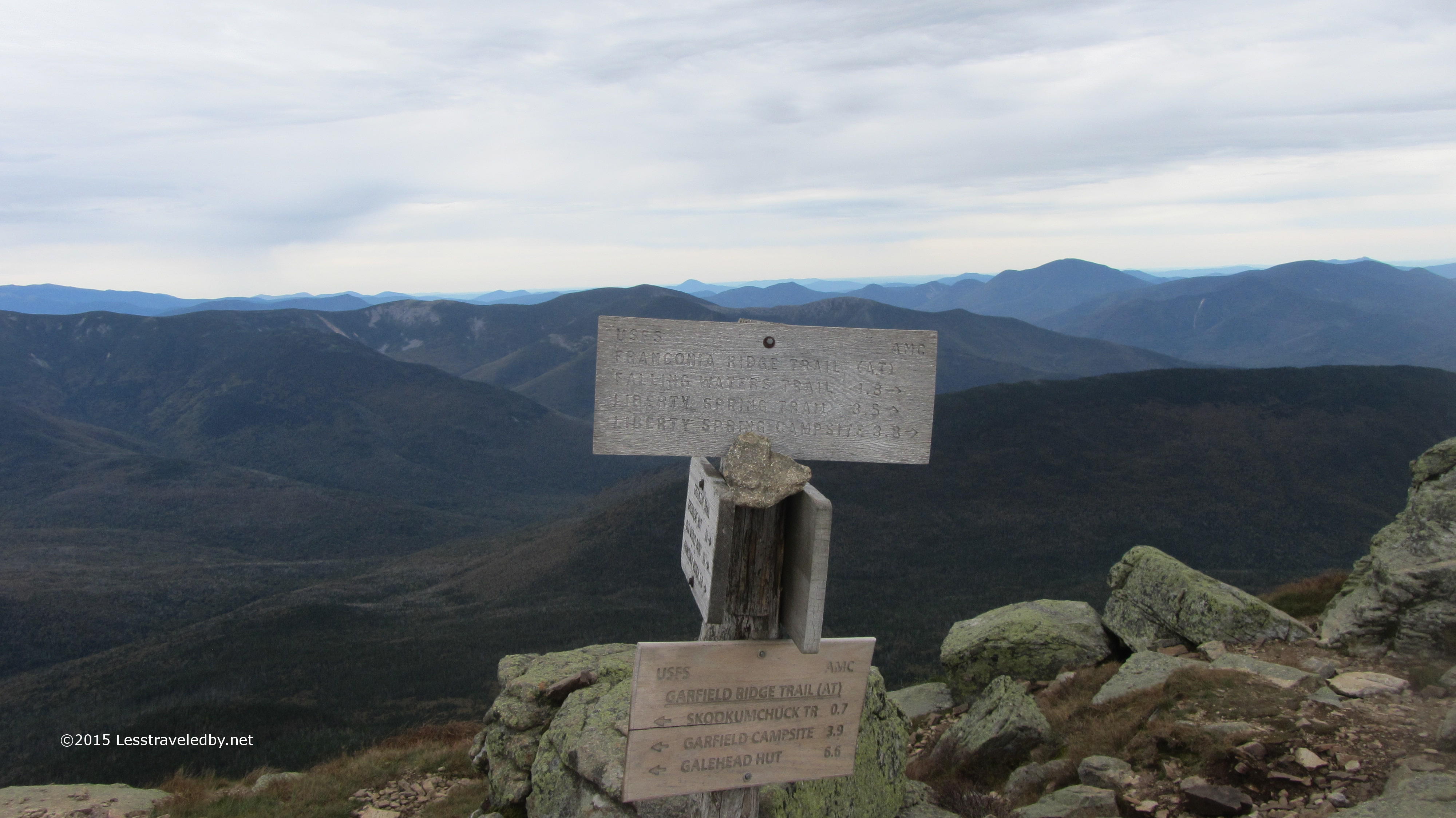
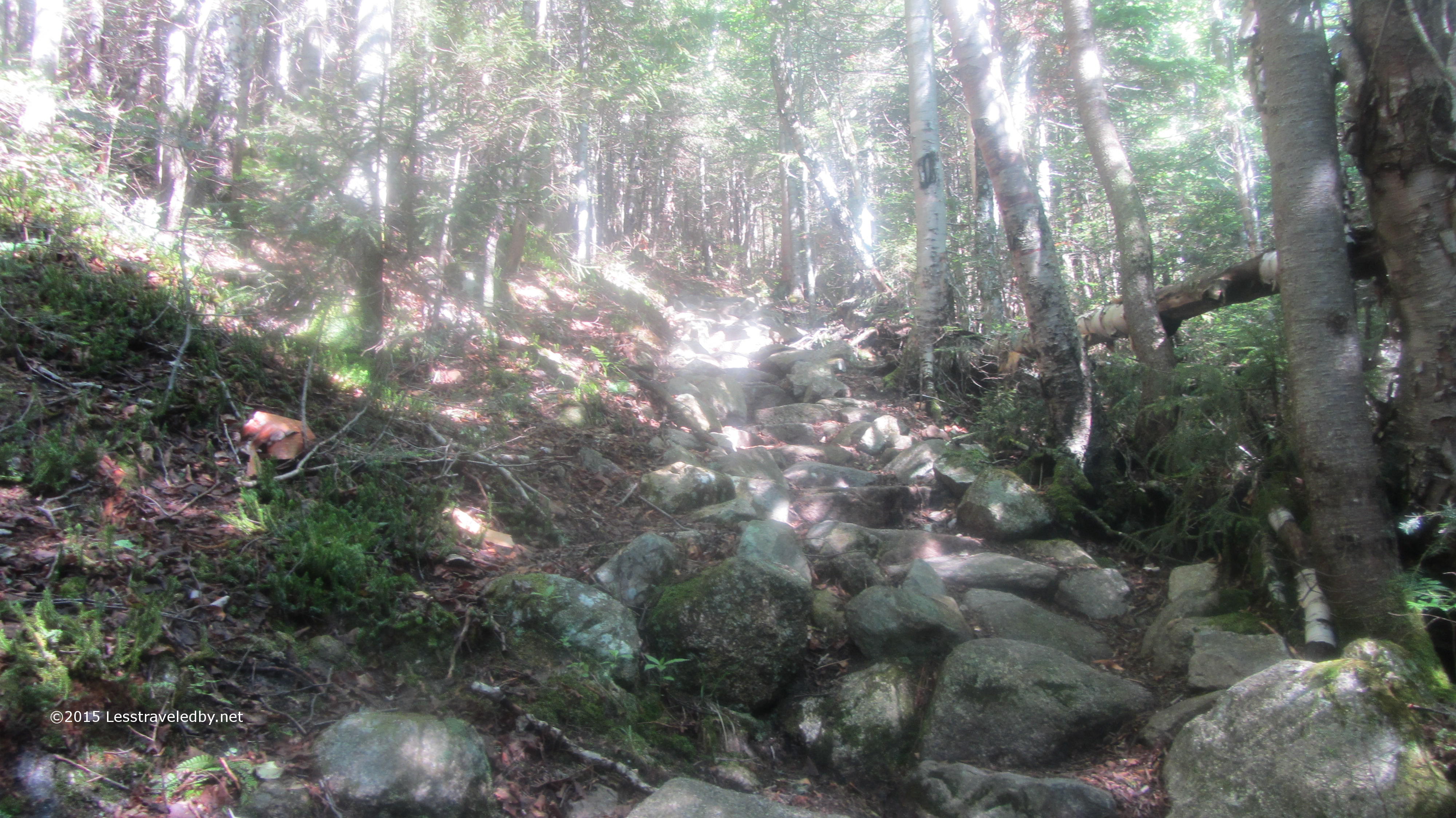
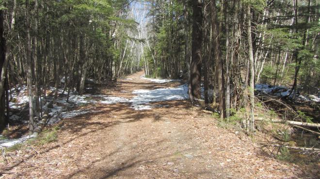
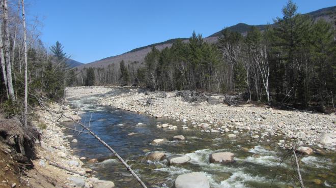
The East Branch of the Pemigewasset River was looking mighty low, but despite the lack of water the trees had some pretty good color going on. I flew down the flat section that starts the trail covering about a mile and a half in twenty minutes even with my pack fresh from the parking lot and full of goodies.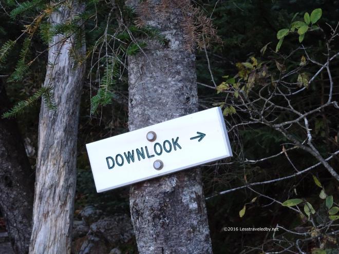 Then I slowed down as the Osseo Trail began its ascent towards Mt Flume. The first sign of real progress is literally a sign. It made no sense the first time I read it, but now I know it means what it says.
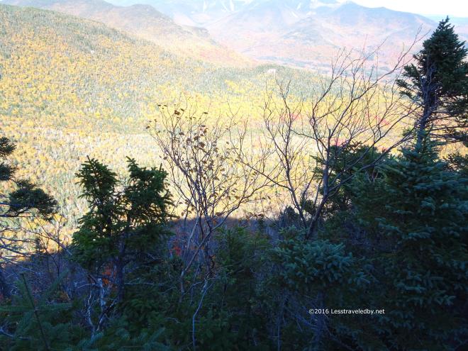 The trees here block the view a bit and I’m not one to get too close to the edge, but you definitely can look down at this spot.
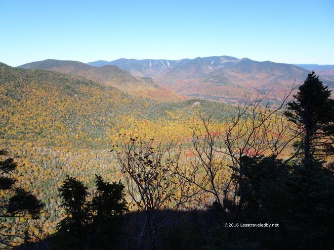 You can look out as well, but that is common in these mountains. Common enough that the down is what was worth noting on the sign at least.
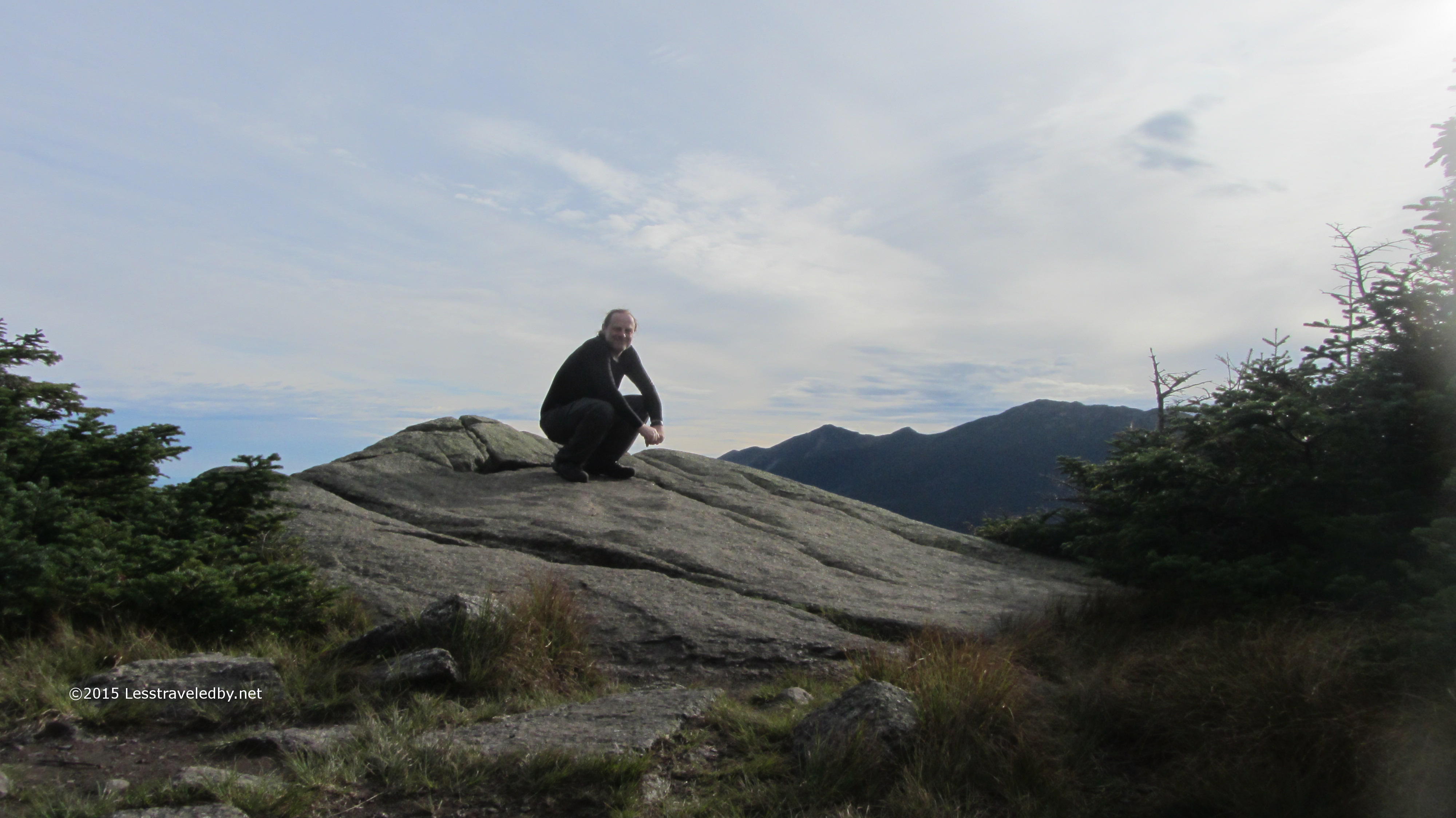
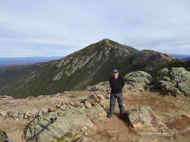
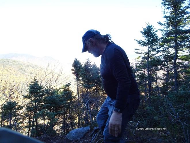 I didn’t get any pictures of me enjoying my lunch here, but I did get this shot of me looking down at the downlook.
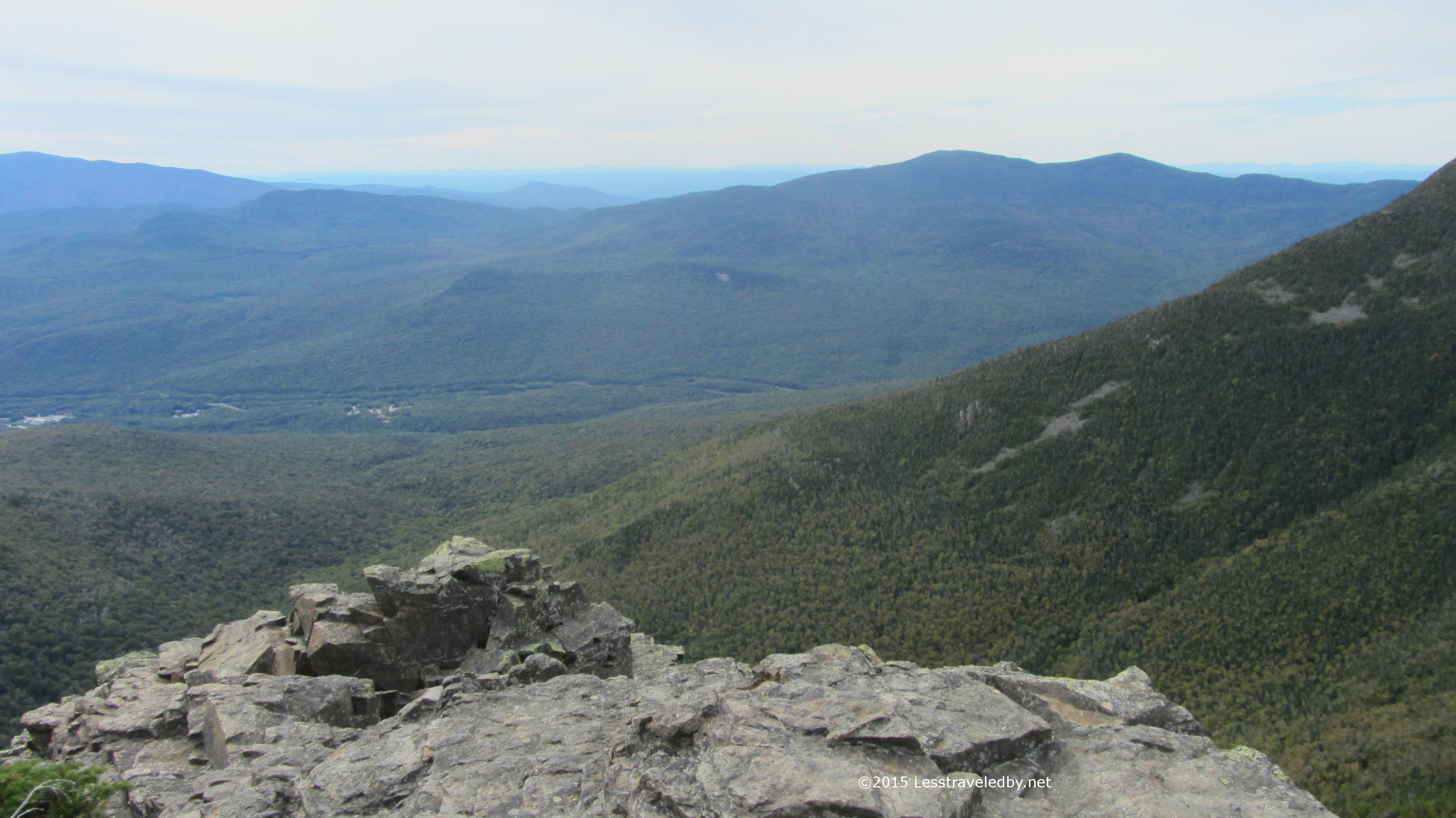
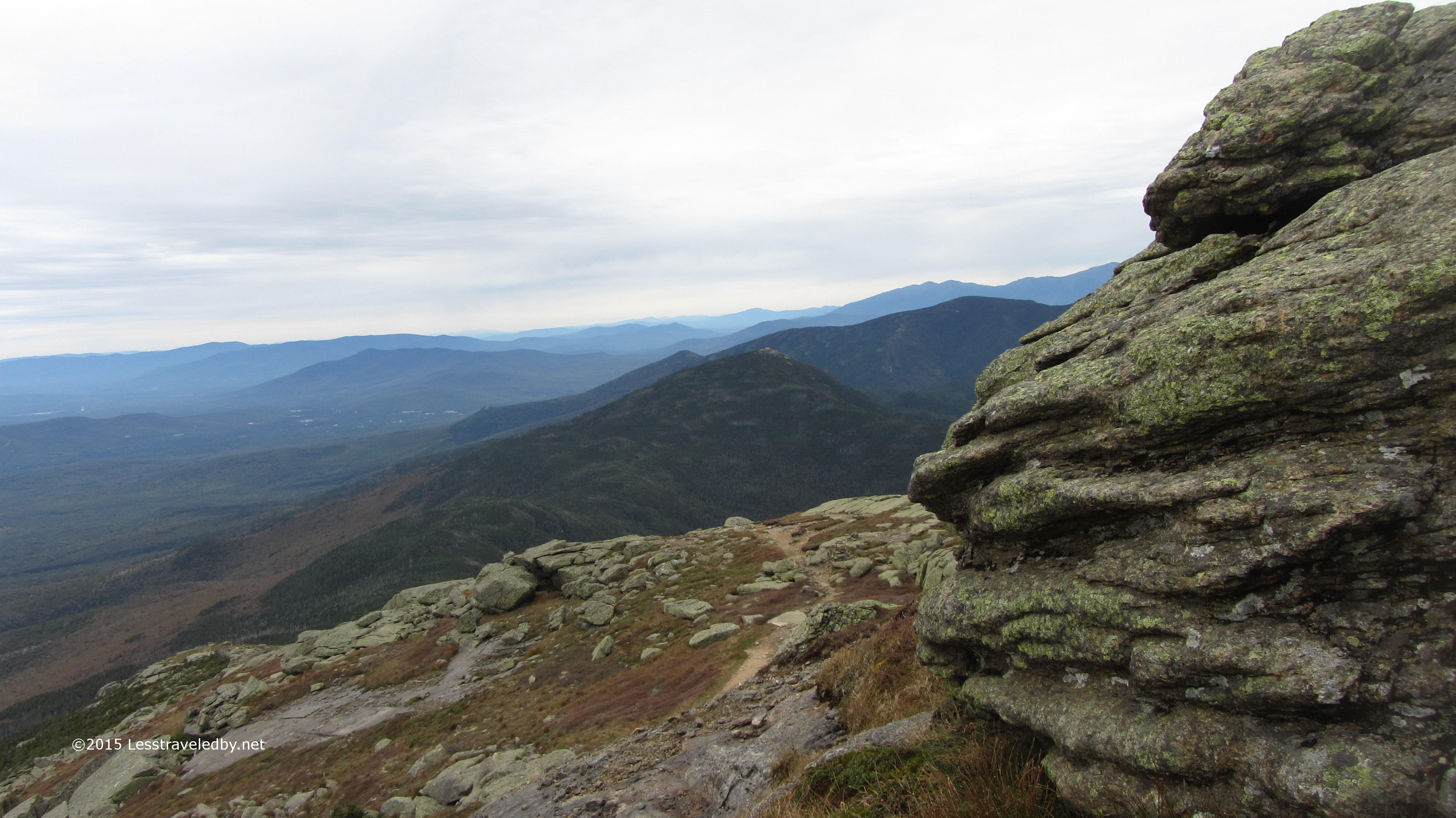
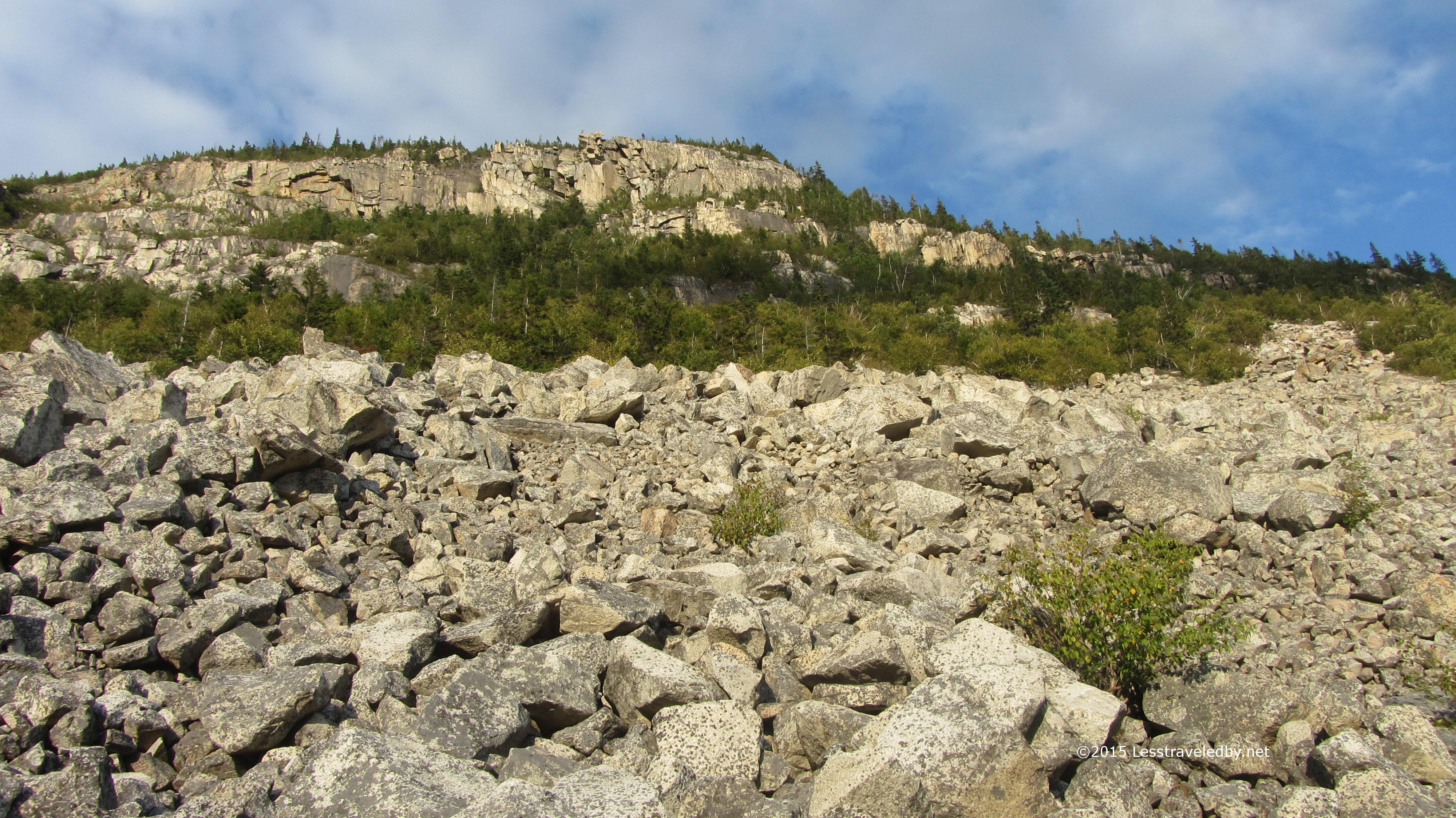
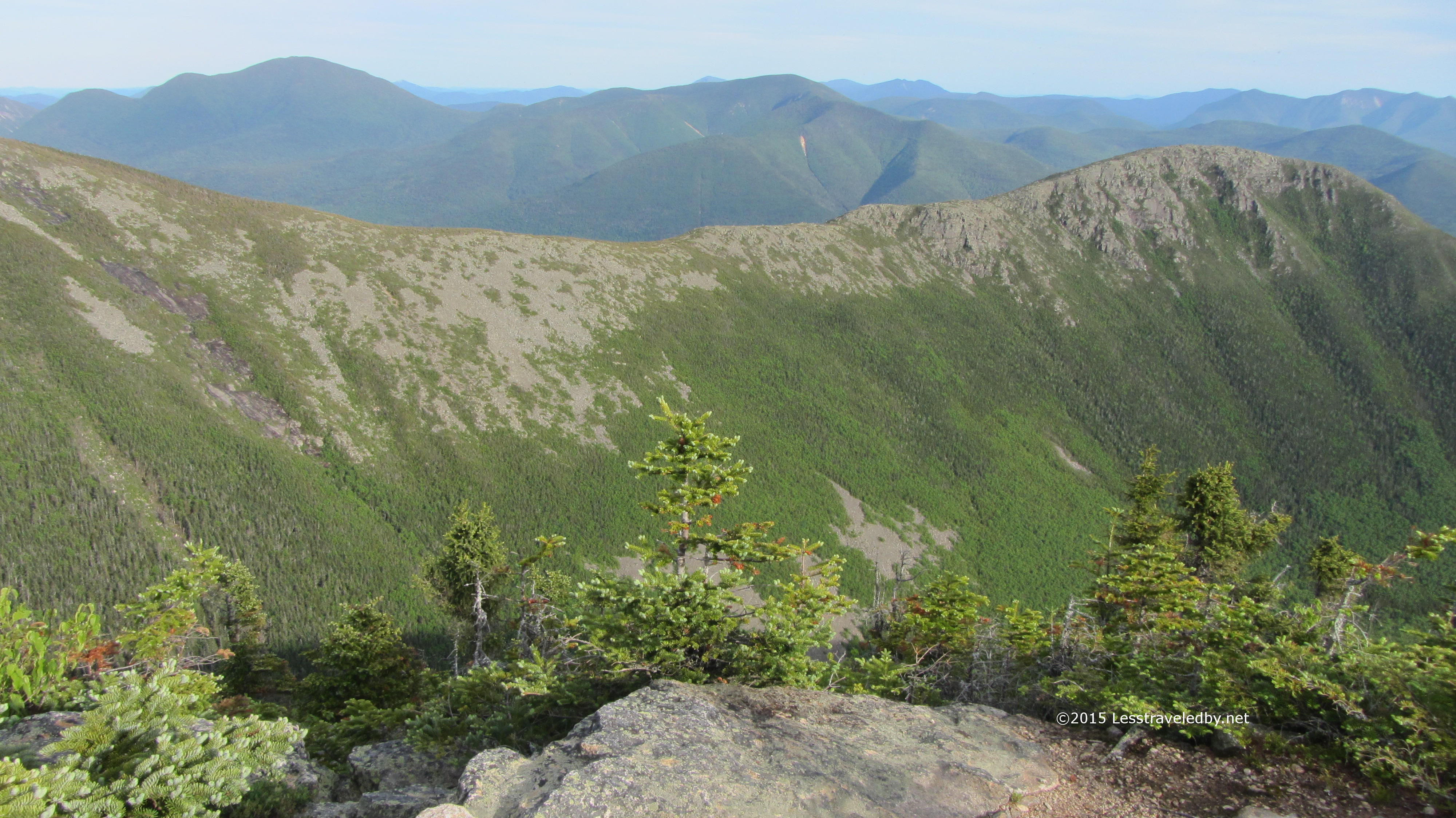
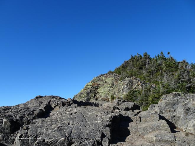 There is a bit more work in the trees before breaking out to this sight which welcomes you to Mt Flume’s rocky summit. Thankfully the wind was light so heading up this open, rocky section was fun rather than terrifying.
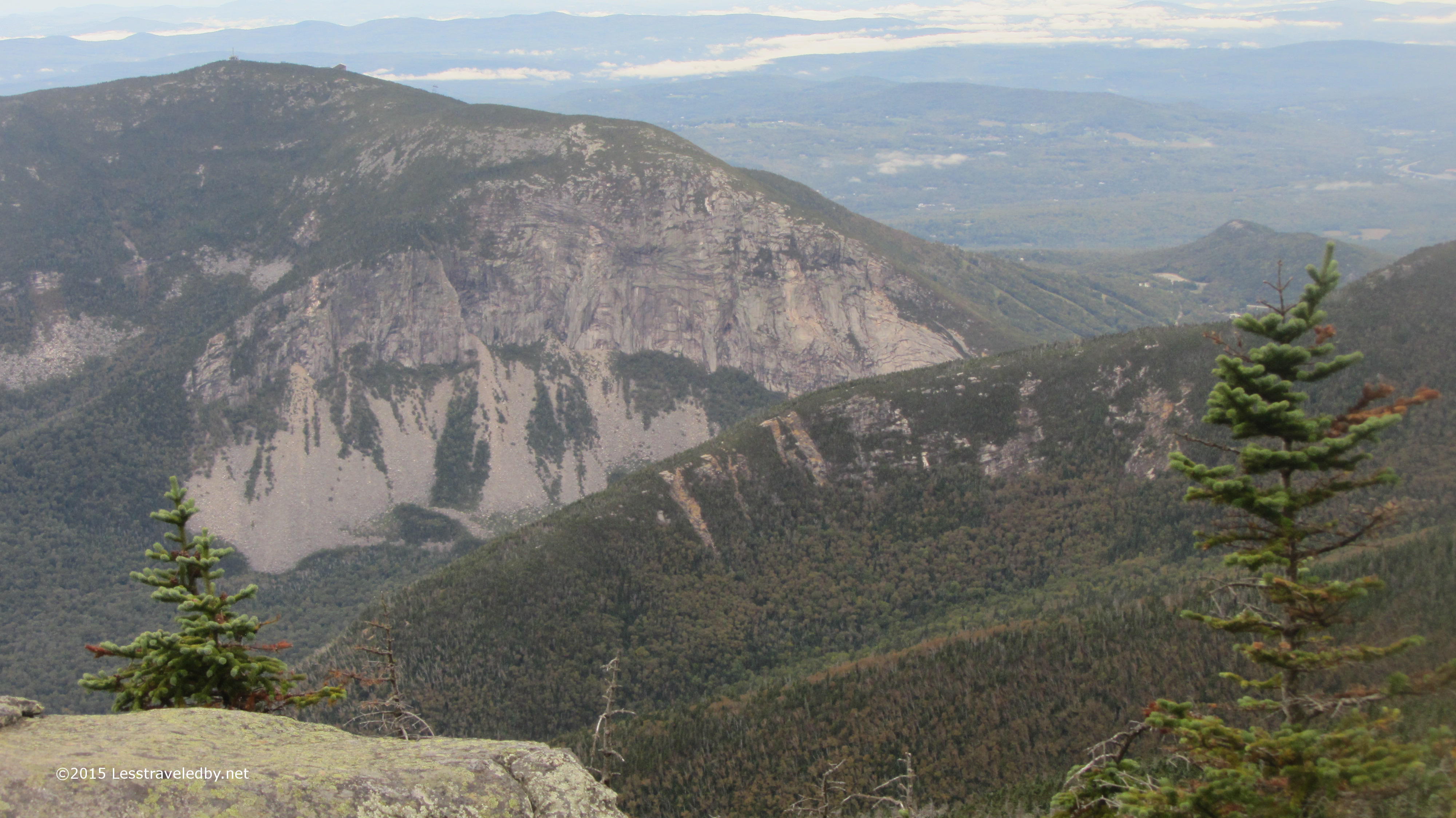
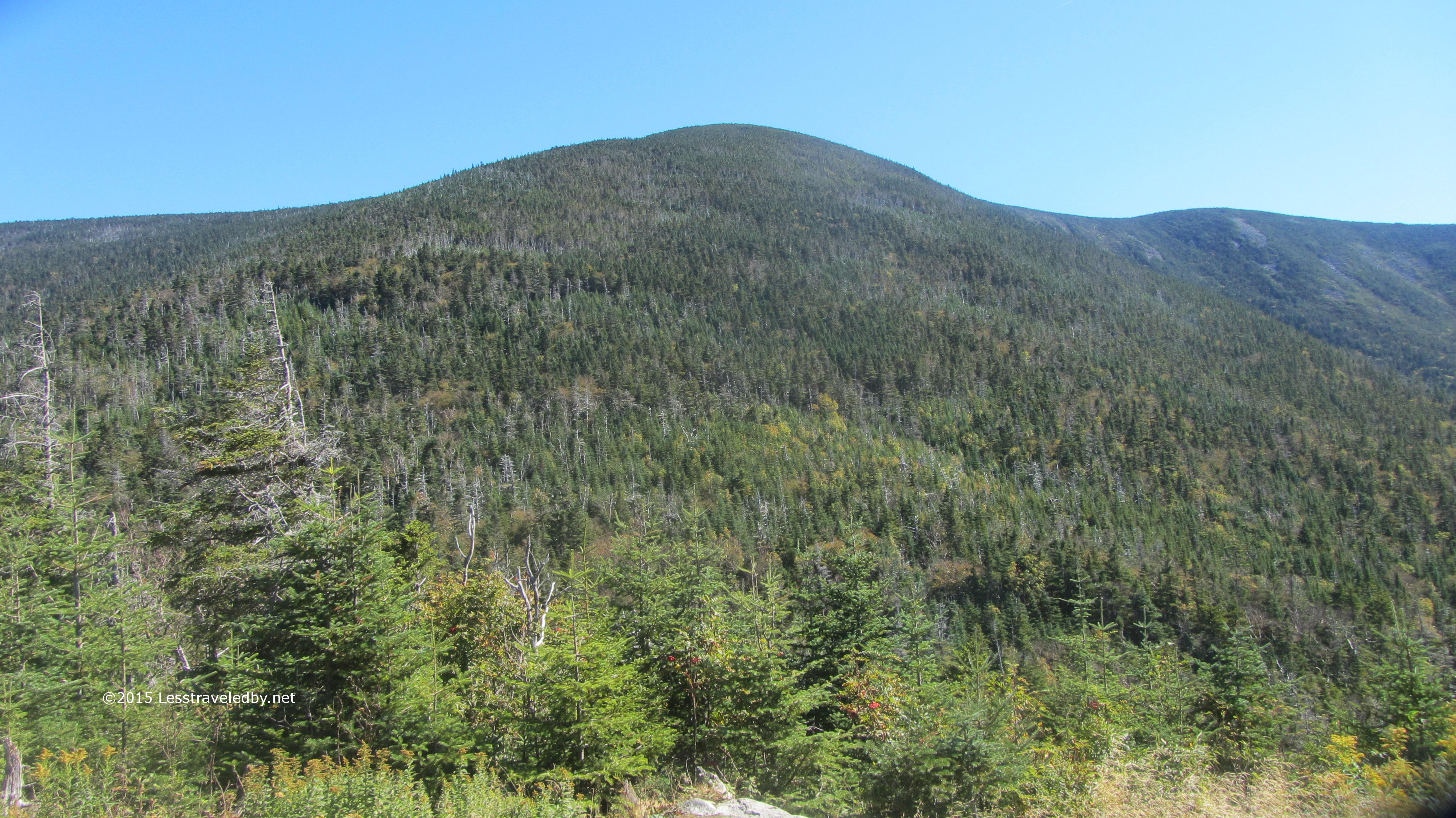
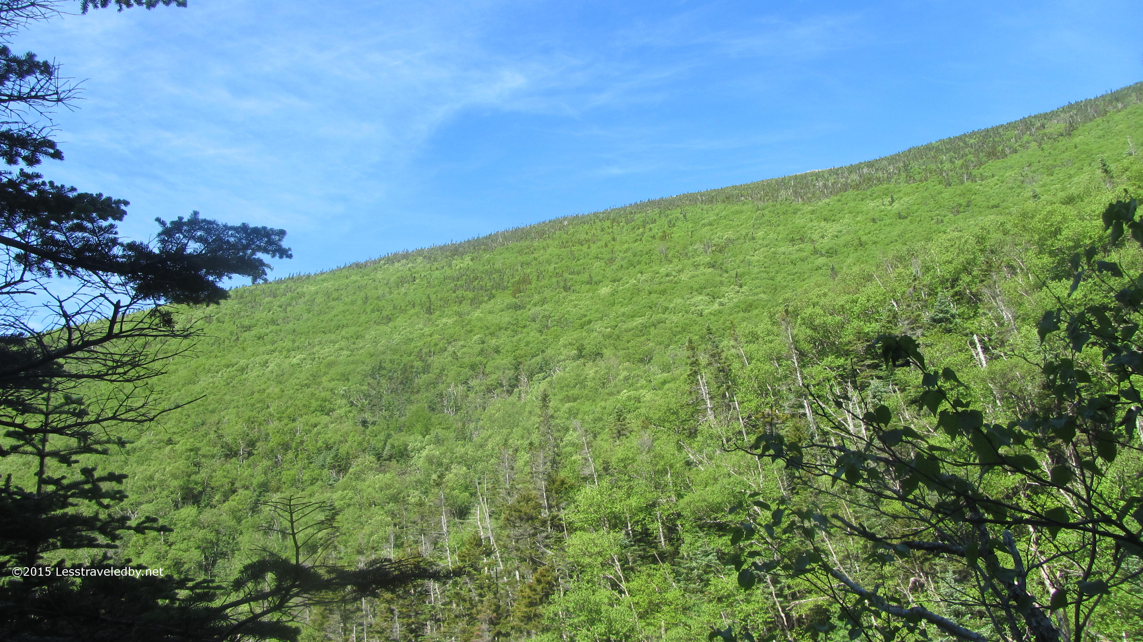
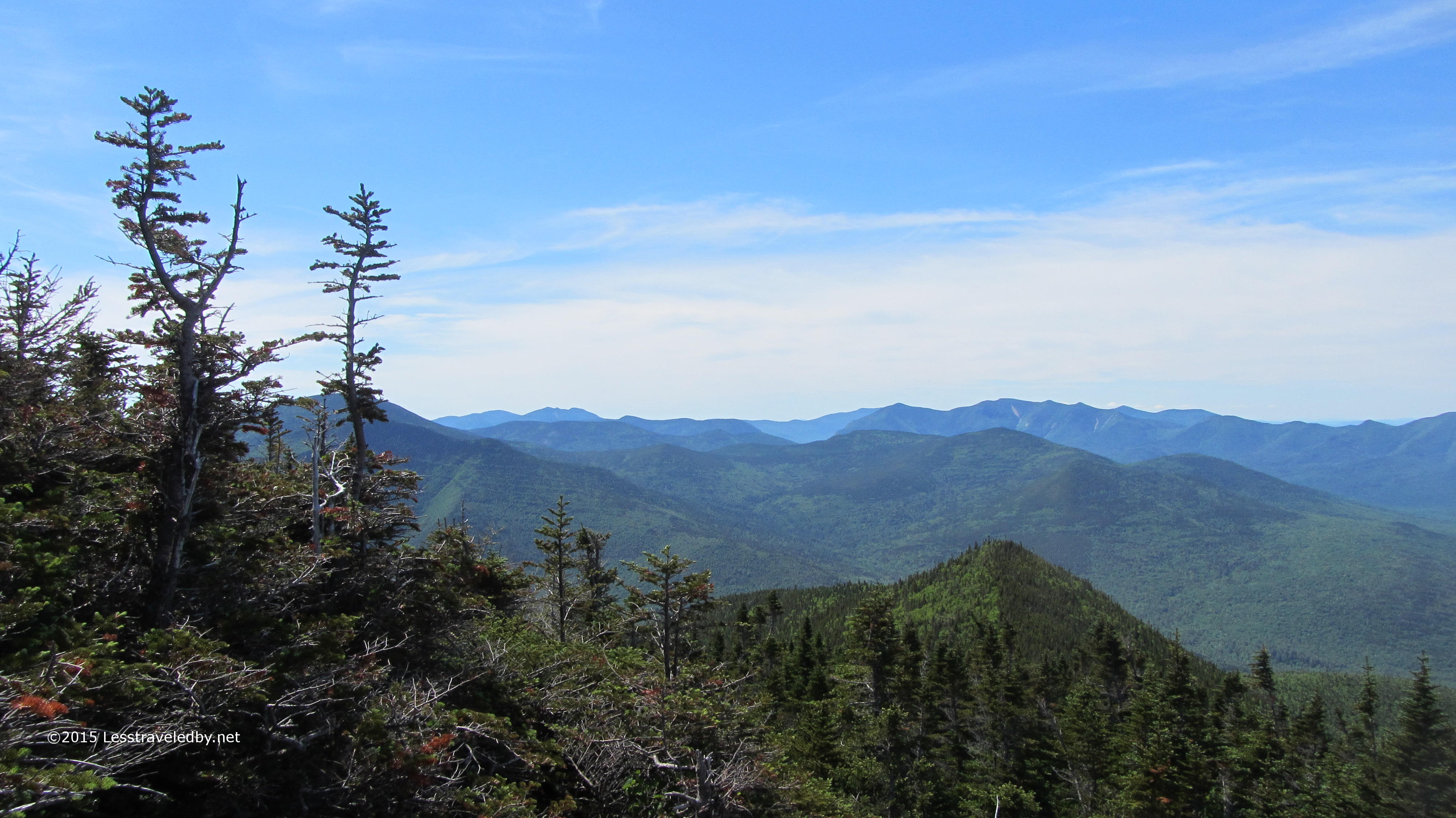
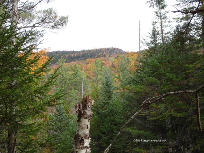
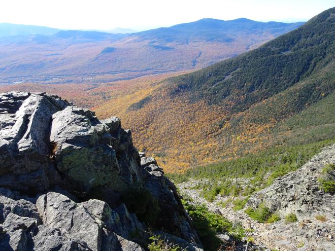 You can see how the deciduous color gives way to the evergreens as the elevation climbs.
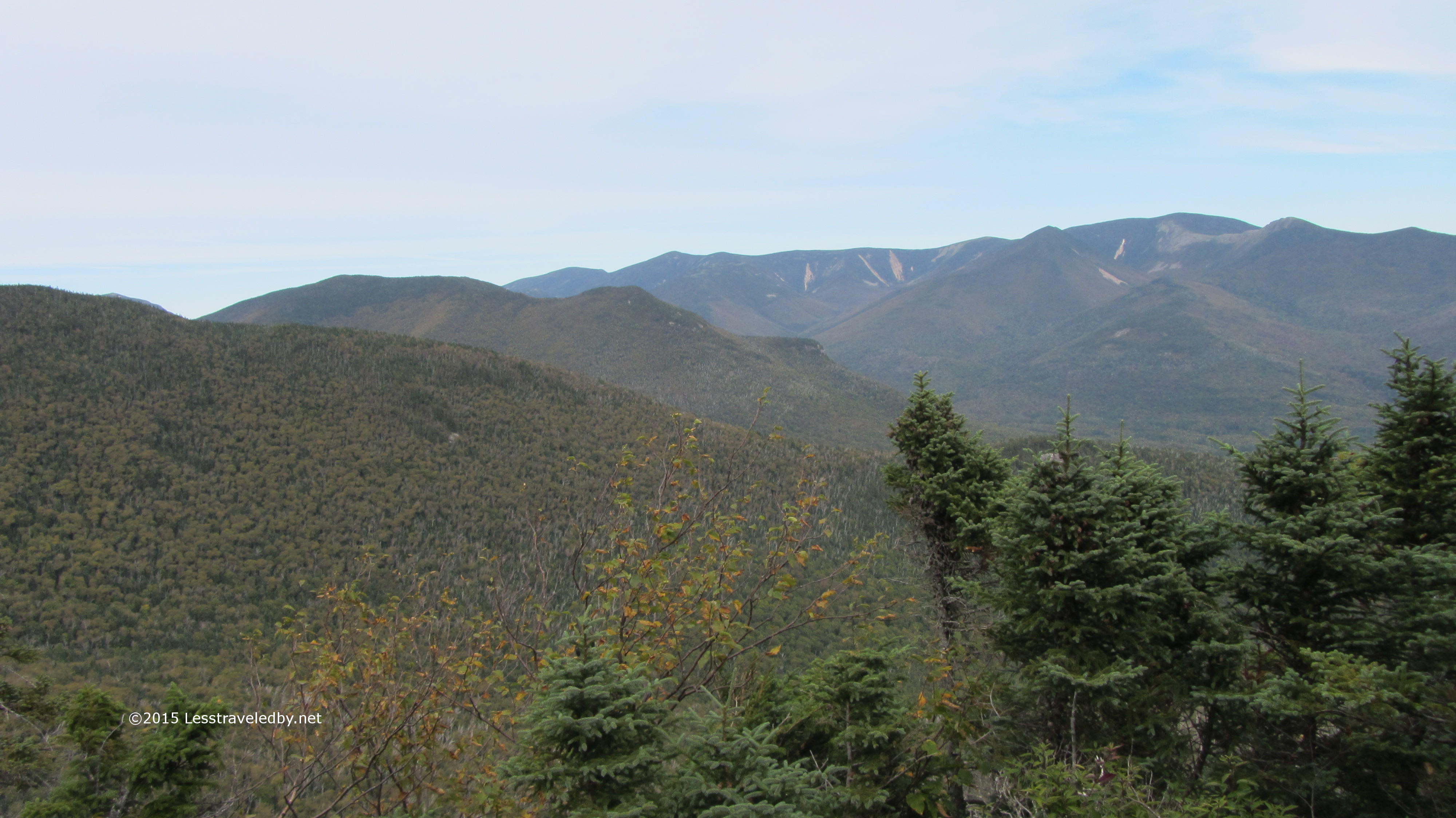
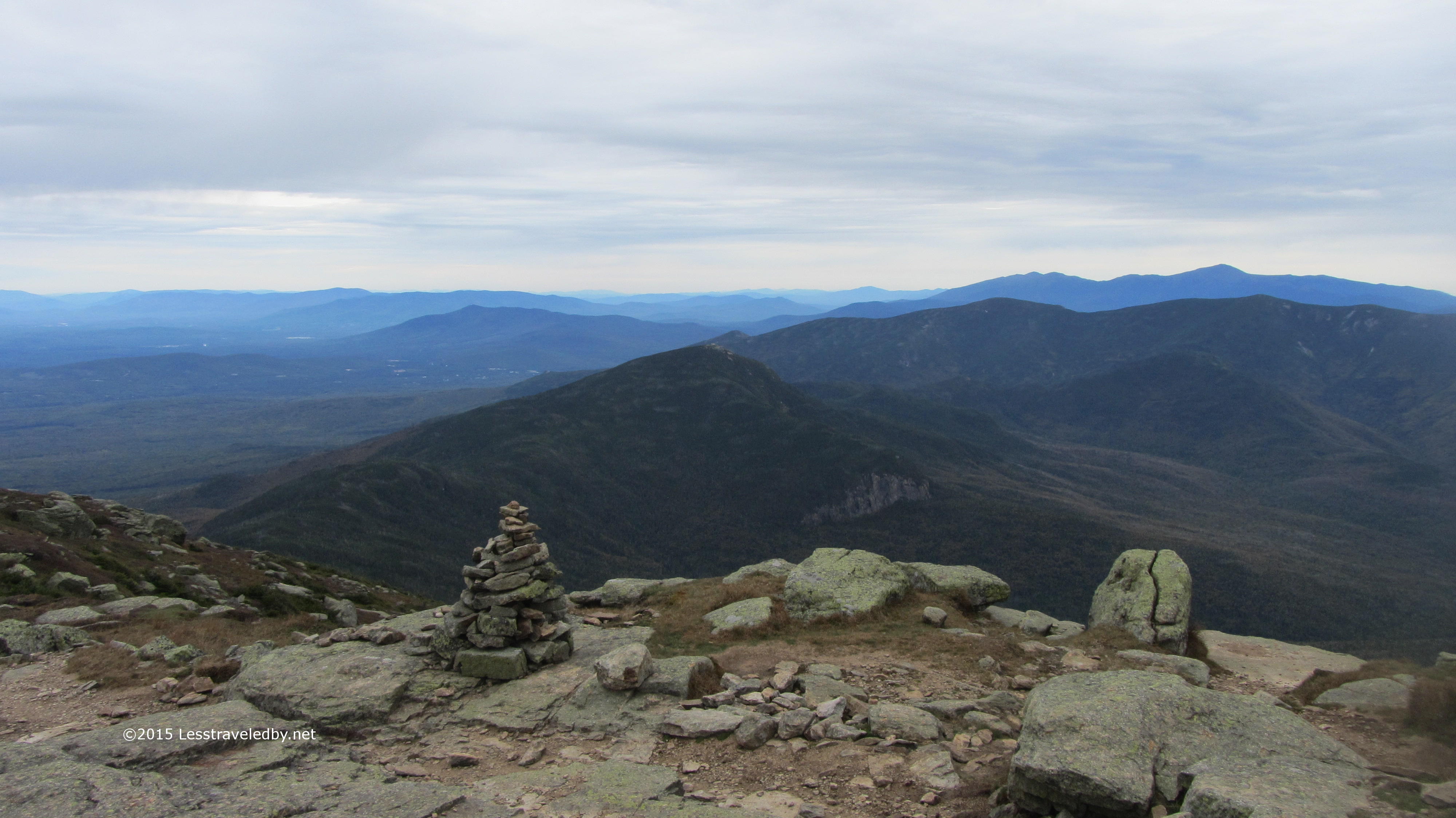
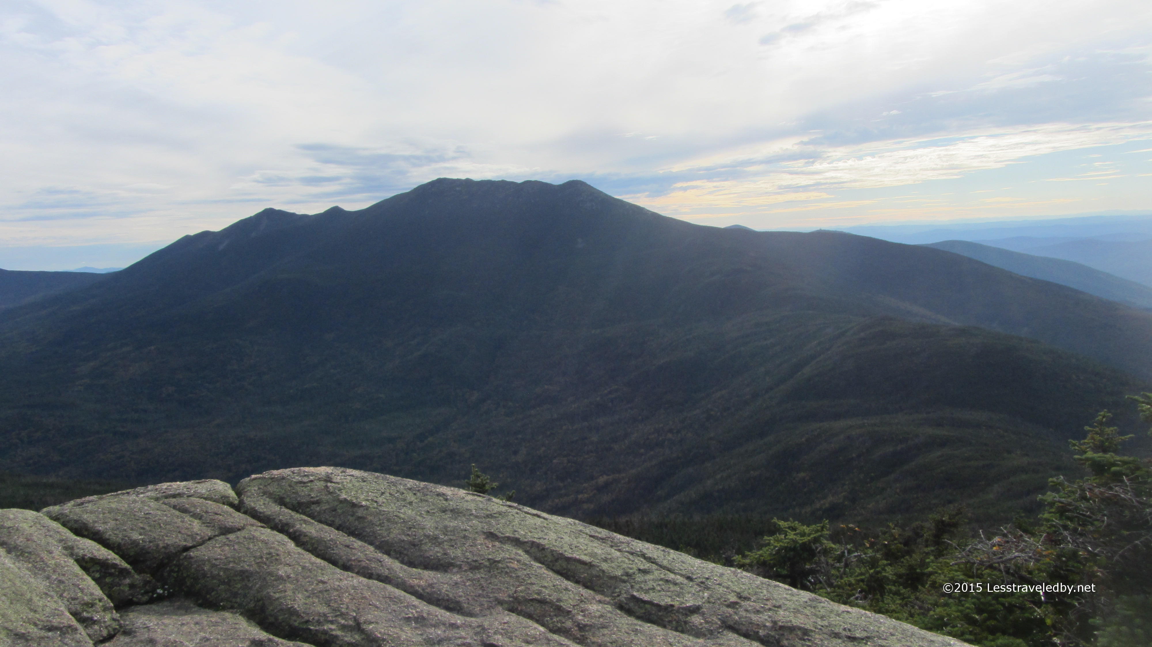
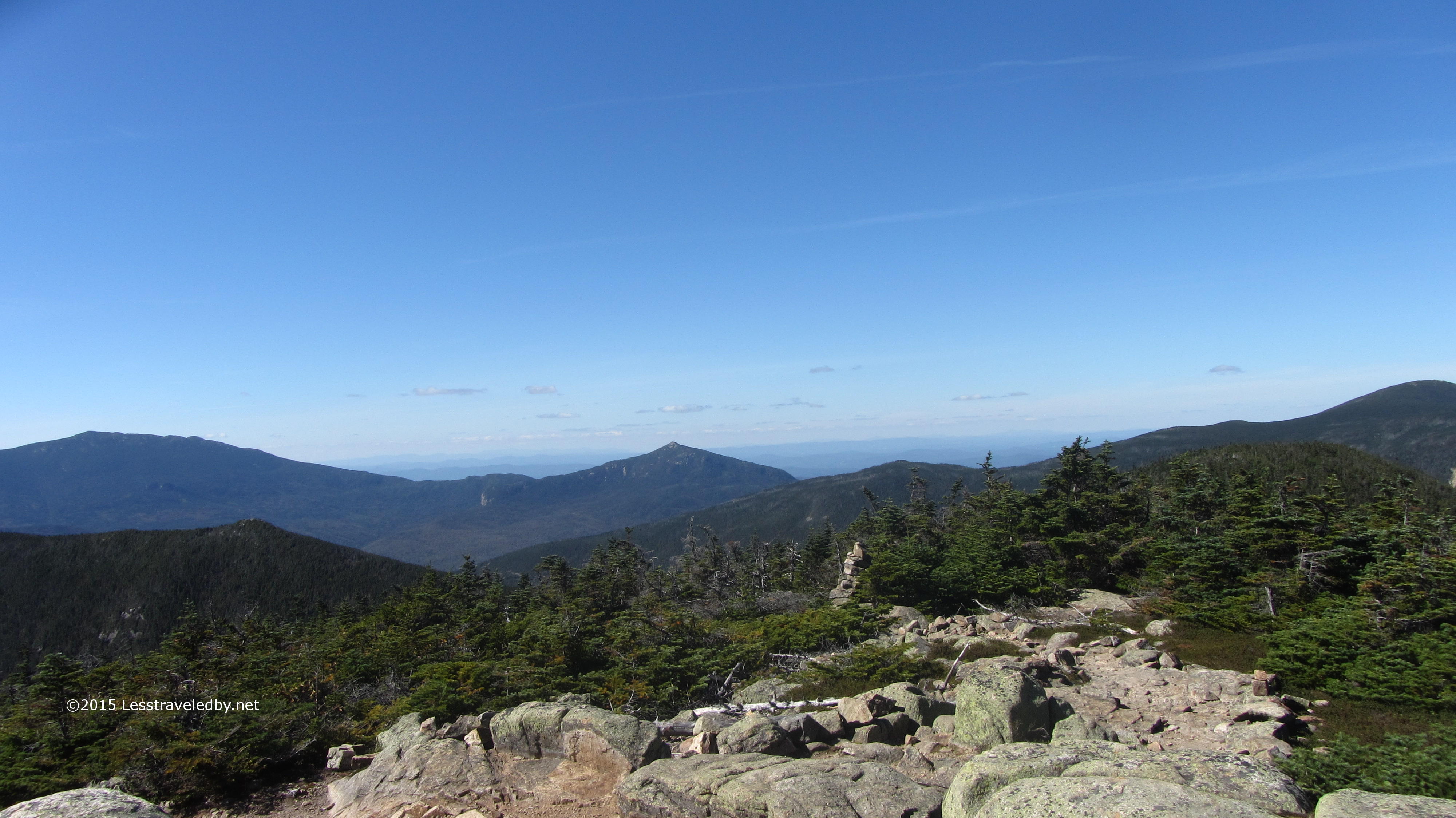
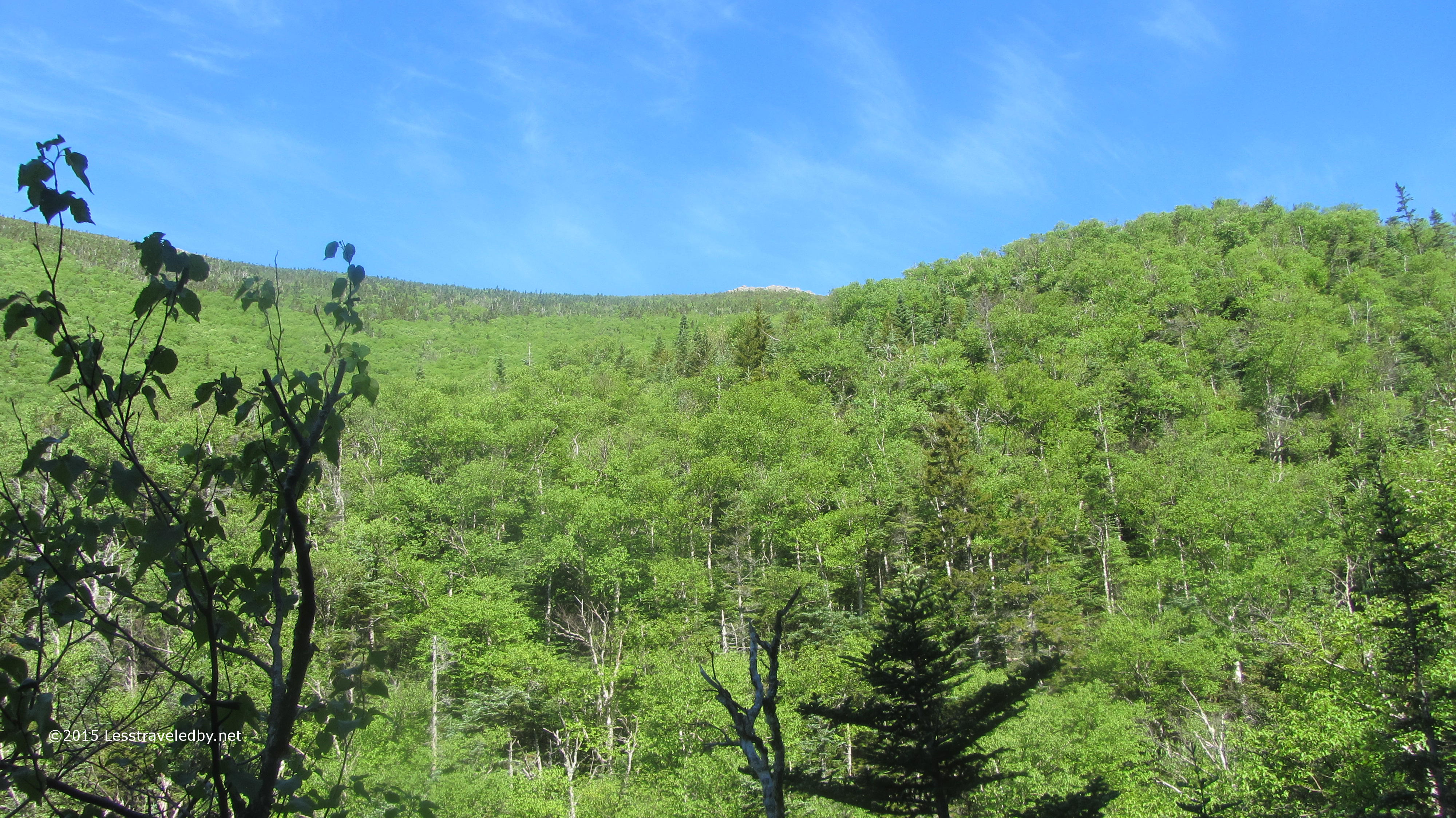
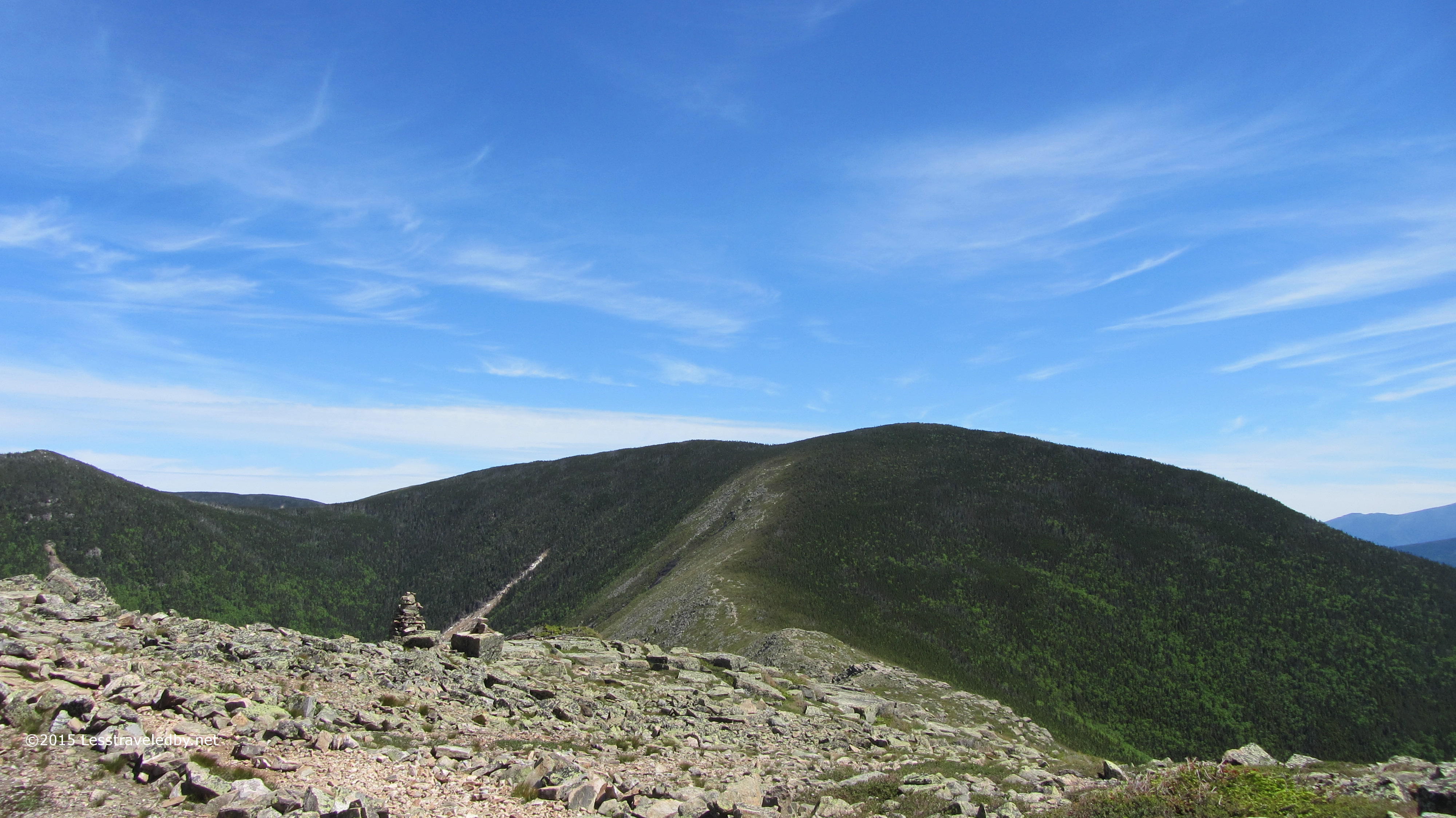
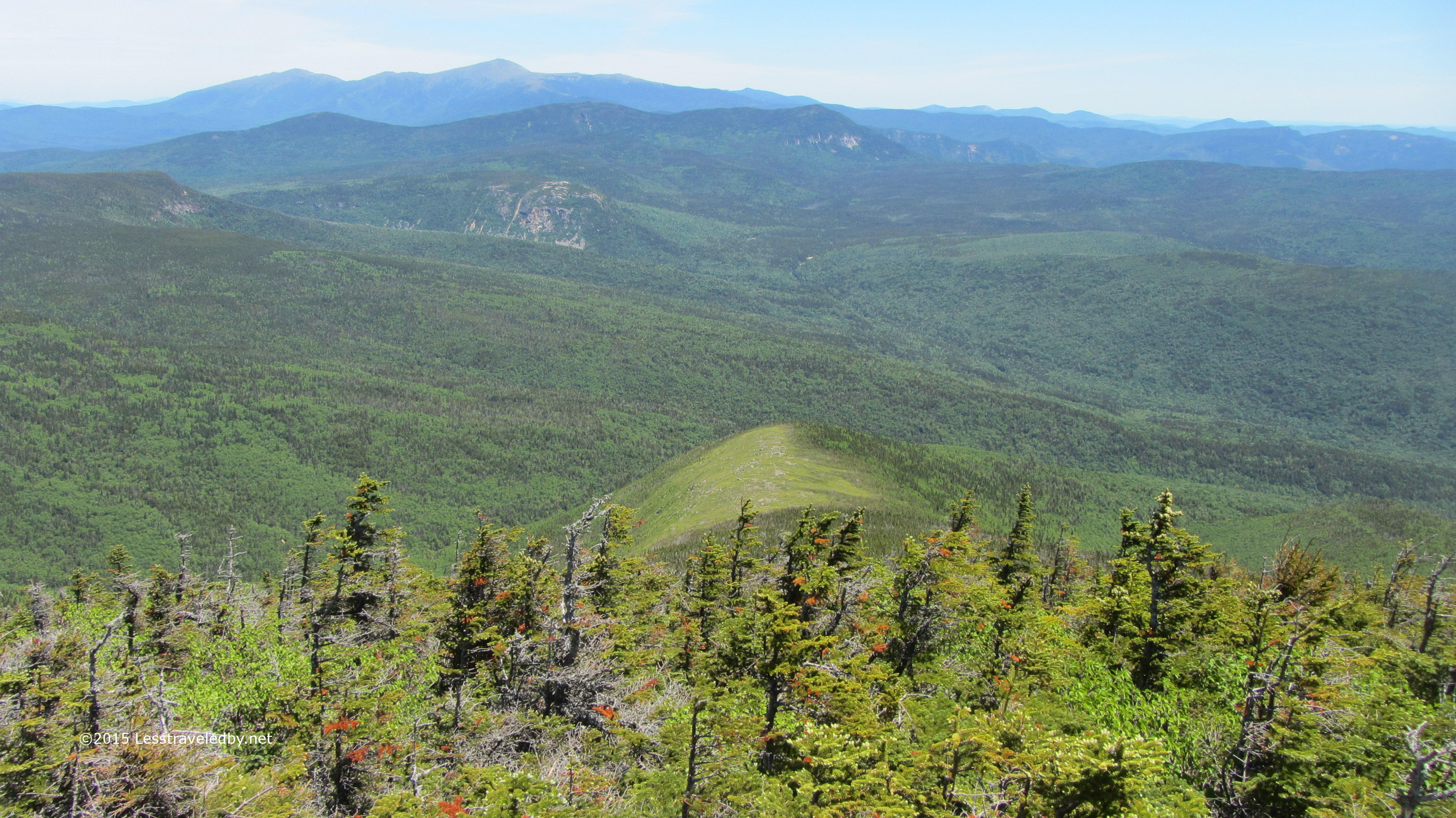
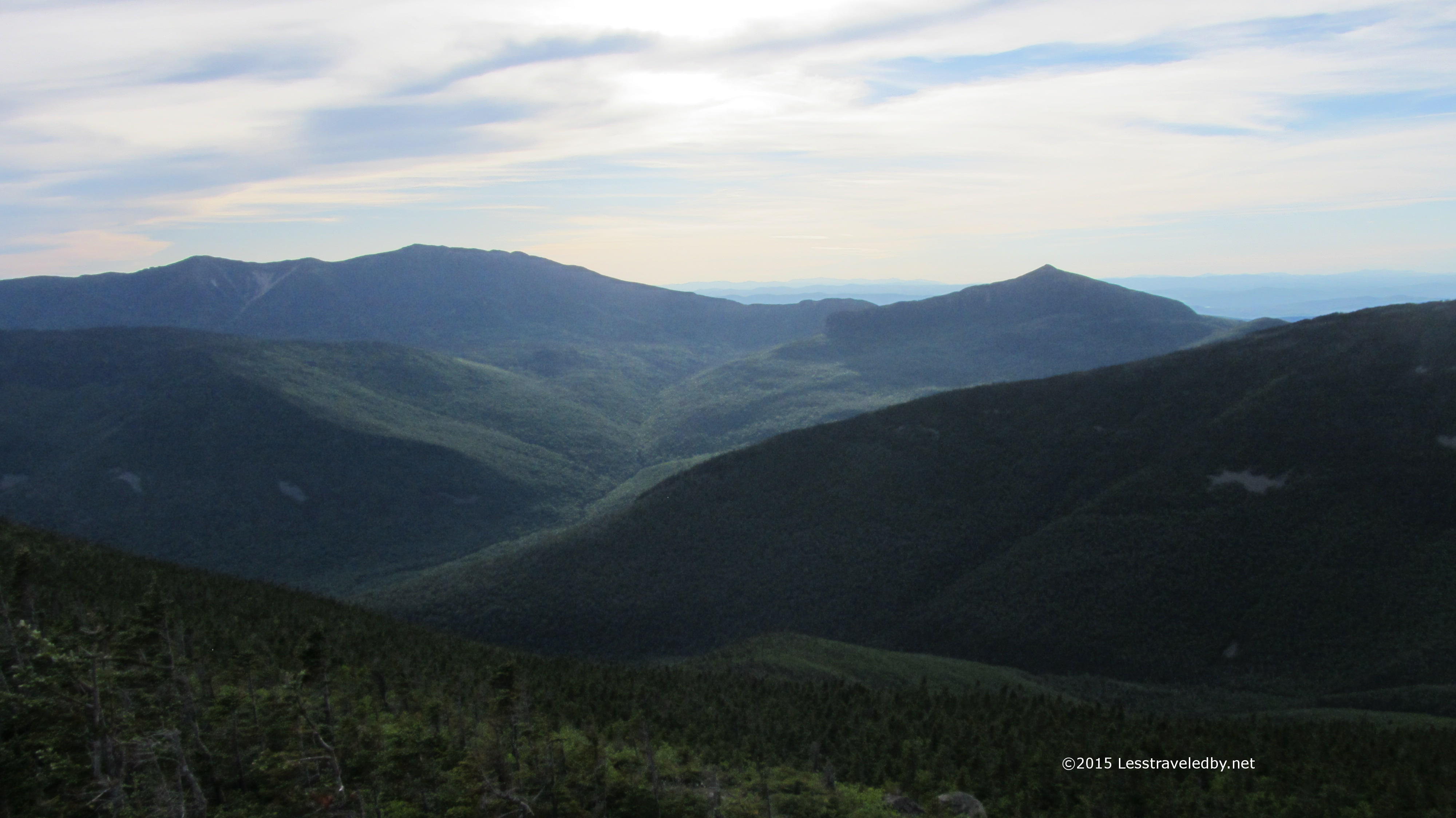
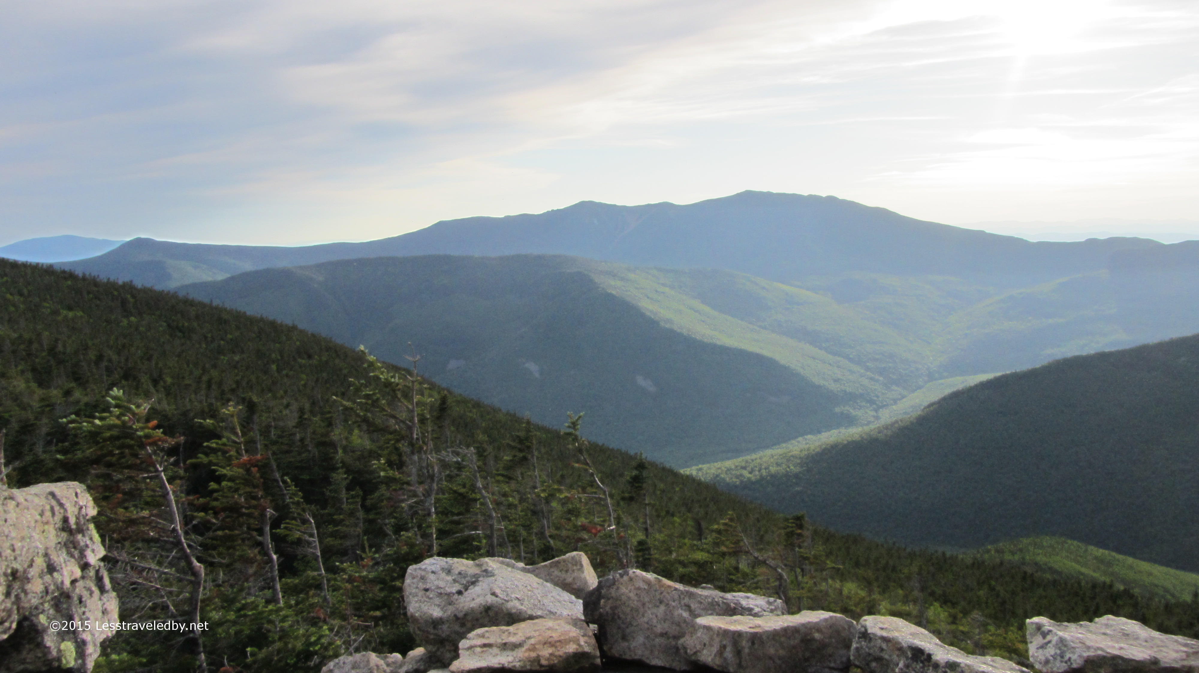
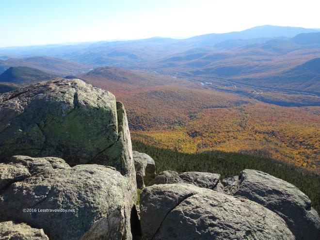
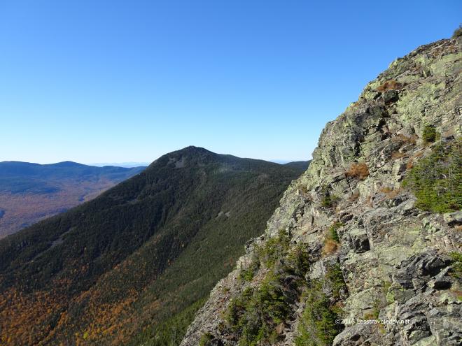 Evergreen gives way to rock in the higher and more exposed spots. From here on Flume I could see Liberty waiting for me next. Previous experience kept me from thinking it was as close as it looked and I knew I’d drop down into a col before having to climb up to reach that peak.
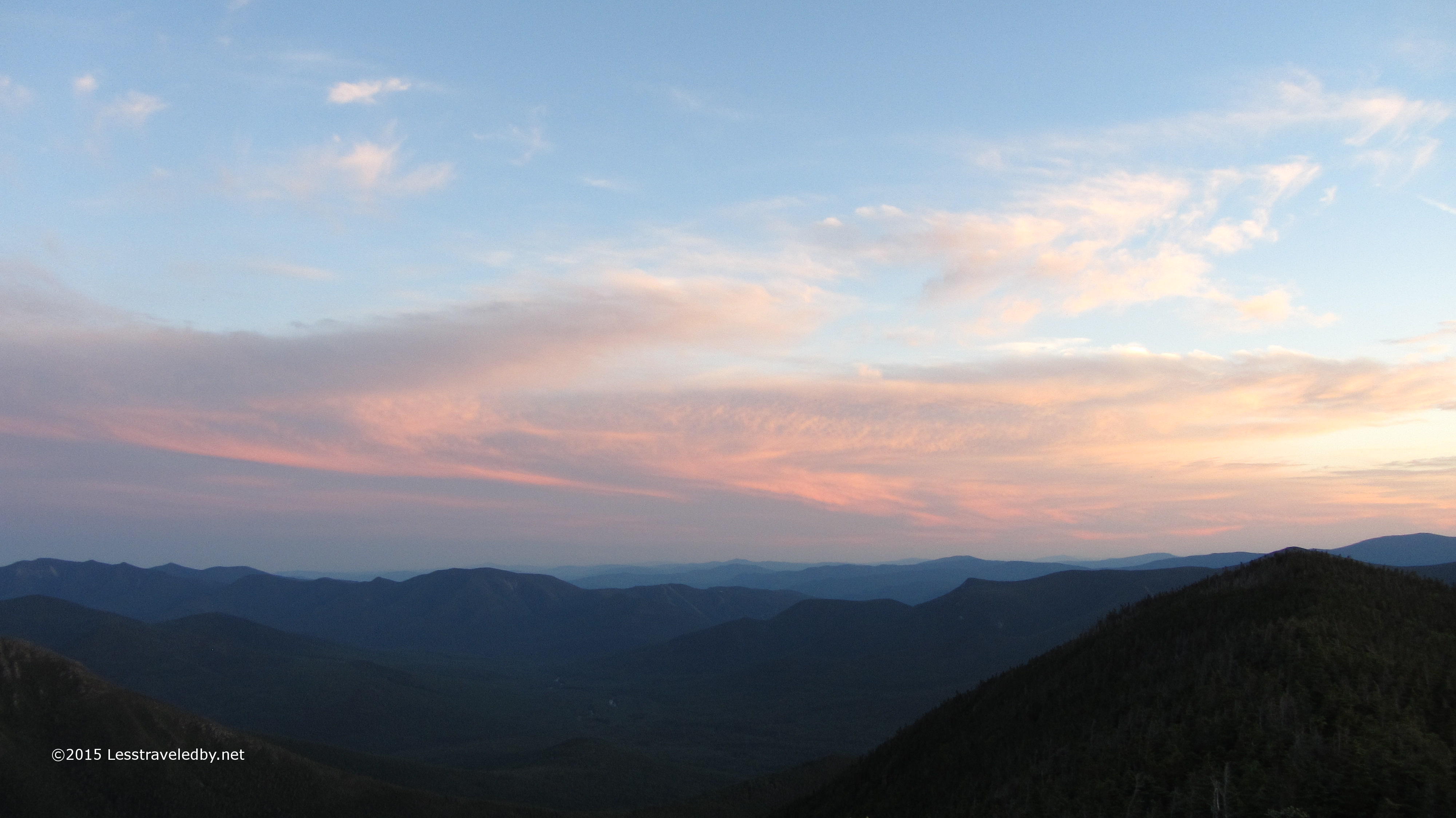
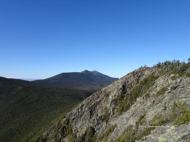 Looking a bit beyond I could see Franconia Ridge waiting for tomorrow. That view really leaves me anticipating the following day but there is little time for daydreaming with the sun already heading towards the mountains in the west.
 Well maybe a few minutes longer to soak up that golden colored sun that Autumn brings.
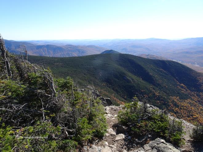
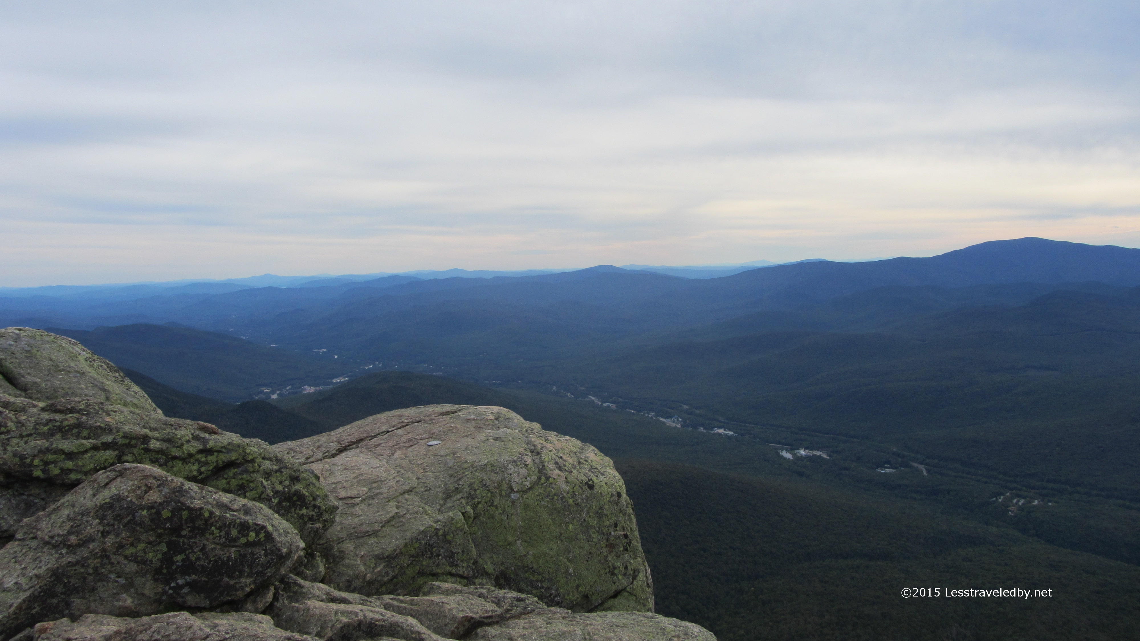
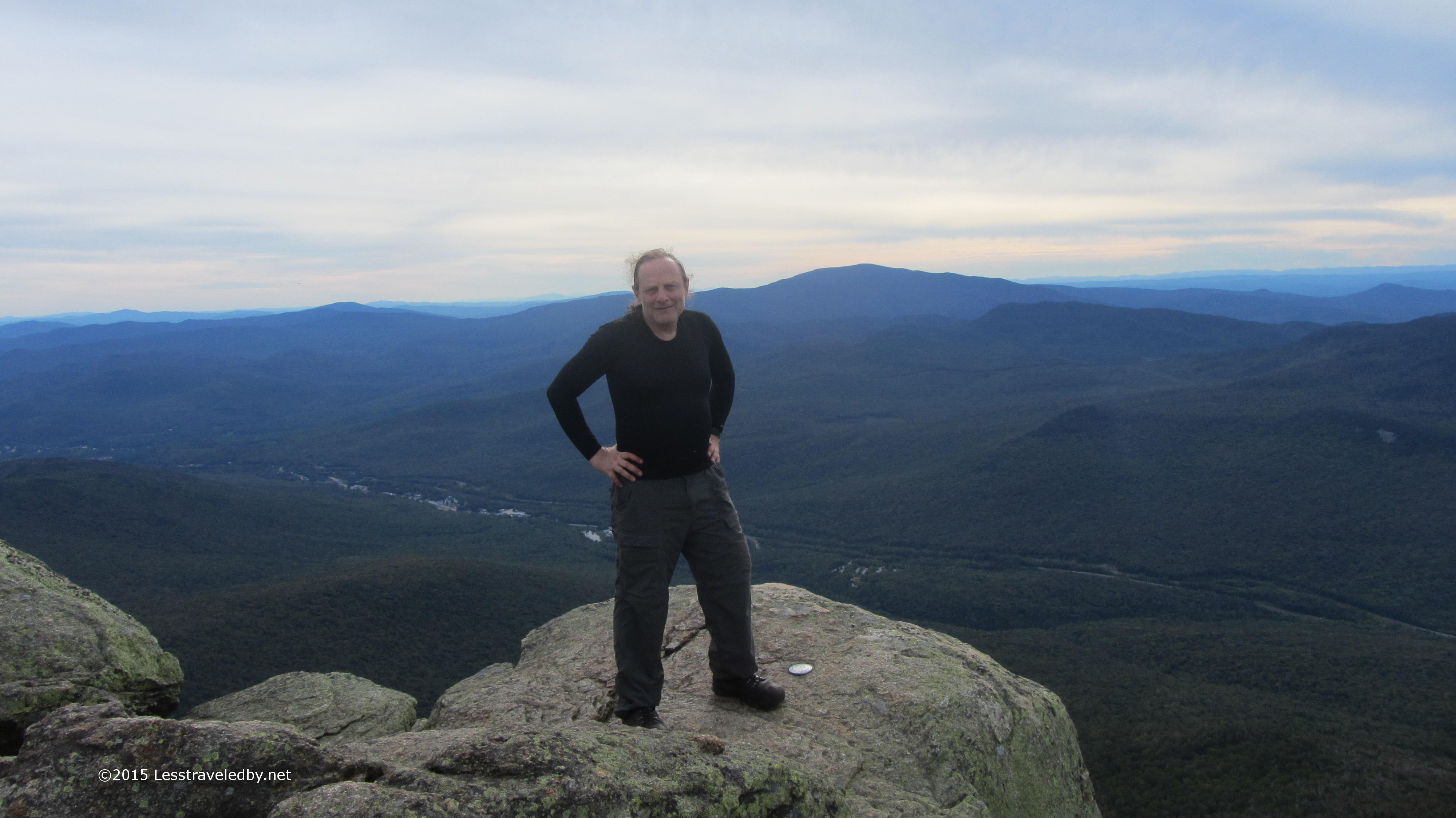
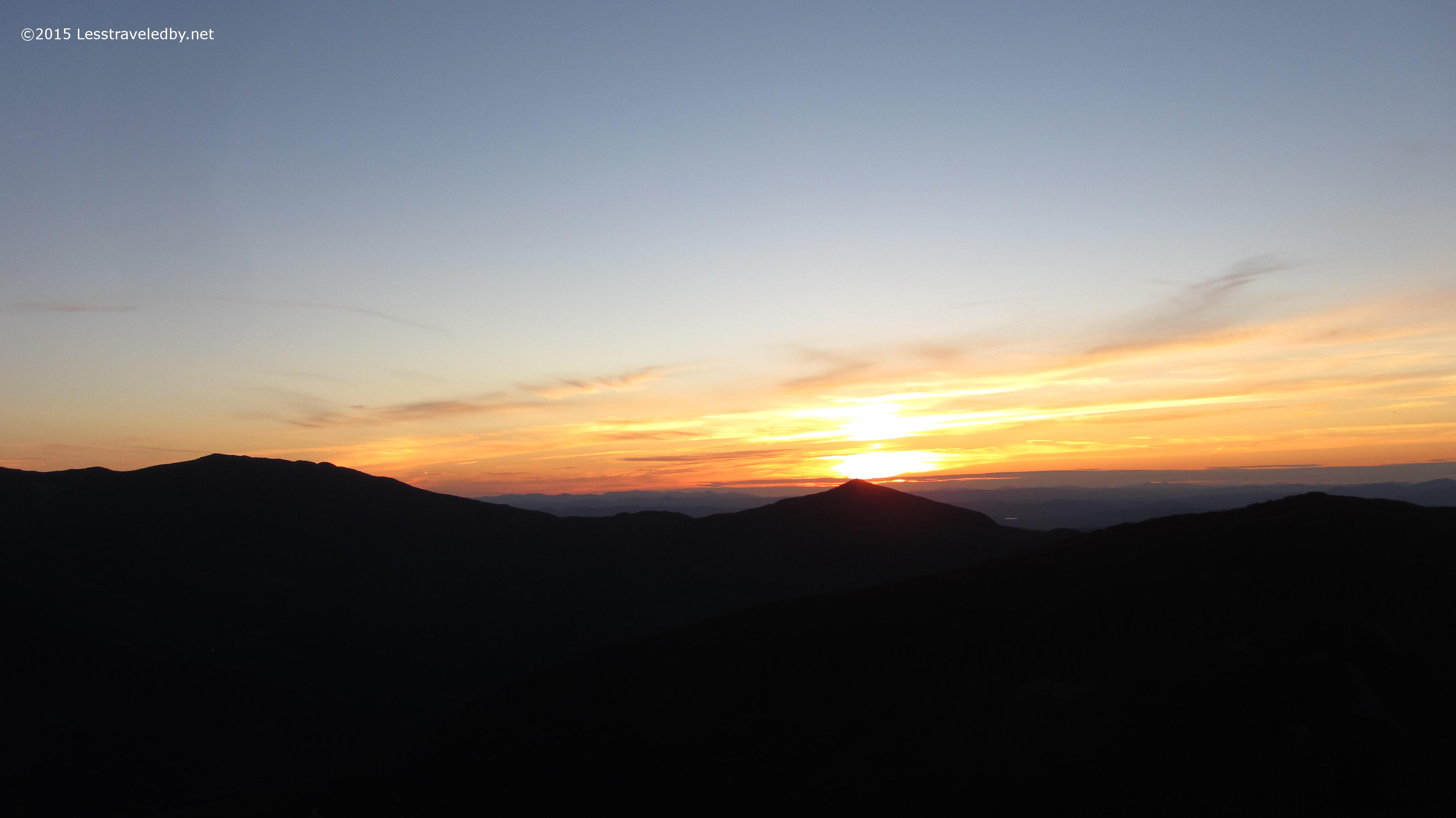
 Up on Liberty the light was even better though it hinted that it wouldn’t last long. There were only a few people on the trail this being the middle of the week. It would have been relaxing to sit here and just think or even be thoughtless which seemed odd as this summit is often full of people.
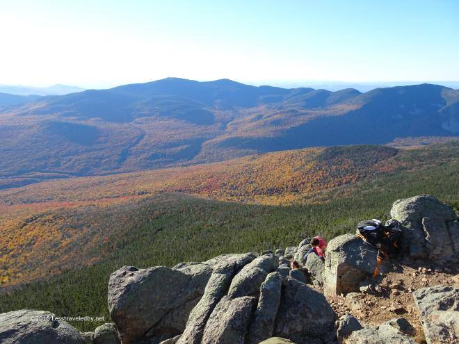 There was one group of day hikers who climbed down to a spot out of the wind. They said they’d spent hours up there though they were going to have to leave soon.
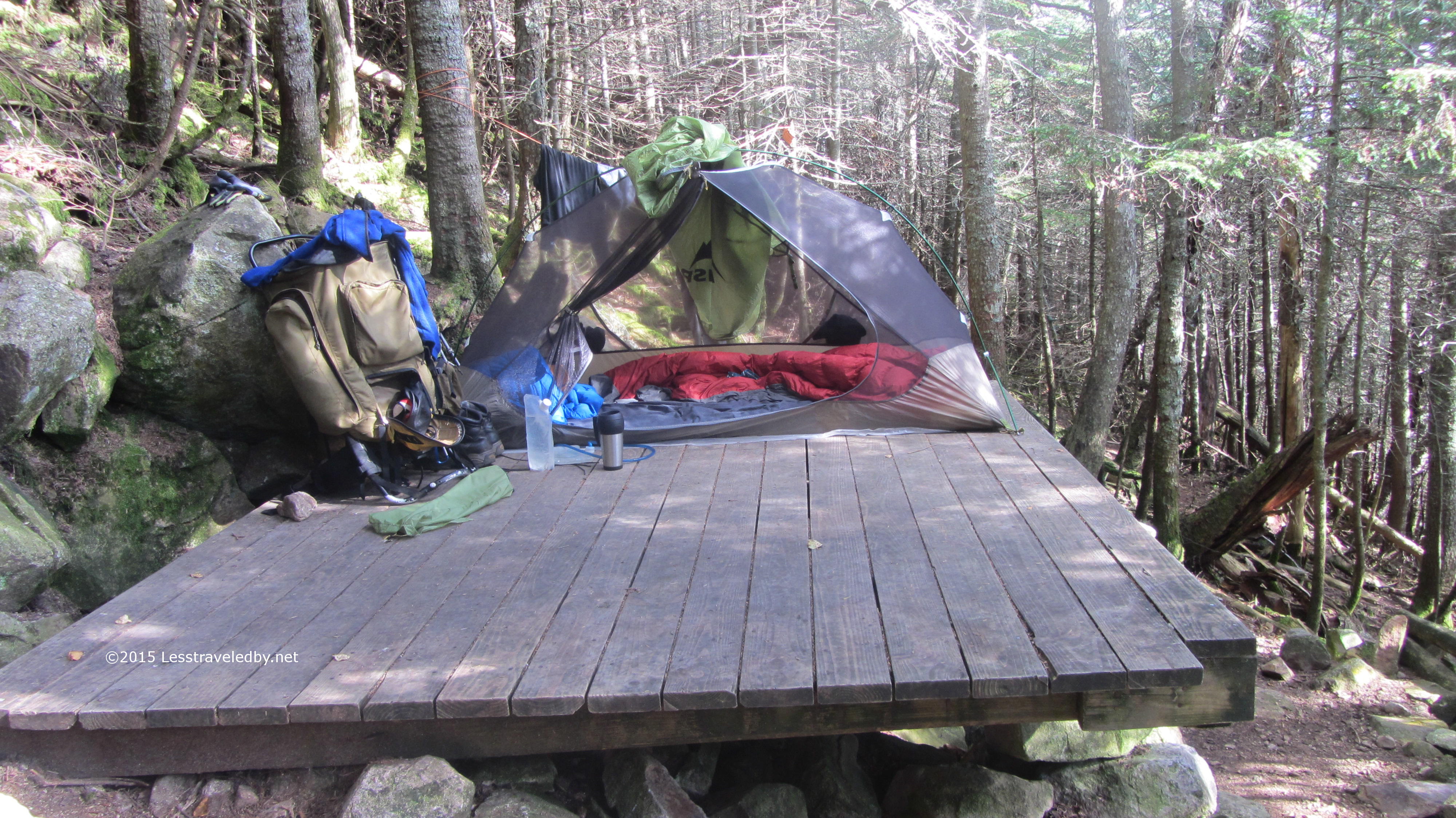
I did as well and headed on to make camp at the Liberty Springs AMC site. The caretakers were gone for the year, but I do believe we filled up every platform that night with late season backpackers. I met a family that was almost done with their loop and a couple of younger guys from Texas who were just starting on theirs.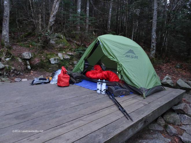 I left room in case anyone needed a spot as my tent doesn’t take up much space, but had no takers. It was a cool night in the upper 30s so most everyone seemed to turn in early.
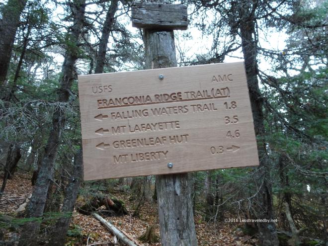 After the incredibly steep ascent back to the ridge from the campsite the legs were warmed up and ready for the day. I was happy to be on the ridge which is challenging, but a lot easier than most of the trails that get you up there.
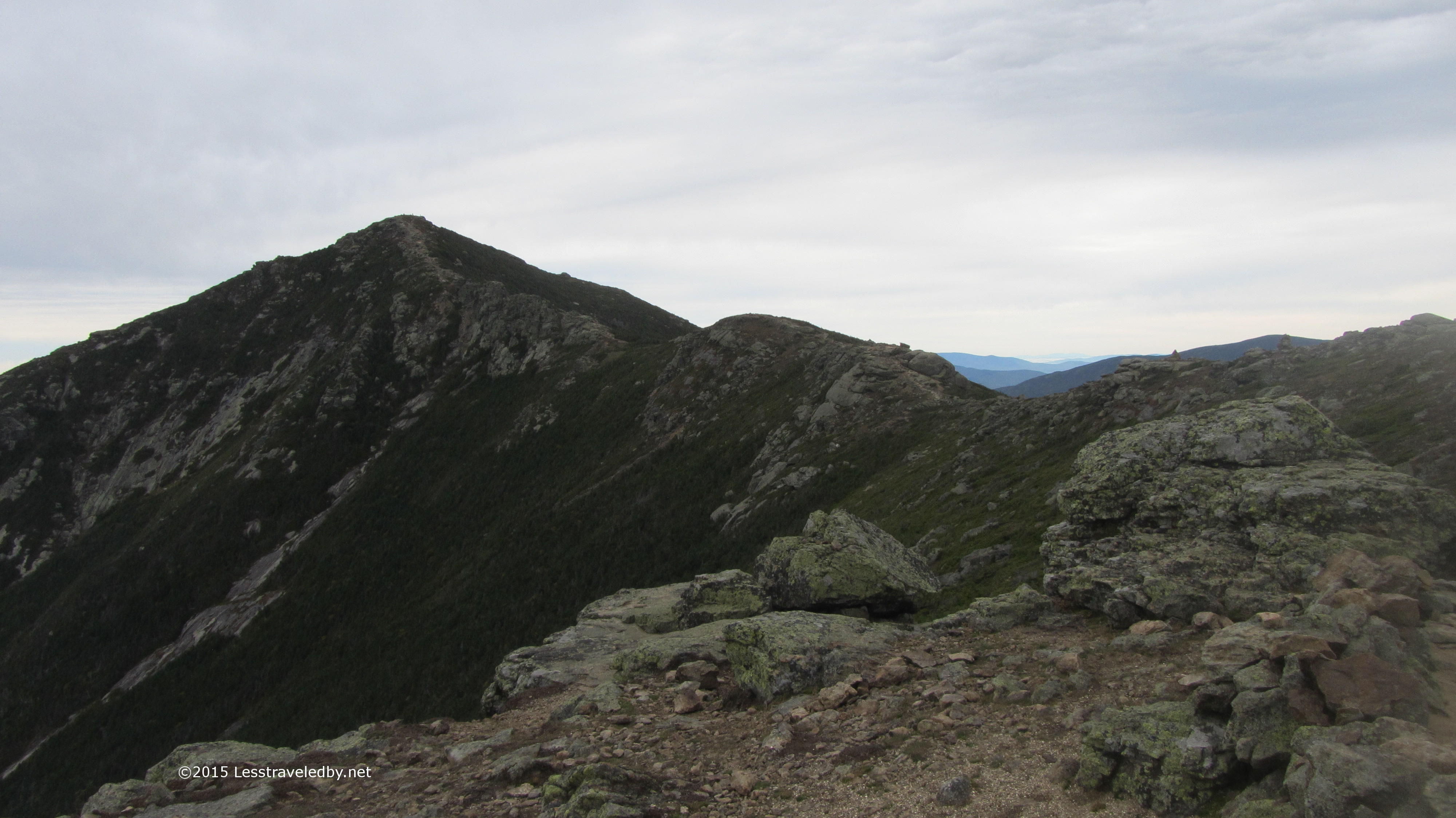
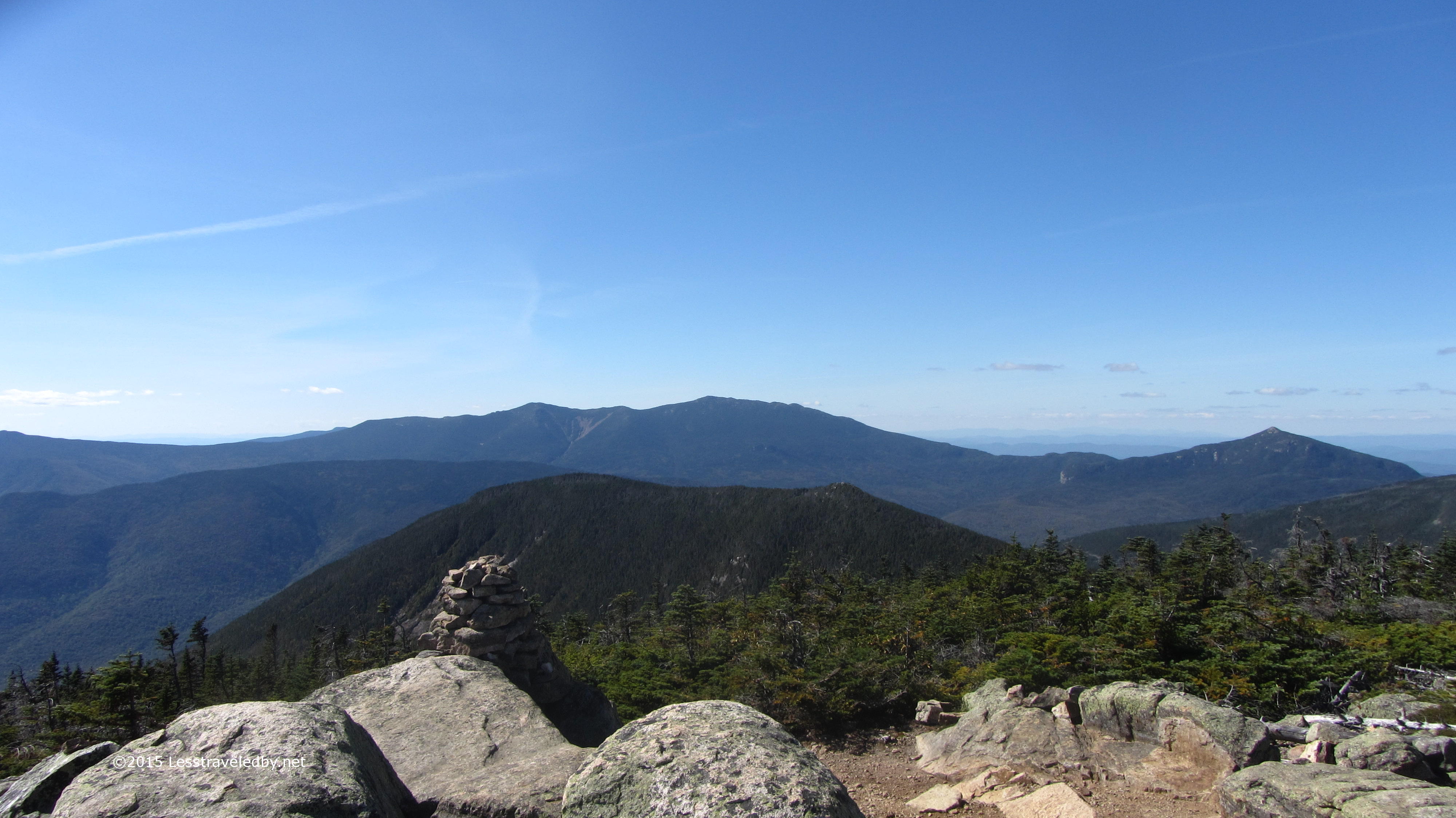
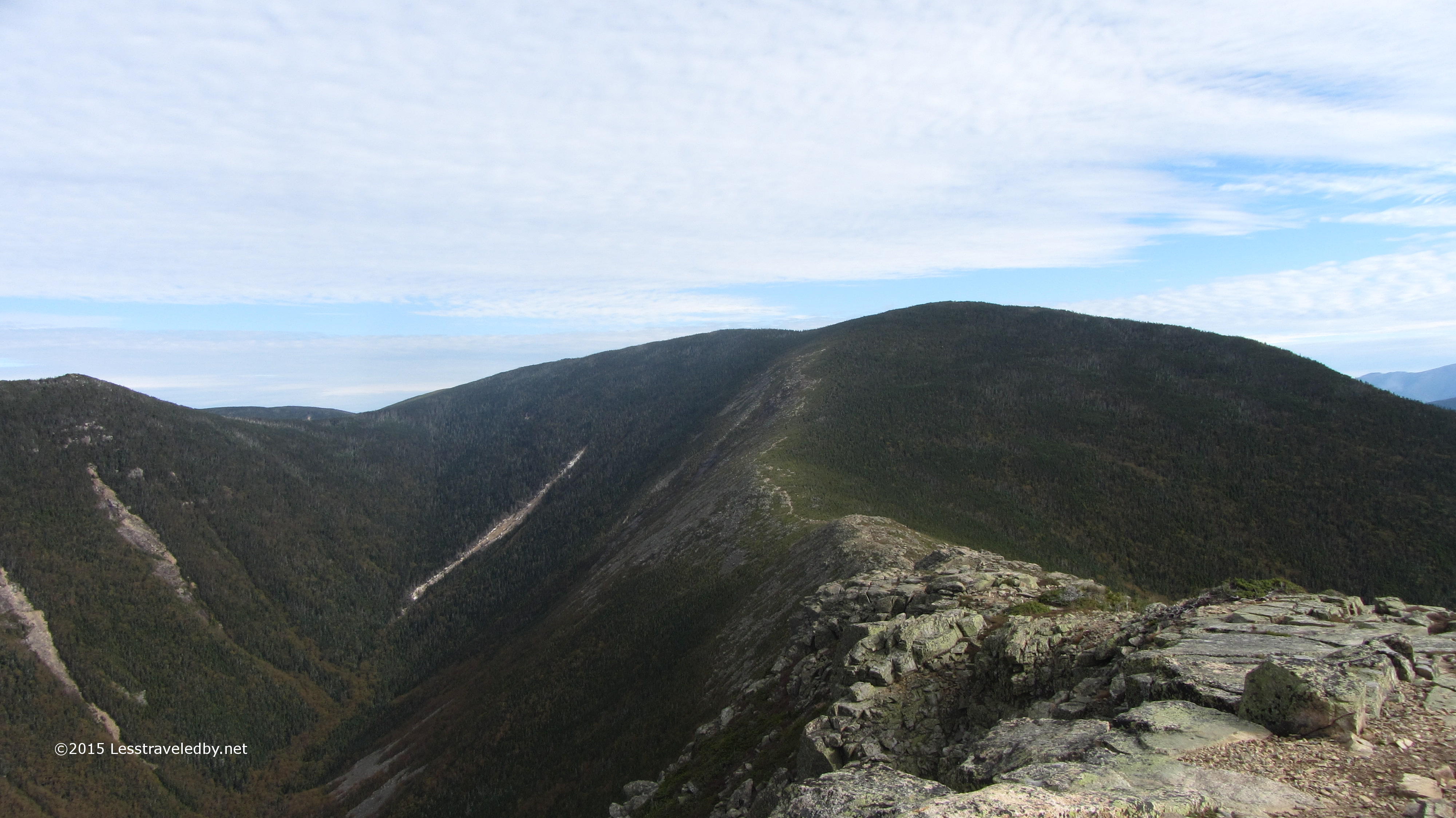
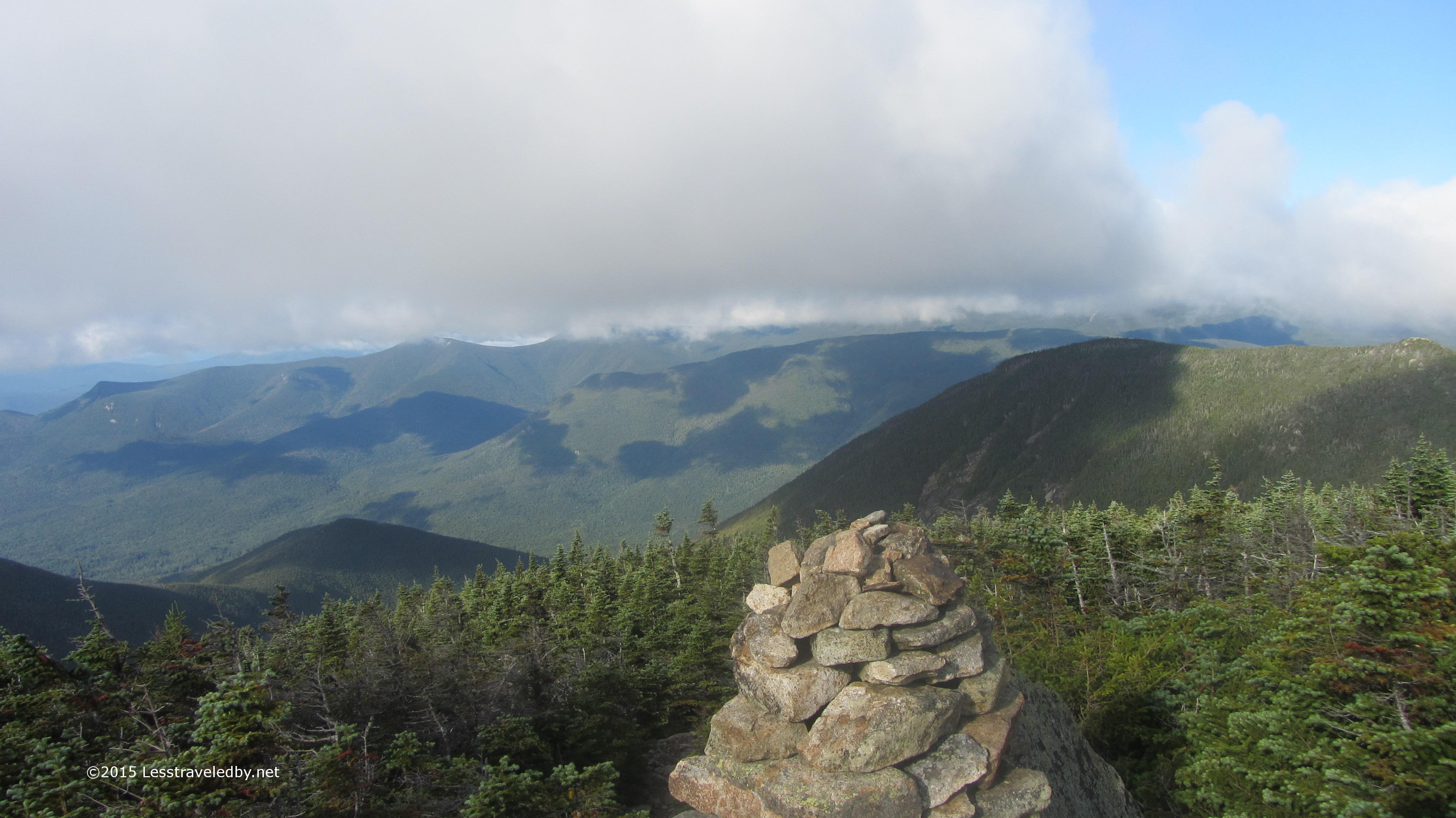
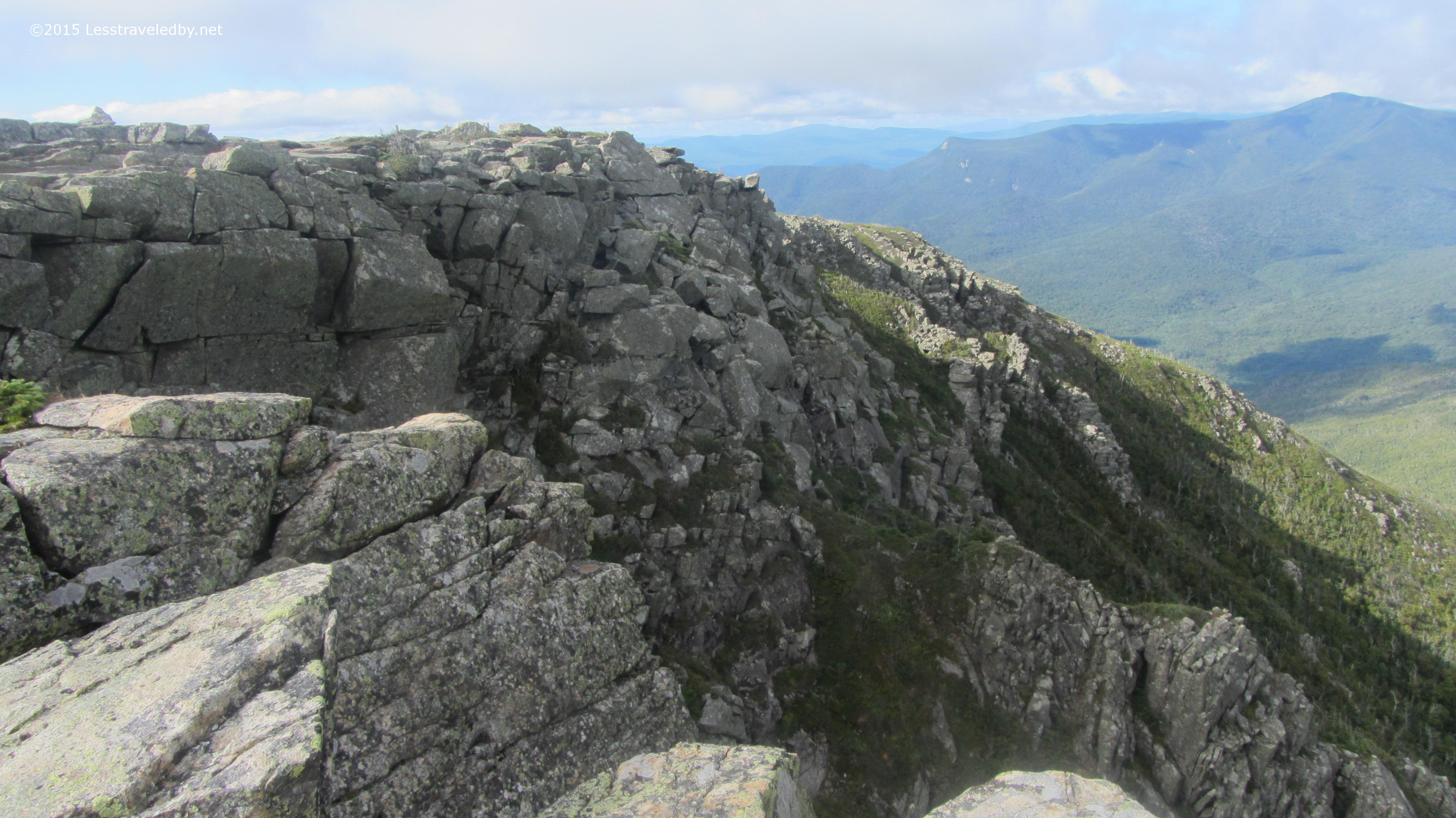
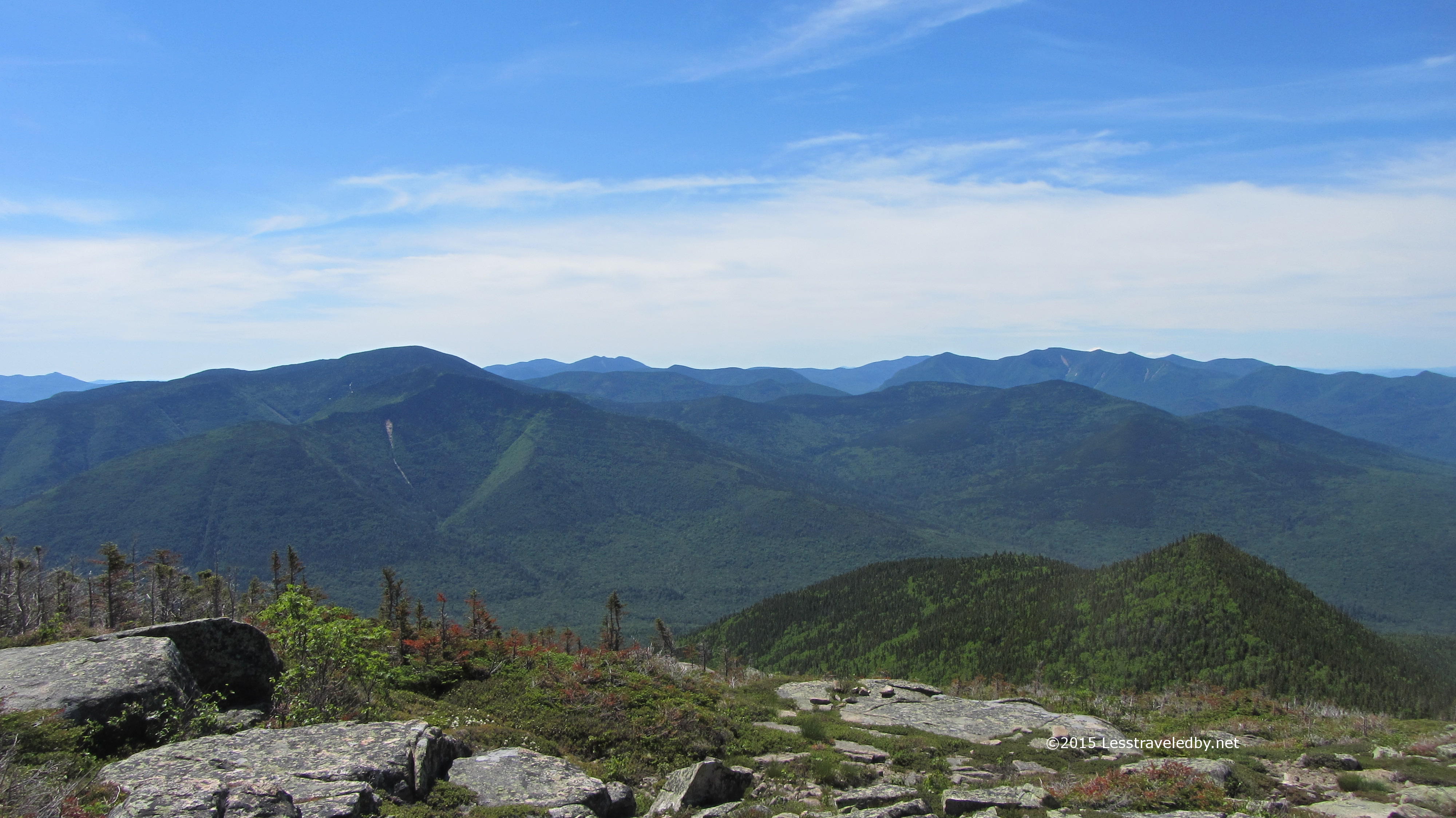
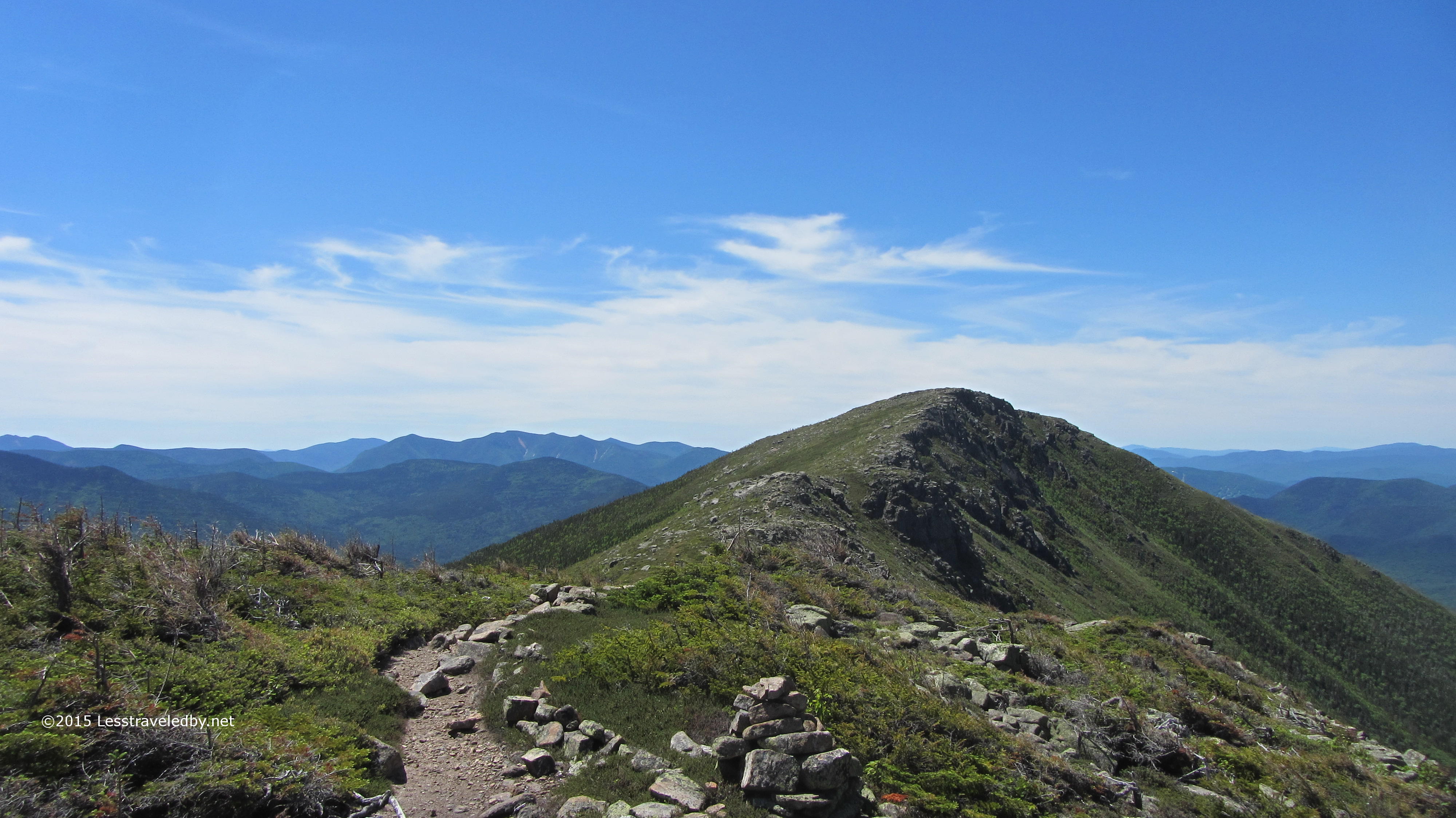
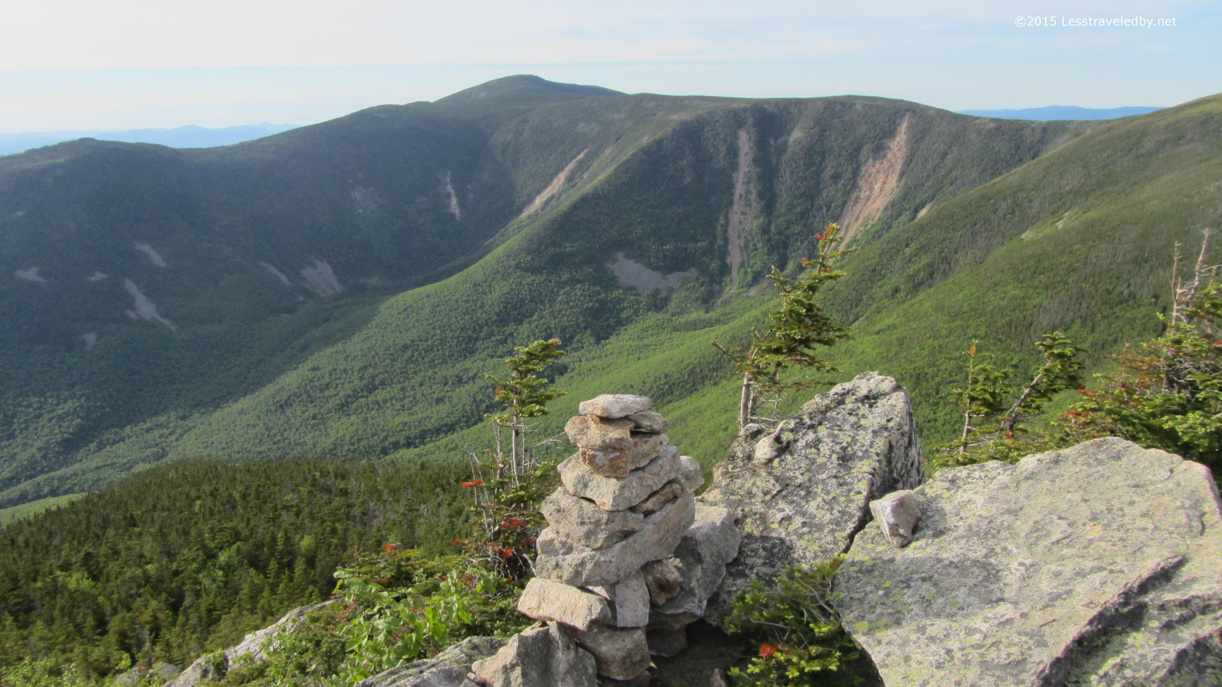
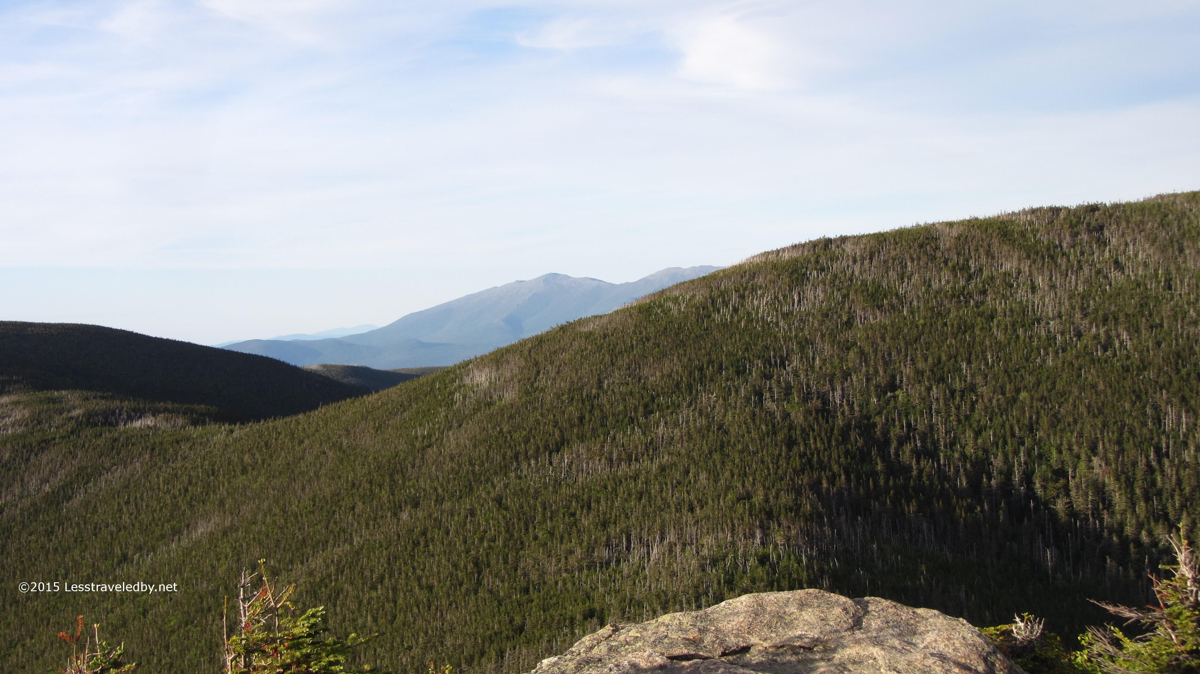
 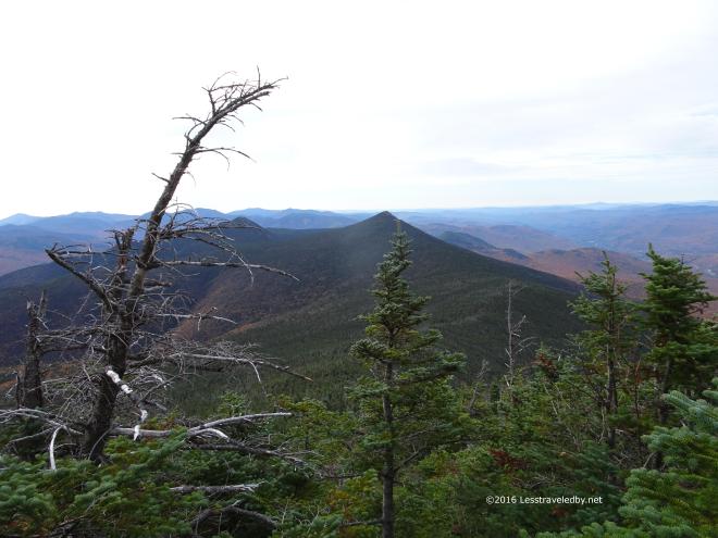 Working my way up Little Haystack there was a nice view looking back at the previous day’s peaks. Flume is sort of hiding behind that tree and Liberty in the center looks pointy from this side. That might explain why it felt that way going up.
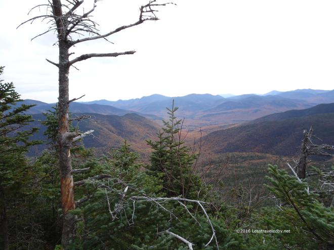 Looking right down the notch of valley that separates Owlshead from the ridge up here. There is a little piece of trail down there that remains in my quest to redline the Pemi.
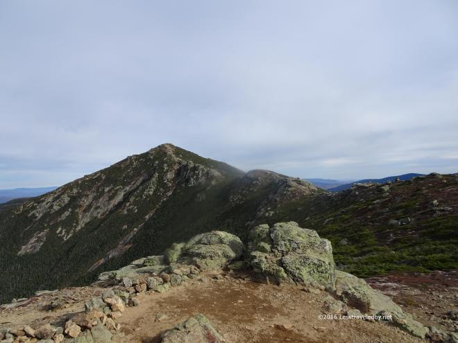
 Topping out on Little Haystack I met the first intersecting trail and my first day hiker. This is a great spot for second breakfast before the real climbs of the day begin. One of the benefits of a popular trail with lots of people is that folks can take turns taking pictures of one another. So much easier than trying to set up selfies on a mountain without falling off.
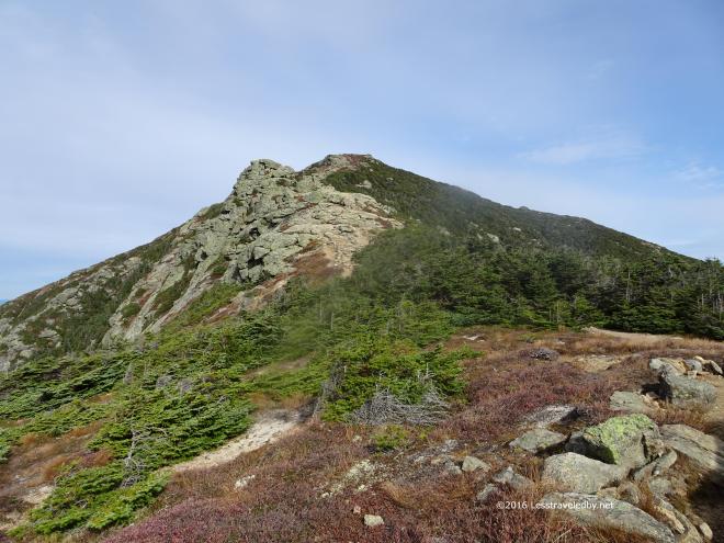 This climb up Lincoln is harder than it looks I find each time I come up here. After the big rocky section there is a steep final pitch up to the top. Thankfully there is a great place to get out of the wind behind a big rock just over the ridge because the wind was really picking up by this time.
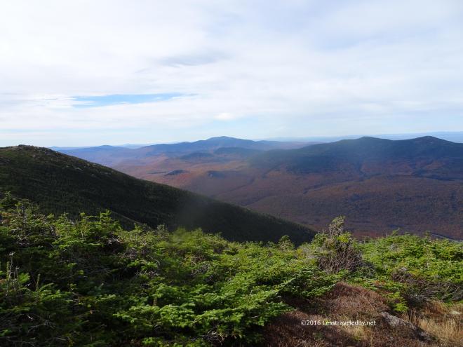 It was getting harder to hold the camera still so I wasn’t taking much time to set up shots. Literally point, shoot, put the camera away so I could grab my hiking poles to keep myself on my feet.
 Coming around these rocks and suddenly being exposed to the full force of the wind was almost enough to knock you over. Thank goodness for a heavy pack to keep me on the ground!
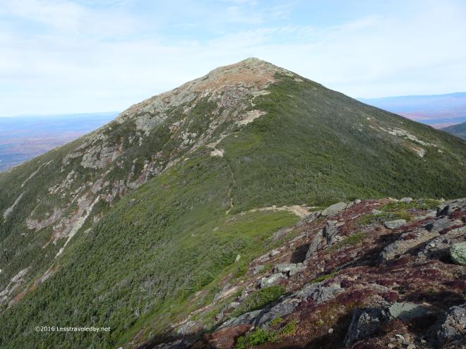 The climb up to Lafayette from Liberty is easier than it looks or at least I feel that way about it. Mostly it is just a gentle slope with a few sections that tilt up a bit more steeply.
 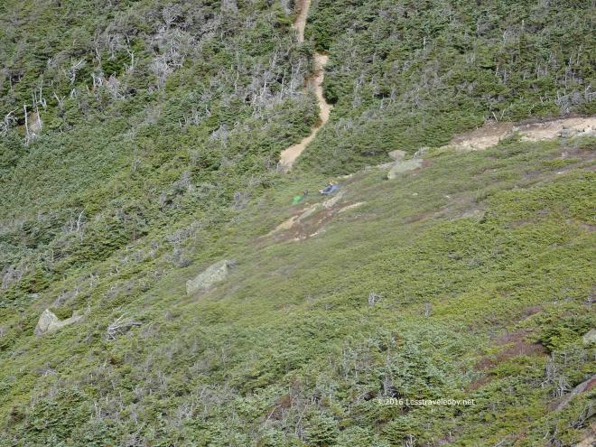 If you look carefully you can spot these two folks eating lunch in the col if you scroll back up to the previous picture. They were tucked into the scrub trying to stay out of the wind while they relaxed in the sun.
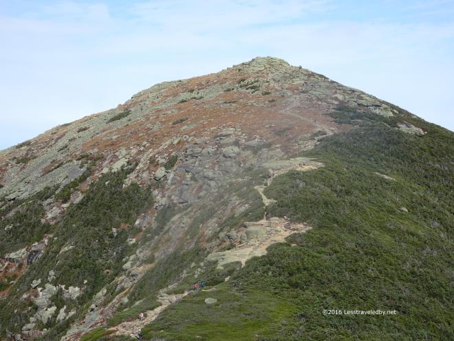 I’d just had elevensies on top of Lincoln so had no excuse to stop again though I’d have liked to sit there for a bit. Instead I took advantage of a quartering tail wind as I ascended the open slope of Lafayette.
 Nearing the top there was nothing to block the wind and it was a constant challenge to keep pointed in the right direction.
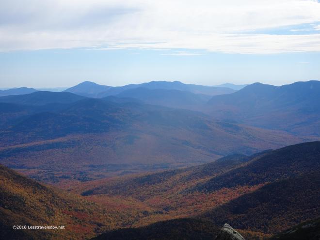 Pretty sure I was hiding behind a rock to stand still enough to get this shot of the valley below.
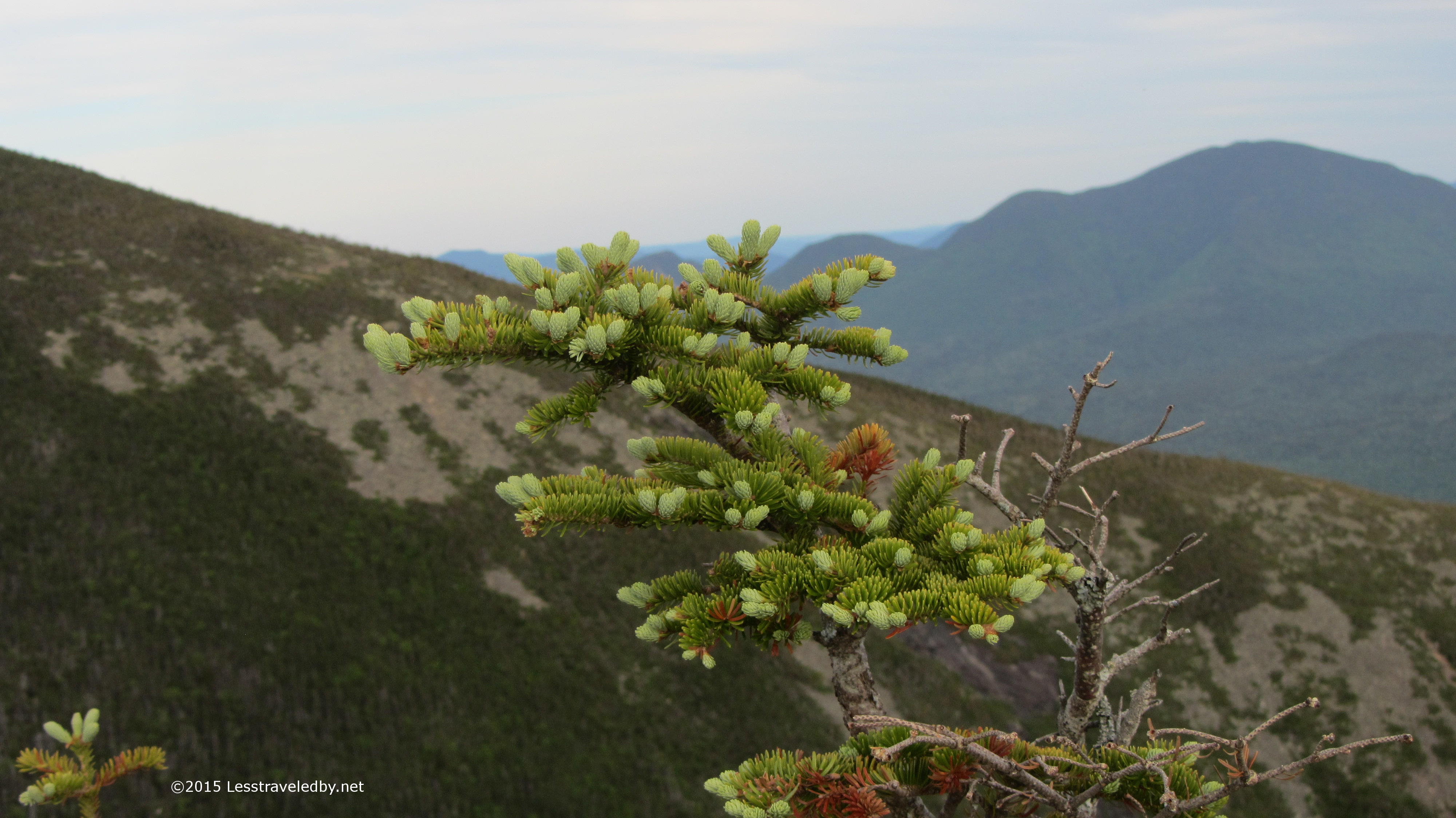
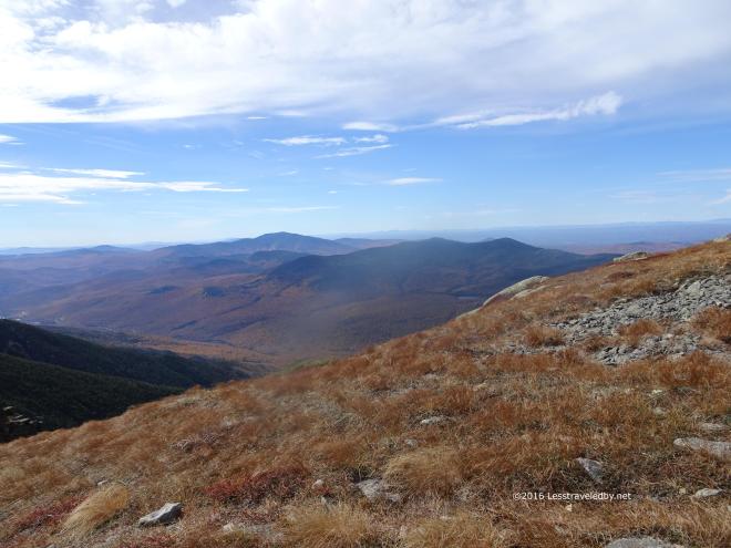 Everything was dry up there. I mean crackling brown and dead. Very strange for a place that is often wrapped in clouds. Hopefully we have a good snowy winter to get things wet up there again.
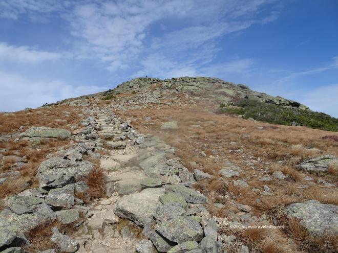 Just this final section of rock to climb. The wind was strong from my left as I worked my way up. I was glad that it was a wide slope rather than a spiny ridge I was ascending. Plenty of room for error 🙂
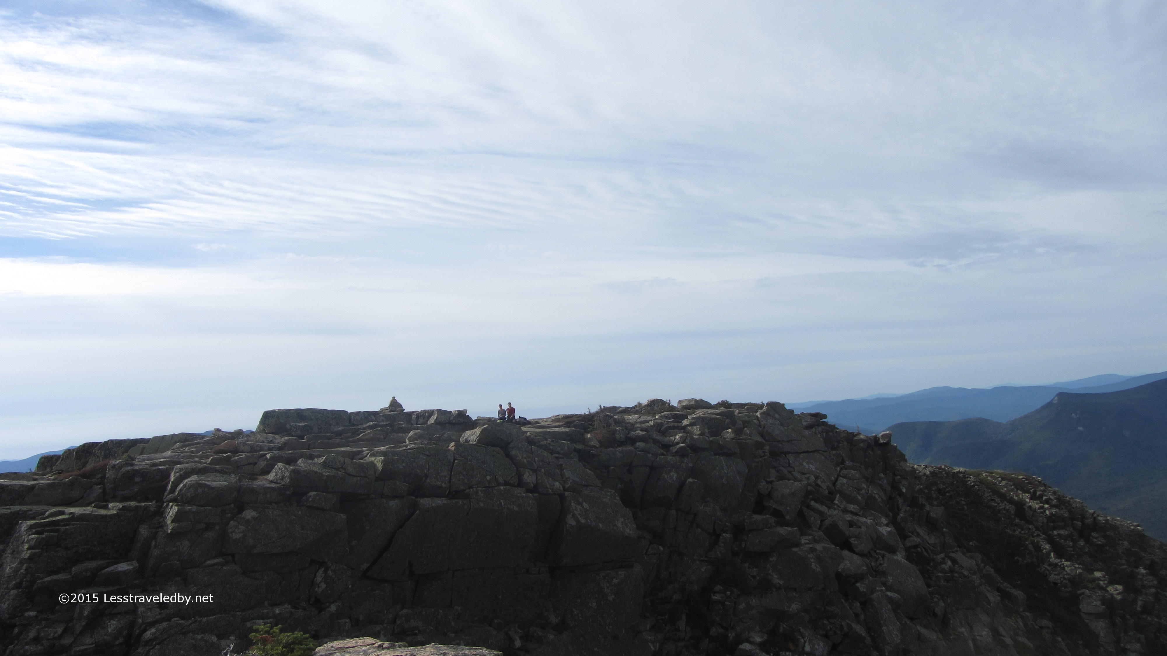
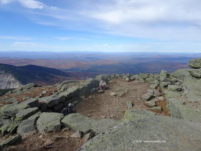 Only a few hearty souls were hanging out at the summit. Usually you can’t find a place to sit up here but I noticed that almost everyone who arrived kept moving. A few stopped to take a picture or two, but these folks hiding behind the rocks were the only ones who stayed long.
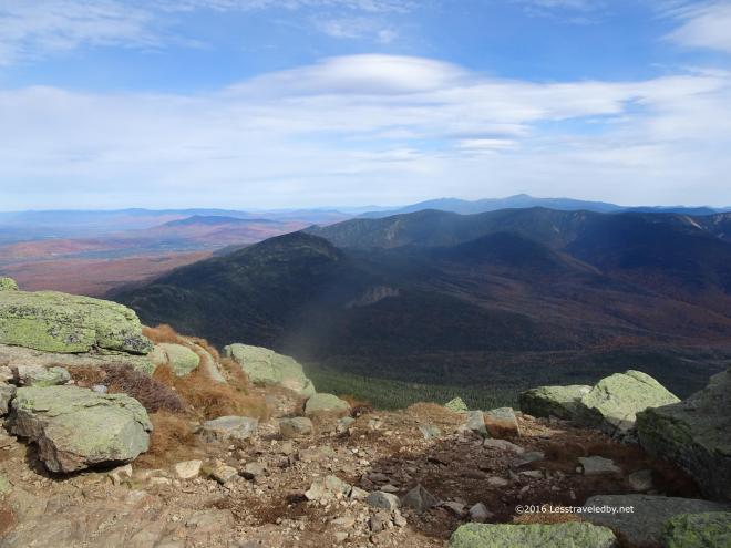 Again it was really hard to hold the camera still so I was just pressing the buttons and hoping for the best.
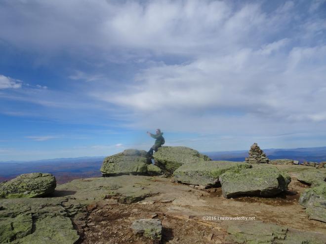 This guy was taking an epic selfie with his beard and hair flying back from his head. He looked pretty stoked about it too 🙂
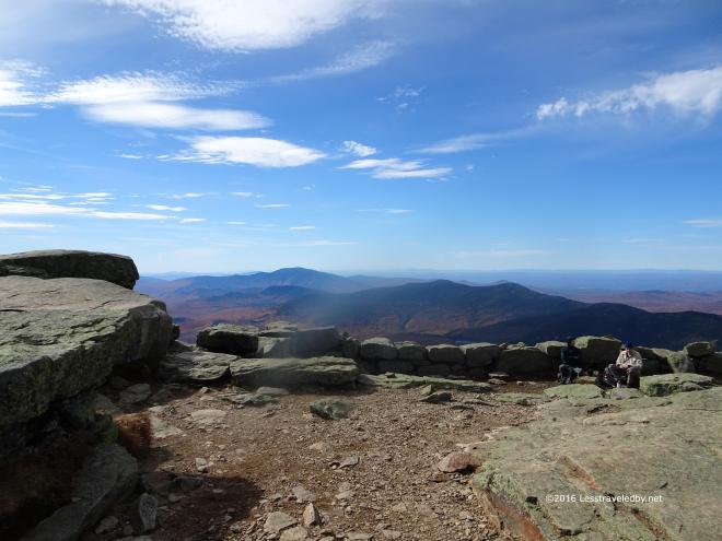 The wind was clearing out the sky some, giving better light. One of the reasons I was making this trip was because it was cloudy the last time I was up here. This wasn’t a perfect day, but it was definitely worth the effort.
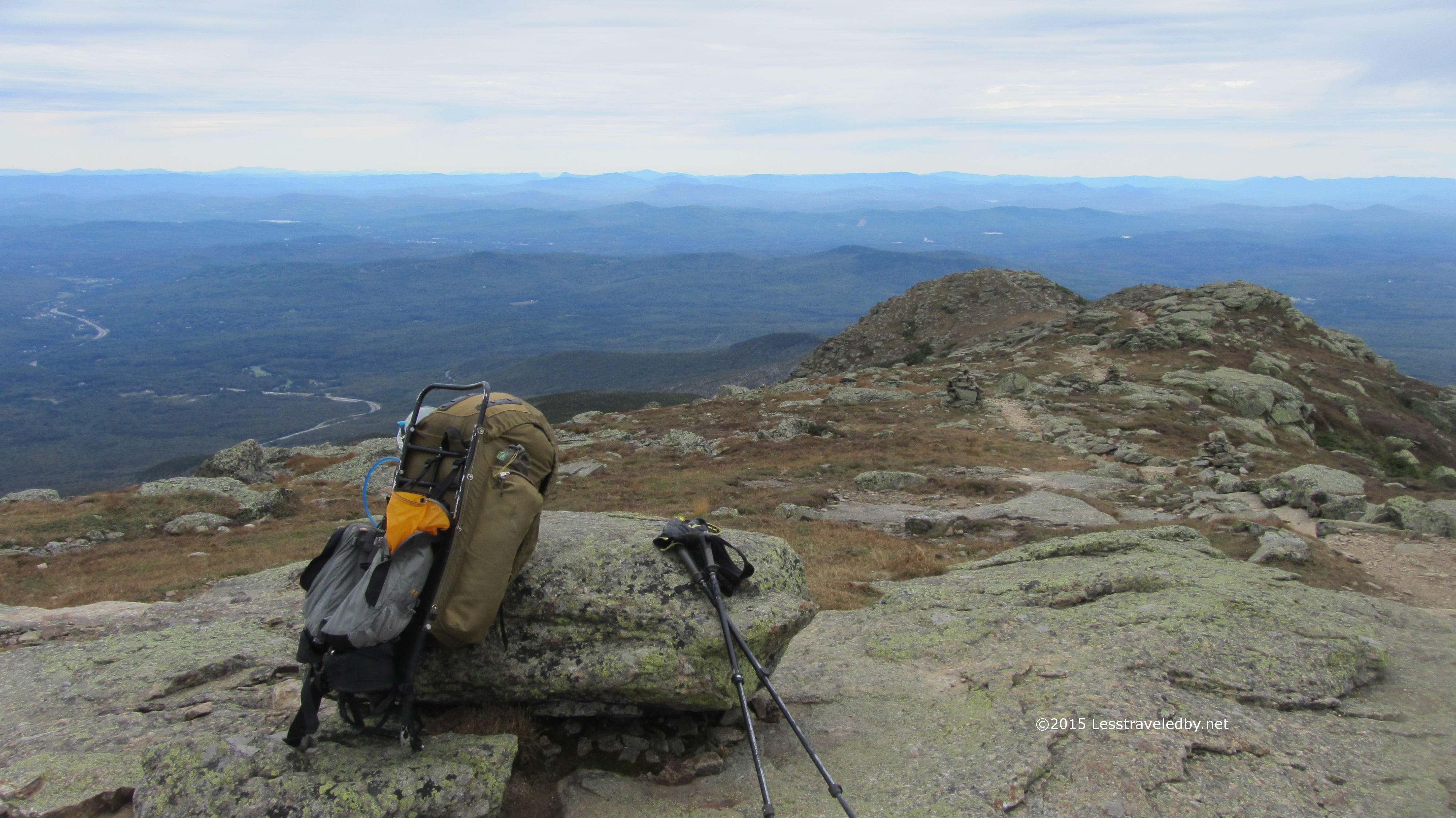
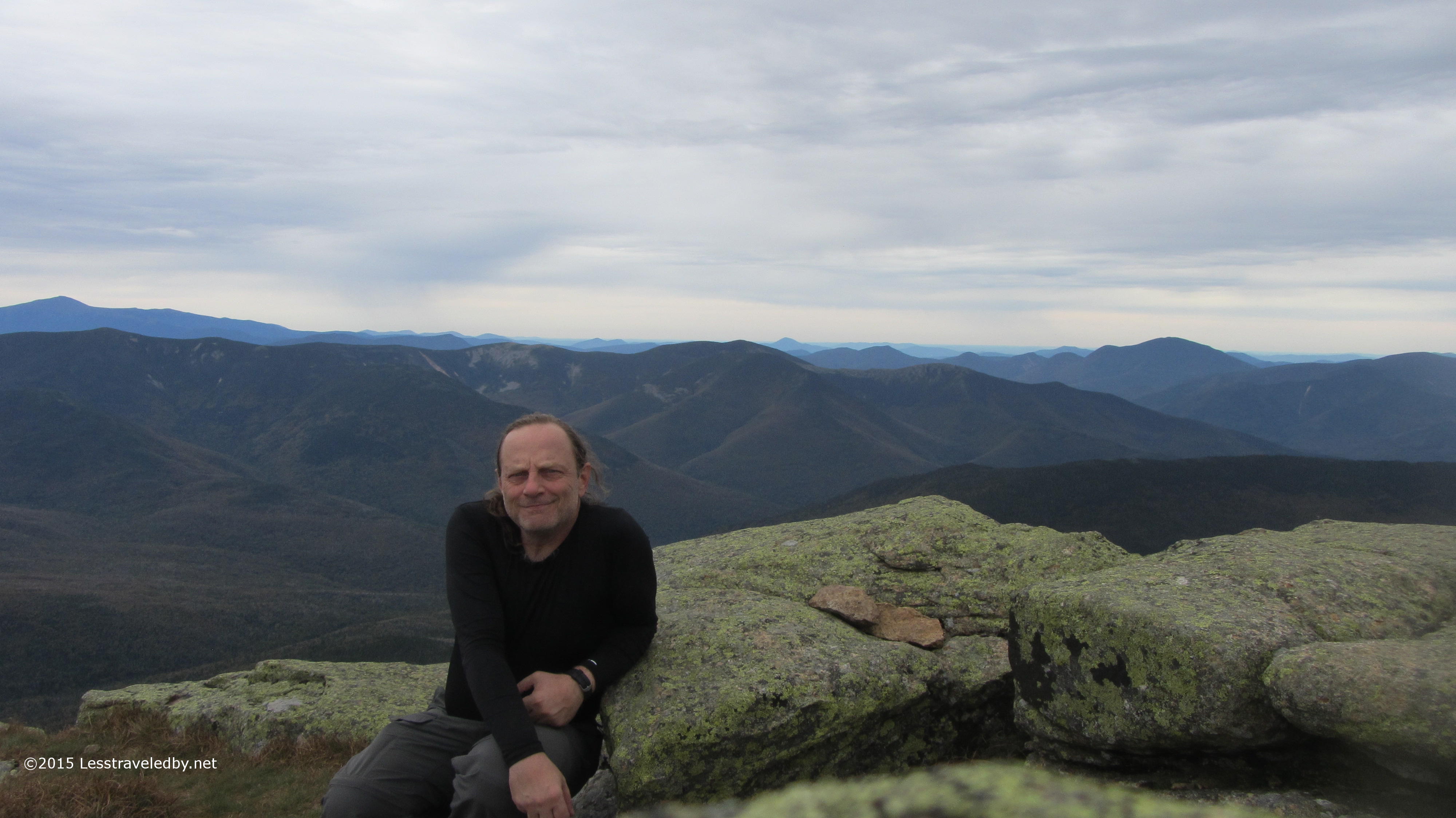
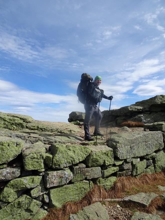 Again enlisting help from a day hiker I got this pic because I have almost no pictures of me wearing the Unaweep. This pack rocks and I intend to do a Trailspace review on it soon so getting some action shots was nice.
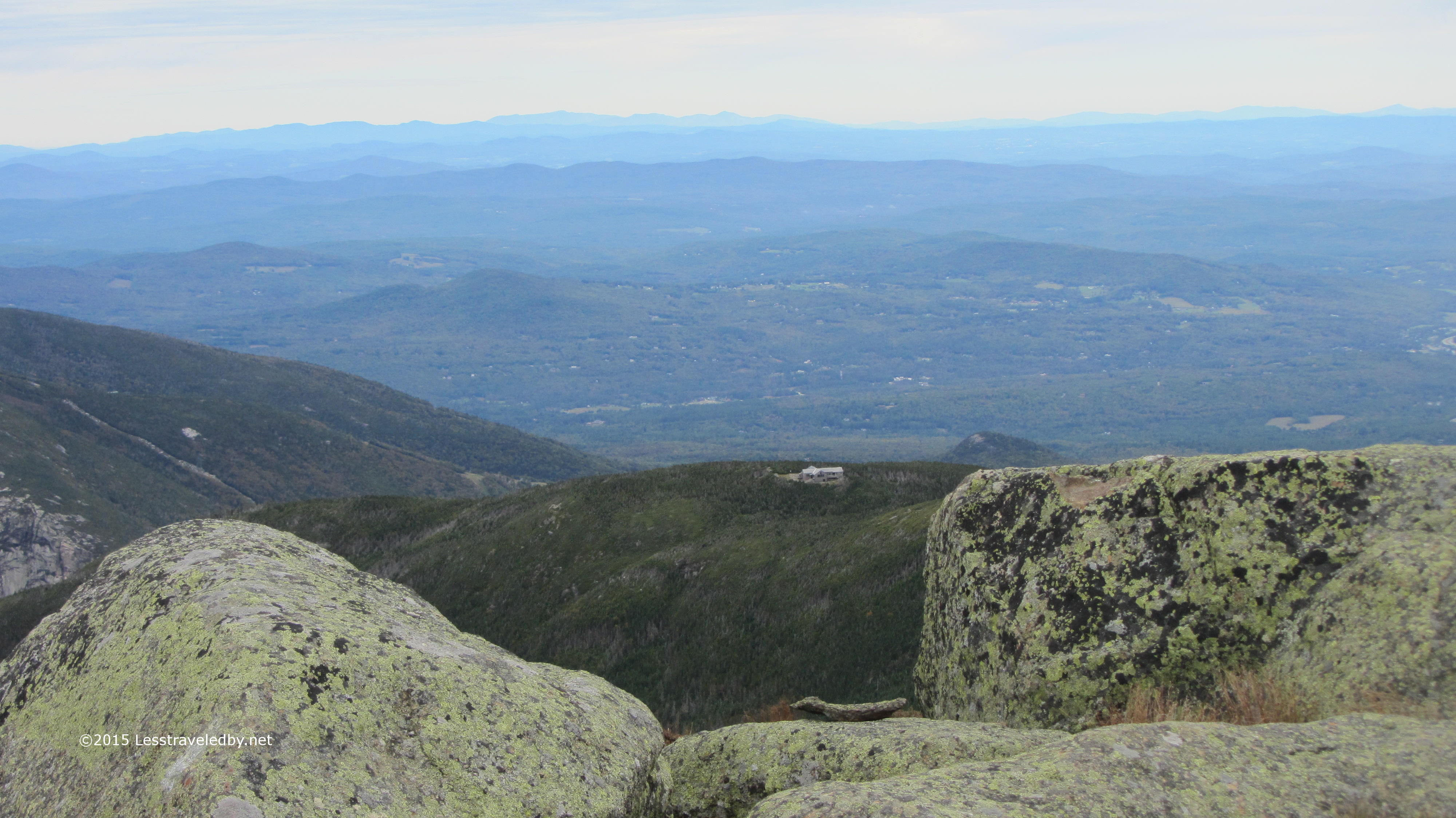
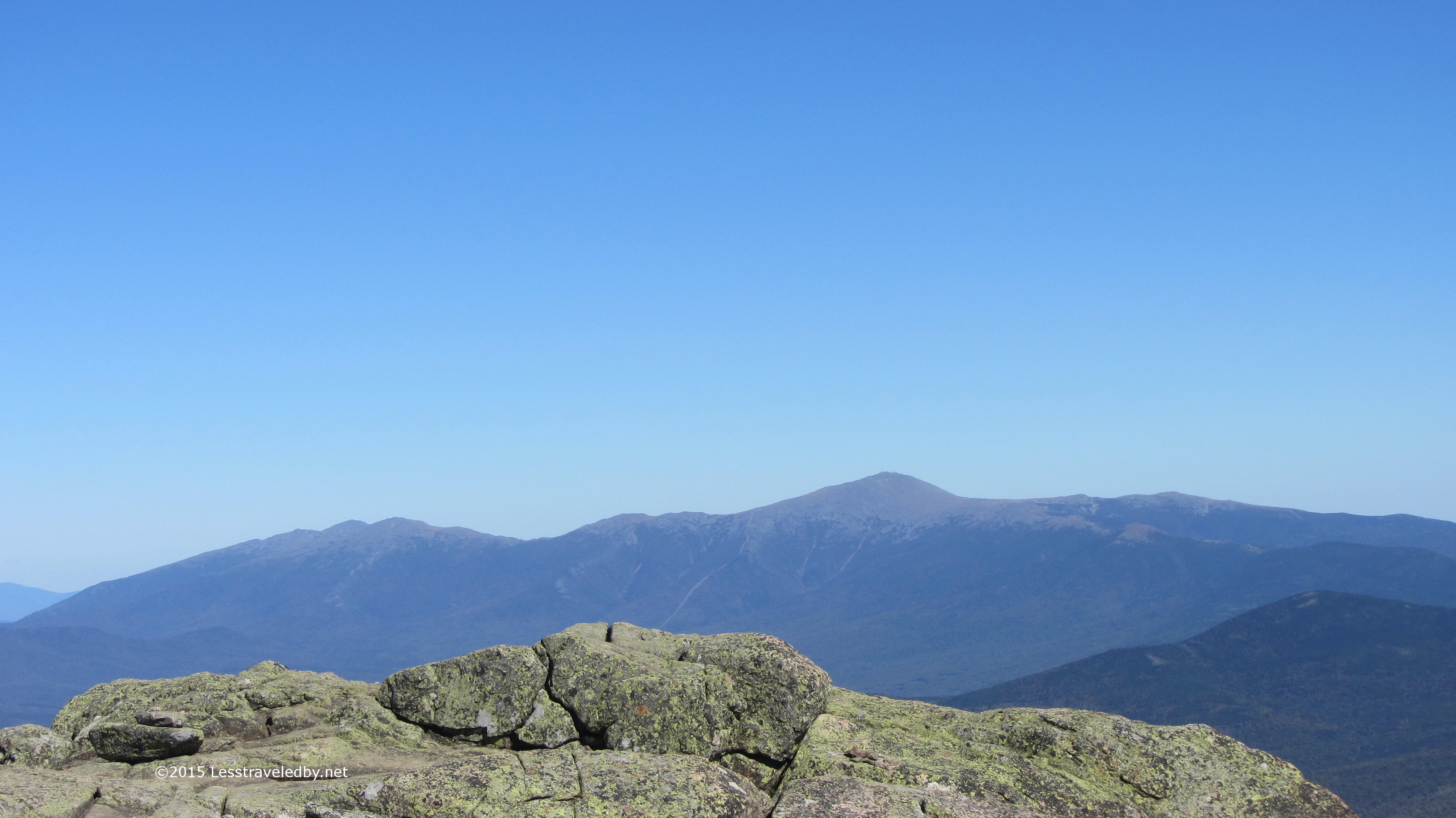
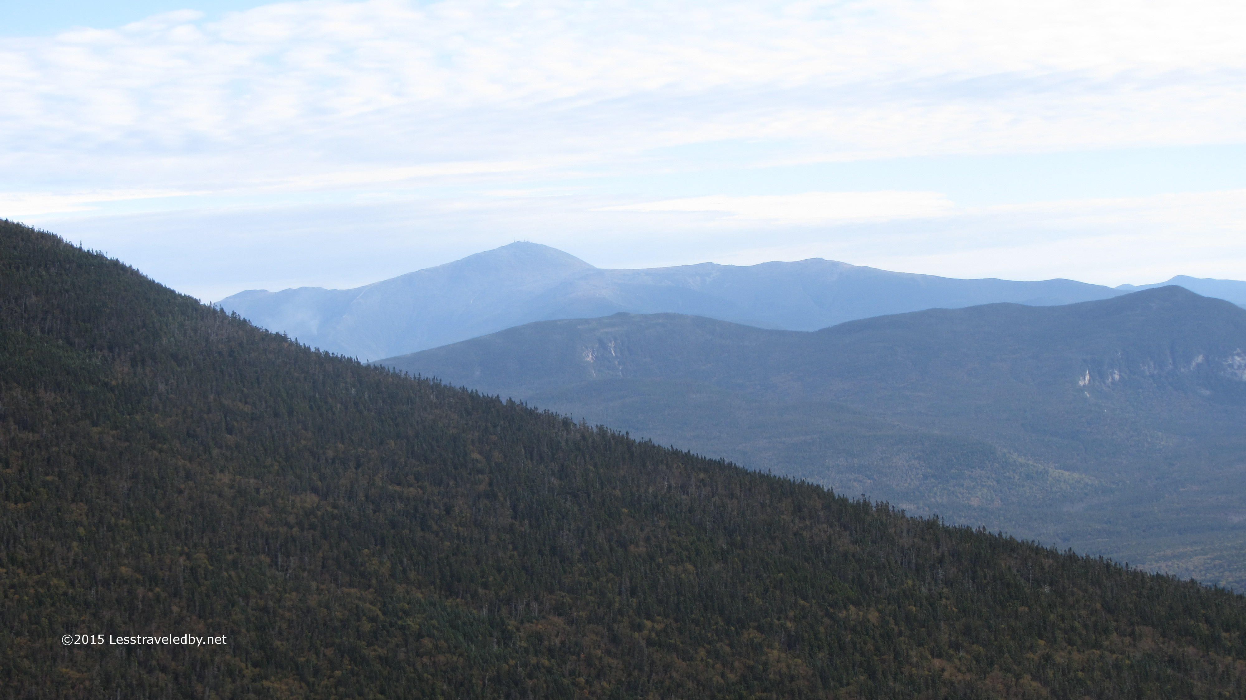
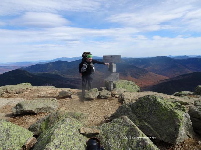 Another great action shot of the pack for my review. Shame it is blocking Mt Washington, but the rest of the view isn’t exactly terrible.
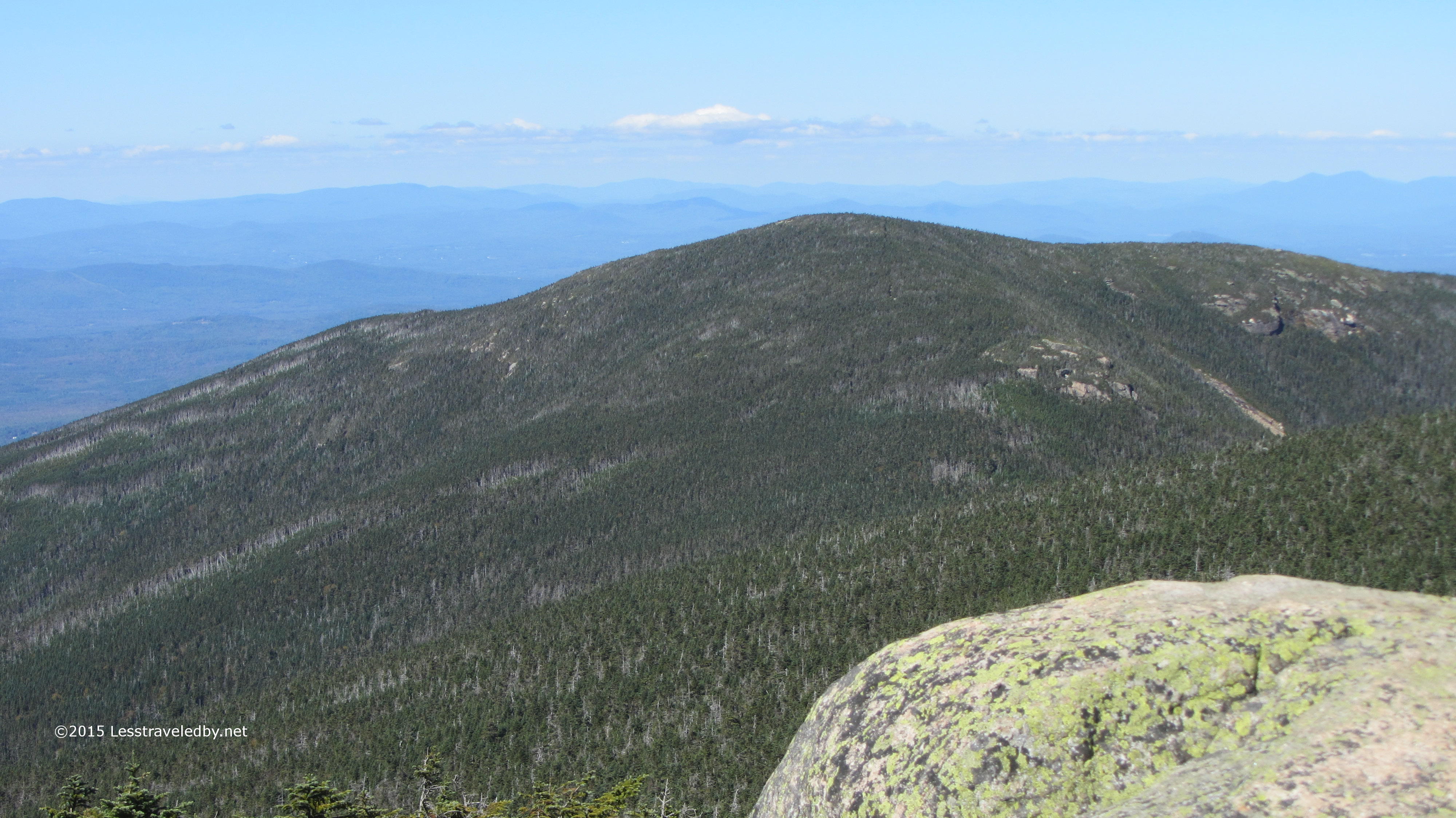
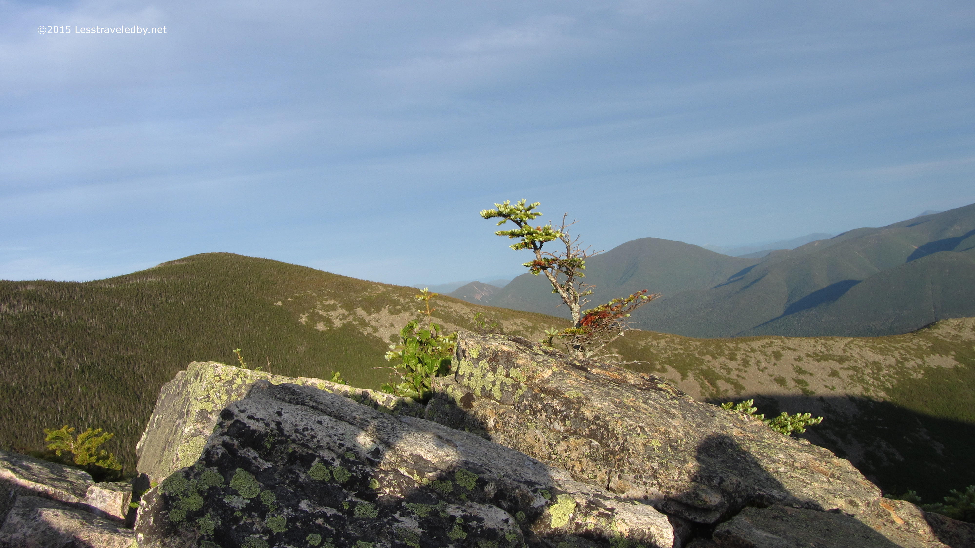
 Garfield peak lies tauntingly close from here at the end of the ridge. Only about a mile and a half as the crow flies, but I’m an old fat guy with a backpack so my route would be a bit longer. First down off the ridge via a steep descent, then a couple of serious PUDs on the knobs in the middle before the final steep ascent of Garfield.
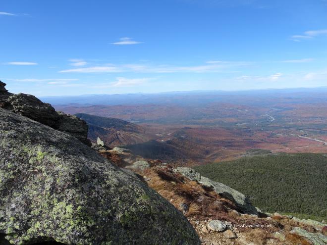 Time to enjoy the views up here before giving up the high ground. The trail is mostly tree shrouded once you descend so good to soak up the sun while you can because the other side of the peak will be in shadow.
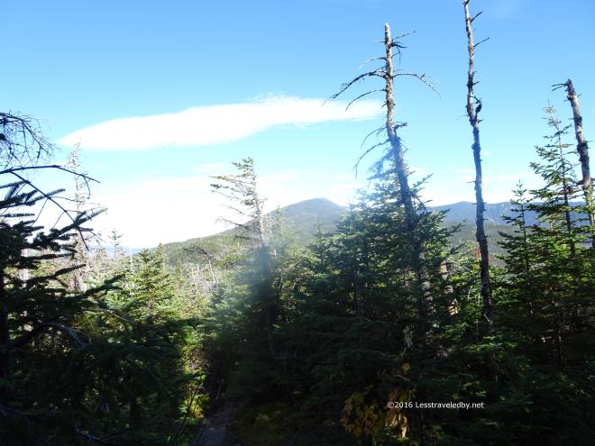 About half way to Garfield from the end of the ridge and it looks at least twice as far away as it did before. Thankfully I had a nice Fall day with cool temps so overheating or running out of water were not an issue. Just a matter of keeping the legs moving.
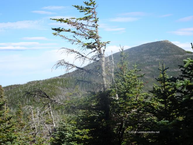 Shot from the same spot with some zoom applied this pic gives a better account of Garfield’s true peaky-ness and the climb that lies ahead.
 Passing by the pond is always a good sign that progress is being made. I think I’d like to plot a trip that involved staying the night in this area below the mountain some time. It would mean a nasty climb first thing in the morning no matter which direction you were traveling the loop, but it seems like a nice bit of forest after a day on the rocky ridge.
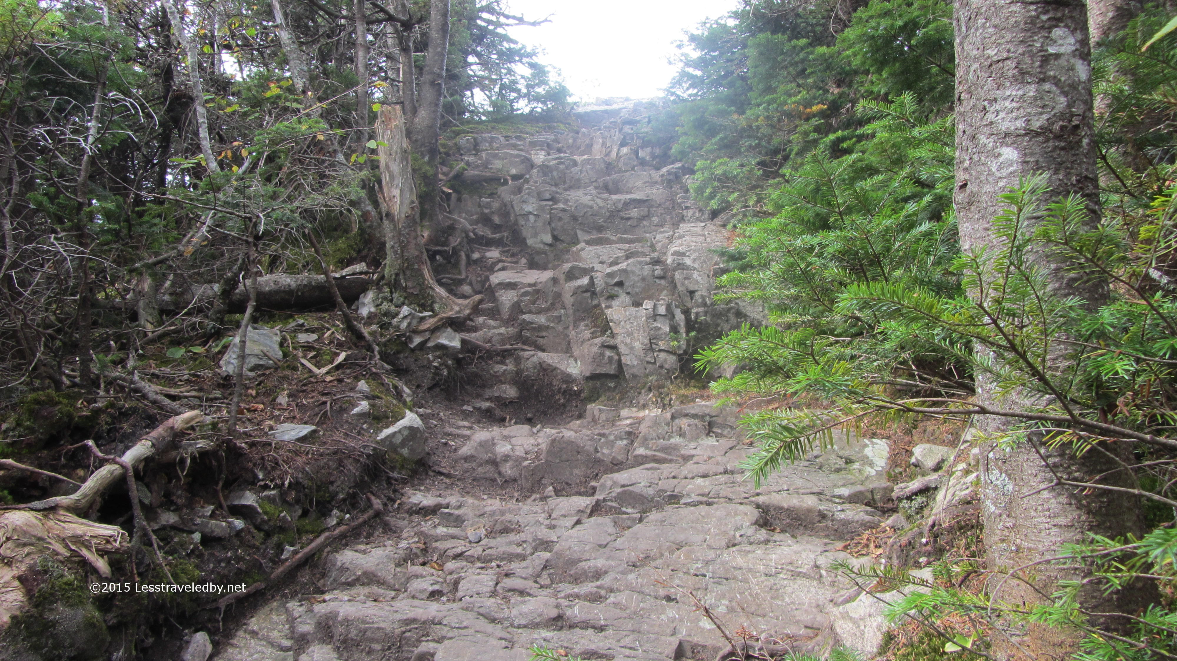
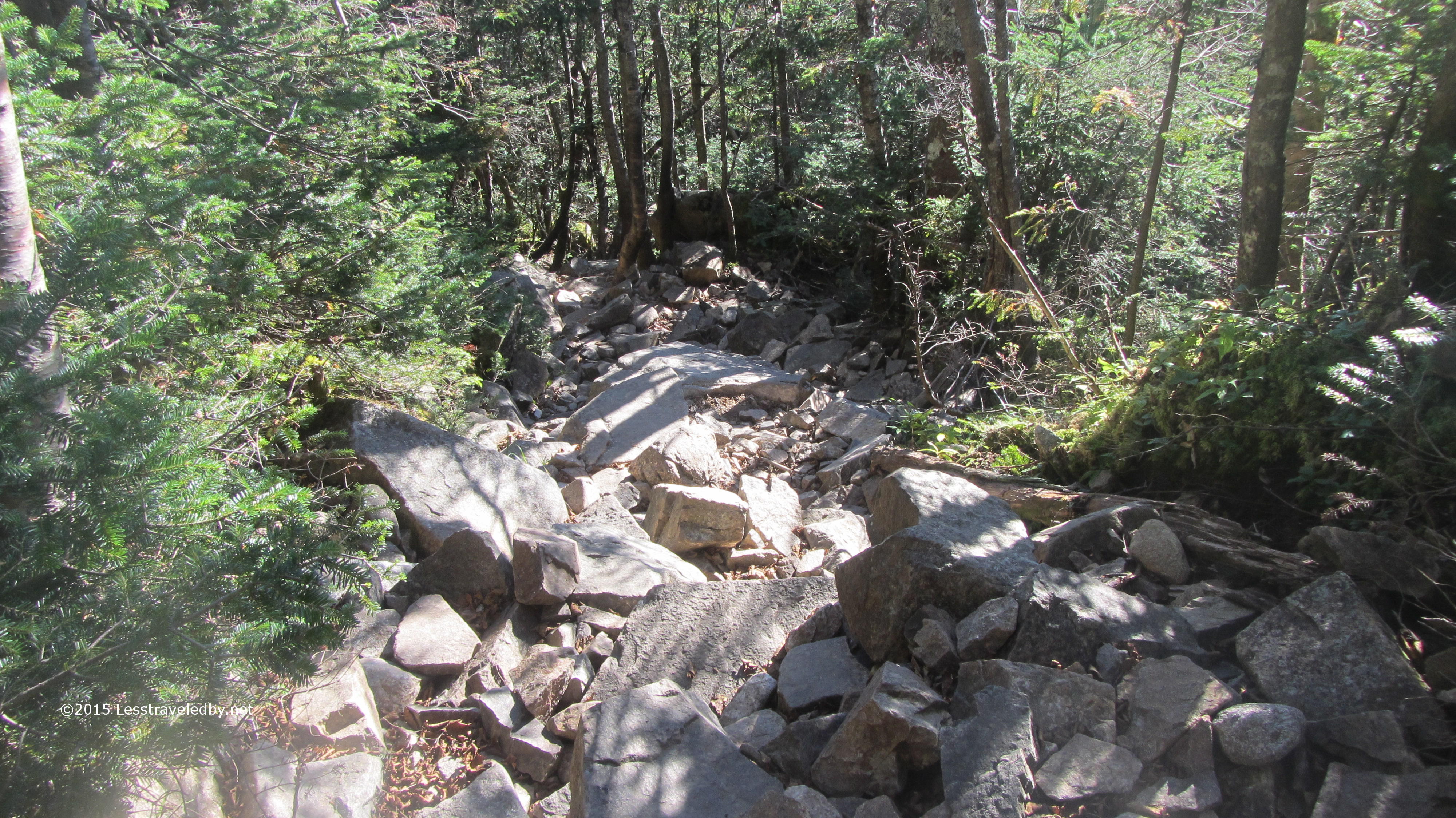
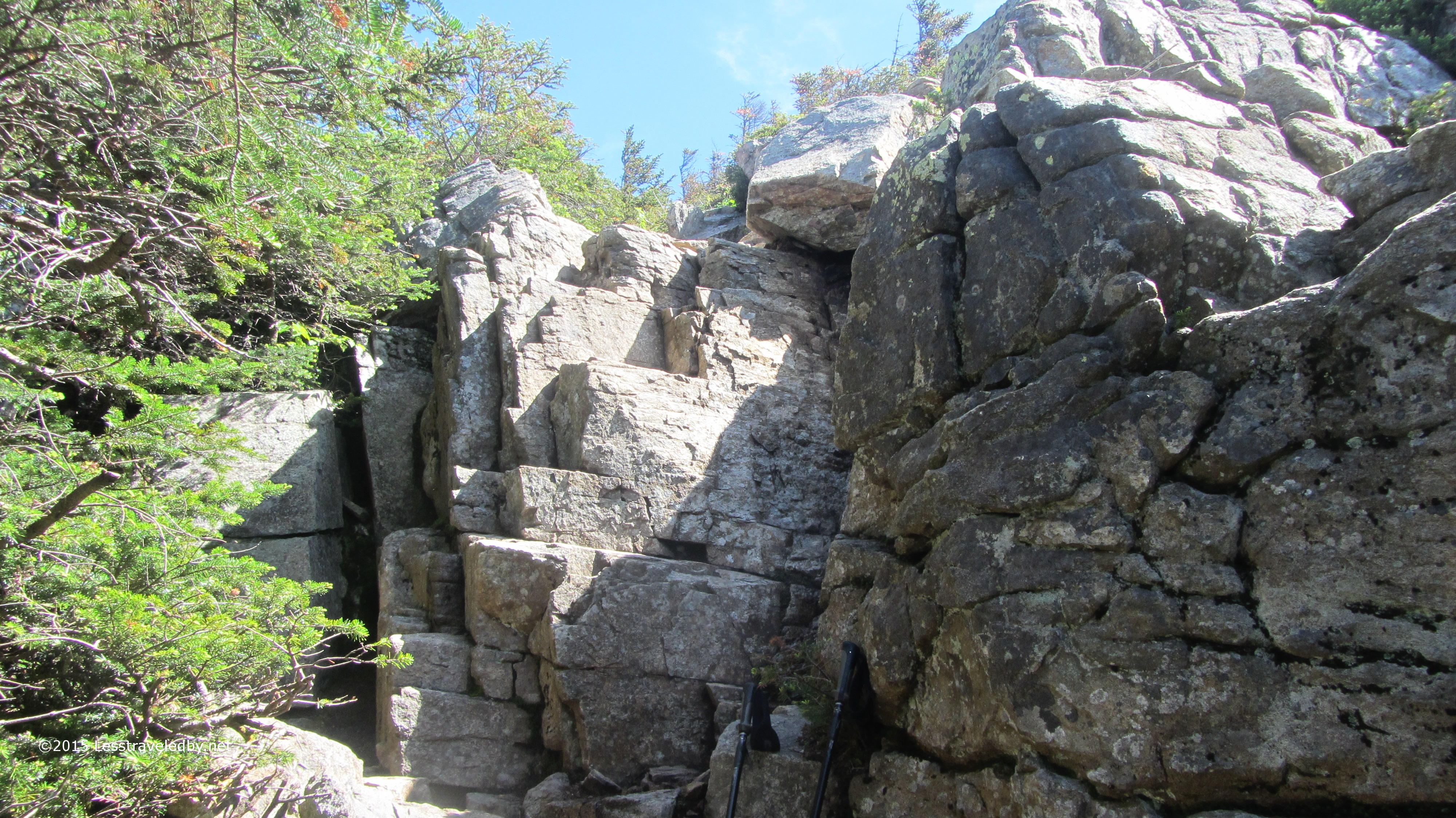
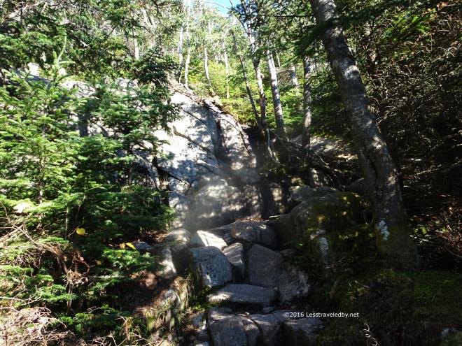 Speaking of rocky…the first time one runs into a “trail” like this it can be a bit unsettling. After traversing this feature a few times I have a longer, but safer route for when it is wet or a more direct and dangerous route for when it is dry enough that I think my feet will stick to it. This time I took the direct route and enjoyed saving the time.
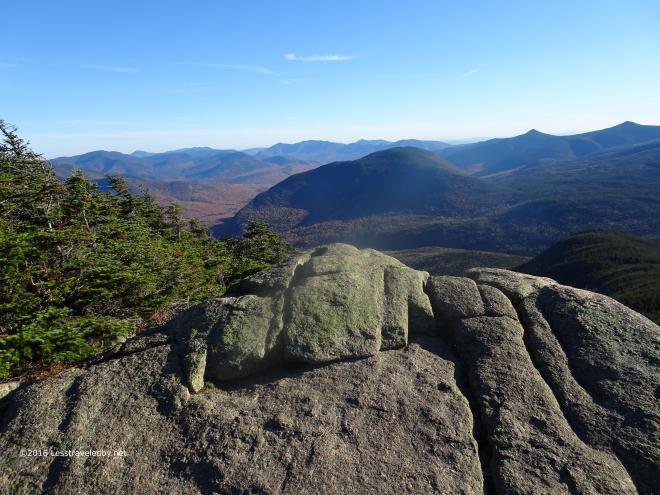 That left me more time to enjoy my time at the top. This rocky ledge is a required stop where food is eaten, pictures taken and the fact that the summit is in sight is celebrated.
 There is still a little more climbing to go, but it can be really windy up there so I always do my eating down below before going up.
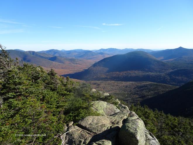 After some time in the trees it is great to be out in the open again. Once again it would be tempting to sit and enjoy this but I know the sun won’t last and the shady side of this mountain always seems to get dark early.
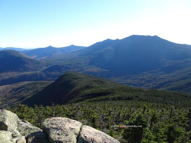 That Autumn light in the afternoon brings out so many beautiful colors and shadows.
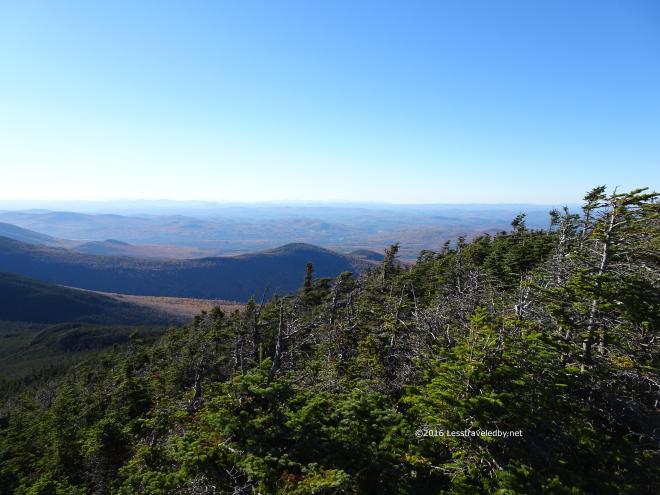 Never know when you’ll be back so best to appreciate these spots when you can. So much effort to get there, but worth every step.
 The boys from Texas that I’d met the night before popped out of the woods and agreed that their efforts had been rewarded. If I hadn’t heard via trail chatter that they weren’t in front of me I’d have assumed they were. Young and strong folks tend to go fast but it seemed they were wise enough to go slow and appreciate the amazing trip they found themselves on.
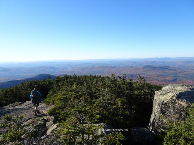 They headed down from the summit towards the campsite below. I reminded them to take water from the spring before climbing the steep trail as I’d learned the hard way last time.
 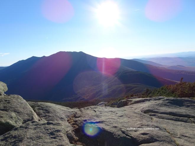 Then I settled back to enjoy a few moments alone in the sun. I wasn’t going all the way around the high loop on this trip so this would be one of my last chances to enjoy this sort of view before heading down into the trees for good.
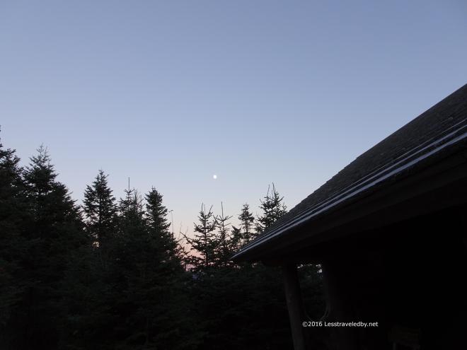 The wind was whipping around the shelter when I arrived. There was a couple there that put up their tent inside the shelter thinking no one else would be around. So long as I could find a spot to lay out my bed I didn’t care, but it seemed sort of silly since there were no bugs and the shelter is almost fully enclosed. Normally I’d prefer to sleep out in the woods in my tent, but that wind convinced me the sleeping would be better inside no matter who I had to share with.
Seeing how happy I looked in there the Texas twosome decided to drag their stuff inside as well. We had another hiker join us a bit after dark, while several other parties poked their noses inside and opted to set up tents rather than keep us up late. Amazing how many people you can meet on top of a mountain even in October. This was also amazing. I took this shot without a tripod. Just elbows against ribs and holding my breath. The image of the moon was dancing back and forth in the digital display as the computer wizardry tried to process the image on the fly. I took one stab at the button thinking it would be a blurry smudge and was amazed to find this when I got home.
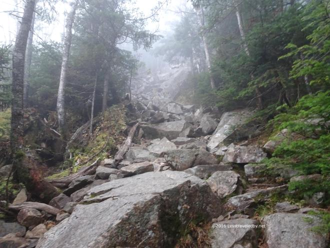 One of the folks in the shelter apparently set an alarm for 5am in hopes of catching the sunrise from the summit. The sky was socked in so I’m pretty certain he didn’t get much of a view, but he did get everyone else moving early which wasn’t the worst thing in the world.
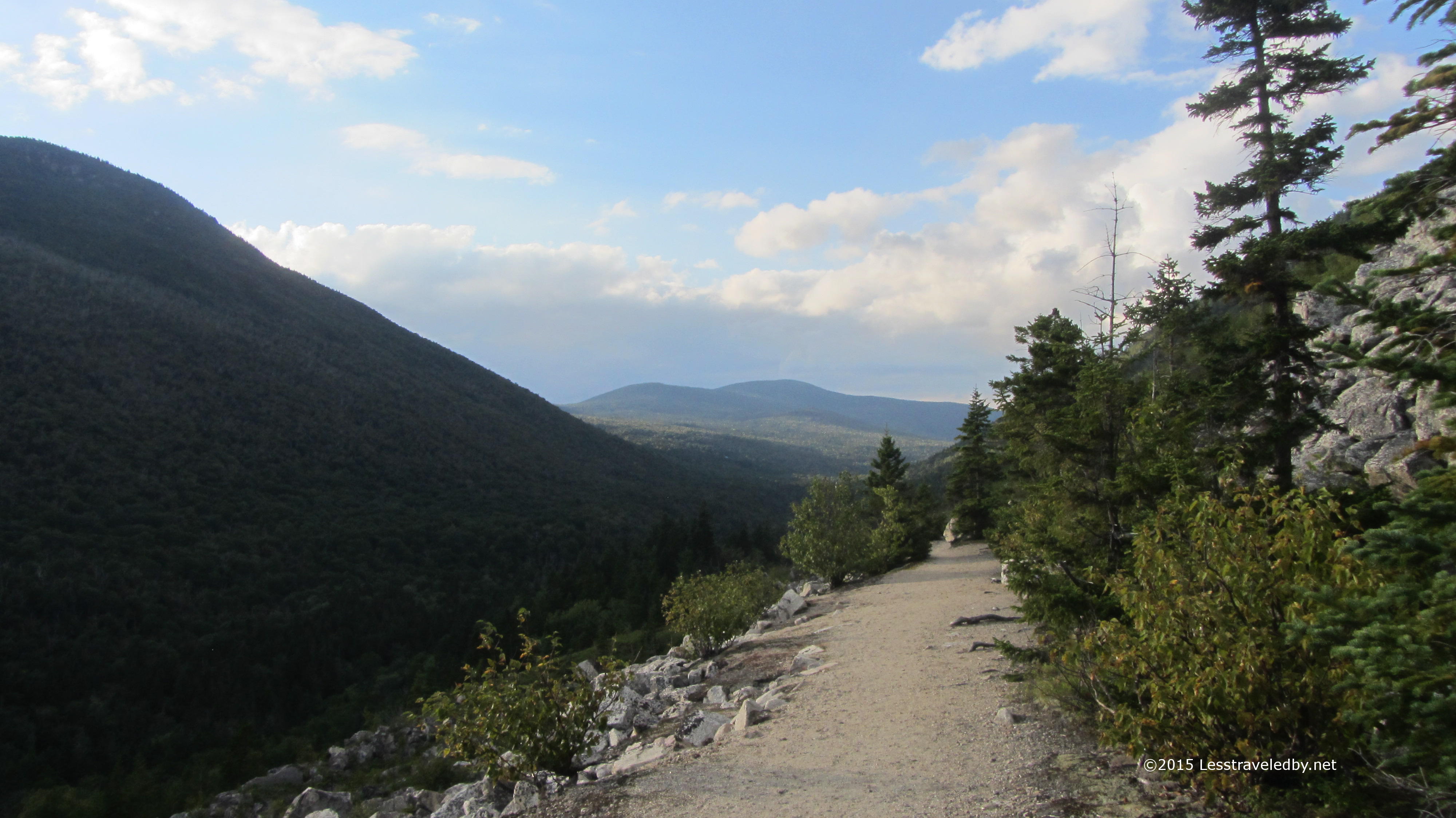
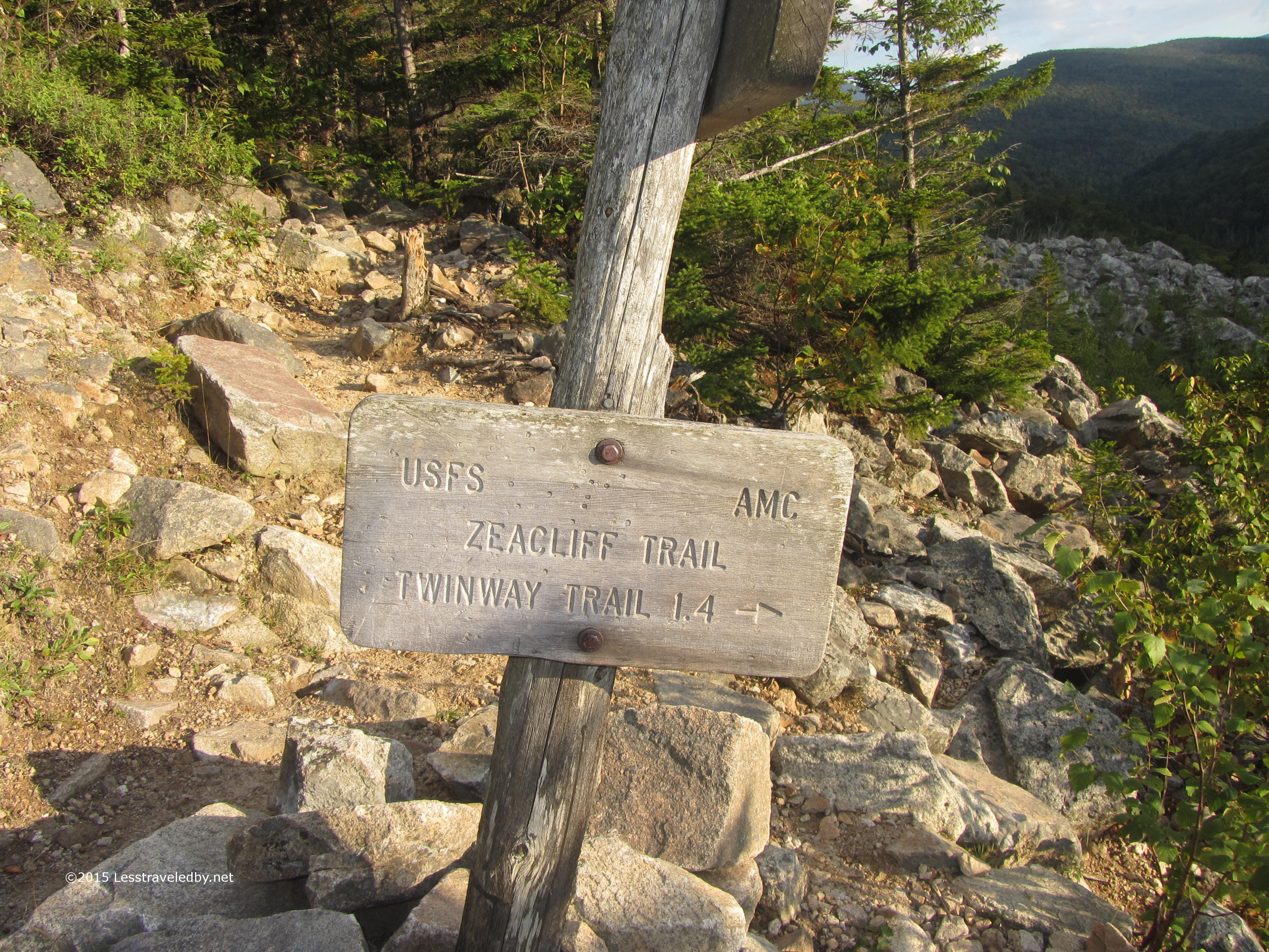
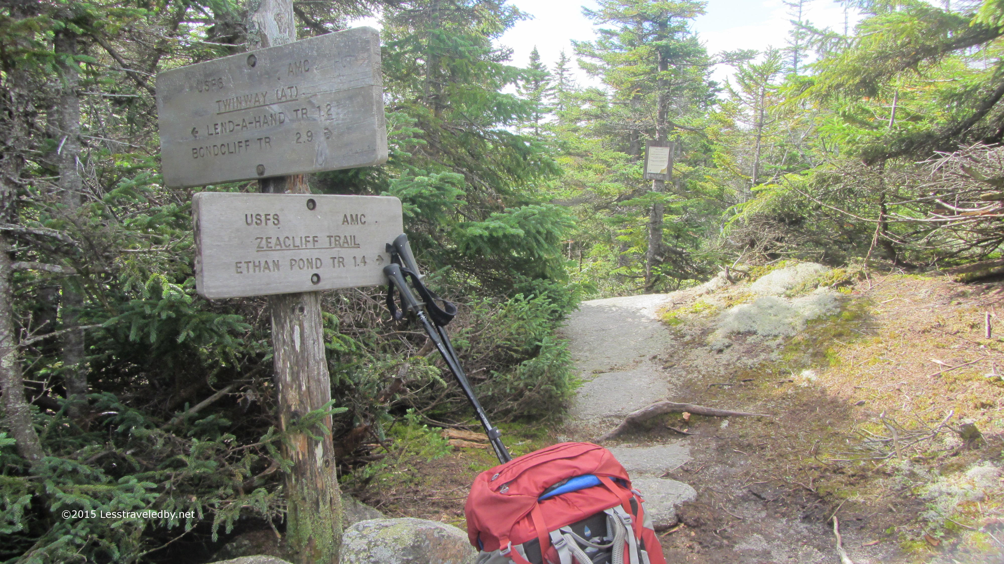
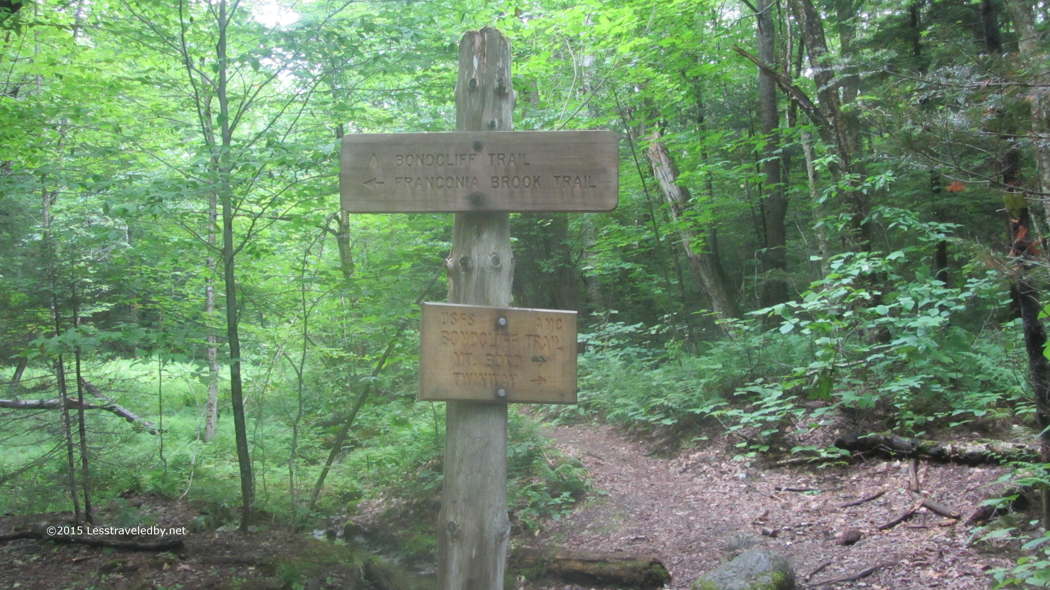
The clouds were swirling around the mountain on gusty winds leaving everything wet. Perfect weather for descending one of the steepest sections of trail on the entire AT. I took my time knowing that my plan called for turning off and heading down from the ridge just a bit further on. No sense in breaking my leg before I get to enjoy the easy trail.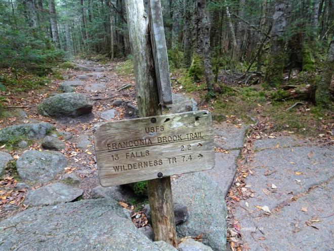 Time to redline the 2.2 miles from here to 13 Falls. Virgin trail to me this was. One of the last few snippets that had been missed over the last few years of exploring the Pemigewasset Wilderness.
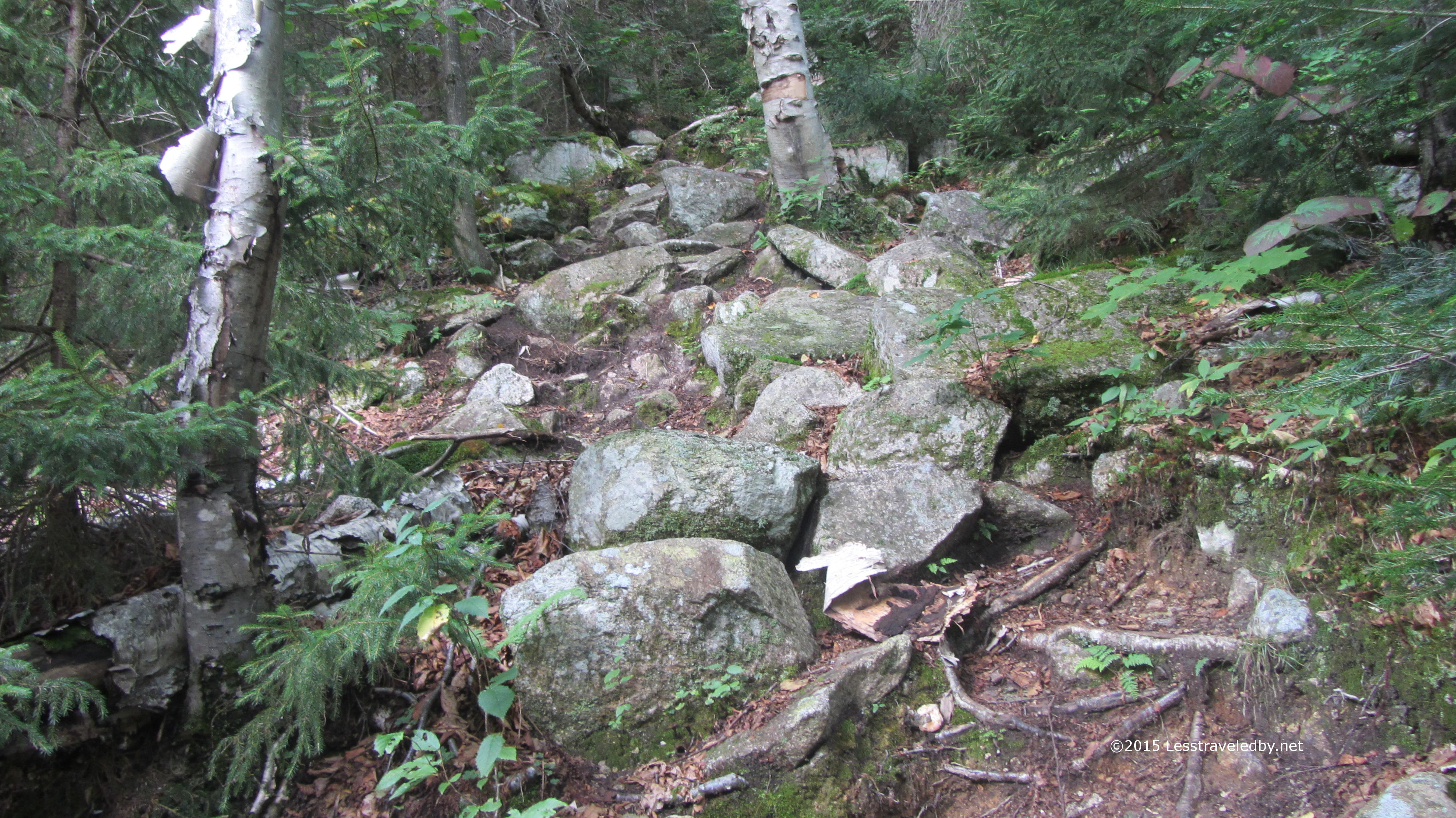
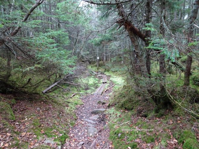 Turning off the rocky AT onto this side trail was a complete change of terrain. Mud and bog boards replaced the rocks except for the spots where there were rocks to stay out of the mud.
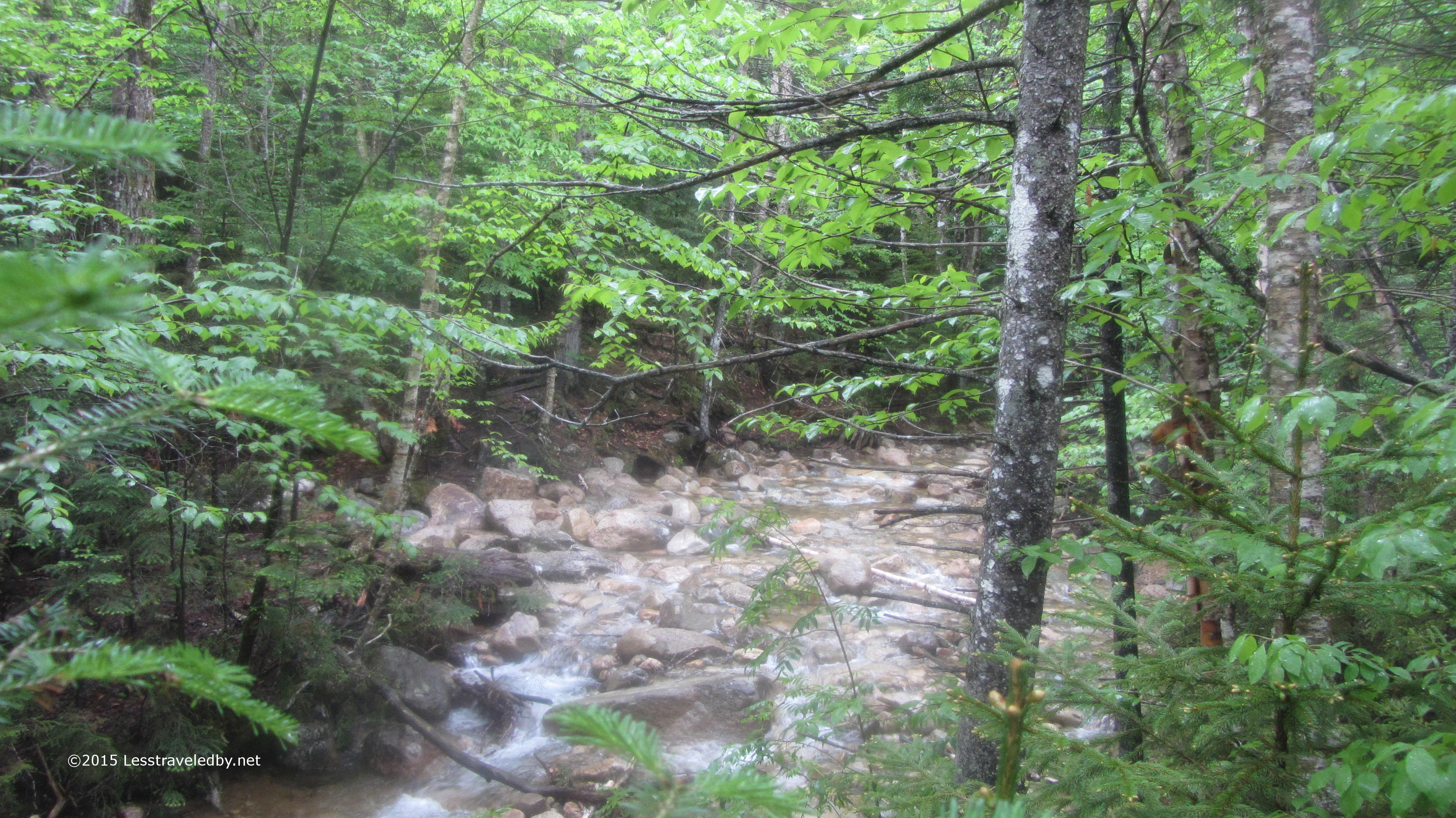
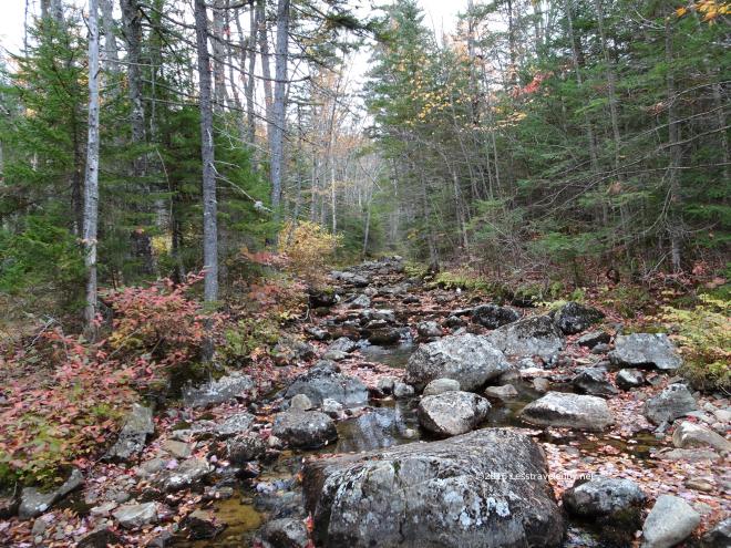 Franconia Brook wasn’t exactly roaring, but at least there was some water to be found. The leaves down at this elevation seem to have taken a beating from all the wind, but there were still some left in the trees.
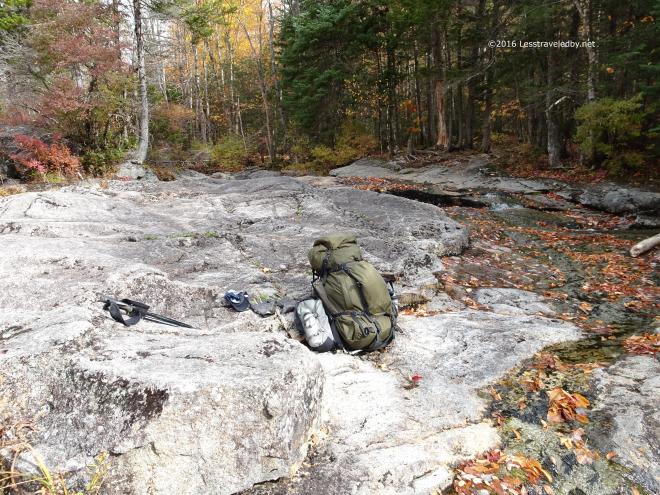 Normally a good flowing series of small falls the Lincoln Brook Trail crossing was almost dry. I sat down for second breakfast on rocks that are often under water.
 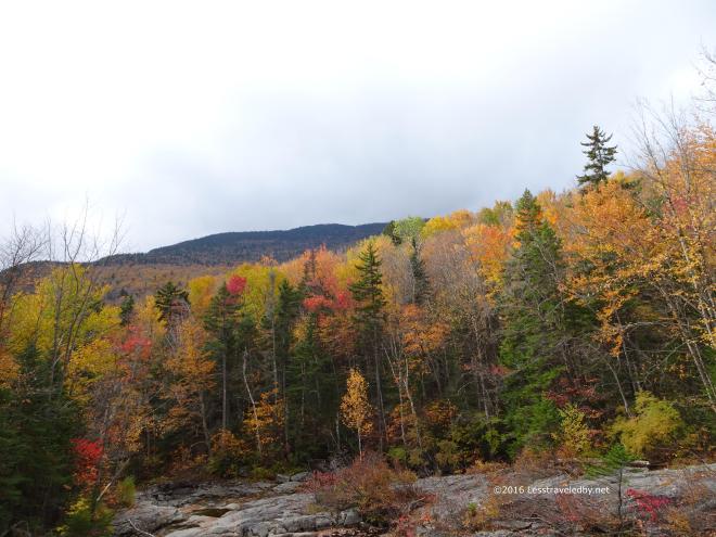 Bad weather was forecast and setting up at 13 Falls campsite was my emergency option if needed, but so far the skies were still looking gray, but not dark. I was debating if I should hike out to my scoot and try to head home, but figured I’d just end up riding in the rain if I pushed my luck.
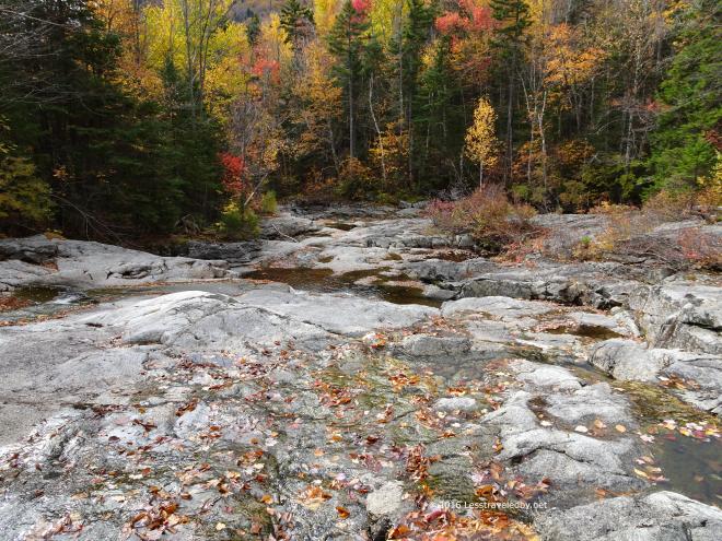 As nice as it was hanging out at the falls I didn’t really want to spend the rest of the day just hanging around camp so I decided I’d head down the trail and figure out what I was doing as I went.
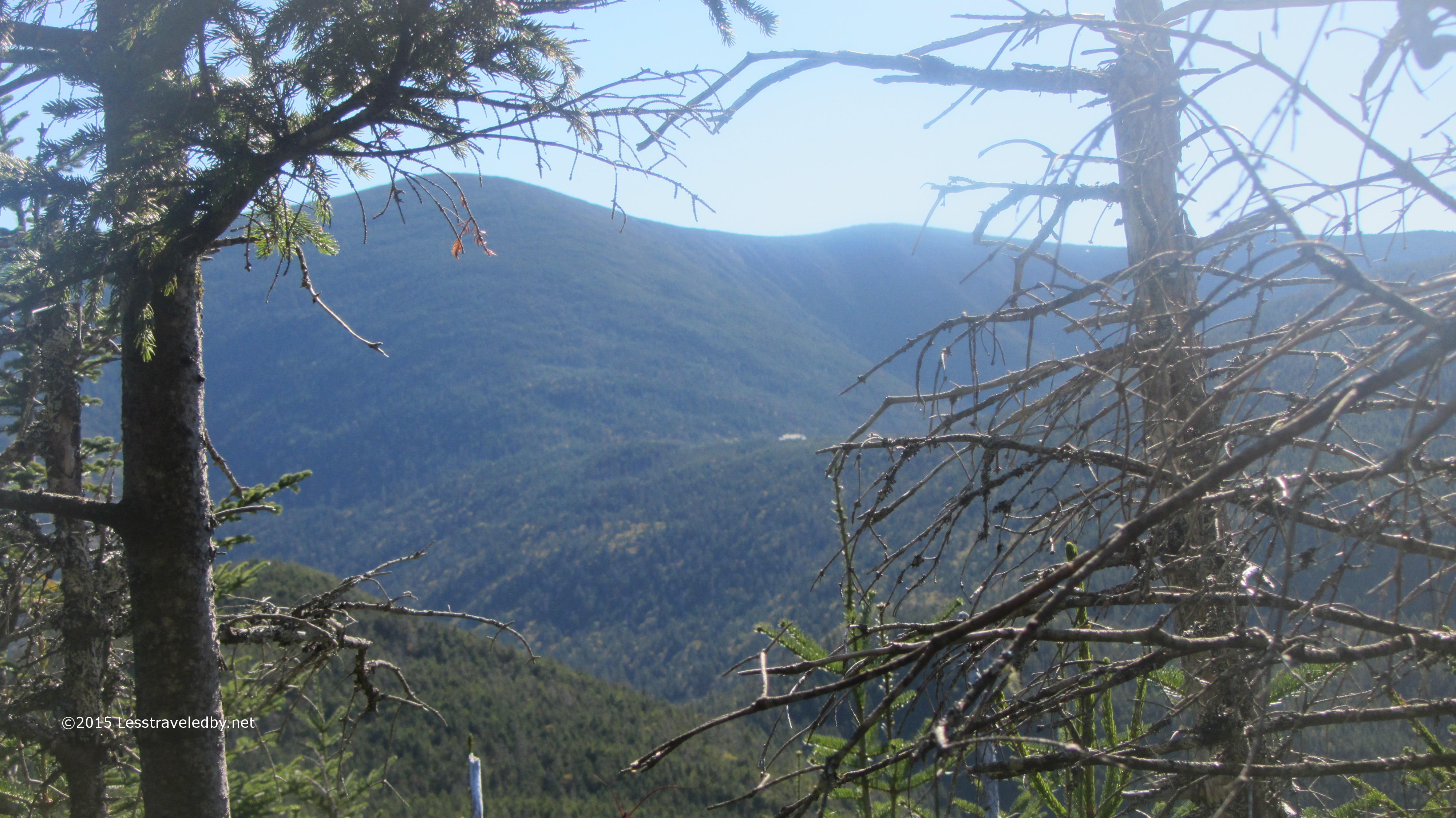
 Rather than worry about what was to come I was just happy it wasn’t raining yet. The colors might have been better with sunshine, but it was interesting to see the trees from down below after looking down on them from above the past few days.
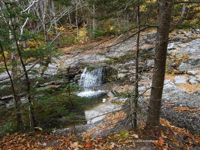
 Since it hadn’t started raining yet I began thinking I maybe should have stayed on the ridge loop and hit South Twin and then Guyot. I still could zip up Twin Brook if I wanted to, but I knew that would probably end up a cold and wet mistake.
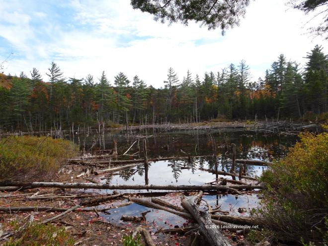 This dismal looking swamp is usually a much more vibrant pond. I’d never seen it looking like this before. Usually I will stop and watch birds here as there are often several paddling around.
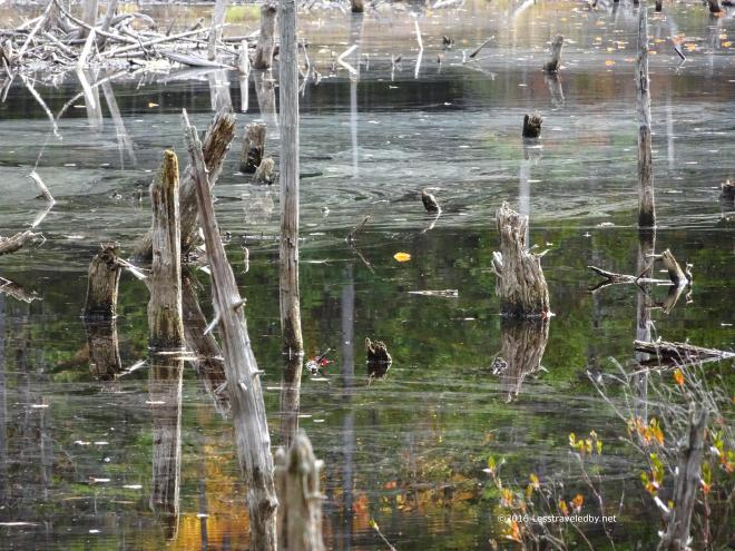 There was something splashing way out in the water but I never saw it clearly. I think I caught the splash in this shot, but not the splasher.
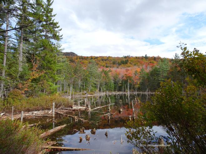 From this side it looks a bit more like a pond. Still, it would be great to have some serious snow to fill these things back up.
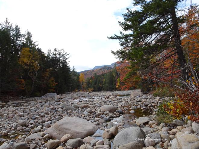 With only a few miles left to get back to the parking lot I realized that I really didn’t want to go home. Inspired by the thought of setting up camp early and eating away the evening I bushwhacked my way towards the East Branch when I hit the bridge. Crossing was easy on the exposed rocks so I didn’t bother taking off my boots. Never done that at this spot before.
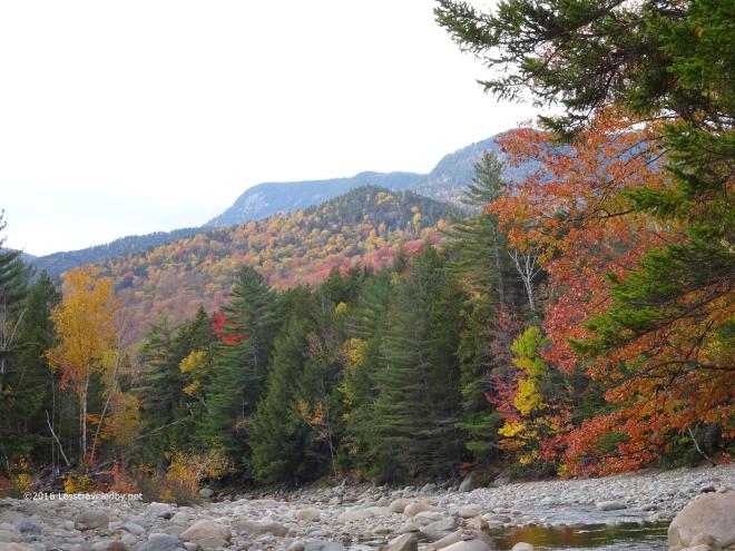 I even stopped to get this pic in the middle of the river. Never been in that spot with a camera before so I thought I’d better document it heh.
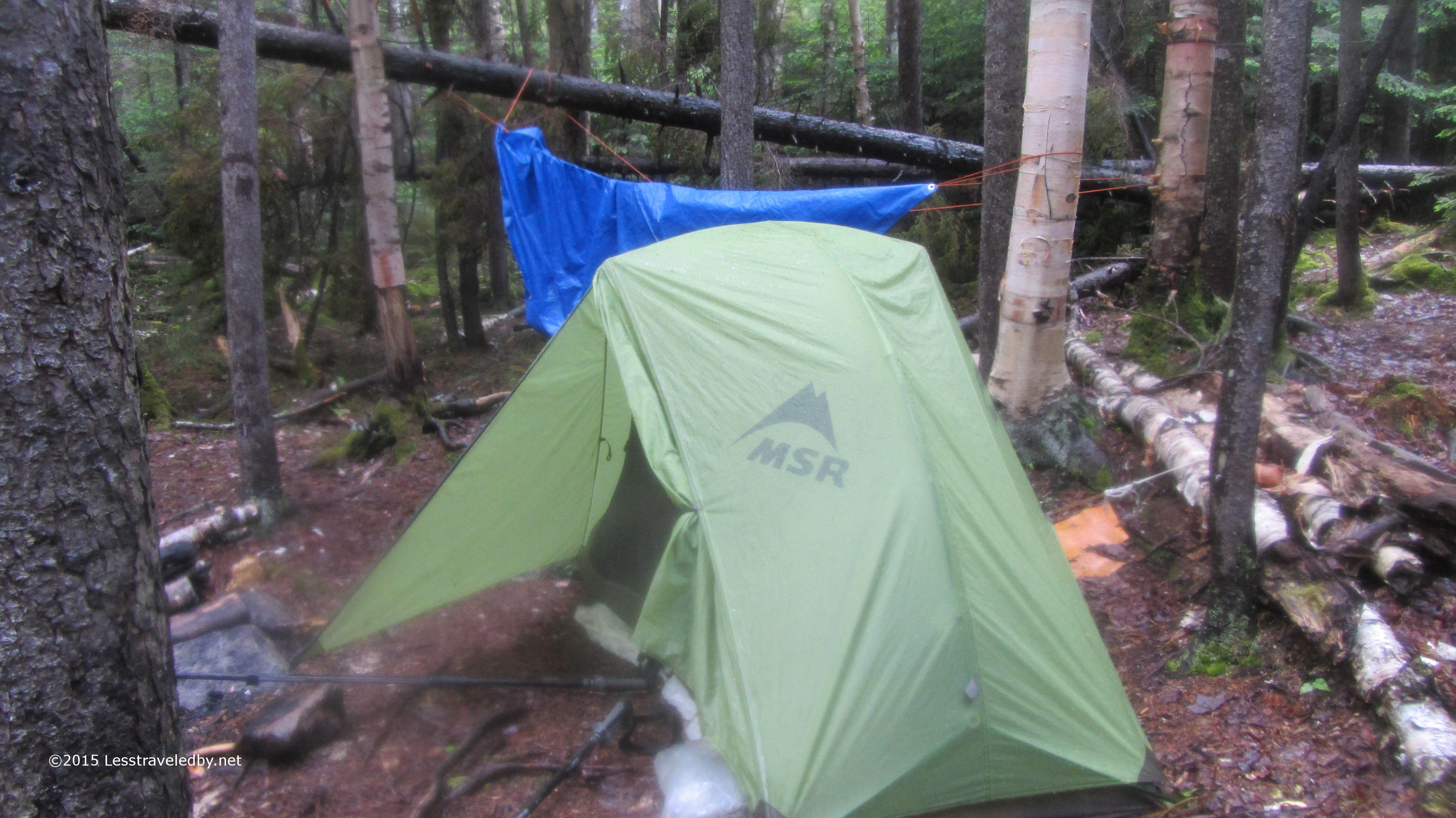
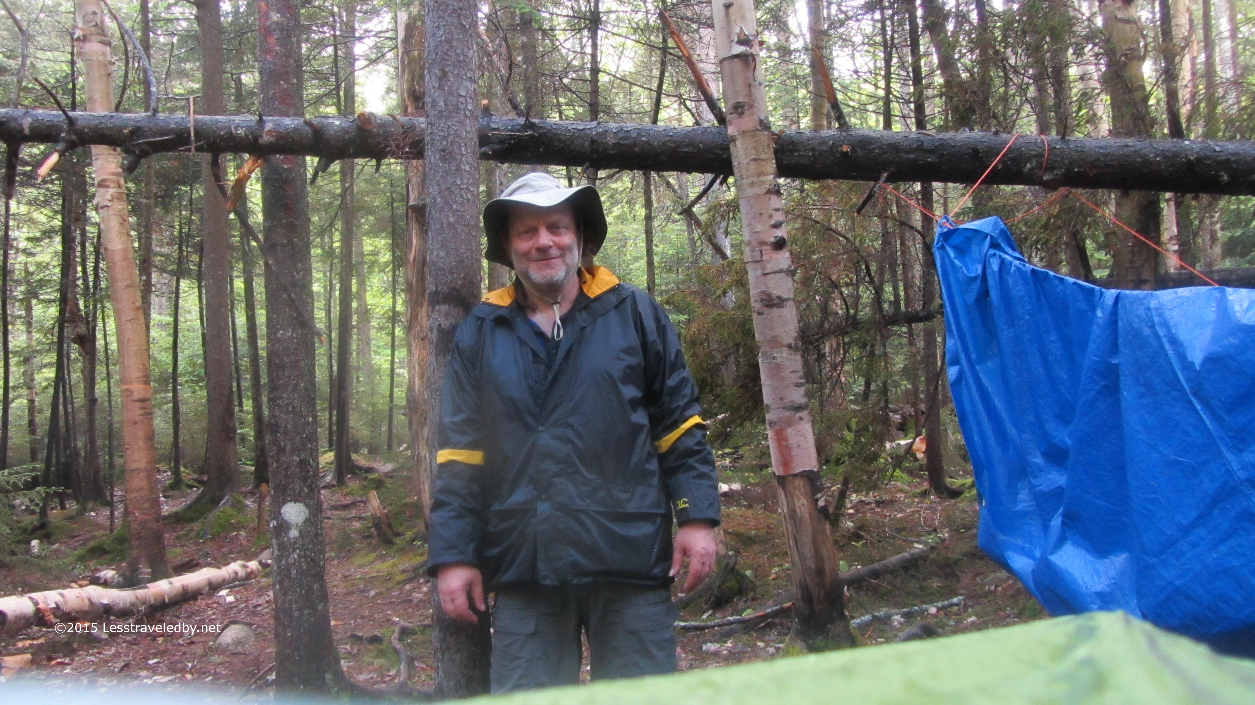
 It pays to have a good camp routine sometimes. Setting up my tent before cutting up sausage and cheese for a late lunch saved me from getting wet. I’d no more than put the first bite in my mouth when the skies opened, but I was able to dive into the tent and finish there before taking a quick nap to the sound of rain on the fly.
Later there was a nice break of about forty minutes that gave me time to cook and eat dinner just before dark. Just after it got fully dark I noticed some lights bobbing in the trees so I turned my headlamp on and off a few times to let them know I was there. Nice couple came wandering up asking about the campsites. I was a bit surprised that they bushwhacked and crossed the river without knowing where they were really going. Turns out they had camped at Garfield the night before and I’d pointed them towards the tent platforms when they came in.
 The next morning dawned brighter and the rain had really brought down a lot of leaves. It was a beautiful morning and I only had a few miles to walk so I was in no hurry. Chatted with a guy who’d shown up after dark and set up camp between storms. He was talking about doing some big miles that day on the ridge which made me feel even better about being a short timer.
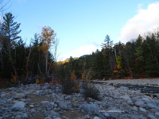 I headed down to the river as the sun was just starting to hit the peaks. Figured I’d best enjoy this season while I can because it will likely be deep winter before I get back to this spot again.
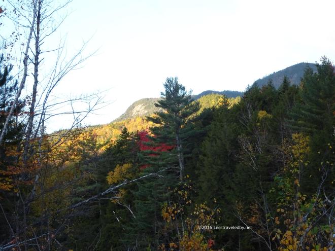 There were still a few leaves on the trees after the rain, but those were short timers too. Fall is so pretty, but you know it could turn to Winter on a moments notice so it seems fragile. Best enjoyed as much as you can before it gets away.
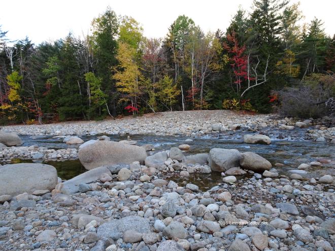 The river doesn’t get any deeper it is liable to freeze solid this year 🙂 No clue what will come, but I know that if this river wants to flow the cold can’t hold it back. I’ve seen car sized chunks of ice tossed into the woods and was glad I wasn’t there when the tossing was going on.
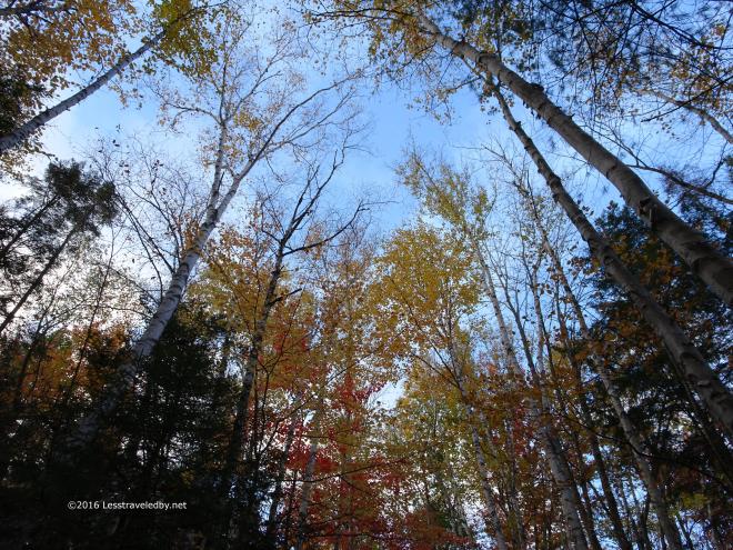 This shot was for my wife, but I figured I’d share it here too. She has a thing about pictures looking up into the trees so I took this one for her.
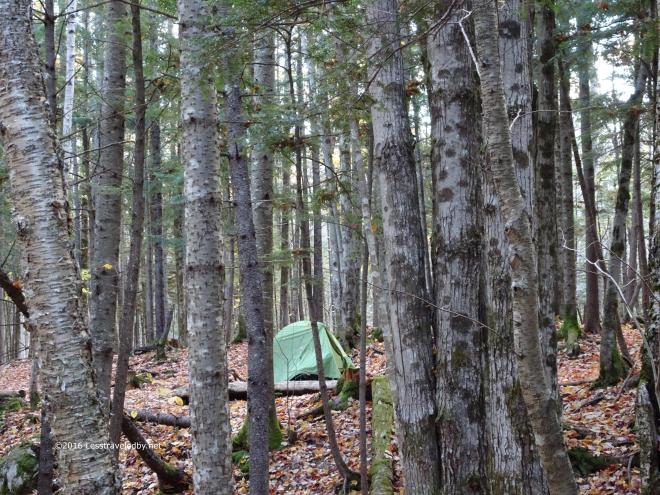 The Hubba does blend into the forest well in all three seasons it is fit for service. The new ones are red, not sure if that is to keep from losing them or what, but I’m not a big fan.
  If I want color I’ll let Nature provide it. The morning sun was certainly bringing out all it could from the remaining leaves. The perfect sky again made me wish I’d stayed on the high route until I thought about descending steep wet slopes in this light rather than the easy trail I was on.
  Yup, I could be content right where I was. Things could always be done differently, but what matters is enjoying where you are right now.
 This was a fine way to wrap up the season if it was the end. I have a feeling I might sneak in one or two more quick trips before the snow flies, but we’ll see. I knew heading out that morning I’d be off trail for at least a few weeks so I took my time. It has been a month now with nothing but day hikes due to scheduling issues so I’m finally caught up on trip reports. I’ll either have to write about something else or go on a trip 🙂

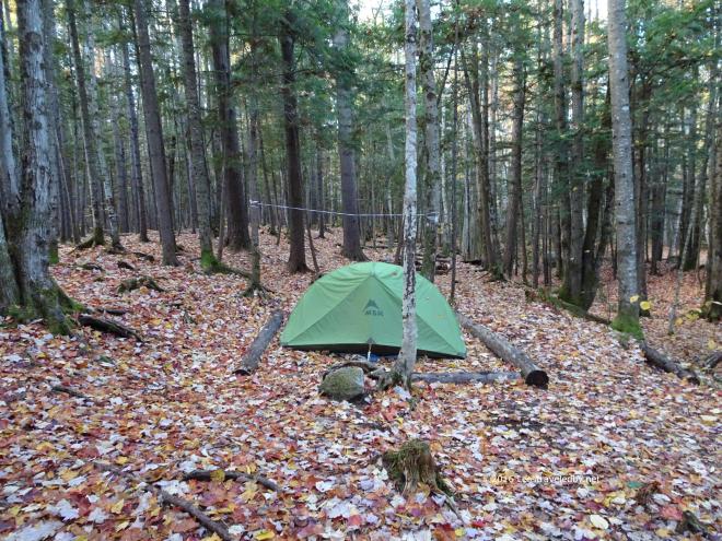
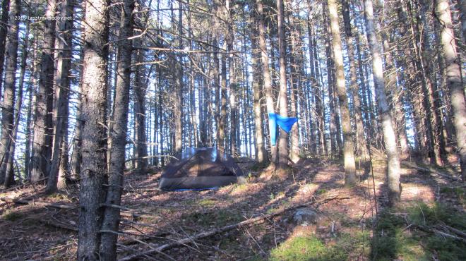 I camped on the same knob above the river as last time, but with the snow melted it looked a very different place. The established ad hoc site was clearly visible with its rarely used fire ring and frequently used sitting log. LNT says use what you find so I set up there and then spent a while trying to find the spot I’d camped on the last trip. I finally found it the next morning on my way out by recognizing the little tree that took a bite out of my Patagucci pants, but there was no trace that anyone had camped there.
 The late afternoon sun was lingering later just a few weeks further into Spring and certainly appreciated. The bug house was up, but only a few random flies were around. Later I would put the roof on to keep a chilly breeze out as the night dipped into the 20s. I brought both quilts along which was overkill, but very snuggly that night.
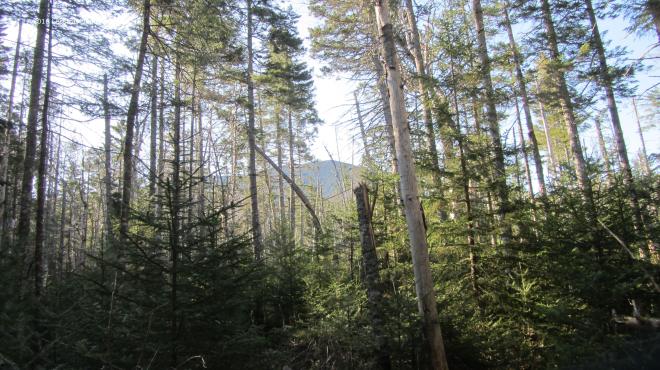 In the morning it was time to go find that mountain. Passing through the new growth of the Stillwater area there were occasional glimpses of Carrigain waiting for me up ahead. The trail through here is all very flat right up until you start the actual climb which I find amusing. It sort of sneaks up on you and then you find yourself on the mountain.
 Well, I guess there is some warning. The name of this trail has always appealed to me, long before I dared to think about climbing it. I recall wishing I was the sort of person who could do that but the elevation profile scared the heck out of me. Now here I was coming back to use this climb to test out how well my boots were breaking in.
 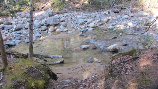 The crossing at the base of the mountain was really low for early May. I like easy crossings, but I’m a bit concerned about how dry this year is going to be. My plans have me traveling mostly to other areas this year so I’ll have to keep an eye on other folks trip reports to know how water supplies are holding up since I won’t be seeing the Pemi nearly as much this year as last.
 Then it was time to head up. For most of the climb there are views of the Vose Spur off to the east which I like to use to gauge my progress. I know it stands a bit lower than where I’m headed so as long as it is above me I shouldn’t get my hopes up I’m almost done.
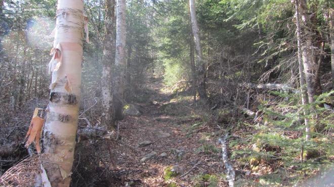 The first thousand feet or so of climbing was done on relatively dry trail. It was a nice cool morning which is my favorite for going up mountains and I was really enjoying the day.
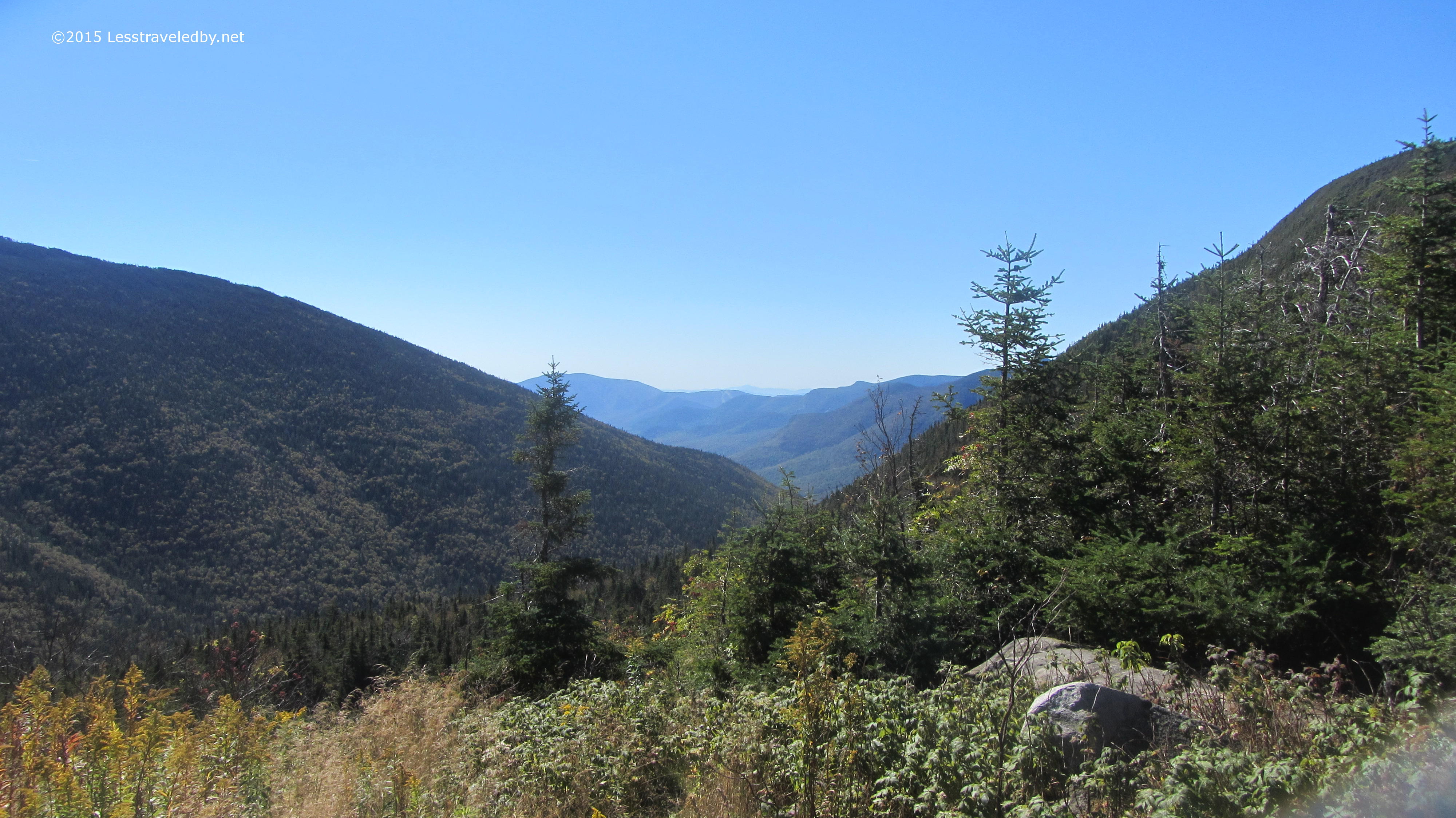
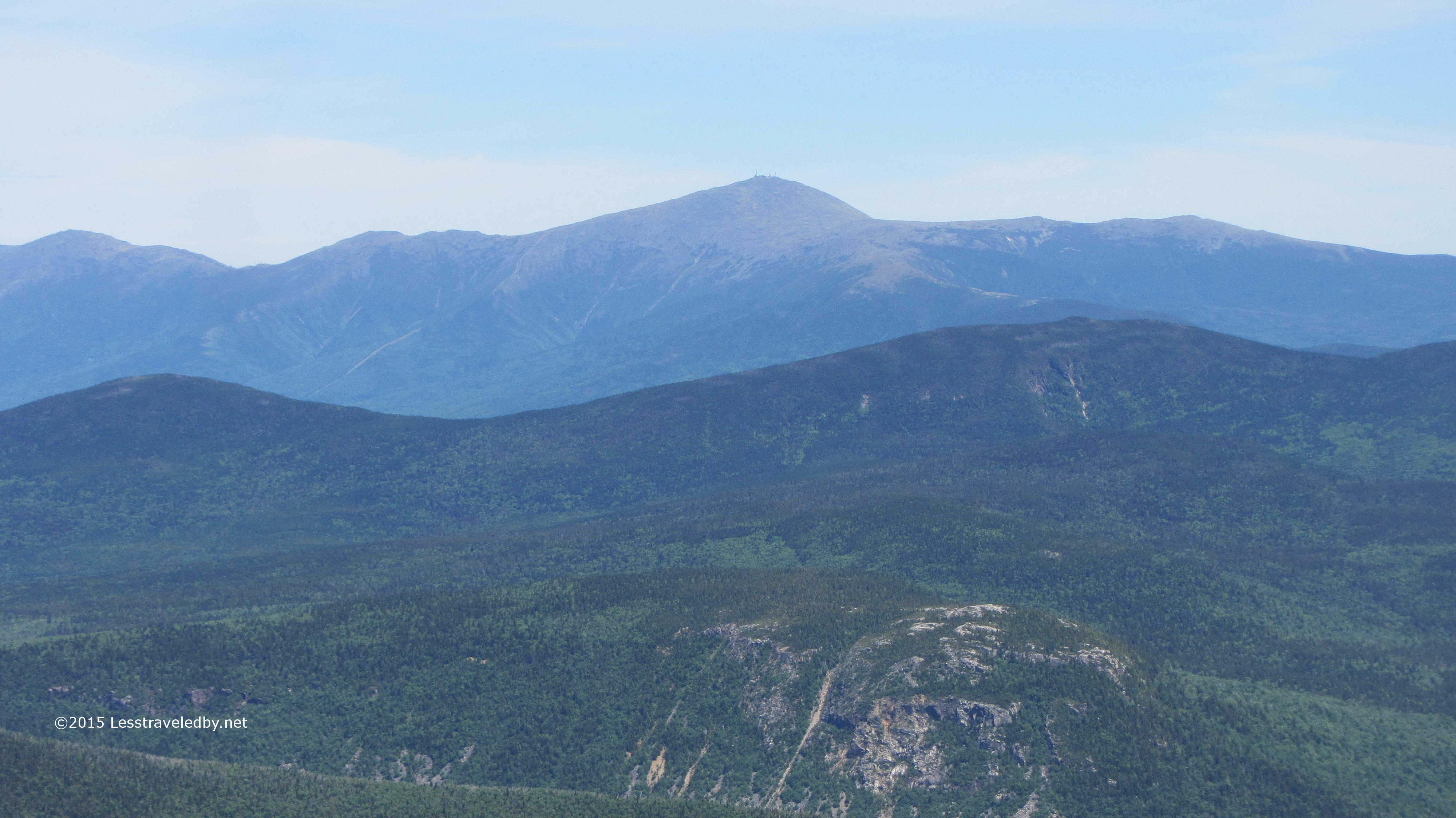
 If you are going to go to all the trouble of climbing mountains it should be on a day with views like this. There was a little haze, not perfect, but Washington in the distance looked pretty clear to me.
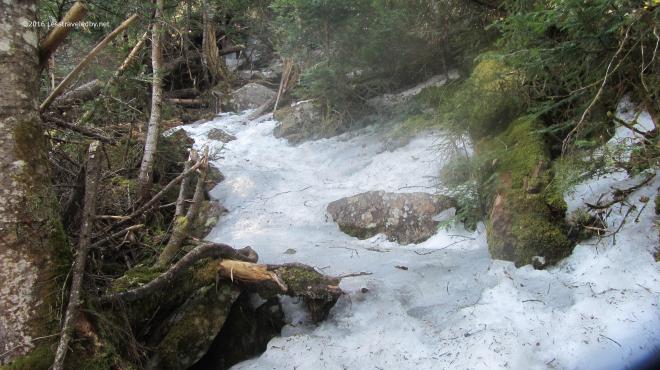 Then I hit the ice! There are no more pictures of the climb because I was too busy to look anywhere but my feet. So long as the trail has some flat spots walking on ice isn’t that hard provided you have your spikes on. It was the more vertical sections that posed the real challenge. Even without ice there are some really steep sections that make you work for every foot of gain on this trail. With the ice there were a few spots that scared the crap out of me heh. At one point I became stuck on the middle of a section that seemed more wall than floor and found myself wishing for an ice axe. After carefully sliding down about twenty feet I stopped on a ledge and found a different route up. This was, at least as far as I’m concerned, some pretty serious stuff.
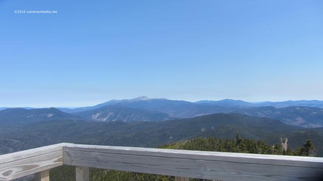 The summit was of course worth the effort. Despite my dislike of climbing towers I raced right up to the top this time. With a seriously chilly breeze blowing up there I didn’t stay long. Not much winter snow left on the high peaks, but I bet there is still plenty of ice up there.
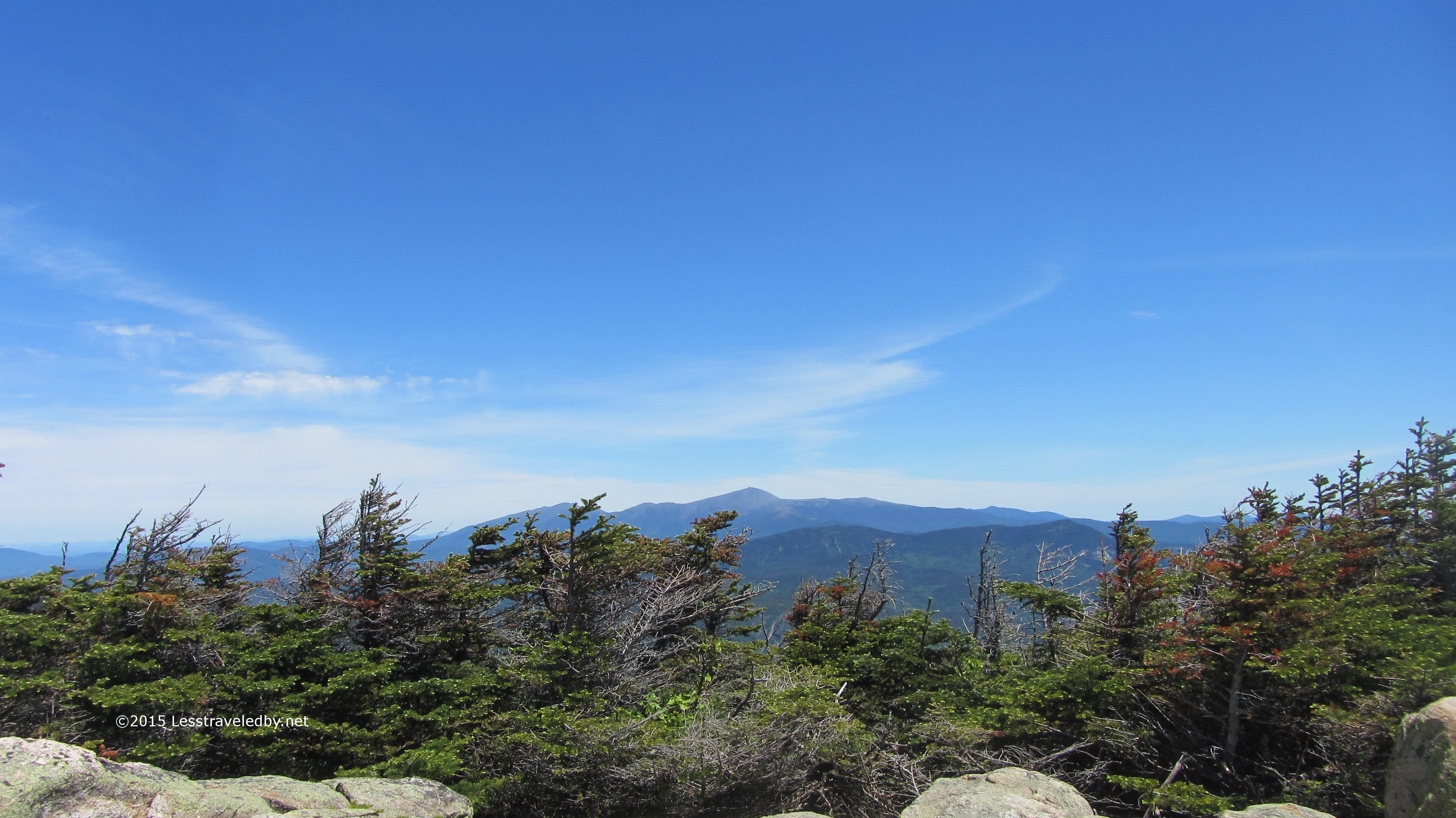
 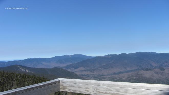 I love this perspective looking back over most of the Pemi from the top of Carrigain. So often I am somewhere else out there looking at this peak, I’ve even spotted the tower from the Bonds. I’m going to miss this place this Summer. Last year allowed me to really explore this place, but other trails are calling.
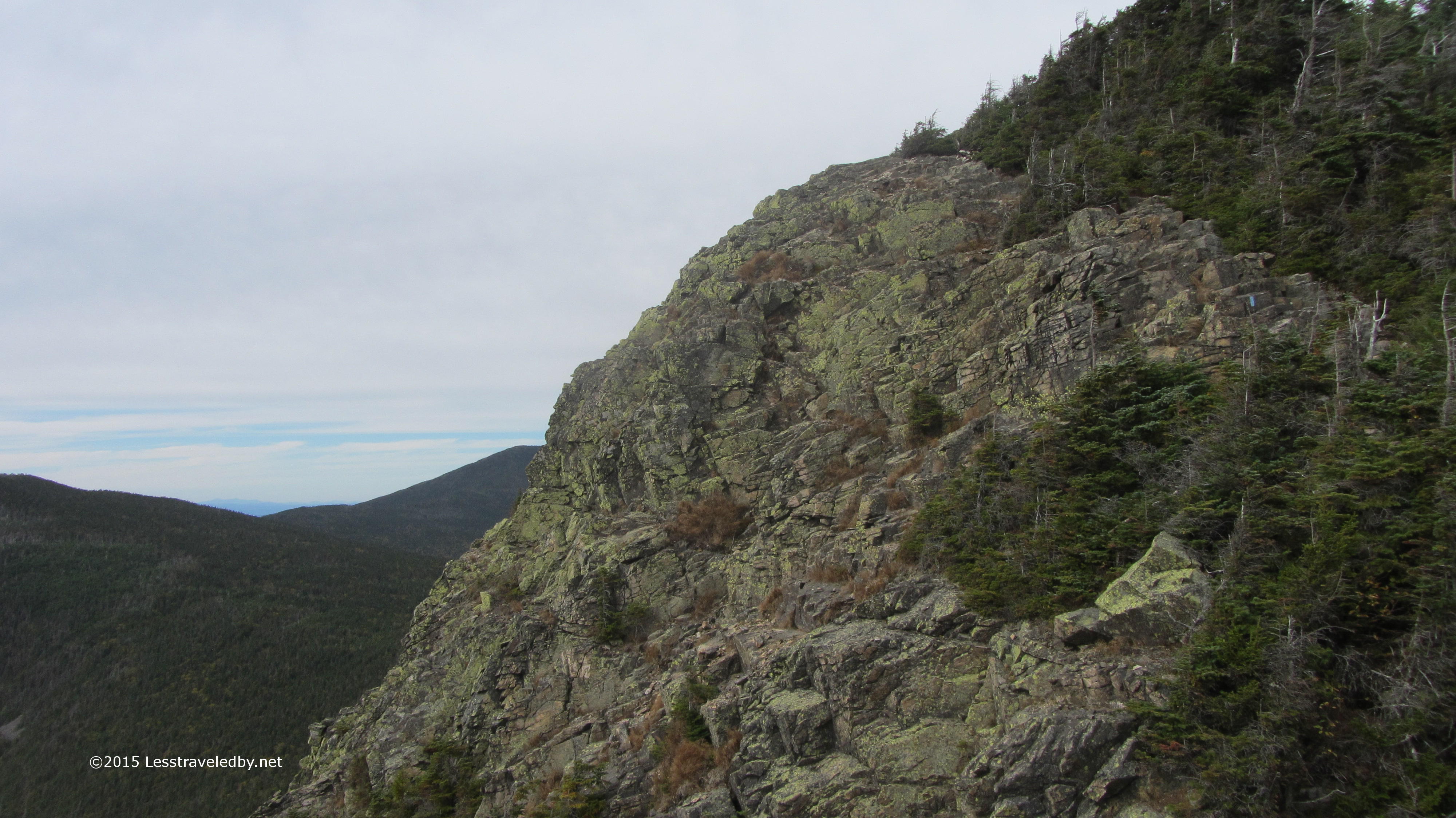
 Never having seen the other side of the mountain I’d planned this trip as a loop so I could do some exploring outside the wilderness before turning around and heading back in. The view looking back up at the tower as I descended Signal Ridge shows this side is pretty steep too, but the trail was much easier with switchbacks easing some of the vertical. There was still some serious ice and I had to put my spikes back on several times.
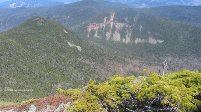 Looking down from the ridge I could see the notch far below. After descending to my right I’d be heading back to my left climbing up that notch. Seemed like a lot of work still to be done, but I comforted myself with the thought that I’d finally redline that missing mile or so of Pemi trail I needed on the Carrigain Notch Trail.
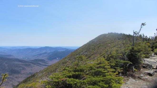 Besides it was a beautiful day for a hike and I was on virgin trail I’d never trampled before. So I’d hike down only to go back up. What else is new?
 These fancy signs make it clear we’re not in the wilderness anymore. Wide groomed trails with clear signage are nice, but I was glad to be headed back into the Pemi rather than out to the highway with the day hikers. Sorry to say the camera crapped out on me at this point so no more pictures. Thinking I may need a new trail camera, but if you’ve ever shopped for photography equipment you know the dilemma of deciding between spending too much money or buying cheap crap. If you’ve found a good middle ground solution I’d love to hear about it.
 The actual climb is about 2500′ via the Desolation Trail and the good or bad news is it is only about 2 miles to the top, depending on how you feel about climbing.
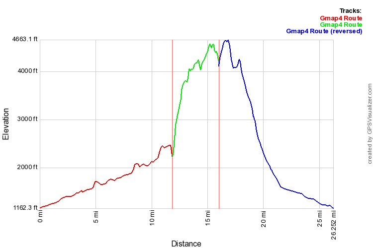
 Not sure the .gpx matched up correctly with the satellite picture in this image, but it gives you an idea of the route at least. Travel was counter clockwise around the loop. You’ll want to bring a real map with you if you go rather than relying on this 🙂
 Since my last trip there had been a pretty good snowfall. It had melted in the sunny spots down low, but there was still some lingering. It seemed odd because there was no snow at all at this elevation just a few weeks prior.
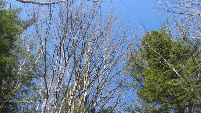 The sky was an amazingly clear blue. No haze or stray wisps floating about. Just that beautiful Spring air and sunshine, though the birch buds were being cautious. Can’t blame them for not wanting to be fooled after all the false starts Spring gave us this year.
 A littler farther on the snow was more than lingering on the Wilderness Trail. There were spots where it was six inches deep in the places where the sun was hard pressed to reach.
 After the previous trip spent in spikes for much of the time it was nice to just bare boot my way through the snow. One or two minor slips, but I never felt any need to reach for traction.
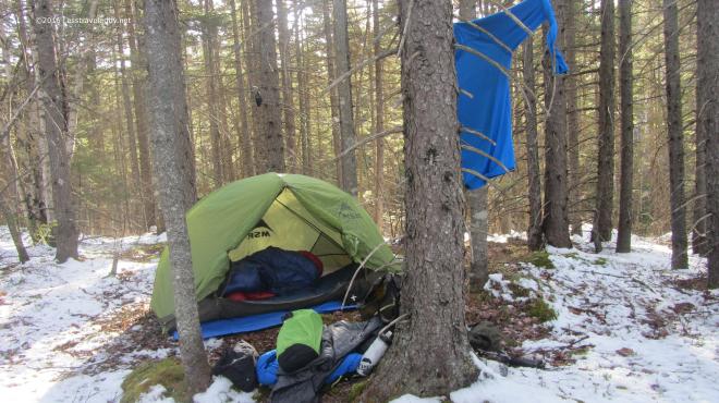 Home sweet home! The chilly nights on the early April trip made me decide to bring both quilts along this time. I was super warm both nights as this combo is good below zero and the nights were only around 20°f.
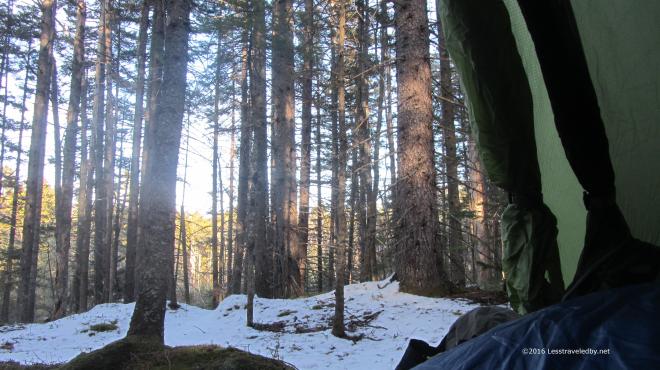 The days were getting longer and it was still quite light out when I decided to move the party indoors. I sat there for a couple of hours with my legs under the quilts and watched the light fade.
 Morning came with another clear sky. I enjoyed breakfast and coffee from my perch above the brook below. As the sun and coffee warmed me I began to shed layers and pack up.
 The Carrigain Branch crossing was amazingly low for April. Most years I’d be worried about crossing with it filled from snow melt, but with no snow there was no melt.
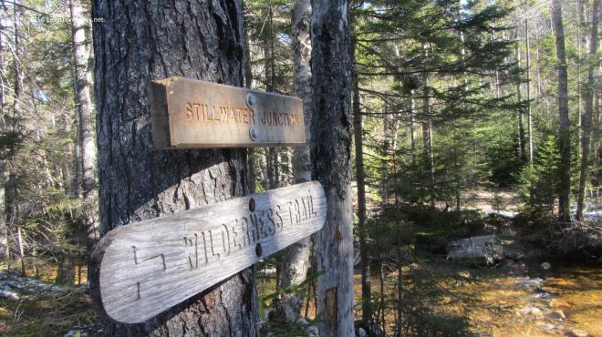 The Stillwater crossing seemed to be missing a few key hopping rocks this year even with the low water level. I eventually found my way across and headed up towards Shoal Pond.
 There are some interesting growth patterns along this section with older and newer generations of forest competing as they recover from the clear cutting done here years ago.
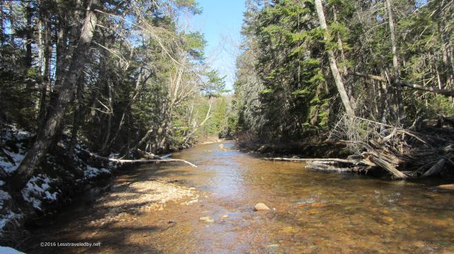 It was a bit cool following this notch up towards the pond and there were multiple crossings of Shoal Pond Brook to deal with. The sun was able to reach down into the open areas, but the shadows were filled with snow.
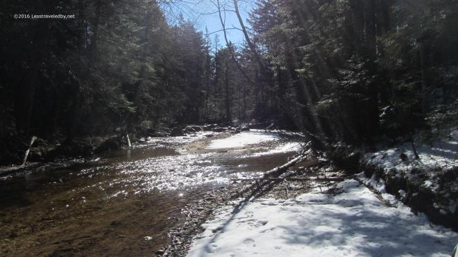 The light had that special Spring quality to it; Something about the color tells the brain that even though you see snow Winter is not coming back.
 The icy crossings were a definite challenge though. The water wasn’t all that deep, but you’d hate to fall in. It was hard to tell which rocks had ice on them so I took to tapping with my stick to check before making my next hop.
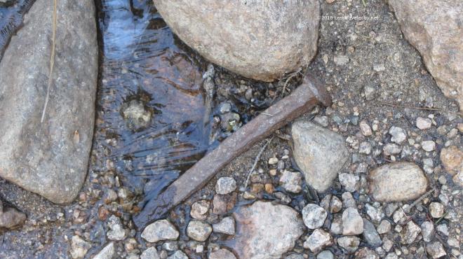 Not certain if this spike came from a bog board or the old logging rail lines. Either way it counts as an artifact now so I took a picture without disturbing it and moved on.
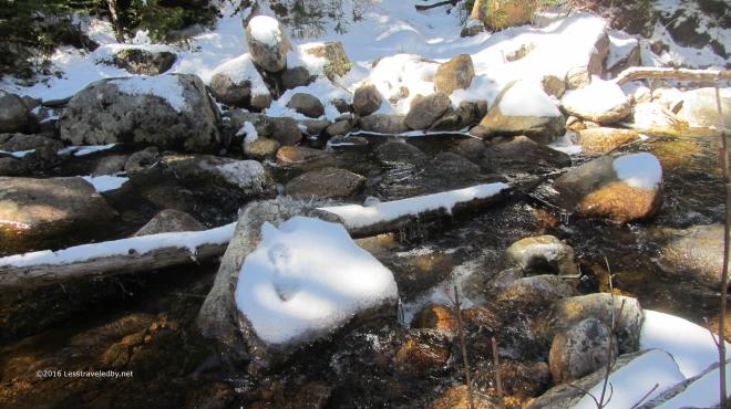 Did I mention the ice water crossings? This area took me some time to navigate as the first couple of attempts ended mid stream with only questionable next steps.
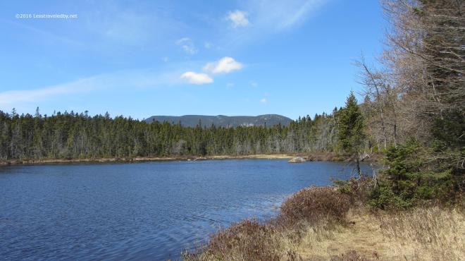 Finally I reached Shoal Pond where there was no sign of ice. I stopped for some serious snacking and to soak up a little sun. By now the temp was pushing 40°f but it felt nice be out of the trees for a while.
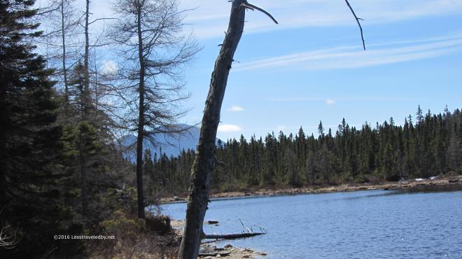 Looking back towards Stillwater gave a nice view of Carrigain beyond. From here it looks quite dramatic and it is a bit hard to imagine the Desolation Trail going pretty much directly from bottom to top. (Insert ominous foreshadowing music here…)
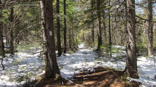 Soon after the pond came the Ethan Pond Trail intersection. I only had a half mile to enjoy it, but this flat, wide section is a rare thing of beauty in the White Mountains.
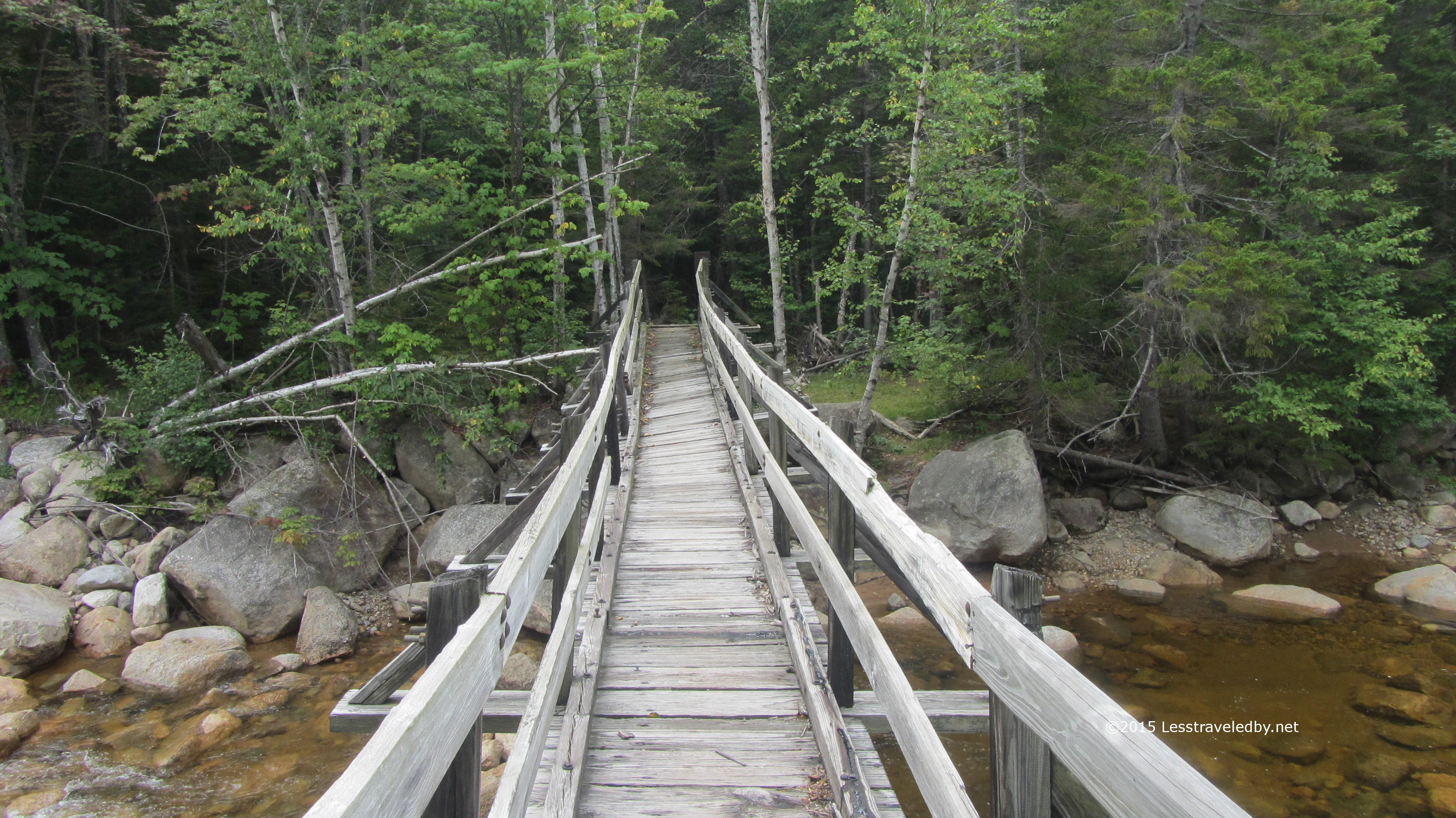
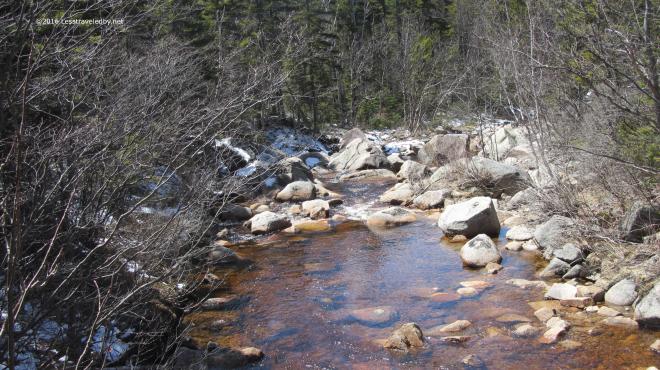 This view is from the footbridge looking down stream towards Thoreau Falls. After all that time in the wilderness it seems like such a luxury to come upon this little wooden bridge and I always enjoy the crossing.
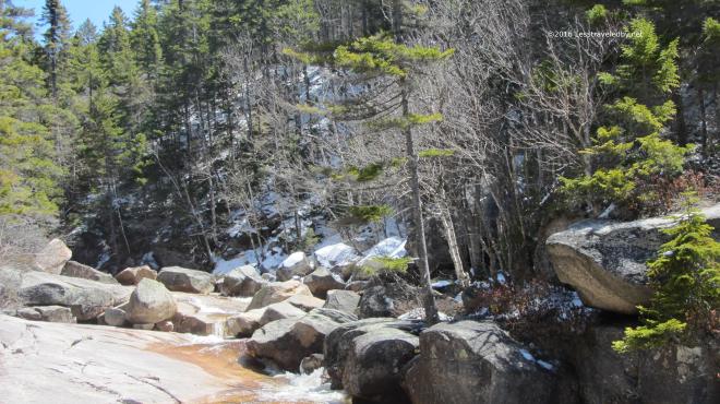 Soon it was time to leave the well manicured Appalachian Trail behind and then it was on to Thoreau Falls. The fresh snow since my last visit gave it a very different look. I spent quite a while here soaking up sun, soaking up snacks and of course taking too many pictures.
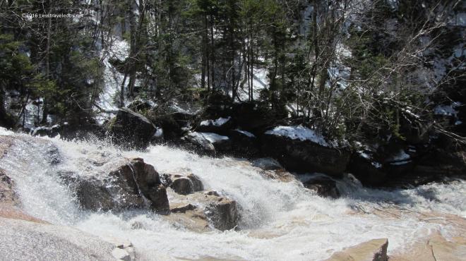 I never get tired of this spot. You can’t camp here or everyone would and it would be ruined I’m sure. So you stay as long as you can and take as much of it with you when you leave as you can carry.
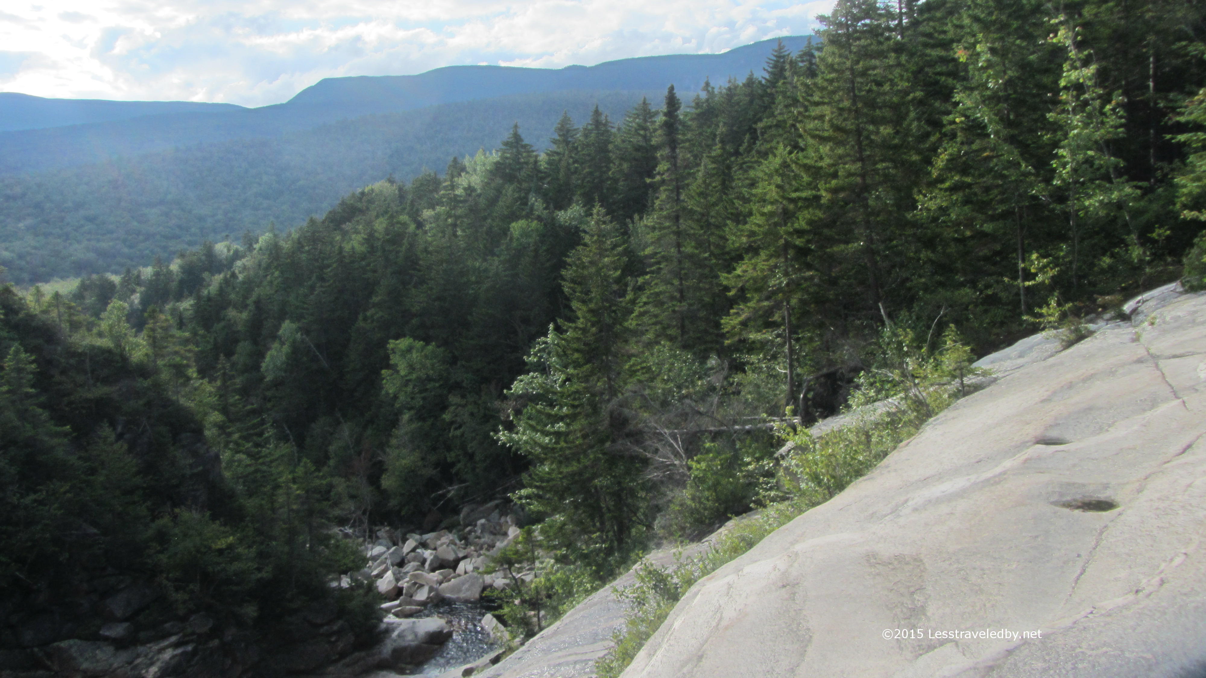
 This view towards the Bonds never gets old. Snow, greenery or Fall colors, it always makes me stop and say “Oh, that is pretty!”
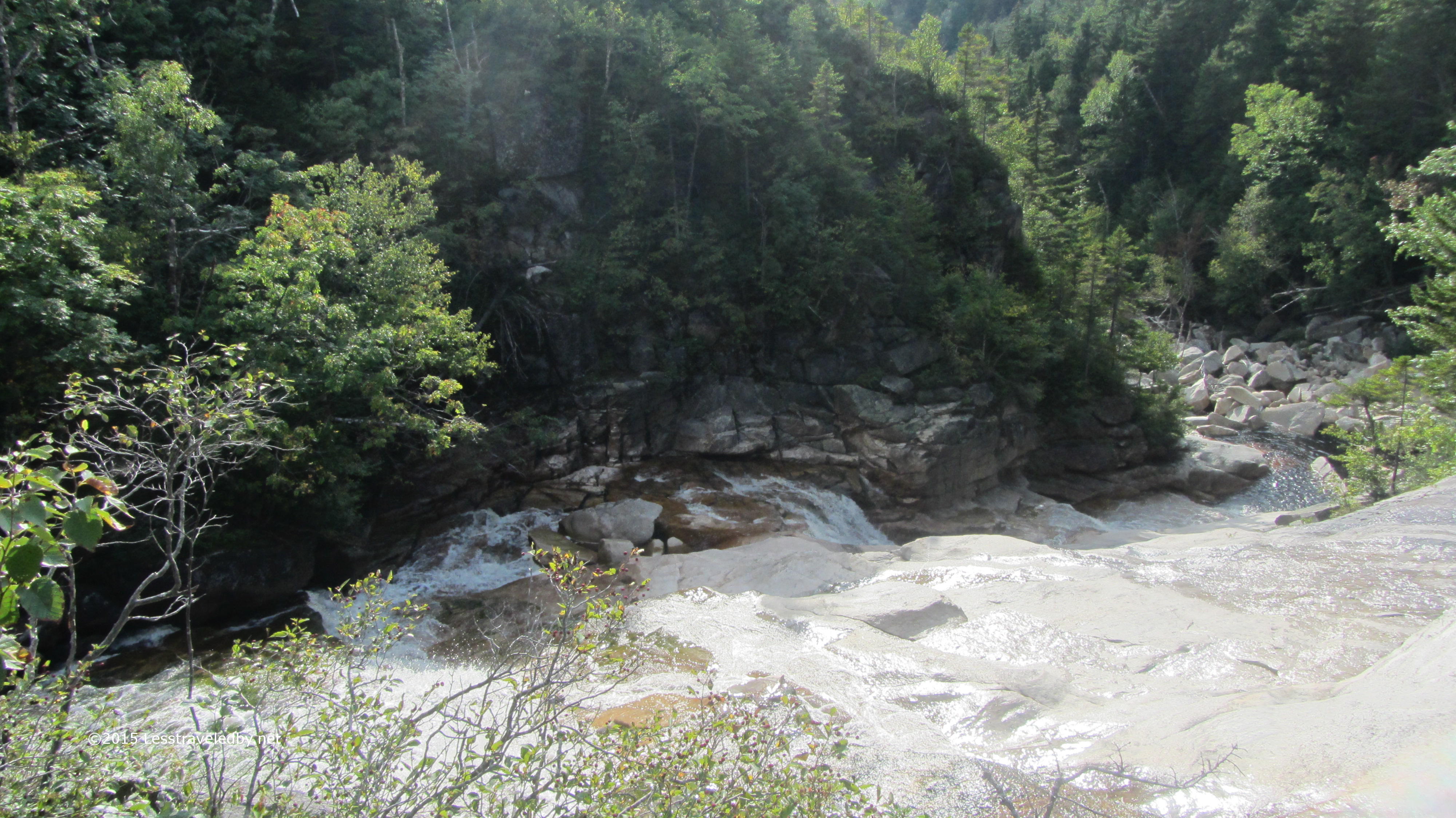
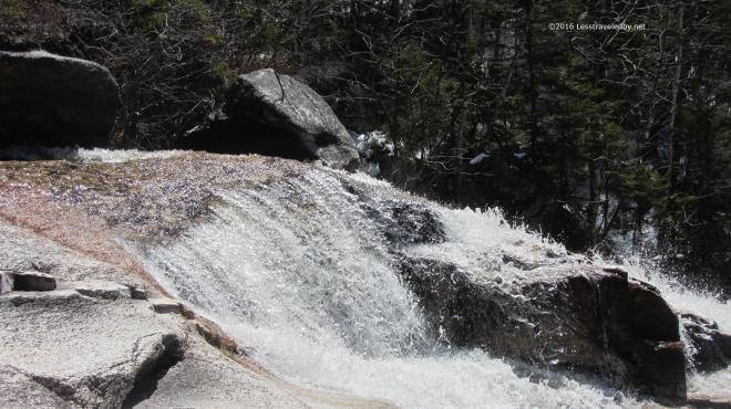 This time of year with at least a moderate flow the falls were pretty as well. Much of the year they flow more than fall, but they had a bit of a roar going this time.
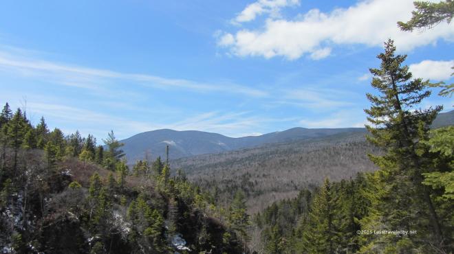 One last look and then it was time to move on. I was a bit concerned about following the trail as the snow was pretty thick in this area and there had been no foot traffic. Then, as soon as I leaped across the falls I was amazed to find a fresh set of footprints in the snow. Someone had walked out to the falls and turned around so they’d done the hard work of trail finding for me! Wilderness trails come without blazes so when you can’t see the ground due to snow or leaves wayfinding can be a real challenge. I was really stoked about these footprints!
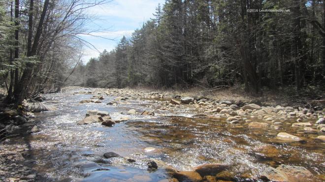 Late afternoon along the North Fork. Another few miles on and I set up my camp for the night. I got in early for a change and had a long time to enjoy dinner, soak up some extra water and just relax and watch as the light faded. I was just dozing off in my tent as darkness began to settle in when I heard something that made me sit up. It started out like a coyote but then faded with more of a howl than the coyotes I knew out west. It called three times in quick succession and then fell silent. Not sure what was out there, coyote, banshee or hellhound I opted to zip up the bug net on my tent. I’d planned on sleeping with it open to increase air flow and cut down on fly frost, but decided it was better to close it in order to prevent whatever was out there from licking my face while I slept. As any good woodsman would, I fell asleep a few minutes later without a care as to what demon stalked the night 🙂
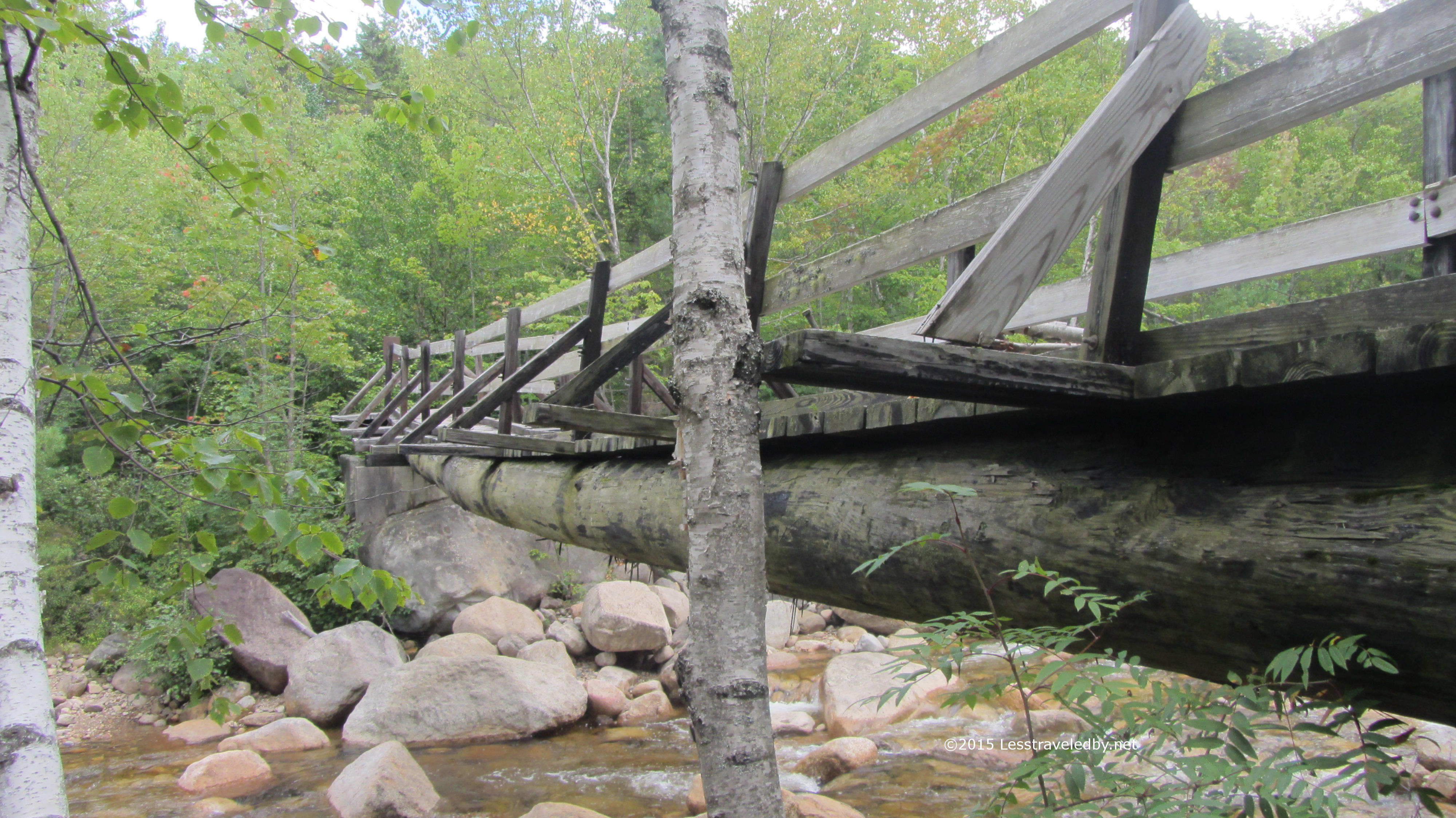
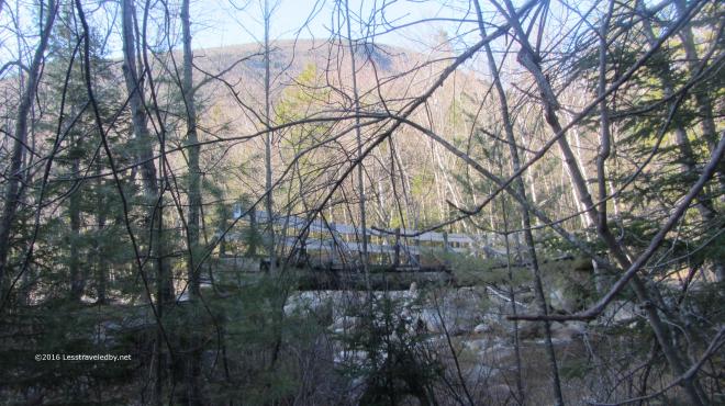 Morning dawned chilly again, low 20s so I fueled up and hit the trail. Soon I reached my old friend, the Thoreau Falls Trail bridge. I know they want to pull this bridge and they don’t want to replace it, so every time I pass through I appreciate it while I can. With it gone I’m not sure I’ll be able to come this way any longer and that makes me sad. This river is nothing to mess with though even above the North Branch.
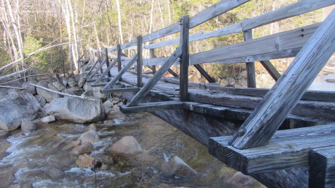 Walking across this old beauty is even more magical than looking at it. The tilt from the broken stringer varies as you cross and there is just a hint of a wobble in the middle. I think they should build a modern duplicate to replace it with that same twisting sag and some old weathered boards under foot, but I don’t think they care what I think heh.
 Snack break at the Cedar Brook/Eastside/Wilderness intersection. The Bonds and Guyot visible through the leafless birches. Always bittersweet to be here…almost time to go get that cheeseburger, almost time I have to go home, always really happy to be done climbing this hill in either direction 🙂
 The East Branch was looking mighty low for this time of year. Normally the melt would still be going strong up above or even at this elevation and the river would be roaring.
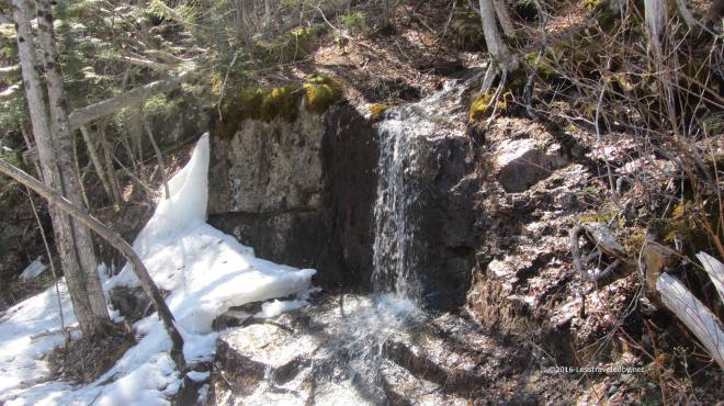 There were plenty of patches of snow among the trees though the temp was around 50°f as I set out just after mid day. The trail had plenty of squish to it in spots and the small flows were burbling so it felt like Spring.
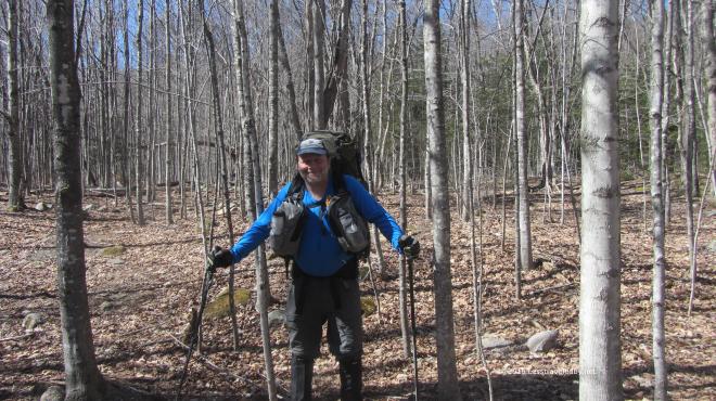 I’m including this picture because I have a good sense of humor and very little pride. You’ll just have to take my word for it, but I’m really not pregnant. The tight pack belt combined with the shadows and my leaning forward posture makes it look like I might be though heh. You can really see how dry the forest floor is in this pic. The lack of snow left the leaves looking more like Fall than Spring.
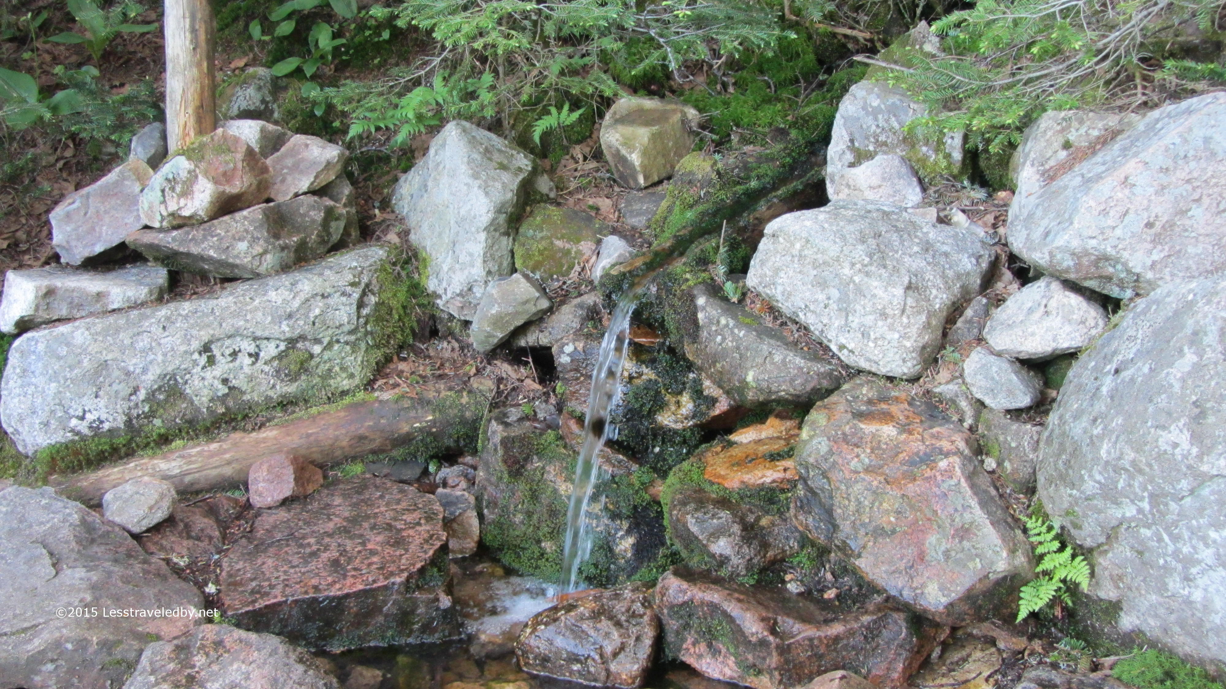
 Speaking of falling springs…I cobbled together this gravity system out of an old Sawyer Mini and a couple of Platy bags I’ve had for years. Ordered a new full size Sawyer to use later, but brought the old one in case I forgot to sleep with it and it froze. Really liking the lack of effort involved in filtering water this way, but I think I am going to get a zip top bag for easier filling in standing water.
 With the sun sinking behind the ridge early I decided to camp relatively low, just past the second brook crossing if I recall correctly. My first real trail day in the Limmers had resulted in some pinkie toe discomfort so I was glad to put on my camp shoes along with my fuzzy camp clothes. Recently added to the fuzzy camp clothes collection was the ibex Meru with the snazzy Trailspace stitching.
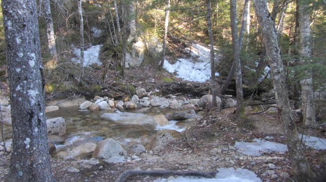 At this elevation the snow was more abundant, but still patchy. It had gotten down to around 20°f overnight so I was glad I had some sunshine pretty early in the day.
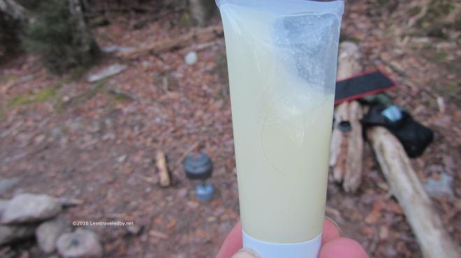 My tube of olive oil had turned into olive slushie. Note the kettle is on the stove there in the background. Getting that on was a definite priority.
 Don’t think I can go back to instant now that I’ve been enjoying the good stuff. More Trailspace swag; both the Innate insulated mug and the GSI coffee screen are part of my mess kit in any weather, but a real favorite on cold mornings.
 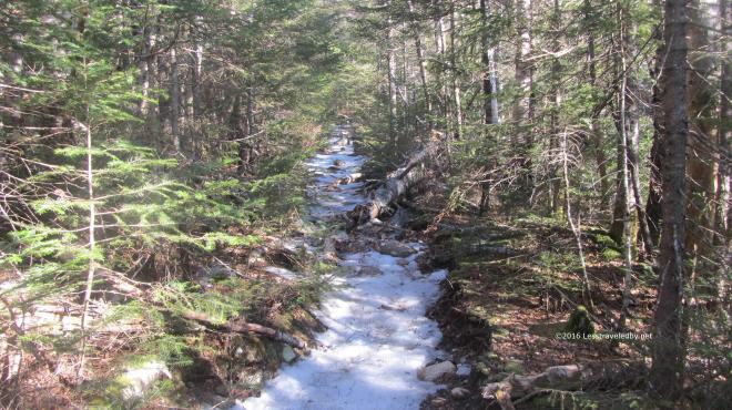 Day two took me higher up and onto a track that was still covered in hard packed ice in most places. Definitely a good time for traction and I was glad I had my Hillsounds many times over the next few days.
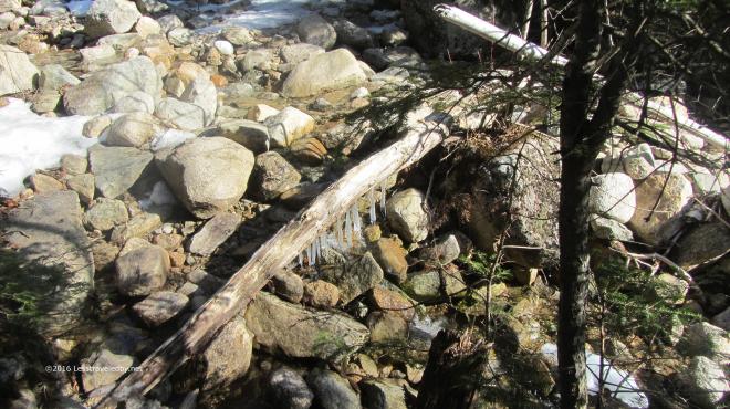 The weather had been alternating between rain and hard freezes for a while so there were lots of interesting ice sculptures to be found.
 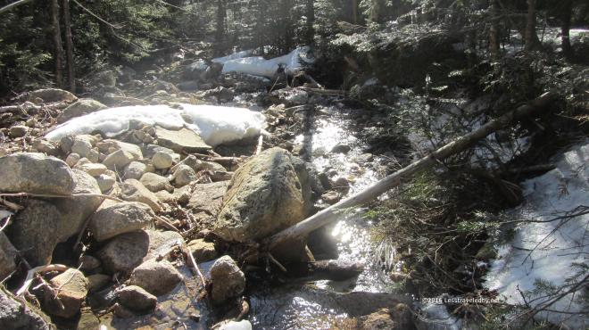 The early Spring light had a wonderful sparkle to it. It was tempting to stay and watch it in spots like this, but I had some climbing to do.
 Well, OK, this spot had to be appreciated for a few minutes. It was an ice flow from the steep slope above the trail that was decaying as it was exposed to the sun.
 It didn’t take long to reach the rock face that signals the base of Bondcliff. You can see I’ve tossed my poles on up so my hands are free for the climb. I took off my gloves not to use the camera, but to scarf down some dark chocolate espresso trail mix. Just the motivator for scampering up a cliff with a 35lb pack.
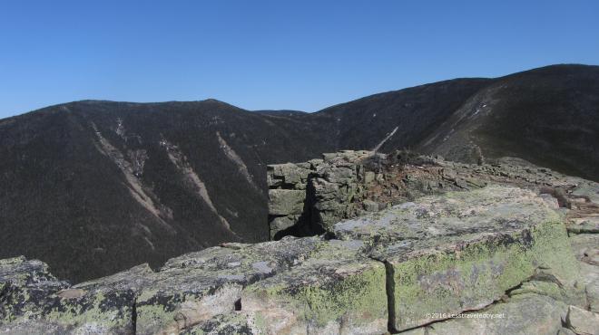 Actually this was my real motivation. This cliff is a pretty darn neat place to be most any day, but if you can get up there on a clear day like this it makes the effort seem a small price to pay.
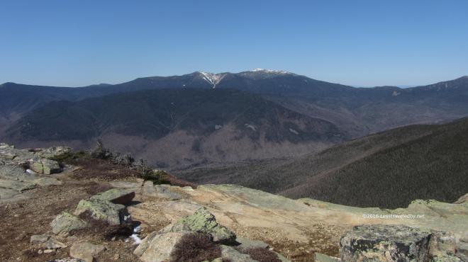 Lincoln and Lafayette rising up beyond Owls Head still seemed to have snow on the peaks and in the chutes, but I’m pretty sure that is all hard ice. I wasn’t headed that way this time, but I sort of wished I was.
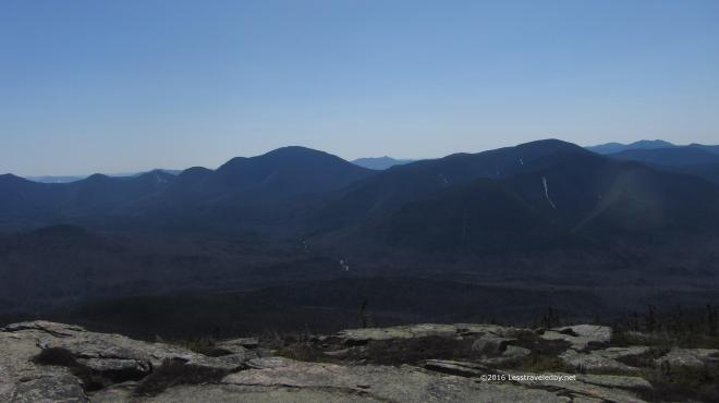 Hancock and Carrigain looked mostly snowless. Very different from last year when I was trying to snowshoe up Cedar Brook and breaking through waist deep snow in spots as it came apart under my snowshoes.
 Each time I come up here it seems the same, yet very different. The ice and snow made interesting contrast with the rock, but what I really noticed was the different color of the sun this time of year. Even though mid day was approaching it was a gentle light that brought out colors rather than blinding. Well except in the icy and snowy sections heh.
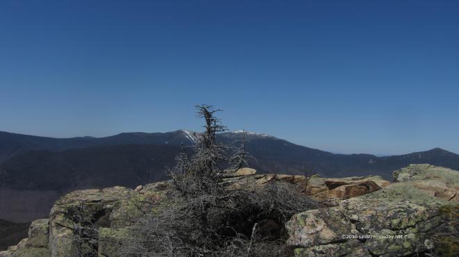 Lincoln, Lafayette and Garfield just barely sneaking in the picture on the right. Can’t help but remember walking that trail last fall, though that day was cloudy and gray.
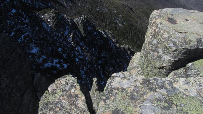 I am a big fan of giant holes in the ground and have visited many in my travels, but this is one of my favorites. The empty space is almost palpable and I’m always reminding myself not to reach out too far to touch it when I’m up there.
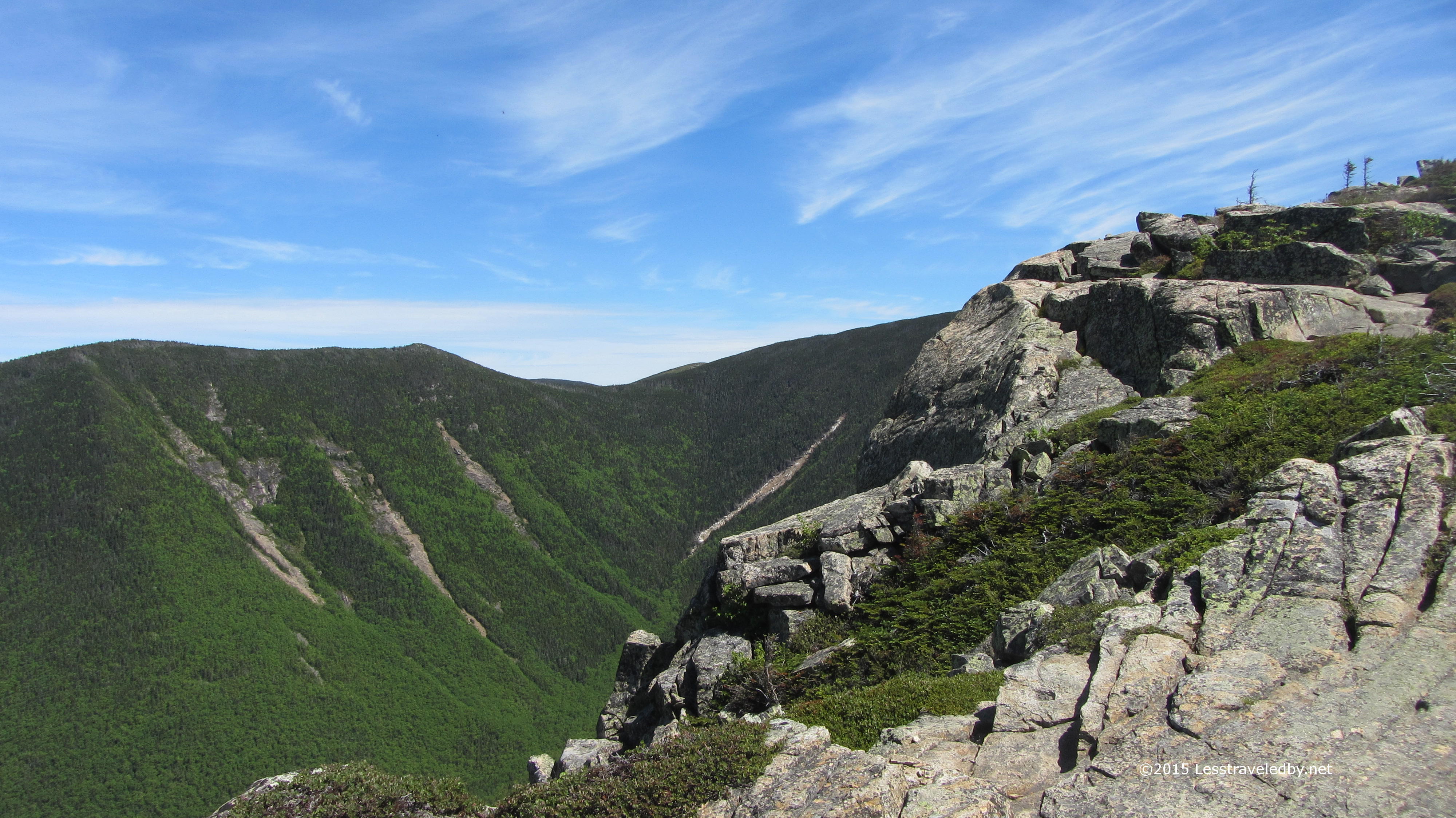
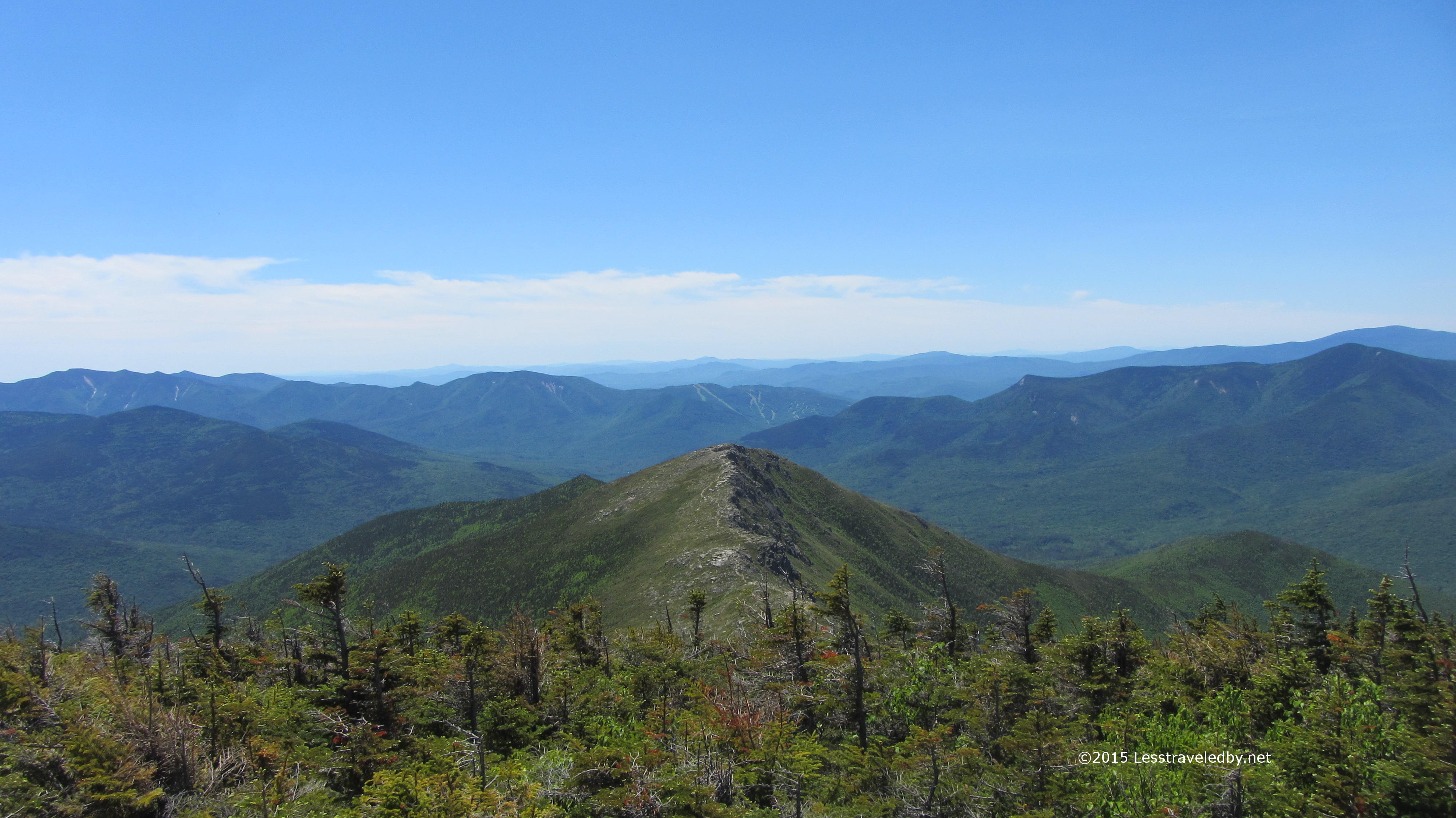
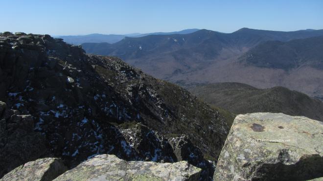 Out beyond that space Flume and Liberty mark the beginning of the Franconia ridge. Again it is hard to look at those mountains without recalling climbing them. I especially remember the col between them and how I was annoyed going down knowing I’d have to go right back up 🙂
 Speaking of going up…time to head up to Bond Summit. The exposed areas were mostly ice free so I did this section bare booted. Once I got up into the scrub closer to the summit I had to put the spikes back on or risk violating the family “No Breaka You Neck” rule.
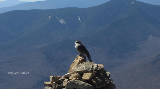 Of course at the summit I was met by the local Gray Jay contingent. Oddly enough I also met a human up there. He arrived from West Bond on a day hike and headed out onto the cliff leaving me and the Jay alone.
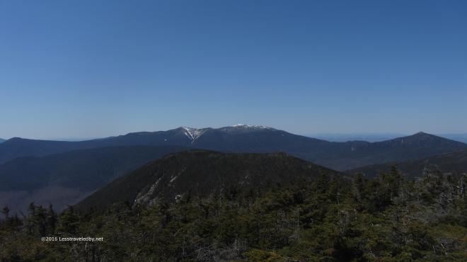 From here on the summit looking over West Bond you get a better sense of the size of the ridge in the distance. The same spot, yet very different from my visits here last Summer. The wind on the summit was brisk so I certainly didn’t stay nearly as long this time.
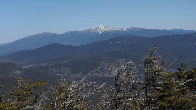 Well, long enough to get yet one more pic of the big Presidents. I guess some day I’ll have to go over that way, but admiring them from here seems a lot easier than climbing them heh.
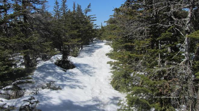 The trail on the north side of the summit was snow rather than ice and I’ll admit I took advantage a few times to buttslide in the steep spots.
  Arriving at the Guyot camp in the middle of the afternoon I had the place to myself. The view from the shelter porch was pleasant enough and I spent a few hours soaking up snacks and rehydrating.
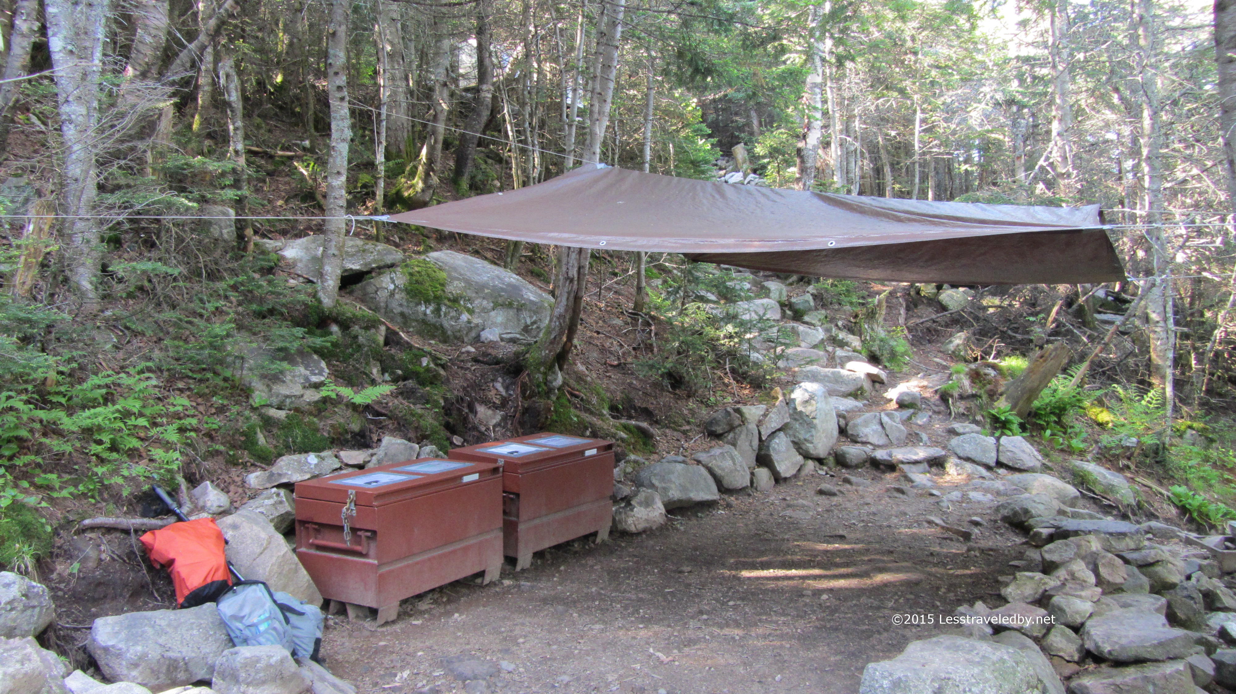
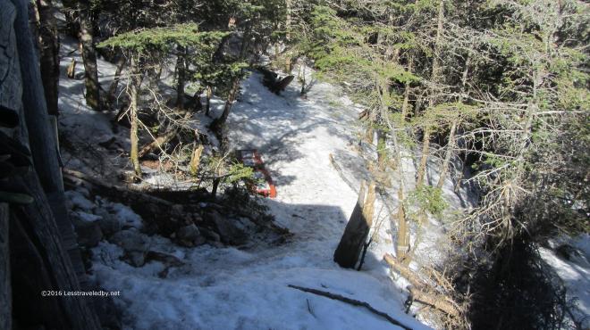 The bear boxes were just poking out of the snow down below in the cooking area. Don’t think the bears were a worry this time of year, but I was hoping there weren’t any shelter mice.
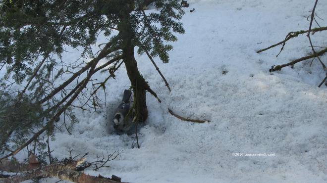 Of course there were a couple of Gray Jays hoping I’d let them steal my food, but I know better. They seem cute, but they are fearless and will take the food from your hand on its way to your mouth.
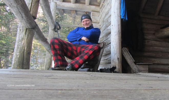 If I look pretty happy to be sitting on the porch in my fuzzy clothes it is because I was. Those little chairs weren’t very sturdy, but to have some place comfortable to sit out of the snow seemed pretty great to me. Surprisingly enough I had two separate hikers toddle in over the next few hours. Pretty sure each of us had expected to be there alone, but we managed to share the shelter and survive the night.
 Morning from the front porch was cold, but worth getting up for. Thankfully it wasn’t the solstice so I didn’t feel I’d needed to get up early and shoot and video 🙂 I shot this and crawled back under the quilt for a few minutes before getting up to make coffee.
 This Gray Jay was looking pretty fat for the time of year, but the lack of snow cover had probably helped him find food. Some from the ground and probably more from hikers heh. He was getting none of my breakfast cereal that day I can assure you.
 This sight made me a little sad. The friendly host long gone I had no one to share afternoon coffee with on this trip. Good memories though 🙂
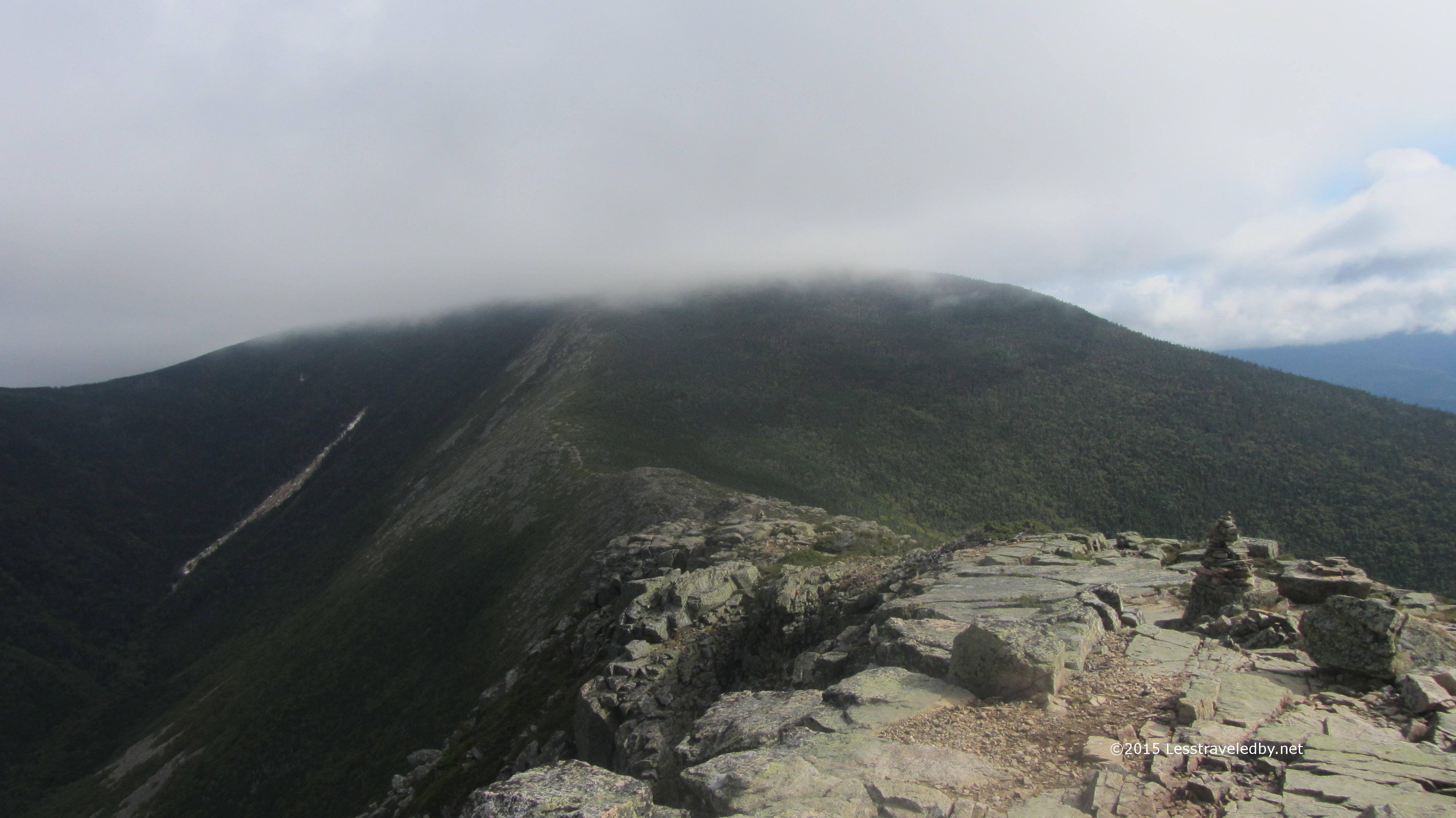
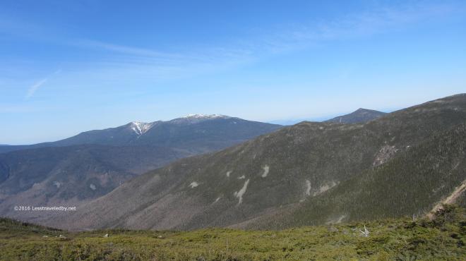 Again the morning light was fantastic. As I made my way up Guyot towards the Twinway I kept stopping to look at the peaks around me. I knew soon enough I’d be in the trees so now was the time to enjoy the views while I could.
 There was some snow in the scrub trees along the ridge, but most of the Twinway was covered in hard ice, much of it wet with melt. I was hanging from my spikes and using my poles for all I was worth to keep myself stuck to the ground on the steep sections.
 In between exertion and terror there were of course these amazing views every few minutes. It was a bit hazier on day three, but still there were some far horizon lines. I always love seeing the far ridges beyond the other ridges that are beyond the ones in front of me. Comforting to know you won’t run out of mountains any time soon I guess.
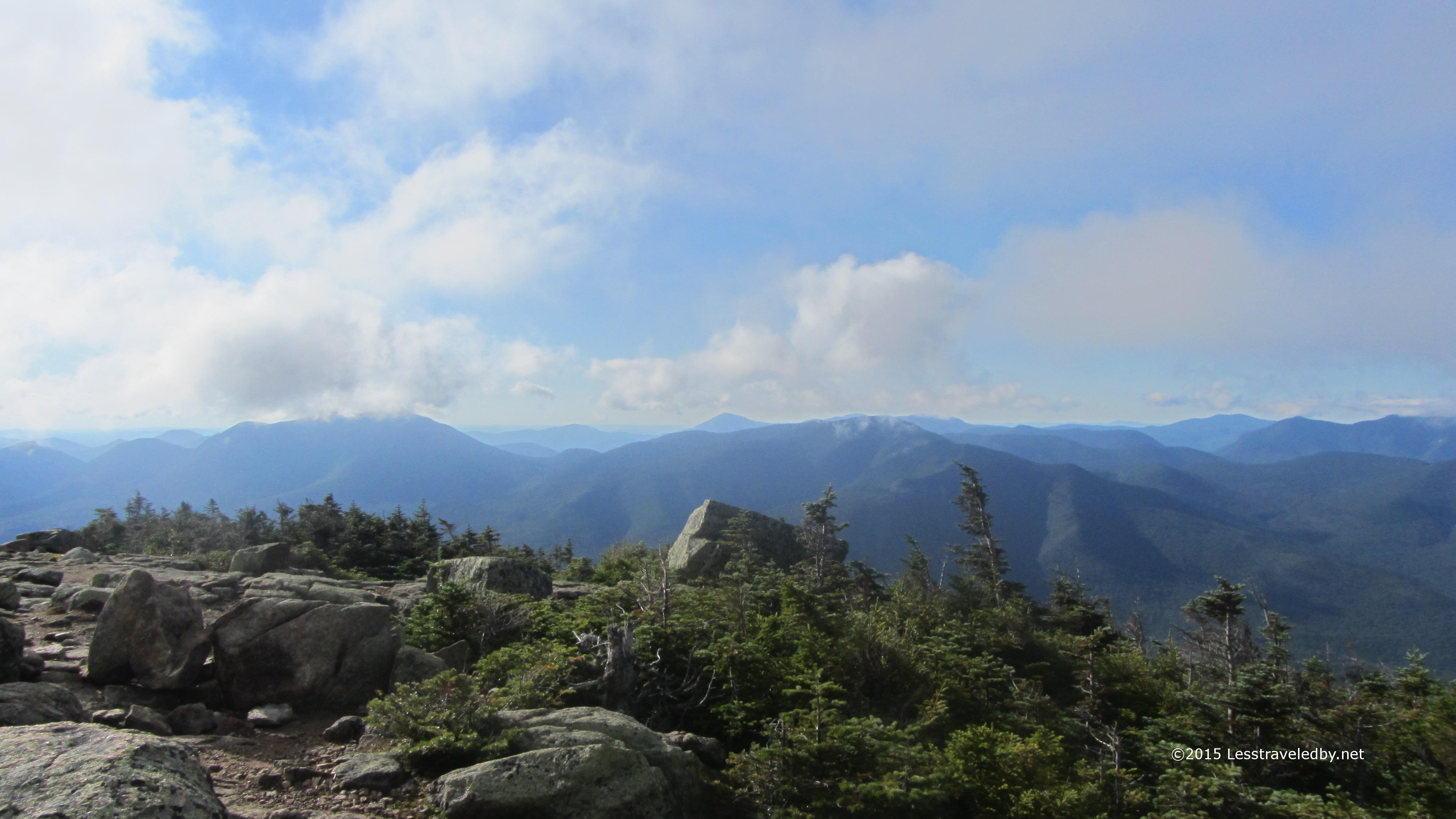
 All this time, about three hours, I had yet to see another soul. This was a Saturday and the weather was astoundingly clear so I’d expected to run into throngs headed up the way I’d come from on this trail. Maybe it was the ice, maybe they were all climbing Washington in the nice weather, but I was really enjoying the peace.
 No idea if it was crowded up there, but again, a lot easier to look at it from here. Certainly worth looking at from pretty much any angle.
 You can sense it is time to head down from this shot I think. No more pics for a while because going down this icy trail took all my attention. In some ways it was easier because the rocks were all buried, but even with spikes, walking down steep hills covered in ice uses up a lot of energy.
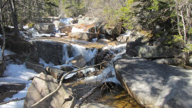 Reaching the crossing just before the Zealand Hut just before lunchtime seemed a good sign. I snacked there for an hour, chatting with the hutmaster as he started greeting his guests for the day. There were some hikers here heading up as well. I was glad my hard work was done for this trip and my spikes were tucked away.
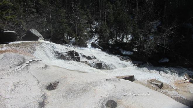 After a few easy miles on the Ethan Pond section of the AT, I made my way down to Thoreau Falls. Listening the roar as I approached started to worry me and at first glace I wasn’t sure I wanted to try crossing. Then I remembered the rocks I’ve used before and hopped over with no issue other than a pounding heart.
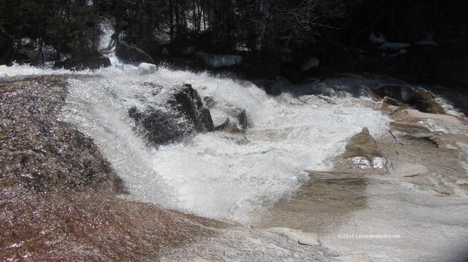 Definitely another one of my favorite places to be. I didn’t have much time to enjoy it on this trip because I knew I had a few hard miles to cover before I’d get to where I wanted to camp that night.
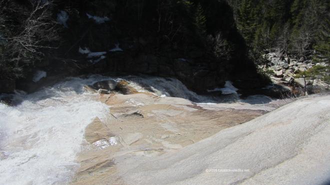 This is where I’ll leave you as far as pictures go. If you haven’t seen it already check out the waterfall video below. The rest of the trip was mostly about stomping my way back to the scoot. The legs are feeling pretty strong considering what felt like a lazy Winter season. As usual keeping the body happy is the biggest challenge and I really need to focus on drinking more water I think.