35 pictures from an adventure that didn’t go as planned, but certainly was worth the hot, sweaty effort. The idea was a two week trip to test out the Seek Outside Unaweep’s ability to carry that much food and my ability to live out of my pack for that long. The pack did its part and the food was fantastic, but there were a few other issues along the way 🙂 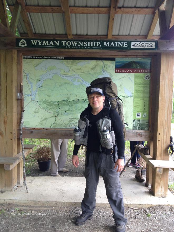 The girls were kind enough to drop me off where the AT crosses the highway just south of Stratton. They were headed on to VT and NY for some road trip camping while I did it the hard way. I remember being a bit nervous before walking away from the car, but as soon as I crossed the road and entered the woods on the other side the peace started to wash over me.
  A rare peek at the peak through the forest gave me a glimpse of where I was headed that afternoon. Warm and steamy down below, but I was hopeful of cool breezes up above.
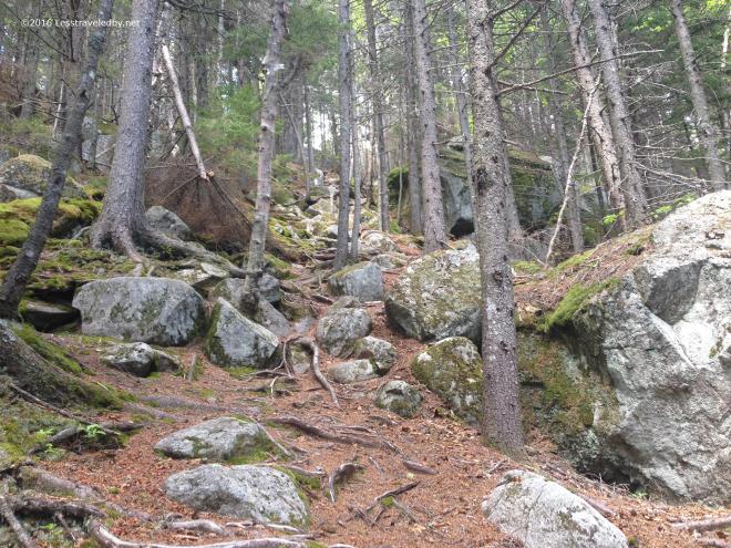 There would be some climbing involved to find those breezes though. You might be tempted to think this picture shows a particularly difficult section of trail, but this is actually the easy part. Later there would be large, cracked slabs of rock with water flowing down them in parts to navigate. I didn’t pull out the camera there because my hands were wet.
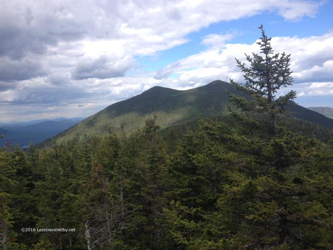 There were breezes on top of the ridge and “viewpoints” too! I’d made myself a promise to visit viewpoints on this trip. My natural inclination is to stomp on past them so it can be hard to stop, but I was rewarded with some sights like this one of The Horns.
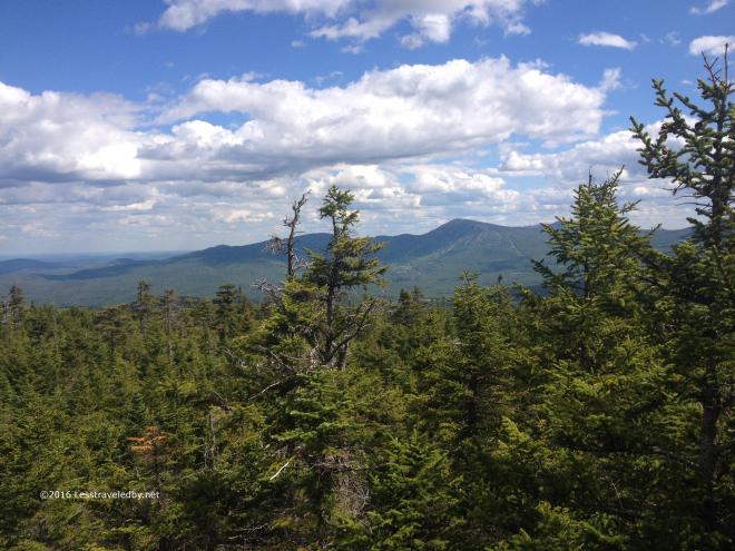 There were lots of other great views along the ridge often framed by the stunted evergreens. Not a fully exposed trail, but you could tell from the trees that life was hard up here when the winds blew.
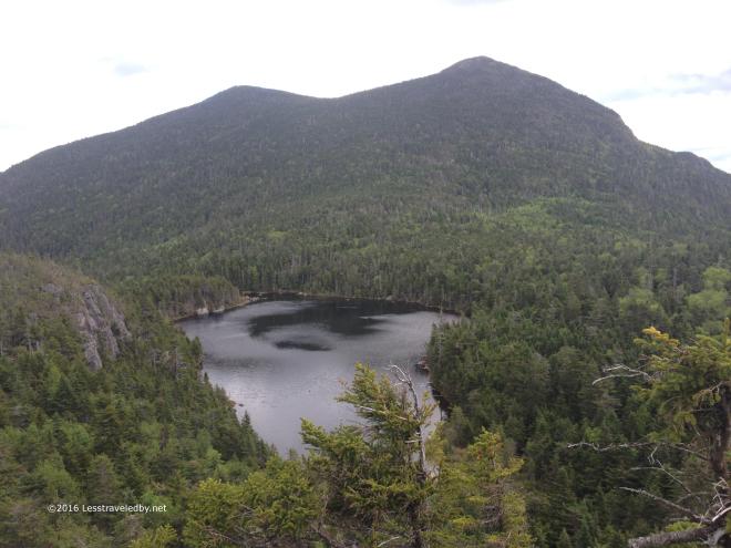 Then on one of my viewpoint visits I finally spotted Horn Pond below me. Somewhere down there I’d find a campsite waiting for me though it was impossible to guess exactly where from up here.
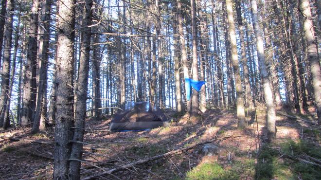
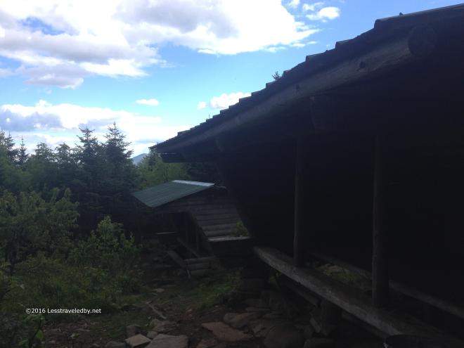 The Horn Pond campsite is actually quite large. There are these two good sized lean tos, plus a number of tent sites spread over a wide area. Each site had a 5 gal plastic bucket to protect food from the squirrels and chipmunks and there were several signs warning to be on guard of them.
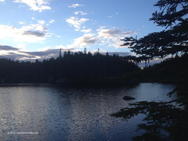 Horn Pond was amazing up close as most lakes you find at altitude tend to be. I guess I enjoy all lakes I visit, but something about finding water like this up high always seems extra special. They had just hiked up a fresh batch of trout to stock the pond and the big fish were feasting on the recent arrivals in the early evening.
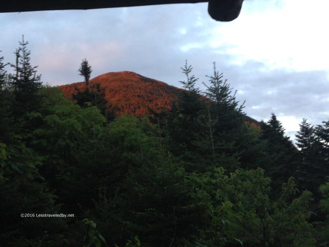 Back at the lean tos, which I had all to myself at this point, I was treated to a wonderful alpenglow display up on South Horn. Tomorrow I’d climb up there, but for now it was nice to relax and enjoy the view. I had a visit from Frog, the first of many SOBO thru hikers I’d meet on this trip, before he headed out to set up his tent after a long day crossing the Bigelows. Around dark, about 1030pm or so, another thru hiker came in and set up in the empty lean to next door.
  Day two started out clear and warm. The sort of day you know is going to be rough for climbing, so I took off early at a good pace and soon found myself at the top of South Horn. I’d bypassed the option to catch the view from North Horn, despite the recommendation of the camp host back at the pond, because it was listed as .3 miles on the sign and looked a lot more.
This sign was my first time noticing that the mileages listed seemed to be different from what I was expecting and not in my favor. Seems the electronic mapping and .gpx files I used were greatly underestimating distances and elevation change in some spots. So much for planning! Next time I rely on old fashioned paper maps that at least tell the same lies as the trail signs 🙂 Standing up there on South Horn looking back towards the pond I could just make out the two lean tos below. I always get a kick out of being on one spot looking at where you are going and then going there and looking back to where you were before. Being able to actually see the exact spot made it even better.
 Then it was time to continue on the Bigelows roller coaster. After South Horn came West Bigelow Peak and eventually Avery. The col between each peak drops several hundred feet which lets you cross the 4k mark multiple times.
 Nearing the top of West Bigelow looking back at The Horns you can see how they earned their name. You can just barely make out the only cloud in the sky there on the horizon. Probably in NH or maybe even VT, it did little to provide shade on this exposed ridge. Air temps were in the low 80s and I was looking forward to finding the campsite coming up to refill my water supply.
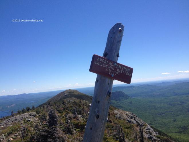 Well, I suppose there were more clouds than the one in NH, but these still were too far off to be of much use. Nice views though, with Avery close by and Little Bigelow down below hiding behind the signpost.
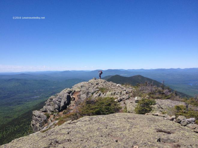 I met a lot of SOBO thru hikers coming across this ridge. Seemed I was heading into a large bubble that formed after Katahdin finally opened for the season. Each day I’d meet more and more of these hikers. First it was the fast ones, then the ones who were moving a bit more slowly with a few fast late starters mixed in.
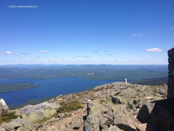 I managed a bit of water from the nearly dry spring in the Avery col and then headed up to the last big peak I’d see for a while. Hard not to stop and enjoy the views so I had a late lunch here. A big change I’ve made to my feeding program for these longer hikes is the addition of lunch. Rather than snack all day I tried out bringing dried sausage and tortillas. With the addition of a cheese stick one or two of those makes a satisfying, high fat content, meal.
 Then it was time to drop off the ridge and head back into the trees. I had hopes of making it over Little Bigelow that afternoon so despite losing the summit breeze I pushed on at a pretty good pace. Finally reaching the bottom much later than I’d expected I again realized that my mapping had underestimated the actual trail miles. Seeing a sign for the Safford campsite I headed off onto a side trail that took me through a small rock cave before ending at a tiny, primitive camp area well off the AT.
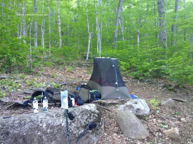 There was a broken tent platform so I used this spot instead. I found a tiny stream nearby to filter some water and located a well maintained privy a bit farther in the other direction near another sad looking platform. Being used to wilderness camping this barely there campsite seemed pretty luxurious to me and I enjoyed a peaceful evening indeed. There were even a couple of fireflies.
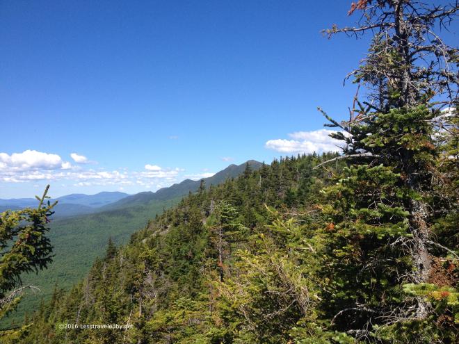 The next day is when I had to admit that with my poorly mapped trails I wasn’t going to cover nearly the ground I’d expected to. So I set my sites on enjoying my walk and not worrying about where I ended up each day. I think it was about the tenth false summit coming up Little Bigelow that broke me. Combined with a hot sticky day it was enough to make me set up camp mid afternoon at the Little Bigelow shelter and spend the day soaking up water in the shade and visiting with the SOBO hikers who passed through and those who eventually stayed the night.
 The Tubs are a series of natural baths in the small stream running near the shelter. Even with the heat the water was much too cold for me to take a dip, but I did enjoy drinking my fill.
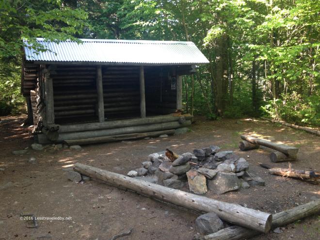 The shelter was filled that night with a half dozen tents set up around it as well. I hadn’t expected so many SOBO thru hikers to be coming through at once and I’m sure I’m not the only one who felt that way. With changes in traffic a lot of folks are going to have to get better prepared for crowds earlier in the season including hostels and the folks who run the canoe ferry.
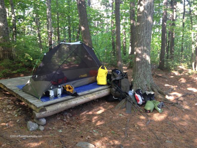 This platform was in fine condition and I enjoyed another peaceful night once the thru hikers finally stopped hooting. That yellow bag is one of two that carried my food supply on this trip. Inside I’d organized things into three five day supplies with larger portions in the later stages.
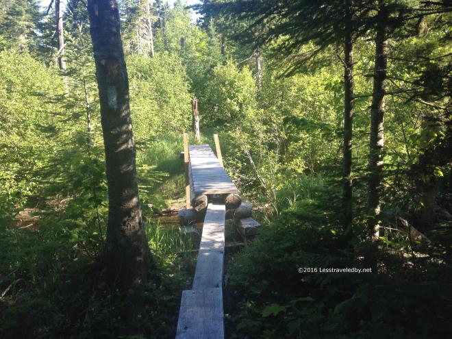 Day four was steamy to start and expected to get close to 90°f so I again headed out as early as I could to put some miles in. This nice bit of bridging put a smile on my face which is always better than mud in my boots.
 This was one of several spots that laid claim to being the 2k mark. I’m assuming that with reroutes the exact spot has moved over time and they were all right at one point. I stopped for second breakfast at a road crossing just past this sign and marveled at the frightening speeds vehicles came rocketing down the road. Well, and I swatted at horseflies too, but that doesn’t sound as romantic as marveling.
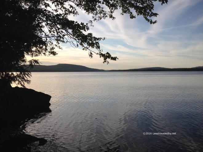 West Carry Pond late in the day looked cool, but it was a bit tropical to be honest. The spring near by was dead so warm pond water was the only source to be had. Another large group was gathered here and I was glad I’d set up my tent early to get a spot.
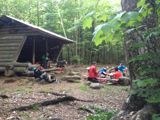 There was such variety in the thru hikers which really made the SOBOs seem like a different species from the NOBOs I’ve grown used to dealing with over the years. These people were still doing their own things in their own way. They hadn’t had their originality beaten out of them yet, though there were a few I met the night before who sounded ready to do as they were told.
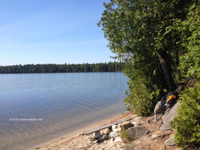 Another hot and sweaty morning meant another early start. I found this fantastic beach as the trail followed the East Carry Pond shore for a bit.
 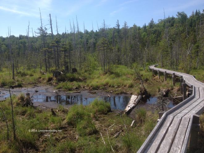 The MATC has built some fantastic bridgework through some areas in this section. I came upon a crew a bit past here that was setting up for the day and looked to be working on another huge section.
Somewhere between East Carry and Pierce Ponds my leg almost fell off. I was just walking down the trail, taking another of the millions of steps I’ve taken over the years and when I went to pick up my leg something went horribly wrong in my hip. Surprisingly enough it held my weight when I set it down and I just kept walking. There wasn’t pain, but I could tell something didn’t feel the same. Pretty soon I was more worried about finding water than my leg and forgot about it for the most part.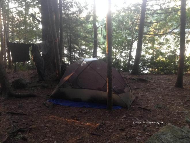 Pierce Pond is pretty popular with NOBO hikers because it is the last shelter before the Kennebec canoe ferry. Harrison’s camp next door with their famous pancake breakfast might have something to do with it too.
After setting up camp and wandering up and down the hills in the area a bit I realized that my hip definitely felt different. Not painful, just not normal. As the afternoon turned into evening another group of SOBO thru hikers moved in and then towards sunset a solo, NOBO section hiker stopped in before heading over to Harrisons to make breakfast reservations. Sunsets come pretty late this far north around the Summer solstice. Pretty pretty too!
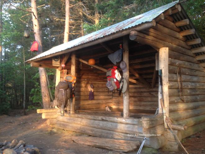 The entire group of thru hikers opted to set up their tents after one of them spotted some big spiders. It struck me as funny that there was this fantastic sunset to be viewed from the shelter, but no one was there to enjoy it because the spiders scared them off.
 Sometime in the night or early the next morning I decided to spend a zero day to see if I could figure out what was up with my hip. Once the thru hikers left in the morning I had this beautiful place all to myself. Well, there were a few passing fisherman in boats on the pond and a couple of folks stopped in for lunch breaks, but really it was a quiet day to relax and enjoy.
I shared the spot with a wide variety of dragon fly type creatures. First there were a bunch of black and white ones.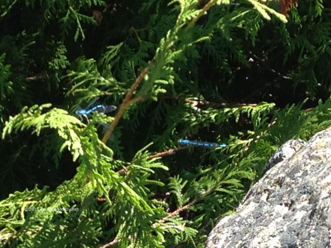 Then I found some blue ones that seemed to be molting. One was ready to go but waited for the other before they moved off eventually.
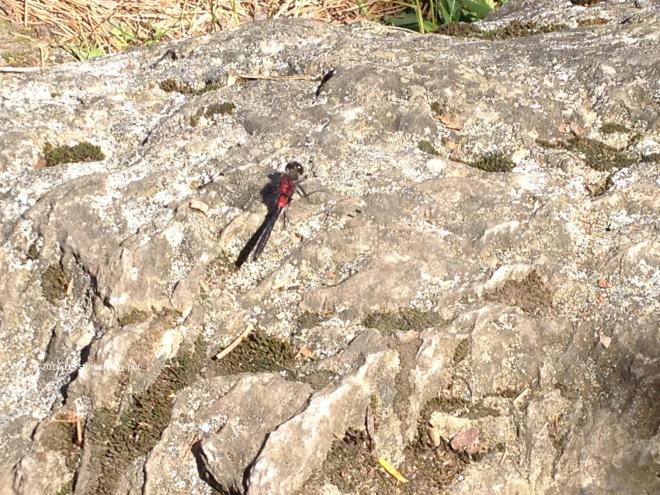 Then this big red one showed up to pose for me. Like I said, it wasn’t a very busy day 🙂
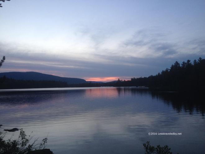 Another peaceful sunset and I had the place all to myself. There was a chance of rain before morning so I moved into the lean to with the spiders. I’ve let wasps move me out of a shelter before, but the choice between sleeping with spiders or packing up a wet tent in the morning was an easy one. All night I had a great view of the pond whenever I woke up. This really is a nice spot if you can find it empty.
The next day I started off rested and hopeful that my leg issue was behind me. I had about four miles to the canoe ferry which only runs from 9a-11a this time of year so got an early start. I was moving pretty well and acually did the four miles in under two hours, but I could still tell something didn’t feel right in my hip. I debated my options and after giving consideration to the poor folks who would have to carry me down the mountain if my leg fell off I decided to pull the plug on this trip. I had a highway where I could get a ride home so better to stop here than risk heading up the next mountains was my reasoning.
So my fifteen day trip only lasted seven and I didn’t cover even half the miles I’d expected. Still I am glad I erred on the side of caution. Working through the leg issue here at home I’m becoming somewhat convinced it was caused by heel cushions I added to my boots just prior to the trip. My feet were incredibly happy in the Limmers on this trip and the cushion did great at absorbing the heel shock I’d been feeling, but removing the cushions seems to be helping the hip issue. I have been day hiking all along and managed a 5 day Baxter loop with the boys from Texas last week so am hopeful that I will continue to walk on.
Besides the leg falling off there were a few other bad points to this trip. The bad electronic mapping really left me with a failed plan to start out. I have good paper maps for most of the areas I visit, but obviously need to find some for this area if I’m going back again. In more forgiving terrain a few miles difference isn’t so much to deal with, but when mountains are involved those unexpected miles can seem very long. The weather really was a big challenge as well. I’d much rather hike in below zero snow than 90° heat, but I dealt with it pretty well considering.
On more positive notes…the Unaweep was amazing at carrying the load. The hip belt and shoulder harness keep the pack in place well even when crawling under blowdowns or clambering up steeps. I started with 57 pounds wet including the front packs and never experienced any contact point pain or abrasion. The food also worked out really well. I wasn’t really hungry after seven days which is somewhat astounding to me. I am usually starving after five or six days, just ravenous. The biggest difference was the sausage and cheese tortillas for lunch. I was so well fed I wasn’t eating my rations of trail mix or chips. One other big win on this trip was a warm weather wool shirt I was testing out for future review. Amazing material worked as a cooling shirt when wet, warming shirt when dry and somehow managed to not smell after a week of hot sweaty trail use.
One other really big positive on this trip was the people. It was fun to meet the SOBO hikers early in their trip. The couple of flip floppers I met really stood out as they were all about the business and not much about the fun by this point. It seems a shame to lose that natural enthusiasm so I’m hoping the folks I met are still rolling down the trail having a good time doing their own thing.
As I mentioned there has been a Baxter trip since then, two actually as we did a family outing up that way as well. Pondering our next move as we have a few weeks before the little one starts school. Then we’ll see what the Fall brings…

 Car camping is very different from backpacking. Some parts are bad, like having neighbors and overused privies. Other parts are good like a cooler full of food, a full sized propane burner and a percolator full of fresh brewed coffee. My wife and I used to hit the road for weeks at a time when we lived out West and have enjoyed eating well in some very remote places.
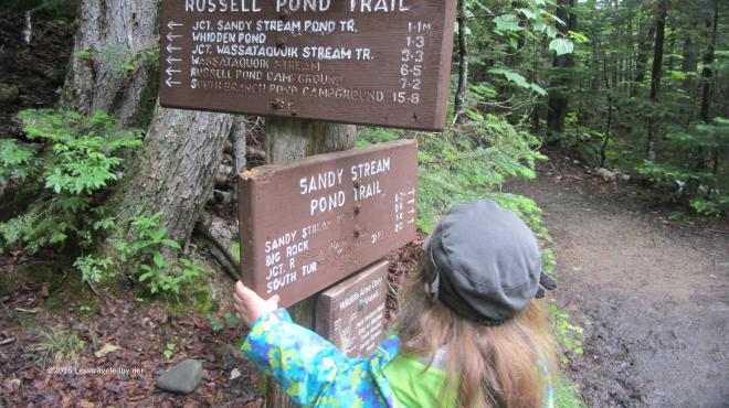 We didn’t let a damp start to the day keep us in camp. With hopes the clouds were about to part soon we headed across the brook via the Russell Pond Trail, but opted to swing off towards Sandy Stream Pond soon after the bridge. The RPT is a bit more rugged and has a rock hop that might have been a bit much for the youngster. Besides, while I’ve gone that way many times I’d never had a chance to try the Sandy Stream Pond Trail.
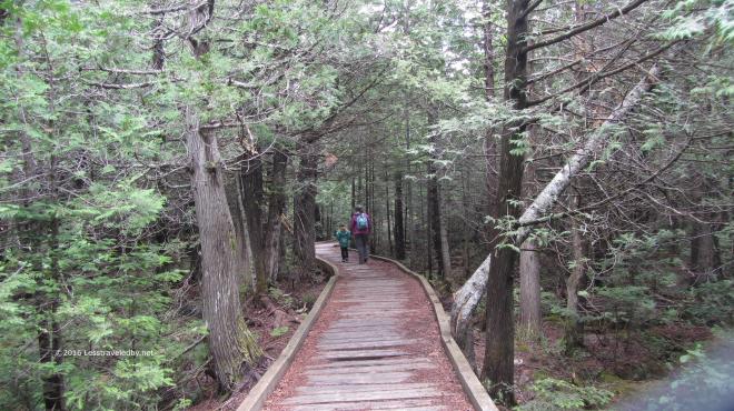 Yup, definitely a bit less rugged this way. The trip out to the pond to look for moose is part of the standard visitor experience it seems and we met many other folks out enjoying the day. My trips to Baxter usually involve rushing away from the trailhead and out into the empty wilderness as fast as possible so it seemed odd to see so many people. I think there may have been a dozen over the four hours we were on this hike, so it wasn’t crowded. I just think of Baxter as empty.
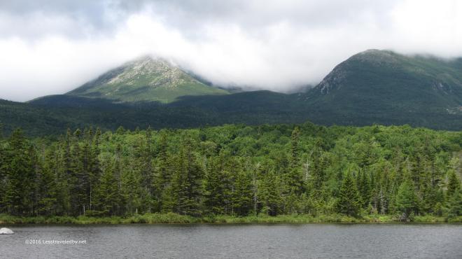 The clouds were starting to lift by the time we reached the first of several viewpoints on the edge of the pond. Hamlin and Pamola were starting to come into view, but Katahdin itself remained shrouded.
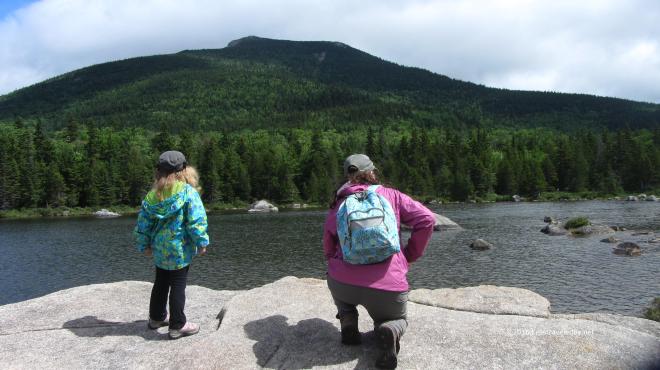 The pond was quite shallow, at least around the edge we were on. The light was constantly changing along with the clouds making it a great day to just sit and look. Backpacking is fun, but there is something nice about not trying to get anywhere too. We had plenty of time to soak the views in before heading further down the trail.
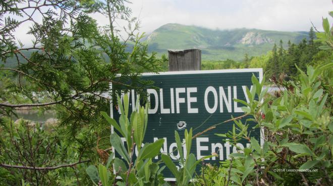 Most folks don’t realize it, but you are free to roam off trail in the Baxter wilderness if you are so inclined. There are a few exceptions though and the area around most of Sandy Stream Pond is set aside to allow the animals a place to be completely free of humans. The signs make me laugh because it seems odd to have a preserve in the middle of a giant park.
 We eventually rejoined the RPT and headed out to Whidden Ponds for lunch. The clouds had continued to linger on the mountains but it was a great day down below.
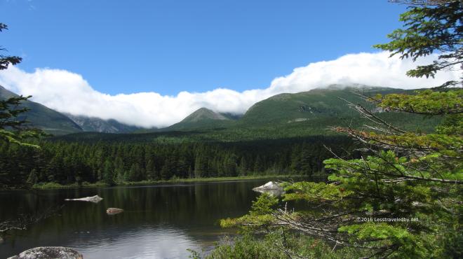 What may have been an annoyance for those hoping for summit views made for a beautiful sight to us. I have stopped at this pond on every trip down this trail to take pictures and probably always will.
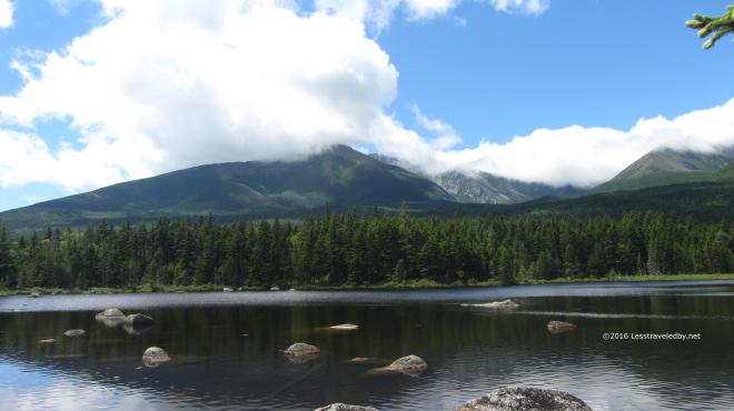 This day was special though because I had the girls with me. Every other time I’d been to this spot I’d thought how nice it would be if my wife could see it. She has had to look at all the pictures I’ve taken from here over the years so it was nice that she finally got to see it in person.
 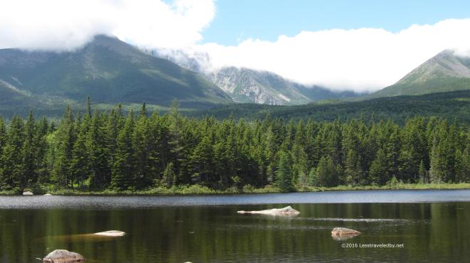 Baxter Peak was starting to be glimpsed through the clouds at times. Maybe the folks would get their summit view yet that day, but we finished up our tuna wraps and started back towards camp.
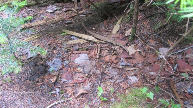 Along the way we came across this well hidden toad. Actually we came across quite a few of a wide variety, but this one was so hard to spot at first I decided to take some pictures.
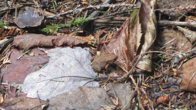 If you couldn’t find him before this close up might help. Was glad I’d taken this picture to remind me in case I lost him in the wide shot.
 My daughter insisted we were going to climb up South Turner Mountain because the sign said it was only 1.5 miles and she was sure she could walk that far. No matter how much I tried to explain why that wasn’t going to actually happen she refused to be dissuaded. So we went a ways down the trail until we hit the boulder field that marked the start of the actual climb. She didn’t want to admit defeat, but the size of the rocks eventually convinced her we should wait till next year to see if her legs were longer.
  Later in the day we decided to explore the Nature Trail which is a small loop just across the brook from the campground. It wound through the forest, first along the brook and then away from it. Eventually it gave access to two separate boardwalks that let you travel well out into a large bog.
  There were several interesting types of plants to be found. A ranger later explained that there are two types of carnivorous plants in this bog, though they like to eat tiny flies so we were never in any real danger.
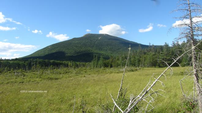 Besides the bog there was also a really nice view of South Turner. My daughter was still saying we should go up there and I think she’s right, we should.
 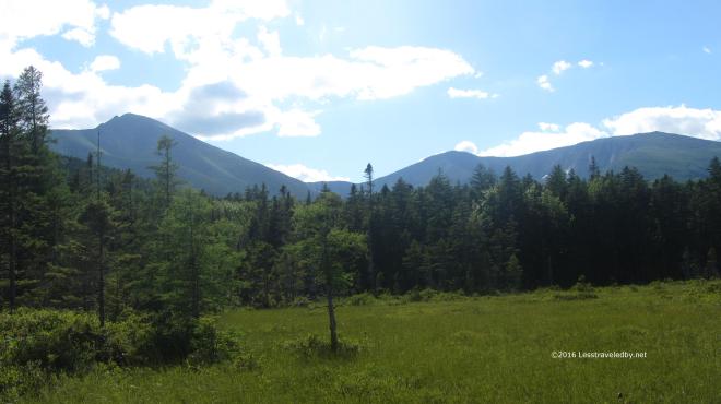 Late in the day to be on the summit, but the views definitely opened up. I’m sure there were a few folks coming down in the dark with their headlamps on with memories to last a lifetime. We had it much easier on this trip. Unless you count the hard work of carrying our gear into our walk in lean to or the challenge of cooking the perfect campfire pizzas we didn’t do much to earn our reward, but we left with memories to last too.


 We aren’t afraid of the early season bugs because we come prepared. Good thing too because those early season bugs certainly weren’t afraid of us! I’d treated our clothing with
  The light in the forest was amazing! Still the clear, white light of Spring, but strong with the coming intensity of the approaching Summer.
 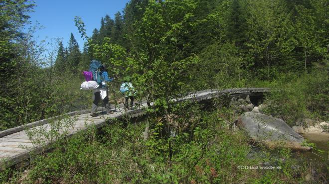 We didn’t have far to travel compared to my usual solo adventures, but part of keeping it fun for everyone is keeping the distances realistic for a five year old. Starting out from the Avalanche Field trailhead we covered the first two miles pretty fast as the trail followed an old logging road and was pretty flat.
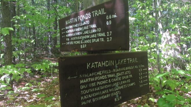 Reaching the turn off for the Martin Ponds trail we left the flat of the old road and walked on some authentic Maine hills, mostly up, towards our destination.
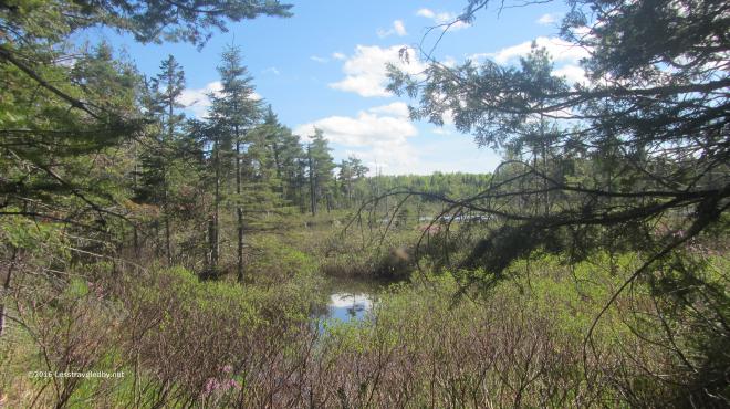 Approaching from the boggy end we could see the open water of the pond ahead. Later, after a good look at the pond I realized that all the ends were boggy.
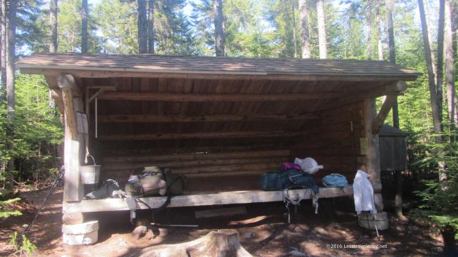 The Martin Ponds lean to advertises room for six. This was our first attempt at family camping in a lean to so we were glad to have plenty of room. I was able to rig up our
 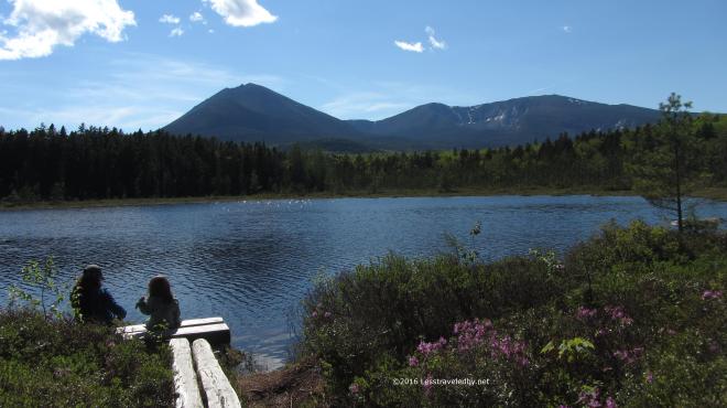 The girls headed down to the pond to enjoy the breeze. I’d often heard that this spot was one of the best places to view Katahdin and I have to agree. So much easier than climbing up there and seeing it up close, that’s for sure!
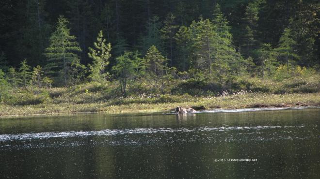 Later I went down to spend a moment alone on the shore only to notice that I wasn’t alone. Mrs Moose had been standing on the far side, out of the water until she saw me. She moved into the water and browsed for a minute so I ran to bring the girls down to see.
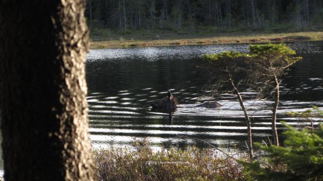 By the time we returned the cow was swimming half way across the pond. We watched, whispering in awe, as she swam towards us and then veered off as she approached. I can never tell if they are just checking us out when they do this or putting on a show for the cameras.
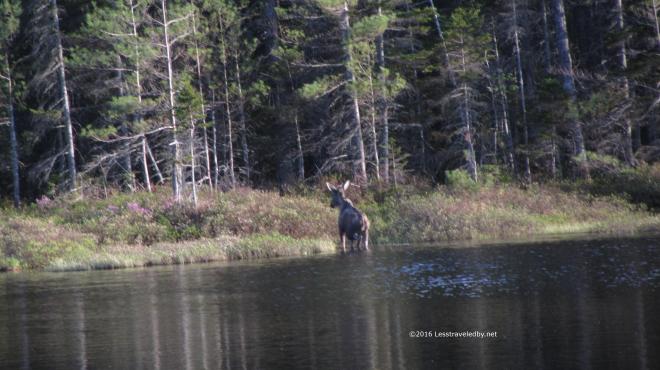 She took to the shore and dawdled a bit making sure we had time to get a few more shots before disappearing into the forest.
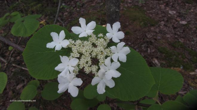 We still had plenty of nature to enjoy though. There were a wide variety of frogs providing background music throughout the afternoon and evening. There also were some lovely Spring flowers to be seen including this Hobblebush which we mistook for some sort of dogwood.
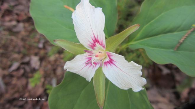 We also were there at the right time to see some Painted Trillium at their peak. These only last for a few days and then disappear for another year.
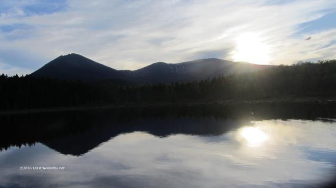 Sunset over the pond was calm and quite froggy. Things cooled rapidly once the sun dropped and a shower came through overnight.
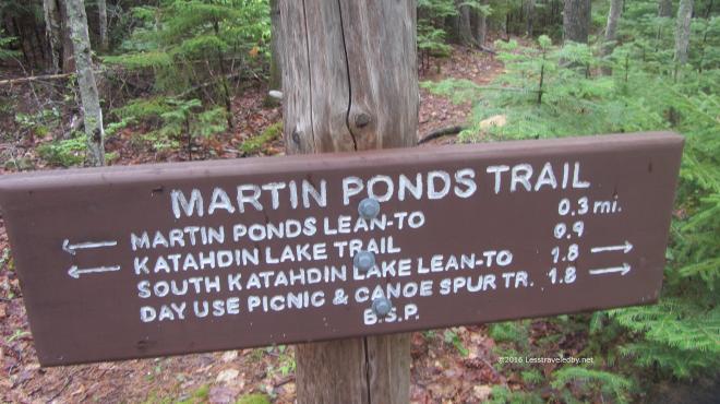 In the morning we were off to our next camp at South Katahdin Lake. It was only about a two mile hike, but with lots of interesting terrain for a five year old. We were all happy to reach the lake shore, especially since it looked like there might be more rain on the way.
 The ceiling was a bit higher than
 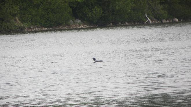 I think the expression is “Great weather for a duck.” but the local loon population seemed pretty happy as well. There seemed to be a group of at least four or five that was hanging around near our camp on the shore.
 We had some breaks in the clouds near sunset, but not enough to reveal the big mountains to our west.
 Morning brought definite signs of clearing, but this bank of clouds remained for some time. Watching it closely I realized it was a long narrow tube of moisture being pushed around the side of the mountain in a steady stream. Weather does some weird things around these big peaks poking up all of a sudden.
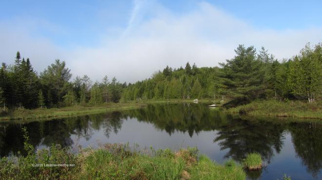 We had a great day for hanging around and exploring. This flowage enters the lake just downstream, but is backed up by something resembling a beaver dam.
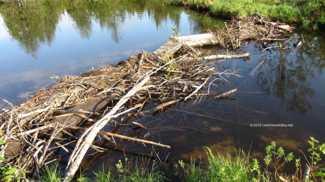 Not sure if any beaver were involved in this or not, as they usually do a better job on construction. I do know those bog boards are the trail crossing we arrived on the day before and that tilted one towards the top was very interesting while wearing the big daddy pack.
 This was a day of many walks as our daughter was taking full advantage of her time in the woods. We’d no more than sit down from one than she would announce it was time to begin another. We visited all the local landmarks and even roamed through the nearby Katahdin Lake Camp and some distance beyond. I have no real account to rely on, but would guess we did at least seven miles that day.
 There was some time for cards though. This girl never stops even when she stops so we know to bring along plenty of things to keep her entertained. Of course that is never enough which is why I’m sure a few minutes after this picture it was time for another walk.
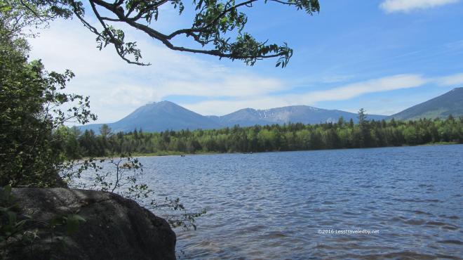 With the low cloud deck finally gone the mountain came into full view. We couldn’t see it from our camp site, but thankfully we had plenty of chances to see it on our walks.
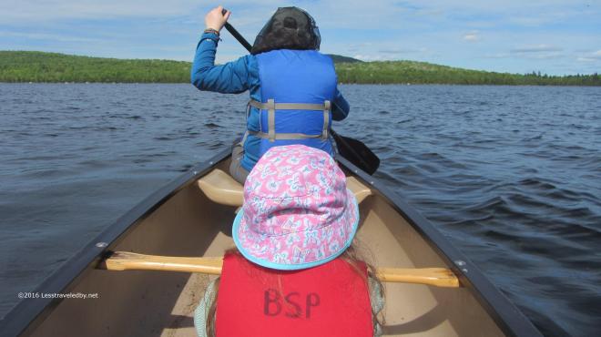 Later in the afternoon the breeze died down enough we felt confident enough to try taking the canoe out. On a lake this size the weather can cause a lot of trouble so we opted to just take a tour around the nearby island.
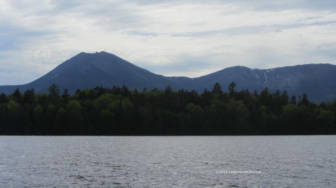 Between the breeze that was still blowing and my wife’s incredibly powerful paddling stroke I had to spend most of my time focused on manning the rudder. I did manage to get a few shots of the mountain from this unique perspective in the middle of the lake.
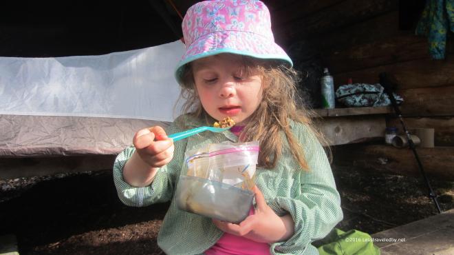 We earned our dinner that day for sure! Between all the walks and a bit of paddling everyone was ready for a bag of dinner. She may be only five but she is getting the hang of eating out of a freezer bag like a pro. I made her a special chili mac without the added dehydrated salsa that went into the parent’s portions which were also a bit larger.
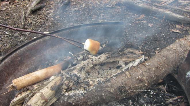 I didn’t want to fill her up with chili mac and have her turning down toasted marshmallows. My wife is an artist when it comes toasting, patient and always aiming for perfection.
 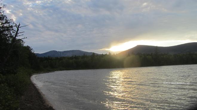 One last sunset over the mountains before the clouds moved back in. Again I was reminded of my previous visit, tired, wet, wet and wet. That was an adventure, but I’m pretty sure this was more fun. Maybe next time we’ll try the north end of the lake!
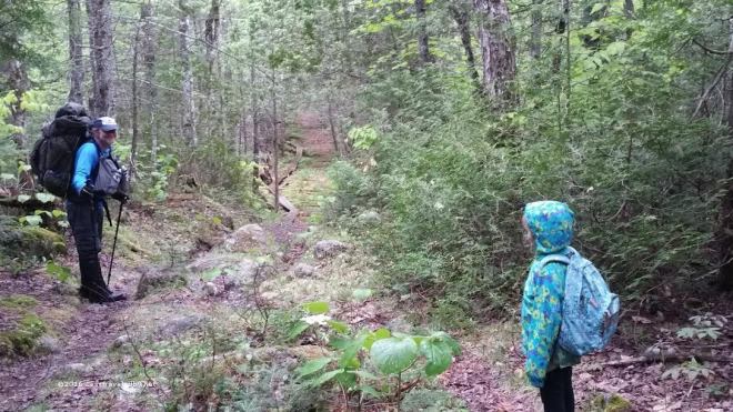 The next day brought showers which arrived just about the exact time we left camp. We had three miles of trail to cover including some wet and slippery bog boards. The girls put on raincoats but in warm temperatures like this I prefer to just get wet. Well up to a point at least heh.
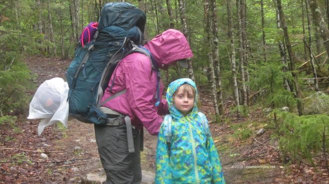 We didn’t let a little shower keep us from stopping for a snack break. Loading up afterwards I could tell the little one was enjoying being out in the rain. I didn’t realize just how much until she saw a trail head sign on the drive out and tried to get me to stop so we could go on a hike. That’s my girl!!
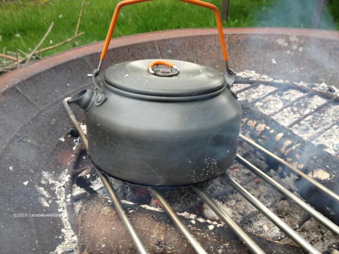
 Taking advantage of a fire we made in the back yard to cook pizzas I did another test muffin last night. I used a bigger fire this time, just coals, but more than
 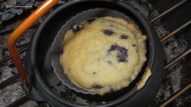 I also broke out the new, oversized, silicone muffin mold. As you can see experimental muffin baking is not an exact science and there were a few issues with escaping batter. That was due to an unstable spacing platform under the mold.
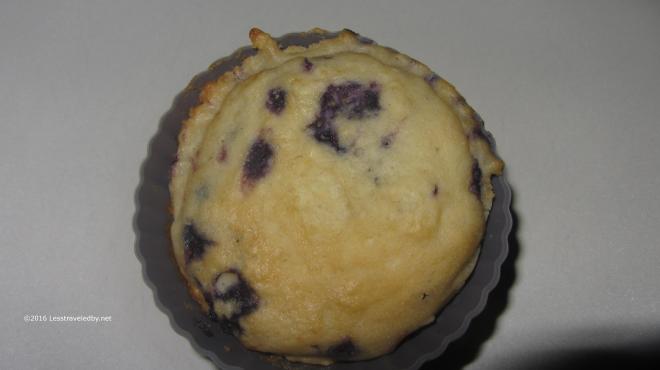 You can see the higher heat did a much better job browning the top of the muffin. I guess twig fires might work if you were willing to work that hard, but a good coal bed seems the way to go.
 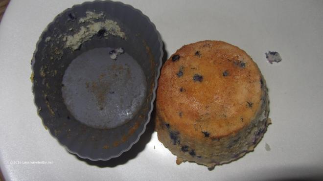 That bottom is nicely browned and looking like an actual baked good. The untreated mold released pretty well leaving an easy clean up job and a nicely formed muffin.
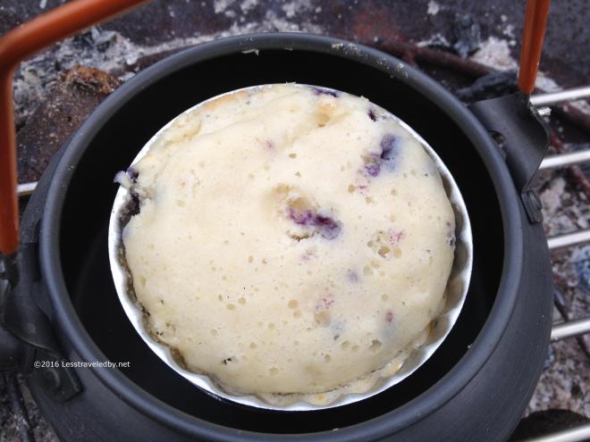
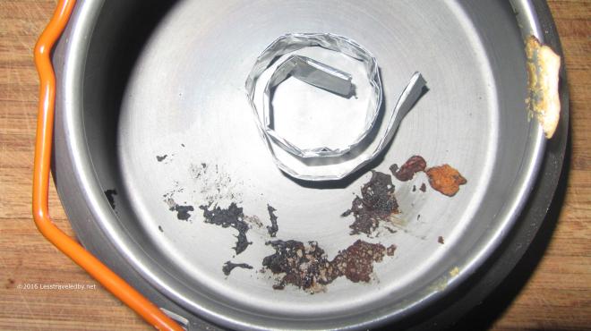 Here you can see cause of the problem; the folded aluminum foil spacer was too small to hold the muffin as it baked. Uneven heating made the batter rise more on one side and the muffin tipped over. I either need a bigger spacer or a wider platform on top to act as a tray to hold up the mold as it bakes.
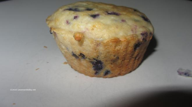 Enough about the failures, lets look at the successes. Out of the mold this baby looks like something a mother would make in the kitchen at home. Nicely browned but not burned and a bit of character to the uneven top.
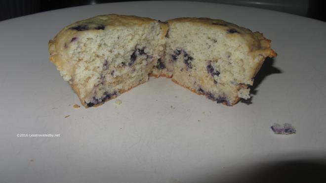 Inside you can see this time it baked all the way through. Using twice as much batter and the over sized silicone mold results in a nice sized treat. Definitely going to have to find space to carry a few bags of mix on this next trip to do some field testing, but it tasted pretty darn good here at home.
 Less than a week before I head off on a little walk I’ve been planning since last year. As most of my grand adventures seem to, this started out as a crazy idea I didn’t expect to actually do, but these things take on a life of their own sometimes. After being dropped off where the trail crosses the highway near Stratton I’ll be heading north on the AT with food for 15 days and almost 200 miles to cover before my family meets me up in Baxter State Park on the other side of Katahdin.
 This elevation profile only goes as far as the summit of Katahdin and is missing the descent to Roaring Brook. It also isn’t very accurate in terms of mileage as the official distance for this section is listed at 188, not 177. GPX files often do this as they only reflect points along the trail as opposed to the actual line walked, but on a long trip like this you can really notice the difference.
 New this year for long distance hikers entering Baxter State Park via the AT is this lovely green Hiker Permit. You can find more info on the park
  Sunrise on the Knife Edge as seen from the Lunksoos shelter on the IAT. This is a view of the side of the mountain most thru hikers never see. I’ll be heading down this side, via the Knife Edge weather permitting, to a reunion with my girls at the Roaring Brook campground. They are bringing a big cooler full of food in hopes that I won’t eat them. They are also bringing me some clean clothes and deodorant in hopes that we can sleep in the same lean to. Then the next day we’re going to go on a hike and have a picnic because I’ll probably want to stretch my legs a bit.
 I camped on the same knob above the river as last time, but with the snow melted it looked a very different place. The established ad hoc site was clearly visible with its rarely used fire ring and frequently used sitting log. LNT says use what you find so I set up there and then spent a while trying to find the spot I’d camped on the last trip. I finally found it the next morning on my way out by recognizing the little tree that took a bite out of my Patagucci pants, but there was no trace that anyone had camped there.
 The late afternoon sun was lingering later just a few weeks further into Spring and certainly appreciated. The bug house was up, but only a few random flies were around. Later I would put the roof on to keep a chilly breeze out as the night dipped into the 20s. I brought both quilts along which was overkill, but very snuggly that night.
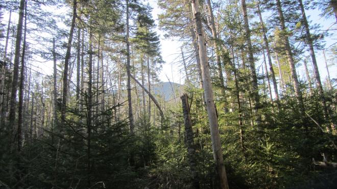 In the morning it was time to go find that mountain. Passing through the new growth of the Stillwater area there were occasional glimpses of Carrigain waiting for me up ahead. The trail through here is all very flat right up until you start the actual climb which I find amusing. It sort of sneaks up on you and then you find yourself on the mountain.
 Well, I guess there is some warning. The name of this trail has always appealed to me, long before I dared to think about climbing it. I recall wishing I was the sort of person who could do that but the elevation profile scared the heck out of me. Now here I was coming back to use this climb to test out how well my boots were breaking in.
 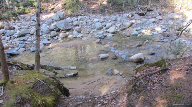 The crossing at the base of the mountain was really low for early May. I like easy crossings, but I’m a bit concerned about how dry this year is going to be. My plans have me traveling mostly to other areas this year so I’ll have to keep an eye on other folks trip reports to know how water supplies are holding up since I won’t be seeing the Pemi nearly as much this year as last.
 Then it was time to head up. For most of the climb there are views of the Vose Spur off to the east which I like to use to gauge my progress. I know it stands a bit lower than where I’m headed so as long as it is above me I shouldn’t get my hopes up I’m almost done.
 The first thousand feet or so of climbing was done on relatively dry trail. It was a nice cool morning which is my favorite for going up mountains and I was really enjoying the day.
 If you are going to go to all the trouble of climbing mountains it should be on a day with views like this. There was a little haze, not perfect, but Washington in the distance looked pretty clear to me.
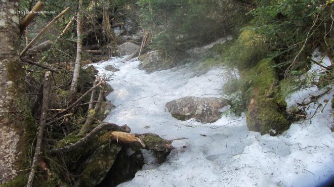 Then I hit the ice! There are no more pictures of the climb because I was too busy to look anywhere but my feet. So long as the trail has some flat spots walking on ice isn’t that hard provided you have your spikes on. It was the more vertical sections that posed the real challenge. Even without ice there are some really steep sections that make you work for every foot of gain on this trail. With the ice there were a few spots that scared the crap out of me heh. At one point I became stuck on the middle of a section that seemed more wall than floor and found myself wishing for an ice axe. After carefully sliding down about twenty feet I stopped on a ledge and found a different route up. This was, at least as far as I’m concerned, some pretty serious stuff.
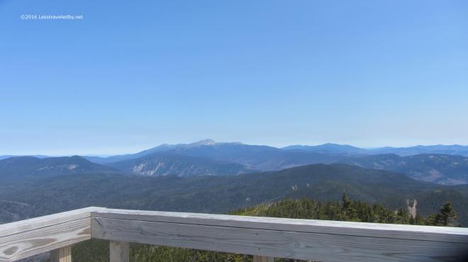 The summit was of course worth the effort. Despite my dislike of climbing towers I raced right up to the top this time. With a seriously chilly breeze blowing up there I didn’t stay long. Not much winter snow left on the high peaks, but I bet there is still plenty of ice up there.
 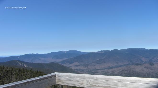 I love this perspective looking back over most of the Pemi from the top of Carrigain. So often I am somewhere else out there looking at this peak, I’ve even spotted the tower from the Bonds. I’m going to miss this place this Summer. Last year allowed me to really explore this place, but other trails are calling.
 Never having seen the other side of the mountain I’d planned this trip as a loop so I could do some exploring outside the wilderness before turning around and heading back in. The view looking back up at the tower as I descended Signal Ridge shows this side is pretty steep too, but the trail was much easier with switchbacks easing some of the vertical. There was still some serious ice and I had to put my spikes back on several times.
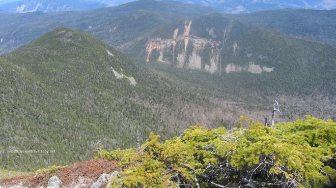 Looking down from the ridge I could see the notch far below. After descending to my right I’d be heading back to my left climbing up that notch. Seemed like a lot of work still to be done, but I comforted myself with the thought that I’d finally redline that missing mile or so of Pemi trail I needed on the Carrigain Notch Trail.
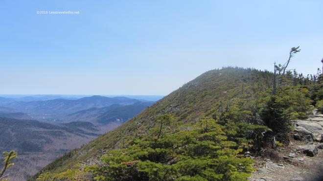 Besides it was a beautiful day for a hike and I was on virgin trail I’d never trampled before. So I’d hike down only to go back up. What else is new?
 These fancy signs make it clear we’re not in the wilderness anymore. Wide groomed trails with clear signage are nice, but I was glad to be headed back into the Pemi rather than out to the highway with the day hikers. Sorry to say the camera crapped out on me at this point so no more pictures. Thinking I may need a new trail camera, but if you’ve ever shopped for photography equipment you know the dilemma of deciding between spending too much money or buying cheap crap. If you’ve found a good middle ground solution I’d love to hear about it.
 The actual climb is about 2500′ via the Desolation Trail and the good or bad news is it is only about 2 miles to the top, depending on how you feel about climbing.
 Not sure the .gpx matched up correctly with the satellite picture in this image, but it gives you an idea of the route at least. Travel was counter clockwise around the loop. You’ll want to bring a real map with you if you go rather than relying on this 🙂
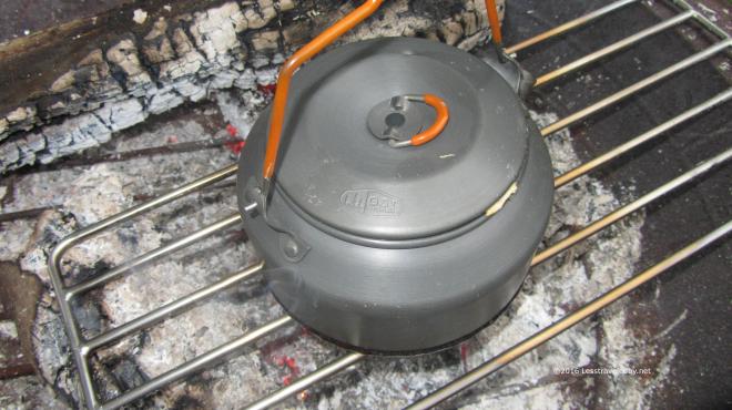
 I used our backyard fire pan for this test, but on trail I can easily make a small bed of coals or take advantage of a social fire at a shelter. Over the fire I set my Purcell Trench Voyageurs Grill which I carry for emergency trout cooking. Then I set down the metal top of a #10 can to keep the fire from scorching the bottom of my kettle.
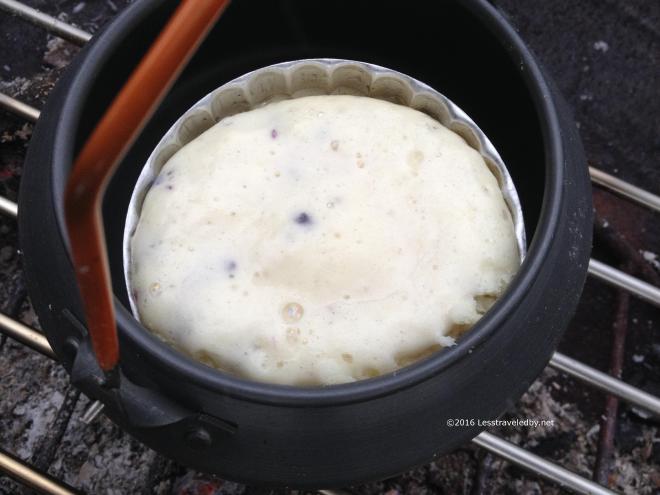
 Another 15 minutes or so and you can see some browning around parts of the edge. The top was springy and dry to the touch so duplicating the field environment where I’d have no patience I pulled the kettle off of the fire and moved indoors to see what I had made.
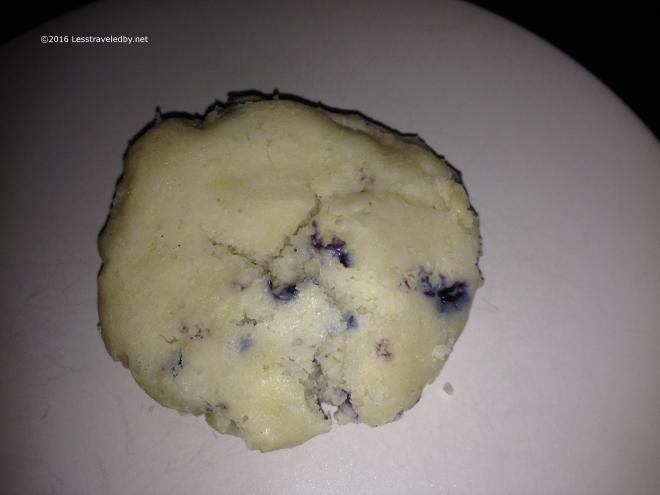 The muffin held its shape pretty well when pulled out of the mold. The top could use more browning and the interior was overly moist so I’m thinking another 10 minutes or so would be good or a bigger fire as the one I was using was quite small.
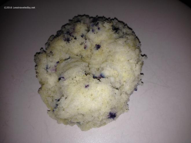 Turning the muffin over revealed something that actually looked like a baked good despite being a tad underdone.
 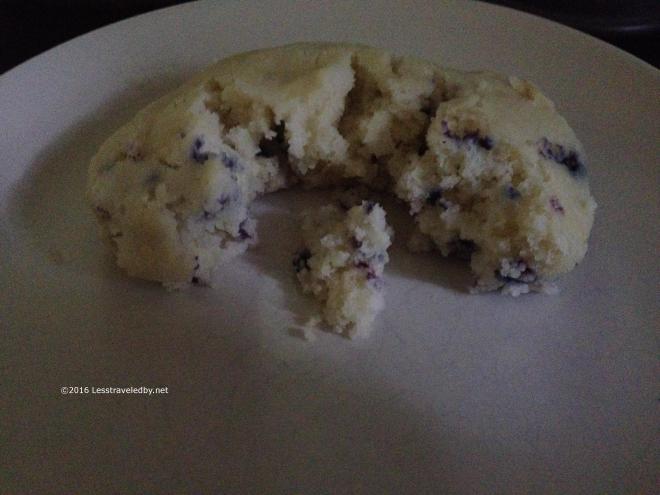 From this angle it looks even more like a real baked item in terms of texture. Clearly there is a lot of potential here for good eats out on trail, but more testing is definitely in order. Next up I’d like to try a silicone baking mold because cleaning these aluminum molds in the field would be a major pain. I used some olive oil which helped, but still more than I want to mess with out there.
 Since my last trip there had been a pretty good snowfall. It had melted in the sunny spots down low, but there was still some lingering. It seemed odd because there was no snow at all at this elevation just a few weeks prior.
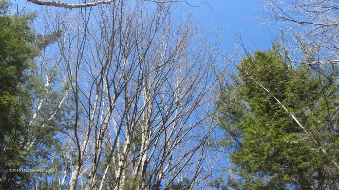 The sky was an amazingly clear blue. No haze or stray wisps floating about. Just that beautiful Spring air and sunshine, though the birch buds were being cautious. Can’t blame them for not wanting to be fooled after all the false starts Spring gave us this year.
 A littler farther on the snow was more than lingering on the Wilderness Trail. There were spots where it was six inches deep in the places where the sun was hard pressed to reach.
 After the previous trip spent in spikes for much of the time it was nice to just bare boot my way through the snow. One or two minor slips, but I never felt any need to reach for traction.
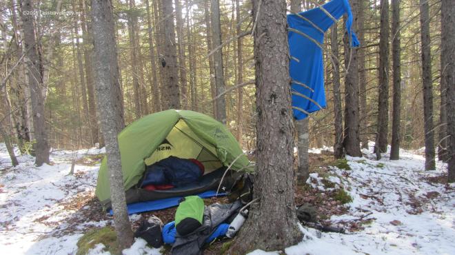 Home sweet home! The chilly nights on the early April trip made me decide to bring both quilts along this time. I was super warm both nights as this combo is good below zero and the nights were only around 20°f.
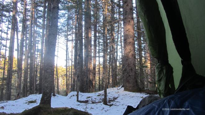 The days were getting longer and it was still quite light out when I decided to move the party indoors. I sat there for a couple of hours with my legs under the quilts and watched the light fade.
 Morning came with another clear sky. I enjoyed breakfast and coffee from my perch above the brook below. As the sun and coffee warmed me I began to shed layers and pack up.
 The Carrigain Branch crossing was amazingly low for April. Most years I’d be worried about crossing with it filled from snow melt, but with no snow there was no melt.
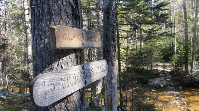 The Stillwater crossing seemed to be missing a few key hopping rocks this year even with the low water level. I eventually found my way across and headed up towards Shoal Pond.
 There are some interesting growth patterns along this section with older and newer generations of forest competing as they recover from the clear cutting done here years ago.
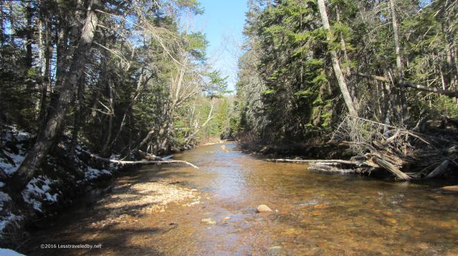 It was a bit cool following this notch up towards the pond and there were multiple crossings of Shoal Pond Brook to deal with. The sun was able to reach down into the open areas, but the shadows were filled with snow.
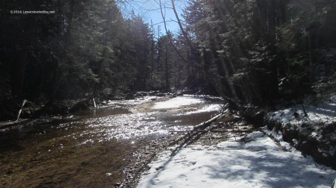 The light had that special Spring quality to it; Something about the color tells the brain that even though you see snow Winter is not coming back.
 The icy crossings were a definite challenge though. The water wasn’t all that deep, but you’d hate to fall in. It was hard to tell which rocks had ice on them so I took to tapping with my stick to check before making my next hop.
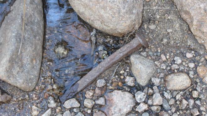 Not certain if this spike came from a bog board or the old logging rail lines. Either way it counts as an artifact now so I took a picture without disturbing it and moved on.
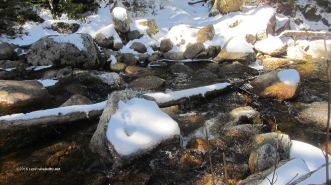 Did I mention the ice water crossings? This area took me some time to navigate as the first couple of attempts ended mid stream with only questionable next steps.
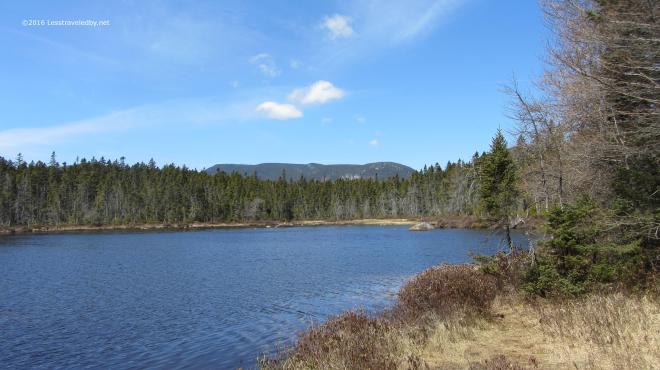 Finally I reached Shoal Pond where there was no sign of ice. I stopped for some serious snacking and to soak up a little sun. By now the temp was pushing 40°f but it felt nice be out of the trees for a while.
 Looking back towards Stillwater gave a nice view of Carrigain beyond. From here it looks quite dramatic and it is a bit hard to imagine the Desolation Trail going pretty much directly from bottom to top. (Insert ominous foreshadowing music here…)
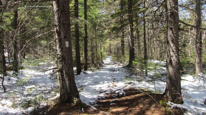 Soon after the pond came the Ethan Pond Trail intersection. I only had a half mile to enjoy it, but this flat, wide section is a rare thing of beauty in the White Mountains.
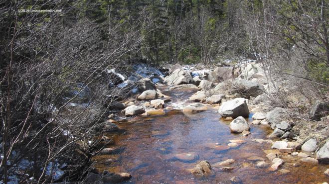 This view is from the footbridge looking down stream towards Thoreau Falls. After all that time in the wilderness it seems like such a luxury to come upon this little wooden bridge and I always enjoy the crossing.
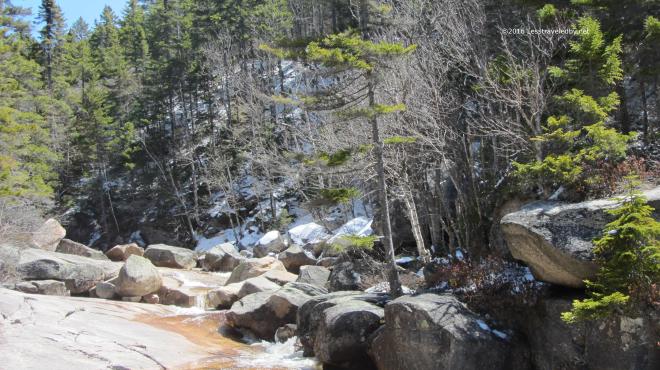 Soon it was time to leave the well manicured Appalachian Trail behind and then it was on to Thoreau Falls. The fresh snow since my last visit gave it a very different look. I spent quite a while here soaking up sun, soaking up snacks and of course taking too many pictures.
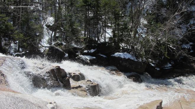 I never get tired of this spot. You can’t camp here or everyone would and it would be ruined I’m sure. So you stay as long as you can and take as much of it with you when you leave as you can carry.
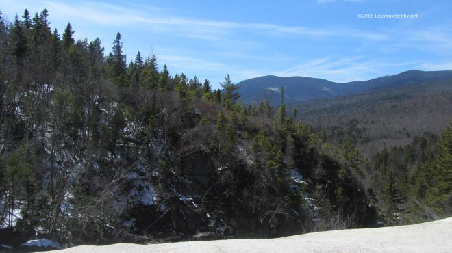 This view towards the Bonds never gets old. Snow, greenery or Fall colors, it always makes me stop and say “Oh, that is pretty!”
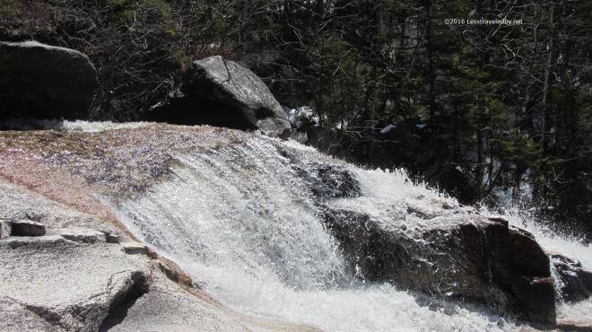 This time of year with at least a moderate flow the falls were pretty as well. Much of the year they flow more than fall, but they had a bit of a roar going this time.
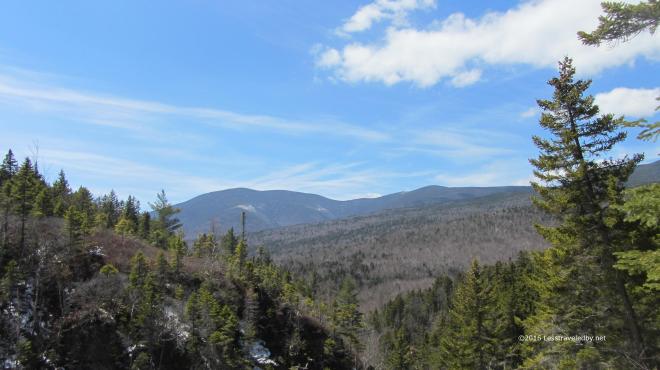 One last look and then it was time to move on. I was a bit concerned about following the trail as the snow was pretty thick in this area and there had been no foot traffic. Then, as soon as I leaped across the falls I was amazed to find a fresh set of footprints in the snow. Someone had walked out to the falls and turned around so they’d done the hard work of trail finding for me! Wilderness trails come without blazes so when you can’t see the ground due to snow or leaves wayfinding can be a real challenge. I was really stoked about these footprints!
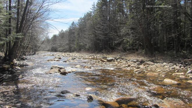 Late afternoon along the North Fork. Another few miles on and I set up my camp for the night. I got in early for a change and had a long time to enjoy dinner, soak up some extra water and just relax and watch as the light faded. I was just dozing off in my tent as darkness began to settle in when I heard something that made me sit up. It started out like a coyote but then faded with more of a howl than the coyotes I knew out west. It called three times in quick succession and then fell silent. Not sure what was out there, coyote, banshee or hellhound I opted to zip up the bug net on my tent. I’d planned on sleeping with it open to increase air flow and cut down on fly frost, but decided it was better to close it in order to prevent whatever was out there from licking my face while I slept. As any good woodsman would, I fell asleep a few minutes later without a care as to what demon stalked the night 🙂
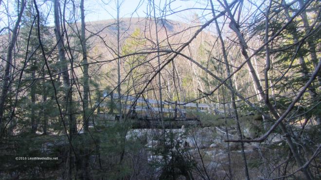 Morning dawned chilly again, low 20s so I fueled up and hit the trail. Soon I reached my old friend, the Thoreau Falls Trail bridge. I know they want to pull this bridge and they don’t want to replace it, so every time I pass through I appreciate it while I can. With it gone I’m not sure I’ll be able to come this way any longer and that makes me sad. This river is nothing to mess with though even above the North Branch.
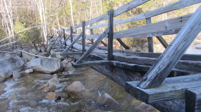 Walking across this old beauty is even more magical than looking at it. The tilt from the broken stringer varies as you cross and there is just a hint of a wobble in the middle. I think they should build a modern duplicate to replace it with that same twisting sag and some old weathered boards under foot, but I don’t think they care what I think heh.
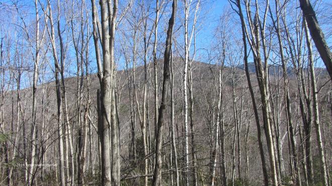 Snack break at the Cedar Brook/Eastside/Wilderness intersection. The Bonds and Guyot visible through the leafless birches. Always bittersweet to be here…almost time to go get that cheeseburger, almost time I have to go home, always really happy to be done climbing this hill in either direction 🙂
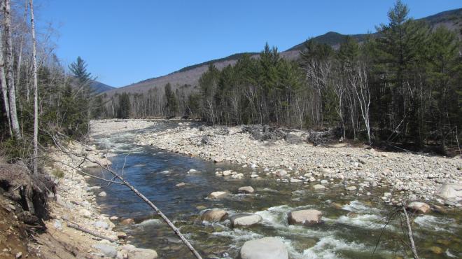 The East Branch was looking mighty low for this time of year. Normally the melt would still be going strong up above or even at this elevation and the river would be roaring.
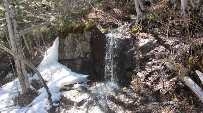 There were plenty of patches of snow among the trees though the temp was around 50°f as I set out just after mid day. The trail had plenty of squish to it in spots and the small flows were burbling so it felt like Spring.
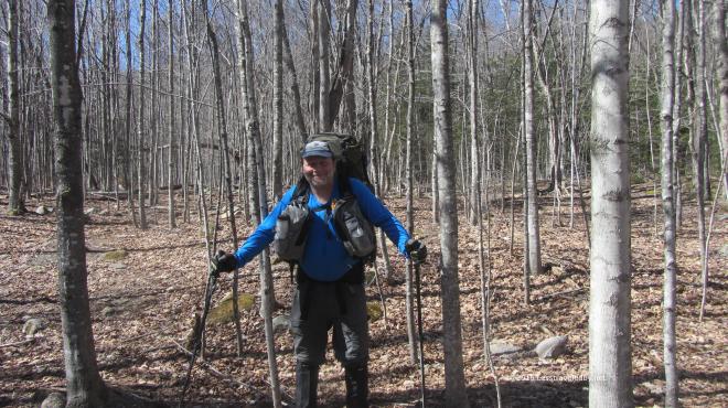 I’m including this picture because I have a good sense of humor and very little pride. You’ll just have to take my word for it, but I’m really not pregnant. The tight pack belt combined with the shadows and my leaning forward posture makes it look like I might be though heh. You can really see how dry the forest floor is in this pic. The lack of snow left the leaves looking more like Fall than Spring.
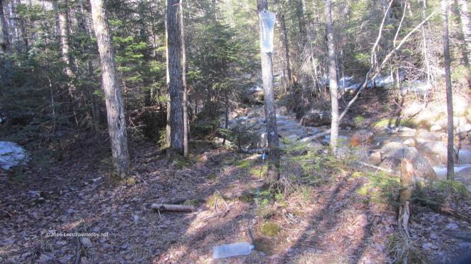 Speaking of falling springs…I cobbled together this gravity system out of an old Sawyer Mini and a couple of Platy bags I’ve had for years. Ordered a new full size Sawyer to use later, but brought the old one in case I forgot to sleep with it and it froze. Really liking the lack of effort involved in filtering water this way, but I think I am going to get a zip top bag for easier filling in standing water.
 With the sun sinking behind the ridge early I decided to camp relatively low, just past the second brook crossing if I recall correctly. My first real trail day in the Limmers had resulted in some pinkie toe discomfort so I was glad to put on my camp shoes along with my fuzzy camp clothes. Recently added to the fuzzy camp clothes collection was the ibex Meru with the snazzy Trailspace stitching.
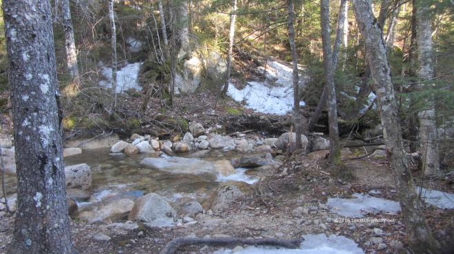 At this elevation the snow was more abundant, but still patchy. It had gotten down to around 20°f overnight so I was glad I had some sunshine pretty early in the day.
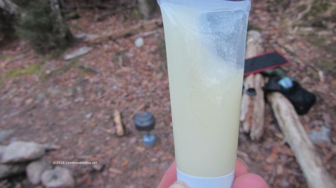 My tube of olive oil had turned into olive slushie. Note the kettle is on the stove there in the background. Getting that on was a definite priority.
 Don’t think I can go back to instant now that I’ve been enjoying the good stuff. More Trailspace swag; both the Innate insulated mug and the GSI coffee screen are part of my mess kit in any weather, but a real favorite on cold mornings.
 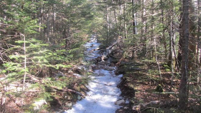 Day two took me higher up and onto a track that was still covered in hard packed ice in most places. Definitely a good time for traction and I was glad I had my Hillsounds many times over the next few days.
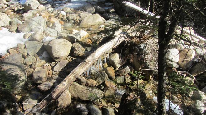 The weather had been alternating between rain and hard freezes for a while so there were lots of interesting ice sculptures to be found.
 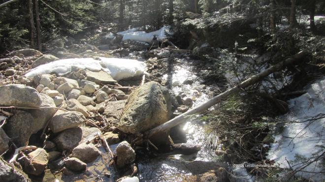 The early Spring light had a wonderful sparkle to it. It was tempting to stay and watch it in spots like this, but I had some climbing to do.
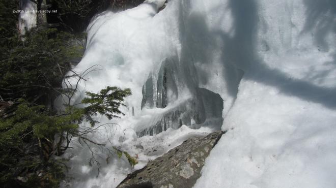 Well, OK, this spot had to be appreciated for a few minutes. It was an ice flow from the steep slope above the trail that was decaying as it was exposed to the sun.
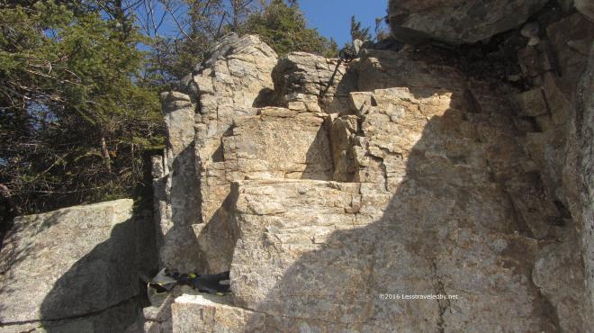 It didn’t take long to reach the rock face that signals the base of Bondcliff. You can see I’ve tossed my poles on up so my hands are free for the climb. I took off my gloves not to use the camera, but to scarf down some dark chocolate espresso trail mix. Just the motivator for scampering up a cliff with a 35lb pack.
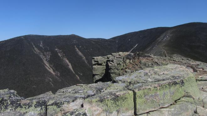 Actually this was my real motivation. This cliff is a pretty darn neat place to be most any day, but if you can get up there on a clear day like this it makes the effort seem a small price to pay.
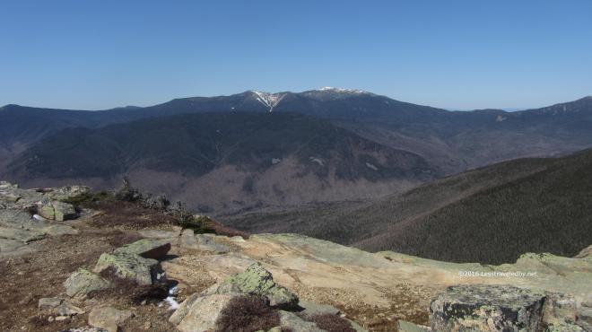 Lincoln and Lafayette rising up beyond Owls Head still seemed to have snow on the peaks and in the chutes, but I’m pretty sure that is all hard ice. I wasn’t headed that way this time, but I sort of wished I was.
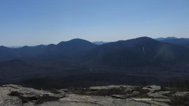 Hancock and Carrigain looked mostly snowless. Very different from last year when I was trying to snowshoe up Cedar Brook and breaking through waist deep snow in spots as it came apart under my snowshoes.
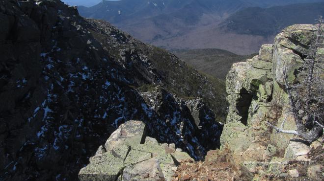 Each time I come up here it seems the same, yet very different. The ice and snow made interesting contrast with the rock, but what I really noticed was the different color of the sun this time of year. Even though mid day was approaching it was a gentle light that brought out colors rather than blinding. Well except in the icy and snowy sections heh.
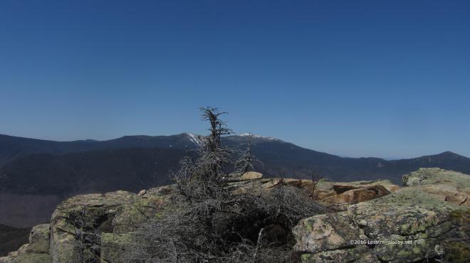 Lincoln, Lafayette and Garfield just barely sneaking in the picture on the right. Can’t help but remember walking that trail last fall, though that day was cloudy and gray.
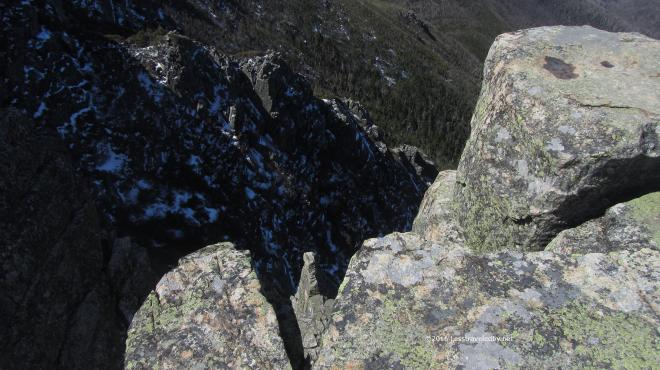 I am a big fan of giant holes in the ground and have visited many in my travels, but this is one of my favorites. The empty space is almost palpable and I’m always reminding myself not to reach out too far to touch it when I’m up there.
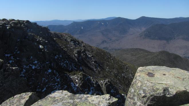 Out beyond that space Flume and Liberty mark the beginning of the Franconia ridge. Again it is hard to look at those mountains without recalling climbing them. I especially remember the col between them and how I was annoyed going down knowing I’d have to go right back up 🙂
 Speaking of going up…time to head up to Bond Summit. The exposed areas were mostly ice free so I did this section bare booted. Once I got up into the scrub closer to the summit I had to put the spikes back on or risk violating the family “No Breaka You Neck” rule.
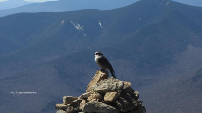 Of course at the summit I was met by the local Gray Jay contingent. Oddly enough I also met a human up there. He arrived from West Bond on a day hike and headed out onto the cliff leaving me and the Jay alone.
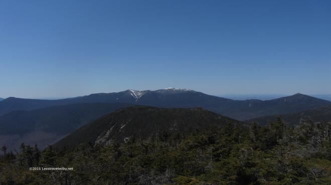 From here on the summit looking over West Bond you get a better sense of the size of the ridge in the distance. The same spot, yet very different from my visits here last Summer. The wind on the summit was brisk so I certainly didn’t stay nearly as long this time.
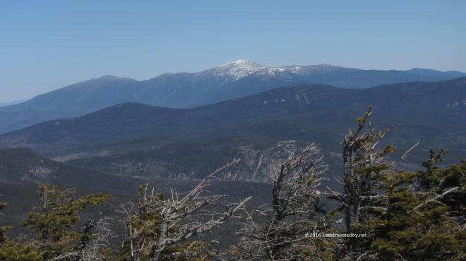 Well, long enough to get yet one more pic of the big Presidents. I guess some day I’ll have to go over that way, but admiring them from here seems a lot easier than climbing them heh.
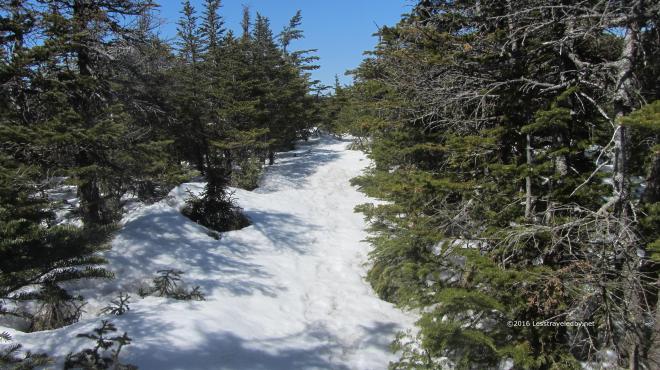 The trail on the north side of the summit was snow rather than ice and I’ll admit I took advantage a few times to buttslide in the steep spots.
  Arriving at the Guyot camp in the middle of the afternoon I had the place to myself. The view from the shelter porch was pleasant enough and I spent a few hours soaking up snacks and rehydrating.
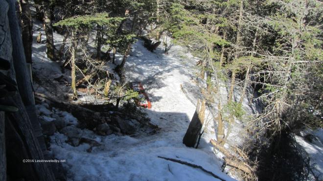 The bear boxes were just poking out of the snow down below in the cooking area. Don’t think the bears were a worry this time of year, but I was hoping there weren’t any shelter mice.
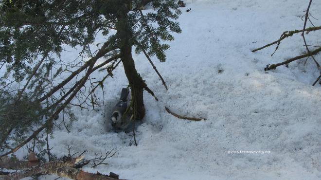 Of course there were a couple of Gray Jays hoping I’d let them steal my food, but I know better. They seem cute, but they are fearless and will take the food from your hand on its way to your mouth.
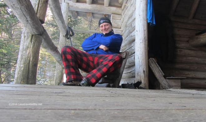 If I look pretty happy to be sitting on the porch in my fuzzy clothes it is because I was. Those little chairs weren’t very sturdy, but to have some place comfortable to sit out of the snow seemed pretty great to me. Surprisingly enough I had two separate hikers toddle in over the next few hours. Pretty sure each of us had expected to be there alone, but we managed to share the shelter and survive the night.
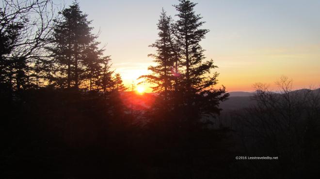 Morning from the front porch was cold, but worth getting up for. Thankfully it wasn’t the solstice so I didn’t feel I’d needed to get up early and shoot and video 🙂 I shot this and crawled back under the quilt for a few minutes before getting up to make coffee.
 This Gray Jay was looking pretty fat for the time of year, but the lack of snow cover had probably helped him find food. Some from the ground and probably more from hikers heh. He was getting none of my breakfast cereal that day I can assure you.
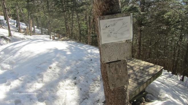 This sight made me a little sad. The friendly host long gone I had no one to share afternoon coffee with on this trip. Good memories though 🙂
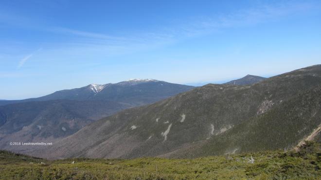 Again the morning light was fantastic. As I made my way up Guyot towards the Twinway I kept stopping to look at the peaks around me. I knew soon enough I’d be in the trees so now was the time to enjoy the views while I could.
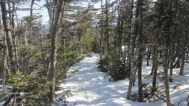 There was some snow in the scrub trees along the ridge, but most of the Twinway was covered in hard ice, much of it wet with melt. I was hanging from my spikes and using my poles for all I was worth to keep myself stuck to the ground on the steep sections.
 In between exertion and terror there were of course these amazing views every few minutes. It was a bit hazier on day three, but still there were some far horizon lines. I always love seeing the far ridges beyond the other ridges that are beyond the ones in front of me. Comforting to know you won’t run out of mountains any time soon I guess.
 All this time, about three hours, I had yet to see another soul. This was a Saturday and the weather was astoundingly clear so I’d expected to run into throngs headed up the way I’d come from on this trail. Maybe it was the ice, maybe they were all climbing Washington in the nice weather, but I was really enjoying the peace.
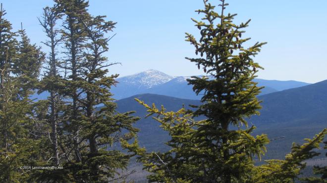 No idea if it was crowded up there, but again, a lot easier to look at it from here. Certainly worth looking at from pretty much any angle.
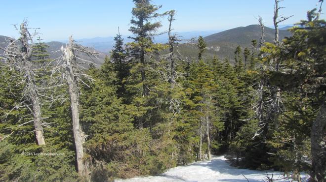 You can sense it is time to head down from this shot I think. No more pics for a while because going down this icy trail took all my attention. In some ways it was easier because the rocks were all buried, but even with spikes, walking down steep hills covered in ice uses up a lot of energy.
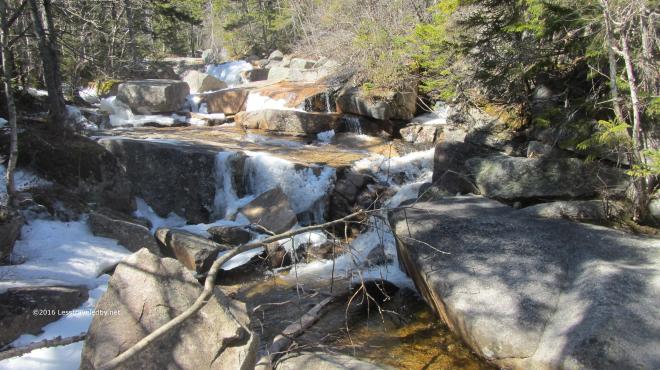 Reaching the crossing just before the Zealand Hut just before lunchtime seemed a good sign. I snacked there for an hour, chatting with the hutmaster as he started greeting his guests for the day. There were some hikers here heading up as well. I was glad my hard work was done for this trip and my spikes were tucked away.
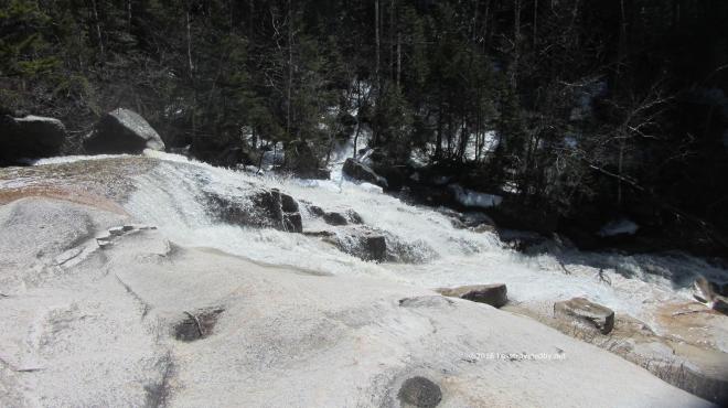 After a few easy miles on the Ethan Pond section of the AT, I made my way down to Thoreau Falls. Listening the roar as I approached started to worry me and at first glace I wasn’t sure I wanted to try crossing. Then I remembered the rocks I’ve used before and hopped over with no issue other than a pounding heart.
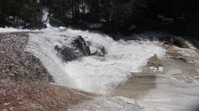 Definitely another one of my favorite places to be. I didn’t have much time to enjoy it on this trip because I knew I had a few hard miles to cover before I’d get to where I wanted to camp that night.
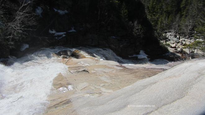 This is where I’ll leave you as far as pictures go. If you haven’t seen it already check out the waterfall video below. The rest of the trip was mostly about stomping my way back to the scoot. The legs are feeling pretty strong considering what felt like a lazy Winter season. As usual keeping the body happy is the biggest challenge and I really need to focus on drinking more water I think.